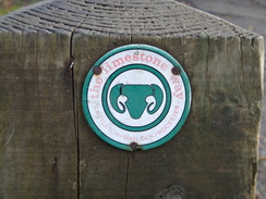
Walk #935: Limestone Way: Rocester to Matlock
 |
 |
|
General Data
| Date Walked | 01/11/2011 |
| County | Staffordshire, Derbyshire |
| Start Location | Rocester |
| End Location | Matlock Station |
| Start time | 07.18 |
| End time | 17.16 |
| Distance | 24.6 miles |
| Description | This long walk followed the Limestone Way from its trailhead in Rocester into the Peak District, before heading northeast across classic Peak District terrain to a final descent into Matlock. |
| Pack | Today I carried my 30-litre Karrimor rucksack, filled with water, my waterproofs, a book and other odds and ends. |
| Condition | I am fairly tired after this walk, but could have walked further if I had needed to. I had a few little problems with my left knee when climbing some of the frequent stiles. |
| Weather | Today's weather was far from perfect; there was some light rain early on and this was replaced with cloud and some sunny periods. It was quite warm for the time of year, although the breeze was quite chilly. |
| OS map | Landranger number 128 (Derby & Burton upon Trent), Landranger number 119 (Buxton & Matlock, Bakewell & Dove Dale) and Outdoor Leisure number 24 (The Peak District - White Peak Area) |
 |
 |
|
Map of the walk
Maps courtesy of Google Maps. Route for indicative purposes only, and may have been plotted after the walk. Please let me have comments on what you think of this new format. For a detailed table of timings for this walk, please see the table file.
 |
 |
|
Notes
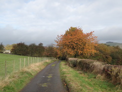
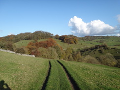
The Limestone Way was one of the first named trails that I ever did, as part of my campaign to get fit to do the Pennine Way in '99. I took no photos of much of the trip, and my notes and directions were all sparse to the point of non-existence. It crosses some spectacular Peak District landscape and I could see no reason not to do it again, especially as it meant that I could see my folks for a few days.
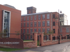
My plan for today was to walk the southern branch of the trail, which heads northeastwards from Rocester in Staffordshire to Matlock. Due to the distance to be walked I asked my dad to drop me off at Rocester just after seven in the morning. This village has changed a great deal from when I went to school nearby, with the nearby JCB factory having pumped in a great deal of money into the local economy. I bought some snacks from the shop before walking down the road to reach the starting point of the Limestone Way near Arkwright's 1781-built cotton mill, which has been rather elegantly converted into the JCB Academy.
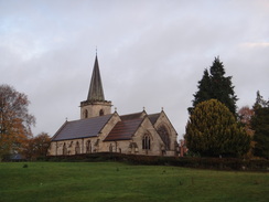
Rocester church has several large buildings topped by a spire, and seems to change shape from every angle that you view it. Shortly afterwards I made the first navigational mistake of the day when new housing sent me off in the wrong direction. Fortunately this was only by a few yards and I was soon striding north across fields, with the JCB factory dominating the landscape behind. It has won awards for the way it fits into the landscape, and it must be said that it is about as far as you can get from a traditional metal-bashing building.
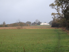
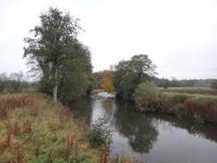
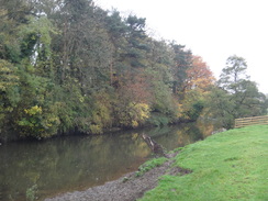
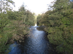
The first climb of the day took me across a main road and up a slight hill towards a prominent white building, and a descent dropped me down to the western bank of the River Dove. A pleasant mile followed alongside the river which trickled away behind me. Sadly this had to end and a road took me towards Ellastone; I never saw the village as another track took me northeastwards towards Calwich Park. At this moment the weather, which had been grey all morning, turned decidedly damp as it started to drizzle. It was not heavy enough to force me to put my coat on but was annoying on what was supposed to be a sunny day.
A long and fairly nondescript walk followed to the south of the Ordley Brook, crossing a lane before reaching the A52 main road. An unusual stretch of public road - little more than a semi-surfaced track - took me north towards the farm at Woodhouses, where a path headed down into a valley and up the other side to reach Coldwall Farm.
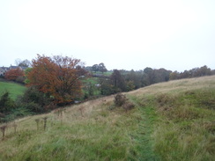
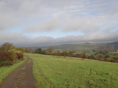
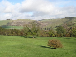
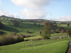
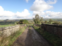
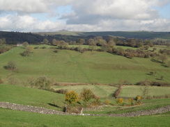
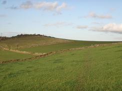
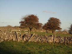
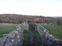
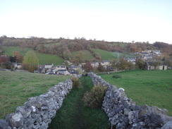
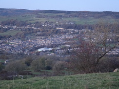
A descent took me down to the rather lovely Coldwall Bridge over the River Dove, where I entered the Peak District before climbing up past an old milestone to the village of Thorpe. Roads and footpaths took me northeastwards across that familiar White Peak feature - small fields lined with drystone walls. Although they look pretty these are exhausting to cross and you can never get any speed up. I did not mind it as the walls were part of the seemingly timeless farmed landscape and were in no way artificial. This was in stark contrast to a recent walk along the Speyside Way, where the vast majority of stiles had been unnecessary.
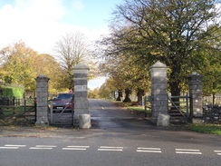
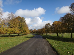
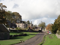
After crossing the A515 a tree-lined road called The Avenue took me northeastwards to the famous village of Tissington. This always brings a smile to my face, with the rather grey and austere hall fitting like a glove into the surrounding landscape. Paths and roads took me to a bridge across the Tissington Trail which follows the old Ashbourne to Buxton railway line. An easy descent down to the Bletch Brook was followed by a rather steep climb up the other side towards Parwich.
I was in need of a break and so the pub in Parwich seemed to be as good a place as any. A group of four other walkers had just got in before me, so I ordered a drink and a meal and waited. A local man proved rather friendly and we chatted away as I waited - sadly the food took a while to arrive and instead of spending the half-hour I wanted I spent an hour in the pub. Ordinarily this would not be a bad thing, but the short daylight hours meant that I would soon be pressed for time.
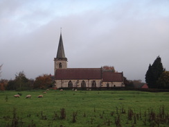
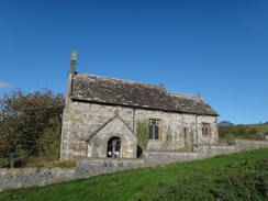
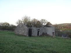
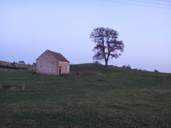
Paths took me east from the village towards the hamlet of Ballidon, which is dominated by a rather large quarry to the north. I then passed one of my favourite Peak District features - a small church that sits alone on a hillside a short distance away from a road, a reminder of a village that no longer exists. It seemed in reasonable condition aside from one broken pane of glass, and I wonder who looks after it now.
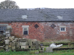
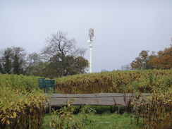
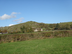
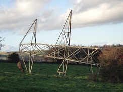
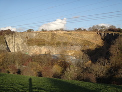
A descent to the B5056 road - one that I used to drive along every week - was followed by a long road walk uphill to the east. The trail eventually left this and took a track, and this in turn led to paths that headed to the north of the village of the pretty village of Brassington. These ended at a road before more paths took me northeastwards towards the High Peak Trail - another Peak District cycle path that follows the course of an old railway line, this one being the rather famous and much missed Cromford and High Peak. The next stretch of trail was rather nonedescript as it continued northeastwards, skirting the eastern corner of the massive Grange Mill Quarry before descending down to reach the A5012 road at Grangemill. One thing of note was the top section of an electricity pylon that lay on its side in the field next to its replacement, leaving me to wonder why no-one had bothered carting it away for scrap.
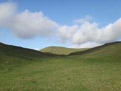
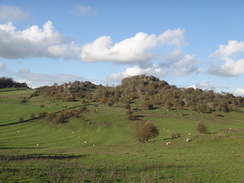
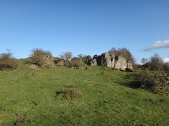
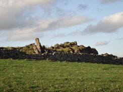
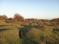
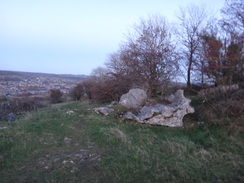
A steep path took me uphill past the edge of the smaller Prospect Quarry to a road, which was then followed all the way through the hamlet of Ible. The sun was starting to get worryingly low in the sky behind me and I knew that time was pressing so I tried, and failed, to speed up. Paths took me east-northeastwards across a series of small drystone walled fields and across the bumpy ground of the old Bonsall Mines, where grass-covered history surrounds you. Sadly I went rather too far into the mines complex and had to make a diversion to rejoin the trail.
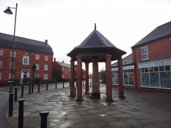
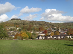
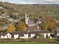
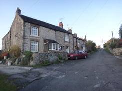
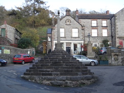
Soon a road was reached in Bonsall, which is a rather disjointed settlement strung along several roads. Another climb took me up along a road before reaching a junction in the trail. Here the main route to Castleton headed off to the left, whilst the route to Matlock turned right along a road whose houses were proudly displaying Halloween pumpkins. An easy path took me down into one of the village centres of Bonsall, where a pub beside the magnificent market cross looked very inviting.
Unfortunately I had to press on, and a rough, steep track took me north out of the village. It was starting to get quite dark by now and I was forced to put my head torch on to gain a bit of extra light. At the summit of this hill the path curves to start descending northeastwards towards Matlock, whose lights shone brightly in the valley far below. My headlight started to make a circle of light on the ground as I passed Masson Lees Farm and the gloom grew as the path continued to descend.
Soon the combination of darkness, the gradient of the path and the wet slippery ground forced me to divert off the trail and onto the nearby road. This was easy to find and soon I was descending down to Matlock Station. I used to know this area well and it has been transformed in the last six years by the construction of a Sainsburys in the old Cawdor Quarry and the allied construction of a bypass. I crossed a rather large and ungraceful footbridge over the railway line to reach the station about ten minutes before the next train to Derby was due. This was rather fortunate timing and gave me just enough time to buy a ticket before settling down on a seat.
It had been a very enjoyable day's walk, although somewhat spoilt by the failed rush to beat the darkness. My train to Derby, then anther to Uttoxeter, was followed by another lift from my dad.
 |
 |
|
Directions
This walk starts off from the new village cross in the centre of the Staffordshire village of Rocester at SK109393. Head east along Mill Street for a fifth of a mile until a surfaced road called West View leads off to the left, just before the mill (now the JCB Academy) is reached. This road junction marks the start of the Limestone Way.
Turn left and follow West View northwards, passing the churchyard on the left. When it curves to the right continue straight on along a surfaced path that soon curves to the left, passing a school on the right to reach a gateway that leads into the churchyard. Here turn right to follow Dove Lane northwards. This soon curves to the left; as it does so pass Woodseat Grove on the right and take a driveway that leads off to the right. This ends after a few yards and a path continues on with a fence on the right to reach a clappergate that leads into a field.
Cross the field and turn slightly to the right to head in a northerly direction with a hedge on the right, aiming for a white building on the hillside ahead. The path crosses a clappergate into a second field; when the hedge curves to the right towards a field gate continue straight on to reach a stile in a fence. Cross this and go through a gap in a hedge to reach the B5030 road at SK110401.
Carefully cross the road and turn right along it. After ten yards turn left across a stile to enter another field. Head uphill with a fence on the left aiming slightly to the right of the white building; at the top of the field turn right along the hillside with another fence on the left for about twenty yards until a stile is reached. Cross this and turn half-right to continue north-northeastwards across another field; it soon crosses a surfaced track and heads on. Aim for the upper-right hand corner of the field, with Dalesgap Farm on the left. Cross a stile in the corner of the field to reach the B5030 road at SK112407.
Very carefully cross the road and turn down a short track to reach a stile beside a field gate. Turn half-left to head north-northeastwards downhill; a hedge is soon reached on the left. Follow this hedge until a gateway is reached in the corner of the field. Go through the gate and cross a second narrow field to reach another gate that leads into a third field. Turn half-right to head north-northeastwards across this, aiming for a stile in a fence near the bottom. Cross this stile and head across a narrow grassy strip to reach another stile beside a field gate. On the other side turn right to start walking around the edge of the field; it soon curves to the left to head north with a band of woodland to the right. At the far-right hand corner of the field turn right to cross a stile and descend down to reach the western bank of the River Dove at SK115414.
Turn left to start following the river northwards; it passes through three pedestrian gates and reaches the stone Ellastone Bridge at SK119423after three-quarters of a mile. Turn left to pass the stone wing wall of the bridge on the right, and when this ends turn right through a clapper gate that leads up to the road. Turn left to follow the road northwards for a couple of hundred yards; there is a pavement on the left. As the road curves to the left towards Lower Ellastone turn right to join a track. This immediately heads past two stone gateposts and curves slightly to the right. It crosses a stream on a small bridge and passes barns belonging to Dove Farm on the left. Shortly afterwards it crosses a second stream and curves to the right to approach Park Cottage on the right.
Immediately after passing the cottage, turn left along another track; cross a stile beside a field gate and pass some trees and a pond on the left. Initially keep the field boundary to the left to reach another stile beside a field gate. Cross the stile and when the field boundary curves to the left continue along the path as it slowly curves to the right. It passes a lumpy hillock on the right; when the path forks take the right-hand branch which reaches a stile over a fence. Cross a small paddock to reach another stile that leads onto the B5032 road at SK120434.
Turn right and follow this road uphill; care needs to be taken. As the road curves to the right slightly after 150 yards turn left through a field gate to enter a field. Keep a hedge on the left and follow this uphill to reach a stile beside another field gate. Cross the stile and contour across another field with a stream down to the left, aiming for the right-hand corner of a copse ahead. Join this and keep the trees on the left to reach a stile beside a field gate. Turn slightly to the right across another field, passing the corner of a copse called Aldercarr Wood on the right. Head between two trees and then continue slightly downhill towards a stile beside a field gate in the far-right hand corner of the field.
Cross the stile and follow a fence on the right. The path joins a track that passes barns belonging to The Hutts Farm on the right and continues downhill. As the track curves sharply to the left in a hairpin, turn right through a stile beside a field gate to enter a field. Keep a fence to the left; this is soon replaced with a band of woodland. At the end of the field cross a stile through a hedge and keep the woodland on the left to reach another stile that leads into a third field. Here turn slightly to the right uphill to meet the corner of a hedge on the right.
Join another hedge on the right and keep this on the right to reach a stile. A narrow path heads through a small band of coniferous woodland, and when this ends go through another stile into a field. Keep a hedge on the right and follow this eastwards for a short distance to reach a stile. Cross this and head diagonally across the next field aiming for a field gate in the far right-hand corner. Go through the gate and turn left to follow a hedge on the left eastwards to reach a track at SK136446.
Cross the track and follow another hedge on the left to the corner of the field. Go through a stile in the corner of the field and then turn half-right to head diagonally across the corner of a field to reach a stile through another hedge. Turn left to start following a hedge on the left; after five yards it reaches a stile beside a field gate. Keep the hedge to the left as the path falls slightly to reach another stile beside a field gate. Cross this and continue on with a hedge on the right. Cross a stile beside a field gate and continue across another field. The path curves slightly to the left, keeping a field boundary to the left. Hedges start on either side; cross a stile beside a metal field gate and continue on, still with hedges on either side.
The path soon becomes a track that runs between hedges for nearly a quarter of a mile. After passing a building in a field to the right the path curves to the left at SK143355; here turn right across a stile to enter a field. Angle slightly away from the hedge on the left to aim for a stile in the hedge ahead; cross this to enter a larger second field. Head north across this to reach another stile; on the other side keep a hedge on the right for a short distance to reach another stile beside a field gate. Cross this to enter a fourth field; turn slightly to the left to head diagonally across this field to reach a couple of field gates.
Cross a stile beside the right-hand gate and continue with a hedge on the left. After a hundred yards cross a stile through the hedge on the left and continue with the hedge on the right. Go through a stile beside a field gate and continue with the hedge still on the right. Turn right and then left to join a track that runs between hedges; follow this northwards passing Harlow Farm on the left before it reaches a stile beside a field gate. Cross this to reach a junction with Stanton lane at SK142463.
Cross the lane and start up the track that leads to the farm at Lordspiece, then immediately turn left over a stile to reach a footpath that parallels the track. This heads across a field to reach a stile beside a field gate, with the farm on the right. Continue on with a hedge roughly to the left; cross a stile through a hedge and angle slightly on the right to reach a stile beside a field gate. On the other side follow a hedge on the right to reach a stile that leads through a hedge ahead.
Continue with the hedge on the right; at the end of this field cross a stile through a hedge and turn right and then left to follow the same hedge on the left. After a while follow the hedge as it curves to the right to reach a stile through a hedge ahead. Continue on with the hedge on the right, and then turn left in company with the hedge. At the top of the field go through a field gate and turn slightly to the left across a field aiming for a stile in the wall and hedge ahead. Cross this stile and head on to reach the A52 at SK139476.
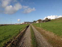
Turn right to follow the A52 downhill; it is probably best to follow the right-hand side of the road where the verge is wider. After a couple of hundred yards turn left down a single-track road that soon reaches a field gate. Go through this and follow the main track as it continues northwards; it passes through more gates and after 0.8 miles it reaches Woodhouses Farm at SK139487. Pass the farm and a few yards further on turn right through a double field-gate that leads into a field. Head straight on downhill to reach a gateway at the bottom-right hand corner of the field. Go through this and start heading uphill along another field. The path crests the hill and continues on towards a stile beside a field gate. Go through this to reach a road at SK142493.
Cross the road and continue on down the access track that leads to Coldwall Farm. The track passes the farm on the right and continues between hedges to reach a field gate. On the other side of the gate leave the vague track and continue straight on downhill, aiming for Coldwall Bridge at the bottom. The path rejoins the track; turn right to follow the track to a stile beside a field gate. Cross this and head on to the bridge over the River Dove. On the other side cross a stile beside a field gate and head on up the track, passing a milestone on the right. The track continues climbing; after a while turn left off the track to reach a stile through the wall ahead. On the other side join a track that passes a house on the right. This ends at a road in Thorpe at SK155500.
Turn left down the road for a few yards before turning right down another track. When this ends head straight on along a path, passing the graveyard of Thorpe Church on the left. At a fork in the path take the right-hand branch which continues downhill with a wall on the right. At the bottom cross a small bridge over a stream and follow the path as it curves to the left with a house to the left. Cross another little bridge and turn left, climbing up a slight slope to reach a surfaced road at SK157503.
Turn left and follow this road uphill for a short distance until it ends at a T-junction with another road in Thorpe. Turn right to follow this road northeastwards out of the village; there is a pavement on the right. After 250 yards the road curves to the right with the entrance to the Peveril of the Peak Hotel on the left; here turn left through a stile to enter a field. Head diagonally across this field to another stile, with the hotel away to the left. Continue across a field for a short distance to another stile through a stone wall. Go through this to enter Thorpe Pastures and turn right, keeping the wall on the right.
Pass a lovely dry green valley on the left to reach a pedestrian gate on the right. Go through this to enter a sheepfold and climb up three steps to reach a pedestrian gate. On the other side follow a wall and fence on the right. These curve to the left; in the far corner of the field turn right through a stile, and then left to start following a hedge on the left. Go through a pedestrian gate in the wall ahead and continue on with a hedge a short way away to the left. The hedge becomes a stone wall; at the end of the field go through a stile to reach a surfaced road called Spend Lane at SK162508.
Turn left along the lane to follow it northwards for a short distance, then turn right through a stile beside a field gate to enter a field. Head across three fields that are separated by stiles to reach a track that leads to Hollington End Farm on the left. Cross this track and head across another field, keeping the farm on the left, to reach a stile that heads across a field towards a stile that leads onto Washbrook Lane at SK166514. Cross the lane and negotiate a stile to enter another field. Keep a wall away to the right as the path heads downhill; at the bottom of the field cross a stile and head on for about two yards to reach a road. Turn right and follow the road uphill to the east for a sixth of a mile until it ends at the A515 road opposite Tissington Gates at SK171517.
Carefully cross the A515 and the cattle grid that sits between the gate posts (there are pedestrian gates on either side of the posts to avoid the grid). Follow the tree-lined Avenue as it heads northeastwards; it eventually curves to the right and crosses another cattle grid. After 0.4 miles it reaches a junction on the left in the centre of the village of Tissington. Head past the village green on the left and a bus shelter on the right, and then turn left up a road. After a few yards turn right through a gate to enter the churchyard. Follow the path towards the main porch of the church, then turn right along a paved path that lead towards a pedestrian gate. Go through the gate to enter a field and then turn half-left across the field to a reach a stile beside a field gate. On the other side follow a wall on the left to reach another stile that leads out onto Chapel Lane at SK176525.
Cross the road and go through a stile to enter a field. Head across a corner of the field to reach another stile that leads out onto a lane. Turn right to follow this lane as it heads eastwards; it soon curves to the left to head northeastwards. After a third of a mile it crosses the Tissington Trail on a bridge. Cross a cattle grid on the other side of the bridge and follow the track as it curves to the left; immediately after the bend turn right to take a footpath that heads downhill to the northeast. At the end of the field cross a stile and continue straight on downhill, keeping a field boundary away to the right. At the bottom of the second field it crosses a stile and heads on across a third to reach a footbridge over the Bletch Brook at SK183535.
Cross the footbridge and some stones across a boggy area on the other side before heading uphill. At the top of the field cross a small footbridge through a hedge and turn half-left, keeping a hedge on the left. At the end of the field cross a stile beside a field gate into another field, still keeping the hedge on the left. It starts to head downhill to another stile through a hedge; follow the path as it curves slightly to the left. Cross a stile and then turn right to reach another stile in a fence. Cross this and continue downhill with a fence and copse on the left and a hedge on the right. Follow this path to another stile; on the other side the path curves to the right and then left to head down a short track. This crosses a bridge over a small stream. As the track curves to the right after the stream head straight on along a path with a house on the left and a wall on the right. This path ends at a road in Parwich at SK187543.
Turn left along the road for a few yards, and then turn right up another road that heads east, passing Parwich Church on the right. Shortly after the church turn left up a narrow path with a low stone wall on the left and a fence on the right. This path soon ends at Croft Avenue; turn right down this until it ends at a T-junction with Creamery Lane. Turn right down this road and when a road comes in from the right, turn left along a path that leads to a stile beside a gate.
Cross this into a narrow field and continue towards a pedestrian gate. Go through this and head across another field to a stile; cross this and follow the path as it curves to the right with a stone wall on the right. This reaches another stile; cross this and descend some steps and continue on with a hedge on the right to reach a gate. On the other side continue uphill with a hedge on the right to reach a stile at the top of the hill. Cross two stiles within a few yards and head on across the crest of the hill, following a hedge on the right. At the end of the field cross another stile to join a road at SK195544.
Turn right and follow this road south for 250 yards; just before the road ends at a T-junction turn left through a gate and continue across a field with a hedge to the left. As the hedge curves to the right turn left across a plank footbridge to enter another field, then turn half-right to cross the corner of the field. Cross a stile through a hedge and curve half-left, aiming for the right-hand edge of some trees. At the end of this field cross a plank footbridge over a ditch and go through a hedge to enter a field. Keep a hedge on the left; in the far corner of the field go through a stile to reach a road at SK202543.
Turn left up the road; after a short distance turn right through a stile and skirt some trees on the right. This leads to a path of stone slabs that leads towards Ballidon church. Pass the church on the right and continue uphill, aiming for a fingerpost near the top left-hand corner of the field. Go through a stile beside a field gate and continue with a wall on the right. When the wall curves to the right continue straight on across the field, aiming for a fingerpost beside a track. Join the track and follow it as it slowly curves to the left and starts to descend. It soon curves to the right and then left in a couple of hairpins before it reaches a pedestrian gate beside a field gate. Go through this to reach the B5056 road at SK211545.
Carefully cross the B5056 and start following Pasture Lane eastwards uphill. After 0.6 miles the lane curves to the right; as it does so head straight on along a green lane that continues uphill to the east between walls. After a quarter of a mile the track ends; go through a pedestrian gate beside a field gate and turn slightly to the left to continue uphill. The path passes to the left of some boulders and a series of bumps and hollows as it heads northeastwards. It goes through a gap in a wall and curves slightly to the left as it continues across rough ground. At the top of the field cross a stile and head on down a field, keeping some power cables to the left. Go through a gateway and head diagonally to the far left-hand corner of another field to reach a stile beside a field gate. Cross this to reach a road immediately to the north of Brasisington at SK229551.
Turn right to head down this road for a sixth of a mile until a road junction is reached on the left. Turn left along this road, immediately passing a telephone exchange on the left, and continue uphill along the road. After a sixth of a mile turn left up a track with a stone wall on the left. Follow the track as it enters a farmyard and curves to the right, passing a bungalow on the right. Squeeze past an open-fronted double garage and then turn left to head behind them to reach a stile beside a field gate. Cross this to enter a field and turn half-left to head diagonally across the field; skirt the corner of a stone wall on the right as the path slowly curves to the right.
As you approach an open gateway turn right, keeping a stone wall on the left. Just before a gate is reached in the wall ahead, turn left across a stile and continue on with a wall on the right. Go through a gateway and continue with a wall on the right to reach a pedestrian gate. Go through this and follow the wall on the right for about five yards, then descend steps to reach the old Cromford and High Peak Railway Line at SK236556.
Cross the trackbed (now a cycle path) and climb some steps on the other side to reach a a couple of stiles that lead into a field. Head downhill towards a field gate in the corner of the field. Go through the gate and turn right to continue downhill along a track. This soon starts to climb; follow it uphill as it starts to curves to the left away from a field wall. The track meets a wall on the left; as it curves away to the right continue with a wall on the left past a field gate to reach a stile in the corner of the field. Go through this and turn half-left to contour across the corner of a field. Cross a stile in the wall and turn slightly to the right to head diagonally across another field, aiming for a wall corner ahead, with some rocks behind the wall.
Pass the corner of the field and angle slightly to the right away from the wall on the left to reach a stile. Cross this and head directly across the field with a band of trees protecting a quarry to the left. This meets a track in the bottom left-hand corner of the field; cross this and go through a bridleway gate and head downhill, aiming for an electricity pylon ahead. The path becomes a rough and muddy track after passing the pylon; this goes through a gateway into another field, descending with the power lines to the right. Keep a bank guarding the large Grange Mill Quarry to the left and at the end of the field go through another field gate. Continue downhill along a green track, passing a pylon on the right. Pass under the power lines and aim for a field gate in the corner of the field; aim for this and descend to meet the A5012 road at Grangemill.
Carefully cross the A5012 and start following the B5056 northwards for a few yards, passing a pub on the left before turning right along a minor road that heads uphill. Opposite a cottage on the left, turn right across a stile to enter a field. A path climbs steeply uphill; at the top of the field cross a gap in a fallen wall and on to a gap in a second wall. Go through the gap and continue with the edge of the Prospect Quarry a short way away to the right. Near the top of the hill turn left through a gap in a stone wall and turn right, keeping a fence on the right. At the end of this field cross a stile beside a field gate to reach a road at SK246575.
Turn right to start following this road southwards, initially with Prospect Quarry down to the right. It enters the little hamlet of Ible and curves to the left; after nearly half a mile it passes a farm on the right. Just before some houses are met on the left, turn left through a gap in a wall to enter a field. Head up a bank and diagonally across the corner of a field, aiming for a gap in the wall ahead. Continue across another field, passing the back of the houses on the right and aiming for a stile through a stone wall. Cross this and head across a very narrow field to reach a fallen-down wall. Join a wall on the right and follow it to the end of this field and go through a stile in the wall ahead. Follow a wall on the right; as this curves away to the right continue on to another stile.
Cross four more fields in quick succession through gates and stiles to enter a larger field; cross this downhill and join a fence on the right to reach a stile in the far corner of the field. On the other side turn left to follow a wall on the left with some barns away to the right. At the end of this field go through a stile and continue with the wall on the left towards Leys Farm ahead. Go through a pedestrian gate in the corner of the field and continue across another field with the wall on the right, heading towards the farm. At the end of this field cross a stile and head on, still with the wall on the right. This path passes the farm on the right; cross a stile beside the leftmost of two gateways and walk on a few yards to a wooden gate. Continue on with the wall on the right. At the end of this field go through a pedestrian gate and continue with a low broken wall to the right. Finally cross a stile to reach Leys Lane at SK262575.
Cross the lane and go through a wooden clapper gate and angle half-right to head diagonally across the corner of the field, aiming for a stile in the wall. Negotiate the stile and continue diagonally across the second field; cross a fallen stone wall and head on across the corner of a field to reach another low wall. Cross this and an adjacent stile to reach another field with some large boulders to the left. Start heading diagonally across the field, soon passing a very large hole to the left. At the hole turn left to start heading northeastwards across the rough field with a wall some way away to the left. Cross a stile at the end of this field to enter a narrower field; at the end of this turn slightly to the right to follow a wall on the right. Head straight on along four narrow fields passing a barn on the right before reaching the end of a track at SK269578.
Go through a gate and join the track as it heads downhill between stone walls. Halfway down the track turn left through a stile to enter some scrubland with a barn away to the left. It passes through the scrubland to reach anther stile. Go through this and turn half-right to head diagonally across the corner of a field to a gap in a wall ahead. On the other side turn slightly to the left across another field, aiming for the buildings of Bonsall ahead. Cross a little bank and head diagonally across the corner of a field on the left; go through a gap in a low stone wall and continue along the path as it curves slightly to the right. At the end of the field cross a stile and turn left along a path with a low stone wall and a cottage on the left. This path heads steeply downhill and curves to the right; the stone wall becomes a hedge before the path curves to the left to reach a road in Bonsall Dale at SK272581.
Cross the road ahead and head uphill along road between cottages on either side. The road curves to the right in a hairpin and heads steeply uphill. Ignore a sign pointing off to the left at a road junction (this is the branch of the Limestone Way that heads towards Castleton) and instead climb for a few more yards before turning right down Bell Lane. When the lane ends continue straight on along a green path; cross a stile and head on between walls. Go through a second stile and head straight on, aiming for a church spire ahead. Pass two benches on the left and go through two stiles within about ten yards.
After these the path continues on between stone walls to reach a stone stile. On the other side cross a short area of grass to another stile that leads to a path that continues between walls. The path becomes surfaced as it heads downhill. Steps lead down between buildings before reaching the end of a short lane. Head along this for a few yards until it ends at a T-junction with Yeoman Street opposite the Kings Head in Bonsall. Turn left up this road to reach the spectacular cross in the village at SK279582.
Pass the cross and take a path that heads past a phone box on the left and a house on the right. The path is surfaced with concrete as it heads steeply uphill between walls, passing a building on the left. At a junction turn left, following a stone wall on the left. Follow the path as it curves to the right, continuing uphill between ramshackle walls. At a track junction turn right to head between a wall on the right and a fence on the left. Head on to a field gate; go through this and continue on uphill with a hedge on the right. The track curves to the right towards a field gate. Do not go through the field gate and instead turn right through a stile into a field.
Once in the field turn half-left to head diagonally across the field, almost directly between two field barns. It then curves to the left, passing the left-most barn on the left and keeping a stone wall on the right. At the end of this field cross a stile through a wall and head on, keeping five trees to the left and a grass-covered buried water tank to the right. Cross a stile at the end of this field to reach a track; cross this and climb another stile to enter a field. Turn slightly to the right to head diagonally across this field towards a stile. Cross this and then turn left to keep a wall on the left.
Continue downhill along the obvious path with a fence and wall to the left. At the bottom of the field cross a tumbledown stone wall and angle slightly to the right to meet a track. Turn right down the track for about twenty yards and then turn left through another stile. Head downhill with a fence on the left. At the bottom of the field cross a stile beside a field gate and head on diagonally towards another field gate. Squeeze past this gate to reach a track with Masson Lees Farm immediately to the right; turn right and then immediately left to go through a stile into another field. Keep a hedge on the left as the path heads downhill.
At the bottom of the field go through a stile and continue with a hedge now on the right. Head through a stile in a wall ahead and continue downhill, still with a hedge on the right. Eventually a wall is joined on the left and the path reaches a pedestrian gate. Go through this and continue to reach a stile at the bottom of the field; negotiate this and continue with a hedge on the right. Just before the end of the field go through a pedestrian gate and head on along a rough track with a hedge on the left. This continues to a stile. On the other side follow the hedge on the right; go through a gateless gateway and continue downhill to another stile that reaches a small patch of woodland.
Here I left the Limestone Way for safety's sake; the obvious path through the trees turns to the left to reach a stile that leads out onto a minor road at SK294600. Turn right down this road and follow it as it curves sharply to the left. When a junction is reached on the right, turn right and follow this road downhill past houses on the right. Near the bottom turn left to join a metal footbridge that crosses the railway line in Matlock. On the other side of the bridge turn left down some steps to reach Matlock station forecourt at SK296601.
 |
 |
|
Distances
| From | To | Distance (m) | Ascent (ft) | Descent (ft) |
|---|---|---|---|---|
| Rocester | Lower Ellastone | 2.9 | 246 | 226 |
| Lower Ellastone | Thorpe | 7.2 | 1073 | 771 |
| Thorpe | Parwich | 3.8 | 558 | 58 |
| Parwich | Upper Town | 8.3 | 1470 | 1194 |
| Upper Town | Matlock station | 2.4 | 358 | 899 |
This makes a total distance of 24.6 miles, with 3705 feet of ascent and 3148 feet of descent.
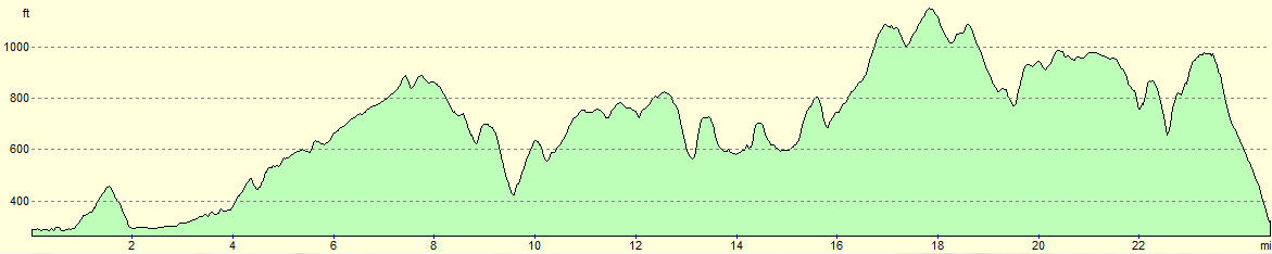
For more information on profiles, ascents and descents, see this page
Accommodation
Travel between Matlock and Rocester is difficult. In the morning I got a lift to the start of the trail in ROcester, and in the evening I caught a train from Matlock to Derby, and another from Derby to Uttoxeter, after which a lift got me back to my parent's house.
It is possible to use public transport the entire way; as usual Travel line is a useful resource for working out public transport details. One possible route is to take the Transpeak bus from Matlock to Dervy bus station, and then Trent Bus's Swift service to Uttoxeter via Ashbourne, which calls at Rocester. This journey currently (2011) takes about two hours, and both services run roughly hourly during weekdays.
 |
 |
|
 |
 |
|
 |
 |
|
 |
 |
|
 |
 |
|
 |
 |
|
 |
 |
|
 |
 |
|
 |
 |
|
 |
 |
|
 |
 |
|
 |
 |
|
 |
 |
|
 |
 |
|
 |
 |
|
 |
 |
|
 |
 |
|
 |
 |
|
 |
 |
|
 |
 |
|
 |
 |
|
 |
 |
|
Disclaimer
Please note that I take no responsibility for anything that may happen when following these directions. If you intend to follow this route, then please use the relevant maps and check the route out before you go out. As always when walking, use common sense and you should be fine.
If you find any information on any of these routes that is inaccurate, or you wish to add anything, then please email me.
All images on this site are © of the author. Any reproduction, retransmissions, or republication of all or part of any document found on this site is expressly prohibited, unless the author has explicitly granted its prior written consent to so reproduce, retransmit, or republish the material. All other rights reserved.
Although this site includes links providing convenient direct access to other Internet sites, I do not endorse, approve, certify or make warranties or representations as to the accuracy of the information on these sites.
And finally, enjoy your walking!
Nearby walks
| # | Title | Walk length (miles) |
|---|---|---|
| 11 | Stanton Moor | 2.9 |
| 12 | Darley Dale, Stanton Moor and Rowsley | 8.7 |
| 14 | Friden, Long Dale and Gratton Dale | 7.8 |
|
|

|