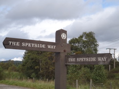
Walk #927: Speyside Way: Cromdale to Aviemore
 |
 |
|
General Data
| Date Walked | 21/09/2011 |
| County | Highlands |
| Start Location | Cromdale |
| End Location | Aviemore |
| Start time | 09.48 |
| End time | 16.46 |
| Distance | 21.2 miles |
| Description | This was a very pleasant walk following the Speyside Way southwards; it passes through some picturesque woodland near Grantown-on-Spey before following an old railway trackbed to Nethy Bridge. More forestry walking to Boat of Garten is then followed by a wonderful moorland walk to Aviemore, at the foot of the Cairngorms. |
| Pack | Today I carried my 30-litre Karrimor rucksack, filled with water, my waterproofs, a book and other odds and ends. |
| Condition | Fortunately the chaffing problems of yesterday did not recur, and aside from tiredness and some more footsoreness I feel okay after this stroll. |
| Weather | Today's forecast was for heavy rain; heavy enough for me to consider taking the day off as I am ahead of schedule. Only light rain was falling in the morning and so I decided to set off. At about midday some heavy rain was blown in by a blustery southwesterly breeze. As I was walking southwards, this meant that the rain was into my face. Fortunately it only lasted for an hour or so, and the rest of the day was a mixture of sunshine and clouds. |
| OS map | Landranger number 36 (Grantown & Aviemore, Cairngorm Mountains) |
 |
 |
|
Map of the walk
Maps courtesy of Google Maps. Route for indicative purposes only, and may have been plotted after the walk. Please let me have comments on what you think of this new format. For a detailed table of timings for this walk, please see the table file.
 |
 |
|
Notes
Today's weather forecast was for periodic heavy rain and I seriously considered taking a day off. However I was more than a little fed up after yesterday's travails, and was keen to see an end to the Speyside Way. For this reason I threw on my wet-weather gear and went to the bus stop in Grantown ready to get one of the only two busses of the day to Cromdale. As I was early I went into a nearby bakery and bought a bacon burger and a very large, steaming hot sausage roll which I munched as I waited. The food helped me feel much better about the day ahead, as if my mood was improving with every mouthful.
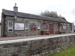
The sun was shining through gaps in the cloud as the bus dropped me off in Cromdale, although the blustery wind did not bode particularly well. Initially the trail followed an old railway line to the site of the old Cromdale station, which had been excellently restored - some preserved railways would love to have a station of that quality.
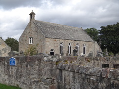
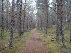
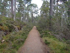
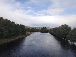
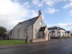
Immediately afterwards the trail joined a road that passed a spectacularly-sited church and crossed the Spey on a bridge. Immediately on the other side it left the road and entered some woodland. I had been fairly fed up with the monoculture forestry I had encountered earlier in the trail, but in comparison this was superb - light, airy, and run by the community. Capercaillies live in the woodland, and signs warned of their breeding season. It was a wonderful woodland, made all the better by the fact that the weather was remaining dry.
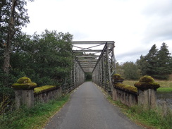
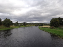
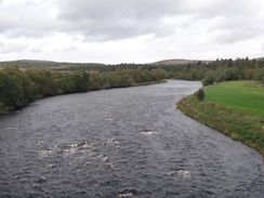
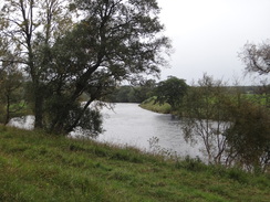
As the trail approached Grantown I met a foreign couple who had stayed in the hostel last night. They were walking north and were enjoying their stroll. It was easy to see why - this stretch was undoubtedly lovely. More trails took me south, sadly leaving the woods and following a road to another bridge over the Spey. This bridge was no longer open to motor traffic, meaning that it seemed particularly unspoilt, with a gravel surface and great views down over the river. Some fishermen - ever-present on the Spey - were cheerily getting ready for a day's fishing.
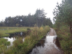
After passing a smokehouse the trail rejoined the old railway line and started following it southwards. It was an easy wall, but it soon started to drizzle and then rain. The rain was blown straight into my face by the blustery southwesterly, so I lowered the rim of my Tilley hat and buttoned up against the worst of the weather. I was as snug as a bug, the only problems being the wind that hampered my progress and the rain that blurred many photographs.
The worst was over by the time I reached Telford's bridge at Nethybridge. I was surprised to find a shop here, and the entrance to the bus shelter - which would have been perfect to shelter in whilst I took notes - was blocked by a man on a mobility scooter. A red squirrel darted across a garden on the outskirts of the village, its tail a shock of silver. The sight cheered me considerably as the breeze helped dry out my waterproofs. Although the trail followed roads for the next half-mile, the makers of the trail had done a good job in creating off-road sections that kept me away from the little traffic on the quiescent road.
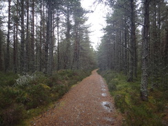
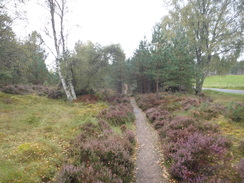
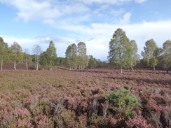
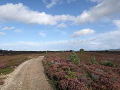
Soon the trail dove into another area of woodland, twisting and turning before following some power lines westwards through a broad clearing in the trees. This was a pleasant walk, with empurpled heather stretching off in all directions. Eventually it left the trees and followed paths alongside roads, although again the roads were hardly busy.
This led me to Garten Bridge over the Spey, and on into the village of Boat of Garten. This is dominated by the Strathspey railway, and this was an indication that the trail was nearly at an end. I passed through the pretty village as a steam train pulling crimson coaches came into the station, but soon afterwards I was walking down a rural road with sparse housing on either side - a lovely location and subsequently pricey, I would imagine.
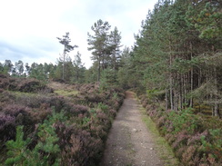
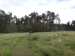
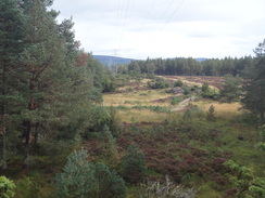
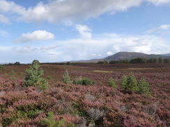
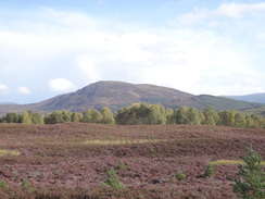
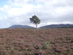
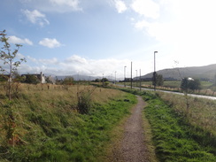
A couple were walking in front of me and we were soon chatting as we walked along. The road was soon left behind and a track - which also carried a cycle path - headed southwestwards with the railway line close by on the left. It soon headed under the line and then came perhaps the best stretch of the entire trail, a broad track across moorland with grand vistas over the Cairngorms ahead. It was a superb stretch of path and the company was highly entertaining.
sadly I soon had to say goodbye as bridges took me under both the preserved railway line and the main line to Inverness. This took me past a few chalet-type houses and onto the road in the north of Aviemore. I diverted off the trail to take a more rural route through some woods before rejoining the road for the last stretch into the village. I have never really liked Aviemore as it is far too commercial for my tastes, but it felt good to be there once again. There was no obvious trailhead so I nipped into the Tourist Information office who said that there was not one, but that a signboard I had passed acted as one.
My bus back to Grantown was due in just ten minutes, so my pressured walking had paid off. I looked back at what had been a particularly noteworthy trail, although not necessarily for good reasons. There are parts of the Speyside Way that I would do again, but other parts that I would want to avoid like the plague.
 |
 |
|
Directions
This walk starts off from outside the Haughs Hotel in the village of Cromdale at NJ075285. Leave the hotel and follow the A95(T) as it heads southwestwards, soon reaching a traffic-light controlled bridge over the Burn of Cromdale. A footpath leads off to the left immediately before the bridge to reach a footbridge over the burn. Cross this and take a path that immediately leads back up to the main road.
Carefully cross the main road and turn right to head back towards the bridge; after a few yards turn left down a track that curves to the left away from the road. The track goes through a scissor stile beside a field gate and continues north along the track, with the burn to the right to head towards the abutments and piers of an old railway bridge over the stream. Here the Speyside Way is joined.
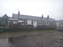
Just before the abutments of the bridge are reached turn left down a path, keeping the stream on the right. This crosses a stile and climbs up onto the old railway embankment; at the top turn left to follow it southwestwards as it goes through more scissor stiles. After a sixth of a mile the site of the restored Cromdale Station is reached; pass the platform and then immediately head under an overbridge.
On the other side of the bridge turn right along a path, with the ramp up onto the bridge on the right. This meets the end of a track; turn right along this for a couple of yards to reach the road. Turn left to follow the road as it heads in a rough northwesterly direction for a third of a mile, passing a whitewashed church and graveyard on the right before reaching a bridge over the River Spey at NJ066289. A path has been created along the left-hand side of the road to keep you away from what little traffic that there is.
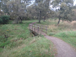
Cross the bridge and on the other side and on the other side immediately turn left down a track. When a gateway is reached after about twenty yards turn right down a path that skirts away to the right, with a fence on the left. Go through a metal gate and join a track; turn left down this track as it immediately crosses a bridge over a stream. After a while a field gate is reached; turn half-right to a pedestrian gate and join a track that head sup through the trees.
When the track forks at NJ054283 turn left along the wider branch which heads southwestwards through the woodland; it soon forks once again at NJ051279. Here take the right-hand branch that continues southwestwards before winding around; the proper track is east to find. After 0.7 miles another junction is reached at NJ043278; take the right-hand branch. As it approaches the western edge of the woodland at NJ039279 turn left up a minor path (do not continue along the main path that heads out of the forest - this is a convenient way to reach the town of Grantown-on-Spey).
The path heads south, soon emerging out into a little clearing. Head across this and follow a path that heads back into the trees; squeeze past a field gate and pass a car park on the left. Cross a track and head straight on along a narrow path that leads to a second clearing at NJ034273 turn left down a wide track that heads south through the trees, following the course of an old military road. After a little over a third of a mile it heads past a wooden vehicle barrier to reach a road at NJ035268, with the Spey immediately beyond.
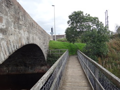
Turn left and follow this road as it curves to the right; the road ends but a surfaced track continues across an attractive bridge across the Spey. On the other side of the bridge turn right to follow it for a fifth of a mile as it curves to the right. As it curves to the left, turn right down a surfaced track that leads to a field gate, with a wooden cottage on the left. Walk past the field gate and after a short distance turn left to reach the A95(T).
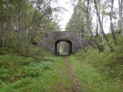
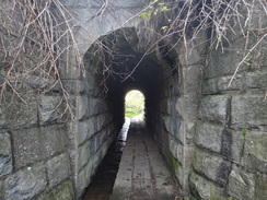
Carefully cross the road, and on the other side join the B970 as it heads past a smokehouse on the right. Cross the entrance driveway to the smokehouse and then head straight on along a path with a fence on the right. Almost immediately the path turns to the right to run between fences to a gate behind the smokehouse. Go through the gate and continue along the path, which curves to the left to reach an old railway trackbed. Turn left and follow this trackbed as it heads west, almost immediately passing under an old bridge.
It is now simply a case of following the trackbed as it heads in a south-southwesterly direction for 4.4 miles with the Spey away to the right, passing through a number of gates and footbridges on the way. It passes through Balliefurth Farm before eventually reaching the site of Nethy Bridge station. Pass the old station on the left and had on until it reaches a road at NJ000206. Turn left down this road to reach the B970 in Nethy Bridge.
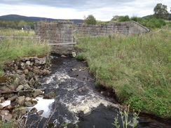
Turn right down the B970 and cross Telford's bridge over a river. Pass a Spar shop on the left, and a short distance further on turn left through a gate and then immediately right to follow a path that parallels a road on the right, with playing fields on the left. This path soon ends and the path goes through another gate to rejoin the B970. Continue along the road as it crosses a small arched bridge over a stream.
When the road curves to the right a third of a mile after Telford's bridge, turn left down another road. When this reaches the 60 MPH signs beyond the last house, turn left down a path that immediately curves to the right to parallel the road through trees. After a while it curves to the right to meet the road; cross the road and had past a vehicle barrier to join a path that enters the forest.
The path becomes a track that heads in a rough northwesterly direction for a quarter of a mile before curving to the left to head south-southwest. It passes under some power lines, then at NH986194 it curves to the right to parallel the power lines westwards. After a third of a mile the track curves to the right, but the path continues straight on, following the power lines. It enters some trees and slowly climbs through more trees; it summits a small hill and slowly descends.
The path meets a track once more and follows this downhill alongside the power lines for nearly half a mile. As it reaches the bottom of the slope at NH972195 a path curves to the left, with a little quarry on the right to head into the trees. It heads southwards before curving to the right to head southwestwads; after 0.4 miles the path reaches a public road at NH968190.
Just before it meets the road, turn right to follow a path that parallels the road. After a short distance this turns to the left to cross the road, and on the other side turn right to follow another path that parallels the southern side of the road. It passes a lake on the left and the path crosses a couple of boardwalks over boggy areas of ground before reaching a little car park that nestles in the trees at NH952190.
Leave the car park and turn right and then left to join the road, with a road junction on the right. After a hundred yards turn right through a gate to join a gravel path that runs between fences. Follow this as it goes through a gate; soon afterwards it joins a road. Turn left and start following this road westwards. It reaches Garten Bridge over the Spey; head across this and continue on as it heads under a railway bridge and curves to the left to enter the village of Boat of Garten.
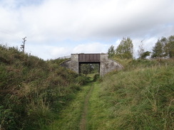
The road heads south through the village for 250 yards before curving to the right beside the Boat Hotel. After a few yards turn left up Kinchurdy Road. This heads south-southwestwards out of the village, passing a series of widely-spaced houses in the trees. When the houses end a track continues on through the trees; at NH925172, 1.6 miles after the road junction in Boat of Garten, a path leads off to the left. This passes through a bridge under a railway line, and soon afterwards another track leads off to the right.
Follow this track as it heads southwestwards with the railway line away to the right. It soon leaves the trees and crosses some spectacular moorland, with the Cairngorms visible to the left. After 1.3 miles at NH912154 the track curves to the left, heading away from the railway line before curving to the right to enter some woodland with a golf course off to the left.
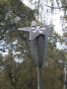
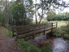
As the track forks at NH904141 by a set of strange metal sculptures, take the right-hand branch which heads downhill; it soon passes through a high, narrow arch under the railway line. On the other side of the bridge the path curves to the left to cross a footbridge and ascend a slope. The path approaches some house ahead; it crosses a couple of footbridges before reaching a bridge under the main railway line to Inverness.
The path continues on the other side; the path passes a number of houses on the left and continue along a gravel path through a couple of gates. Just before it meets the A9(T) at NH897142 turn left along a path that heads south paralleling the road. This crosses Dougall Drive and continues on; it becomes surfaced as it winds past houses before meeting Dalfaber Drive at NH896136. Turn right down the road for a few yards to reach the B9152 on the northern outskirts of Aveimore.
(The next paragraph describes an alternative route that can be taken; a much more direct route if you are in a hurry is to turn left and follow the road south for a quarter of a mile).
Carefully cross the main road and on the other side follow a path that heads westwards along a green path with houses off to the left. It crosses a footbridge as it enters some woodland and climbs a slight slope. Just before the A9(T) is reached turn left along another path. When this immediately forks take the left-hand branch that heads away from the main road. The path parallels the road until NH892131, where a path leads off to the left downhill. This crosses a footbridge over a stream and leaves the trees, heading eastwards past school grounds on the left to reach the main road at NH895131.
Turn right to follow the road southwards for half a mile, crossing a roundabout on the way. There is no official southern trailhead to the Speyside Way, perhaps because an extension of the route southwards is planned in the future. One possibility is a Speyside Way signboard that sits beside the road about 100 yards north of the tourist information office; however, a more logical choice would be the railway station at NH895123, from where many people would be starting their journeys.
 |
 |
|
Distances
| From | To | Distance (m) | Ascent (ft) | Descent (ft) |
|---|---|---|---|---|
| Cromdale | Forest near Grantown | 3.8 | 240 | 187 |
| Forest near Grantown | Nethy Bridge | 5.7 | 331 | 328 |
| Nethy Bridge | Boat of Garten | 5.2 | 292 | 259 |
| Boat of Garten | Aviemore station | 6.5 | 312 | 341 |
This makes a total distance of 21.2 miles, with 1175 feet of ascent and 1115 feet of descent.
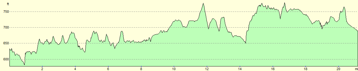
For more information on profiles, ascents and descents, see this page
Transport
Public transport between Grantown and Aberlour is very limited; Speyside Community Bus and Maynes Coach service 338 runs between Grantown on Spey and Aberlour, but there are only two service on most weekdays. Unfortunately these are not very conveniently timed, although they are better than nothing.
Fortunately the public transport between Aviemore and Grantown-on-Spey is slightly better. Stagecoach Bluebird Service 15 runs occasionally throughout the day.
Accommodation
I spent the night at the Ardenbeg Bunkhouse in Grantown-on-Spey, which was a friendly and cheap place to spend the night. It is situated in the middle of the town, which means that the shops and pubs are all very accessible.
 |
 |
|
 |
 |
|
 |
 |
|
 |
 |
|
 |
 |
|
 |
 |
|
 |
 |
|
 |
 |
|
 |
 |
|
 |
 |
|
 |
 |
|
 |
 |
|
 |
Disclaimer
Please note that I take no responsibility for anything that may happen when following these directions. If you intend to follow this route, then please use the relevant maps and check the route out before you go out. As always when walking, use common sense and you should be fine.
If you find any information on any of these routes that is inaccurate, or you wish to add anything, then please email me.
All images on this site are © of the author. Any reproduction, retransmissions, or republication of all or part of any document found on this site is expressly prohibited, unless the author has explicitly granted its prior written consent to so reproduce, retransmit, or republish the material. All other rights reserved.
Although this site includes links providing convenient direct access to other Internet sites, I do not endorse, approve, certify or make warranties or representations as to the accuracy of the information on these sites.
And finally, enjoy your walking!
Nearby walks
| # | Title | Walk length (miles) |
|---|---|---|
| 670 | Kingussie to Aviemore | 15.1 |
| 671 | Aviemore to Derry Lodge | 18.0 |
|
|

|