Walk #928: Hadrian's Wall Path: Bowness-on-Solway to Carlisle
 |
 |
|
General Data
| Date Walked | 23/09/2011 |
| County | Cumbria |
| Start Location | Bowness-on-Solway |
| End Location | Carlisle |
| Start time | 10.24 |
| End time | 16.24 |
| Distance | 15.5 miles |
| Description | This walk follows the first fifteen miles of the Hadrian's Wall Path eastwards from Bowness-on-Solway to the centre of Carlisle. It is an easy walk, with little climbing to be done in the first few miles. |
| Pack | Today I carried my 30-litre Karrimor rucksack, filled with water, my waterproofs, a book and other odds and ends. |
| Condition | This short day proved to be quite easy, and I have no problems to report aside from the underside of my feet being rather sore. |
| Weather | There was a little drizzle during the day today, but this was combined with periods of sunshine and quite high breezes. It was not a particularly warm day. |
| OS map | Landranger number 85 (Carlisle & Solway Firth, Gretna Green) |
 |
 |
|
Map of the walk
Maps courtesy of Google Maps. Route for indicative purposes only, and may have been plotted after the walk. Please let me have comments on what you think of this new format. For a detailed table of timings for this walk, please see the table file.
 |
 |
|
Notes
I spent yesterday driving down from Grantown-on-Spey to Carlisle, a rather long journey that precluded a walk on that day. I stayed in a cheap, friendly and functional hostel on the Solway Firth where I had a long chat with a lovely Czech girl, Livia. I had intended to drive to the trailhead of the Hadrians Wall Path and walk to Carlisle before getting the bus back; however road works and the parking situation at the trailhead in Bowness-on-Solway made me decide to do it the other way. This meant that I would drive to Carlisle and get the bus to the start. The first bus was at six in the morning, and as this was too early for me to reach from the hostel I opted for the next at about nine thirty.
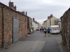
Four people were waiting for the bus: two older men who are walking the trail in seven days, and two rather fit lads (Guy and Rick) who were running it over three days for charity. Although we were alone on the bus out to Bowness there were about ten people waiting in the village to catch the bus back to Carlisle - obviously people who had finished the walk yesterday and who had stayed overnight in the local B&B's. A landlady called to us from an upstairs window, inviting us in for a cup of tea, but everyone's attentions were set on the trail ahead.
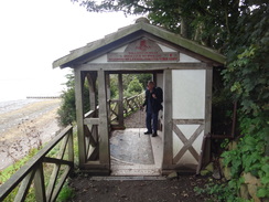
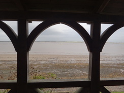
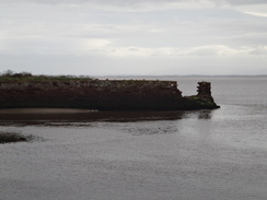
We headed off the road to reach the official trailhead, which was a rather fascinating Romanesque archways with windows that allowed grand views over the Solway Firth. After this we started walking the trail, initially along roads and then paths that took us past the entrance to the old Carlisle canal, along with a strange, derelict stone wall in the firth. The canal's owners decided that they would prefer a railway and filled in the canal; I would walk beside the trackbed later. The two runners were already out of sight (and no wonder: they were planning on doing 28 miles today despite a late start!)
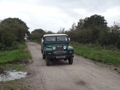
After skirting the road for a little while the trail headed inland and followed the wall's Vallum for a while, the first time that it followed the course of the wall. This led us past the pub in Glasson and out again in a big, looping walk that bought me out into Drumburgh. Whilst on a track a well-kept example of an Austin Gipsy pulled up beside me and the farmer driving asked if I wanted a lift. It was a kind offer, but there was no way I was going to stop walking after such a short distance!
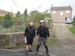
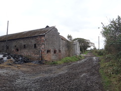
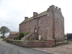
I had left the two men behind by this stage, and also passed another man walking in the opposite direction; he had only three miles to go before he finished the trail and looked very happy. Drumburgh Castle is a large fortified house with some Roman remains in the garden and a first-floor entrance, a classic sign of the fortified Peel houses and an indication that this area was far from calm after the Romans had left.
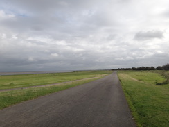
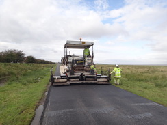
I was now well back onto the route I had followed years before on my Coastwalk. The path headed eastwards along a road that often floods at extreme high tides, with warning signs and markers for the unwary. The road was being resurfaced and I had to squeeze past a pavement laying machine, the soles of my boots sticking to the warm surface with every step and making a suitably crisp sound as they prised away.
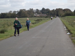
The trail passed Boustead Hill, from where I got a good view of the hostel I had stayed in last night. A steady stream of people were coming in the other direction, many in high spirits as they strolled towards the end of the trail. It seems strange that so many people are walking it east to west, against the prevailing winds - perhaps it is because the main guide describes it in that direction?
Soon I came across a large crow beside the road. Its right wing was broken and I watched, mesmerised, as it repeatedly tried to stretch out the wing. Strangely it did not seem to be in any discomfort but the way it walked in a series of small circles indicated otherwise. Birds with broken wings are not an uncommon sight, but it always makes me wonder how long the creature will live on the ground before some animal gets them.
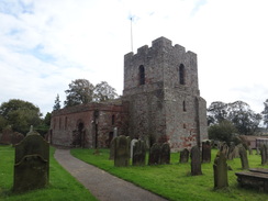
I stopped off for a couple of pints of biter shandy in the pub in Burgh by Sands - I had eaten a meal there last night, and the food had been both good and cheap, an excellent combination. I chatted to a couple of men who were just about to finish the trail, and it reminded me just how far I still had to go. Eventually I prised myself out of my seat and headed on along the road, passing the village church with its strong, thick tower (another sign of the troubles in the area). On the way I passed a large van that was acting as a mobile store, with groceries and various odds and end within.
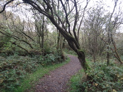
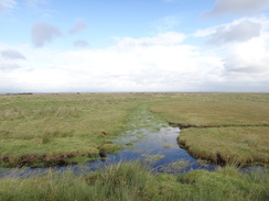
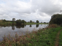
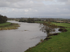
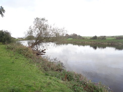
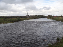
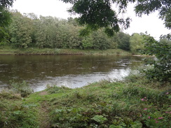
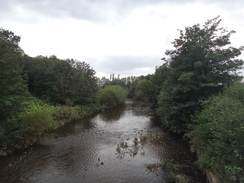
A muddy path led me on over the first significant hill of the day to the little village of Beaumont, after which the character of the trail changed. After passing the church it joined the southern bank of the River Eden and started following it southwestwards, another stretch that I remembered from my coastal walk. All too soon it left the river behind and headed inland towards Kirkandrews-on-Eden, after which it followed the course of the wall for a short distance to the hamlet of Grinsdale. The wall on this stretch had been made of turf, meaning that little nothing now obviously remained to be seen (although experts would probably differ).
The rest of the day was spent following the southern bank of the river upstream.It seems to be a deceptively flat walk on the map, but was rather hilly on the ground as the path regularly climbed and descended from the low cliffs onto the floodplains and back again. This process was made more difficult by the thick mud that made me glad that I had worn my gaiters.
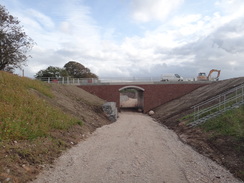
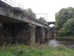
I had to make a slight diversion to get past a new bridge that was being built over the river; this was obviously not marked on the map and I found it hard to see where it is going to - later research showed that it was the Carlisle Northern Relief Road. After passing under an old railway bridge it came to the twin bridges that carry the WCML over the river. The first of these was a hideous concrete carbuncle, but the other was a modern concrete deck on older stone piers.
Soon the magnificent red sandstone walls of Carlisle Castle came into view and I walked on to the main road bridge over the river, before doubling back past the walls to reach the car park where I had left the car. It had been a good day's walk and it brought back many memories of my previous trip in the area. There had not been much to see of the Roman Wall, but I think that might well change over the next couple of days.
I drove from Carlisle to Greenhead, where I was booked into the YHA hostel. I had a rather large and tasty meal in the Greenhead Hotel before dropping to sleep very early - the short walk had tired me out more than I had realised.
 |
 |
|
Directions
This walk starts off at the King Arms Inn at Bowness-on-Solway (NY223627). Keep the pub on the right as you head eastwards down the road through the village; after 150 yards turn left down a surfaced path that leads between two whitewashed houses towards the foreshore of the Solway Firth. This path soon curves to the right to parallel the foreshore, reaching a covered Romanesque archway that marks the western trailhead of the Hadrian's Wall Path.
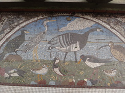
Walk through the starting point, taking time to examine the information boards and the fresco that lies underfoot. After a few yards the path curves to the right, soon squeezing between two buildings to reach the road on the eastern outskirts of the village. Turn left to start following the road eastwards out of the village; continue on as it flirts with the foreshore to the left. After a mile it approaches the small village of Port Carlisle. As the road curves to the right at NY239623, turn left along a surfaced track that continues skirting the foreshore on the left. It crosses the mouth of an old canal lock, now only recognisable by ruined brickwork, and continue along a gravel track.
Just before a house is reached on the right, turn left through a gate and cross some grass to another gate, with a wall ahead. It goes through two more gates as it continues on across an area of rough scrubland, with the road a short distance away to the right. Two-thirds of a mile after the lock the path goes through another gate to join the road at NY246613.
Cross the road and go up the entrance driveway to the Cottage and Glendale Holiday Park. When the gates into the park are reached turn left along a track that runs southeastwards for a little over half a mile; this is following the course of the Vallum of Hadrian's wall, whilst off to the left is the embankment of the old railway line to Bowness. The track curves to the left and then the right before emerging onto a road opposite the Highland Laddie Inn in the village of Glasson at NY252605.
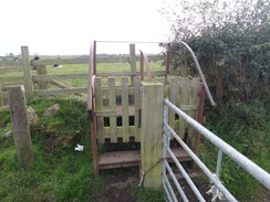
Turn right to head southwestwards along the road, passing an elegantly-converted chapel on the way. After a sixth of a mile turn left through a wooden clapper gate and continue across a field with a hedge on the right. At the end of the field go through another clapper gate and follow the hedge as it turns to the right. It approaches a gateway; go across some stone slabs, through a gate, across a footbridge over a ditch and then through a second gate, before turning half-left to head diagonally across a narrow field towards a third gate.
In the far corner of the field go through another gate and continue with a ditch on the left. Stone slabs cross a boggy area; at the end of the field go through another clapper gate and cross a little footbridge and continue on along a rough track. It passes Walker House farm on the left, after which the track becomes better quality. The track curves to the left before reaching a metal field gate; on the other side it reaches a T-junction with another track at NY259592.
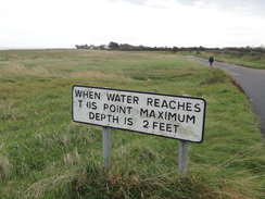
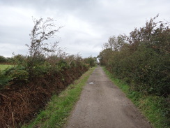
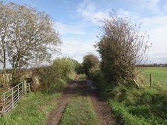
Turn left along this track and follow it as it heads northeastwards. After nearly half a mile it curves to the left and passes houses on both sides before ending at a T-junction with the coastal road in Drumburgh. Turn right to start following the road eastwards, soon passing the dominating Drumburgh Castle on the right and the embankment of an old railway line on the left; the latter crosses the road and parallels it for many miles. From here it is simply a case of following this road eastwards for 4.5 miles as it heads through the villages of Dykesfield and Burgh by Sands. Parts of this road can flood at exceptionally high tides, so it can be wise to check tide tables for these occasions.
Shortly after passing Burgh by Sands church, turn left through a wooden clapper gate and continue on with a hedge and the road on the right. At the end of the field go through a wooden clapper gate to rejoin the road as it crosses a small bridge over a stream. Just beyond a slight right-hand bend on the road at NY333590, turn left through another wooden clapper gate and continue on with a hedge to the left. At the end of the field cross a little footbridge over a stream and then continue straight on up a field. Keep an intermittent hedge on the left as the path climbs up a slight hill; just before the top of the field turn left through a gate and head on along a track that runs between hedges. When the track forks, take the left-hand branch; this becomes surfaced before ending at a road in Beaumont at NY348593.
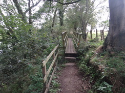
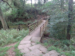
Turn right along the road for a short distance until a triangular junction is reached with the church a short distance away to the right; turn left and then left once more to take a road that descends downhill to the northeast. As the road curves to the left at NY350594 turn right through a clapper gate. This path soon reaches a narrow footbridge before ascending and descending steps as it skirts the cliffs above the River Eden, which lies off to the left. It goes through more gates and crosses footbridges.
After half a mile the riverside path curves away to the left; climb a long flight of steps up the cliff, go through a pedestrian gate and turn left to head across a field with a hedge on the left. At the end of this field go through a clapper gate; on the other side the path skirts a hedge and gardens on the right. At the end of the gardens go through another clapper gate and follow a fence on the right. At the end of this field the path slopes downhill to the left through a muddy area to reach some stone slabs that lead to a clapper gate.
As it meets the end of a track, turn left down the track for about three yards and then right through another clapper gate and head on along the base of the slope, with a fence on the left. Go through another clapper gate and continue on with the fence on the left; cut diagonally across the corner of another field, aiming for a gap in the fences on the left, and at the gap turn half-right to follow the fence on the left. After a short distance go through a clapper gate and continue with the fence on the right and a ditch on the left. It goes through a clapper gate and climbs up a steep set of steps.
At the top turn left through a clapper gate, then right up another few steps, then left through another clapper gate to continue on with a fence on the left. At the end of this field go through another clapper gate and turn half-right to continue with a hedge on the right. The path goes down the field to reach Sourmilk Bridge over a stream at NY360580, which is guarded by a gate and a stile. On the other side continue on with a hedge on the right as it passes under a couple of sets of high-tension power lines.
At the end of this field go through a strange stile consisting of two gates with steps leading over the fence. On the other side follow a rough green lane which curves to the right to head towards a farm. As it reaches a field gate turn right along stone slabs for about five yards and then left through a wooden clapper gate; continue on between fences with the farm on the left. It descends a few steps to reach a gate that leads onto a road in Grinsdale at NY368579.
Turn right to head south along the road for a hundred yards; immediately after a residential road comes in on the left turn left through a clapper gate to join another footpath. Continue along this as it runs along the edge of a field. At the end of the field go through a gate and cross a footbridge; on the other side turn right to reach another gate. On the other side turn left to continue across a field; as this narrows turn right to head up a short but steep bank through a band of trees and turn left to continue with a hedge on the left.
At the end of this field go through a clapper gate and continue along the obvious path, which descends through scrubland before ascending once more. It then descends some stone steps to a footbridge. More steps climb up the other side; at the top go through a clapper gate and continue with a hedge on the left along the top of the slope. At the end of the field go through a clapper gate and then turn right to head down a slope that leads through an arch under a new bridge, part of the Carlisle Northern Development Route, which was built in 2011.
Head straight on up a slope on the other side of the bridge, and then turn left to a gate. Go through this and turn right to continue along the top of the escarpment; the route described past the new bridge may change once it is opened. At the end of the field the path heads down more stone steps to another footbridge; more steps climb up the other side to reach a clapper gate. Continue with a hedge on the left towards three power pylons, before reaching a fourth.
Soon after the fourth pylon it reaches a gate; go through this and down a few steps before continuing on with a fence on the right. Another descent and ascent follows before the path joins the river once more. It runs above the river, passing under an old railway bridge at NY383564 and curving to the left to take a more northeasterly course. It soon passes under the bridge carrying the West Coast Main Line over the river and slowly starts to curve to the right before ending at a car park.
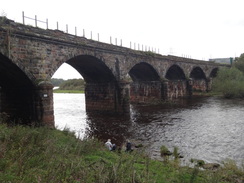
Head through this, keeping a running track to the right; at the far (southern) end of the car park turn left along a surfaced road that immediately crosses the River Caldew. On the other side continue straight on along the surfaced track that heads southeastwards; after a third of a mile it curves to the left to reach a large road bridge over the River Eden at NY400565 in Carlisle.
Here the trail is left behind; double back for a short distance before turning left through some parkland, aiming for the castle which stands prominently on a mound. Keep the castle on the left as the path curves to join a road; the car park where this walk ends lies ahead, in the lee of the castle's western walls.
 |
 |
|
Distances
| From | To | Distance (m) | Ascent (ft) | Descent (ft) |
|---|---|---|---|---|
| Bowness on Solway | Drumburgh | 4.4 | 118 | 108 |
| Drumburgh | Beaumont | 5.6 | 167 | 157 |
| Beaumont | Carlisle car park | 5.5 | 410 | 407 |
This makes a total distance of 15.5 miles, with 695 feet of ascent and 672 feet of descent.
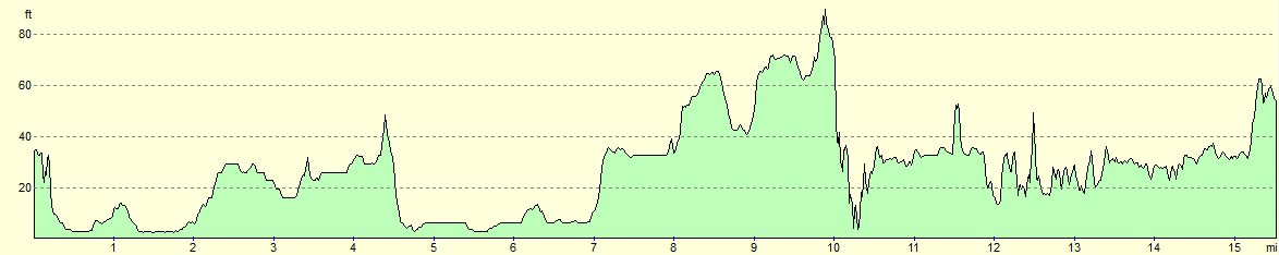
For more information on profiles, ascents and descents, see this page
Transport
Cumbria County Council operates bus service 93, which operates between Carlisle and Bowness on Solway. About five trips operate each day, with no services on Sunays or public holidays.
Accommodation
I spent the night before this walk at the Hillside Farm Bed and Breakfast and bunk barn. The bunk barn cost me £10 for the night, and was basic but solid accommodation. A cooked breakfast is available for a small price the next morning.
I spent the night after at the Greenhead Hostel, which is part of the Greenhead Hotel complex. This ex-YHA hostel is roomy and well-equipped, and hearty food is available from the hotel.
 |
 |
|
 |
 |
|
 |
 |
|
 |
 |
|
 |
 |
|
 |
 |
|
 |
 |
|
 |
 |
|
 |
 |
|
 |
 |
|
 |
 |
|
 |
 |
|
 |
 |
|
 |
 |
|
 |
Disclaimer
Please note that I take no responsibility for anything that may happen when following these directions. If you intend to follow this route, then please use the relevant maps and check the route out before you go out. As always when walking, use common sense and you should be fine.
If you find any information on any of these routes that is inaccurate, or you wish to add anything, then please email me.
All images on this site are © of the author. Any reproduction, retransmissions, or republication of all or part of any document found on this site is expressly prohibited, unless the author has explicitly granted its prior written consent to so reproduce, retransmit, or republish the material. All other rights reserved.
Although this site includes links providing convenient direct access to other Internet sites, I do not endorse, approve, certify or make warranties or representations as to the accuracy of the information on these sites.
And finally, enjoy your walking!
Nearby walks
| # | Title | Walk length (miles) |
|---|---|---|
| 438 | Allonby to Angerton | 24.1 |
| 439 | Angerton to Burgh by Sands | 17.3 |
| 440 | Burgh by Sands to Cargo via Carlisle | 17.3 |
|
|

|