Walk #926: Speyside Way: Cromdale to Aberlour
 |
 |
|
General Data
| Date Walked | 20/09/2011 |
| County | Grampian, Highlands |
| Start Location | Cromdale |
| End Location | Aberlour |
| Start time | 09.30 |
| End time | 17.49 |
| Distance | 23.0 miles |
| Description | This was a very disappointing stroll. The first half crosses hillsides with many stiles that makes for very slow progress. The second half follows an old railway line, and although the going is easier the views are far from stellar. This is one of the worst stretches of national trail that I have everdone. |
| Pack | Today I carried my 30-litre Karrimor rucksack, filled with water, my waterproofs, a book and other odds and ends. |
| Condition | I feel very tired after this walk, and the underside of both my feet ache. The worst problem is that I have some chaffing that, although not currently bad, will require some management for the next few days. |
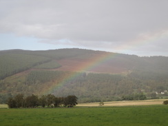
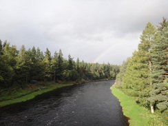
| Weather | This was a funny old day weather wise. Periods of bright, warm sunshine were interspersed with lots of drizzle and, on a couple of occasions, sharp showers. It was a perfect day for rainbows, and I saw at least five during the walk. |
| OS map | Landranger number 36 (Grantown & Aviemore, Cairngorm Mountains) and Landranger number 28 (Elgin, Dufftown & surrounding area) |
 |
 |
|
Map of the walk
Maps courtesy of Google Maps. Route for indicative purposes only, and may have been plotted after the walk. Please let me have comments on what you think of this new format. For a detailed table of timings for this walk, please see the table file.
 |
 |
|
Notes
Today was always going to be a bastard of a day. Public transport between Aberlour and Grantown-on-Spey is limited to two busses a day, at the unhelpful times of 9.30 and 14.00; the latter too early to finish the 25-mile leg and the former too early to complete it easily before dark. For this reason I decided to walk the shorter stretch between Aberlour and Cromdale instead, leaving the 3.5 miles to Grantown to be done another day.
I set off on the drive to Aberlour and soon decided to change my plans; I had not eaten that much last night and so it seemed sensible to divert off to visit a McDonalds in Elgin. This turned out to be a mistake; I had one of their Big Breakfasts which turned out to be a virtually inedible mess. Particular disdain has to be saved for the egg, which looked and tasted as though it had been extruded from a machine. Many chickens went to a great deal of trouble in vain to lay those eggs; although it tasted as though it had never been in contact with any eggs. My hunger meant that I ate it all, but I will never, ever visit a McDonalds for a breakfast again.
As I was driving through Aberlour I decided to change my plans and walk the stretch from Cromdale south, rather than north to the village. This would allow me to get the bus to Grantown, which would gain me forty minutes of walking time. After a little difficulty in finding the proper bus stop I boarded the bus for the journey south.
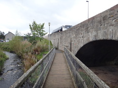
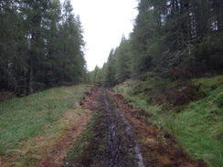
It dropped me off outside the hotel in Cromdale rather later in the day than I normally like to start walking. A good track took me down to join the Speyside Way beside the abutments of an old railway bridge. Initially the trail headed along the old railway trackbed and this made for good, if somewhat squelchy, walking. Aware that I had started a lot later than is normally the case I put my foot down and walked fast, soon coming across what was to become the bane of my day - ankle-biting stiles.
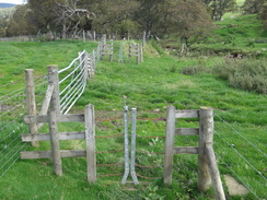
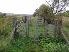
These are in a back-to-back 'J' shape, hinged at the bottom and with chains at the top. You disconnect a catch, pull them apart and then walk through. Unfortunately if you mistime letting go then they can close on your trailing ankle. As I experienced, this can be very painful. What is worse they tend to be fairly awkward and time-consuming to negotiate, especially when they are clasped shut.
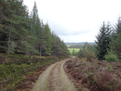
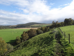
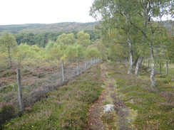
The trail left the old railway line and crossed the main road to enter a forest. This proved to be a good stroll with unfortunately sparse views, despite the path being much higher up the hillside than depicted on the OS maps. A descent followed, the path trapped between two fences and with several annoying stiles to reach a road.
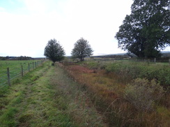
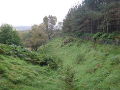
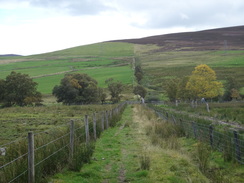
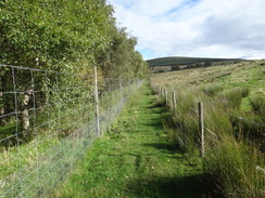
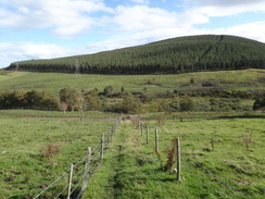
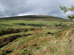
What followed was one of the worst stretches of path I have ever come across. The landowners have forced the path between two narrow fences for mile after mile, with frequent ankle-biter stiles. There were so many stiles, in fact, that there were often three in a few yards, and I counted five within view from one location.
Because it has been forced between the fences, the ground between them was frequently boggy and churned up. To ease this problem, boulders - not slabs - have been placed in the worst stretches. These were uneven and slippery and my feet were constantly trying to slide off into ankle-deep water and mud. I am used to such stones, but not hundreds of yards of them.
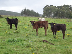
There is something seriously wrong with this stretch of trail. My guidebook states that the double fences are to protect walkers from cattle; in which case I wonder what sort of genetically-enhanced super-monster walker-eating cattle exists in the neighbouring fields?
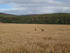
To make matters worse, one particularly boggy stretch of double fence protected... a corn field. It made for miserable walking, and I wished that I had my walking poles, which I had stupidly left in the car. On the other hand I had not needed them on the Great Glen Way, and this had given me some false confidence that the Speyside Way would be similarly good.
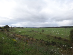
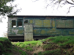
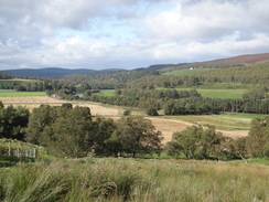
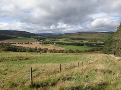
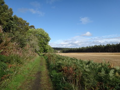
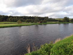
The trail did have some upsides: The occasional views down the Spey valley were good, and I passed what seemed to be an Edwardian railway carriage sitting alone in a field. Yet these were hardly compensation for the soul-crushing slog between the fences. The route the paths took were very different from those depicted on the OS map, but getting lost was very difficult due to the stiles that marked the progress.
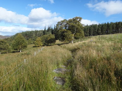
I felt things had got better when I entered the woodland on Knock Frink, where the stiles suddenly ended. Sadly they started again with a vengeance when the trail left the woods and descended down to cross the Burn of Coire Seileach. It was a hateful time; in dry weather it would be more manageable, but stretches were a quagmire after the recent heavy rain.
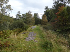
Relief came when the path entered some more woodland, but the stiles resumed as the path headed down to the main road and crossed it for a descent to rejoin the old railway line. Thankfully that meant (nearly) the end of the stiles for the day and I started to make good progress. Yesterday I managed to walk 26 miles at 3.2 mph over all sorts of terrain; a few miles of the stiles and fences had slowed me down to a snail-like 2.6. In short, I felt low, tired and utterly fed up.
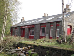
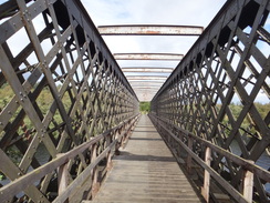
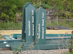
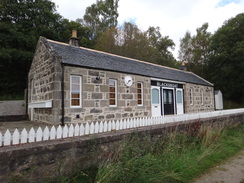
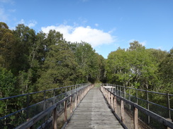
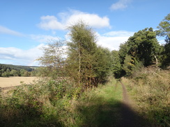
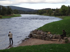
I normally like walking along old railway lines, but this one did little to lift my spirits. The station buildings at Cragganmore were neat and tidy, and there was even an official camping spot nearby. This was then followed by a wild and airy crossing of the Spey on an interesting metal lattice bridge. What followed was mile upon mile of flattish walking, interspersed with old stations (some carefully restored) and several distilleries. I forced myself to walk faster, knowing that once I had finished walking I still had to drive to Grantown in order to find my hostel for the night. The views over the river were sometimes superb, but mostly it was hidden out of sight.
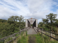
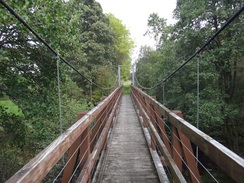
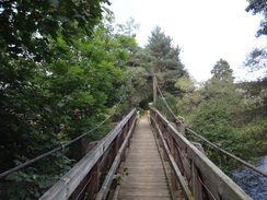
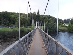
It was a relief when my car came into sight in the car park at Aberlour. Regretfully I walked on for another half-mile to reach the place where I had left the trail the day before, only then returning to the car park. This little diversion granted me the best views over the Spey of the entire trail so far, and the people who live in the houses that overlook it are very lucky. Before going to the car I made a quick diversion to cross the magnificent suspension bridge that spans the river nearby, an airy and wobbly viewpoint over the river.
It proved easy to find the hostel and I immediately had a shower before looking for somewhere to eat. A bar in the town - Craig's Bar - had been recommended to me as having a mad barman and great pies. This advice was true on both counts, although the barman was more over the top than truly mad, and I would like to think I gave him as good as I got. The walls of the place are covered in pictures of planes, and there are even remnants of a Lancaster than crashed near Hope in the Second World War. I can see why the barman might not be to everyone's cup of tea, but the evening cheered me considerably. It was a good end to a bad day, and I am glad that only one more day is needed to reach Aviemore and the end of the Speyside Way.
 |
 |
|
Directions
This walk starts off from outside the Haughs Hotel in the village of Cromdale at NJ075285. Leave the hotel and follow the A95(T) as it heads southwestwards, soon reaching a traffic-light controlled bridge over the Burn of Cromdale. A footpath leads off to the left immediately before the bridge to reach a footbridge over the burn. Cross this and take a path that immediately leads back up to the main road.
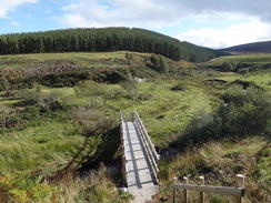
Carefully cross the main road and turn right to head back towards the bridge; after a few yards turn left down a track that curves to the left away from the road. The track goes through a scissor stile beside a field gate and continue north along the track, with the burn away to the right. Go through a field gate and head towards the embankment of an old railway line. The track crosses the burn on a bridge before reaching the abutments and piers of an old railway bridge are reached. Here the Speyside Way is joined.
Turn right through a scissor-stile to join a path that runs east-northeastwards along the old railway trackbed. Continue along this as it slowly curves to the left to take a more northeasterly course, passing through several scissor-stiles, crossing several tracks and a bridge over a stream on the way. After a mile it reaches an access track at NJ083300, with Easter Pollollowick Farm to the west. Here turn right up the track to reach the A95(T). Carefully cross the main road and turn right to start following it southwards.
After a sixth of a mile a lay-by is reached; turn left up a surfaced track. After a short distance turn left through a scissor stile to join another track that continues to climb, reaching a summit before steeply descending. Go through a scissor-gate by a tall field gate and continue on along the track, which is now narrower as it climbs once more. It summits for a second time and then falls once more to reach another scissor-gate.
Go through this to reach a more open area, with only sparse trees. Continue on downhill along the track, which leads down to another scissor-stile. On the other side turn left to follow a path that heads downhill between fences. At the bottom of the hill the path curves to the right with a field on the left and trees on the right. Go through a gate and turn right down a steep-sided valley; the path curves to the right to angle towards a road. Initially it parallels the road without joining it, before curving to the left to go through a scissor-stile onto a small lane at NJ108317, 2.2 miles after having left the main road.
The next five miles of path to the A95(T) are fairly tortuous, with narrow paths running between fences and many scissor-stiles. For this reason these notes give a basic description of the route, with stiles and gates only mentioned when they are strictly necessary.
Cross the lane and head down some steps to join a path that runs between fences to a footbridge over a stream; go through more gates and then turn right to continue between fences. Go through another couple of gates and then turn left along a stretch of path that is frequently muddy, heading up a slight slope. When the path forks take the right-hand branch that heads slightly uphill; this soon hairpins to the right and the left, still climbing. It finally curves to the left to reach the top of the field, following a fence on the right and a hedge on the left.
Continue following the fence on the left. Go through another stile and then turn right for about three yards to another stile; go through this and continue on between fences along a muddy stretch of path. Finally it goes through another few stiles, crossing another boggy area and continue between two fences. Head through another stile and turn right, to continue between fences that leads to a couple of stiles that guard a track.
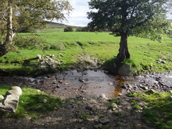
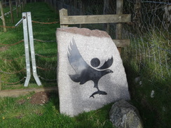
After the second stile turn left to head down a path between fences, with a track over the fence to the left. Cross more stiles as the Allt Eoghainn is followed down to the right; soon it passes an old railway carriage on the left at NJ118319; go through more stiles; when the fence ends turn right through another stile. It crosses a stream and follows a fence on the left to reach a stile beside a stone marking the boundary of the Cairngorms National Park, then turn left to cross a stream on a field bridge and then immediately turn left through another stile to continue on between fences.
The path curves to the left through more stiles, still between fences, before reaching some stepping-stones over a stream. On the other side follow the path as it heads up the bank half-left; take the safest route you can find to reach the fence at the top. Go through another stile and turn half-right aiming diagonally for about thirty yards across a field to another stile. Head across some stones and through another couple of stile, with a fence on the right.
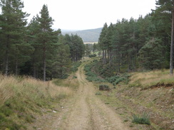
Follow a line of stones across some boggy land; care needs to be taken as they can be slippery. The stones lead to the southern edge of the Woods of Knockfrink; turn right to head uphill with the forest on the left and a fence on the right. Go through a field gate and turn left across another stile, keeping a fence on the right as it enters the woodland. This leads onto a clear track that in turn leads onto a better track. Turn left and join this as it continues through the trees, heading downhill and losing much of the height that has just been gained.
After a quarter of a mile another track leads off to the right at NJ124328; this starts to climb through the forest. The ascent is hardly onerous, and soon ends. Pass through a fence to enter some more woodland, passing a little stone quarry beside the track, which then curves to the right, becoming rougher. It turns to the left through a deer gate and then right to head between fences. At the end of this stretch of path cross a stile and turn left across a track to reach another stile. Head downhill along a path between fences to another stile. Go through this, cross a muddy track and go through another stile before turning right to keep a fence on the right.
Turn left through another stile and then turn half-right to join another track that heads downhill to a gate. Go through this gate and then down steps to reach a footbridge over the Burn of Coire Seileach at NJ137330. Cross this, go through a gate and then head on for about thirty yards to reach another gate. On the other side of this climb some steps to reach another gate. Contnue on for five yards to turn left down a muddy track. After a short distance turn right to head along an indistinct path that heads uphill to the east for a short distance, aiming for the trees of the Garvault Plantation.
The path enters the trees through a stile beside a field gate at NJ139331. The path climbs steeply uphill through a broad gap in the trees for a couple of hundred yards. Well before the top of the hill is reached the path curves to the left to enter the trees, thankfully on an easier gradient. Soon afterwards this reaches a broad forestry track at NJ141331; turn left and follow this track as it heads downhill.
After half a mile it crosses a little valley; immediately after this turn left down a path that leads off through the trees. Exit the woods through a stile and head on along a path that runs between fences, heading under power lines. Go through two stiles guarding a track and continue on, still between fences. After another stile the path parallels a track on the left until it reaches the A95(T) once more at NJ142343.
Turn right and follow the road as it heads eastwards; the road slowly curves to the left. Fortunately there is a good path on the right-hand side of the road, although this ends shortly after a cottage is passed on the left. Carefully cross the main road and head through a stile into a field, and then turn right to head between fences, paralleling the road. At the end of the first field the path turns to the left, heading slightly downhill between fences. At the bottom of this field go through a stile and descend to join a track. Turn right to head northeastwards along this track; just before a gate is reached turn right up a slope that leads to two stiles that guard another track. After the second stile continue on between fences.
At the end of this path turn left through a couple of stiles across a stream and then onto several more stiles. This leads onto a line of stones across a boggy area of land, with pieces of wood thrown into some of the worse of the morass. Go through a field gate and continue on through a similar boggy area. As the track widens out, follow the fence on the left; a fence is soon reached on the right and the path continues between the fences as it enters some sparse woodland. Finally it crosses another stile and heads on between fences before curving to the right to reach the old railway trackbed at NJ148363.
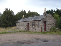
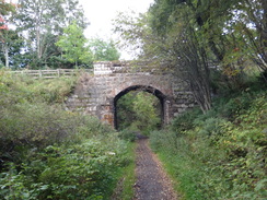
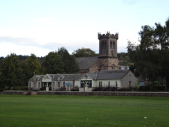
Follow the old railway line as it heads east-northeastwards, and slowly curves to the right. After a mile pass a cottage on the left and then go past a field gate to descend to cross a road; off to the left are the abutments of a missing bridge. Cross the road and a plank footbridge across a stream, then climb back up onto the trackbed once more. It passes between the platforms of the old station at Cragganmore at NJ166366.
This marks the end of the strenuous part of the day's walk, and the second half is much simpler. Continue along the old railway as it curves to the left to cross an old lattice-girder bridge over the River Spey, the first time that the trail has really seen the river all day. It crosses a few gates as it heads on, then heads over a suspension bridge over the Allt a' Gheallaidh. The trackbed then becomes a firm farm track before reaching the platforms of Blackboats Station at NJ183388, 1.6 miles after crossing the river.
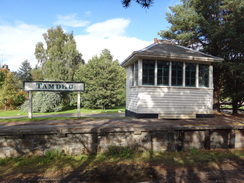
Pass the platforms and continue on under a bridge that heads under the B9138 road. After 0.9 miles it crosses another suspension bridge over a stream and then curves to the right to approach the Tandhu Distillery on the left. Here the path joins an access road to the distillery, passing the buildings on the left. After a short distance bear right past the platforms of Tamdhu Station at NJ191416.
Continue on, passing the Knockando Distillery on the left. The old railway trackbed then curves to the left to head north with the river to the right. It soon curves to the right, still with the river on the right. It goes through a gate and passes a house at Millhaugh on the right and continues on southeastwards. Eventually it parallels a road to the left, with a row of cottages called Imperial Cottages on the other side.
The old railway line starts to curve slowly to the left, still with the road on the left, breaking out of the trees to reach the Imperial Distillery on the right. Walk along the grass in front of the distillery, keeping the road to the left. When the grass ends turn left to follow the road as it curves to the left to head northwards. After a short distance turn right along a grassy area to follow a platform edge on the left. This path soon parallels the road on the left, before eventually joining it. Turn right down the road towards a bridge over the Spey at NJ224411.
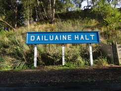
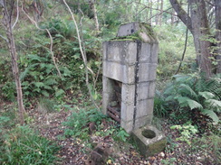
On the other side of the bridge a path leads off to the right; it soon crosses the road and climbs a bank to rejoin the old railway trackbed. Follow it eastwards with a road a short distance away on the right, passing an overbridge on the way. Two-thirds of a mile after the road it passes the small platform of Dailuaine Halt on the right. Pass this and go through a gate to join a road that follows the trackbed. Turn right along a path that goes past a gate; this skirts an effluent plant on the left (otherwise known as a biological treatment plant that treats the water from the distilleries).
The path follows the trackbed northeastwards with the river below and to the left; it slowly curves to the right past Delmore and then the left. 2.1 miles after Dailuaine Halt a suspension footbridge over the Burn of Aberlour is reached at NJ261427. Cross this and continue on along the path, which soon emerges out into a car park. Immediately turn left down a track that leads to another suspension bridge that spans the Spey; do not go onto the bridge and turn right to start walking along a path that follows the southern bank of the river.
It passes the site of Aberlour Station on the right and then curves to the right and then the left, continuing with houses to the right and the river on the left. Head on until a track is reached at NJ271434; turn right along this to reach the A95(T). Turn right to follow the road through Aberlour to reach the bus stop at the square in the town.
(It should be noted that the route that I took at the end of the day was slightly different; my car was at the car park near the suspension bridge, so once I reached the point where I left the trail yesterday, I turned back and followed the Speyside Way back to the car park).
 |
 |
|
Distances
| From | To | Distance (m) | Ascent (ft) | Descent (ft) |
|---|---|---|---|---|
| Cromdale | Cragganmore | 11.9 | 1660 | 1808 |
| Cragganmore | Carron | 6.7 | 623 | 735 |
| Carron | Aberlour | 4.4 | 272 | 371 |
This makes a total distance of 23.0 miles, with 2555 feet of ascent and 2914 feet of descent.
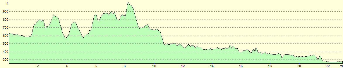
For more information on profiles, ascents and descents, see this page
Transport
Public transport between Cromdale and Aberlour is very limited; Speyside Community Bus and Maynes Coach service 338 runs between Grantown on Spey and Aberlour, but there are only two service on most weekdays. Unfortunately these are not very conveniently timed, although they are better than nothing.
Accommodation
I spent the night at the Ardenbeg Bunkhouse in Grantown-on-Spey, which was a friendly and cheap place to spend the night. It is situated in the middle of the town, which means that the shops and pubs are all very accessible.
 |
 |
|
 |
 |
|
 |
 |
|
 |
 |
|
 |
 |
|
 |
 |
|
 |
 |
|
 |
 |
|
 |
 |
|
 |
 |
|
 |
 |
|
 |
 |
|
 |
 |
|
 |
 |
|
 |
 |
|
 |
 |
|
 |
 |
|
 |
 |
|
 |
 |
|
 |
 |
|
 |
Disclaimer
Please note that I take no responsibility for anything that may happen when following these directions. If you intend to follow this route, then please use the relevant maps and check the route out before you go out. As always when walking, use common sense and you should be fine.
If you find any information on any of these routes that is inaccurate, or you wish to add anything, then please email me.
All images on this site are © of the author. Any reproduction, retransmissions, or republication of all or part of any document found on this site is expressly prohibited, unless the author has explicitly granted its prior written consent to so reproduce, retransmit, or republish the material. All other rights reserved.
Although this site includes links providing convenient direct access to other Internet sites, I do not endorse, approve, certify or make warranties or representations as to the accuracy of the information on these sites.
And finally, enjoy your walking!
Nearby walks
| # | Title | Walk length (miles) |
|---|---|---|
| 927 | Speyside Way: Cromdale to Aviemore | 21.2 |
|
|

|