Walk #875: A circular walk from Iford to West Parley
 |
 |
|
General Data
| Date Walked | 09/12/2010 |
| County | Dorset |
| Start Location | Iford |
| End Location | Iford |
| Start time | 09.42 |
| End time | 15.30 |
| Distance | 14.9 miles |
| Description | This was a bitty walk following two legs of the Stour Valley Way. |
| Pack | Today I carried my 30-litre Karrimor rucksack, filled with water, my waterproofs, a couple of books and other odds and ends. |
| Condition | I am rather fatigued after this walk, but this was mainly down to a tiredness that I had before I even set off. ASide from this I feel fine. |
| Weather | The weather today was bright and clear, with few clouds in the sky until later in the afternoon. It was also fairly cold, and I doubt it got much above freezing all day. |
| OS map | Landranger number 195 (Bournemouth & Purbeck, Wimborne Minster & Ringwood) |
 |
 |
|
Map of the walk
Maps courtesy of Google Maps. Route for indicative purposes only, and may have been plotted after the walk. Please let me have comments on what you think of this new format. For a detailed table of timings for this walk, please see the table file.
 |
 |
|
Notes
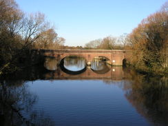
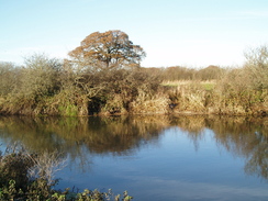
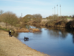
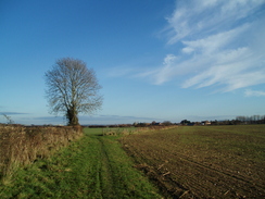
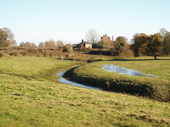
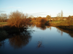
This walk was supposed to be so easy. A short stroll along the Stour Valley Way, followed by a return by the same route. Yet the day turned out to be complex than I planned. It was cold when I parked by the old Iford Bridge, from which the River Stour looked superb in the bright sunshine. The other cars were covered in a heavy frost, so it was on with the hat and gloves before setting off.
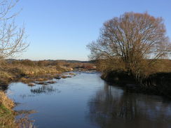
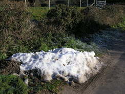
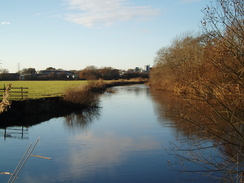
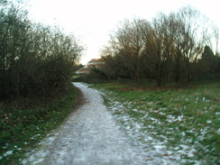
The surrounding area was fairly built up, so it was a relief when the path headed away, following the southern bank of the river as it snaked northwards. Almost all of the snow that fell the previous week had disappeared, except for stretches of the path where it had been compacted into ice. This made the going somewhat slippery, and it was a relief when the gravel path was left behind and I could walk along the grass.
Soon the path skirted around the edge of, and then across, a golf course. A few people were out and playing despite the cold, and soon the traffic on the A338 dual carriageway could be heard. This was crossed by a long footbridge whose sloping steps were slippery with frost.
The river was left behind on the other side, and roads took me westwards and then northwestwards. It was a fairly pedestrian stroll and I managed to keep up a good pace, aside from when a *&^%*!& representative from Vodafone called me for the sixth time in the last month, wanting to know the same puerile and unimportant information as before. It took me five minutes to finally convince her that, as she was phoning my mobile, she must have my mobile number...
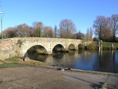
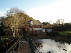
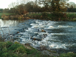
I stopped to take a photo of the mill at Throop, only for my camera battery to run out; a victim, I think, of the cold. I had no spare with me, so I swapped over to use my spare camera instead. In the process a load of stuff fell out of my bag onto the road, and I only just retrieved them before a heavy lorry thundered past. This entertainment took me on towards the end of the road, which was right by what appeared to be a sewage works.
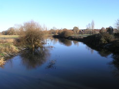
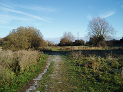
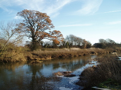
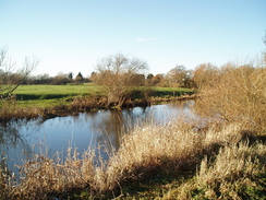
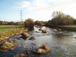
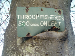
What followed was a wonderful stroll through the Stour Valley Nature Reserve. The path was easy to follow, and indeed much of it had been made wheelchair accessible. Halfway along I came across something I had not seen before; a platform built into the river to allow the disabled to fish. It was truly an excellent idea.
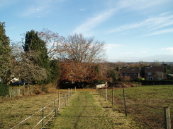
It was a shame when the park ended and I had to follow a busy main road across the river. The Stour was crossed by a couple of arch bridges, and it was a relief when the trail plunged off to the left. It rejoined a main road for a short distance in West Parley, before heading off back along footpaths. It climbed up a small hill, giving me the first decent distant views of the day.
On the spur of the moment I decide to stop off at the Dudsbury, which appeared to be a fairly up-market place. The interior more than matched my expectations, but I was welcomed in. There was not another customer to be seen, so I ordered a pint and a pack of crisps before sitting down in a remarkably comfortable sofa.
Before I knew it, my head started bowing and I was asleep, the first time that I have ever fallen asleep in a pub whilst on a walk. I woke when my head touched the table in front of me, jerking me awake. There was a moment of all too familiar manner confusion as I wondered where I was, and then I took a quick sip of the pint whilst making a surreptitious glance around. None of the staff appeared to have noticed amidst their conversation about how much they hated the Christmas music that was playing.
There was no doubt about it: I was knackered. Not as a result of this unstrenuous walk, but because of a lack of sleep over the last few nights. The pint appeared to have been the last straw. I downed the rest of the pint regardless and left the pub. There was no way I was going to extend the walk, so my only option was to head straight back. My Walkman battery was also low and all I had in my pack were rechargeables that I had not bothered to recharge, so instead of returning the same way I diverted off to a nearby Tesco store to get some more.
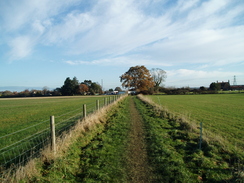
On my way back to rejoin the trail I noticed that another limb of the Stour Valley Way headed off along the northern bank of the river, rejoining the route I had walked earlier at Throop Mill. I had walked this particular stretch a few years before, and on the spur of the moment I decided to walk it again.
Planes roared off, taking off from Bournemouth airport a short distance to the north. Utter tiredness started to overwhelm me as I strolled along, and I took the wrong turn twice on a route that I had walked twice before. My mind drifted even more than usual, and was flitting everywhere else but on the trail. It was a relief when I finally passed the picturesque Throop Mill by by a raised concrete walkway and joined the road I had walked along earlier.
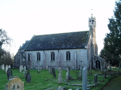
The rest of the walk was simply a case of following the route I had taken earlier in reverse. I diverted off to take a few photos of Holdenhurst church. The sun was starting to go down, and the golf course was understandably not as busy as it had been in the morning. The walk alongside the river was pleasant in the dusk, and I reached the car well before it got dark. It should have been a pleasant day's walk, but my pre-existing tiredness had somewhat taken the edge off it.
 |
 |
|
Directions
This walk starts off at the old Iford Bridge. Head westwards for a few yards along Old Bridge Road to reach the A35 beside a pub. Carefully cross the A35, and turn right for a few yards towards the new bridge. Do not cross the bridge and instead take a good path that leads off to the left. For the next few miles this route will be following the Stour Valley Way. When the path forks after a couple of hundred yards, take the right-hand fork that runs alongside the river, curving to the right to take a more northerly direction.
It passes a footbridge on the right and continues on as the river curves to the left and right with a golf course on the left. The path curves to the left across the golf course, almost immediately curving to the right to head northwards with a hedge on the right. When another hedge is reached turn left to head northwestwards with a hedge on the left. The hedge curves to the left towards the corner of a sewage works; at the corner turn left to join a path that leaves the golf course to head southwestwards through scrubland. It crosses a footbridge and then turn left to head south-southwestwards across scrubland parallel to a road. This footpath passes through a hedge to reach a footpath; turn right along this footpath to reach Riverside Avenue.
Cross the road and take a footpath that immediately climbs up onto a footbridge over the A338 road. Descend on the other side to reach Holdenhurst Road. Turn right and follow this road for 1.7 miles; initially it heads northwards before curving to the left to take a more westerly course through Holdenhurst and Throop. The road ends by a sewage works at SZ108961 near Muccleshall Farm.
When the road swings to the left continue straight on northwestwards along a surfaced road for a quarter of a mile until it ends at the entrance to a sewage works. At the gate into the sewage works turn left through a wooden clappergate that leads into some scrub woodland. It soon breaks out to head westwards along the edge of the field. It jinks to the left for a short distance, then to the right to continue westwards to reach the southern bank of the river.
Turn left and follow the southern bank of the river as it winds in a rough westerly direction for 1.7 miles, passing through the Stour Valley Nature Reserve. The path is easy to follow, and in places is wheelchair-accessible. The path eventually turns to the left at about SZ082969 to head southwestwards away from the river, reaching a car park. Go up the access track for the car park, which joins Brecon Close that ends at the A347 road.
Turn right and follow the A347 northwestwards. After a few hundred yards the road curves to the right to head northeastwards to cross Ensbury Bridge. Continue on along the road until a footpath leads off to the left at SZ083973. Cross the stile to the right of a metal gate and continue on along a broad track. This soon ends, and a narrow path enters some trees and curves to the right to head uphill to the north. It soon levels out and continues on to meet Ridgeway road end-on. Continue north along this road until it ends at the B3073 road.
Turn left to head westwards along the B3073 road for a few yards before taking a track off to the left. This immediately splits into two; take the left-hand fork, and when a stile is reached by a house cross this to gain access to a field. Turn half-right to head up the field and reach the car park of The Dudsbury Inn.
This marks the end of this stretch of the Stour Valley Way. Leave the car park and head back down the footpath and track to reach the B3073 road. Turn right and follow the road eastwards downhill; do not turn right to take the route that was followed earlier. When a crossroads with the A347 road is reached turn right to head south along the road.
After a quarter of a mile at SZ083975 turn left to cross a stile and walk eastwards with a fence on the left. The footpath becomes a track that soon ends at Church Lane. Turn right to head south down Church Lane for a fifth of a mile until a track leads off to the left immediately before Church Farm is reached.
The track heads eastwards across fields for two-thirds of a mile to Parley Court at SZ, initially with hedges on the left before crossing over and following them on the right. Keep the buildings at Parley Court on the right, and once past them cross a lane and continue on along a footpath that angles to meet Parley Green Lane.
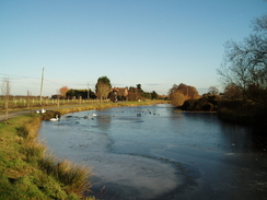
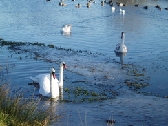
Follow the lane eastwards to Parley Green, passing a couple of lakes on the way. When a junction of several tracks is reached at SZ102973 turn right and then immediately left along another track. This heads in a rough easterly direction, curving around a golf course. It passes between some buildings and a car park; when the buildings end turn left to head eastwards with a practice area on the left. Turn left to head northwards, and follow the path as it angles to the right to end at Merritown Lane. Continue straighr on eastwards down this lane as it passes immediately to the south of the 'Alice in Wonderland Family Park'.
Shortly after the park at SZ112971 turn right down a footpath that heads southwards. It approaches the northern bank of the river. After two-thirds of a mile on this path a footbridge over the river is reached at SZ112960. Turn right to cross this bridge and continue on along the footpath, which crosses another tributary of the river and passes Throop Mill to reach a road at SZ112957 in Throop.
From here it is simply a case of retracing your steps back from Throop to Iford Bridge. Turn left and follow the road eastwards for 1.4 miles as it passes through Holdenhurst and curves to the south to reach the footbridge over the A338. Cross this and the minor road on the other side to continue eastwards along a footpath for a few yards before turning to the left along another footpath. This heads northeastwards across scrubland before reaching a footbridge over a stream. Cross this and continue on eastwards until the corner of a sewage works is reached.
Turn right to keep a hedge on the right as it crosses a golf course. Just before the river is reached turn right to head south with a hedge on the left; when the hedge ends turn left to reach the riverbank. Turn right to follow the footpath southwards. Continue along this footpath for a little under a mile with the river in close company to the left. When the A35 is reached carefully cross the road and turn left to take a short stretch of cycle path that leads down to Old Bridge Road. This walk ends at Iford Bridge, a few yards down the road.
 |
 |
|
Distances
| From | To | Distance (m) | Ascent (ft) | Descent (ft) |
|---|---|---|---|---|
| Iford Bridge | Dudsbury | 7.3 | 200 | 102 |
| Dudsbury | Iford Bridge | 7.6 | 95 | 193 |
This makes a total distance of 14.9 miles, with 295 feet of ascent and 195 feet of descent.

For more information on profiles, ascents and descents, see this page
 |
 |
|
 |
 |
|
 |
 |
|
 |
 |
|
 |
 |
|
 |
 |
|
 |
 |
|
 |
 |
|
Disclaimer
Please note that I take no responsibility for anything that may happen when following these directions. If you intend to follow this route, then please use the relevant maps and check the route out before you go out. As always when walking, use common sense and you should be fine.
If you find any information on any of these routes that is inaccurate, or you wish to add anything, then please email me.
All images on this site are © of the author. Any reproduction, retransmissions, or republication of all or part of any document found on this site is expressly prohibited, unless the author has explicitly granted its prior written consent to so reproduce, retransmit, or republish the material. All other rights reserved.
Although this site includes links providing convenient direct access to other Internet sites, I do not endorse, approve, certify or make warranties or representations as to the accuracy of the information on these sites.
And finally, enjoy your walking!
Nearby walks
| # | Title | Walk length (miles) |
|---|---|---|
| 311 | Milford on Sea to Southbourne | 16.9 |
| 312 | Southbourne to Hamworthy Station | 15.3 |
| 801 | A circular walk from Brockenhurst to Burley | 23.5 |
|
|

|