Walk #868: Fordingbridge to Salisbury
 |
 |
|
General Data
| Date Walked | 13/09/2010 |
| County | Hampshire, Wiltshire |
| Start Location | Fordingbridge |
| End Location | Salisbury station |
| Start time | 07.47 |
| End time | 14.31 |
| Distance | 16.8 miles |
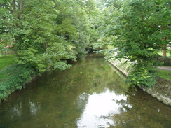
| Description | This was a pleasant walk following the Avon Valley Path as it winds northwards to Salisbury. |
| Pack | Today I carried my 30-litre Karrimor rucksack, filled with water, my waterproofs, a couple of books and other odds and ends. |
| Condition | I feel absolutely fine after this walk. |
| Weather | The day started off slightly overcast, with the sun occasionally making short appearances through the cloud. near the end of the walk it started to spit with rain, although I missed the downpour that started soon after I completed the walk. |
| OS map | Landranger number 195 (Bournemouth & Purbeck, Wimborne Minster & Ringwood) and Landranger number 184 (Salisbury & The Plain, Amesbury) |
 |
 |
|
Map of the walk
Maps courtesy of Google Maps. Route for indicative purposes only, and may have been plotted after the walk. Please let me have comments on what you think of this new format. For a detailed table of timings for this walk, please see the table file.
 |
 |
|
Notes
The task for today was to finish off walking the Avon Valley Path, a trail that runs from Christchurch in the south to Salisbury. About a month ago I had reached Fordingbridge, and there was only sixteen miles to reach the end of the trail at Salisbury Cathedral. Sencan dropped me off in the long-stay car park in Fordingbridge and I headed off.
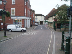
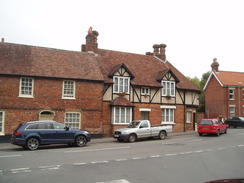
The centre of Fordingbridge has not been too spoilt by progress, and the initial stroll through was enjoyable. I stopped to take a photo of a pretty shop, only for the proprietor to come running out, asking for a donation for the air ambulance in exchange for the photo. I put a quid into the pot and left, slightly bemused.
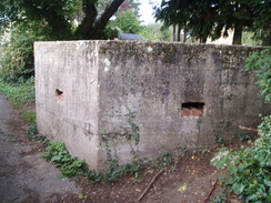
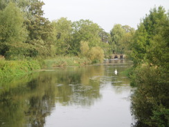
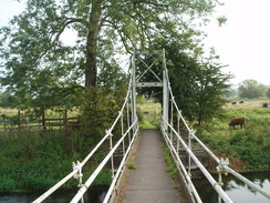
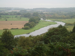
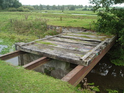
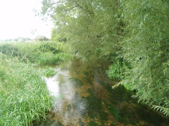
I munched on a couple of bananas as I joined a steady stream of children going to school. The trail soon diverted off down a narrow path that passed a pillbox before joining a track that ended at a road. At Burgate Manor Farm I came across something most unexpected - a small white suspension bridge over the River Avon. It was a very pleasant spot, and the bridge provided a pleasant bounce as it was crossed. For some reason this raised my spirits, which had been unaccountably low.
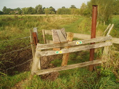
A curious, Heath-Robinsoneque squeeze stile took me to a track that led to another farm, and then a road that climbed up onto Castle Hill. The hillside was covered with trees, and there was no way of knowing where the castle may once have been. Indeed, a quick Google search when I got back home also did not provide any answers. A little further on there was a little lay-by where a gap provided glimpses of the river far below. It was a pleasant spot, but the views from another lay-by a few yards further on were blocked by vegetation. It is a shame for the council to provide viewpoints and not to ensure that they are clear.
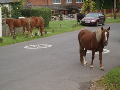
The road took me down into the pleasant little hamlet of Woodgreen. This sits within the New Forest National Park, and as if to reinforce the fact three ponies stood nonchalantly in the road. Another stood on the verge, its head stuck over a fence to eat from within a garden. It was a marvellously tranquil scene. A little further on an area of clear heathland opened up on the right, replete with the obligatory dog walkers. I am well aware of the troubles that afflict country areas, but the scene gave me little doubt that there are compensations. Woodgreen must be a superb place to live.
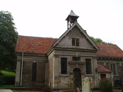
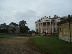
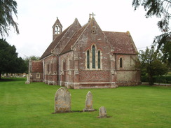
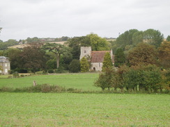
The trail passed by an oddly-styled Church of St Mary, nestled amongst trees in Hale Park. It was rebuilt by the 18th Century architect Thomas Archer, who also rebuilt the nearby Hale House in Palladian style. The church contains a monument to Thomas Archer, designed by himself. A short distance further on I passed the house itself, and I diverted off the path to take a photograph of it.
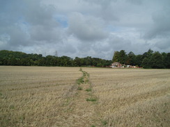
A long and fairly uninteresting walk too me on to Hatchet Green, and then northwards across fields and through scrubby woodland, before eventually descending to cross an old railway line to reach the road in Downton. Nearby was The Moot, attractive gardens situated in the grounds of a 12th Century castle. I did not enter, and instead strolled through the town.
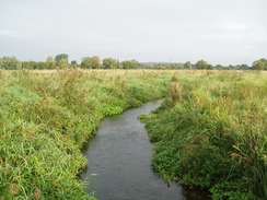
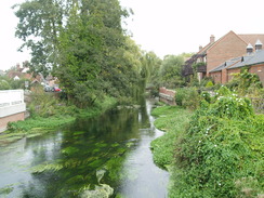
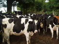
The River Avon is separated out into a series of streams in the town, and after the second of these an Avon Valley Path sign pointed down a footpath to the right. On the map, the trail continued along the road towards the nearby village of Wick before turning to the north. I decided to follow the waymarked path, which led me across a pleasant stretch of floodplain. This ended near a bridge over a small stream, but the stile to leave the field was blocked off by a herd of cows. It took me a few minutes to negotiate my way past them and access the track on the other side.
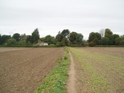
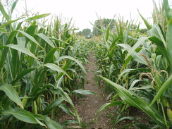
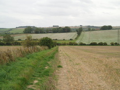
A path across the floodplain took me to the little hamlet of Charlton. I had walked from Charlton to Salisbury a couple of years before, and was therefore not expecting any navigation problems. I passed the attractive Charlton church before plunging into a field of tall corn. Broad leaves stroked my arms and face as I walked, and it was a relief when I finally emerged from the field. Unfortunately I was soon led into another one, except this time the path was harder to find. A rough, narrow path took me in what I felt was roughly the right directions, and eventually I emerged out onto a track.
The trail climbed uphill after crossing the A338, before skirting the northeastern flank of a hill. Here I was greeted with the same problem as before - a herd of cows crowding the stile. A couple of them gave me contemptuous looks as they all refused to move; a gently slap on the buttocks caused one to move and then, like a cascade, the others followed, giving me room to access the stile.
I stopped off at the pub in Odstock, which is a pleasant place aside even if the roof is a little too low for someone of my height. The food all looked very tempting, but Sencan had made me some sandwiches. Instead, I drunk a couple of pints whilst chatting to a couple who had come in; the man had checked the instructions for the council's guide to the Test Way.
The next stretch of path was familiar and seemed to fly. A bridge took me over the River Ebble, and I then climbed uphill towards Dogdean Farm. The clouds were starting to gather and it started to get a little cooler. I had planned to extend the walk by heading nirht to Old Sarum and back, but the clouds made me start to doubt that plan.
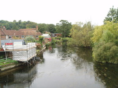
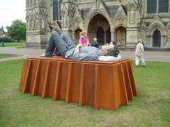
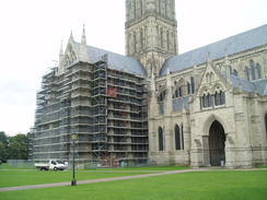
I fought my way along an overgrown stretch track that led to the A354. I was now on a path that I had walked on many occasions, leading me to the top of Harnham Hill. As I descended down the good track on the other side towards Salisbury it started to drizzle. A road took me north across the River Avon and on towards Salisbury Cathedral, which was impressive despite the gloom. A sculpture of an oversized man lying down was outside the west end of the cathedral, the face slightly resembling my own!
It was a simple case of walking from the cathedral to the railway station, again a walk that I had done on many different occasions. A train was due in about a quarter of an hour, so I had plenty of time to purchase a ticket and get on board. It started to rain heavily as the train took me back to Romsey, but this had stopped by the time I got off the train. From there it was a mile and a half walk to pick up the car outside Sencan's workplace, completing another good (if short) day's walk.
 |
 |
|
Directions
This walk starts off from the long-stay car park in the centre of Fordingbridge. Leave the car park and pass the public toilets on the left. Turn left to head northeastwards along Round Hill. After a few yards turn left down Salisbury Street. This heads northeastwards; immediately after the post office on the left, turn left down Green Lane. Head northwestwards along this road, and then turn right down Whitsbury Road.
Head slightly west of north, and then at SU146148 turn right down Pennys Lane. This heads northwards; pass Burnham Road on the left, and just before it curves to the right continue straight on along a footpath that heads northwards. Initially there are gardens on either side, and later on there is a school on the right. The path emerges out into fields; continue straight on until a track is reached at SU147155. Turn right at the track to head eastwards for a third of a mile until the A338 is reached.
Turn right at the main road to head south for a short distance, passing a pub on the right. Carefully cross the road and then head down a track that heads eastwards to Burgate Manor Farm. Pass between the farm buildings; immediately after the last one on the left, and before the end of the barn on the right, turn left along a footpath that leads down to a suspension bridge over the River Avon.
Cross the bridge, and on the other side head straight on along a footpath northeastwards for a short distance across the floodplain, following a heavilly-eroded bank. When a hedge is reached turn half-right, following a fence on the left to reach the first of three footbridges over streams. Cross these and start heading east-northeastwards along a track. After half a mile Folds Farm is reached.
Pass through Folds Farm and then cross a stream. The track soon curves sharply to the right; a few yards later turn left along another track that continues for a few yards to end at a tarmac road. Turn left, and follow this road as it heads north-northeastwards uphill, summitting Castle Hill. Nearly a mile after Folds Farm, a road junction is reached at SU171169. Turn left to head northwards down this road for a hundred yards, and then take the first road to the right, Brocks Lane.
Follow Brocks Lane north-northeastwards as it climbs uphill. An area of common land appears on the right at the top of the hill, and the road then ends at another road. Turn left down this for a few yards, and then turn right to head northeastwards along Lower Densome Wood. At a junction turn left and follow this as it swings to the left to meet another road. Turn left along this road and follow it northwestwards as it heads downhill.
The track curves to the right to head northwards; at another right-hand bend continue straight on, crossing a stile to enter a field. Continue in a rough northerly direction with trees on the left, passing under power lines. The path heads to the left of a house on the right, then descends a slight slope to end at a road. Turn right along this road for a few yards, and then immediately turn left up Moot Lane. Follow this north-northeastwards for a fifth of a mile. At SU177186 turn right up a track that heads uphill to the east, passing Hale Church on the right. Continue along the good path as it swings to the right.
Just before it reaches Hale House on the right, turn left along a footpath that heads eastwards with a fence on the left. This heads east-northeastwards with a track parallel to the right, before ending at Hale Lane. Turn left to follow Hale Lane northwards for a few yards to a sharp right-hand bend near Home Farm; continue on along the lane as it heads east-northeastwards After half a mile at SU191191, turn left along a track just after a cattle grid. The track head northeastwards, passing a house and barns before entering a field.
Head downhill across the field, aiming for a small gap in the hedge at the bottom. Go through this and continue northwards through a patch of woodland, descending down to a stream. The path emerges from the trees, and continues uphill to the north with the woodland on the left. When the woodland ends, continue on as the path swings to the left to reach a track at SU190197.
Turn left along the track for a few yards, and then turn right to join another footpath that heads north with an area of woodland on the right. Cross a stile and continue on, soon joining an area of woodland on the left. This becomes a hedge as it heads north to meet a track west of Woodfalls Farm. Cross the track and continue on northwards with a hedge on the right. At SU189205, just before the end of the field, turn left to cut across the field, aiming for a wooden pylon at the northern edge of the field. From here skirt the edge of the field northwestwards downhill. The path crosses a stream at the bottom before climbing slightly. At the western end of the field it crosses an old railway trackbed to join a track that soon ends at Moot Lane in Downton.
Turn right and follow Moot Lane northwards for a coupleof hundred yards until it ends at a T-junction with High Street. Turn left and follow the High Street as it heads westwards, curving around to cross a tributary of the River Avon. The road curves again to head northwestwards, soon reaching another tributary of the river. Cross this bridge, and then immediately turn right to join a footpath.
This footpath initially follows the river on the right, before curving away slightly to the left to head northwestwards for a few yards, before curving to the right to head northwards once more along an obvious path. The path curves to the left to reach a stile; cross this and reach a track on the other side. Turn right and start following this track northwards. When this curves to the left at SU175225, turn right to cross a stile and continue northwards across a series of fields. In the third field aim just to the right of a house; pass this and go through a clapper gate to join Warrens Lane. Turn left to head westwards along this road. After a few yards a junction with Lower Road is reached; turn right to head northwards along Lower Road.
Follow the road as it curves to the left near the church. The map shows the path heading off to the right across a playing field; instead, continue west along the road past the church and then turn right to cross a stile into a field. The path heads northwestwards across fields; it joins a track for a short distance before heading off to the right across fields before meeting a road at SU170245. Turn right along this road and follow it northwards for a third of a mile until just after Matrimony Farm, and then turn left along another footpath that heads northwestwards for a short distance across a field before ending at the A338 road. Carefully cross the A338 and turn left for a few yards before turning right uphill along a bridleway to the west, with a hedge on the right. After a tenth of a mile turn right to go through the hedge and join a footpath that initially heads northwards, passing under some power lines. It becomes a track that curves to the left to take a more westerly course.
The path passes a farm on the left and meets a road to the south of Nunton; follow this road westwards for a couple of hundred yards, and when it curves to the left cross a stile to continue straight on along another footpath that heads westwards for 0.4 miles to a track to the south of Odstock Farm. Continue on along the footpath as it squeezes past a wall on the right and enters a paddock. Head diagonally across this paddock to reach another road in Odstock. Cross this road and take a footpath directly opposite that heads up Shepherd's Close. When this road ends, continue on through a car park and then across a playing field. The footpath soon curves to the right to end at a bend in a road at SU143261. Head down this road, and when it curves to the right turn left along another footpath.
This footpath heads slightly north of west for about half a mile to a footbridge over the River Ebble. The path winds around before heading northwestwards along a footpath that ends at a track. Cross the track, and on the other side climb uphill to the north along another track that climbs uphill north to Dogdean Farm. At the farm the track curves to the left to head westwards, and then turn right to follow another path northeastwards for 0.6 miles, descending and climbing until a crossroad with another track is reached at SU137279.
Turn left along a track for 0.4 miles to the A354 road; cross this, and continue along a track called Old Shaftesbury Drove for a short distance. Turn right to climb eastwards, and just after the first house on the right turn left to take a footpath that heads northwards across Harnham Hill, with houses on the right. When this ends at a T-junction with another track at SU134287 above Harnham Slope, turn right to head eastwards along the track. This slowly descends before ending at the junction of Glasmere Close and Old Blandford Road. Turn left and follow Old Blandford Road for a short distance down until it ends at the A3094. Turn right and then left, to follow Harnham Road northeastwards. At a road junction turn left to head north along St Nicholas Road and reach a bridge over the River Avon.
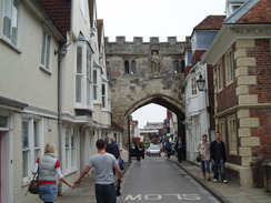
Continue on along this road from the bridge, and when it curves to the right turn left along another De Vaux Place. Head under a gateway and turn to the right to head northwards towards the cathedral. Join a path that passes the cathedral, and continue northwards to join a road beside a car park. This heads through a gateway. Soon after this turn left to head westwards along Crane Bridge Road. This crosses a stream and then curves to the left, becoming Mill road. This curves to the right to head northwards; pass the junction with Churchfields Road on the left, and then a little further on turn left to walk up to Salisbury railway station, where this walk ends.
 |
 |
|
Distances
| From | To | Distance (m) | Ascent (ft) | Descent (ft) |
|---|---|---|---|---|
| Fordingbridge | Downton | 7.5 | 663 | 630 |
| Downton | Salisbury Cathedral | 8.5 | 486 | 466 |
| Salisbury Cathedral | Salisbury station | 0.8 | 16 | 0 |
This makes a total distance of 16.8 miles, with 1165 feet of ascent and 1096 feet of descent.
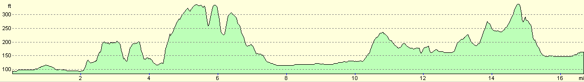
For more information on profiles, ascents and descents, see this page
Transport
Wiltshire and Dorset bus company Service X3 runs regularly between Salisbury and Fordingbridge, as part of the service between Salisbury and Bournemouth.
 |
 |
|
 |
 |
|
 |
 |
|
 |
 |
|
 |
 |
|
 |
 |
|
 |
 |
|
 |
 |
|
 |
 |
|
 |
 |
|
 |
 |
|
 |
 |
|
Disclaimer
Please note that I take no responsibility for anything that may happen when following these directions. If you intend to follow this route, then please use the relevant maps and check the route out before you go out. As always when walking, use common sense and you should be fine.
If you find any information on any of these routes that is inaccurate, or you wish to add anything, then please email me.
All images on this site are © of the author. Any reproduction, retransmissions, or republication of all or part of any document found on this site is expressly prohibited, unless the author has explicitly granted its prior written consent to so reproduce, retransmit, or republish the material. All other rights reserved.
Although this site includes links providing convenient direct access to other Internet sites, I do not endorse, approve, certify or make warranties or representations as to the accuracy of the information on these sites.
And finally, enjoy your walking!
Nearby walks
| # | Title | Walk length (miles) |
|---|---|---|
| 788 | Romsey to Salisbury | 23.1 |
| 790 | A circular walk from Salisbury | 24.0 |
| 796 | Romsey to Salisbury via Dean Hill | 23.6 |
|
|

|