Walk #787: Romsey to Eastleigh via Winchester
 |
 |
|
General Data
| Date Walked | 03/10/2007 |
| County | Hampshire |
| Start Location | Home in Romsey |
| End Location | Eastleigh station |
| Start time | 09.30 |
| End time | 17.13 |
| Distance | 21.1 miles |
| Description | This is a walk of two halves; the first half is a cross-country walk to Winchester, followed by a pleasant stroll south along the River Itchen. |
| Pack | Today I carried my 30-litre Karrimor rucksack, filled with waterproofs, a book and other odds and ends. |
| Condition | I feel fine after this walk. |
| Weather | Today started off sunny, but it slowly clouded over as the day went on. |
| OS map | Landranger number 185 (Winchester & Basingstoke, Andover & Romsey) |
 |
 |
|
 |
 |
|
Map of the walk
Maps courtesy of Google Maps. Route for indicative purposes only, and may have been plotted after the walk. Please let me have comments on what you think of this new format. For a detailed table of timings for this walk, please see the table file.
 |
 |
|
 |
 |
|
Notes
As is usual when I move house, I wanted to do my first walk from my front door. I had put off doing this first walk for a couple of weeks, wanting to get us settled in the new house and area before sparing the personal time to do a walk. The main aim of the walk was to visit Winchester, the only place of any real size that I know at this time.
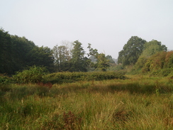
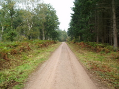
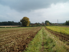
Initially I followed roads north through Halterworth, crossing a railway line and then a stream before rising up to meet the A3090 road. It was a pleasant, sunny day, although not overly warm. A series of roads took me past the Sir Harold Hillier gardens, and I then turned off northwards to join a footpath. This was not clear on the ground, and I headed off through an area of trees that had recently been cut down. I soon joined the footpath proper, and started following this eastwards through Ampfield Woods. The path crossed the Monarch's Way, and I then turned right down Claypit Road, climbing up a hill.
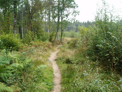
Here I went wrong; I took what looked like an obvious track, except after a third of a mile I realise dthat I was heading westwards; totally the wrong direction! A sign for the Monarch's Way told me this. Instead of backtracking, I decided to take the Monarch's Way onwards. A track led to the southern edge of the wood, and then a path led me on onto a road at Knapp. At the end of this road the Monarch's Way took me eastwards through Ampfield Wood; a pleasant stretch of walk.
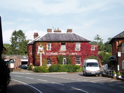
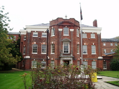
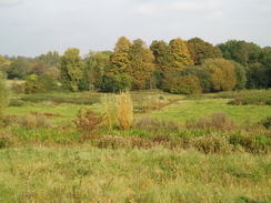
Eventually the path emerged out from the trees and crossed some well-kept fields, part of the massive complex at IBM Hursley Park. This path eventually ended at the A3090 in Hursley, which is a pretty little village. A few months ago Sencan and I stayed at a pub here whilst we were looking for somewhere to live in the area. By this stage I was in need of a break, so I went into the Dolphin Pub for a little food. It was a pleasant break and the pub was fairly busy.
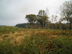
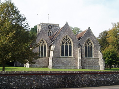
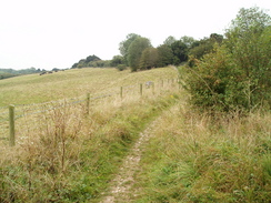
After a couple of pints I headed off once again, walking towards the church, where Richard Cromwell, ex-Lord Protector of the Commonwealth and son of Oliver Cromwell, is buried. I followed the Monarch's way eastwards for a little over a mile as it climbed uphill over fields to Silkstead, where I left the named path behind. Instead, I took a good track that led northeastwards to Yew Hill, from where there were some good views over Winchester.
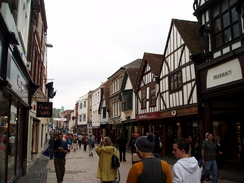
Another good track and footpath took me northeastwards, descending down towards Winchester. It joined the Clarendon way (a path between Winchester and Salisbury), before crossing over a railway line and meeting a road in St Cross. A long road walk followed northwards towards the centre of the city, passing a couple of regimental museums on the way. Winchester is a pretty place, and although I did not see the best of it as I made my way towards the railway station, the bits I saw were not bad.
I considered stopping this walk at the station, but instead I chose to extend the walk. I had only ever been to the station once before, when I had started my South Downs Way walk a couple of years ago. It felt good to be back, and I enjoyed the stroll through the city centre. I did not bother diverting off to see the Cathedral as there will be plenty of time to see that in the future. The centre of town was bustling, and I nipped into WHSmiths to get a few provisions for the rest of the trip.
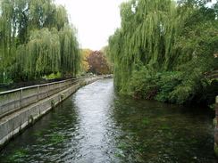
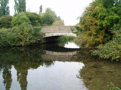
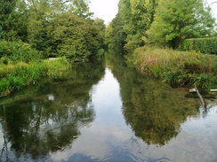
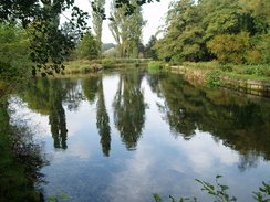
City Mill is perched above the River Itchen in the centre of the town, and marks the start of the South Downs Way. I followed the path south beside the river; a pleasant and fairly historic stroll. The entire river in this place is man-made, the romans having diverted several rivulets into this channel. At another mill a road took me southwards, following the Itchen Way. The path rejoined the side of the river (actually the Itchen Navigation), and continued south to the elegant Tun Bridge.
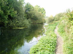
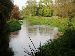
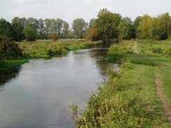
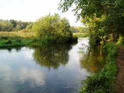
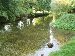
After this, it continued on as the vast bulk of St Catherine's Hill rose to the left. The path passed under an old railway bridge, then under the M3, before rejoining the river. The next stretch of walk south was superb; the water was perfectly clear, and although it was cloudy, the skies were bright. A series of old locks were passed, and a road was crossed in Shawford. I was starting to feel a little tired by now, but the beautiful walk was helping me keep plodding in.
More locks were passed, as was a road near Brambridge House. A little further on the B3355 road was reached near Highbridge, and here I left the canal. I had to get to Eastleigh station, and the best way of getting there appeared to be by following the road. I could have walked further south and walked west along the B3037, but dusk was starting to fall, and I had already completed a good distance for the day. I got to the station, bought a ticket and had to wait a while for the train. The day's walk had been beautiful, and it was a superb introduction to my new home area. In particular, the River Itchen is something that I shall have to explore more on sunny days.
 |
 |
|
 |
 |
|
Directions
This walk starts off at my house, just to the east of Southampton, at grid reference SU370214. Head east along Saxon Way until it ends at a T-junction with Halterworth Lane. Turn left along Halterworth Lane down a slight hill. At the end turn right, and then left to continue on down Halterworth Lane as it descends to cross a railway line before climbing up to end at a T-junction with the A3090 road.
Turn left along the A3090 for a short distance, then turn right to start following School Road northwards. When this ends at a T-junction, turn right to start following Braishfield Road northwards. After half a mile a crossroads is reached; here turn right to head east along Jermyns Lane. After 0.8 miles a footpath heads off to the left, with a little lake on the right at SU385234.
Follow this footpath as it heads northwards for about a third of a mile unti it ends at a T-junction with a track. Turn right, and start following this track as it heads eastwards through the woods. At SU391243 turn right down a track, and then at SU391241 turn left to head slightly north of east through Ampfield Wood. After 0.8 miles a track, Claypit Road, is reached; here turn right to head south along it.
After a third of a mile turn right along another track to head westwards for 0.3 miles until a junction with the Monarch's Way is reached. Turn left and follow this footpath southeastwards; it emerges from the trees and continues on before ending at a road in Knapp. Turn left and follow the road as it heads northeastwards; when the road ends take a footpath that heads off to the northeast through Ampfield Wood. After passing Park Pake it curves to take a more easterly course; it leaves the trees and emerges out into fields. About a mile and a half from the end of the road it passes a school and ends at the A3090 road in Hursley.
Turn left to follow the A3090 road northwards through Hursley; opposite the village church turn right to head eastwards up Collins Lane. When the road curves off to the left after a short distance, turn right to join a footpath that carries the Monarch's Way eastwards. This path soon crosses Bunstead Lane near Parsonage Farm, then continues on for two-thirds of a mile until a track junction is reaches in Silkstead.
Here leave the Monarch's Way by turning left to start heading north along a track called Silkstead Lane. This curves to take a slightly more northeasterly course, and after 1.3 miles a track is crossed at Yew Hill. Cross this track, and then continue on. At a fork in the tracks turn right to head downhill to the northeast. At another junction turn left to walk the short distance to the A3090 badger Farm Road.
Carefully cross this road and continue on northeastwards along Whiteshute Lane for 0.6 miles, following the Clarendon Way. This ends at a railway line; cross this, then on the other, eastern, side, turn left to continue along Whiteshute Lane. Initially this parallels the railway line before curving to the right to end at Stanmore Lane. Turn right to head east down Stanmore Lane for a short distance until it ends at a T-junction with the B335 road in Winchester. Turn left and follow the B335 road northwards for 0.9 miles until the B3090 road is reached. Turn left along this, and at the fork to the right. Just before a bridge over a railway line is reached, turn right to head north towards Winchester railway station.
At the station turn right and follow the station approach road down to a complex junction. Join the B3044 North Walls road eastwards, then turn right southwards down the B3047. When the end of the High street is reached, turn left to start following the High Street eastward.
When City Mill is reached by the bridge over the River Itchen turn right along a footpath that runs alongside the river. At a mill building turn left for a few yards to join a road, then turn right along Wharf Hill Road. At the end of this turn left to head south along Domum Road. Near the end of this road, turn right to join the eastern bank to the Itchen Navigation.
follow a footpath that runs south along the bank of the navigation. This crosses a road at Tun Bridge, then skirts beneath the mass of St Catherine's Hill. The path passes under an old railway bridge, then ends at a road. Turn left to pass under the M3, then head south along the B3335 road for a short distance before turning right down another footpath.
This leads back to the eastern bank of the Itchen Navigation. Follow this southwards for a mile to a road in Shawford; cross the road and then continue on southwards on the western bank of the river. After half a mile the path crosses over to the eastern bank, then continues on for another 0.4 miles to an old lock, where it crosses over to the western bank. It keeps the disused canal in close company as it heads south for 0.8 miles towards a road near Brambridge House. Stay alongside the canal for nearly a mile until it reaches the B3335 road.
Here leave the canal and turn right, to start heading westwards along the B3335 road. It passes under a railway bridge, then after a third of a miles ends at a roundabout with the A335 road, turn left here, and start walking south along the A335 road for a little over a mile into Eastleigh. At a junction with the B3037, continue on southwards along the A335 until Eastleigh railway station is reached on the left.
 |
 |
|
 |
 |
|
Distances
| From | To | Distance (m) | Ascent (ft) | Descent (ft) |
|---|---|---|---|---|
| Home in Romsey | Hursley | 7.2 | 489 | 443 |
| Hursley | Winchester station | 6.1 | 505 | 531 |
| Winchester station | Eastleigh station | 7.8 | 240 | 322 |
This makes a total distance of 21.1 miles, with 1234 feet of ascent and 1296 feet of descent.
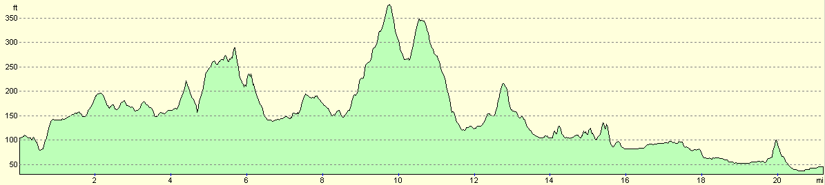
For more information on profiles, ascents and descents, see this page
Transport
There are regular train services between Eastleigh and Romsey, running via Chandler's Ford; from Romsey, it is a mile walk back to the start of the walk. Alternatively, you could start the work at Romsey station and add the mile onto the start of the walk.
 |
 |
|
 |
 |
|
Disclaimer
Please note that I take no responsibility for anything that may happen when following these directions. If you intend to follow this route, then please use the relevant maps and check the route out before you go out. As always when walking, use common sense and you should be fine.
If you find any information on any of these routes that is inaccurate, or you wish to add anything, then please email me.
All images on this site are © of the author. Any reproduction, retransmissions, or republication of all or part of any document found on this site is expressly prohibited, unless the author has explicitly granted its prior written consent to so reproduce, retransmit, or republish the material. All other rights reserved.
Although this site includes links providing convenient direct access to other Internet sites, I do not endorse, approve, certify or make warranties or representations as to the accuracy of the information on these sites.
And finally, enjoy your walking!
Nearby walks
| # | Title | Walk length (miles) |
|---|---|---|
| 307 | Bursledon to Southampton | 9.2 |
| 308 | Southampton to Fawley | 16.4 |
| 709 | South Downs Way: Winchester to Wether Down | 20.4 |
|
|

|