Walk #779: Thames Path: Windsor to Marlow
 |
 |
|
General Data
| Date Walked | 14/07/2007 |
| County | Berkshire, Oxfordshire |
| Start Location | Windsor Eton Riverside station |
| End Location | Marlow |
| Start time | 09.45 |
| End time | 15.48 |
| Distance | 15.1 miles |
| Description | This was a pleasant, short walk following the Thames Path along the Oxfordshire / Berkshire border. |
| Pack | Today I carried my 30-litre Karrimor rucksack, filled with waterproofs, a book and other odds and ends. |
| Condition | The underside of my feet really ache after this walk, and this would actually have limited how much further that I could have walked. Aside from this I was fine, but the discomforst from my feet was annoying and slightly worrying after such a short stroll. |
| Weather | Today was mainly cloudy with only occasional glimpses of the sun, but despite this it was quite a warm day with no traces of any rain. |
| OS map | Landranger number 175 (Reading & Windsor, Henley-on-Thames & Bracknell) |
 |
 |
|
 |
 |
|
Map of the walk
Maps courtesy of Google Maps. Route for indicative purposes only, and may have been plotted after the walk. Please let me have comments on what you think of this new format. For a detailed table of timings for this walk, please see the table file.
 |
 |
|
 |
 |
|
Notes
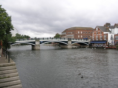
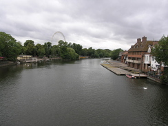
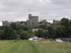
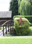
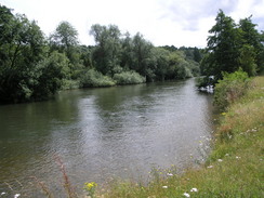
It was some time since Sencan and I had last done one of our walks along the Thames Path, and as the weather today looked set to be fair we set off from Cambridge early for the long drive down to Windsor. The traffic was light and we managed to make good time, the journey being made enjoyable by a series of Escape Pod podcasts that we listened to on the radio. Once in Windsor it had been my intention to park at the same car park as last time, by the Eton and Riverside station, but I took a wrong turn in the confusing road system and ended up near to the Central station, right next door to a large coach park. This seemed like as good a place as any to park, and so we purchased a ticket for the car park and got our gear together. Windsor is a lovely place, and their were some tempting brief views of the castle as we walked towards the Eton and Riverside station, passing a large Ferris wheel that had been temporarily erected on an area of parkland. There were plenty of attractive buildings to see, but before we knew it we found ourselves standing outside the other railway station, where we had ended the last walk.From there it was a short walk through the outskirts of the town to reach the pretty pedestrianised bridge over the river, and after crossing this we headed out past the boat houses to reach riverside meadows. There were plenty of swans on the river, and as the path headed away from the town and passed under several large bridges the town was slowly left behind. On the other side of the river was Windsor racecourse, and this seemed to stretch on for miles as we walked, continuing on as we passed Boveney Lock.
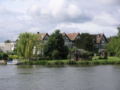
As with all Thames locks this was a pretty place, with well-maintained gardens and even a flower pot man by the footbridge over the lock. The path headed on, with occasional views across the river towards the racecourse towards the pretty little chapel of St Mary Magdelene, looking lovely as always. The path became increasingly tree-lined as it headed westwards, and as the racecourse was left behind Windsor Marina and the magnificent Oakley Court became visible across the river. This was replaced with what must be some fairly expensive riverside houses, but all the time the path remained in trees. To the right there were occasional glimpses of the new Eton rowing lake, a long structure that must have cost a great deal of money to build. There was not much to be seen of it from the path aside from the occasional building and the landscaped banks of excavated material.
A little further on we bumped into a woman who was walking from Bath to London to raise awareness of the situation in Iraq. We chatted for a while; she was a doctor and had taken the Kennet and Avon canal to Reading before joining the Thames. The noise of the M4 started to intrude once we restarted, and soon we were passing under this large steel structure to approach Bray Lock. The last time I had walked along here the towpath beside the lock had just closed and a diversion path headed around the lock; as we approached I was surprised to see that the works, which were due to finish in March had not yet been completed.
As the morning was wearing on there were more people on the towpath, including some cyclists who were sitting on a bench. A road was joined with some houses to the right, and then one of the highlights for me of the entire Thames Path came into view - Brunel's Sonning Arch that carries the Great Western main line over the river in two arches. This bridge is still the lowest, flattest brick arch in the world, and carries far heavier trains at far greater speeds than when it was first constructed nearly 170 years ago. I waxed lyrically to Sencan about the construction, but soon stopped as I realise that I can sometimes be a bit of a bore when it comes to civil engineering structures.
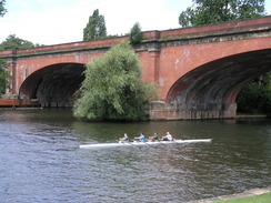
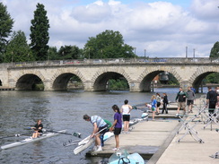
There were some rowing boats on the river and we soon had to wind our way around a series of eights boats that had been hauled out of the water and placed onto stands. The rowers who were standing around seemed to be enjoying themselves, and we soon reached Maidenhead bridge, which carries the old A4 over the river. This bridge, despite being less than a century older than Brunel's railway bridge, is of an entirely different generation, with a series of small stone arches carrying the road over the river. It is a pretty bridge, but details well how much Brunel pushed the engineering of his time, and indeed how fast civil engineering was progressing in the early nineteenth century.
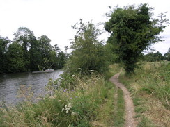
A long road walk followed northwards alongside the river, a boring walk with some fairly pleasant views over the river. About halfway along the road there was a cafe by a park, and we decided that as this was the halfway point of the day it would be a good place for a stop. I bought a cake and a bottle of water, whilst Sencan settled for a cup of tea. It was a good break, and before long we set off once again to pass by the bustling Boulter Lock, next to which in the middle of the river is Ray Mill Island.
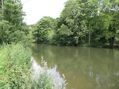
Shortly after the lock the path thankfully left the road and headed along a path behind houses, with some pleasant view across the river. The houses were soon left behind and a rough path continued along the riverside for about a mile, and just after the boathouses at Cliveden on the other side of the river were reached the path left the river to had inland towards Cookham. Cliveden, now a hotel, is best known as being the scene of the Profumo scandal in the sixties, and apparently the riverside cottages was heavily involved.
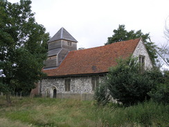
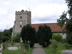
During the walk into Cookham Sencan's foot began to hurt, so when we reached the road junction in the village we stopped off at a bench so that she could rearrange the cushioning bandage she had on her foot. I was running low on water by this stage, but as there was not too much further to walk we walked on through the village, passing the Tarry Stone and the beautiful church to reach the river once more.
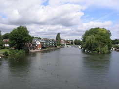
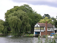
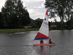
The walk from Cookham to Bourne End was very pleasant, and there were many people out and about enjoying the sunshine along with us. At Bourne End a footbridge attached to the railway bridge carried us over the river, after which the path headed along the northern bank of the river. Bourne End seemed fairly pleasant as we passed a sailing club, but this was soon left behind as we passed a tempting ice-cream van and entered a field.
As we walked we chatted as we passed some cows standing in the river, and as we approached Marlow the sounds of music started to come over from somewhere on the other side of the railway line to the right, and although this intruded slightly it was not too bad and proved easy enough to ignore. On the other side of the river there were some nice houses, although one castellated one seemed slightly out of place.
In Marlow we followed the path as it bypassed the lock, heading away from and back towards the river before eventually reaching the suspension bridge over the river. This was as far as we were planning to go for the day, so we headed along the roads through the town towards the station, reaching the bleak single platform twenty minutes before the train was due.
It had been a short walk - only fifteen miles - but regardless had been one that had taken its toll on me, probably because of the trouble I had caused me feet the previous weekend. I have been having trouble with my wisdom teeth recently, and as we sat waiting for the train they started to really hurt. Although I had some aspirin with me we had both run out of water, and so I suffered in silence as we waited for the train to arrive.
There were two changes of train required to get back to Windsor; one at Maidenhead and the other at Slough, and both connections were easily made. At Slough I had time to buy a bottle of water and could take an aspirin, which meant that by the time that we were in the queue of traffic to leave the car park in Windsor the pain in my teeth had greatly reduced.
 |
 |
|
 |
 |
|
Directions
| The walk is also covered in detail in the Thames Path National Trail Guide, by David Sharp, ISBN 1-84513-062-6 published by Aurum Press Ltd. Click on the image to the right to go to the Amazon page for the book. The exception to this is at the end of the walk, when you have to get from Marlow Bridge to the station; the route to take is well signposted on the ground, and it is not a long walk. | 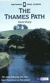 |
 |
 |
|
 |
 |
|
Distances
| From | To | Distance (m) | Ascent (ft) | Descent (ft) |
|---|---|---|---|---|
| Windsor Eton Riverside station | Maidenhead | 7.0 | 141 | 138 |
| Maidenhead | Bourne End | 4.5 | 59 | 49 |
| Bourne End | Marlow station | 3.6 | 66 | 56 |
This makes a total distance of 15.1 miles, with 266 feet of ascent and 243 feet of descent.
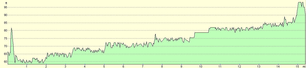
For more information on profiles, ascents and descents, see this page
Transport
Unfortunately to get from Marlow to Windsor you need to change twice on what should be a short journey; there are regular train services from Marlow to Maidenhead; you then have to change on a train for Slough, and finally get on a train from Slough to Windsor Central station. From the latter, the Riverside station is a five minute walk away.
 |
Disclaimer
Please note that I take no responsibility for anything that may happen when following these directions. If you intend to follow this route, then please use the relevant maps and check the route out before you go out. As always when walking, use common sense and you should be fine.
If you find any information on any of these routes that is inaccurate, or you wish to add anything, then please email me.
All images on this site are © of the author. Any reproduction, retransmissions, or republication of all or part of any document found on this site is expressly prohibited, unless the author has explicitly granted its prior written consent to so reproduce, retransmit, or republish the material. All other rights reserved.
Although this site includes links providing convenient direct access to other Internet sites, I do not endorse, approve, certify or make warranties or representations as to the accuracy of the information on these sites.
And finally, enjoy your walking!
Nearby walks
| # | Title | Walk length (miles) |
|---|---|---|
| 60 | Slough to Alperton | 16.7 |
| 61 | Reading to Marlow | 18.5 |
| 62 | Marlow to Slough | 16.3 |
|
|

|