Walk #778: Icknield Way: Great Chesterford to Dullingham
 |
 |
|
General Data
| Date Walked | 11/07/2007 |
| County | Essex, Cambridgeshire |
| Start Location | Great Chesterford station |
| End Location | Dullingham Station |
| Start time | 08.20 |
| End time | 15.12 |
| Distance | 19.5 miles |
| Description | This was a pleasant walk following the Icknield Way through Cambridgeshire. |
| Pack | Today I carried my 30-litre Karrimor rucksack, filled with waterproofs, a book and other odds and ends. |
| Condition | I feel absolutely fine after this walk, and have no problems to report. |
| Weather | Toda was a cloudy day with a few spots of rain in the air at times, but despite the lack of sun it was still quite warm. |
| OS map | Landranger number 154 (Cambridge & Newmarket, Saffron Walden) |
 |
 |
|
 |
 |
|
Map of the walk
Maps courtesy of Google Maps. Route for indicative purposes only, and may have been plotted after the walk. Please let me have comments on what you think of this new format. For a detailed table of timings for this walk, please see the table file.
 |
 |
|
 |
 |
|
Notes
Today was the only date in the year that I had yet to walk on, and so earlier in the year I had booked the day off so that I could finally walk it. I had wanted to walk the 26-mile stretch of the Icknield Way from Baldock to Great Chesterford, but I was unaware if the footbridge over the M11 at the end of the walk was yet open. It was therefore an easy decision to alter the walk to do the next stretch further northeast. I therefore set out on the half-mile walk to Shelfords station happy that I would be able to get a good distance in without many problems.
At the station I was pleased to bump into Gwilym, an ex-colleague of mine from the company that I work for. He now works in Harlow, and we boarded the train together and as he held his bike upright we chatted until I got off the train at Great Chesterford. It was a couple of months since I had last seen him, and it was great to be able to chat to him once again.
Once off the train I walked along the short station approach to reach the main road. The company that I work for designs DAB digital radios, and I had been given a trial version of a new hand-held device to literally field test. The final plastics for the radio were not yet back, and it was therefore a little mass of cables attached to a jury-rigged battery pack. As I was unravelling all of this and performing a scan for stations I turned right instead of left, and had walked for five minutes before realising that I was heading in totally the wrong direction.
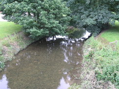
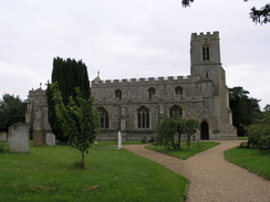
Annoyed, I headed back to the station and reset my GPS. Before heading along the proper road, which crossed the infant River Cam before turning off the main road to enter the village and pass the church. It is a fairly attractive little village, and although I was in need of a shop to buy some food for the day I could not see one. Fairly soon in the village I reached a problem that would bedevil me for much of the day; the 1:25,000 Explorer map that I was using showed the route following a road, whilst the Icknield Way guidebook showed the trail leaving the village via a footpath. I decided to follow the latter, and soon found myself at the main road once again.
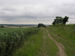
I had walked this stretch at least two times before, and the track leading up onto the hillside from the main road felt like an old friend. It is not a bad walk, and as the path rises and fall slightly some occasional reasonable views can be seen to the west until the path ends at a road. A few yards further on was Burtonwood Farm, and on a telegraph pole was a sign saying that the paths in the area could occasionally be closed due to works on the overhead power lines.
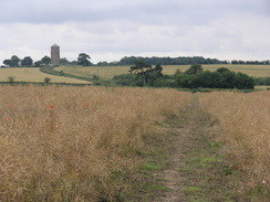
The next stretch across Great Chesterford Common was not that interesting, and after passing someone with a telescope whom I assume was a birdwatcher I reached a trig pillar in the field to my left. When I have visited this previously it was easy to go through a gap in the hedge to visit this, but today there were two poles blocking the hole. I had to limbo under this, and on the other side I walked the short distance to visit the pillar. Immediately to the south there were signs that the electrical company had already done their work, with posts standing upright to denote the height of some other cables.
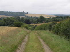
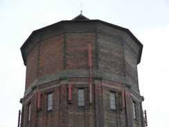
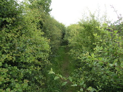
From the pillar the path started to descend, initially in the open before entering a damp and overgrown path between two hedges. The overgrowth was damp and meant that my trouser legs were soon wet through, and it was a relief when the path emerged out into open fields once more. Ahead could be seen Linton and the Rivey Hill water tower on the hillside above the village, which I would soon be at. At the point that the path met the B1052 road there was a new footpath leading up from Linton to the next village of Hadstock, a path that must be far safer than walking along the road.
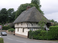
Just before Linton was reached there is Linton zoo, and there was a queue of cars full of children waiting for the gates to open in a few minutes. Soon I was crossing the A1307 and walking down into the pretty village, stopping off at a bakery to buy an Eccles Cake and a lemon curd tart that I ferociously wolfed down as I headed down towards a little recreation ground. A footbridge took me across a stream, after which paths started to take me uphill past houses. Once the houses were behind me another road was crossed and the path started to climb steeply uphill, passing an area of woodland before reaching the top of Rivey Hill and turning to the right to reach the superb brick-built water tower that dominates the area.
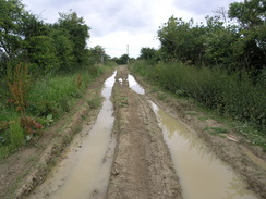
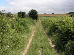
At the water tower the Icknield Way joins a track that heads downhill to the north, joining a main road near the entrance to the vineyard at Chilford Hall. The main road had to be followed for a short distance before the path headed off diagonally across a field to reach the Roman Road that runs from Cambridge to Haverhill. I have walked along this track many times, and I was disgusted by the poor state of the track - there had been heavy rain recently, and four wheel drives had churned up the surface of the track to form what were in places wide expanses of mud and water.
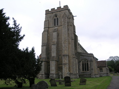
It was therefore a relief when the Icknield Way headed off away from the Roman Road along another, firmer, track that climbed uphill before levelling out and heading towards Wood Hall. The track was easy to follow as it wound around the hall, and soon enough I found myself in the village of Balsham. I stopped off at the post office to buy some refreshments, and I munched on an ice cream as I walked passed the attractive church and joined a winding path that headed out of the village to join a track.
As I walked northeastwards along the track I had a phone call from my ex, Sam, and we chatted as I strolled on along what was a firm track. This rose and fell as I walked, and although there were boggy patches in places none of these were too bad, and I found the stretch to be very enjoyable. A couple of roads were crossed, and suddenly there was a sharp right-angled bend by a building that I remembered from when I had walked here in 2002. After this bend a road was followed uphill for a short distance, before a track led off to the right.
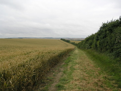
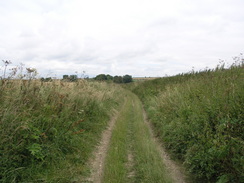
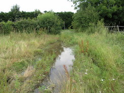
This track was a pleasant walk as it headed eastwards, and as I passed Crick's Farm an attractive girl riding a horse passed me in the opposite direction. The track was soon left and a path took me across fields to reach an extremely boggy area of ground immediately before the road was reached at Willingham Green. The path continues on from a junction in the village, squeezing between some high wooden fences before heading northwards across paddocks to reach the village of Brinkley.
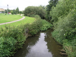
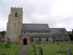
In Brinkley I decided to divert for a short distance to visit the church, and although the door was open I did not enter and contented myself with taking some photographs from the outside. As I was standing there a lady approached me and was obviously concerned about this scruffy man standing around outside the church; we started chatting and after I had put her at ease it turned out that she was a New Zealander, having lived in Britain for years. It was nice to have someone to chat to, but I had to continue on and a damp path took me across fields, crossing a stream before reaching the road in Burrough Green.
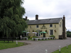
By this stage I was in need of a drink, but annoyingly the pub had closed for the afternoon only a few minutes before. Instead I walked on along a path behind the pub that was very narrow and overgrown, and it was a relief when the path widened out into a track. However this did not last long, and soon the path was narrowing with a hedge to the right and some paddocks to the left. This lasted as far as Marmer's Wood. I had wanted to get as far as Newmarket today, but I had already done more distance than I had been planning, and to get to Newmarket I would need to have a long road walk down into Newmarket that I would have to repeat for the next walk. I therefore decided to stop today in Dullingham, and I phoned Sencan to get the train times. There were two ones soon, and in order to get the first one I pressed on fast.
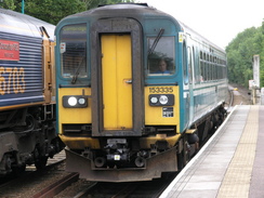
When the path dropped down to cross a stream to the south of Stetchworth I left the Icknield Way and followed a boggy path westwards. As soon as I reached the road I started yomping, having not much time in order to reach the station. Because of this I did not get much time to really look around, and after crossing a road by a closed pub the road started descending downhill with the grounds of Dullingham House to the right. Thankfully I reached the station in time, and as I waited for the train back to Cambridge I studied a class 66 locomotive at the head of a freight train. It had been a good walk, and a great way to start my new campaign to walk the entire walker's route of the Icknield Way.
 |
 |
|
 |
 |
|
Directions
This walk follows the Icknield Way for virtual the entire day. From Great Chesterford Station turn left up the station approach. When you reach the B1383 Newmarket Road turn right and follow it to cross the River Granta via a bridge. Take the first road to the right (Church Street) that you come to and head past the church. Continue along this road through Great Chesterford until TL510429. Here turn right down a lane to head southeastwards; at a junction in paths turn left to head northeastwards to meet the B184 road. Turn right along the B184 and for a few yards before turning left up a small track leading uphill alongside a hedge. The track soon becomes a footpath that heads south-northeast across fields towards Burtonwood Farm.
Continue past the farm and up to a trig point near some power cables. From here on follow the Icknield Way down a hedge-lined green lane until the path emerges out onto the B1052 road. Turn left and head downhill along the B1052, passing Linton Zoo on the way, before the road ends at a T-junction with the A1107 Cambridge to Haverhill road near the village of Linton.
At the A1107 turn left to head westwards for a few yards, before turning to the right and crossing the road to gain access to the B1052 High Street. Follow the road as it crosses the River Granta and swings to the right. Immediately after this turn left up Hillway. When this meets Back Road turn right for a few yards before turning left up a track. This heads northwards, climbing up onto Rivey Hill. Pass the water tower at the top of the hill and continue on until the B1052 is reached near the entrance driveway into Chilford Hall. Continue on northwards until a junction with a track is reached at TL574491.
Turn right and follow the track (part of a Roman Road) eastwards for a little over half a mile before taking another track that leads off to the left. This heads northwards, jinking to the left and then the right to reach Wood Hall. It passes to the west of Wood Hall and continue on into Balsham. Continue straight on through the village; at the village green turn continue straight on along Church Lane. This curves to the left to the church. Turn left and then left again to head westwards along a footpath for half a mile until a junction is reached at TL579511. Here turn right and start following another track northeastwards.
Follow the track or 2.5 mils; it crosses two roads before curving to the right beside a pumping station and reaching a road at TL602544. Turn left and follow this road uphill for a couple of hundred yards before turning right along another track. This heads eastwards for a mile and a half, passing Crick's Farm before reaching a road. Turn right down this road for a few yards to a junction on the left; at this junction take a footpath that leads off between the two roads, heading slightly east of north along a footpath for half a mile until it reaches a road opposite a church.
Turn right for a few yards, and near a phone box turn left along another footpath. This heads eastwards to a stream, before curving to the left to take a more northerly course. After three-quarters of a mile another road is reached in Burrough Green. Turn left along thus road for a few yards before turning right to take another footpath; this passes some houses before turning to the left to head north. A track is reached near Gypsy Hall; turn right to head northeastwards. A road is crossed at Dulingham Ley; the path continues on northeastwards on the other side, jinking around slightly before meeting a track at TL644571.
Turn left along this track as it skirts the southern edge of Marmer's Wood. Leave the track at the western edge of the wood and turn right along another footpath; after a short distance turn left along a footpath that meets a stream at TL642576. Here leave the Icknield Way. Turn left to walk westwards alongside the stream for a third of a mile. When this meets a road continue on westwards along a road through Dullingham. This crosses the B1061; continue on past Dullingham House. The road becomes Station Road; follow it westwards. It curves to the left and then the right to reach Dullingham station, where this walk ends.
 |
 |
|
 |
 |
|
Distances
| From | To | Distance (m) | Ascent (ft) | Descent (ft) |
|---|---|---|---|---|
| Great Chesterford station | Linton | 5.1 | 322 | 285 |
| Linton | Balsham | 4.4 | 400 | 187 |
| Balsham | Brinkley | 5.7 | 299 | 292 |
| Brinkley | Icknield Way jcn | 2.5 | 26 | 79 |
| Icknield Way jcn | Dullingham station | 1.8 | 39 | 108 |
This makes a total distance of 19.5 miles, with 1086 feet of ascent and 951 feet of descent.
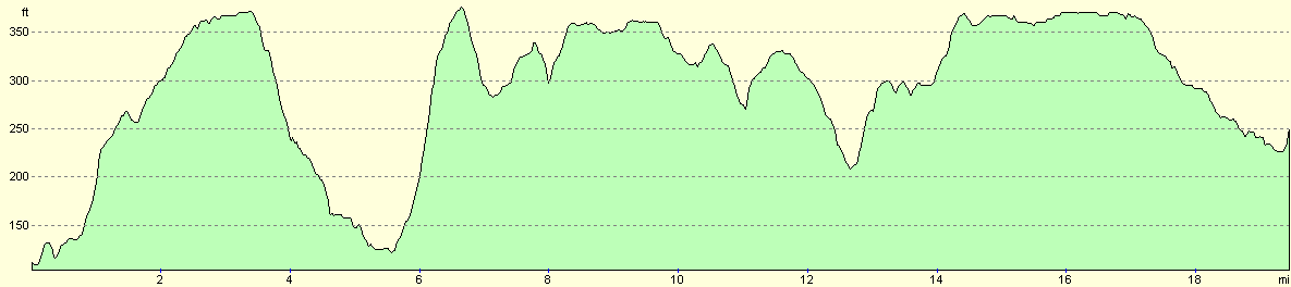
For more information on profiles, ascents and descents, see this page
Transport
There are regular train services from Dullingham to Cambridge (on the Bury St Edmunds line), and from there Great Chesterford is on the line from Cambridge to London Liverpool Street station.
 |
Disclaimer
Please note that I take no responsibility for anything that may happen when following these directions. If you intend to follow this route, then please use the relevant maps and check the route out before you go out. As always when walking, use common sense and you should be fine.
If you find any information on any of these routes that is inaccurate, or you wish to add anything, then please email me.
All images on this site are © of the author. Any reproduction, retransmissions, or republication of all or part of any document found on this site is expressly prohibited, unless the author has explicitly granted its prior written consent to so reproduce, retransmit, or republish the material. All other rights reserved.
Although this site includes links providing convenient direct access to other Internet sites, I do not endorse, approve, certify or make warranties or representations as to the accuracy of the information on these sites.
And finally, enjoy your walking!
This walk was mentioned in the following routes:
| Icknield Way |
Nearby walks
| # | Title | Walk length (miles) |
|---|---|---|
| 7 | Waterbeach - Burwell - Swaffham - Waterbeach | 17.1 |
| 8 | Waterbeach to Newmarket | 17.5 |
| 10 | Waterbeach to Great Chesterford via Cambridge | 21.0 |
|
|

|