Walk #770: Putney Bridge to Hampton Court
 |
 |
|
General Data
| Date Walked | 14/04/2007 |
| County | London |
| Start Location | Putney Bridge station |
| End Location | Hampton Court station |
| Start time | 10.18 |
| End time | 18.04 |
| Distance | 20.1 miles |
| Description | This was an enjoyable day's walk, mainly following the north bank of the Thames as it wound through West London. |
| Pack | Today I carried my 30-litre Karrimor rucksack, filled with waterproofs, a book and other odds and ends. |
| Condition | I wore my trainers today, and as a consequence I have a couple of hotspots on the ball of my feet which may or may not turn into deep blisters. Aside from this I feel fine, and it was a welcome relief to have a smaller pack on my back. |
| Weather | It was foggy for the trip down from Cambridge, but this soon cleared and was replaced with bright sunshine. The day got very hot - probably the hottest day of the year so far at well over twenty degrees, and this made for a very enjoyable, if hot, walk. |
| OS map | Landranger number 176 (West London, Rickmansworth & Staines) |
 |
 |
|
 |
 |
|
Map of the walk
Maps courtesy of Google Maps. Route for indicative purposes only, and may have been plotted after the walk. Please let me have comments on what you think of this new format. For a detailed table of timings for this walk, please see the table file.
 |
 |
|
 |
 |
|
Notes
After our first walk along the Thames Path together last month, Sencan has said that she wants to walk it with me this year. I completed the trail last year, but as I had thoroughly enjoyed it I far from mind doing it again, especially as we will be doing it in the other direction. Therefore this morning I drove us down to South Woodford, and we had a long tube journey over to Putney Bridge, where we had finished the last walk.
Due to the length of the journey we were a bit later setting off than I normally want, and we therefore started walking fairly fast for the first couple of miles as the trail followed the northern bank of the river. Initially the path passed in front of Fulham Palace, although there was not much of the palace visible through the surrounding trees and parkland. This was formerly the country home of the Bishops of London, and now that it has been thoroughly subsumed by the growth of London it could hardly be called countryside! The sun was shining and it was already quite a warm day for the time of year, and it seemed like an almost perfect day to be walking alongside water.
The path diverted away from the river to bypass around Craven Cottage, the home of Fulham Football Club. I am not the greatest fan of football in the world and quite frankly can hardly stand the game, and I gritted my teeth as we passed some children practicing on some grass beside the stands before going around the front of the building. But what a surprise! The side of the stadium that faces the road is fronted by what is an unexpectedly nice structure, with narrow turnstiles leading in through a brick facade. I was intrigued by it, and it looked far superior to many of the newer stadiums that I have walked past previously.
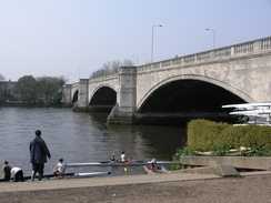
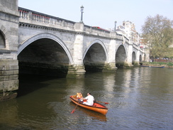
After passing the stadium the path rejoined the riverside as it headed northwards along a long loop in the river towards Hammersmith, passing under Sir Joseph Bazalgette's suspension bridge that opened in 1887 on the site of an earlier structure. For the next couple of miles the path stayed close to the riverside with only very occasional diversions away from it, and this afforded dome good views over the river towards the southern bank.
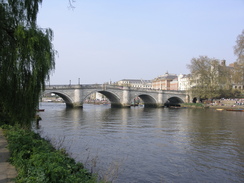
The next diversion was at Barnes Bridge, where the path headed inland for a couple of hundred yards to a bridge under the railway line, before heading back towards the river. A pleasant but short stretch of path headed past Duke's Meadow, until the next bridge, Chiswick bridge, was reached. After this there was about a mile where the path was diverted away from the river, except for a short stretch near Chiswick Quay, and there was not much to report aside from a singular lack of pubs, as we wanted to have an early stop.
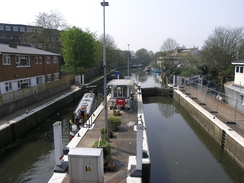
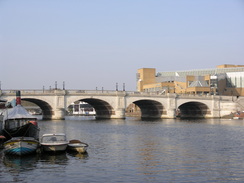
It was therefore a relief when the path rejoined the river front and we suddenly had a surplus of pubs. We stopped at one near a rail bridge over the river, and I had a couple of pints - as usual in summer, one of alcohol and one of orange and lemonade. It was a nice rest, particularly as it allowed us to get out of the sun for a while. Once we set off again we continued to make good time as the river curved once more to reach Kew Bridge, staying alongside the river for a short distance before heading along the Grand Union Canal in Brentford.
When I lived in London during the mid nineties I had walked along this stretch of canal many times, and, if I have the right place, it has changed beyond recognition. A diversion around a little marina that even had a broad dry dock led to a lock, and all around there were relatively new quite posh accommodation that I could not recall having been here before (I could be wrong though). As we walked past a man who had apparently had too much drink shouted down and asked if we were walkers; when Sencan replied yes, he offered to throw us some chicken wings down to eat. It was a kind offer, but as Sencan is a vegetarian one that we had to refuse.
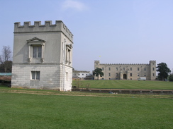
The canal was left behind at a main road, before the path plunged down through Syon Park. By this time it was quite warm, and we both bought ourselves ice creams at a busy van before heading off down the road. This soon passed the entrance to the house itself, and the views past the two lodges over the HaHa towards the house were superb. On the other side of the road there were some highland cattle grazing, and I carefully crossed the road to take some photographs of them.
At the end of the park the road exited onto a public road by the river, and this led towards the church. This has a 14th-Century tower, but when the main church burnt down during the war a frankly ugly modern brick nave was added to it. The contrast between the two is large, and frankly I think that it looked terrible. There were some good views back along the river, but shortly after passing the London Apprentice pub on the left the path again diverted away from the river inland to the A3004 for a short distance, before rejoining the river for the rest of the way to Richmond Lock., a weir consisting of three vertical gates, each weighing 32 tons and which are raised into the footbridge above for a couple of hours each side of high tide - a fascinating arrangement.
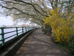
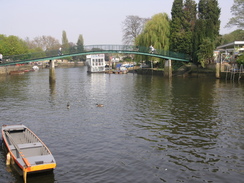
The riverfront in Richmond was bustling, and I enjoyed the walk alongside the river. This was the first twenty mile walk that Sencan had ever attempted, and I was relieved to see that she was managing with no problems. The path stuck to the riverside as it passed Marble Hill Park, with the house visible in the distance across the parkland, and this led on towards Eel Pie Island, a pretty island which is reached via a footbridge from the river bank. A short distance on there was a skew footbridge over a road, and this was near a pub called the Barmy Arms. This had an amusing and fairly unique pub sign, which included a mad hatter and other 'barmy' items. In a garden to the left a little further on there was a pretty, albeit strange, statue of a woman on a two-headed horse.
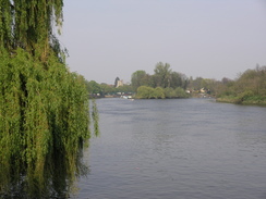
Unfortunately after Eel Pie Island the path left the riverside and headed along a main road through Strawberry Hill, a walk that was not too bad but was nowhere near as good as the riverside would have been. To the left there were new housing developments, many guarded by unfriendly 'Residents only' signs, and which left me wondering how much these homes must cost.
We next saw the river when a little path, open only during daylight hours, headed down through a little area of parkland immediately before Teddington Lock. This was only by the river for a short distance before it curved away and headed up to meet a road beside a pub immediately by the start of a footbridge. The pub garden was pretty full with people enjoying the late afternoon sunshine, but we had decided to go the little cafe at the lock instead, which I had visited on my previous walk late last year.
The bridges over the river and lock gave us a good views of all the locks; firstly the boat rollers, then the skiff lock, the launch lock and finally the barge lock, making quite a large complex. I was feeling quite tired by this stage and so did Sencan, so we walked the last couple of hundred yards on wilting legs and were fortunate to find an empty table in the small garden at the cafe. We ordered a cup of tea each and I also had a bottle of Ribena, and we supped these as a steady stream of people went up to buy various items.
We still have a fair few miles still to go, so after a while we both got up and set off, but not before I bought myself an ice lolly that I could slowly eat on the way. Teddingto Lock marks the point where the walks along the southern and northern banks end, and from here on there is only one path on either bank. We therefore continued along the southern bank as the river curved to head southwards into Kingston; the weather was still nice and the rest had done us good, allowing us to make good time to here.
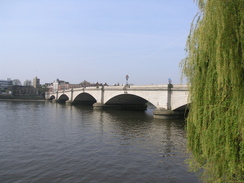
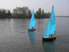
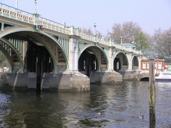
There were a few sailing boats on the river in this area, and at Kingston the path passed by a John Lewis store before climbing up onto the bridge itself, which is a very elegant structure that has obvious been sympathetically widened in the past. The path then crossed the bridge, and the path started heading southwards along the river. It was a pleasant stroll and there were many people out, but we were both starting to tire once again. A boat passed us and the youths on board shouted some rather impolite comments to a woman walking past - the swines!
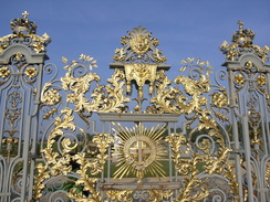
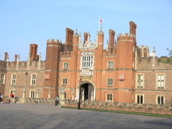
Occasionally we got some glimpses into Hampton Court Park on the right, and the walk along the towpath seemed to take forever. A large faux steamboat started to pass us and we started to jog alongside it to keep up - by this stage we had nearly done twenty miles, and it felt remarkably good to jog. Eventually however I tired, and Sencan stopped shortly after me. As usual when I jog we walked faster for the next few minutes, and before we knew it we had arrived at the entrance to Hampton Court Palace.
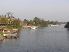
We went into the open area in front of the magnificent palace for a quick look, before heading on to cross the bridge to the adjacent station. There was about twenty minutes to wait for the next train, and so we decided to walk over to the toilets at the nearby Molseley Lock, and these were reached just as they were about to be locked up for the evening. Apparently Surrey County Council is going to shut these in the summer; apparently vandals caused about £70,000 worth of damage last year to their public toilets, so they are all being closed and being replaced with the automatic toilets that I hate. This is a massive shame, and it will certainly be less useful to walkers and boaters than the alternatives.
By the time we got back to the station the train had arrived, and as the train traveled on the half-hour journey to Waterloo Sencan started to fall asleep. It was superb to do a long walk with her, and she seems to be very keen to do the next few sections of the Thames Path - I certainly am looking forward to doing it with her.
 |
 |
|
 |
 |
|
Directions
| The walk is also covered in detail in the Thames Path National Trail Guide, by David Sharp, ISBN 1-84513-062-6 published by Aurum Press Ltd. Click on the image to the right to go to the Amazon page for the book. |  |
Distances
| From | To | Distance (m) | Ascent (ft) | Descent (ft) |
|---|---|---|---|---|
| Putney Bridge | Kew Bridge | 7.2 | 85 | 85 |
| Kew Bridge | Teddington Loc | 7.7 | 184 | 184 |
| Teddington Lock | Hampton Court station | 5.2 | 105 | 89 |
This makes a total distance of 20.1 miles, with 374 feet of ascent and 358 feet of descent.
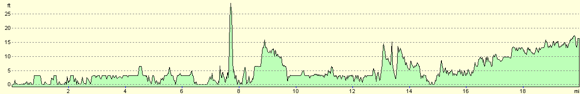
For more information on profiles, ascents and descents, see this page
Transport
There are fairly regular (half-hourly during the week) train services from Hampton Court station to Waterloo. On the way these call at Wimbleon, so if you want a short cut back to Putney Bridge, change for the District line at Wimbledon and take the few stops north to Putney Bridge station. Additionally, there are other train and bus services that operate throughout the area.
 |
 |
|
 |
 |
|
Disclaimer
Please note that I take no responsibility for anything that may happen when following these directions. If you intend to follow this route, then please use the relevant maps and check the route out before you go out. As always when walking, use common sense and you should be fine.
If you find any information on any of these routes that is inaccurate, or you wish to add anything, then please email me.
All images on this site are © of the author. Any reproduction, retransmissions, or republication of all or part of any document found on this site is expressly prohibited, unless the author has explicitly granted its prior written consent to so reproduce, retransmit, or republish the material. All other rights reserved.
Although this site includes links providing convenient direct access to other Internet sites, I do not endorse, approve, certify or make warranties or representations as to the accuracy of the information on these sites.
And finally, enjoy your walking!
Nearby walks
| # | Title | Walk length (miles) |
|---|---|---|
| 50 | Paddington to Mile End | 8.3 |
| 60 | Slough to Alperton | 16.7 |
| 65 | Alperton to Paddington | 6.4 |
|
|

|