Walk #745: Glyndwr's Way: Dolanog to Welshpool
 |
 |
|
General Data
| Date Walked | 28/09/2006 |
| County | Powys |
| Start Location | Dolanog |
| End Location | Welshpool station |
| Start time | 08.45 |
| End time | 17.17 |
| Distance | 19.7 miles |
| Description | This was an enjoyable stroll to the end of Glyndwr's Way, initially following the Afon Efyrnwy eastwards before following cutting across southwards to climb Y Golfa, from where there are superb views in all directions. |
| Pack | Today I carried my 30-litre Karrimor rucksack filled with my waterproofs, three litres of water, and various other odds and ends. |
| Condition | The underside of my feet hurt a little after this walk, but aside from this I have no significant problems. The sore that I have on my right foot has more or less cleared up today, and now only aches when I purposefully press on it. |
| Weather | The day was a mixture of sunshine and cloud, with periodical drizzle showers. At the end of the walk there was a heavy rain shower, but this was not enough to put a dampener on the day. |
| OS map | Landranger number 125 (Bala & Lake Vyrnwy, Berwyn) and Landranger number 126 (Shrewsbury & Oswestry) |
 |
 |
|
 |
 |
|
Map of the walk
Maps courtesy of Google Maps. Route for indicative purposes only, and may have been plotted after the walk. Please let me have comments on what you think of this new format. For a detailed table of timings for this walk, please see the table file.
 |
 |
|
 |
 |
|
Notes
The day started off fairly bright and sunny, and I was looking forward to completing Glyndwr's Way today, a superb feeling after my aborted attempt at walking it this time last year. The injury on my left toes was feeling much better after I had squeezed the pus out of it last night from beneath the Compeed plaster, which had obviously relieved the pressure and the pain. I had another large and filling breakfast at the hotel, before jumping in my car and driving to the start of the walk at Dolanog, which turned out to be an interesting drive along narrow lanes; at one point I went wrong, and head to reverse down a narrow lane before getting on the correct road.
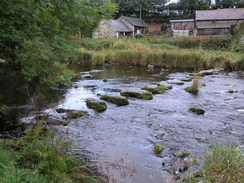
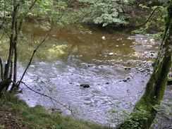
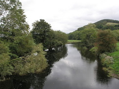
I parked my car in the free car park by the public toilets in Dolanog, and soon had all of my walking gear assembled and ready for the walk to begin. As soon as I left the car it started to spit with rain, and this continued as I crossed the old, narrow bridge over the River Vyrnwy, which has now been bypassed by a modern bridge immediately beside it. The Way followed the road for a short distance as it wound around along the southern bank of the river; there were not many good views of the river, however, as the trees lining the banks interfered with most of them. There was an old set of stepping stones across the river just upstream of a private bridge, and as I strolled along the tarmac I was relieved that the road was not too busy as the drizzle stopped.
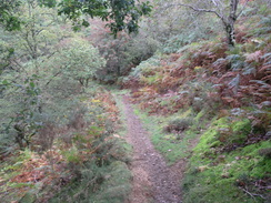
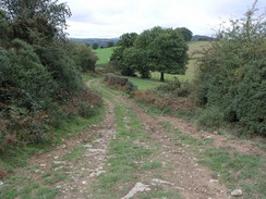
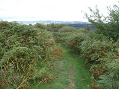
The Way turned off the road at a right-hand bend, heading across a field before climbing up along a bank alongside the river, before dropping down to cross a little stream and climbing once again. Tree-lined stretches were interspersed with more open sections with gorse flowering, the only commonalities being the river flowing low down to the left and the slippery mud underfoot. It was a lovely stroll, but with the mud and all of the climbing and falling it was not necessarily an easy one. The views of the river were again limited by trees, but the sound of it flowing fiercely was pleasant and relaxing.
Eventually the path twisted away from the river, climbing to skirt a house at Gwern-fawr and joining a road. From here on the river was sometimes audible but never in sight, being far down to my left. The stroll along the lane was enjoyable as it only slightly rose and fell, but it seemed to take a long time for it to finally descend down to reach the village of Pontrobert.
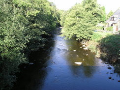
Just before the bridge over the river was reached I saw a small post office on the right, and outside this was another brass plaque marking the Ann Griffiths Walk, similar to the one at the start of the day in Dolanog. I went into the post office and bought a carton of Ribena and a couple of snacks for the journey; I only had one apple left to eat, and I was sure that was not going to be enough for the rest of the day. Afterwards I crossed the river, stopping to watch the river rumbling below it, and headed along the Way as it climbed uphill past the pub.
There were road works going on, and as I turned along the lane that led towards the farm at Bryn-y-fedwen some of the surface underfoot had been ground down ready for resurfacing. A lorry passed me, it barely fitting down the narrow lane, and then when I reached the farm there was a paving machine and workmen, one of whom was driving a roller. The smell of hot tar is one that I strangely enjoy, and I breathed in the heavy vapours as I walked across the freshly-rolled tarmac. A track led on for a short distance, before a path continued on eastwards, descending to cross a stream before climbing up to skirt past the farm at Coed-cowrhyd.
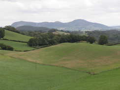
A road led on from the farm, but at one jink in the road the Way continued straight on, heading uphill across a field before rejoining the road. I could not see an obvious reason for this diversion until I was actually near the top olf the hill, when a magnificent view unfolded, and one that would probably have been obstructed by hedges from the road. A little further on and the path left the road once again, this time for longer as it skirted the northern edge of Gallt yr Ancr, an imposing small, streamlined hill. The path headed across a field before plunging through trees. It was fairly level walking albeit muddy underfoot, and I managed to make good time as the path dropped steadily to join a minor road.
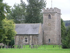
This in turn led me down to a road junction in Meifod, and I walked past a very smart village hall to another junction. Here the Way turned right, but I headed left for a few yards to the post office, where I hoped that I might be able to get a copy of the latest Private Eye. Unfortunately they did not stock it, and as there was nothing else of interest I left and crossed the road to have a quick look at the pretty church opposite.
The Way left Meifod along a road that crossed the river at Brioniarth Brudge, and at the next junction there was a BT van, similar to one of the ones being driven by the engineers staying at the hotel. As I passed I said hello to the engineer, who was not one of the ones staying at my hotel, and started climbing steeply uphill, with some occasional views down over the river. At a house the Way left the road and started climbing up the flank of Broniarth Hill, the surrounding trees giving it a dark, dank and enclosed feeling. The path wound around, and just as it started climbing steeply upwards I was unsure of whether I was heading in the correct direction. I paced around, checked my GPS, and eventually decided to climb further up, where I found a waymarker that showed that I was on the correct route.
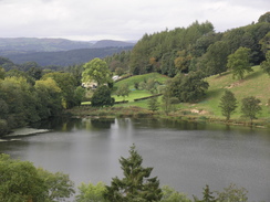
After the path left the trees it continued to climb slightly, although nowhere near as steeply, as it skirted the side of the hill, with occasional glimpses available of LlynDu far below to my right, the waters glinting in the brief periods of sunlight. The path followed a hedge until it reached a road, and this started a long road walk southwestwards for about two and a half miles. The road was very quiet, and as I walked I ate an apple, the juicy sweetness enlivening me as I strolled along.
Eventually the Way left the road, and started heading southeastwards, initially along a track to an old ramshackle wooden-framed barn, partly covered in metal sheeting, and then along a path that descended towards a stream before climbing once again. After crossing a road it headed on, skirting around a small hillside before ending at a bend in a road. The road climbs uphill, and at the top a path leads off to the left, heading through an attractive patch of woodland before descending downhill to reach a track at the edge of a caravan park.
There were no waymarkers here and so I walked on for a few yards, unsure of which way to go. After consulting the guidebook it was obvious that the Way headed up a track to my right, so I turned back towards a couple of small ponds and started climbing up the track, looking down occasionally over the roofs of the caravans to my left. The track ended at a junction with the B4392,and it followed this for a couple of hundred yards before turning off down a minor road to the left. This climbed slightly but was an easy walk, but just after it started to fall slightly the Way headed off to the right along a footpath.
I climbed the stile and entered the field to be greeted by some pleasant views. By this time I was starting to feel slightly tired and footsore, and so I took my rucksack off and sat down on the grass. My mind wandered as I sat, and after a few minutes I took my boots off and started to give my feet a bit of massage. It was a nice place to stop, and it was also very quiet, with no cars passing the road behind me the whole time that I was there. In the distance ahead of me was the summit of Y Golfa, the last summit of the Way, and I could see that there was at least one ridge to be climbed before I reached it.
Eventually I had to set off once again, and descended down towards a farm and on down towards a stream. Here I went wrong, and ended up in the wrong field. I had climbed halfway up the hill with some woodland to my right before I realised that I had taken the wrong route, and instead of descending once again I decided to continue on up the hill. At the top I clambered over a gate, and turned right to walk along the top edge of the trees until I met the Way once more, where it emerged from the trees. Annoyed at this mistake, I continued along the Way as it descended down the other side of the hill, skirting through Graig Wood before descending down a steep bank to a road.
As I was descending I had a phone call from Sencan, and I chatted to her as I carefully made my way down. On the map the Way headed south across a field, but on the stile there was a diversion notice, directing me along the road. Without paying too much attention to the notice I headed off, annoyed that this diversion would add about half a mile onto the day. The road slowly rose as it headed southeastwards, and when it ended at a T-junction I turned right, to head downhill to the west to rejoin the Way. When the road crossed a stream running through an area of woodland I started looking for the Way that followed the stream, but there was absolutely no sign of it anywhere. I tried pushing northwards through the trees on the approximate route of the Way as shown on the map, but after a few yards it was essentially impassable.
Annoyed, I headed back to the road and walked a few yards further on towards Gaer Farm, just to check that I was where I thought I was. Having confirmed this I decided to abandon the Way for a short distance, and follow another footpath that would rejoin with it on the other side of the wood. This involved me climbing back up the road to join a path that I had passed earlier during the descent. Cursing, I did this, and started following the path across the field.
The path entered the trees but I skirted by the left-hand corner, crossing a stream and finally seeing a waymarker. On this was another copy of the diversion notice, and when I looked at it I noticed with dismay that I had not read the earlier copy well enough; the diversion left the road and followed the path that I had just come along. Ideally they should also have a diversion notice on the stile on the road so that it was easy to see that you were meant to take the path, but at the end of the day it was my mistake.
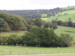
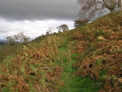
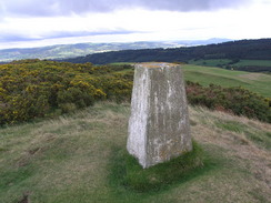
Happy that I was back on the route I followed a series of waymarkers as the Way skirted the edge of a golf course, climbing steeply uphill before descending to cross some boggy land and a stream on a boardwalk and footbridge. On the other side of this the ground became rougher, and the path started climbing up the northern flank of Y Golfa. This was a really enoyabke walk as it headed past patches of gorse, with some good views to the north and west. Eventually the path flattened out as it skirted the top of the hill, and before I knew it the trig pillar came into view.
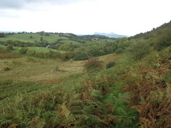
I gleefully climbed up to the pillar from where I got some superb 360-degree views all around. Unfortunately these views also included some dark grey clouds, and in the distance I could see several patches of rain falling. Although it was a very nice location the rainclouds persuaded me to move on quickly, as the path headed on across the rough ground, not going near the cleared areas of the golf course nearby. I loved the rough ground, and even as dark clouds started gathering nearer all around I continued the descent, as the path headed into pasture.
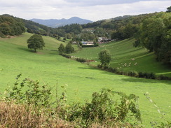
A few fields led me onto a farm at Pen-y-golfa, and from here a rough track descended downhill to the east, passing another farm before entering the grounds of Llanerchydol Hall. The track became a road that wound through the parkland, and I was passed by a car as sheep nonchalantly watched me pass by. As I walked I phone up the taxi firm in Welshpool and ordered a taxi for 17.30 from the station; I figured that I would easily be able to reach it within the hour. The descent, howerver, seemed to take forever, and the aching in my feet seemed to be growing on every impact with the tarmac.
I descended down towards the roundabout on the A458, and below me I could see a shed belonging to the Welshpool and Llanfair Light Railway, a narrow gauge (2 foot six inch) railway line that runs westwards from the town for eight few miles to Llanfair Caereinion. The descent was along tarmac and the underside of my feet were increasingly hurting, but I kept on, enjoying a few views of the station before the roundabout was reached. Once across this I walked into the centre of Welshpool, and as I approached I recalled how I had felt when I was here last, at this time last year. Then I had been returning from Llanidloes after failing in my walk of Glyndwr's Way, and the depression and annoyance I felt then was in marked contrast to the euphoria that I was feeling at the moment.
I strolled down the street, enjoying views of some of the nice architecture along the street. About halfway down I nipped into W.H. Smiths to buy a copy of Private Eye and an Ordnance Survey map for Shrewsbury (one of the few OS maps that I do not have), and when I was waiting to buy these the man in front of me was very rude to the cashier, talking into a mobile phone whilst talking brusquely to the poor girl.
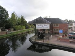
As I walked towards the end of the walk I was feeling increasingly good, and all of the aching in my feet were forgotten. The road led over the canal, with the Powysland Museum and Montgomery canal centre sitting at a wharf beside the canal. Just across the bridge there was a small garden with a slate marking the end of Glyndwr's Way, and I happily walked in and touched the slate, feeling ecstatic that the walk was no over. Just as I touched the stone it started to rain, and within a few seconds this was very heavy. I sheltered under some low hanging branches as what was by far the heaviest rain of the week fell. It only lasted for a couple of minutes, and when it was over I strolled along towards the station in a very, very, happy mood. The fact that bit rained heavily only at the end of the walk added to my good mood, and when I reached the station I sheltered under the canopy at the old station as another heavy shower passed by.
The taxi turned up about five minutes late, and I chatted to the driver as he drove me back towards Dolanog through some lovely Welsh countryside. He had spent fifteen year in the Royal Welsh regiment, and had obviously enjoyed his time in the forces. My euphoria had still not passed, and when he dropped me off in the car park next to my car I said goodbye and literally threw my rucksack onto the rear seat of the car. The drive back to the hotel seemed to fly despite the slow and winding roads that I had to go along, and when I got in the barmaid invited me to have a drink immediately. I did so, and ate a packet of port scratchings as I supped my pint and chatted, before going up to my room and freshening up. Later on in the evening I went down for a meal, and watched with enjoyment the Geordie BT engineers watching Newcastle play a European match on the television. I am keen to do another walk tomorrow, but as the weather looks fairly dreadful I may just head home, the main purpose of the trip having been fulfilled.
 |
 |
|
 |
 |
|
Directions
|
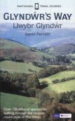
The walk is also covered in detail in the Glyndwr's Way National Trail Guide, by David Perrott, ISBN 1 85410 968 5, published by Aurum Press Ltd. Please click on the link to the right to access the Amazon page for the guidebok. The exception to this is the end of the walk, from the end of Glyndwr's Way to Welshpool railway station. Simply leave the memorial garden beside the canal and rejoin the B4381 Severn Road. Walk southeastwards down this for about a hundred yards to a roundabout; cross this and continue on the other side through a car park. On the right is the old station, now a set of tastefully-restored shops, and slightly to the left is the ramp leading up to the footbridge that leads to Welshpool station. |
|
 |
 |
|
Distances
| From | To | Distance (m) | Ascent (ft) | Descent (ft) |
|---|---|---|---|---|
| Dolanog church | Pontrobert | 3.6 | 515 | 676 |
| Pontrobert | Meifod | 3.7 | 482 | 541 |
| Meifod | Pant | 4.7 | 1175 | 886 |
| Pant | Welshpool station | 7.7 | 1217 | 1542 |
This makes a total distance of 19.7 miles, with 3389 feet of ascent and 3645 feet of descent.
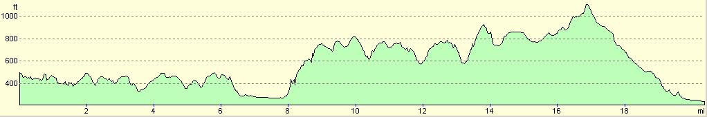
For more information on profiles, ascents and descents, see this page
Accommodation
I spent the night at the Cann Office Hotel, which cost me thirty pounds for the night in a double en-suite room. This was a lovely place to stay, with several small bars and lovely food available at the bar in the evening, and a massive brekfast in the mornings. They can be contacted at the Cann Office Hotel, Llangadfan, Welshpool, Powys, SY21 0PL, telephone (01938) 820202, or email cannoffice@tiscali.co.uk.
Transport
I used Amber Taxis in Welshpool to get back to the start of the walk; the journey cost me fifteen pounds.
Disclaimer
Please note that I take no responsibility for anything that may happen when following these directions. If you intend to follow this route, then please use the relevant maps and check the route out before you go out. As always when walking, use common sense and you should be fine.
If you find any information on any of these routes that is inaccurate, or you wish to add anything, then please email me.
All images on this site are © of the author. Any reproduction, retransmissions, or republication of all or part of any document found on this site is expressly prohibited, unless the author has explicitly granted its prior written consent to so reproduce, retransmit, or republish the material. All other rights reserved.
Although this site includes links providing convenient direct access to other Internet sites, I do not endorse, approve, certify or make warranties or representations as to the accuracy of the information on these sites.
And finally, enjoy your walking!
This walk was mentioned in the following routes:
| Glyndwr's Way |
Nearby walks
| # | Title | Walk length (miles) |
|---|---|---|
| 743 | Glyndwr's Way: A circular walk from Llanbrynmair to Llangadfan | 23.8 |
| 744 | Glyndwr's Way: Llangadfan to Dolanog | 15.8 |
| 746 | Welshpool to Newtown | 14.7 |
|
|

|