Walk #427: Overton to Silverdale
 |
 |
|
General Data
| Date Walked | 28/04/2003 |
| County | Lancashire |
| Start Location | Overton |
| End Location | Silverdale |
| Start time | 08.53 |
| End time | 16.35 |
| Distance | 19.9 miles |
| Description | This was a lovely, varied walk, with many things of interest to see along the way. |
| Pack | Today I carried my 30-litre Karrimor HotRock rucksack, which was filled with my packed lunch, waterproof leggings, water bottle and a couple of spare shirts, together with the usual assortment of odds and ends. |
| Condition | I am quite tired after this walk, and the underside of my feet were aching, but aside from this I as fine. Both my ankles were fine, despite having worn my boots, which I am quite thankful for. |
| Weather | The forecast was for today to be very wet, and I set out wrapped up very well against the weather. It rained at various scales of intensity for an hour, but the rain then stopped. As the day went on the clouds became thinner and there was even some signs of the sun, although occasionally some very black and threatening clouds rolled over. The wind started to get stronger in the afternoon, and towards the end of the walk it was strong enough to be annoying as I tried to make progress against it. |
| OS map | Landranger number 102 (Preston & Blackpool, Lytham St Anne's) and Landranger number 97 (Kendal & Morecambe, Windermere & Lancaster) |
 |
 |
|
 |
 |
|
Map of the walk
Maps courtesy of Google Maps. Route for indicative purposes only, and may have been plotted after the walk. Please let me have comments on what you think of this new format. For a detailed table of timings for this walk, please see the table file.
 |
 |
|
 |
Notes
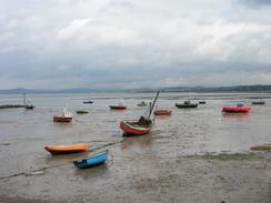
I had resigned myself to getting wet today, as the forecast was for a very wet day. I was also concerned about crossing the tidal road south to Sunderland, so I was pleased when I woke up and heard the sound of cars coming over the cattle grid, which meant that the road must be passable by cars. I set off relatively early, and this was just a ell, as the tide was rising fast. By the time that I reached the southern end of the tidal road at Silverdale the tide was lapping at the edge of the road, and I reckon that if I had set off ten minutes later then I would not have made it across.
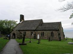
Just before I reached Heysham I came across the ruins of the sixth century St Patrick's Chapel. This is one of the earliest chapel's in England, and I enjoyed looking around the ruins and imagining what it must one have been like. It also transported me back to the early chapel (this time intact) that I visited near Bradwell-on-Sea in Essex, which seems like an eternity ago. From the ruins I dropped down to the adjacent St Peter's Church, which is a lovely example. Inside I chatted to a parishioner, and he showed me the lovely 10th Century Viking hogback, which was so well preserved that you could easily make out the animals of the story that it told. It was a lovely little church, the oldest parts of which date back to the 8th century, and was consecrated in 967 AD. I eventually dragged myself away, disappointed at not having looked around more - I was loathe to walk over the carpeted areas in my muddy boots.
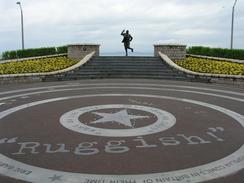
In Morecambe I wanted to see the statue dedicated to Eric Morecambe, the comedian of Morecambe and Wise fame. He is one of the town's most famous sons, and his statue in the town is pictured on the cover of the Ordnance Survey map. It looked lovely, so I wanted to find it and take a picture of it for myself. The statue is exceptional because of its setting - it is placed behind a circular garden, with quotes from Morecambe and the stars that they appeared with in a series of circles. So many statues are placed in towns with no context of who the statue represents or what they did, but this area gives lots of names and quotes. It is a lovely idea, and one that impressed me greatly.
The rest of the walk was fairly straightforward, and I managed to switch myself off and walk. As I approached Carnfoth, where I had intended to end for the day, I realised that I still felt fit and so I decided to walk on further. I phoned Sam and arranged to meet her in the little village of Silverdale. This extended the walk to nearly twenty miles, which is another long day. With hindsight the last couple of miles were probably a little too much, but it sets me up well to do another long walk tomorrow.
We had smelt the roast dinner in the buffet of the hotel that we visited last night, and it both made us want to have a roast dinner. Sam bought a joint of lamb today, and she cooked us an absolutely superb lamb dinner. Having a girlfriend who is a great cook is such a hardship! After we finished we chatted for a long time to a lady outside the van who gave us a donation. We went back into Mervan for a little time before setting out to the pub, which was just up the road. When we got there we found out that the lady has left us a card and paid for us both to have a drink each. We drank our pints whilst we chatted to the locals, when Sam noticed that the pub had free Internet access. We got permission to use it, so we went into a rear room and spent over three hour surfing the 'net. I have not spent so long on the 'net since the walk began, and I did a little research into things that I had seen on the walk. During this time I had four more pints, and we had to pour ourselves out of the pub and walk down the hill after a lovely evening out. This was the most that I have drunk on the entire trip, and whilst it meant that I was out of sorts the next morning, in a strange way it was nice and relaxed me considerably.
Very early on tomorrow I shall cross the border from Lancashire into Cumbria, and after that I shall have to walk up the estuary of the River Kent. This will be quite a long diversion and whilst there is a rail bridge further downstream it is quite a long bridge, and I do not fancy my chances of getting safely across.
Directions
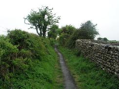
This walk starts off by the Globe Hotel in the village of Overton. Leave the car park opposite the pub and turn right to head south down the road, which rises up over a flood bank and descends down onto the flood plain to head south to the village of Sunderland. This stretch of road is tidal, and floods at high tide, so be careful with your timing. When Sunderland is reached join a track that runs at a higher level beside some houses until a bridleway called 'The Lane' leads off to the right. Take this bridleway and follow it westwards until it meets the coast. Drop down onto the foreshore and turn to the right to follow a track that heads northwards. The track becomes indistinct in places, but keeps to the foreshore before ending at a car park at Potts Corner.
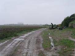
Turn right and follow the road as it curves around, before it eventually passes to the right of the fence of a long-disused holiday camp. Before an industrial estate is reached turn to the left down a footpath that runs between the fences of the holiday camp to the left and the industrial estate to the right before ending at the coast. Do not descend down but turn to the right to enter a caravan park; walk through this northward and make your way towards the exit. At the exit join Money Close Lane, which heads north past the Heysham nuclear power stations. The road passes over a railway line before ending at the A589 road. Cross the road and follow a road on the other side for a few yards, before turning to the right down another road that heads downhill.
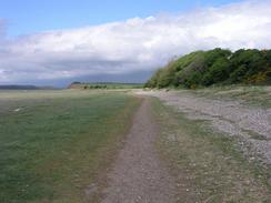
At the bottom of the hill the road curves to the right; take a footpath that heads straight on and follows the cliffs northwards to Heysham Point, where it turns to the right to head eastwards past St Patrick's Chapel before it ends at a road near St Peter's Church. From here join a path that heads over a little headland before descending down onto a promenade. This promenade can be followed northwards through Morecambe, before it turns to head northeastwards up towards Scalestones Point. From here a clear footpath continues on, following the Lancashire Coastal Way towards the car park at Morecambe Lodge where it climbs up a little hill, passing a trig point before descending and skirting to the left of Red Bank Farm. It follows the track leading from the farm, which joins a road for a short distance before continuing on down a footpath that soon ends at another road.
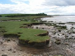
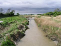
Follow this road until Wild Duck Hall is reached, where a footpath continues on along the foreshore at the base of some cliffs. The path passes Marsh House Farm before meeting a road, which is followed along until a footbridge is reached on the left. Cross the stream on this bridge, and on the other side turn left down a track that ends at a bridge over the railway line. Turn left to cross this bridge, and on the other side turn left down another road that heads at the base of a hill for two miles north to Crag Foot.
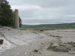
At Crag Foot follow the road as it turns to the left until a bridge is reached, where a track leads off to the left to pass under the railway line. From here on follow a distinct path across the marshland westwards until it meets the base of Heald Brow. Do not follow the Lancashire Coastal Way up the hill, but turn to the left to walk around the base of the hill past an old chimney. Pass under Brown's House's and then climb up to join the end of a public road, which can be followed westwards past Jenny Brown's Point, where it turns to the right to head northwards for a mile into the village of Silverdale. Once in the village turn to the left for a few yards down another road until the pub is reached, where this walk ends.
Distances
| From | To | Distance (m) | Ascent (ft) | Descent (ft) |
|---|---|---|---|---|
| Overton | Morecambe | 9.0 | 446 | 456 |
| Morecambe | Silverdale | 10.9 | 673 | 614 |
This makes a total distance of 19.9 miles, with 1119 feet of ascent and 1070 feet of descent.

For more information on profiles, ascents and descents, see this page
Accommodation
We parked Mervan for the night on a road just down the hill from the pub in Silverdale. This was a quiet enough spot to spend the night, although we did not have any television reception.
Disclaimer
Please note that I take no responsibility for anything that may happen when following these directions. If you intend to follow this route, then please use the relevant maps and check the route out before you go out. As always when walking, use common sense and you should be fine.
If you find any information on any of these routes that is inaccurate, or you wish to add anything, then please email me.
All images on this site are © of the author. Any reproduction, retransmissions, or republication of all or part of any document found on this site is expressly prohibited, unless the author has explicitly granted its prior written consent to so reproduce, retransmit, or republish the material. All other rights reserved.
Although this site includes links providing convenient direct access to other Internet sites, I do not endorse, approve, certify or make warranties or representations as to the accuracy of the information on these sites.
And finally, enjoy your walking!
This walk was mentioned in the following routes:
| My walk around the coastline of Britain |
Nearby walks
| # | Title | Walk length (miles) |
|---|---|---|
| 425 | Thornton to Cockerham Marsh | 18.1 |
| 426 | Cockerham Marsh to Overton | 19.4 |
| 428 | Silverdale to Grange-over-Sands | 22.2 |
|
|

|