Walk #428: Silverdale to Grange-over-Sands
 |
 |
|
General Data
| Date Walked | 29/04/2003 |
| County | Lancashire, Cumbria |
| Start Location | Silverdale |
| End Location | Grange-over-Sands |
| Start time | 09.23 |
| End time | 17.24 |
| Distance | 22.2 miles |
| Description | This was quite a nice walk up the estuary of the River Kent up to Levens, and then back down the other side to Grange-over-Sands. |
| Pack | Today I carried my 30-litre Karrimor HotRock rucksack, which was filled with my packed lunch, waterproof leggings, water bottle and a couple of spare shirts, together with the usual assortment of odds and ends. |
| Condition | I am fairly fatigued after this walk, but aside from this I feel absolutely fine. I had a fairly insignificant bout of pain from my right ankle that lasted only five minutes, which is quite a relief after the way it has been. |
| Weather | Yet again I expected today to be a wet day, and yet again this did not turn out to be the case. There was one short, sharp shower in the mid afternoon, but aside from this the day was coudy with some occasional sunny periods. The wind had also died down from yesterday, although there were some short-lived strong gusts. |
| OS map | Landranger number 97 (Kendal & Morecambe, Windermere & Lancaster) |
 |
 |
|
 |
 |
|
Map of the walk
Maps courtesy of Google Maps. Route for indicative purposes only, and may have been plotted after the walk. Please let me have comments on what you think of this new format. For a detailed table of timings for this walk, please see the table file.
 |
 |
|
 |
Notes
I woke up with a medium-sized hangover this morning, and after I did my morning ablutions I went back to bed for another hour. When I reawoke I felt much better, and I got up and continued writing up my notes describing the antics of last night. The main side effect of last night was a headache, but my leg muscles were slightly sore and tender, probably a side effect of being dehydrated.
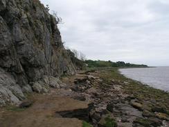
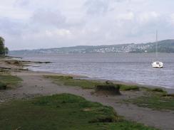
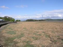
The area around Silverdale is absolutely superb, and I enjoyed the walk north from the village to the border with Cumbria. The cliffs are lovely limestone ones, and they blended in well with the blue of the sea in Morecambe Bay. This stretch of path was lovely, and I took my time, as I wanted to break myself slowly into the walk and to admire the scenery.
Whilst walking along the road in Meathop I saw a white peacock strutting down the road. I have never seen a white peacock before, and I took several photographs of it. I do not think that it was an albino as it did not have red eyes, and I suppose that it must be some sort of different breed of peacock. I am quite curious about this, and I may have to do some research into this when I get back. This is one of the things that I miss about not having 24-hour Internet access - I cannot research items of interest like this when I want to.
Sam was waiting for me by the Tourist Information in Grange-over-Sands, and we went in so that I could buy a 1:25,000 map of the Scafell Pike area in case I decided to walk up it in a few days time. We then went into a shoe shop in the town so that I could buy some new Sorbothane inlays for my boots, as the old ones have nearly worn out (I believe this may be why the underside of my feet have been aching if I have been doing lots of road walking in a day). After that we walked the half-mile back to the car park where Mervan was parked; a long walk when I was so tired and my body had cooled down slightly. Grange-over-Sands is a very nice little town, and I enjoyed the walk through it. Sam has also been impressed with Cumbria, and says that the parts of it that she has seen so far are lovely.
Over the years I have had five or six operations on my left ankle, and I have spent long periods in some pain as a result. Obviously it is far better now, but I am still suffering from some psychological effects from this, which have become obvious on this walk. Occasionally (perhaps once a fortnight) I may be walking over some rough ground and I suddenly get a feeling - a sense - that I have twisted that ankle. I get an adrenalin rush, and I feel like I am falling to the ground and screaming in intense pain as my ankle and leg is on fire. But I am not, I am walking normally along the ground, with absolutely no idea of why I feel like that. Every time that I get this feeling it knocks the wind out of me, and I have to stop to regain my composure. This is purely a mental effect, and I have done nothing to my ankle, no harm at all, but the effect is so real - the symptoms are those that I have had in the past when I have twisted my ankle.
I have been pushing myself quite hard recently, and I have been putting more miles in each day than I have at any other time on the walk so far. My body is coping with this quite well, and whenever I say that I am going to have a shorter day I always tend to walk further than I expected. I have this mental target of doing at least seventeen miles every day, and I am managing to keep this up quite well. The generally good weather has certainly helped (it is hard to keep mentally focussed on walking a long way if you are soaked), but I shall not be able to keep it up forever. Tomorrow I may aim to get as far as Ulverston (the path does not pass through the town, but goes near it). This involves walking around another river estuary, this time the River Leven, and this will take up the majority of the day.
Directions
This walk starts off at the pub in the little village of Silverdale. Head downhill from the pub for a short distance and follow he road as it curves around to the right. The road crosses a cattle grid and soon ends, and when it does continue on along a footpath that runs along the foreshore northwards. If the tide is high then this may be slightly difficult to do, but it should still be passable. The footpath reaches a little beach and the end of a road; follow this road and at a T-junction with another road turn left and follow this road northwestwards across the Lancashire / Cumbria border.
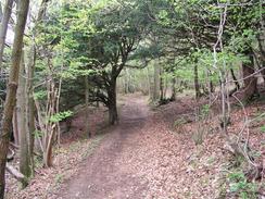
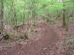
The road curves to the right up towards Far Arnside; take the first road off to the left that heads westwards into a caravan park. Walk through the caravan park and take a footpath that heads through woodland along the south side of Arnside Park. When the footpath reaches a caravan park that is not marked on the map do not take the footpath that is signposted for Arnside, take one for White Creek. This leads down to the beach at White Creek. Turn right and walk northwards along the beach, at the north end of which a path climbs up onto the top of the cliffs for a few hundred yards before dropping back down onto the beach. Walk along the beach past New Barns and onwards until the village of Arnside is reached.
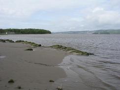
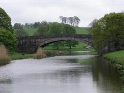
In Arnside climb up onto a road and follow this along to a junction near the Albion Pub. Here the road becomes the B5282 road; follow this as it curves past the imposing Railway Bridge and the station, before heading under the railway line and heading northeastwards into the village of Sandside. On the north side of the town a footpath leads off to the left; this follows the seward side of an old railway embankment before dropping down onto the floodplain and curving around to reach Milnthorpe Bridge, which carries the B5282 road over the River Bela, where my route joins the Cumbria Coastal Way, which it will follow for the rest of the day. Cross the bridge and once on the other side turn left and head northwards along a road for a little over a mile, and when the road turns to the right at Marsh Farm follow it. Shortly after this it turns to the left to head northwards once more, before turning to the right at College Green to head eastwards to the A6 road.
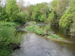
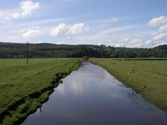
At the A6 road turn left and walk northwards for a kilometre along it to Levens Bridge. On the northern side of the bridge turn left and walk along the A6 until a road leads off to the left (there is a footpath that runs alongside the road on this section, but I found the walk along the road to be easier). Take the road off to the left, which passes Low Levens Farm and continues on for a kilometre until it approaches the farm at Sampool. Before the road curves to the left a track leads off to the right, heading westwards before curving to the right to head northwards up to the A590 road. Turn left along a pavement beside the A590 to head westwards across the River Gilpin at Sampool Bridge. On the western side of the river a road heads off to the left to head southwards towards the farm at High Foulshaw. The Ordnance Survey map shows the path heading through the farm but it has been diverted; continue along the road past the farm and then turn left along a footpath that heads eastwards across a field before ending at a very indistinct track by a flood bank.
Turn right and follow the track beside the flood bank southeastwards and then southwards past Middle Foulshaw. It then curves to the right and heads westwards. The path diverts to the south of a little hillock before reaching a track beside a cottage. Pass the cottage and then take a footpath that leads off to the right to cross a stream on quite an imposing but narrow concrete bridge. The path then heads westwards along the northern side of the stream before ending at a road. Turn left to head southwestwards along this road, and it then turns sharply to the right before curving around to head southwestwards through Meathop before descending downhill to the south.
When the road approaches a railway line it curves to the right and follows the railway line westwards before ending at a T-junction with the B5277 road. Turn left along the B5277 road for a short distance before a footbridge leads off to the left, heading over the railway line and reaching the promenade in Grange-over-Sands. Turn right and follow the promenade past the station until a gate is reached on the right; this gate leads to a crossing over the railway line, on the other side of which a lane leads uphill into the centre of the town. When the lane meets the B5277 road turn left and walk out of the town for about half a mile until a car park is reached on the left, where this walk ends.
For more details of the Cumbria Coastal Way, see the excellent little book, The Cumbria Coastal Way: A Walker's Guide", by Ian and Krysia Brodie, ISBN 187355110X. This book is a lovely and detailed description of the walk, and unfortunately I did not manage to get a copy until after I fnished the walk, for it would have been quite handy.
Distances
| From | To | Distance (m) | Ascent (ft) | Descent (ft) |
|---|---|---|---|---|
| Silverdale | Arnside | 4.7 | 443 | 486 |
| Arnside | Skippool Bridge | 8.6 | 315 | 331 |
| Skippool Bridge | Grange-over-Sands | 8.9 | 381 | 325 |
This makes a total distance of 22.2 miles, with 1139 feet of ascent and 1142 feet of descent.
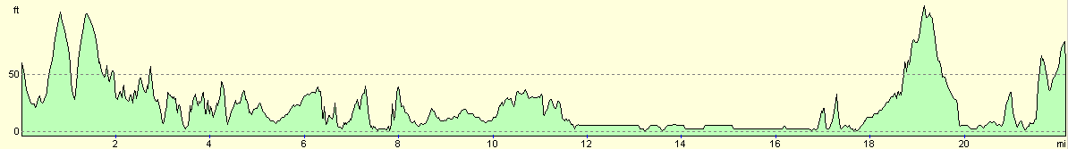
For more information on profiles, ascents and descents, see this page
Accommodation
We parked Mervan in a public car park about half a mile southwest of Grange-over-Sands on the B5277 road. This car park had some public toilets in it, and there were some pubs nearby that we really did not feel like using after the excess of last night.
Disclaimer
Please note that I take no responsibility for anything that may happen when following these directions. If you intend to follow this route, then please use the relevant maps and check the route out before you go out. As always when walking, use common sense and you should be fine.
If you find any information on any of these routes that is inaccurate, or you wish to add anything, then please email me.
All images on this site are © of the author. Any reproduction, retransmissions, or republication of all or part of any document found on this site is expressly prohibited, unless the author has explicitly granted its prior written consent to so reproduce, retransmit, or republish the material. All other rights reserved.
Although this site includes links providing convenient direct access to other Internet sites, I do not endorse, approve, certify or make warranties or representations as to the accuracy of the information on these sites.
And finally, enjoy your walking!
This walk was mentioned in the following routes:
| My walk around the coastline of Britain |
Nearby walks
| # | Title | Walk length (miles) |
|---|---|---|
| 427 | Overton to Silverdale | 19.9 |
|
|

|