Walk #243: Skeffling to Paull
 |
 |
|
General Data
| Date Walked | 22/10/2002 |
| County | Humberside |
| Start Location | Skeffling |
| End Location | Paull |
| Start time | 08.10 |
| End time | 14.56 |
| Distance | 18.9 miles |
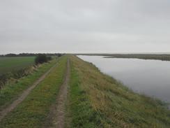
| Description | This was a nice walk along the seawall on the north side of the River Humber. Unfortunately I could not follow the seawall for the second half of the walk, so a diversion inland along roads was necessary. |
| Pack | Today I carried my 30-litre Karrimor HotRock rucksack, which was filled with my packed lunch, waterproof coat, water bottle and a couple of spare shirts, together with the usual assortment of odds and ends. |
| Condition | I feel absolutely fine after this walk, and I could easily have walked further if I had needed to. Indeed I find it hard to warrant that I have actually walked as far as I have - I measured the map several times to check this and my pedometer reads the same sort of distance. |
| Weather | The weather today was mainly thin cloud, with an occasional glimpse of the sun through it. It was a surprisingly warm day, and this helped me dry off when there was a light drizzle shower when I sat down to eat lunch. Aside from this there were a couple of other periods when there was some drizzle in the air, but none of these were serious enough for me to have to put the hood of my coat on. |
| OS map | Landranger number 107 (Kingston upon Hull & surrounding area) |
 |
 |
|
 |
 |
|
Map of the walk
Maps courtesy of Google Maps. Route for indicative purposes only, and may have been plotted after the walk. Please let me have comments on what you think of this new format. For a detailed table of timings for this walk, please see the table file.
Notes
Another day, another walk. The Humber estuary is the first major estuary that I have had to cross, and it is going to take me a couple of days to walk around it. I do not mind this so much, however, as it looks as though the route will be quite straightforward and I also have the crossing of the Humber Bridge to look forwards to tomorrow. In reality I am quite glad that the long, grinding miles of beach walking that I have had to endure over the last few days are over, and for the next day or so I shall have a little more variety in the scenery.
Whilst I was walking along the seawall I got a phone call from Radio Humberside, who wanted to know when I was going to be in Hull. I explained that I was going to be a day later than I had told them last week, and the lady at the end of the phone told me that she would phone me tomorrow. Consequently I am going to have to plan tomorrow's walk so that I can get into Hull for around midday, as that looks like a likely time that they will need me for.
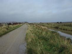
I quite enjoyed the walk along the seawall, even though the long grass made the walk slightly harder than it should have been. The path from Winestead Pumping Station to Stone Creek is not a right of way but a courtesy path; and it is one that I am thankful for because without it I would have had to walk much further. When I got to Stone Creek, however, I found the path that runs along the seawall to the northwest from there - which is a public footpath - was closed of. There were no other signs explaining why, or for what period the closure may be. I looked on my map, and the path was very long with no intermediate access points for miles. To make matters worse, to the south of the back is the estuary and to the north is a drainage channel. This meant that if I did get caught out I may have to walk all the way back again. I therefore reluctantly decided to take a longer route along roads; this would be harder on my feet and further away from a true coastal route, but I found it hard to justify any other choice. Later on in the walk near Thorngumbald Drain I came across the reason for the closure - the seawall was being strengthened (indeed, it looked as though a new wall was being constructed further inland). The works are costing three and a half million pounds, and are expected to take until the autumn of 2004 to complete, so it looks as though I made the correct decision in taking to the road.
Directions
This walk starts off at the car park beside the Humber estuary to the south of Skeffling. Leave the car park and join the sea banking. Turn right and follow a path along the top of the bank in a general westwards direction. After a couple of miles the path starts to divert inland and becomes rougher, although still easily discernable on the ground, as it turns slowly to head in a more north-westerly direction. As it does so the path leaves the sea banking, which is much flatter, and follows the base of the bank.
The path passes to the right of a couple of small wooded areas, which are marked as small lakes on the map, with good quality arable farmland on either side. Through the trees Outstray Farm can be seen quite nearby on the left. Continue on past the farm and then take a green path that passes to the left through the trees. This path curves round to the left and then immediately to the right before becoming a very muddy track that leads southwestwards to a bridge over the Patrington Channel.
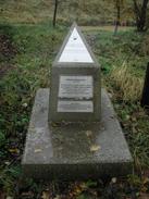
Cross the bridge and join a tarmac road on the other side of the channel. Turn left down this road for a short distance towards Outstray Farm, and when the road turns to the right to enter the farm at a small stone monument continue straight on southeastwards down a stony track.
The track follows the western bank of the Patrington Channel until it reaches the large pumping station at Winestead. Here the track ends, and you have to join a path that follows the top of the banking, which heads in a roughly westerly direction. The path has a little jink to the right and then the left, on which there is another monument, which as a plaque commemorating the raising of the flood defences and another one which marks the spot as being exactly on 0 degrees longitude.
Continue on along the top of the sea bank for many miles, passing Hawkin's Point and a small wooded area before eventually reaching a bridge that carries the path over a tributary to Stone Creek. Cross the bridge and reach a small tarmac road. At the road turn left over another bridge that carries a muddy track over the main creek and follow it around to the left until it meets the sea bank once more.
When the track meets the sea bank it turns to the right and becomes surfaced once more. There is then a path that runs along the top of the sea bank for over six miles to Paull, but this path was closed when I walked this route, so I will describe another route below.
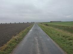
Follow the surfaced road as it heads north-westwards for a few miles, passing Sand Farm as it crosses the Cherry Cobb Sands. Shortly after New House Farm on the right the road curves around sharply to the right. At this point continue straight on down a tarmac driveway that leads to the farm at Little Humber. It should be noted that this is not a public right of way, and therefore walking along it is slightly naughty.
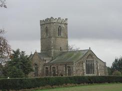
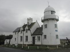
Walk along the driveway, which is surfaced throughout, to Little Humber and then join the public road that head northwards for a couple of kilometres from the farm. When this road ends at a T-junction turn left along another road that heads southwestwards for a little under a mile before turning to the right and crossing over the Thorngumbald Drain. The road continues on, passing Paull church and the road leading to Paull Battery, before finally entering the village of Paull. Follow the road as it curves around to the right and then take the second road to the left, which leads down to a very attractive disused lighthouse. Follow the road as it curves to the right along the riverfront and the post office is about a hundred yards ahead on the right.
Distances
| From | To | Distance (m) | Ascent (ft) | Descent (ft) |
|---|---|---|---|---|
| Skeffling | Stone Creek | 11.5 | 69 | 69 |
| Stone Creek | Paull | 7.4 | 85 | 85 |
This makes a total distance of 18.9 miles, with 154 feet of ascent and 154 feet of descent.
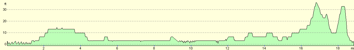
For more information on profiles, ascents and descents, see this page
Accommodation
We stayed at the St Quinton caravan site, Sandalwood, Hull Road, Easington, Hull, HU12 0TE, tel. 01964 650273. The pitch cost us six pounds for the night, although as the owners were away we had to put the money through the letterbox. This was the third night that we have stayed at this campsite, as there is a lack of good campsites in the immediate area.
Disclaimer
Please note that I take no responsibility for anything that may happen when following these directions. If you intend to follow this route, then please use the relevant maps and check the route out before you go out. As always when walking, use common sense and you should be fine.
If you find any information on any of these routes that is inaccurate, or you wish to add anything, then please email me.
All images on this site are © of the author. Any reproduction, retransmissions, or republication of all or part of any document found on this site is expressly prohibited, unless the author has explicitly granted its prior written consent to so reproduce, retransmit, or republish the material. All other rights reserved.
Although this site includes links providing convenient direct access to other Internet sites, I do not endorse, approve, certify or make warranties or representations as to the accuracy of the information on these sites.
And finally, enjoy your walking!
This walk was mentioned in the following routes:
| My walk around the coastline of Britain |
Nearby walks
| # | Title | Walk length (miles) |
|---|---|---|
| 241 | Mappleton to Easington | 19.7 |
| 242 | Easington to Skeffling via Spurn Head | 14.8 |
| 244 | Paull to Barton-Upon-Humber | 15.7 |
|
|

|