Walk #999: Nene Way: Wansford to Whittlesey
 |
 |
|
General Data
| Date Walked | 26/05/2018 |
| County | Cambridgeshire |
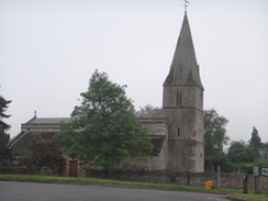
| Start Location | Wansford church |
| End Location | Whittlesey Station |
| Start time | 06.11 |
| End time | 13.11 |
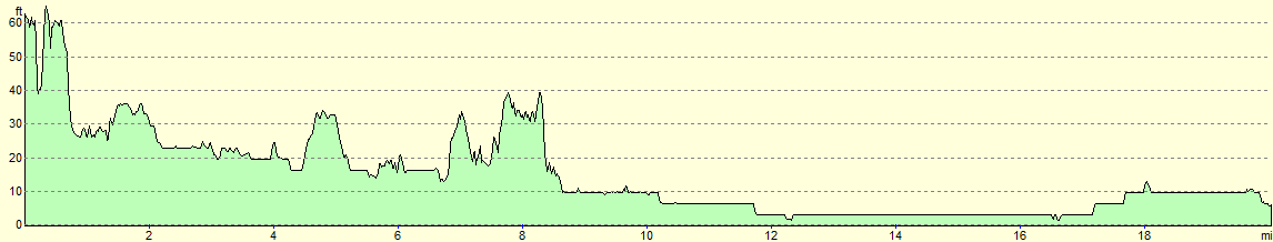
| Distance | 20.0 miles |
| Description | This was a very pleasant, if slightly overgrown, walk following the Nene Way eastwards from Wansford through Peterborough to the little Cambridgeshire town of Whittlesey. |
| Pack | Today I carried my 30-litre Karrimor rucksack, filled with water, my spare waterproofs, a book and other odds and ends. |
| Condition | I feel absolutely fine after this walk. My right foot got fairly wet, but no blisters developed. |
| Weather | The day started off grey and misty, without much of a breeze. A couple of periods of liht drizzle was replaed by strong sunshine for the last hour of the walk. |
| OS map | Landranger number 142 (Peterborough, Market Deeping & Chatteris) |
 |
 |
|
Map of the walk
Maps courtesy of Google Maps. Route for indicative purposes only, and may have been plotted after the walk. Please let me have comments on what you think of this new format. For a detailed table of timings for this walk, please see the table file.
 |
 |
|
Notes
I hadn't managed to do a walk for a while due to weather and family obligations, and today looked like the only dry available day for some time. As it was a Saturday, I negotiated the day off whilst Sencan took our son to Ely. I first walked this stretch (minus the first mile from Wansford) back in 1999 as part of a stroll along the Hereward Way. I have been back several times since, and it's always been a pleasant, easy stroll.
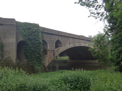
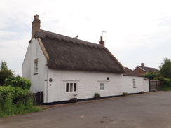
I parked my car on a street in Wansford just after six, got my kit together and headed off along the road. Wansford is a pretty little village, and it is a shame that the noise from the adjacent A1 intrudes so much. The trail headed through faint mist towards the A1, before diving down to pass under the viaducts that carries the dual carriageway over the river - one has concrete arches, whilst the other is a much more modern and dismal structure. The path then climbed up towards an old toilet block and lay-by, where some lorries had parked up for the night. I've never known the adjacent picnic site to be clean and tidy, although today it was not too bad - save for the rubbish lying around full roadside bins, whilst the bins in the picnic site just a few metres away were empty. People cannot even be bothered to walk to an empty bin ...
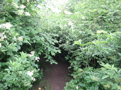
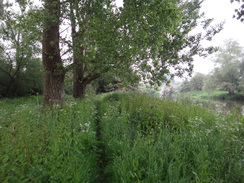
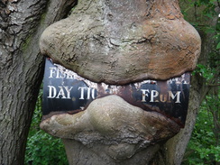
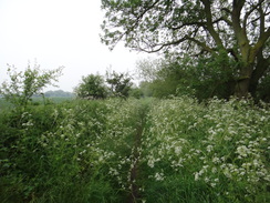
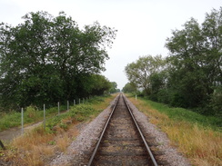
The next stretch of path past a pumping station was very overgrown; I had last walked this stretch a couple of month ago, and the difference in vegetation was startling. The path dropped towards the riverside, where long grass soon wetted my trousers to above my knees, and my decision to wear long trousers rather than shorts paid off as as I had to wade through a patch of nettles. A tree had a metal sign nailed to it, and over the last two decades more of the sign has slowly been enveloped. The trail then skirted the old Wansford to Stamford railway line, which opened in 1967 but was closed to passenger services in 1929. Its nickname, the 'Bread and Onion line' highlights its limited traffic potential.
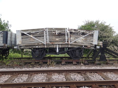
The small village of Sutton was as pretty as ever, and I diverted away to take a quick look at the church, although vegetation blocked any good photos. The journey south was very picturesque, with the fields awash with yellow buttercups. I passed under the bridge that carries the Nene Valley Railway across the Nene, after which the path climbed up to join the top of the embankment. Wagons were stored on the far side of the line, including one wagon that was bent like a banana, and which looks unlikely to ever roll again.
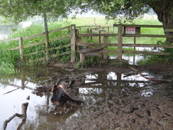
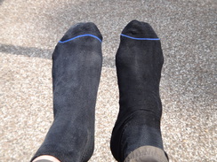
The Hereward Way does not stick with the railway for long, and soon dives off towards the river. This was the route I had taken previously, whilst the Nene Way continues along the bank. However there was no sign of any onwards path, and Nene Way markers pointed along the Hereward Way route towards the river. This turned out too be very overgrown, and I felt my right foot getting damp - final confirmation that my boots are no longer waterproof. This was not helped by a clappergate that stood in the middle of a muddy, flooded area - I did not fancy using the logs people has thrown in to get across, so I waded around the fence.
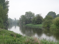
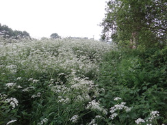
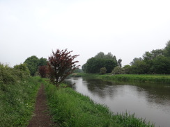
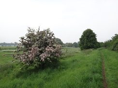
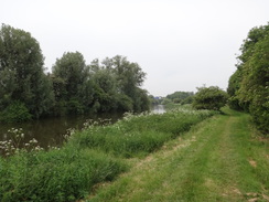
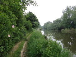
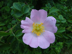
Aside from this, the riverside walk was pleasant, if rather overgrown. This spring was so dismal that it's as though plants are making up for a couple of lost months and growing as rapidly as they can. The earlier mist had been replaced with cloud, and as I walked there were a few spots of drizzle, and the river's surface rippled from the raindrops.
This whole area is filled with Roman history: Ermine Street, the Roman road between London and Lincoln and York, crossed the Nene on a wooden bridge, and there were settlements on both sides of the river. The Castor romans website has more information.
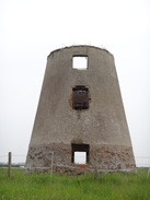
A road was joined for a short distance near Castor watermill, and a path led on to Castor windmill, which is barely more than a stump whose walls show some rather alarming cracks. Then the trail followed a tributary of the Nene called Back Dike, which presumably was once a long mill race. Again the route on the ground differed from that on the map, with the latter shows the Nene Way following the dike's northern bank, whilst Nene way markers pointed across the bridge to follow the Hereward Way's route.
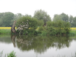
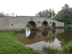
The path soon recrossed the dike and started alongside the river; this stretch was not so overgrown, but it mattered little as my right foot was now thoroughly wet. The views over the river were mostly interrupted by vegetation, with occasional glimpses of brown, fast-flowing water. I knew the next few miles fairly well, and was pretty much on autopilot the entire way. Ferry Bridge was as attractive as ever, and again the map showed the Nene Way diverting across the river, whilst the waymarkers on the ground showed it continuing allong the Hereward Way. A pleasant stretch followed along an easy path through Bluebell Woods, the trail climbing the hillside before dropping down to pass a golf course that is on the site of yet another Roman settlement.
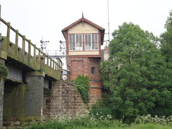
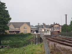
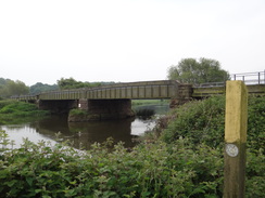
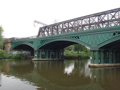
Eventually the path reached Orton Lock and passed under a large viaduct that carries the A1260 overhead. The next stretch felt remarkably rural despite being enveloped within the city; the long rowing lake off to the left was mostly hidden behind tall vegetation, whilst dragonflies flittered through the riverbank's thick vegetation. It was an enjoyable little stroll that ended when a footbridge, and then a couple of rail bridges, came into view on the outskirts of Peterborough. One of the rail bridges was built in 1850, and is the only remaining cast-iron bridge remaining on a high-speed railway in the UK. Its newer neighbour, built to expand the line's capacity 75 years later, is a steel truss that spans the gap without any intermediate supports. The single span may be more efficient than the earlier three-arch bridge, but it is nowhere near as beautiful.
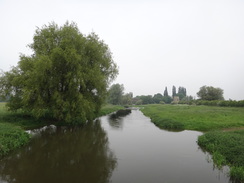
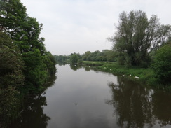
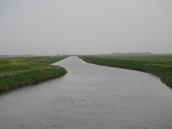
The Nene changes its nature in Peterborough, from a meandering, joyful thing that trickles along, to a long, straight beast that seemingly cannot wait to get to the sea. Upstream of the city the river twists around, whilst downstream it is straight, flat, and constrained within large floodbanks, its old winding course through the Fens mostly abandoned. The straightness feels unnatural, almost as if the waters are in jail.
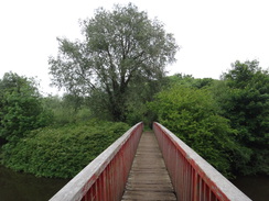
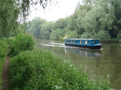
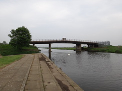
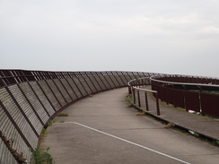
The river may be manmade, but it was easy walking. The promenade ended at the Fitzwilliam bridge over the river, and the trail continued along the top of the floodbank. Fortunately there was a cycle path along the top, and I made good time as another small period of drizzle passed over. Soon the cyclepath reached a curving metal bridge over the river. This was built in ?2004? and won a regional architectural award; it is certainly striking, and the Hereward Way uses it to finally leave the Nene.
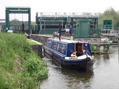
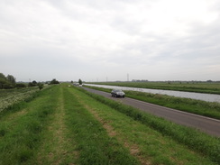
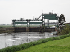
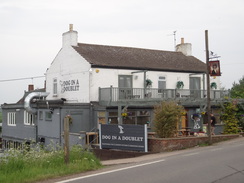
The Nene Way continues on beside the river. The cyclepath ended at the bridge, and a road ran along the gap between the bank and the river. Fortunately the grass was nice and short, so I could stride along with no problems. Eventually the wonderfully-named Dog-in-a-Doublet lock came into view; this is the last lock before the sea, which is still many miles away. It is a suitably large structure, and I was tempted to nip into the adjacent pub. However as there are only trains every two hours, I was keen to catch the next one and so I pressed on, crossing the river into Cambridgeshire.
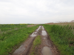
Here the Nene Way leaves the main river and headed south towards the town of Whittlesey. On the other side of the river, the trail left the road and headed along a track. It was easy walking and not too boggy, but all too soon it ended back at the road. This was very busy and the verge was narrow; there were indications of an old roadside path, but it was so covered in vegetation that following it would have been dangerous. Instead I walked along the road, frequently stepping onto the verge to allow cars past. It was a relief when a pavement started on the outskirts of Whittlesey and I could make better time.
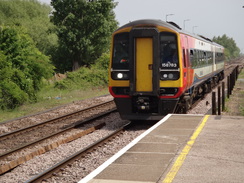
I had about an hour until the next train, and only a mile and a half to go. Instead of heading directly there, I decided to follow the Nene Way out of the town, before diverting off towards the station. There was little of note in this part of town, and I was soon reached the station, which had a gated crossing operated by a friendly woman. She told me I should buy a ticket on the train, and as I waited I took my boots off to find my right sock was totally sodden. The train arrived and I got on, but there was no sign of a ticket inspector. When I got to Peterborough I went to the ticket barrier, explained the situation, and a smiling inspector just waved me through without paying!
I had a little wait at Peterborough bus station for the next bus back to Wansford, and I spent the time exploring the adjacent shopping centre. I gave Sencan a call when I got back to the car, and she was just walking with Robert back to Ely station. We agreed to meet at Cambridge North station, and despite the roadworks on the A14 her train arrived just as I was driving into the station car park. A minor win after a good day's walk!
Next comes walk #1000, and we have a few plans for that ...
 |
 |
|
Directions
This walk starts off at a road junction beside Wansford Church at TL07369929. Head eastwards down Peterborough Road away from the church. A few yards before the road ends at the A1, turn right down a concrete track that parallels the dual carriageway - do not try to cross the A1 directly. The track descends below the road, and then a path leads off to the left to head under two bridges that carry the road overhead. Follow the path as it curves left, climbing up a slope to reach an old (and now (2018) closed toilet block at TL07689952.
Pass this to meet the end of a dead-end road; turn right along this, passing a little picnic area on the right. Pass a road leading off to a pumping station on the right, and as the road curves to the left towards a junction with the A47, turn right down a footpath that heads towards a big telecoms mast. The path joins a fence on the right that protects the pumping station below; follow the fence as it turns right and heads downhill to reach a stile at TL08239961
Cross the stile and turn left to descend a slope off a small shelf onto the floodplain. Parallel the river on the right, and at the corner of this field, cross a footbridge over a dry ditch and head on along a second field, with the river off to the right, eventually squeezing between a line of trees on the left and the river. Cross a footbridge guarded by stiles over a stream and continue through a small wooded area. After twenty metres the path emerges out into a third field. Continue following the river on the right. Go through a clappergate and head on; eventually a fence is met on the left, with the river behind a hedge on the right. Continue on; when the fence curves left away from the river, follow it to walk between fences. The path curves left and the right and joins a track at TL09229909.
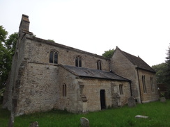
Follow this track along between fences; when a field gate is reached on the track ahead, go through an adjacent clappergate and follow a grassy path, with the track over a fence on the left. The path curves right away from the track, and then goes through a pedestrian gate beside a field gate. It continues on between fences to end at as road in the village of Sutton. Turn left up this road for a short distance to reach Sutton church on the right at TL09519874.
Immediately past the church, turn right down an unsurfaced track called Lover's Lane. When this curves left, turn right across a stile beside double field gates to enter a field. Follow a vague green track with a fence and trees on the right; when the fence ends, turn half-left across a meadow towards a distant rail bridge. At the far side of the meadow, cross a stile through a fence and continue on to reach a footbridge over a dry ditch. Cross this, and on the other side turn left to head towards the rail bridge. Cross a stone causey under the rail bridge, and then immediately turn left to follow a path, keeping the bridge on the left, to reach a stile. Cross this and head on with the railway embankment on the left and a fence on the right. After a short distance steps lead up the embankment on the left. At the top turn right to follow a narrow path that runs alongside the railway line on the left. Follow the railway line on the left for nearly half a mile until the path ends at TL10069802.
Turn right through a clappergate to enter a field, and then left to follow the bottom of the railway embankment eastwards. At the corner of the field, go through a clappergate and turn right to follow a hedge on the right under some power lines. At the corner of the field follow the path as it curves left, with a fence on the left. Cross a stile opposite a weir and head on with a hedge on the left and the river on the right. This eventually leads to a stile beside a field gate; cross this to reach a track that leads to a bridge over the river on the right at TL11109767.
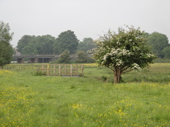
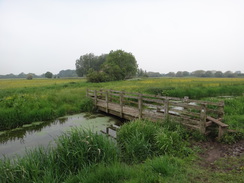
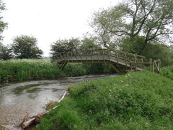
Do not cross the bridge, and instead cross the track and go through a pedestrian gate beside a field gate to join a path that soon forks. Take the right hand branch that soon reaches a pedestrian bridge over a ditch that leads to a clappergate. On the other side of these follow a path alongside the river on the right. Cross a stile and a causey over a flooded area to a second stile. On the other side, continue along the path with the river on the right. When the path forks near the end of the field, take the right-hand branch to continue following the river. It eventually curves away to the left across the meadow, passing a clump of trees in an ox-bow lake on the right. The path curves right beside the lake, and then left away from it, following a stream towards a bank ahead. Just before the bank is reached, cross a stile to reach a footbridge over another stream at TL12449724.
Cross the footbridge and a second stile on the other side, and then curve right and left to head up the bank, following a fence on the right. At the top of the slope, turn right across a stile beside a double field gate and then follow a fence on the right. This curves around to the left, right and then left once more, joining a hedge on the right. At the next corner of the field, go through a gap ahead to reach a surfaced road called Mill Lane. Turn right down this road; it soon curves left in front of Castor watermill at TL12809688.
Here the lane curves left and becomes unsurfaced, passing a barn on the right to reach a pedestrian gate beside a field gate. Go through this and continue along the track following a hedge on the left. Shortly after the track passes the stump of Castor windmill over the hedge on the left, the track curves right towards a ford over a tributary called Back Dike.; before this, leave the track and head downstream for a few metres to reach a bridge over the stream. Cross this, and on the other side turn left to start following the tributary downhill; do not take the path heading across the field towards a lock ahead. The path passes a small clump of trees and heads on, as the tributary veers away to the left. It soon rejoins the path, and the two curve left to reach a gate in front of a second bridge over the tributary at TL13439635.
Cross the footbridge, and on the other side follow the dike downstream on the right for a short distance until it meets the river, where the path turns left to follow the river downstream between a hedge and the river. After two-thirds of a mile a bridge carrying the Nene Valley Railway over the river is reached. Either climb up to cross it on the level crossing, or head underneath it past two stiles to reach the northern side. Continue for a third of a mile to two bridleway gates in quick succession, and then follow a fence on the left that angles away from the river. This climbs up a small bank, and at the top the fence is replaced by a hedge. Continue along the obvious path as it slowly descends towards the stone Ferry Bridge across the river ahead. Just before the bridge, turn left to reach a stile beside a pedestrian gate, and then walk on three metres to a second pedestrian gate; on the other side turn right to reach the road that leads onto the bridge at TL14339849.
Do not cross the bridge, and instead join a track that heads east way from the bridge, with the river on the right. When the track forks, take the larger left-hand branch that climbs uphill through the trees of the Bluebell Plantation. The track heads along the top of a wooded slope down to the right. Some industrial/office buildings are passed through trees on the left. Eventually the track ends at a T-junction with a surfaced path; turn right down this path, with a golf course away to the left; it descends downhill to reach Bluebell Bridge over the river at TL15439774.
Immediately before the bridge, turn left through a gap in a fence to join a rough path that follows the river on the right. Shortly afterwards cross a footbridge over a ditch and emerge out onto the side of the golf course. Continue following the riverside path downstream past the greens; after half a mile a footbridge is reached over a stream; cross this and on the other side turn right to continue along the riverside path. After another third of a mile Orton Lock is reached; head past this and continue along a surfaced path. When this curves left just before the A1260 overbridge, continue straight on along a lesser path that heads under the bridge at TL16689727.
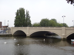
As the main path curves to the left after passing under the bridge, continue straight on along the riverside path. Over the next mile and a half it crosses two substantial footbridges over inlets as it heads eastwards towards the centre of Peterborough. The path passes under a footbridge leading to the 'Railworld' museum on the other side of the river, and then two large railway bridges. Continue on through the riverside in Peterborough; the path eventually curves to the left to reach the approach to the A1139 bridge at TL19279819.
Carefully cross the approach road using the pedestrian crossing, and on the other side pass a stone building on the right and rejoin the riverside path, which at this point runs along a stepped promenade. Continue on; after a third of a mile it passes under the A1139 road bridge, and then diverts around a small boat-launching slope. Continue along the riverbank for another half mile until the stepped concrete riverbank ends at a stream inlet, with Fitzwilliam Bridge over the Nene ahead. Turn left to join a cycle path that crosses the inlet on a bridge; after a few metres this ends at a junction with another cycle path by the bridge. Join the surfaced cycle path and follow it eastwards along the top of the flood bank, with the river about ten metres away to the right. After 1.75 miles a gate is reached, go through this and follow a fence on the left to reach a road at TL23489840, with the Shanks Millennium Bridge over the river on the right.
The Hereward Way crosses the river on the bridge, whilst the Nene Way continues on along the grassy floodbank, with a road between the bank and the river. After 2.4 miles the bank approaches Dog-in-a-Doublet lock; go past a farm gate and carefully walk along the road past the lock. Continue past the Dog-in-a-Doublet pub on the left until the road ends at a T-junction with the B1040 at TL27499940.
Turn right to carefully cross the bridge; on the other side, turn left down a track that descends onto the floodplain. After nearly 200 metres the track curves right to head in a rough southerly direction; initially it is a green and slightly boggy track, but soon becomes much firmer as it passed under power lines. After nearly half a mile the track curves right, and after another 250 metres ends a T-junction with the B1040 road once more. Turn left to follow the road south; there is no pavement, and care needs taking. The road enters Whittlesey, and after two-thirds of a mile a traffic-light controlled crossroads is reached at TL26979758.
Turn left at the crossroads to follow Bassenhally Road eastwards. After a third of a mile this curves sharply left to become Drybread Road, and shortly afterwards turns right to resume its eastwards course. The road passes a school on the right and the Straw Bear pub on the left; shortly after the pub, turn right down Crescent Road. Here the Nene Way is left. Crescent Road slowly curves to the right, before ending at a T-junction with Victory Avenue. Turn left and follow this road south for a sixth of a mile until it ends at a T-junction with the A605 at TL27899712.
Carefully cross the A605 and turn right to follow it westwards; after 250 metres turn left down Eastfield Drive. When this road curves right, head straight on down Millfield Way. When this cul-de-sac ends, go past a vehicle barrier and join a track that curves right and then left to reach a second barrier that leads onto another section of Millfield Way. Follow this until it ends at a T-junction with New Road. Cross this, and then turn left and then right down Hawthorne Drive. When this ends, go past a vehicle barrier and on between two walls for fifty metres to reach a second barrier that leads out onto a bend in Marne Road. Turn right to follow this road until it ends at a T-junction with the B1093 beside the Railway Inn. Turn left along the road for a short distance until Whittlesey station is reached at TL27639627. For trains back to Peterborough, you need the platform across the level crossing.
 |
 |
|
Distances
| From | To | Distance (m) | Ascent (ft) | Descent (ft) |
|---|---|---|---|---|
| Wansford church | Castor watermill | 5.0 | 138 | 161 |
| Castor watermill | Peterborough | 6.2 | 82 | 108 |
| Peterborough | Dog-in-a-Doublet bridge | 5.3 | 30 | 10 |
| Dog-in-a-Doublet bridge | Whittlesey station | 3.5 | 26 | 43 |
This makes a total distance of 20.0 miles, with 276 feet of ascent and 322 feet of descent.
For more information on profiles, ascents and descents, see this page
Transport
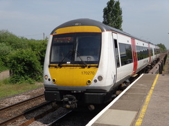
Two journeys are required to get back from Whittlesey to Wansford; trains operate wvery two hours between Whittlesey and Peterborough, and then the Centrebus Number 9 bus service runs from Peterborough bus station to the centre of Wansford.
There are also regular bus services from the centre of Wansford to Peterborough; and Peterborough bus station is only a short walk from the railway station.
 |
 |
|
 |
 |
|
 |
 |
|
 |
 |
|
 |
 |
|
 |
 |
|
 |
 |
|
 |
 |
|
 |
 |
|
 |
 |
|
 |
 |
|
 |
 |
|
 |
 |
|
 |
 |
|
 |
 |
|
 |
 |
|
 |
 |
|
 |
 |
|
 |
 |
|
 |
 |
|
 |
 |
|
 |
 |
|
 |
Disclaimer
Please note that I take no responsibility for anything that may happen when following these directions. If you intend to follow this route, then please use the relevant maps and check the route out before you go out. As always when walking, use common sense and you should be fine.
If you find any information on any of these routes that is inaccurate, or you wish to add anything, then please email me.
All images on this site are © of the author. Any reproduction, retransmissions, or republication of all or part of any document found on this site is expressly prohibited, unless the author has explicitly granted its prior written consent to so reproduce, retransmit, or republish the material. All other rights reserved.
Although this site includes links providing convenient direct access to other Internet sites, I do not endorse, approve, certify or make warranties or representations as to the accuracy of the information on these sites.
And finally, enjoy your walking!
Nearby walks
| # | Title | Walk length (miles) |
|---|---|---|
| 55 | Peterborough to Whittlesey | 8.6 |
| 56 | Peterborough to Stamford | 16.5 |
| 58 | Stamford to Oakham | 16.8 |
|
|

|