Walk #998: A circular walk between Sawtry and Oundle
 |
 |
|
General Data
| Date Walked | 16/05/2018 |
| County | Cambridgeshire, Northamptonshire |
| Start Location | Sawtry, Church Street |
| End Location | Sawtry, Church Street |
| Start time | 06.18 |
| End time | 15.00 |
| Distance | 25.2 miles |
| Description | This was a long walk along roads and brildways to reach the Nene way past Oundle, followed by another long road walk back. |
| Pack | Today I carried my 30-litre Karrimor rucksack, filled with water, a light running waterproof and spare trainers. |
| Condition | I am very chilled after this walk, and have a small blister on one of my toes. |
| Weather | Today was a cloudy day with some sunny periods; there a fierce northerly wind that was bitterly cold for the time of year. Early on there were a few spots of rain in the air. |
| OS map | Landranger number 141 (Kettering, Corby & surrounding area) and Landranger number 142 (Peterborough, Market Deeping & Chatteris) |
 |
 |
|
Map of the walk
Maps courtesy of Google Maps. Route for indicative purposes only, and may have been plotted after the walk. Please let me have comments on what you think of this new format. For a detailed table of timings for this walk, please see the table file.
 |
 |
|
Notes
My rather piecemeal approach to completing the Nene Way, coupled with the flooding in April, meant I had a couple of disjointed five-mile sections of the trail left to complete. I did the southernmost one of these on the last walk, and this left the northern one that follows the river past Oundle. When I attempted this stretch in April the path had been flooded, and I had been forced to use roads to divert around it. For completion's sake I needed to do it, but I have no immediate desire to rewalk the stretches immediately to the north and south. However I have never walked the area to the east of this stretch of the Nene, and so I planned a long walk - mainly along roads - to fill in the gap and explore new territory.
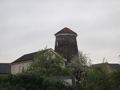
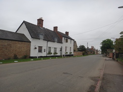
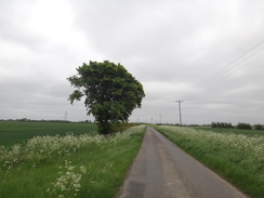
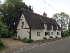
I parked up in a side street in the village of Sawtry early in the morning, got my kit together, and headed off. I had checked the weather forecast the previous night and it had seemed dry and fair, and so I had put on shorts and a short-sleeved running top that is little more than a series of holes stitched together. As I passed an old windmill - now converted into a house - on the outskirts of the village I started to feel cold and I stopped for a minute to get my fleece out of my rucksack, only to realise that I'd left it behind. Instead of heading back to my car to get it, I plodded along a road as a few drops of drizzle fell. This was not a problem, and neither was the cloud - but the cold northerly wind that cut straight through me was.
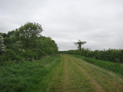
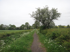
Another annoyance occurred when I left the road to head up a green lane. My dictaphone's batteries ran out, and I tried two spare sets of batteries in my pack before I found a third that actually held any charge. I used to have a procedure when packing my rucksack, and part of that was to check that I had enough spare batteries. Sadly, it seems as though this procedure has disappeared during my time-out from walking. It would not have been the end of the world even if I had found no batteries, as there was a little shop in the next village, where I bought some spares.
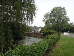
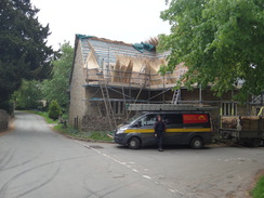
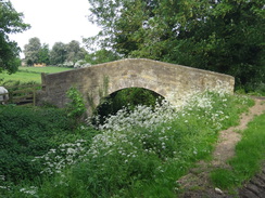
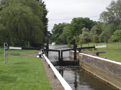
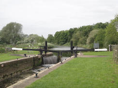
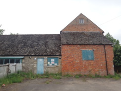
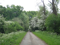
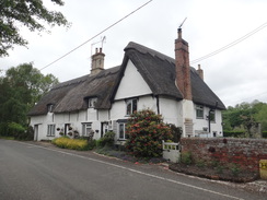
There is not much to report about the next few miles; a mixture of road and track walking took me down into the Nene Valley and into the picturesque village of Barnwell. I stopped on a bench outside the village pub to take a stone out of my boot, and watched a thatcher working on a roof opposite. It had taken me ten miles and three hours to get there, but finally I was on the Nene Way - even if the first mile was one I had walked before. A track took me down to cross the A605, after which a rather laborious plod took me towards Barnwell Mill; much nearer Oundle than its eponymous village, but a pleasant place nonetheless, especially with its lock alongside. Until recently the mill had housed a pub and restaurant, and although that has now closed it still seemed rather well-kept.
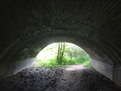
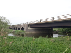
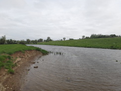
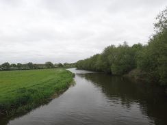
A track led toward another lock, where the trail crossed the river and headed across the floodplain towards the town of Oundle. However just before the town is reached, the path diverted back towards the river and a pleasant riverside walk began. Eventually the path headed under a low brick arch that once carried an old railway line south from Peterborough, but which now carries the A65 over the river. Railways require less width than roads, and the arches had been very sympathetically widened on the downstream side, with the new span barely distinguishable from the old. The effect was somewhat spoilt by the modern-looking girder bridge that spanned the river.
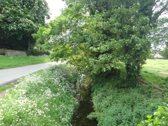
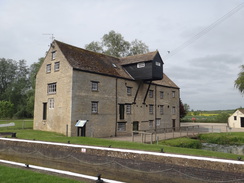
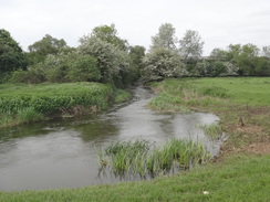
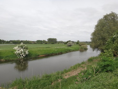
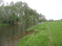
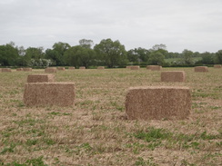
The next couple of miles followed the river as it wound around to the east of Oundle, much of which had been under water six weeks earlier. Some bails lay scattered across a field, and I wondered if they had been there during the floods. In reality it was difficult to tell that the area had been flooded, aside from a build-up of debris against a gate. It was a pleasant walk that ended all too soon at a footbridge over the river that led out to Ashton Mill, and I rejoined the stretch of the Nene Way that I had previously walked.
I stopped off on the village green in Ashton to eat my sandwiches and take my boots off to allow my feet to cool down, because they were overheating despite the chilly wind. The pub did not seem open, so I contented myself with listening to the calls of a peacock that was strutting around nearby, a spectacular that was only slightly spoilt by the noise of the grass being cut behind me.
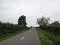
The next stretch of the trail took me past a shooting range, and I left the Nene Way just before Warmington to join a road that headed uphill, offering some expansive views over the valley behind me. I passed through some woodland before taking another road that headed on to the village of Lutton. When I was sheltered from the wind it was a pleasant stroll, but when exposed to it I felt utterly chilled.
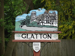
More roads took me on to the village of Glatton, and as I had plenty of time left I decided to nip into the local pub for a drink and a rest I was greeted by three men sitting at the bar and we immediately had a conversation that was both funny and welcomingly insulting. It was enjoyable, and all too soon I pulled my boots back onto my feet and headed out the door.
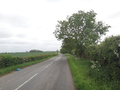
Another mile or so took me along another road back to my car in Sawtry. It had not been a classic walk, but had been enjoyable in its own way, especially as the roads had hardly been busy. The worst thing was that I was thoroughly chilled through to my core, the wind having made the most of my mistake of forgetting my fleece.
 |
 |
|
Directions
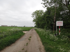
This walk starts off at Annesley Close in Sawtry at TL16758398. Leave the close and turn left down Church Street for a short distance until it ends at a T-junction with the High Street. Turn left down this road and follow it south, crossing over to the pavement on the right-hand side. When the road soon forks, take the right-hand branch, which soon curves to the right past a village green to become Gidding Road. Follow this road in a rough westerly direction as it winds around and slowly climbs. After 1.7 miles the road turns abruptly to the left at TL14448301.
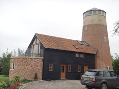
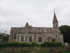
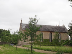
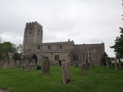
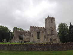
Turn right past a vehicle barrier to join a green lane called Bullock Road. Follow this north-northwestwards for 0.8 miles until it passes a second vehicle barrier to reach a bend in a road. Turn left to join Milking Slade Lane, and follow this west-southwestwards. After 1.2 miles this ends at a T-junction with another road at TL12268314, just after passing a converted windmill on the left. Turn right along Mill Road as it enters Gidding; after a third of a mile it ends at a T-junction. Turn left down Main Street, soon passing the Fox and Hounds pub on the left. The road descends through the village, passing Gidding church away to the right; after nearly half a mile this road ends at a crossroads at TL11688295.
Turn right along Luddington Road; after a couple of hundred metres, turn left to join a bridleway that runs between hedges. It soon crosses a footbridge over Alconbury Brook and emerges out into a field; continue uphill following a hedge on the left with a field away to the right. At the top of the field go through a gap in the hedge ahead and continue between a hedge on the left and a fence on the right along a second field. At the end of this field, go through another gap into a third field, and after a short distance go through another gap to reach a bend in a surfaced track leading to Luddington Farm on the right. Head straight on along this track, and 1.5 miles after the brook, the track ends at a T-junction with Thurning Road at TL09608164.
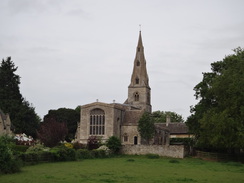
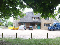
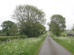
Turn right and follow Thurning Road as it heads northwestwards. After a mile it reaches a triangular junction with Thurning Church on the left. Take the right-hand branch, and then turn right to head north along another road. After a hundred metres, turn left along another road. Follow this road northwestwards; after 2.2 miles it descends to meet a road junction. Turn left along another road that heads west into Barnwell; after 0.4 miles the Montagu Arms is reached at TL05028485. Here the Nene Way is joined.
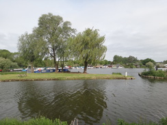
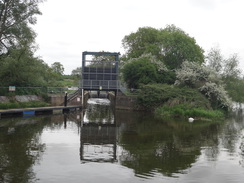
Turn right along a road, passing the pub on the right. Follow the road as it curves to the left alongside a brook on the left. 450 metres after the crossroads, the road ends at a T-junction. Turn right up the road and follow it as it curves to the left. On the next right-hand bend at TL04788562, turn left off the road to join a track that curves to the left, heading downhill to reach a farm bridge over Barnwell Brook. Follow a hedge on the right uphill past a field until a gateway is reached in front of the A605 road; go through this and carefully cross the main road. On the other side go past a vehicle barrier to join a track that soon ends at another vehicle barrier that leads out onto another road. Cross the road to reach the pavement on the other side and then turn right along the road. After a mile it passes Upper Barnwell Lock on the left and approaches a bridge over the river at TL03818698.
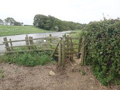
Do not cross the bridge, and instead turn right to cross the road and join a track. Pass a vehicle barrier and follow the track as it curves to the left to run between the river on the left and a lake on the right. When the track curves to the right after the lake ends, continue straight on along a path beside the river to reach Lower Barnwell Lock. Turn left to cross a footbridge by the lock's guillotine gate, and turn half-right and then left along a path to reach a footbridge guarded by gates over a stream. On the other side of the bridge, turn half left to walk across the floodplain for a short distance to a gate in front of a longer footbridge. Cross the bridge, and then head on for a short distance towards a clappergate beside a field gate in some trees, beyond which is the end of Bassett Ford Road to the south of Oundle at TL04198764.
Do not go through the gate (although the town of Oundle lies a short distance away on the other side), and instead turn right to almost double back across the floodplain, heading towards two trees; the path soon reaches the northern river bank. Turn left and follow a path beside the river southeastwards. Cross a farm bridge over a reed-filled ditch and continue along the riverbank, with houses at the top of a slope away to the left. Go through a clappergate and continue following the river on the right; the path then climbs up a slope, still following the river. It then passes under the arch of an old railway bridge that now carries the A605 overhead at TL04858702.
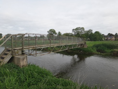
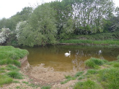
On the other, eastern, side of the bridge, go through a clappergate and continue following the river on the right as it slowly curves to the left. Go through another clappergate through a hedge and pass a reedy area on the left. Head on to a third clappergate through a hedge to reach a fourth clappergate through another hedge. Continue on to a fifth clappergate through a hedge; walk on to a sixth clappergate. (At this point I should perhaps just say go through any clappergates you come across...) About thirty metres from the end of this field, and before a weir is reached ahead, curve left to cut the corner off the field, to reach a clappergate beside a field gate. Go through this and walk on for three metres to another clappergate, and then curve half-right, following a river stream on the right. Pass Ashton Lock away to the right, and then go through a clappergate, walk on for five metres, and then go through another clappergate. Continue alongside the river stream until a footbridge over the river is reached at TL05008813.
Turn right to cross the footbridge, and follow the obvious path across the floodplain to reach a bridge over another river stream beside Ashton Mill. Pass the old mill and walk on to reach a road. Turn right down the road, using the pavement on the right-hand side of the road, and after about fifty metres carefully cross the road and head up some steps that lead to a clappergate. Go through this and follow a path that runs uphill between fences before ending at another clappergate. Follow a stone wall on the left, as a track joins on the right. The track soon ends at a road in Ashton at TL05528828.
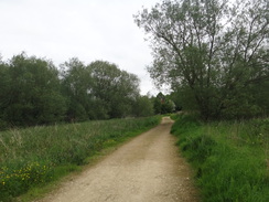
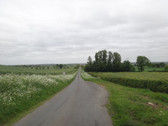
Continue straight on along the road; after nearly half a mile a triangular junction is reached just in front of a cottage; here turn left along another road. After another half-mile the road ends near a rifle range, and a good track continues onwards. Pass some barns on the left and then a vehicle barrier; continue on along a green lane to reach another vehicle barrier guarding a road at TL06898983. Here the Nene Way is left. Turn right to head along the single-lane road in a rough east-southeastwards direction; it climbs uphill, passes Tansor Grange on the left, and after 1.5 miles a road comes in from the left at TL08898878.
Continue straight on along the wider road as it passes through woodland. Two-thirds of a mile after the junction, and shortly after the trees on the left end, turn left along another road, signposted for Papley. A little triangular junction is reached after half a mile; ignore the track heading straight on, and instead follow the road as it swings around to the right; after another half-mile it ends at a T-junction with a road in Lutton. Head straight on down the road through the village until it bends to the left at a triangular junction beside Lutton Church at TL11208775.
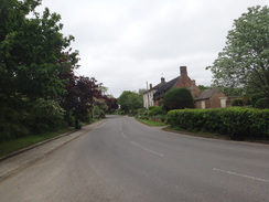
At the bend, turn right down another road, and follow it as it winds in a rough southerly direction. After a third of a mile, a road junction is reached on the left. Follow it southeastwards for 1.5 miles, passing under power lines before a road leads off to the left at TL12848564. Turn left along this road and follow it north-northeastwards for a third of a mile to reach another road junction with High Haden Road. Turn right along High Haden Road, and follow it eastwards. After 1.4 miles it curves to the right to enter the village of Glatton. Pass the church on the right, and follow the road until it ends at a T-junction with the B660 road at TL15428605.
Carefully cross the road, and continue south-southeastwards along Sawtry Road. It eventually enters Sawtry, and 1.5 miles after the junction in Glatton, Church Street is reached on the left. Turn left down Church Street, and then right up Annesley Close to reach the place that this walk started.
Distances
| From | To | Distance (m) | Ascent (ft) | Descent (ft) |
|---|---|---|---|---|
| Sawtry | Great Gidding | 4.6 | 246 | 154 |
| Great Gidding | Barnwell | 5.5 | 217 | 266 |
| Barnwell | Ashton | 5.1 | 194 | 171 |
| Ashton | Lutton | 4.7 | 226 | 138 |
| Lutton | Sawtry | 5.3 | 131 | 285 |
This makes a total distance of 25.2 miles, with 1014 feet of ascent and 1014 feet of descent.
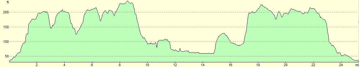
For more information on profiles, ascents and descents, see this page
 |
 |
|
 |
 |
|
 |
 |
|
 |
 |
|
 |
 |
|
 |
 |
|
 |
 |
|
 |
 |
|
 |
 |
|
 |
 |
|
 |
 |
|
 |
 |
|
 |
 |
|
 |
 |
|
 |
 |
|
 |
 |
|
| |
 |
|
 |
 |
|
 |
 |
|
 |
 |
|
 |
Disclaimer
Please note that I take no responsibility for anything that may happen when following these directions. If you intend to follow this route, then please use the relevant maps and check the route out before you go out. As always when walking, use common sense and you should be fine.
If you find any information on any of these routes that is inaccurate, or you wish to add anything, then please email me.
All images on this site are © of the author. Any reproduction, retransmissions, or republication of all or part of any document found on this site is expressly prohibited, unless the author has explicitly granted its prior written consent to so reproduce, retransmit, or republish the material. All other rights reserved.
Although this site includes links providing convenient direct access to other Internet sites, I do not endorse, approve, certify or make warranties or representations as to the accuracy of the information on these sites.
And finally, enjoy your walking!
Nearby walks
| # | Title | Walk length (miles) |
|---|---|---|
| 56 | Peterborough to Stamford | 16.5 |
| 142 | Huntingdon Station to Hargrave | 17.3 |
| 203 | Huntingdon to Peterborough | 24.5 |
|
|

|