Walk #990: Jurassic Way: Market Harborough to Corby
 |
 |
|
General Data
| Date Walked | 06/04/2018 |
| County | Leicestershire, Northamptonshire |
| Start Location | Market Harborough Old Grammar School |
| End Location | Corby railway station |
| Start time | 06.38 |
| End time | 13.46 |
| Distance | 19.6 miles |
| Description | This was a pleasant stroll along a central section of the Jurassic Way, including a walk to it along the Brampton Valley Way and a diversion into Corby at the end. |
| Pack | Today I carried my 30-litre Karrimor rucksack, filled with water, my spare waterproofs, a book and other odds and ends. |
| Condition | I feel absolutely fine after this walk. |
| Weather | Today's weather was a mixture of sunshine and cloud; it started off slightly chilly, but soon warmed up. The breeze was quite strong when I was exposed to it, and I never took my fleece off. |
| OS map | Landranger number 141 (Kettering, Corby & surrounding area) |
 |
 |
|
Map of the walk
Maps courtesy of Google Maps. Route for indicative purposes only, and may have been plotted after the walk. Please let me have comments on what you think of this new format. For a detailed table of timings for this walk, please see the table file.
 |
 |
|
Notes
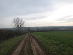
I've decided to abandon the Nene Way for a few weeks so it can dry out after the recent flooding. I looked around for another trail that is less likely to be affected by the rain, and eventually ssettled on the Jurassic Way. This stretches for 88 miles from Stamford to Banbury, and connects up several other walks I have done. It is not one I have seriously considered doing before, but it looks as though it met my immediate requirements. Because of a lack of public transport, much of the walk would have to be done as circular or there-and-back walks, except for part of the central section that could be done as a linear walk from Market Harborough to Corby, using the train to return.
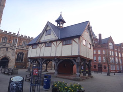
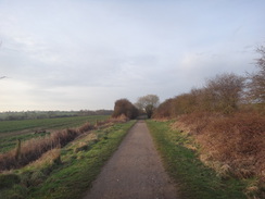
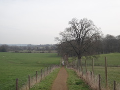
I parked up at a car park by the bus station in Market Harborough; this was convenient, but rather pricey at six pounds for the day. The town was quiet at six thirty in the morning, and I had little company as I strolled to the spectacular Old Grammar School, which seemed a fitting place to start. The Jurassic Way passes about three miles south of the town, but there is a convenient path to get there - the Brampton Valley Way, which follows the course of the old railway line to Northampton.
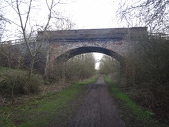
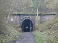
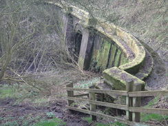
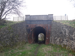
I had brought no food with me, but a shop that had just opened for the morning provided me with a few snacks, and soon I was heading out of town along the railway line. There were few signs of the path's railway heritage aside from occasional patches of exposed ballast: a concrete packing bin that had nearly been overtaken by nature, or a solitary milepost on the side of a cutting. A jogged passed me near a water splash - a ford over a stream - and one of his dogs seemed keener to follow me than his master. Eventually a large double-arch bride appeared ahead, spanning the cutting. I walked on a little further to the northern portal of one of the twin Oxendon tunnels. The railway had originally been built as a single-track line, and when it was doubled another tunnel was built alongside the first. I took a photo of one of the portals before heading back towards the bridge.
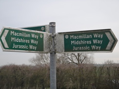
I left the Brampton Valley Way by climbing up a steep path onto the top of the cutting, and then above the portals, although the vegetation prevented a good view. The first Jurassic Way marker had company, as for the next few miles the trail coincides with the Macmillan Way and Midshires Way trails. Three different trails with very different trailheads, and none of which I have ever completed.
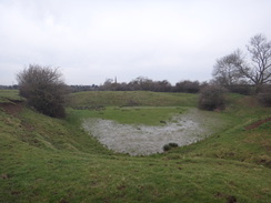
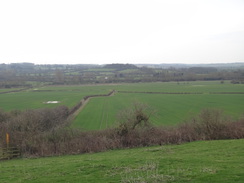
The trails crossed rolling fields, before joining a track that led down into Braybrooke. The village has an area marked on the map as 'Braybrooke Castle'; now little more than a few lumps and bumps on the ground, but once the site of a moated manor house. I went a little wrong in the next field; I knew I had to cross the railway line, so I angled towards a large bridge over the line. Unfortunately this bridge carries another path over the railway, and I had to backtrack to find a bridge that led under the Midland Main Line.
The trail headed crossed the A6 beside a roundabout, and then along a stub stretch of old road before heading along the edge of some woodland. This easy stretch was followed by a boggy one, where I found it hard to match the wooded terrain with my map. Despite this I did not go wrong, and I was soon striding across fields towards the A427 and the village of Stoke Albany.
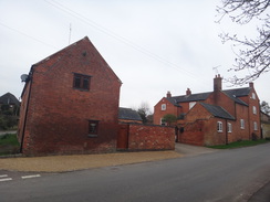
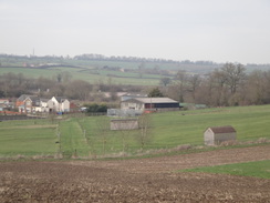
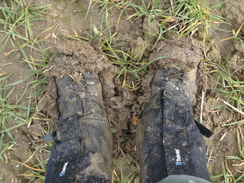
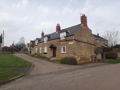
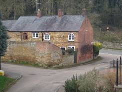
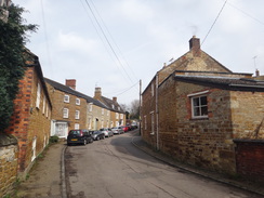
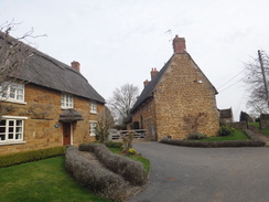
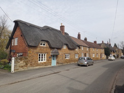
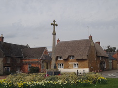
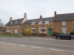
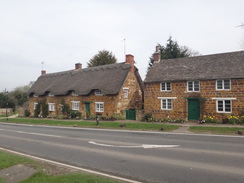
This was a pleasant place, with many houses of the yellow stone so frequently found in Northamptonshire villages. The trail does not take a direct route to the next village, Wilbarston, and instead makes a big loop along roads. Once in Wilbarston, I stopped off at the shop where a friendly lady served me some snacks before I headed out. The next stretch of path appears arrow-straight on the map as it heads towards East Carlton. Most of it was easy going, but unfortunately the last stretch was up a hillside that had been badly churned up by horses in the surrounding paddocks into a thick, gloopy mud, making progress difficult.
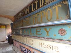
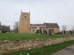
Eventually I struggled up into East Carlton, which the trail immediately leaves via a firm path that runs past a park. The firm path underfoot allowed most of the mud on my boots to slough off, reducing the weight on each step and lightening my mood as well. A steep road climbed out of the village of Middleton, after which a path led to the village of Cottingham. The sun was just at the right angle to prevent me getting a good photo of the village's church, but a short distance further on I saw something interesting in a little alley: a number of large boards on the wall, looking something akin to advertising hoardings. This appears to be a recently-closed business that used to produce replicas for museums.
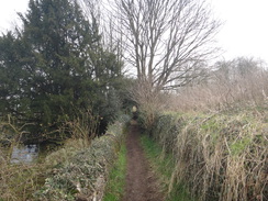
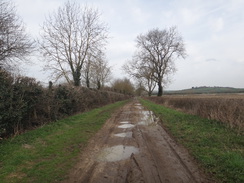
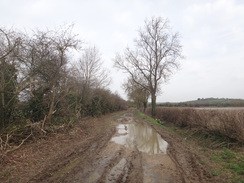
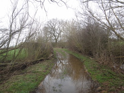
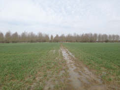
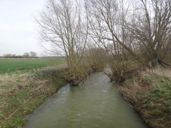
I followed a couple of horse and riders out of the village, before the trail joined a track. On my old 1:25000 OS map this is marked as a track, but on the latest on-line version it is a public road - I can only hope no-one attempts to drive along it as it is very rough. Big puddles led to a bridge over the River Welland, after which the track become well and truly waterlogged. I had little choice but to splash through, my gaiters valiantly keeping the water from getting into my boots. The entire stretch was almost impassable, which makes the map's depiction of it as a public road seem somewhat optimistic.
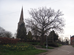
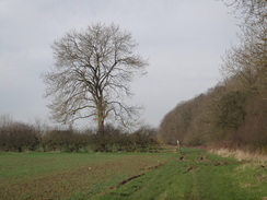
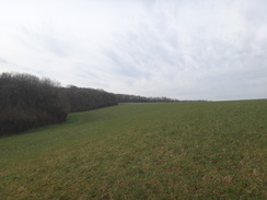
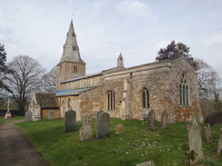
The trail left the track just as it became a narrow path, and headed across a waterlogged field to an old railway trackbed that once carried the old Rugby to Stamford line, which closed as part of the Beeching Cuts in 1966. The field on the other side was boggy in places, which probably is not too good for the plants that were trying to grow in the water. I managed to divert around the worst bits, and the ground got firmer and drier as the path climbed uphill to reach Bringhurst church. This sits at the centre of a tiny and perfectly formed hamlet of stone houses that sit atop a small hill.
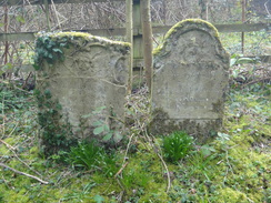
The trail took a road out of the village, and then a path led across fields to the village of Great Easton. This is Bringhurst's older and brasher brother, still with pleasant-looking houses but also a pub and shop. A house in the village had a plaque on its wall made from old horseshoes, whilst nearby a tiny graveyard set in an alcove off the road contained three large gravestones and one much smaller one - I've no idea why it is set in such a location.
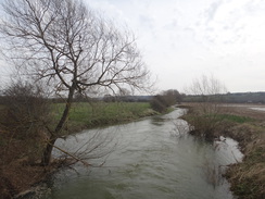
The trail took a road away from the village that slowly deteriorated in quality, becoming firstly a rough track and then a waterlogged footpath. It crossed a stream over the River Welland to reach a road, after which a short section of path took me into the pretty little village of Rockingham beside a barn that had been converted into a cafe. I felt rather dishevelled as I passed the people sitting in the sun outside the cafe, and even more so as I passed a group of elegantly-dressed women who were making their way into the village pub.
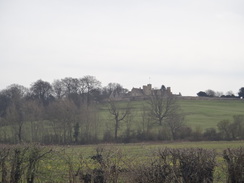
Rockingham Castle dominates the village; unlike other castles I have visited on recent walks, this one is substantially complete, and is still lived in by the same family who bought it off Henry VIII. Unfortunately I could not get a very good photo of it from the trail, although I should visit it some time in the future for a look around.
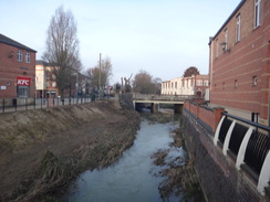
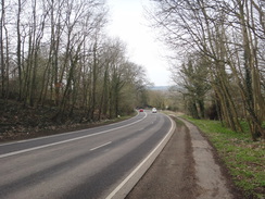
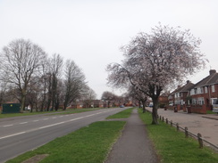
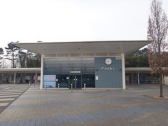
I left the trail in Rockingham and started the walk into Corby. This meant a steep stroll uphill alongside the road that soon had me puffing for breath. A water tower marked the highest point, after which I was in the outskirts of Corby. I have never been to Corby before, and it was just as I expected the ex-steelworks town to look like: a little down at heel with few signs of the sparkling regeneration that some parts of the town have apparently undergone. Foremost amongst these was the station, opened in 2009, although this sits amidst dirty, weathered hoardings that await developers.
I had twenty minutes to wait for my train, and I helped a lady purchase a ticket at a machine that seemed overly complex for its function - the NFC payment system seemed almost tacked on and unrelated to the old-style chip and pin card reader. Despite being nine years old, the station seemed so clean it could almost be brand new, and works on a bridge outside were for the double-tracking of the line to Kettering and electrification of the line.
My train arrived, and it soon arrived in Kettering, where I would change for the next train back to Market Harborough. The timetable had the latter train setting off a couple of minutes before mine arrived, but as mine pulled in I could see it still waiting on another platform. I ran to catch it, but it set off whilst I was on the footbridge. I had a little under an hour to wait, and so I took a stroll into Kettering for a quick look around.
It had been a good day's walk despite the soggy ground, and I look forward to walking more of the Jurassic Way soon.
 |
 |
|
Directions
This walk starts off from the Old Grammar School in the centre of Market Harborough, beside St Dionysius' church at SP73368726. Leave the building and head south down the High Street, away from the church. At a junction, cross the road ahead and turn left and then right to enter a shopping plaza called St Mary's Place. Walk through this until a bridge over the River Welland is reached; cross the bridge, and on the other side turn right to walk down to Northampton Road. Turn left to follow the road southwards, soon passing an indoor market and the bus station on the left. Continue along the road until Auriga Street leads off to the left; head down this, and when it curves to the left, head straight on past a gate to enter a park. Turn right along a surfaced path that is the start of the Brampton Valley Way.
Follow the track southwards; after 250 metres it reaches Scotland Road. Go past a field gate, cross the road, and go past a second gate to rejoin the surfaced path. Continue along the old railway line; it passes under a single arch overbridge, and after nearly two miles it reaches a double-arch bridge just before the portals of the Oxendon tunnels at SP73938367. Pass under the bridge and then turn right to join a footpath that climbs steps up the side of the cutting. At the top of the cutting, the path angles left to run through trees alongside the edge of the cutting on the left. It passes the end of the tunnel portals, after which the path curves left to run above them, climbing a few steps before reaching a stile at SP73918348 where the Jurassic Way is joined.
Cross the stile to enter a field, and turn half-left to head diagonally across it, descending down into a little dip and up the other side. At the top left-hand side of the field, cross two stiles over a ditch, and then turn half-left across a second field, aiming for some red-brick buildings in the distance. The path crests a little rise and descends down to reach a bridge over a ditch immediately in front of a stile through a fence. Cross the ditch and fence, and angle slightly to the right across the middle of the third field, aiming for trees to the left of the buildings. At the trees, cross a stile into the woodland; the path winds through the trees before curving right to follow a fence towards the buildings. After about fifty metres, turn left through a clappergate, and then immediately right beside a fence for ten metres to reach a second clappergate that leads to a track at SP74538387, with the farm nearby to the right.
Cross the track and head on along a rough track. Go through a gap in the hedge ahead to enter a field; after about ten metres take a slightly concealed stile on the right, just before a hedge starts. Follow the path between the hedge on the left and a fence on the right to reach another stile. Cross this to enter a field, and continue following the hedge on the left downhill. Near the bottom of the hill, cross a stile beside a field gate and pass a pond on the right. Go through a gap in a hedge to enter a field, and turn slightly to the right to head diagonally across the field. At the top, go through a gap in a hedge to enter another field at SP75048369.
Turn left along a track, following a hedge on the left. At the bottom of this field go through a gap in the hedge ahead and continue along the track, still with the hedge on the left. Ignore a footpath leading off to the right. The track becomes better defined as it heads downhill. At the bottom corner of the field go straight on through a broad gap and continue along the track as it runs between hedges. The track levels off and curves sharply to the right; it crosses a bridge over a stream (according to Google Maps, the 'River Jordan') and passes under some power lines. The track becomes surfaced and passes houses on the right. When the road ends at a T-junction in Braybrooke, turn right to pass a red-brick baptist church on the left. The road crosses a bridge over a stream and curves right and then left before reaching The Swan pub on the right at SP76438428.
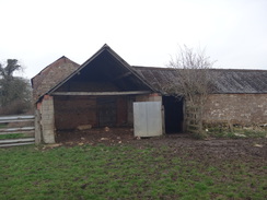
Turn left along School Lane opposite the pub, and follow it for 250 metres until it ends at a T-junction with Desborough Road. Turn right to head straight on along Desborough Road; there is no pavement, but the verges are wide. Pass an old barn on the left, and then immediately turn left through a clapper gate to enter a field. Turn half-right across the field, aiming for a kink in the hedge on the right. Join the hedge at the kink, and keep it on the right. Before the corner of the field is reached, turn right to cross the hedge via a footbridge guarded by two gates, and then turn left to reach a second footbridge over a stream, also guarded by gates. On the other side, turn right along a narrow field, angling towards an embankment carrying a railway line. After a short distance turn left to reach a clappergate that leads to a bridge under the railway line at SP77368467. Pass under the railway line and cross a stile to enter a field. Angle half-right across the field, aiming for the far corner. At the corner go through a gateway to reach a road opposite Park Hill Farm at SP77548479. (The trail actually crosses a footbridge through the hedge next to the gateway, but in 2018 this was overgrown).
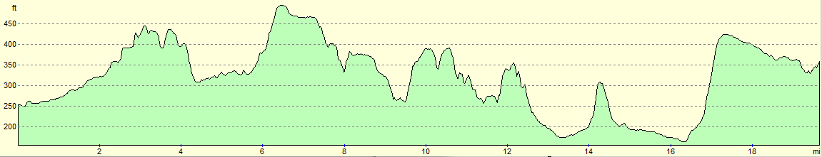
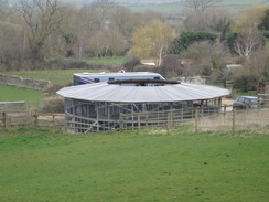
Cross the road, and on the other side, cross a stile beside a gate. Follow a track past a barn on the left to reach a stile beside a field gate. Cross this to enter a small turning area in front of the barn, and head towards another stile on the left beside a field gate. Cross the stile and turn half-right between fences guarding paddocks. When the fences veer right after a short distance, turn slightly left to cross an electric fence and continue straight on between fences (as ever with paddocks, fences can change, so just aim for a stile leading out of the paddocks). At the end of the paddock, cross a stile and turn slightly right to head diagonally across a field, aiming for a broad gap in the hedge at the top. Go through the gap, and head straight on across the middle of a second field. At the top, cross a stile through a gap in a hedge and then turn half-right across a third field. Go through a bridleway gate and descend to reach the A6(T) road at SP78078534, with a roundabout immediately to the right.
Carefully cross the A6, and on the northern side follow an obvious grassy path ahead. The path soon enters a tunnel of trees; after a short distance it reaches a path ahead. Turn right along this path (part of an old road) and follow it until it soon emerges out at Hermitage Road. Turn left down this road. The road heads downhill; after 200 metres turn right across a stile into a field. Follow the edge of some woodland on the left, and at the corner of the field, cross two stiles immediately after one another through fences, with a field gate away to the right, to enter a second field. Continue following the trees on the left; at the corner of this field go through a gateway to enter a third field. At the corner of this field go through a broad gap in the hedge ahead (complete with old cattle grid) to join a very rough track that soon emerges out to a rough track ahead at SP79138579, where the woodland on the left ends.
Cross the track and head straight on across the field, aiming for an area of woodland ahead. At the end of the field cross a stile and follow a path through the trees, which soon leads to another stile that emerges out across a bridge over a ditch into a field. Head straight on, following a hedge on the right with a field away to the left. The path descends into a little dip, and at the bottom angle slightly left across a scrubby area of land, away from the trees on the right. At the end of the scrubby area, go through gap in a fence and through a small band of woodland to emerge out into a field at SP79588616.
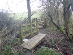
Head diagonally across the field, initially descending into a dip before climbing up a slight slope, and then paralleling the woodland down to the right. The field narrows, and at the tip go through a gap between the woodland on the right and a hedge on the left to enter a second field. Turn right to follow the edge of the field as it curves left. After about 100 metres, turn right to cross a stile that leads into some woodland. The path descends a short distance to a plank bridge over a stream, and then a footbridge over a bigger stream at SP79948671.
A gate then leads out of the woodland and into a field. Head straight on up the field, and at the top cross two stiles through a single hedge to enter a second field. Cross these and turn left, angling away from the hedge on the left, heading towards a farm gate in the hedge ahead. Go through the gate into a third field and parallel a hedge on the right. At the far corner of the field, cross as tile beside a bridleway gate into a fourth field.
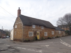
Angle slightly right across this field, and at its far side turn right to follow a fence and trees on the left; on the other side of the trees is a road cutting carrying the A427. Just before the fence reaches some gates and barns ahead, turn left across a stile through the fence to join a path that angles right through trees, with the road below to the left. Go down a few steps to reach a road. Carefully cross the road to reach the pavement, and turn left to head under a bridge that carries the A427 overhead. This road ends at a crossroads in Stoke Albany at SP80718775, beside the White Horse Inn.
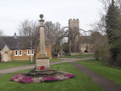
Carefully cross the road and head straight on up Ashley Road. Follow the pavement on the right as the road descends; when it ends in front of the war memorial and church, turn right along Lower Road. The road curves to the right and climbs uphill, passing Wilbarston church on the right before ending at a crossroads with the B669 road in the centre of the village beside the Fox Inn. Turn left along the B669 and follow it as it heads uphill; the gradient slackens and the road curves to the right. After 300 metres pass the village hall on the left, and continue on for a short distance until a pedestrian gate beside a field gate is reached on the left at SP81648834.
Go through the gate to enter a playing field and head on, keeping a hedge on the right. At the end of the playing field, go through a gap in the hedge ahead into a second field. Continue on with the hedge on the right; it descends downhill, and at the bottom go through a gap in a hedge ahead to enter a small area of woodland. Start climbing uphill, still with the hedge on the right. The path soon emerges from the trees, and continue uphill. At the top, the hedge curves right for a couple of metres and then left (do not go through a gap into another field), and heads on towards an electricity pylon at SP82358882.
Pass the pylon, and when the corner of the field is reached, squeeze between a disused stile and a broken brick wall to enter another field. Angle slightly to the left to head downhill across the field, and at the bottom cross a stream and go through a pedestrian gate into another field. Turn left to follow a hedge on the left, and after about 250 metres turn left across a stile through the hedge to enter another field. The path curves to the right past paddocks and heads uphill between fences. At the end of the paddocks, cross a stile and continue between a fence and a hedge to reach a gate that leads out onto a road in East Carlton at SP82908942.
Carefully cross the road, and on the other side go through a gate to the side of a field gate to join a good path that runs between fences. It heads downhill and then climbs once more, passing woods in East Carlton park; after half a mile go through a pedestrian gate as the woodland on the right ends. Head on between fences; go through another pedestrian gate and continue on for twenty metres between low stone walls before emerging out onto a road in Middleton at SP83898985.
Turn right up the road, and after a short distance taken the first road off to the left, School Hill. This climbs steeply and curves to the right; take the first road off to the left, Camsdale Walk. When this road soon ends, continue past a clapper gate and head on, initially between stone walls. The path narrows; go through a clapper gate to enter a field and follow a hedge on the left. In the corner of the field, head straight on to reach a clappergate. Go through this and head downhill beside a fence on the left. At the bottom, continue between fences. Ignore a clappergate to the right, and instead turn left down a good path that runs between fences towards Cottingham Church at SP84598994.
At the church entrance, turn left down some winding steps that lead down to reach Church Street. Follow Church Street away from the church; when it ends at a T-junction with High Street in Cottingham beside the Spread Eagle pub, turn left to head down the High Street. Just before the road curves to the left, turn right up Mill Road. The road immediately passes the village primary school on the left, and then curves to the left. Just before it curves to the right, go through a clappergate on the left and head through a narrow band of trees to enter a playing field. Keep a hedge on the right past the field; at the far corner, go through another clappergate and continue on, initially between a fence and a hedge. When the fence on the left ends, continue alongside the hedge past a field on the left. At the end of the field, go through a gap ahead and follow a fence on the left and a hedge on the right. The path then curves left for a few metres, and then right across a bridge over a ditch and through a gap in a hedge to reach a broad bridleway at SP83779052, with a road just off to the left.
Turn right to follow the bridleway northwards; it crosses a bridge over the River Welland and after nearly half a mile curves to the left and becomes more enclosed. 200 metres after the bend, turn right across a footbridge over a ditch and then through a clappergate to enter a field. Head straight on across the field; at the end go through another clappergate and then up some steps to reach an old railway trackbed at SP83469143.
Cross the trackbed, descend some steps and then go through a stile and a footbridge across a ditch to enter a field. Angle half-right across the field, aiming roughly to the left of a church tower on the hill ahead. Cross a footbridge over a ditch to enter a second field, aiming for a gap in a hedge ahead. At the end of the field, cross a farm bridge over a little ditch and go through the gap in the hedge to enter a third field. Climb up the field, aiming for the top right-hand corner. At the corner, cross two stiles through a hedge to enter a fourth field, and then turn half-right across the field, angling towards the hedge ahead. Keep the hedge on the left until it reaches a stile beside a field gate. Cross this to join a road near Bringhurst church at SP84089212.
Follow the road as it curves right and then left past the churchyard; when it reaches a triangular junction, turn right to head downhill along Middleton Road. After about 250 metres, just before it curves sharply to the right, turn left across a stile to enter a field. Head straight on across the field, but after twenty metres the path curves to the left across the field, aiming slightly to the right of a distant church tower. When the corner of a hedge is reached, cross a plank bridge over a ditch and then a stile to enter a second field. Keep the hedge on the left across this field; at the next corner turn left over a stile beside a field gate.
Angle slightly right across the third field, aiming for a hedge ahead, about thirty metres from the corner with the hedge on the right. At the hedge, squeeze past a fence and then cross a stile to enter a fourth field. Head straight on across this field, aiming for a broad gap in the hedge ahead. Cross a double stile through a ramshackle fence in the gap and then angle half-left across a fifth field towards some houses ahead. Aim for the corner of the field, and in the corner cross a stile beside a field gate to reach Barnsdale Road in Great Easton. Turn right along the road, and follow it until it ends at a triangular junction with the High Street and Caldecott Road at SP84999294.
Turn right to follow Caldecott Road out of the village; after 450 metres turn right down a surfaced track called Gatehouse Lane. Follow the lane, and when the surfacing ends after 450 metres, go through a bridleway gate beside a double field gate and continue on towards a barn ahead. At the barn the track curves to the left and then right to head past the front of a barn, and then continue on along a rough path through trees, aiming for a corner of a hedge ahead. Follow the hedge on the right, and when the trees end cross a narrow brick bridge over a stream to enter a field. Head straight on across the field, and at the far end cross a farm bridge over the River Welland and go through a small band of trees to enter a field. Do not take the obvious track ahead, and instead turn left, keeping the trees and river on the left and the field on the right. At the field's corner, go through a gap in a hedge ahead to access a track. Turn right down this track and follow it until it soon ends at the B670 road at SP86259178.
Carefully cross the road, turn left along it for a few metres, and then turn right to enter a field. Turn half-left to go diagonally across this field; at the far side, go through a gate and continue on across a small field, aiming for the right-hand edge of a barn. Go through a double gate and pass the barn (now tea rooms) and head on to reach the A6003 in Rockingham. Turn right up the road, passing the Sondes Arms on the right; cross the road when it is safe to reach the left-hand side. After 250 metres the Jurassic Way heads off to the left at SP86749155.
However this day's walk leaves the trail here, and instead continues into the centre of Corby. Continue along the pavement on the left-hand side of the road as it climbs steeply uphill; after 700 metres the gradient slackens and a roundabout is reached. Turn left at the roundabout to join the A6116, and carefully cross the road to join the pavement on the right-hand side. Continue along the road; when a roundabout is reached after half a mile, continue straight on along Rockingham Road. This curves around past a series of roundabouts, and after 1.3 miles a bridge over a railway line is reached at SP89368924.
Cross over the bridge, and just before a roundabout is reached on the other side, turn right along a surfaced path across a grassy area, with the railway's palisade fencing off to the right. The path crosses a bridge over a small stream and then curves to the right up a slope before ending at High Street, with the White Hart off to the left. Turn right along the road, and when it soon ends at a T-junction, turn left down Station Road. Pass a bus depot on the right, and take the first road off to the right, Station Road, which leads directly to Corby Railway Station at SP89178866.
 |
 |
|
Distances
| From | To | Distance (m) | Ascent (ft) | Descent (ft) |
|---|---|---|---|---|
| Market Harborough | Oxendon Tunnels | 2.8 | 157 | 10 |
| Oxendon Tunnels | Wilbarston | 7.0 | 397 | 463 |
| Wilbarston | Rockingham | 7.0 | 420 | 515 |
| Rockingham | Corby station | 2.8 | 210 | 108 |
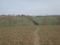
This makes a total distance of 19.6 miles, with 1184 feet of ascent and 1096 feet of descent.
For more information on profiles, ascents and descents, see this page
Transport
Trains run regularly from Corby down to Kettering stations, where you can change for other services up to Market Harborough. The journey can currently (2018) take anything from half an hour to an hour and a half, depending on how the connection at Kettering is timed.
 |
 |
|
 |
 |
|
 |
 |
|
 |
 |
|
 |
 |
|
 |
 |
|
 |
 |
|
 |
 |
|
 |
 |
|
 |
 |
|
 |
 |
|
 |
 |
|
 |
 |
|
 |
 |
|
 |
 |
|
 |
 |
|
 |
 |
|
 |
 |
|
 |
 |
|
 |
 |
|
 |
 |
|
 |
 |
|
 |
 |
|
 |
 |
|
 |
 |
|
Disclaimer
Please note that I take no responsibility for anything that may happen when following these directions. If you intend to follow this route, then please use the relevant maps and check the route out before you go out. As always when walking, use common sense and you should be fine.
If you find any information on any of these routes that is inaccurate, or you wish to add anything, then please email me.
All images on this site are © of the author. Any reproduction, retransmissions, or republication of all or part of any document found on this site is expressly prohibited, unless the author has explicitly granted its prior written consent to so reproduce, retransmit, or republish the material. All other rights reserved.
Although this site includes links providing convenient direct access to other Internet sites, I do not endorse, approve, certify or make warranties or representations as to the accuracy of the information on these sites.
And finally, enjoy your walking!
Nearby walks
| # | Title | Walk length (miles) |
|---|---|---|
| 137 | Market Harborough to Northampton | 18.3 |
| 138 | Market Harborough to Leicester | 17.7 |
| 653 | A circular walk from Welford to Foxton | 20.6 |
|
|

|