The Wayfarers Walk
|
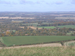
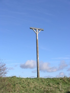
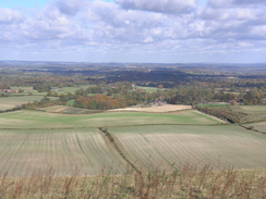
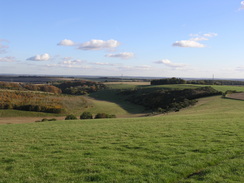
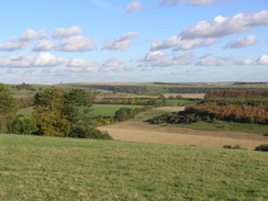
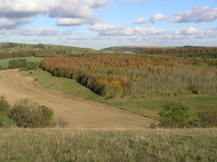
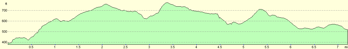
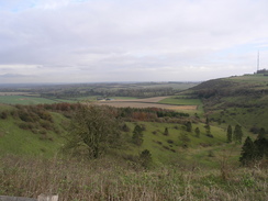
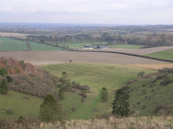
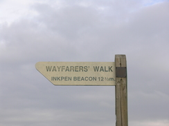
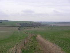
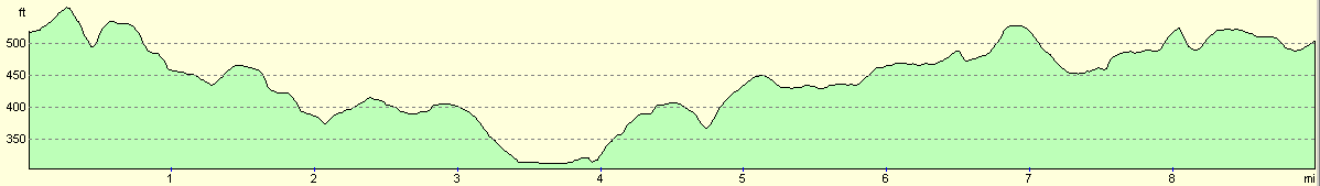
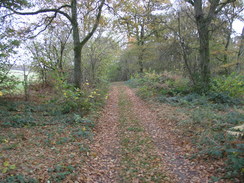
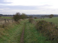
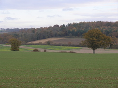
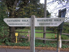
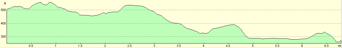
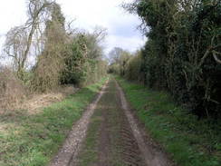
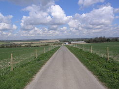
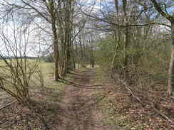
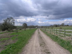
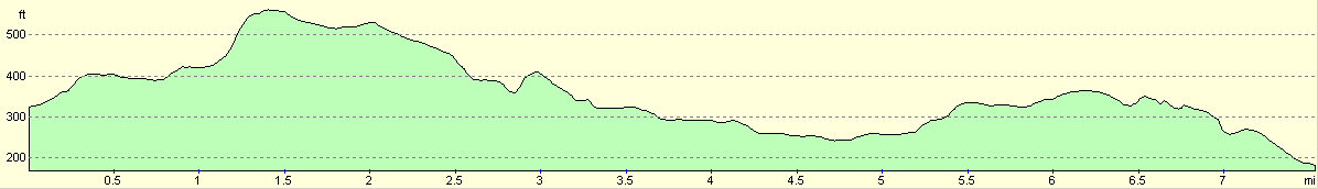
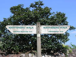
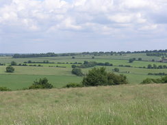
The Wayfarers Walk is a 71-mile trail in Hampshire, running from Inkpen Beacon in the north of the county to the sea at Emsworth, in the south. On the way it passes through a series of pleasant towns and picturesque villages, and the scenery, if not grand, is certainly attractive. it is a varied walk; the start is high, with imposing views north from the escarpment of Walbury Hill; whilst the end is a pleasant stroll along the coast past the northern end of Hayling Island. Routefinding was, with one or two noteable exceptions, easy enough, and for long periods the Way follows long, linear tracks. The Way is well waymarked, with discs that contain a 'WW' symbol. These can be situated on gateposts, fenceposts, stiles, lampposts, or just about anything that is stationary. |
The walk in full:
| No. | From | To | Distance | Ascent | Descent |
|---|---|---|---|---|---|
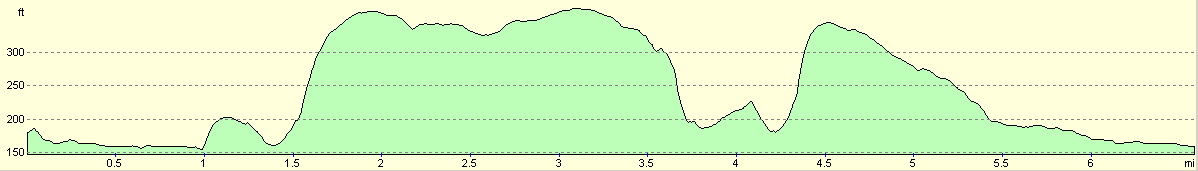
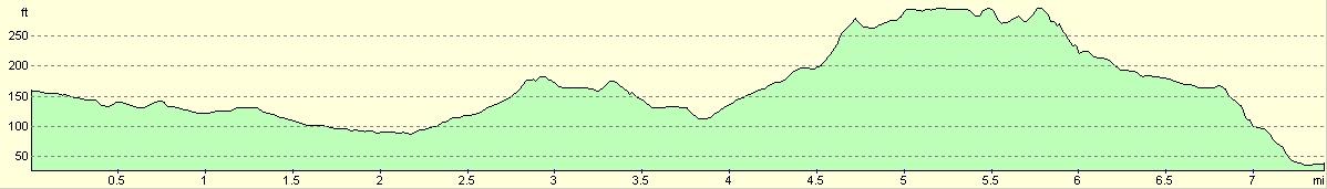
| 1 | Inkpen Beacon | A34(T) at Litchfield | 8.3 | 577 | 1037 |
| 2 | A34(T) at Litchfield | North Oakley | 7.1 | 863 | 735 |
| 3 | North Oakley | Dummer | 9.2 | 640 | 640 |
| 4 | Dummer | Totford | 6.6 | 308 | 568 |
| 5 | Totford | New Alresford | 7.5 | 584 | 584 |
| 6 | New Alresford | Kilmeston | 6.3 | 581 | 525 |
| 7 | Kilmeston | Droxford | 7.6 | 548 | 686 |
| 8 | Droxford | Denmead | 6.6 | 561 | 581 |
| 9 | Denmead | Bedhampton | 7.4 | 427 | 551 |
| 10 | Bedhampton | Emsworth | 5.2 | 85 | 118 |
| 71.8 | 5174 | 6025 |
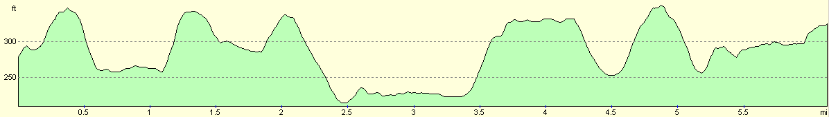
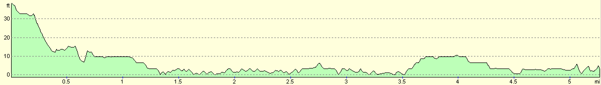
Leg 1 - Inkpen Beacon to A34(T) at Litchfield
No. From To Distance Ascent Descent Profile
1
Combe Gibbet
A34(T) at Litchfield
8.3
577
1037

| No. | From | To | Distance | Ascent | Descent | Profile | 1 | Combe Gibbet | A34(T) at Litchfield | 8.3 | 577 | 1037 |
|---|
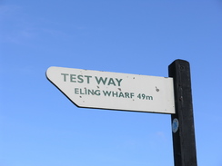
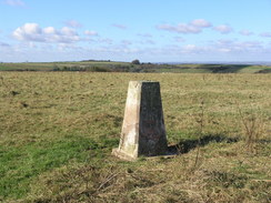
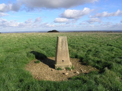
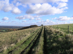
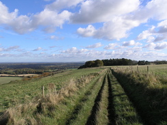
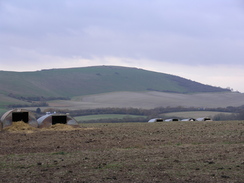
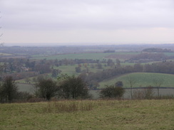
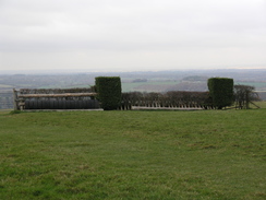
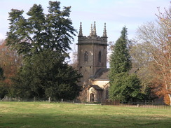
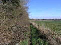
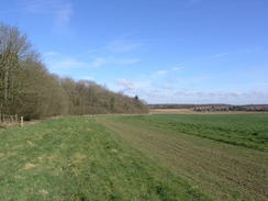
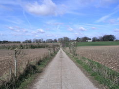
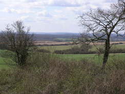
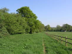
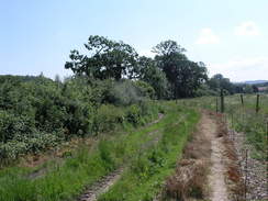
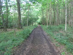
The Wayfarers Walk starts off from the car park on Walbury Hill; however, I think a better starting point is from Combe Gibbet on Inkpen Beacon, a couple of hundred yards to the west. From Combe Gibbet descend down to reach a road, on the other side of which is a car park. This marks the end of the Test Way and the start of the Wayfarers Way. Keep the car park on the left as another track heads uphill, passing across the top of Walbury Hill before descending down to another road. Follow this road for a couple of hundred yards; at the next junction turn left along the road for a couple of yards before turning right down another track. This heads southeastwards, rising and falling as it heads along the edge of the ridge passing Pilot Hill
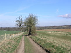
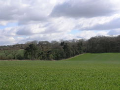
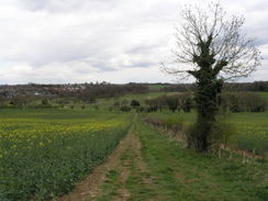
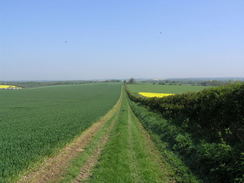
Continue on along the track as it continues southeastwards, eventually passing Charldown before descending to meet a road. Turn right and follow this road southeastwards for a few hundred yards and, shortly after a little patch of woodland on the left, turn left to join another track. Follow this track as it heads southeastwards past Bunghanger Copse, the trees ending before and the track continuing on before ending at a road after about a mile. Cross this road and continue straight on along another track, this one called Ox Drove, for a little under a mile until it ends at the A343 road. Turn left along the road for a few yards to a road junction on the right; turn right up this new road and then, when the road curves to the right, turn left to join another track. The track forks; take the right hand fork and pass a circular building on the left before slowly curving to the right and heading southwards towards Upper Woodcott Down.
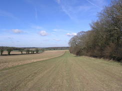
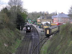
When the track curves to the left continue straight on uphill across a field towards the corner of a patch of trees. Skirt this corner and then head diagonally across a field, as the path meets a fence on the right which it follows to a gate. Go through the gate and continue along the track as it heads eastwards along the top of a little ridge. After a mile it descends to meet the A34(T); this road is busy, and instead of crossing it on the level you can turn right to walk south parallel to it for a third of a mile until a tunnel under the A34 is reached. The village of Litchfield is just a short distance away to the south.
 |
 |
|
 |
 |
|
 |
 |
|
 |
 |
|
 |
 |
|
 |
 |
|
 |
 |
|
 |
 |
|
 |
 |
|
 |
 |
|
 |
Leg 2 - A34(T) at Litchfield to North Oakley
No. From To Distance Ascent Descent Profile
2
A34(T) at Litchfield
North Oakley
7.1
863
735
| No. | From | To | Distance | Ascent | Descent | Profile | 2 | A34(T) at Litchfield | North Oakley | 7.1 | 863 | 735 |
|---|
This stretch starts from the underpass beneath the A34 just to the north of the village of Litchfield. Climb up to join a footpath that heads north alongside the A34(T) until it is opposite the point we were before.
Turn right to start heading eastwards uphill along a rough track. This curves to the left under some power lines towards a band of trees, passes them and then turns tot eh right to walk along the northern end of the trees. It continues eastwards until some more trees are reached at SU472554, and then turns to the left to walk northwards, initially with trees on the right. The path heads northwards as it climbs, before taking more of a northeasterly course onto Great Litchfield Down.
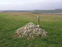
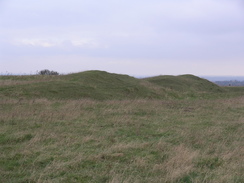
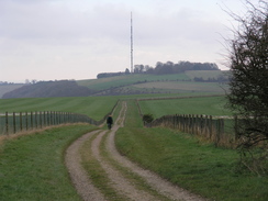
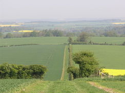
As it approaches the fort on Ladle Hill it turns to the right to head east along a track, initially skirting the ramparts and then passing a tumulus on the right.At the end of the field turn left to head north, and then just before the end of the field turn right along a footpath. Initially this heads eastwards before curving to the right to head southeastwards and then eastwards to reach a road on Nuthanger Down, Cross this road and take a footpath that climbs uphill to the northeast; at the top of the hill it joins a track that starts to head eastwards for a mile and a third past Watership Down and Cannon Heath Down, curving to head southeastwards and ending at a road on White Hill at SU516565
Cross this road and continue along the Wayfarer's Walk as it heads southeastwards, curving to take a more southerly course to end at another road after 0.8 miles. Cross this road and follow a track southwards that leads towards Walkeridge Farm. Pass the farm, and then continue on southwards; a mile later it ends at a T-junction with another track. Turn left to head eastwards along this track into North Oakley.
 |
 |
|
 |
 |
|
 |
 |
|
 |
 |
|
 |
 |
|
 |
 |
|
 |
Leg 3 - North Oakley to Dummer
No. From To Distance Ascent Descent Profile
3
North Oakley
Dummer
9.2
640
640
| No. | From | To | Distance | Ascent | Descent | Profile | 3 | North Oakley | Dummer | 9.2 | 640 | 640 |
|---|
This walk starts of from North Oakley. When the track ends at a road continue straight on eastwards along the road towards Manor Farm, and then turn right to head uphill along a footpath, slightly east of south. At the top of the hill this joins another track, which can be followed eastwards for a few hundred yards to Freemantle Farm.
Just pass Freemantle Farm a crossroads of paths is reached; turn right to head south along a path for a few hundred yards uphill, and then it leaves the track and turns to the left to run eastwards. After a short distance it turns to the right to start heading southeastwards, entering some woods before reaching the end of White Lane. Continue on along the path from the end of the line, as the path heads southeastwards, skirting the eastern edge of Great Deane Wood.
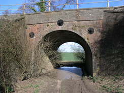
0.7 miles after White Lane a path leaves the track to the right, heading slightly west of south towards the southeastern corner of Little Deane Wood. Cross a track, and then follow the path as it heads southwestwards to end at a road near Deane Down Farm. Turn right along this to head westwards for a few hundred yards, and then turn left to head south to a bridge over a railway line. Cross the bridge, and on the other side turn half-right to head downhill to the southeast. After half a mile this ends at a road near Manor farm in Deane; turn left along the road westwards, and follow the road as it curves around to head south to end at the B3400 road opposite the Deane Gate Inn.
Head southwards down the road for a few hundred yards until directly opposite Cheesedown Farm, and then turn left along a track that heads eastwards. The track is easy to follow as it slowly climbs, before heading southeastwards downhill to a bridge under the railway line. Continue on the track as it curves to the left to head eastwards, skirting past a coppice called Itchen Row before reaching a bend in a road. Head straight on along this road for a hundred yards, and when it curves to the left continue straight on along another track past Bull's Bushes Copse.
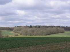
Here the path on the map heads southeastwards through the middle of the copse, but waymarkers on the ground showed he path continuing along the northern edge of the copse. I followed the waymarkers, which took me eastwards along the edge of the trees for about a third of a mile to the edge of the trees. At the end of the trees it curved to the right, heading south as it climbed uphill with the copse on the right to reach bull's Bushes Farm. The track crosses the farm and then curves to the left, to head southeastwards along the edge of a field. Go through another field to reach the northwestern end of South Wood. Turn right for a hundred yards down a track, keeping the trees on the left, and then turn left to head southeastwards along the southern edge of South wood.
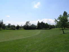
When the trees end a path continues on for a short distance, skirting a house on the left before ending at a bend in a road. Continue straight on down this road for a short distance until the A30 is reached. The next section of route is fairly complex. Carefully cross the A30, and on the other side turn left. After a short distance follow a feeder road that heads off to the left; when this ends at a T-junction, turn left and take a footpath that skirts the left-hand side of a road. After fifty yards, carefully cross the road and join a footpath. This heads southeastwards along the edge of Peak Copse, with a golf course on the left. As the path approaches the M3 it turns to the left and then vlimbs up to a bridge over the motorway.
Cross the bridge and then turn right to join a footpath that initially heads through trees before meeting a surfaced driveway at a building. Follow the driveway for a little over half a mile, with the motorway on the right, until it ends at a T-junction immediately below Junction 7. Turn left along this road, and follow it as it heads southwards for half a mile, climbing uphill through the village of Dummer until it meets a crossroads by the church.
 |
 |
|
 |
 |
|
 |
 |
|
 |
 |
|
 |
 |
|
 |
 |
|
Leg 4 - Dummer to Totford
No. From To Distance Ascent Descent Profile
4
Dummer
Totford
6.6
308
568
| No. | From | To | Distance | Ascent | Descent | Profile | 4 | Dummer | Totford | 6.6 | 308 | 568 |
|---|
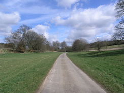
Turn right and then immediately left, to start following a surfaced track that heads southeastwards, climbing uphill. At the top of the hill the track curves sharply to the right to head southwestwards for a couple of hundred yards, and then curves to the left to head down Tidley Hill towards Dummer Grange. On this last part, the track is very indistinct.
Just before the buildings of the grange are reached, turn right along a path that skirts southwards past the grounds. At a field boundary, turn left and head down to meet the driveway leading to the grange Turn right down this, and walk along the driveway for a third of a mile until a road is reached opposite Dummer Grange Farm. Turn left down this road for a couple of hundred yards past Breach Farm Cottages, and then turn right down the driveway that heads southwestwards towards Breach Farm. Pass the farm, and when the track ends continue on along a footpath that enters a patch of woodland. The path curves to the left, to start climbing uphill to the south. In places it is just a path, others a track, as it heads for a couple of miles from the farm, heading southwards before descending downhill past Becket's Down to end at a road at Lone Barn House.
Immediately turn to the left, walking along a footpath through the garden of the house and follow the Church Lane track that heads uphill, passing Church Lane Farm at the top before descending down towards Brown Candover church. Pass the church, and then walk through the churchyard before going through a gate that leads down to a track. Follow this track for a short distance until it ends at a road. Turn right down this road, and follow it as it heads southwestwards through Brown Candover for half a mile. When the road curves to the left, continue straight on along a minor road with a stream on the left.
For a little under half a mile the path skirts the stream, before climbing up the hillside slightly to pass above Totford Farm. From here the path continues to ascend diagonally across the field before reaching a road. Turn left, and head eastwards down it until it reaches the B3046 road opposite a closed pub in Totofrd.
 |
 |
|
 |
 |
|
 |
 |
|
 |
 |
|
 |
 |
|
 |
 |
|
 |
Leg 5 - Totford to New Alresford
No. From To Distance Ascent Descent Profile
Totford
New Alresford
7.5
584
584

| No. | From | To | Distance | Ascent | Descent | Profile | Totford | New Alresford | 7.5 | 584 | 584 |
|---|
This walk starts off at the B3046 in Totford. Cross the road, and head up a track on the other side. This climbs eastwards, before slowly curving to take a more northeasterly course. After three-quarters of a mile a track junction is reached; turn right to continue along the Wayfarer's Walk as it heads southwards, climbing uphill.
At the top of the hill the track turns to the right beside a band of woodland and then almost immediately to the left, to continue heading southwards. As it turns right to head towards Swarraton Farm, continue straight on along another track that climbs up through some trees, emerging from them to end at the B3046 road on Abbotstone Down. Cross the B3046, and follow a track that heads southwestwards through an area of woodland. In a couple of places the track becomes a narrow path, but if you keep the southern edge of the trees close by to your left you should find the gate out with no problems. Once out of the trees, a track continues on southwestwards for about a mile as it slowly descends. When the end of a road is met near Abbotstone Farm, join the road and follow it as it heads southwestwards to end at a T-junction in Abbotstone.
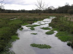
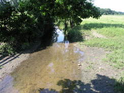
At the junction turn right and cross a bridge over a river. After a couple of hundred yards there is a complex junction; ignore all of the roads and head straight on along a track that heads uphill to the west. After nearly half a mile a complex junction of tracks are reached; here turn hard-left and start following another track southeastwards. This soon crosses a road; after this continue on as it slowly descends downhill to re-cross the river near some watercress beds.
When the track curves to the left on the other side of the river, turn right and follow another track that heads southwards, and as it climbs it slowly curves to an easterly course. When this track ends at a road, turn left along another road, but soon pull off to the right, to follow a footpath that skirts between the road on the left and the River Alre on the right as it heads northeastwards. The path skirts through some trees, before joining the northern bank of the river. At a building the path crosses onto the southern side of the river and continues on eastwards, eventually climbing up slightly and meeting a surfaced track. Here turn left to continue walking along the same bank of the river. When the end of a road is met, turn right and follow this road as it heads uphill slightly. When it ends at a T-junction, turn right for a few yards to reach the B3046 in Alresford.
 |
 |
|
 |
 |
|
 |
 |
|
 |
 |
|
 |
 |
|
 |
 |
|
 |
 |
|
 |
Leg 6 - New Alresford to Kilmeston
No. From To Distance Ascent Descent Profile
6
New Alresford
Kilmeston
6.3
581
525
| No. | From | To | Distance | Ascent | Descent | Profile | 6 | New Alresford | Kilmeston | 6.3 | 581 | 525 |
|---|
Head straight on and follow the B3046 south uphill. When it ends at a T-junction, head straight on down a path that enters the churchyard. Walk past the church on the right, and continue on as the path leaves the churchyard. When it reaches the top of the railway cutting, it turns to the left to follow the cutting for a short distance to a road. Turn right at this road and follow it as it immediately crosses the railway line on a bridge. As it heads southwards the road climbs up a hill, passing a school on the right before dropping downhill. Follow the road as it curves to the right at the bottom of the hill, and then after about a hundred yards take a path that heads uphill to reach a footbridge over the A31 road.
Cross the road, and on the other side carefully follow the Wayfarer's Walk as it crosses the golf course southwestwards. Once across the course it climbs up a slight hill, before entering a band of trees that it follows to the B3046 road. Turn left and follow the B3046 road southwards for a couple of hundred yards; when it curves to the right at Crooked Billet, turn left and follow a green lane called Hinton Lane uphill.
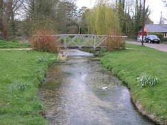
At the top of the hill turn right and descend downhill along Prite Lane. When the B3046 road is reached cross it, and continue along the road opposite as it crossed the River Itchen. At Cheriton Mill turn left, and walk through the grounds of the mill before taking the footpath that skirts the western bank of the river southwards for a little over half a mile until it ends at a road. Turn left down this road, and follow it eastwards to the B3046 in the village of Cheriton.
Cross the B3046, and on the other side continue straight on along a one-way lane. When this ends at another lane, turn right and walk along the road past the stream. As the road curves to the right turn left to cross a bridge over the stream, and then turn right along a short dead-end road. When it ends at a gate, turn left along a footpath that climbs uphill eastwards out of Cheriton. Initially it is narrow and enclosed on either side, but as the gradient slackens it emerges out onto a hillside. Keep the hedge on the right, and walk to the end of the field. Here turn right, keeping a hedge on the right, and then after a hundred yards turn left, to resume an easterly course.
Cross the first track that is reached and walk on until the track ends at a T-junction with another track. Turn left down this track northwards for a few yards, and then turn right along a footpath that heads eastwards with a hedge on the left. When it ends at a T-junction with another track, Broad Lane, turn right and start following this track southwards downhill. At a crossroads with another track continue straight on, and at Primrose Cottages the track becomes surfaced for the short distance to the A272 road.
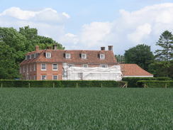
Cross the A272 road and continue uphill along the road opposite into Hinton Ampner. When the road curves sharply to the left, head straight on through some gates into the grounds of Hinton Ampner House. After a few yards the church is on the right; here leave the driveway and turn left along a footpath that soon swings to the right, following a fence around the garden of the house, curving around on a southerly course. At the bottom of the hill the footpath crosses a track at the end of the gardens, and then continues on slightly south of southwestwards across a series of fields; initially diagonally, and then skirting a hedge on the right until it ends at a road near Kilmeston Manor. Cross the road and, with a church on the right, continue southwards along a footpath for a third of a mile until another road is reached in Kilmeston.
 |
 |
|
 |
 |
|
 |
 |
|
 |
 |
|
 |
 |
|
 |
 |
|
Leg 7 - Kilmeston to Droxford
No. From To Distance Ascent Descent Profile
7
Kilmeston
Droxford
7.6
548
686
| No. | From | To | Distance | Ascent | Descent | Profile | 7 | Kilmeston | Droxford | 7.6 | 548 | 686 |
|---|
This walk starts off at a road in Kilmeston. Turn right along this road westwards for a few yards until it ends at a T-junction with another road. Cross this new road, and directly opposite there is a stile that leads to a footpath that heads southwards across a series of small fields. After the third or fourth field, turn right through a gap in the hedge as the Wayfarer's Walk starts heading southwestwards across three fields, starting to climb slowly and then steeply to meet a road. Note; this is a place I went wrong. There is an obvious track on the ground that heads in a more southerly direction, and I followed that instead of the path. The route of the path on the ground appeared to be covered with crops, with no obvious path that I could see.
Cross the road and go through a gate to join a track that immediately swings to the left near Wind Farm. For the next three-quarters of a mile the path follows the South Downs Way as well, as it follows a track that heads eastwards, more or less level, all the way to Lomer Farm. Once out of the initial trees there is a hedge to the left. At Lomer Farm leave the South Downs Way, following a track that heads southwestwards. When the track ends at the end of the next field, turn left to had downhill with a hedge on the left, and then at a fence turn right, to head southwestwards, keeping the fence on the left. Beyond the fence is the bottom of a little valley.
The track is picked up once more as it joins a track that skirts the southern end of Preshaw Wood. Just before the woods end, turn right to take a footpath that heads southwestwards across a field for a short distance before it enters a band of trees and rejoins a track. Follow the track as it curves to the left, and then turn right to join a footpath that skirts some trees along Betty Mundy's Bottom. When a house is reached the path turns to the left to enter the trees, skirting around the grounds of the house before emerging out of the trees into a field.
From here a path leads southwards across fields, with trees on either side. A track starts when the trees end, continuing on southwards to St Clair's Farm. The way continues through the farm and out the other side, to join a road a short distance to the north of a crossroads. At the crossroads continue straight on for a couple of hundred yards, and then turn left to join a bridleway. This approaches the trees of Bottom Copse, and then turns to the right to run with the trees on the left and a hedge on the right. The bridleway curves around to head along the southern edge of the woods for a little over half a mile, and when it ends at a T-junction turn right for a short distance to reach a road beside Steynes Farm.
Turn left along the road, and opposite the entrance to the farm take a footpath that leads off to the right. Initially this heads through trees, before emerging out onto the grounds of the Corhampton Golf Club on Droxford Down. In places this is a narrow path through a band of trees; when a patch of woodland is reached the path turns to the left to head eastwards with the woods on the right. At the end of the trees the path heads southeastwards across a field, curving around with a hedge on the left. After a while the path heads through another narrow tunnel in the middle of the hedge before reaching a road.
Turn right and start following this road southwards. Almost immediately a crossroads of five roads is reached; here head straight on southwards across Peak Down. The road curves to the left; shortly after the bend turn right down a footpath that heads southwards. The path skirts right and then left around a field boundary, and at the next field go past the hedge before turning left, to walk with a hedge on the left. A small band of trees is reached; the footpath descends through these, and when it emerges turn left along a new footpath to head eastwards across fields. A hedge starts on the left after a while, and then after a gate a road starts in Droxford. Continue on down this road past a school on the right. At a crossroads continue straight on for about fifty yards until the A32 road is reached in Droxford.
 |
 |
|
 |
 |
|
 |
 |
|
 |
 |
|
 |
 |
|
 |
 |
|
 |
 |
|
Leg 8 - Droxford to Denmead
No. From To Distance Ascent Descent Profile
8
Droxford
Denmead
6.6
561
581
| No. | From | To | Distance | Ascent | Descent | Profile | 8 | Droxford | Denmead | 6.6 | 561 | 581 |
|---|
This leg starts off by the A32 in Droxford. Cross the A32 and take a lane that heads eastwards on the other side towards Droxford church. Enter the grounds of the church and, keeping the hedge on the left, walk through the churchyard. At the end of the churchyard turn right to keep the hedge on the left, and at the southeastern corner of the churchyard go through the hedge to join a track. This track leads to a footbridge over the River Meon; cross this and another, smaller, footbridge afterwards, and then turn right to join a footpath to start heading southwards along the floodplain.
Initially it heads with a hedge on the right, and on the other side of the hedge is the river. After crossing a couple of fields the path curves to the left away from the river, and then passes through a small band of trees before heading south with the embankment of an old railway line to the left. When the path ends at a road turn left along the road; this climbs up to cross the old railway on a bridge. Soon the road curves sharply to the right, and then to the left near the church to head eastwards for a short distance to reach a road junction in Soberton. To the right is a very nice pub.
At the pub turn right to head southwards down the road, and at the crossroads head straight on up Chalk Hill. After a hundred yards turn left along a driveway, and when this ends at a house squeeze pas the house and join a footpath that heads uphill to the east. Half a mile after the road it turns sharply to the right to head south for a short distance, and then turns to the left to take a track that heads slightly south of eastwards.
When the path enters an area of trees continue straight on, crossing a stile and entering a field, keeping Shere Copse off to the left. Continue eastwards until East Hoe Road is reached. Cross the road, and head southeastwards across a field, with East Hoe Manor visible to the north. The path crosses a stile to enter a small patch of scrubby woodland; soon after this turn left to start heading steeply downhill to the southeast until the B2150 road is reached. Turn right to head south along the B2150 for a short distance, and then turn left.
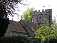
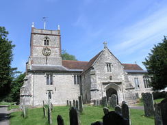
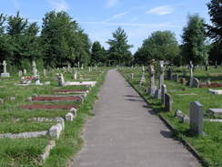
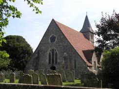
Cross a road and a patch of grass to another road, and then squeeze past a house to join a footpath that heads uphill to the east. At the end of the field squeeze between a hedge and a flint wall, before following the flint wall towards the church. After the wall ends near the church turn right to take a path through the graveyard, passing the church on the left. At the end of the churchyard exit onto a road, and follow this for a short distance until it ends at a road in Hambledon.
Cross the road and follow a road that heads uphill to the south. As this curves to the left, turn right down a footpath and then immediately left, to climb up a steep footpath up the hill. At the top squeeze through a patch of trees, and then continue south across a field towards a road. Cross this road and take a footpath directly opposite; this soon turns to the left and then the right, to follow a hedge southwards. It crosses over into another field, and continues southwards with the hedge on the left. At the end of the second field turn left along a green track that heads eastwards for a short distance before ending at Rushmere Lane.
Turn right to head south along Rushmere Lane for a short distance, and then turn left to join a bridleway that heads eastwards with a hedge on the right. After a few hundred yards turn right, to take a footpath that heads slightly east of south, passing under some power lines before ending at a road. Turn right along this road to heads south for a few yards until a T-junction is reached; turn left and then immediately to the right to start heading south along another footpath.
The footpath heads south with a hedge on the left past a couple of fields, and then joins a track that continues southwards. Eventually it turns to the left for a few yards, then the right to head southwards once more. It then turns right, and then left to head down to reach the B2150 road in Denmead.
 |
 |
|
 |
 |
|
 |
 |
|
 |
 |
|
 |
 |
|
 |
 |
|
 |
 |
|
 |
 |
|
 |
 |
|
 |
 |
|
Leg 9 - Denmead to Bedhampton
No. From To Distance Ascent Descent Profile
9
Denmead
Bedhampton
7.4
427
551
| No. | From | To | Distance | Ascent | Descent | Profile | 9 | Denmead | Bedhampton | 7.4 | 427 | 551 |
|---|
Turn left along the B2150, and then take a road off to the right that heads southwards. When it ends continue on along a footpath that joins another road for a short distance until it ends at a T-junction. Turn left along this road for a fifth of a mile until the first road leads off to the right. Follow this road southwestwards for a couple of hundred yards, and then turn left along a track that passes immediately to the south of Glenfield Farm.
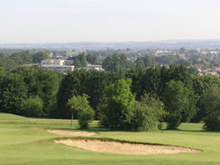
The track becomes a path, with a hedge on the right, and on the other side the car park of a golf course. The path squeezes between a building on the left and the hedge on the right, and shortly after the building turns to the right to enter the golf course. Head south across the golf course, and at the end continue southwards until the path ends at Closewood Road.
Turn right to head west along Closewood Road for a short distance, and then turn left to head south down another road. When this curves to the left, turn right to join a footpath that heads southwestwards across fields to end at Sheepwash Lane. Turn right down the lane and then immediately to the left, to continue southeastwards along a path. When some woodland is reached the path curves to the left to head southwards across a field, eventually joining a track that heads southwards for three-quarters of a mile through the woods.
The path ends at Purbrook Heath Road. Turn left and start following the road eastwards for a little under a mile. In Purbrook Heath turn right down a lane, and when this ends continue on up a track that leads uphill to the south. Half a mile from the road the path turns to the left, and then shortly afterwards to the right to start heading south, with the back gardens of houses on the left. After half a mile the path ends at the B2177 road.
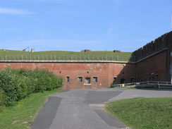
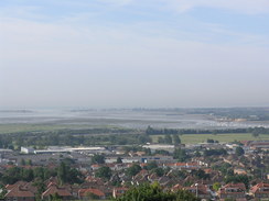
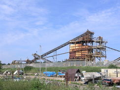
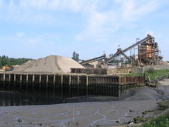
Turn around and start following the B2177 eastwards. Almost immediately it crosses the A3(T) on a bridge, and after a quarter of a mile a footpath leads off to the left, just before a junction on the right with a road from Drayton. Turn left along tis path as it heads northwards before almost immediately turning to the right to head eastwards behind some houses. The path approaches Fort Purbrook, and then turns left to walk right the way around the outside of the fort. Once the access driveway is reached on the eastern side of the fort, turn left and walk down it until it ends at a junction with the B2177.
Turn left to start heading east along the B2177 for 1.4 miles; it crosses the A3(M) on a bridge and then enters Bedhampton.
 |
 |
|
 |
 |
|
 |
 |
|
 |
 |
|
 |
 |
|
 |
 |
|
 |
 |
|
Leg 10 - Bedhampton to Emsworth
No. From To Distance Ascent Descent Profile
10
Bedhampton
Emsworth
5.2
85
118
| No. | From | To | Distance | Ascent | Descent | Profile | 10 | Bedhampton | Emsworth | 5.2 | 85 | 118 |
|---|
This walk starts off at a complex road junction between the B2177, B2149 and B2150 at grid reference SU703066, turn right directly opposite the junction and take a footpath that heads southwards. This soon enters a recreation ground; continue on past a building and then angle right, to walk diagonally across a car park to reach Bidbury Lane. Cross the lane, and on the other side start walking southwards along Mill Lane.
This lane rises up to cross over a railway line on a bridge; on the southern side of the bridge turn right to join a footpath that heads down under the bridge before running northeastwards alongside the railway line. When a track is reached on the right follow it, and when it almost immediately ends at a gate, turn left down a footpath that runs along with a stream on the right. When a bridge across a stream is reached on the right, cross it and then cross two stiles to enter an area of meadowland.
Cross the meadowland southeastwards, keeping a set of power lines immediately to the left, and when this ends at a road in an industrial estate cross the road and continue on along a footpath. This squeezes past a car park before turning to the left to run eastwards along the foot of the embankment of the A27(T), before turning to the left once more. This leads shortly to some steps that leads up to a road. Turn right along this road and follow it southwards as it crosses the A27(T) on a bridge and reaches a roundabout.
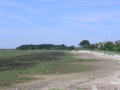
Here turn right for a short distance, and then immediately after crossing over a stream turn left to follow a footpath southwestwards. Soon a bridge over the stream is reached; cross this, and follow the southern bank of the stream onwards. The stream becomes a tidal creek, and the path opens out. Continue walking along the footpath around the seawall. Near Langstone it dives in along a creek; at the top of this turn right to cross a footbridge and walk eastwards along a driveway past an old mill on the left. Shortly after some houses on the right the road curves to the left; here continue straight on along a path that leads out onto the A3023.
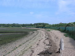
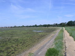
Turn right and follow the B3023 southwards for a short distance until a car park is reached on the left. Enter the car park, and walk past the Inn before following the path around the foreshore. Near a large, black columnar building the path diverts on the inland side, before rejoining the foreshore. Continue on around the foreshore until a metal clapper-gate is reached on the left. Go through this, and walk diagonally across a field to reach Warblington churchyard. Walk through the churchyards towards the church, and then take a path that heads off eastwards immediately to the south of the church.
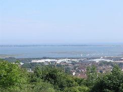
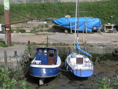
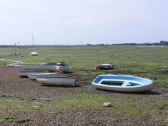
This path, called the Church Path, heads eastwards for a little over a mile, entering and leaving an area of woodland before joining the foreshore near Emsworth. Continue on along the coast to the tidal Mill Pond, and follow the wall into the centre of Emsworth, where the Wayfarer's Walk ends.
 |
 |
|
 |
 |
|
 |
 |
|
 |
 |
|
 |
 |
|
 |
 |
|
 |
 |
|
 |
 |
|
 |
 |
|
 |
 |
|
 |
Circular walks
The following circular and linear walks are based on the Wayfarers Walk:
