Walk #812: A circular walk from North Waltham
 |
 |
|
General Data
| Date Walked | 19/03/2008 |
| County | Hampshire |
| Start Location | North Waltham |
| End Location | North Waltham |
| Start time | 08.14 |
| End time | 16.16 |
| Distance | 22.9 miles |
| Description | This circular walk was based around the Wayfarer's Walk in Hampshire, following it southwards through Hampshire. |
| Pack | Today I carried my 30-litre Karrimor rucksack, filled with waterproofs, a book and other odds and ends. |
| Condition | I suffered a little on this walk, with my feet and legs aching before the end of the walk was reached. |
| Weather | The day started off sunny but slowly clouded over. There was no sight of any rain, and the breeze was not too chilly. |
| OS map | Landranger number 185 (Winchester & Basingstoke, Andover & Romsey) |
 |
 |
|
 |
 |
|
Map of the walk
Maps courtesy of Google Maps. Route for indicative purposes only, and may have been plotted after the walk. Please let me have comments on what you think of this new format. For a detailed table of timings for this walk, please see the table file.
 |
 |
|
Notes
It had been some time since I had last done a walk, and so I was keen to get one under my belt. I did not fancy a long drive, so I decided to go and do the next stage of the Wayfarer's Walk. I therefore drove up the M3 to North Waltham, where I found a good-sized public car park by the village school. A couple of other cars pulled up as I got my kit together and I set off expecting a long but enjoyable walk. A footpath took me northwestwards, and in an area of woodland I went wrong, heading in the wrong direction through the trees. By the time I emerged I had to walk back along a field for a short distance to reach the church at Steventon Park.
Road walking took me on through Steventon to Steventon Arch, a fairly spectacular tunnel under a high railway embankment that ran high overhead. I walked carefully through the narrow tunnel, and once out in the daylight walked north along a fairly nondescript road past Ashe Park to a pub on the main road at Deane. This was where I had left the Wayfarer's Walk on my last trip along that trail, so having reached the pub I turned around and headed back. After a short distance a track led off the right, taking me over a hill before plunging down to a bridge under a railway line. The ground here was fairly boggy as it was the lowest point for some distance around.
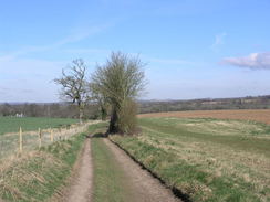
A track climbed up on the other side, and it soon became less boggier. A couple of freight trains passed by, and I got some good views of these as I strode on. The map showed the Way passing through Bull's Bushes Copse, but wayposts on the ground showed it passing along the edge of the woodland. I decided to follow the latter, and it did not extend the walk much. On the northern side of the copse the path runs just inside the trees; on the other side it was alongside the trees in the field.
As I headed southeastwards towards the A30 I listened to a story on Radio Five about two girls who were kidnapped ten years ago - a very sad story, and it was very hard listening. What was most surprising was that they found the social care afterwards to be harder than the actual events that had occurred to them. Eventually I put some music on to get my mind off it. The path followed the A30 for a while around a complex junction, and I had to be careful to stay on the correct route as there were not many signs. After this it went through yet another copse to reach a bridge over the M3.
I stopped on the bridge for a minute and watched the traffic crush by below, just as I had on many occasions last year when we had moved down from Cambridge to Romsey. On the other side of the bridge there was a company, and the well-surfaced track paralleled the motorway, meaning that I had to put my Walkman on full volume to drown out the drone of the traffic. A road took me on down to Dummer, which had some pretty thatched cottages. The pub was not open, which was a shame as I was ready to get a drink.
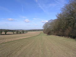
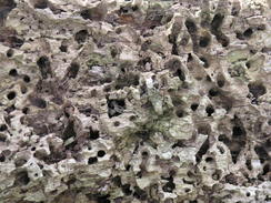
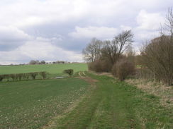
Near Manor Farm in Dummer there was a gateway flanked by two round, carved stones, which were engraved 'Clifton' and 'memorial'. A concrete track took me on from here onto Tidley Hill, and then a path down past Dummer Grange to a road. Near Breach Farm another track headed uphill through a patch of woodland, climbing slowly and easily as it headed southwards. There were some reasonable views in places, and at the top of the hill there was an old farmer's quarry on the right, where the landowners had taken stone out to build the tracks in the area. The views from here were very good, and it would make a good spot for a house. After this a long and fairly boring plod took me downhill, the view slowly decreasing until a road was met.
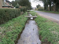
Initially I was unsure which way to go here, but eventually I found the path that headed through a garden before becoming an enclosed path that headed uphill. There were no views to be had due to the hedges, and the next thing of note was the pretty Brown Candover church that was passed. I was tempted to go in for a look around, but instead I plodded on, heading down to the road that headed through the village. Here I had planned to turn back, but I decided that as I was feeling fit I would extend the walk slightly. A road ended, at the Wayfarer's Walk continued on alongside a stream on a pleasant stretch, climbing uphill to meet a road and descending to cross the main road in Totford.
There was a pub marked on the map here that I intended to stop at, but when I reached it, it looked as though it had been shut for some time. It was not a particularly nice spot to stop for a break, so I continue don along the Way as it headed up along a track. At a farm I left the Wayfarer's Walk, as I continued eastwards along more tracks to reach a road. This led me down to Chilton Candover, and then another long climb started. The views were not as good as from the track further to the west that I had walked earlier, and I was starting to feel tired. Near the top of the hill there was the remains of some trees that had been cut down, and I sat down on a piece of wood to rest. There were no views, and I took my boots off for a while to allow them to cool down.
Once I set off again I felt more tired than I had before I had stopped, and it was a good job that the tracks were fairly good for most of the way back to Breach Farm. Helicopters had been flying overhead for most of the day, and as I approached and passed the farm a Chinhook passed low overhead, allowing me to get some good shots of it. A long road walk followed; the road was very quiet and I could make good time, but I felt surprisingly tired. Eventually a series of bridges leading under the M3 motorway and associated slip roads were reached, and immediately beyond these was the A30 road.
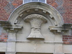
On the opposite side of the road was the Wheatsheaf pub, and by this time I was very tired, and although it looked quite inviting I continued on. The pub had an elegant stone carved into the shape of a sheaf of wheat above the door - a good touch. Popham Lane took me on towards North Waltham, and by the time I reached the village I was very thirsty. I nipped into the local shop where there was a little delay before I was served, and bought a little grub and a bottle of water. Suitably reprovisioned, I headed on through the village towards the church and the car park and the end of the walk.
It was not a classic walk, but despite this it was very enjoyable indeed. There were some good, if not beautiful, views, and a little too much road walking. Some of the latter could be cut out at the cost of either lengthening or shortening the walk slightly.
Directions
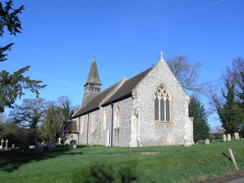
This walk starts off at the car park by the village school in North Waltham, just up the road from the church. Turn right along the road for a few yards, before taking a footpath that leads off to the left. This footpath heads westwards across a field, skirting to the north of paddocks at Manor Farm before emerging out into an open field. Cross a stile into this field and then turn right, to walk with the hedge on the right. At the corner of the field the path curves to the left, to continue on with a hedge on the right. The path meets the trees at West Wood, skirting the edge for a while before plunging through the woods along a track. It continues on northwestwards, passing near to buildings and immediately to the northeast of Steventon Church before reaching the end of a road.
Follow this road downhill northwards for a little under half a mile, and when a T-junction is reached turn left to head towards Steventon. At another T-junction in the village turn right to head northwards along another road. This passes through a long tunnel under the railway line at Steventon Arch, and from here continue northwards for a mile until the B3400 road is reached at Deane.
Here the Wayfarer's Way walk is joined. Head back southwards down the road for a few hundred yards until directly opposite Cheesedown Farm, and then turn left along a track that heads eastwards. The track is easy to follow as it slowly climbs, before heading southeastwards downhill to a bridge under the railway line. Continue on the track as it curves to the left to head eastwards, skirting past a coppice called Itchen Row before reaching a bend in a road. Head straight on along this road for a hundred yards, and when it curves to the left continue straight on along another track past Bull's Bushes Copse.
Here the path on the map heads southeastwards through the middle of the copse, but waymarkers on the ground showed he path continuing along the northern edge of the copse. I followed the waymarkers, which took me eastwards along the edge of the trees for about a third of a mile to the edge of the trees. At the end of the trees it curved to the right, heading south as it climbed uphill with the copse on the right to reach bull's Bushes Farm. The track crosses the farm and then curves to the left, to head southeastwards along the edge of a field. Go through another field to reach the northwestern end of South Wood. Turn right for a hundred yards down a track, keeping the trees on the left, and then turn left to head southeastwards along the southern edge of South wood.
When the trees end a path continues on for a short distance, skirting a house on the left before ending at a bend in a road. Continue straight on down this road for a short distance until the A30 is reached. The next section of route is fairly complex. Carefully cross the A30, and on the other side turn left. After a short distance follow a feeder road that heads off to the left; when this ends at a T-junction, turn left and take a footpath that skirts the left-hand side of a road. After fifty yards, carefully cross the road and join a footpath. This heads southeastwards along the edge of Peak Copse, with a golf course on the left. As the path approaches the M3 it turns to the left and then vlimbs up to a bridge over the motorway.
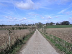
Cross the bridge and then turn right to join a footpath that initially heads through trees before meeting a surfaced driveway at a building. Follow the driveway for a little over half a mile, with the motorway on the right, until it ends at a T-junction immediately below Junction 7. Turn left along this road, and follow it as it heads southwards for half a mile, climbing uphill through the village of Dummer until it meets a crossroads by the church. Turn right and then immediately left, to start following a surfaced track that heads southeastwards, climbing uphill. At the top of the hill the track curves sharply to the right to head southwestwards for a couple of hundred yards, and then curves to the left to head down Tidley Hill towards Dummer Grange. On this last part, the track is very indistinct.
Just before the buildings of the grange are reached, turn right along a path that skirts southwards past the grounds. At a field boundary, turn left and head down to meet the driveway leading to the grange Turn right down this, and walk along the driveway for a third of a mile until a road is reached opposite Dummer Grange Farm. Turn left down this road for a couple of hundred yards past Breach Farm Cottages, and then turn right down the driveway that heads southwestwards towards Breach Farm. Pass the farm, and when the track ends continue on along a footpath that enters a patch of woodland. The path curves to the left, to start climbing uphill to the south. In places it is just a path, others a track, as it heads for a couple of miles from the farm, heading southwards before descending downhill past Becket's Down to end at a road at Lone Barn House.
Immediately turn to the left, walking along a footpath through the garden of the house and follow the Church Lane track that heads uphill, passing Church Lane Farm at the top before descending down towards Brown Candover church. Pass the church, and then walk through the churchyards before going through a gate that leads down to a track. Follow this track for a short distance until it ends at a road. Turn right down this road, and follow it as it heads southwestwards through Brown Candover for half a mile. When the road curves to the left, continue straight on along a minor road with a stream on the left.
For a little under half a mile the path skirts the stream, before climbing up the hillside slightly to pass above Totford Farm. From here the path continues to ascend diagonally across the field before reaching a road. Turn left, and head eastwards down it until it reaches the B3046 road opposite a closed pub. Cross the road, and head up a track on the other side. This climbs eastwards, before slowly curving to take a more northeasterly course. After three-quarters of a mile a track junction is reached; here the Wayfarer's Walk is left behind. Continue straight on with barns on the left until the track ends at a T-junction by the farm. Turn right and follow a new track as it curves to the left following the Ox Drove Track eastwards for about three-quarters of a mile until it ends at a T-junction with a road called Spiers Lane.
Turn left and follow Spiers Lane as it heads northwards, descending for three-quarters of a mile until it ends at a T-junction with the B3046 in Chilton Candover. Turn right along the B3046 for a short distance, and then turn left to take another track that starts climbing up. The track continues for two and a half miles in a rough northerly direction, passing Chilton Manor and barns at Rucksters before dropping down to breach Farm. Head through the farm until the track is reached that was walked along earlier. Turn right along this track, and follow it for a third of a mile until it ends at a T-junction with a road at Breach Farm Cottages.
Turn left, and start following this road northwestwards for a mile and a half, passing Dummer Down Farm and passing under the M3 before it ends at the A30 opposite a pub. Cross the A30, turn left past the pub and then immediately turn right up Popham Lane. Follow the lane northwestwards for a third of a mile to a road junction at the top of a hill, and then follow it downhill into North Waltham. At the next road junction by the village pond turn left, to follow a road northwestwards through the village. When the village church is reached turn right to go up to the school and the car park where the walk started.
Distances
| From | To | Distance (m) | Ascent (ft) | Descent (ft) |
|---|---|---|---|---|
| North Waltham | Deane | 3.2 | 164 | 259 |
| Deane | Dummer | 5.4 | 459 | 249 |
| Dummer | Brown Candover | 5.1 | 236 | 471 |
| Brown Candover | North Waltham | 9.2 | 702 | 582 |
This makes a total distance of 22.9 miles, with 1561 feet of ascent and 1561 feet of descent.
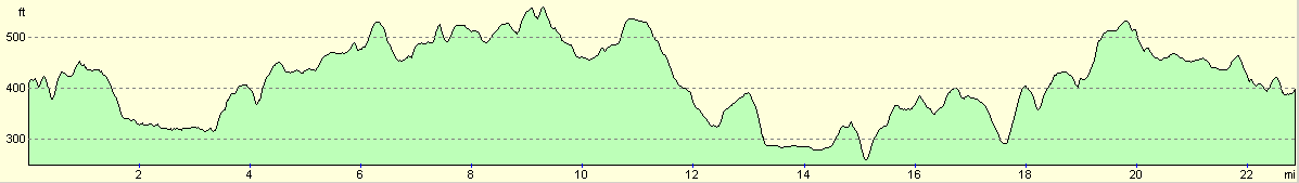
For more information on profiles, ascents and descents, see this page
Disclaimer
Please note that I take no responsibility for anything that may happen when following these directions. If you intend to follow this route, then please use the relevant maps and check the route out before you go out. As always when walking, use common sense and you should be fine.
If you find any information on any of these routes that is inaccurate, or you wish to add anything, then please email me.
All images on this site are © of the author. Any reproduction, retransmissions, or republication of all or part of any document found on this site is expressly prohibited, unless the author has explicitly granted its prior written consent to so reproduce, retransmit, or republish the material. All other rights reserved.
Although this site includes links providing convenient direct access to other Internet sites, I do not endorse, approve, certify or make warranties or representations as to the accuracy of the information on these sites.
And finally, enjoy your walking!
Nearby walks
| # | Title | Walk length (miles) |
|---|---|---|
| 709 | South Downs Way: Winchester to Wether Down | 20.4 |
| 798 | A circular walk from Litchfield | 24.1 |
| 813 | A circular walk from Alresford | 24.0 |
|
|

|