Walk #817: A circular walk from Ports Down to Soberton
 |
 |
|
General Data
| Date Walked | 05/06/2008 |
| County | Hampshire |
| Start Location | Ports Down car park |
| End Location | Ports Down car park |
| Start time | 08.24 |
| End time | 16.42 |
| Distance | 19.6 miles |
| Description | This was a pleasant circular walk following road northwards before returning along the Wayfarer's Walk. |
| Pack | Today I carried my 30-litre Karrimor rucksack, filled with waterproofs, a book and other odds and ends. |
| Condition | I feel very tired after this walk, and my feet ache a great deal. |
| Weather | The day was warm and, for the most part, sunny. There were occasional clouds, but these did not seem to effect the temperature much. |
| OS map | Landranger number 196 (The Solent & The Isle of Wight, Southampton & Portsmouth) |
 |
 |
|
 |
 |
|
Map of the walk
Maps courtesy of Google Maps. Route for indicative purposes only, and may have been plotted after the walk. Please let me have comments on what you think of this new format. For a detailed table of timings for this walk, please see the table file.
 |
 |
|
 |
 |
|
Notes
It had been some weeks since my last walk, so I decided to do the next stage of the Wayfarer's Walk. As with the rest of this walk, this was going to be a circular walk. The drive to the start was long because of traffic on the roads and roadworks on the M3, and as I drove along the road that runs on the top of Ports Down I was both exhilarated by the view and dismayed by the heavy traffic. I had hoped to walk along this road at one time, but it looked like it was going to be busy to do safely. I found the car park where I had planned to stop and pulled up, before getting out to admire the view.
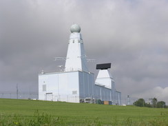
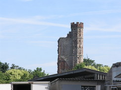
Immediately to the west was the large grey buildings near Fort Southwick, the Maritime Integration & Support Centre for the Type-45 Destroyers that are being constructed. The buildings look somewhat like the superstructure of a destroyer because they are being used to test the radar and other systems that are going to be used. It is a somewhat ugly yet fascinating sight,
I set off, following the main road downhill towards the MISC, which is based on the QinetiQ site at Fort Southwick. There was a pavement up to the base, but after this I was forced to walk along the road, but fortunately the road was wide and it was safe. At a lay-by there was man sitting in a car looking at some porn, and a little further on a car.
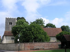
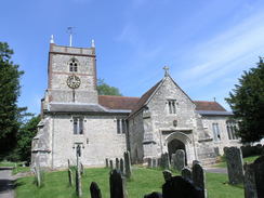
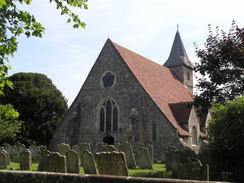
A road led me into Southwick, which was a pretty village. Outside the local post office there were plants for sale, and the church was pretty as well. Immediately to the east is Southwick House, now part of HMS Dryad. It was there in 1944 that the headquarters for SHAEF (Supreme Headquarters Allied Expeditionary Force) was set up.
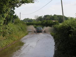
More roads took me on northwards, and on Common Lane to the north of the village I came across a road that was very flooded after the recent rain. A car passed through it showering big sheets of water up on either side, but it also showed me that it was not too deep. I strolled through the water in the centre of the quiet road, where the water was shallowest.
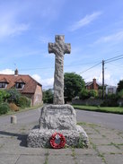
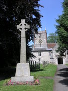
A series of fairly unmemorable roads took me northwards, heading through Newtown and on towards Soberton. In Newtown there was a trig pillar marked on the map, but I decided not to go and see this. The war memorial in Soberton was an attractive stone cross, and I continued on until I reached the White Lion pub near the church, which is where I had left the Wayfarer's Walk on my previous trip. As it was a little after eleven and the door was open I went into the pub, only to find that it was not due to open until midday. There was no way that I was going to hang around for an hour, so I headed off back down the road. After 8 miles I was on the main objective for the day, the Wayfarer's Walk.
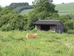
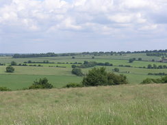
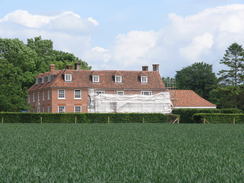
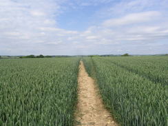
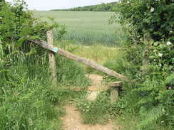
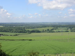
A few roads took me on, before a footpath led me up a steep hill, with some good views over the Meon Valley to the west. The next stretch was across fields and proved to be fairly easy until it approached some woodland. Here I went momentarily wrong, following the King's Way southwards, but I had only gone a few yards before I turned back and took the proper path that headed eastwards. There was a strange smell in the air, and the source soon showed itself to be a piggery. After East Hoe road I got some good views north towards East Hoe Manor, which was surrounded by some scaffolding.
A steep path took me down through trees towards the B2150 in Hambledon, and another path took me on towards the church. There was a pub marked on the map in Hambledon but I could see no trace of it on the ground; I went into the post office, and a kind lady told me that there was one a few hundred yards down the road. I was in need of a rest, so I walked westwards until I reached the Vine pub. Thankfully it was open, and I stopped for a while and took my boots off as the barman chatted amiably to some of the regulars. The pub is soon going to be in new hands, and it will be interesting to see if it remains as popular.
After heading back towards the post office a road and then a very steep path took me uphill, and again from this path there were good views to be had to the north. A series of paths took me southwards, and by this time my feet were starting to ache once again. It felt reasonably warm and there was little of note as the path led me into Denmead. This was the largest town that the path had crossed for some miles, and my route through it southwards was along a particularly undistinguished road. At the southern side of the town the path crossed a busy golf course, and shortly after this I lay down in some long grass for a rest as I listened to an EscapePod podcast.
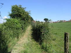
The rest seemed to help, and I set off again feeling better. Roads took me on to Closewood House, and a path led through another piggery and alongside a stream to another road. More paths took me on towards some woodland, and this in turn onto Purbrook Heath Road, which runs along the course of an old Roman road from Chichester to Winchester. In Purbrook Heath a track took me southwards, and then paths led on uphill, eventually skirting the back gardens of some houses, and in places the path was nearly blocked by builder's waste.
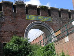
The path ended at the B2177 road, where I left the Wayfarer's Walk behind. The road was as busy as I feared but I managed to walk along it safely. Initially on the southern side of the road there was a long, linear car park that had some good views south over Portsmouth, and later on there was a wide grassy area in front of the impressive brick ramparts of Fort Widley, another one of the Palmerston Forts. After this ended there was another car park and a road coming in from the right, but then I was forced back onto the verge for the last section to the roundabout and my car.
By any rights this walk should not have been that enjoyable; the first half was all along roads, and the second was hardly the best stretch of the Wayfarer's Walk. Despite this, however, I really enjoyed it. Perhaps this was because it was the first walk that I had done in a month, or perhaps because the scenery, although not spectacular, had rarely been bad either.
 |
 |
|
 |
 |
|
Directions
This walk starts off at the car park off the B2177 road between Fort Southwick and Fort Widley, at SU647065. Leave the car park and follow the B2177 northwestwards for 1,.7 miles, as it heads downhill to reach a roundabout. At the roundabout turn right, to follow a road northwards into the village of Southwick. At a road junction by the church heads straight on, and then turn left to head westwards along a lane for a fifth of a mile.
When this road ends at a T-junction, turn right to cross Newman's Bridge, and then immediately turn to the right to follow Common Lane. This climbs uphill and takes a rough northerly course for a little over a mile, before ending at a T-junction with another road. Turn right at this junction to head northwards past Hipley Copse for a little under a half-mile.
When the road curves sharply to the right, head straight on down another road that heads arrow-straight for over a mile and a half through Newtown. After Dradfield Lane comes in from the right the road starts to curve to the right; turn right along another road that climbs uphill and curves to the left, before taking May Bush Lane that heads off to the right.
Follow this road as it heads northwards through Soberton Heath. At the second road to the right (SU612149) turn left and follow a road northwestwards for a third of a mile and then turn right to head northwards through Soberton. After a little over half a mile turn right to head northeastwards up West Street, and at a crossroads turn left to climb uphill to the north to reach a pub near the church.
Here the Wayfarer's Walk is joined. Head back southwards down the road, and at the crossroads head straight on up Chalk Hill. After a hundred yards turn left along a driveway, and when this ends at a house squeeze pas the house and join a footpath that heads uphill to the east. Half a mile after the road it turns sharply to the right to head south for a short distance, and then turns to the left to take a track that heads slightly south of eastwards.
When the path enters an area of trees continue straight on, crossing a stile and entering a field, keeping Shere Copse off to the left. Continue eastwards until East Hoe Road is reached. Cross the road, and head southeastwards across a field, with East Hoe Manor visible to the north. The path crosses a stile to enter a small patch of scrubby woodland; soon after this turn left to start heading steeply downhill to the southeast until the B2150 road is reached. Turn right to head south along the B2150 for a short distance, and then turn left.
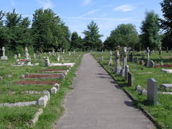
Cross a road and a patch of grass to another road, and then squeeze past a house to join a footpath that heads uphill to the east. At the end of the field squeeze between a hedge and a flint wall, before following the flint wall towards the church. After the wall ends near the church turn right to take a path through the graveyard, passing the church on the left. At the end of the churchyard exit onto a road, and follow this for a short distance until it ends at a road in Hambledon.
Cross the road and follow a road that heads uphill to the south. As this curves to the left, turn right down a footpath and then immediately left, to climb up a steep footpath up the hill. At the top squeeze through a patch of trees, and then continue south across a field towards a road. Cross this road and take a footpath directly opposite; this soon turns to the left and then the right, to follow a hedge southwards. It crosses over into another field, and continues southwards with the hedge on the left. At the end of the second field turn left along a green track that heads eastwards for a short distance before ending at Rushmere Lane.
Turn right to head south along Rushmere Lane for a short distance, and then turn left to join a bridleway that heads eastwards with a hedge on the right. After a few hundred yards turn right, to take a footpath that heads slightly east of south, passing under some power lines before ending at a road. Turn right along this road to heads south for a few yards until a T-junction is reached; turn left and then immediately to the right to start heading south along another footpath.
The footpath heads south with a hedge on the left past a couple of fields, and then joins a track that continues southwards. Eventually it turns to the left for a few yards, then the right to head southwards once more. It then turns right, and then left to head down to reach the B2150 road in Denmead.
Turn left along the B2150, and then take a road off to the right that heads southwards. When it ends continue on along a footpath that joins another road for a short distance until it ends at a T-junction. Turn left along this road for a fifth of a mile until the first road leads off to the right. Follow this road southwestwards for a couple of hundred yards, and then turn left along a track that passes immediately to the south of Glenfield Farm.
The track becomes a path, with a hedge on the right, and on the other side the car park of a golf course. The path squeezes between a building on the left and the hedge on the right, and shortly after the building turns to the right to enter the golf course. Head south across the golf course, and at the end continue southwards until the path ends at Closewood Road.
Turn right to head west along Closewood Road for a short distance, and then turn left to head south down another road. When this curves to the left, turn right to join a footpath that heads southwestwards across fields to end at Sheepwash Lane. Turn right down the lane and then immediately to the left, to continue southeastwards along a path. When some woodland is reached the path curves to the left to head southwards across a field, eventually joining a track that heads southwards for three-quarters of a mile through the woods.
The path ends at Purbrook Heath Road. Turn left and start following the road eastwards for a little under a mile. In Purbrook Heath turn right down a lane, and when this ends continue on up a track that leads uphill to the south. Half a mile from the road the path turns to the left, and then shortly afterwards to the right to start heading south, with the back gardens of houses on the left. After half a mile the path ends at the B2177 road.
Turn right along this road and follow it westwards for a little over a mile as it passes to the south of Fort Widley. There is no pavement and the road is fairly busy, but there are grassy areas that can be walked alongside the road for large portions of the walk. The walk ends at the car park where is started.
Distances
| From | To | Distance (m) | Ascent (ft) | Descent (ft) |
|---|---|---|---|---|
| Ports Down | Southwick | 2.0 | 49 | 285 |
| Southwick | Soberton | 5.9 | 423 | 325 |
| Soberton | Hambledon | 3.2 | 308 | 328 |
| Hambledon | B2177 | 7.3 | 525 | 413 |
| B2177 | Ports Down | 1.2 | 95 | 49 |
This makes a total distance of 19.6 miles, with 1400 feet of ascent and 1400 feet of descent.
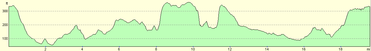
For more information on profiles, ascents and descents, see this page
 |
 |
|
 |
 |
|
 |
Disclaimer
Please note that I take no responsibility for anything that may happen when following these directions. If you intend to follow this route, then please use the relevant maps and check the route out before you go out. As always when walking, use common sense and you should be fine.
If you find any information on any of these routes that is inaccurate, or you wish to add anything, then please email me.
All images on this site are © of the author. Any reproduction, retransmissions, or republication of all or part of any document found on this site is expressly prohibited, unless the author has explicitly granted its prior written consent to so reproduce, retransmit, or republish the material. All other rights reserved.
Although this site includes links providing convenient direct access to other Internet sites, I do not endorse, approve, certify or make warranties or representations as to the accuracy of the information on these sites.
And finally, enjoy your walking!
Nearby walks
| # | Title | Walk length (miles) |
|---|---|---|
| 303 | Chidham to Langstone | 16.0 |
| 304 | Langstone to Tipner | 16.8 |
| 305 | Tipner to Browndown | 18.9 |
|
|

|