Walk #1042: A circular walk between Huntingdon to Sawtry
 |
 |
|
General Data
| Date Walked | 05/04/2019 |
| County | Cambridgeshire |
| Start Location | Huntingdon Washingley Road |
| End Location | Huntingdon Washingley Road |
| Start time | 08.28 |
| End time | 16.03 |
| Distance | 22.2 miles |
| Description | This was a surprisingly pleasant walk, following roads, footpaths and bridleways north from Huntingdon towards Sawtry, and then south back to Huntingdon. There are some good views to be had from hills, and also some very low-lying land to be traversed. |
| Pack | Today I carried my 30-litre Karrimor rucksack, filled with water, my waterproofs, a book and other odds and ends. |
| Condition | The toes on my right foot started aching a little before the end of the walk, but otherwise I feel fine. |
| Weather | The day started off mostly sunny, with only patchy cloud. There was, however, a strong, chilly breeze. Later on, the clouds gathered and there was only sporadic sunshine, although the clouds parted again towards the end of the walk. |
| OS map | Landranger number 153 (Bedford & Huntingdon, St Neots & Biggleswade) and Landranger number 142 (Peterborough, Market Deeping & Chatteris) |
 |
 |
|
Map of the walk
Maps courtesy of Google Maps. Route for indicative purposes only, and may have been plotted after the walk. Please let me have comments on what you think of this new format. For a detailed table of timings for this walk, please see the table file.
 |
 |
|
Notes
This was a slightly unusual walk: my car suffered a fault the previous week, which meant that it would have to spend a day in the garage for repair and a service. My nearest garage is just outside Huntingdon, and as the weather looked good I decided against going to the cinema to see a couple of films and instead do a walk. The well-dressed and impeccably-groomed man who greeted me seemed rather amused as I got my rucksack on and bade him goodbye – I must have appeared very different to their usual customers! My car would be ready by four in the afternoon, which would give me time to get a good walk in.
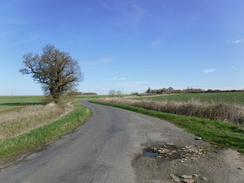
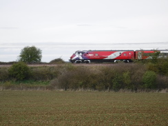
Huntingdonshire is not exactly celebrated walking country, and I have already done a fair few walks in the area. However last year I did a circular walk between Sawtry, just off the A1(M) and Oundle, and there was a gap between Sawtry and Huntingdon that would allow a circular walk. The start of the day was not very auspicious, as a main road led to a path across the East Coast railway line. This sat at the bottom of a deep cutting with three rail tracks, with an access track for road vehicles alongside. I was slightly surprised to see this as there are plans to add a fourth track onto this stretch (where there were four until electrification in the 1980s), but the only sign of work seemed to be a line of pegs on the embankment side – presumably where it will be reprofiled.
The path took me to a large roundabout beside a supermarket. This was busy with rush-hour traffic, but I eventually got across and started strolling north along a road. Thankfully this was not as busy as I feared, and the verges were wide enough to allow me to step off whenever cars approached.
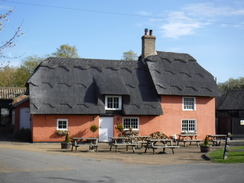
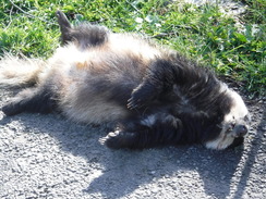
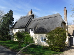
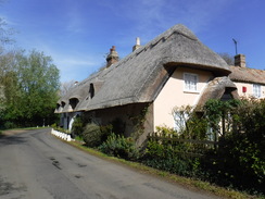
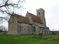
The road eventually ended in the village of Abbots Ripton, which I don't think I've ever having visited before. It is a rather pretty village, with many thatched roofs and exterior walls plastered in pleasant pastel shades. The church was well worth a little diversion, but aside from that there was not much to see. I stopped on a bench to retie my boot laces, and then continued along a road out of the village. This road was much quieter, although not quiet enough for a badger that lay dead on the tarmac, and it eventually ended at the little hamlet of Wennington.
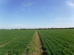
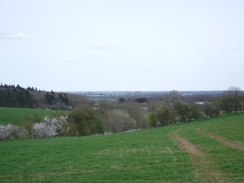
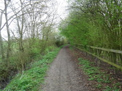
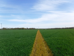
This pleasant – if tiny – place appeared rather timeless. A path took me north across a large field to a junction with a bridleway that offered a surprisingly magnificent view over the Fens to the north and west. Sometimes you do not need great height to get great views, and this was one such example. Three or four windfarms lay scattered on the horizon, and I felt euphoric – there was none of the grandeur of the Lake District, but here, just a few miles from the lowest point in the country, I felt good.
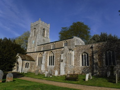
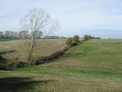
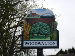
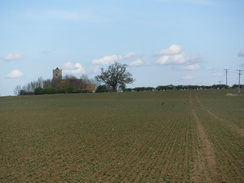
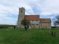
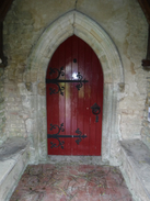
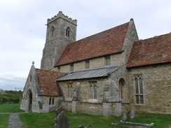
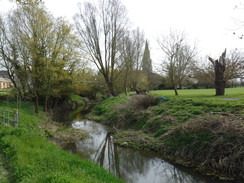
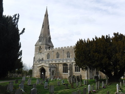
The bridleway provided a pleasant stroll, and it ended at a road that took me down to the village of Woodwalton. This is dominated by the railway line, which cuts past it on a high embankment. A road paralleled the bank's base, after which a footpath led up across fields to St Andrew's Church. This isolated church must once have commanded a supreme view over the surrounding Fens, but those views are now blocked by the railway line. The church was declared redundant in the 1970s, but from the outside appears to be in a better condition than many churches that remain in use, with red tiled roofs and neatly-trimmed grass in the graveyard. Twigs and branches in the porch – the main door being securely locked – were the only signs of dereliction. The church is kept locked because of structural problems due to the common Fenland curse of settlement. I hope that funds are raised to fix the building, as it is a superb little church in a spirit-lifting setting.
But why was the church built on this remote spot, a mile or so north of the village? It might be that there was a village around the church in Medieval times; however the main reason might lie a short distance north. The earthworks of Woodwalton Castle lie within a farmyard, a short distance from where I walked. The historical record provides little information about the castle, and it is unclear when it was built, and by whom. In fact, it is possible that it was thrown up during the Anarchy and was never completed, although the presence of fish ponds indicate that the site remained in use outside a time of war. The church might therefore have been placed midway between Woodwalton Castle and the village so that it could serve both.
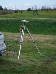
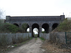
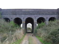
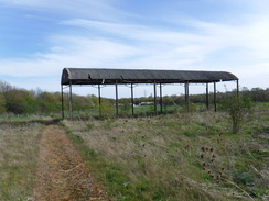
A track led past the farm and motte to reach a surprisingly large drainage channel, beside which stood a high-tech theodolite. A man was trudging around a field with a surveyor's pole, presumably surveying it. In the old days such work would have required at least two people, and probably many more; now it is the work of just one man. The track continued past a compound for rail works, and to something marked on the map as 'Five Arch Bridge'; as the name suggests, this was five arches cut through the railway embankment. This is so high that the arches appear tall and stretched out of proportion, giving them a surprisingly Gothic feel despite being rounded.
I'd planned a route that followed a drainage channel northwest, and then a drove west. However I missed a trick, as I could have chosen a path that passed the site of Sawtry Abbey. This Cistercian Abbey was founded in 1147 by the Earl of Northampton, and survived through to the Dissolution in 1536 despite being poorly-funded. The stone was robbed after Dissolution, although the lumps and bumps of the site are clearly visible on Google Maps. The abbey might have been another reason for the siting of Woodwalton Church, although the high railway embankment now separate them.
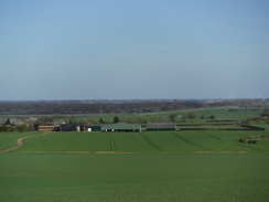
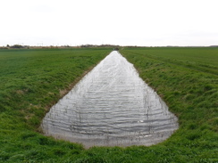
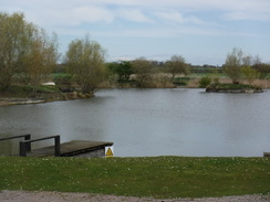
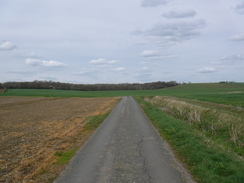
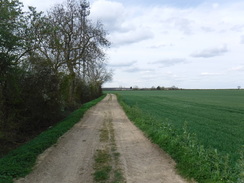
The walk into Sawtry was fairly boring; the drove passed a fishing lake with strict warnings about not letting otters through the gates. I joined the old Great North Road, which runs parallel to the A1(M), and then crossed it to enter the village. Here I connected up with a walk I did last year, and then started off south out of the village. The road skirted a large hillside and became unfenced as it crossed a field. Despite the motorway's noise this was quite enjoyable, the worst problem being a fierce headwind that forced me to keep my fleece on despite the sunshine.
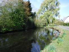
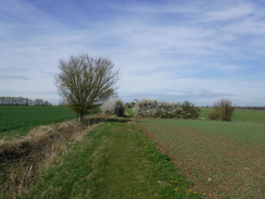
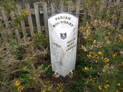
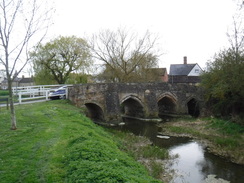
A road climbed up past a farm, and then another bridleway headed south, eventually joining a local road that paralleled the motorway – an easy but rather noisy stroll with one highlight – a roadside boundary marker between two parishes, which I am guessing was moved when the motorway was constructed. Another road descended down into Alconbury Weston, after which a pleasant and well-walked path headed alongside the Alconbury Brook to the main village of Alconbury. I stopped in a shop to buy some food, then called the garage to see how things were going, as I had not heard from them despite it being an hour before I was due to pick my car up. They said my car was just going on the ramp, so I continued through the village, and past a perfect-looking 15th-Century bridge over the brook.
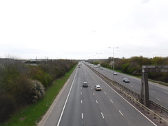
A good track led west out of Alcombury, immediately passing under a massive viaduct that carried the A1(M) overhead. The track soon ended, but a bridleway headed on alongside hedges, eventually joining the southern side of the A1-A14 link road until it reached some steps that led up onto a road bridge. I used this to cross the dual carriageway, and on the other side followed a very straight path southeastwards across fields. The village of Great Stukeley stood at the top of a little slope; the old Roman Ermine Street passes through it, the Romans evidently choosing to stick to higher, drier ground than the drained marshes I was traversing.
It was a pleasant walk, and all too soon I reached Ermine Street and the business park that my garage – and my car – was on. A road I was hoping to take to the garage was blocked, but I found another route that deposited me right beside the garage. Sadly my car was not ready; and worse, they said it could not be driven. But that's another story.
This was a surprisingly pleasant stroll, although it might be good to find a route that avoids some of the more egregious stretches of road walking.
 |
 |
|
Directions
This walk starts off from Washingley Road, which is on the Ermine Business Park on the northwestern outskirts of Huntingdon at TL23137387. This is an unusual place to start a walk, unless your car is in to a garage for a service all day!
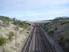
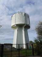
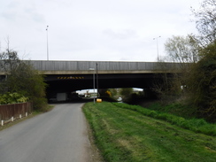
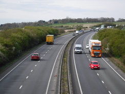
Walk east down Washingley Road until it soon ends at a roundabout with the A141. Carefully cross the A141 at the roundabout to reach the pavement on the other side, and then turn left to start following the road northwards. It starts to curve to the right; when the pavement ends on the bend, turn right past some bollards to join a surfaced path that heads east, crossing a tall bridge over the East Coast railway line. It then passes a retail park on the left and a water tower on the right to reach another roundabout with Huntingdon Road at TL23897410.
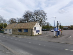
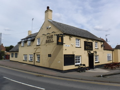
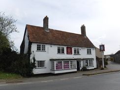
Carefully cross Huntingdon road at the roundabout to reach the pavement on the other side, and then turn left to follow it north, passing a McDonalds on the right to reach another roundabout that leads to a Tescos. Cross the road coming in from the right, and then walk along the verge for a short distance to reach a large roundabout on the A141. Carefully cross the main road (like the previous roundabouts, there is no crossing point), and then start following the road that leads off directly opposite. This winds around in a rough northerly direction; there is no pavement but the verges are generally wide, and 4.0km after the roundabout the road reaches the Abbot's Elm pub in Abbots Ripton at TL23227794.
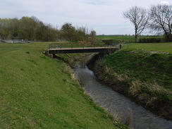
Pass the Abbot's Elm pub on the right, and then continue along the road as it climbs slightly. Shortly after passing the village church on the left, turn right down another road that passes the village primary school on the right. The road heads in a rough northeasterly direction, descending to cross a stream before climbing slightly, and after 1.5km ends at a T-junction in the hamlet of Wennington. At the T-junction turn right along another road that heads eastwards until the houses and gardens on the left end after 250 metres at TL23877932.
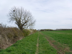
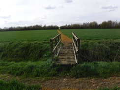
Turn left off the road to join a footpath that runs between hedges, with a field away to the right and a garden to the left. When the hedges end, the path emerges into the field and curves slightly to the right across it. 800 metres after the road, the path reaches a hedge at the northern edge of the field. Cross a farm bridge over a small ditch and go through a gap in the hedge to reach the end of a green lane that runs between hedges. Turn left for a few metres to reach another gap in a hedge that leads into a field at TL24138009.
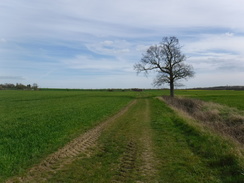
Turn left to start following the hedge on the left, with the field away to the right. The hedge twists and turns, initially northwestwards before settling on a westerly course. After 500 metres the hedge turns sharply right to head north downhill; as it does so, curve left through a gateway and start following a hedge on the left. Follow the hedge on the left as it descends into a little dip to cross a stream, before climbing out to reach a hedge corner. Go through a gap in the hedge corner into another field, and continue following a hedge on the left westwards. At the next field corner, go through a gap in an intermittent hedge ahead to enter a second field, and then at the end of that field, go through a gap in another intermittent hedge into a third field, always following the hedge on the left. This eventually leads out onto Raveley Road at TL22328069.
Turn left along Raveley Road; it soon curves right and starts descending westwards. After nearly 1km it reaches the Elephant and Castle pub in the village of Woodwalton. Immediately after the pub, turn right up Church End. This soon curves right to parallel the base of a railway embankment to the left; after 650 metres at TL21108142 the road curves sharply to the right away from the railway line, climbing a hill.
About 80 metres after the bend, turn left through a gap in a hedge to enter a field. Head directly downhill across the field, passing under some power lines, to reach a footbridge at the bottom that leads into a second field. Head straight on up this field, roughly paralleling the railway line away to the left, slowly ascending up a slope towards St Andrew's Church at the top of the hill. Just before the church is reached, cross a plank footbridge over a ditch and then go through a gap in the hedge to join a track, and follow this for a short distance to reach the church at TL20898214.
Follow the rough track as it passes the church and then the churchyard hedge on the left. When the hedge soon curves left, angle right diagonally down across a field, passing under some power lines, aiming just to the right of a bend in a road and some houses ahead. At the bottom of the field, jump across a ditch (there is no footbridge over the ditch where the footpath sign points) to join the road. Turn left along the road; it soon curves to the left to pass the houses on the right. The road becomes a track as it curves right towards a large drainage channel on the right, where it curves left to reach the 'Five Arch Bridge' under the railway line at TL20278303.
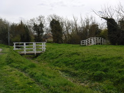
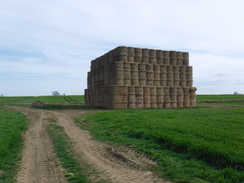
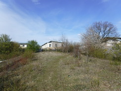
Pass under the bridge, and on the other side join a drove called 'Red Drove'. This heads northwestwards, to cross a bridge over another drain. On the other side, turn right to follow the drove north, keeping the stream to the right. The track soon curves sharply left; as it does so, continue straight on northwestwards alongside a drain on the right with a field away to the left. After 750 metres a line of trees is reached; go through this and turn left to join Straight Drove, which initially follows the line of trees on the left. When the trees end, continue along a fenceless green track with a ditch on the left and a field to the right. After 1km this passes a fishing lake on the right, and the track becomes firmer. Go past a vehicle barrier and cross a bridge over a ditch, after which the track becomes a public road; follow this for a short distance west between large industrial buildings until it reaches the Old North Road at TL17588334.
Turn right to follow the road north, with the noisy A1(M) behind a hedge on the far side of the road. The pavement soon swaps over to the left-hand side of the road, and after 350 metres the road climbs up to reach a roundabout. Turn left to cross the A1(M) on a bridge, and continue along St Andrew's Way, which curves left as it descends to reach a small roundabout on the outskirts of Sawtry. Turn right at the roundabout to join Fen Lane, which heads west-northwestwards through Sawtry. After 500 metres it curves sharply left, passing the village green on the right, to end at a triangular junction with the High Street near some shops at TL16708370.
Take the left-hand branch, and then turn left up Green End Road, passing shops away to the right. Follow the road south; after 850 metres turn left along St Judith's Lane. This approaches a little car park and then turns left to head south; it soon passes a farm on the left and becomes a single-track unfenced road. After 1.6km this ends at a T-junction with another road; turn right along this road which climbs steadily uphill as it heads in a rough southerly direction. At the top of the hill it passes a farm on the right, and 1.2km after joining the road, it curves to the right at TL16798022.
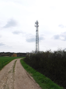
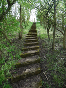
On the bend, turn left through a double gateway to join a good track that curves right, passing by a transmitter tower. Soon after the transmitter the track curves left; continue following a hedge on the right to the corner of the field. At the field corner, go through a broad gap in a hedge and turn left for about ten metres, and then curve right to head south along a rough, unfenced track between fields. This soon joins a more distinct track that slowly curves left. It passes the end of a hedge on the left, after which it reaches the southwestern corner of Upton Wood at TL17687937.
The track curves right; follow it for a few metres, and then turn left to follow the southern edge of the woodland on the left. When the woodland ends, continue on alongside a hedge on the left. This goes through a gap in a hedge ahead into another field; continue following the hedge on the left. At the next field corner, join a path that runs between hedges before emerging out through a bridleway gate onto Nora Wood Way at TL18187889, 2km after leaving the previous road.
The road soon curves to the right to start heading south, with the A1(M) over a hedge to the left. After 1.3km the road rises up to end at a T-junction with another road; turn right to follow this road as it curves left to descend southwestwards down Vinegar Hill into Alconbury Weston. After 1.2km a junction with Hamerton Road on the right, and Church Way on the left is reached at TL17947687.
Turn left down Church Way; when the road soon ends, take a surfaced path that leads on, initially between fences, with the Alconbury Brook away to the right. After nearly 900 metres the path becomes a road, which leads towards Alconbury church. Follow the road as it curves left past the church, and passes an old barn on the right before ending at a T-junction. Turn right along Chapel Street, which soon curves left to become the High Street. This soon ends at another T-junction near a lovely Medieval bridge at TL18617579.
Turn left along the road, which immediately curves right to parallel the Alconbury Brook. The road continues on to pass under a massive viaduct that carries the A1(M) overhead; when it ends soon afterwards, go through a farm gate to join a track that roughly parallels the brook. Continue eastwards along the track, ignoring any others that lead off it, until after 500 metres it approaches a gate through a hedge ahead. Just before the gate, angle right (with a farm bridge over the brook away to the right) to reach a bridleway gate at TL19477544.
Go through this to join a path that runs between hedges. The hedge on the right soon ends and is replaced with a field; continue following the hedge on the left. The hedge on the right soon restarts; walk between the hedges until the path emerges out into a second field. Continue following a hedge on the left past this field, and at the far corner go through a gap into a third field. The path soon angles right to follow a hedge on the left, with the A14 immediately over the hedge. When a small copse of trees are reached ahead, go through a small gap in the trees to reach some steps that leads onto a road bridge at TL20537461.
Turn left to cross the bridge over the A14, and follow the road as it descends down the other side. Once it is at ground level, turn right along a track that immediately passes a small utility building on the left. Follow the track as it heads southeastwards unfenced between fields; at the far side of the field, cross a ditch and continue straight on along a path across a second field; 1.3km after the road, a track is reached at TL21737401.
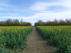
Turn left along the track for a few metres, and then right to head across another field towards some cottages ahead (the exact route may depend on the path the farmer has carved through the crops). At the far side of the field, the path crosses a plank bridge over a ditch and continues across a narrow field to reach a surfaced track at TL22197374, with the cottages to the right.
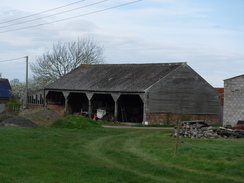
Cross the track, and on the other side go through a gap in a hedge to enter another field. Angle slightly left across this, aiming for a footbridge over a ditch. Cross the bridge, and continue across the field, aiming for an old ramshackle barn. Keep the end of the barn to the right, and head on for a short distance to reach a pedestrian gate and footbridge that lead out onto Ermine Street at TL22827339.
Carefully cross Ermine Street to reach the pavement on the other side, and turn left along it. After a short distance turn right along Lancaster Way, which leads into an industrial estate. When the road ends, turn right along Hurricane Close. About halfway along this, after 100 metres, turn left along a narrow strip of land, with a hedge on the right. This emerges out onto another road; head straight on up this to reach Washingley Road at TL23137387, where this walk ends.
 |
 |
|
Distances
| From | To | Distance (m) | Ascent (ft) | Descent (ft) |
|---|---|---|---|---|
| Huntingdon (Washingley Road) | Abbots Ripton | 3.7 | 126 | 103 |
| Abbots Ripton | Sawtry | 8.4 | 158 | 246 |
| Sawtry | Alconbury Weston | 5.3 | 185 | 168 |
| Alconbury Weston | Huntingdon (Washingley Road) | 4.8 | 84 | 36 |
This makes a total distance of 22.2 miles, with 553 feet of ascent and 553 feet of descent.
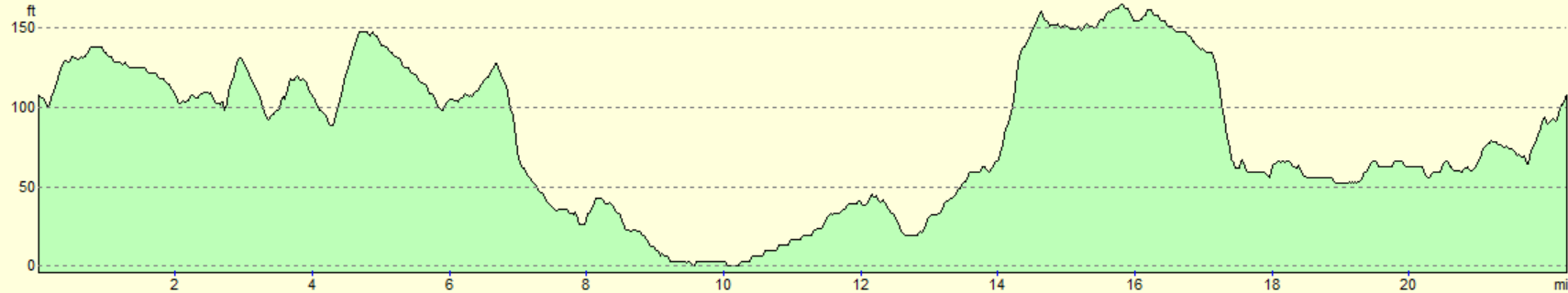
For more information on profiles, ascents and descents, see this page
 |
 |
|
 |
 |
|
 |
 |
|
 |
 |
|
 |
 |
|
 |
 |
|
 |
 |
|
 |
 |
|
 |
 |
|
 |
 |
|
 |
 |
|
 |
 |
|
 |
 |
|
 |
 |
|
 |
 |
|
 |
 |
|
 |
 |
|
 |
 |
|
 |
 |
|
 |
 |
|
 |
 |
|
 |
 |
|
 |
 |
|
 |
 |
|
 |
 |
|
Disclaimer
Please note that I take no responsibility for anything that may happen when following these directions. If you intend to follow this route, then please use the relevant maps and check the route out before you go out. As always when walking, use common sense and you should be fine.
If you find any information on any of these routes that is inaccurate, or you wish to add anything, then please email me.
All images on this site are © of the author. Any reproduction, retransmissions, or republication of all or part of any document found on this site is expressly prohibited, unless the author has explicitly granted its prior written consent to so reproduce, retransmit, or republish the material. All other rights reserved.
Although this site includes links providing convenient direct access to other Internet sites, I do not endorse, approve, certify or make warranties or representations as to the accuracy of the information on these sites.
And finally, enjoy your walking!
Nearby walks
| # | Title | Walk length (miles) |
|---|---|---|
| 108 | Waterbeach to Huntingdon | 21.6 |
| 119 | Huntingdon to St Neots | 11.8 |
| 142 | Huntingdon Station to Hargrave | 17.3 |
|
|

|