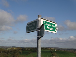
Walk #994: Jurassic Way: A battling circular walk from Welford to Great Oxendon, and back via Kelmarsh and Naseby
 |
 |
|
General Data
| Date Walked | 25/04/2018 |
| County | Northamptonshire |
| Start Location | Salford Close, Welford |
| End Location | Salford Close, Welford |
| Start time | 06.28 |
| End time | 13.37 |
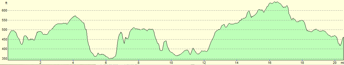
| Distance | 20.5 miles |
| Description | This was an interesting circular walk, taking in a section of the Jurassic Way, followed by a visit to a memorial to the Battle of Naseby. |
| Pack | Today I carried my 30-litre Karrimor rucksack, filled with water, my spare waterproofs, a book and other odds and ends. |
| Condition | I feel absolutely fine after this walk. |
| Weather | The day started off mostly sunny, but as the morning drew on the clouds started to gather. It attempted to drizzle at one point, but a rain shower only started after I had completed the walk. |
| OS map | Landranger number 140 (Leicester, Coventry & Rugby) and Landranger number 141 (Kettering, Corby & surrounding area) |
 |
 |
|
Map of the walk
Maps courtesy of Google Maps. Route for indicative purposes only, and may have been plotted after the walk. Please let me have comments on what you think of this new format. For a detailed table of timings for this walk, please see the table file.
 |
 |
|
Notes
After a gloriously hot and sunny week, normal service was due to be resumed, with wet and windy weather forecast over our area. I can normally walk on Wednesdays and Fridays, and of these two days, today promised to be the best weather, with a dry morning and showers in the afternoon. After my last walk along the Nene Way, I fancied turning my attention back to the Jurassic Way. I planned to park at a little car park by the Welford reservoir dam, but this turned out to be behind a locked gate. (I realised when I got home I had previously parked at Welford Wharf a short distance away, and not at the reservoir). Instead, I drove into the village and parked in a side street, where I hoped local residents would not mind.
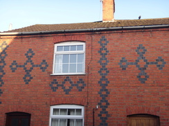
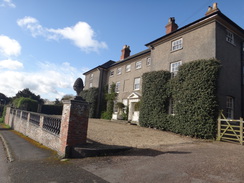
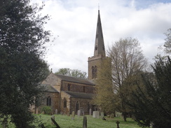
I got my kit together and headed off down the road. Welford is not the prettiest Northamptonshire village, but there was much of note: from the blue-brick diaperwork on some houses, to a house sign called 'Engine House' that seemed somehow to be connected with traction engines. It was an enjoyable early morning stroll, and after passing the church, the trail crossed the main road and joined footpaths. The next half-mile took me across a series of small fields, each well waymarked. After crossing a stream the path passed a farm and reached a road near Welford Grange.
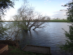
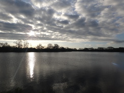
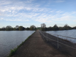
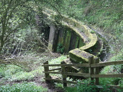
The trail soon joined a path that led along the southern shore of Welford reservoir. This reservoir provides water for the Grand Union Canal via its Welford arm, and I passed a fisherman who was just returning after a night out at the lake, hauling a massive two-wheeled trailer filled with fishing gear behind him. We exchanged pleasantries and he headed on - I think his car must have been behind the locked gate. Soon afterwards the path crosses a narrow strip of concrete across the middle of the reservoir - although it is actually a causeway between two separate reservoirs. Welford reservoir stretched away to my left, whilst Sulby reservoir lay a few feet higher to my right. I can only assume that the one reservoir was built first, and when that did not provide enough water, the Sulby reservoir was added. Disaster struck during the construction of the Sulby reservoir, when a sudden thaw burst a bank, flooding the surrounding area and killing two people.
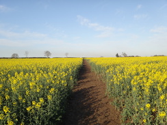
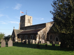
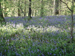
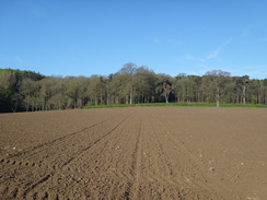
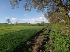
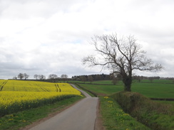
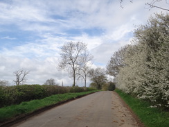
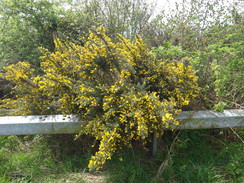
The trail continued on across fields, and then past the lumps and bumps of a deserted medieval village. The going was easy, although the series of small fields made it hard to maintain a good rhythm. The path passed through a field of oil-seed rape during a period of sunshine, and the yellow flowers shone magnificently. Shotyl afterwards I reached the village of Sibbertoft, and the trail passed across fields immediately to the north of the village to reach the village church. The River Welland rises in the village, and the Jurassic Way follows the rough route of the river all the way to Stamford. From Sibbertoft, the trail crossed more fields before entering a band of woodland, where there were beautiful patches of bluebells, and then across more fields to a road.
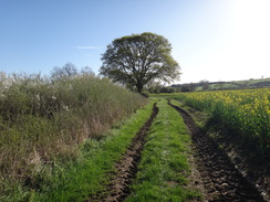
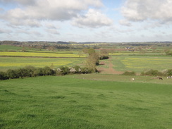
A long slog across a series of fields followed, with little to commend it. Eventually the path climbed up a hill into East Farndon, from where there some great views over the surrounding plains and back the way I had come. The top of the hill was covered with grassy pockmarks from old pits, and a house name in the village made me wonder if these were the remains of clay pits for a brickworks. The trail did not take a direct route through the village and instead headed sharply left, with a useful fingerpost pointing the way. Sadly the trail does not visit the Judith Stone half a mile to the north, which is a glacial erratic dumped in a rather odd location.
I started formulating a plan as I headed southeast along the road from East Farndon towards Oxendon. I had intended to walk back the way I had come, but I had made good time so far, and as the weather still looked promising I wondered if I could extend the walk. Instead of heading back the same route, I could use the Brampton Valley Way to head south, before using roads to get back to Welford. This would allow a circular walk two or three miles longer than the there-and-back route, and allow me to see more of the local countryside.
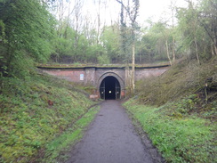
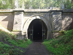
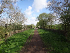
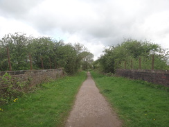
The trail headed to the north of Oxendon, before crossing a road and heading down towards the portals of twin railway tunnels, which now carry the Brampton Valley Way rather than trains. I had walked the trail further east on an earlier walk, and so the moment I stepped on the path above the portals I had completed the eastern half of the trail. The descent down to the Brampton Valley Way was slippery, but things improved once I was on the old railway trackbed. The line from Northampton to Market Harborough was first opened in 1859 to allow local ironstone reserves to be exploited; it was built as a single line, but was later doubled. This meant that the original Oxendon tunnel had a second independent bore built alongside. The line finally closed in 1981 and was converted into a walking and cycle path.
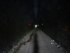
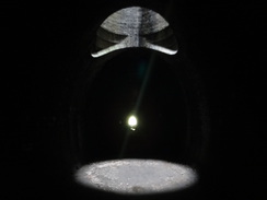
Signs outside the tunnel warned that there were no lights through the 422-metre bore, and that you should use a torch. I had my headtorch handy in my rucksack, but I decided to walk through in the dark. It was an eerie experience, with the slight unevenness of the ground inside the tunnel feeling amplified in the darkness. There were a few small puddles to splash through, and I soon reached a pool of light cast down the solitary ventilation shaft in the middle of the tunnel. My footsteps echoed around, and soon I was calling out and listening to the slightly maniacal retorts.
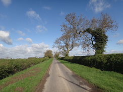
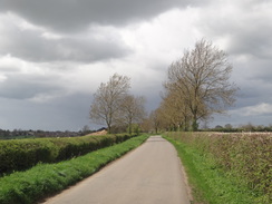
I followed the old railway as far south as Kelmarsh, from where I would be following roads for the rest of the day. There was a nasty section along the A508 through Kelmarsh; fortunately the verges were wide enough to allow me to safely walk along it. A long road walk followed along thankfully quieter roads, crossing the busy A14 on a bridge before heading through the hamlet of Haselbech and on towards Naseby.
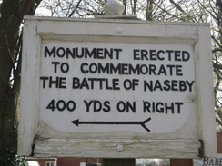
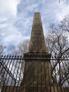
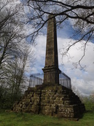
Just before I entered Naseby, a sign pointed along a road towards a monument for the 1645 Battle of Naseby. I still had plenty of time, so I headed up the road towards the memorial. This is an obelisk sitting in a little wooded area surrounded by a small circular moat. I walked to it and went around its base; sadly the sun and the surrounding trees meant it was hard to get a good photograph. A nearby signboard described the battle, which was the decisive fight of the English Civil War, and one which the Royalists lost. The war continued on for another year, but King Charles was never able to field a large army again. The battle was a surprisingly widespread affair, with much of the terrain I had walked over today being part of the battlefield.
The pub marked on the map in Naseby turned out to be closed, so I headed on to the village shop so I could buy some snacks. Inside, I ended up chatting to a local man for ten minutes about snake and spider bites, and Tilley hats! Suitably refortified, I headed along roads back to Welford. Grey clouds were starting to gather and I could see rain falling in the distance on either side of me. The wind had also strengthened, and I wondered if I would be able to get back to my car without getting wet. There had been a few spots of drizzle earlier on that had soon petered out, but I really did not want to have to get my coat out this near the end of the walk. A few drops of rain started to fall as I entered Welford, but it only started to rain heavily when I was taking my boots off in my car. I had beaten the rain on what had been a very pleasurable stroll.
 |
 |
|
Directions
This walk starts off from Salford Close in Welford at SP64248063. Leave the close and turn left along West Street; immediately after this passes the church on the left, turn left down Church Lane, which ends at the A5199 High Street. Carefully cross the road to reach the pavement on the other side, and turn right along it for about thirty metres until a stile beside a farm gate is reached on the left, opposite a garage at SP64168019.
Cross the stile and follow a path between some woodland and a fence. The path soon ends at a stile by a field gate; cross the stile to enter a small field. Head straight on; at the end of the field cross a double stile through a hedge, and then angle slightly left towards the top left-hand corner of the second field. At the corner, cross a stile and then turn left for two meters to a second stile; cross this, and then angle left diagonally across a third field, aiming for a stile about ten metres to the left of a big tree. Cross a stile through a hedge to enter a fourth field and angle slightly right towards a gap in the hedge on the right. Go through the gap into a fifth field, and head on towards a stile beside a field gate. Cross this into a sixth field, and turn half-right across it, aiming for another stile beside a field gate in the hedge on the right. On the other side, turn half-left down the seventh field, aiming towards a farm bridge over a stream. Cross this, and angle slightly right to a footbridge guarded by a stile over the tiny River Avon at SP64828051.
Cross the footbridge and head across a field, aiming for the right of some farm buildings ahead. Climb a steep bank, and at the top go through a gate that leads into another field, with barns immediately to the left. Pass the barns, and at the end of the field go through a clappergate to join Naseby Road. Turn left down the road; it slowly descends, and after 300 metres reaches a small car park on the right at SP64758082.
Just before the car park, turn right along a track that soon ends. Go through a wooden gate and follow a path between a hedge and fence, with Welford reservoir through the trees on the left. Go through a clappergate, and head on to a second. Go through the clappergate and turn right and then immediately left to join a concrete causeway between Welford and Sulby reservoirs, with a fence to the left. Cross the causeway, and on the far side cross a footbridge over a spillway between the reservoirs and climb up to reach a clappergate at SP65228124.
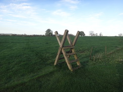
The path crosses a track and heads on for a few metres to another clappergate. Go through this and angle slightly right up a second field, aiming for the top corner. In the corner, cross a stile and a footbridge into a third field and head on, initially with a fence on the left. When the fence curves away to the left, angle slightly left, keeping the fence to the left. The path descends into a little dip and ascends the other side to reach a ladder-stile over a fence that leads into a fourth field. The path passes a corner of some distant woodland to the left and heads on to reach a clappergate through a metal fence that leads onto a track in Sulby at SP65698184.
Cross the track, and go through another clappergate in a fence into a field. Head straight on across the field, aiming immediately for the left-hand corner of a barn ahead. Skirt the corner of the barn, and in the corner of the field cross a stile to join a track. Turn right along the track; when a junction with another track is soon reached, continue straight on along a concrete track. Head eastwards along this track; go through a pedestrian gate beside a field gate and continue on. After about 600 metres on the track, go through a clappergate beside a field gate to join the end of a surfaced road at SP66488212.
Ignore the track going ahead, and instead turn half-left through a gap in a hedge to enter a field. Head diagonally across the field, aiming for about fifteen metres from the right-hand corner. Go through a gap in the hedge into a second field, and aim towards the right-hand edge of some trees surrounding a pond. Skirt the pond on the left to reach a stile that leads into a third field. Angle half-left across the field, heading up a slight slope to reach a stile beside a farm gate in a hedge. Go through this to enter a fourth field. Head straight on across a hedgeless boundary between two fields. When the end of a hedge is reached ahead, turn half-left across the fourth field. At the end of this field, cross a little ditch and a stile into a fifth field. Angle slightly right to head diagonally across the field; in the far corner, go through a gap in a fence to join a road to the west of Sibbertoft at SP67518264.
Turn right down the road; it soon curves to the left to enter Sibbertoft. As it curves to the right immediately afterwards, continue straight on up Westhorpe Road. Head up the road for a little over 100 metres; shortly after passing a house called Welland House on the left, turn right up an almost hidden footpath that initially follows a driveway. This leads to a clappergate into a field. Head across this field, keeping fences away to the right and aiming just to the left of a church tower ahead. Pass a little pond across a fence to the right, and then a gate in a non-existent fence. Angle slightly to the right, aiming for the field's far right-hand corner. Go through a clappergate to enter a churchyard, and then turn half-right along a path that passes Sibbertoft church and emerges out through a gate onto a road at SP68178273.
Turn left up the road; just before it curves to the left, turn right to cross a stile. Initially follow a hedge on the left and a fence on the right to reach a second stile and a plank bridge. Cross these, and angle half-right across the field. In the far corner of the first field cross a stile in a hedge on the left to enter a second field. Follow a hedge on the right; when this peters out, continue on to to a hedge ahead. Cross a stile and turn half-right across a corner of the third field. Pass through an intermittent hedge into field four and head straight on to reach a stile through a hedge into a field five, and then head straight on diagonally across the field, aiming for woodland ahead. The field narrows as the trees enclose on either side; at the field's tip join a track at SP68758372.
Follow the track as it enters the woodland and starts to descend through the trees. When the track ends at a T-junction at the bottom of the hill, head straight on across a stile through a hedge to enter a field. Angle a few degrees left across this field, paralleling a hedge away to the right. At the far end of the field cross a plank footbridge and stile through a hedge into a second field, and again parallel the field boundary away to the right. A corner of the field is reached; cross a stile beside a field gate that leads out onto a road at SP69568406.
Cross the road and go through a field gate to enter a field. Immediately on the other side, cross a farm bridge over a stream and turn right to follow a hedge on the right. In the far corner of the field, turn left along a hedge on the right for about five metres to reach a plank footbridge over a ditch on the right that leads to a clappergate through a hedge into a second field. Turn left, following a hedge on the left; curve right across the field, joining a hedge on the left at the bottom of a slope on the right. At the corner of this field, cross a footbridge guarded by gates into a third field. At the end of this field, go though a clappergate beside a field gate to enter a fourth field. Head on, still following a hedge on the left and a slope to the right. At the next corner, cross a footbridge guarded by stiles to enter a fifth field at SP70458475.
Angle slightly left across the fifth field away from the hedge on the right, and at the far hedge go through a very broad gap in a hedge to enter a sixth field. Follow a hedge on the left along a broad, rough track. At the end of this field continue straight on through another broad gap into a seventh field. Continue along the track with a hedge on the left; just before the corner of the field is reached, turn left across a farm bridge into an eighth field. Follow a hedge on the right, and in the corner go straight on across two stiles a few metres apart into another field Angle slightly left across field nine for a short distance, to a stile through a fence that leads into field ten, and then angle slightly left uphill. At the top of this field, cross two stiles through a hedge and curve half-right across field eleven, aiming for the tower of East Farndon church. Because of a dry valley off to the right, it may be better to follow fence on the left, and when the fence ends, angle half-right towards the church until a fingerpost is reached on the hillside at SP71548491.
At the fingerpost before the church, turn sharply left to head northwards. Keep a dry ditch on the right, and continue to a corner of the field, where a stile beside a field gate leads out onto a track. Head down this track; as it curves right, turn left to cross a stile into a field, and then turn half-right to angle across the field. When the field soon ends, cross two stiles through a hedge and cross a plank footbridge to join Marston Lane in East Farndon. Turn right up the road, and when it ends at a T-junction, turn right up Back Lane and follow this until it ends at a T-junction with Main Street. Turn right to head straight on up Main Street. Near the top of the hill, turn left down a road that soon curves left, and then turn right up a sloping path to a gate that leads into a churchyard. Head on along a path, passing the tower of East Farndon church on the left at SP71628475.
As the path leaves the main churchyard, do not continue on into a graveyard, but turn right through a clappergate into a field. Follow a fence on the left across the field to a second clappergate, and then head on across a second field, angling towards the hedge on the right and aiming for the far corner. At the corner go through a farm gate to reach a minor road called Oxendon Road at a junction with a main road. Turn left down the road (do not take the busier road), and follow it southeastwards. After a little over a mile the road approaches Great Oxendon. Pass some thirty MPH signs, and continue on for ten metres to SP73048345.
Turn left to reach a stile and plank causey that lead into a field. At the end of this field cross a long stile through a hedge into a second field and head across it to a double stile through a hedge that leads into a third field. Head between two trees, with a fence, hedges and houses off to the right. Cross a stile though a hedge into a fourth field; when a corner of the field is reached, pass a hedge on the right and at the next corner go cross a stile through a fence. On the other side head on between fences; the path joins a track that merges in from the left. Head down the track to reach the A508 road in Great Oxendon at SP73578349.
Carefully cross the road, and then go through a gateway (with a house called 'Tunnels End' on the left) and head down a track on the other side. Cross a stile beside a field gate across the track, and then turn left across the track to reach another stile beside a field gate. Cross this into a field, and angle towards another stile across a fence into a second field. Head across this field, between fences and paddocks, angling slightly downhill. Squeeze between a farm storage area on the right and a hedge on the left to reach a stile through a fence, that leads to the top of the Oxendon tunnels at SP73838354.
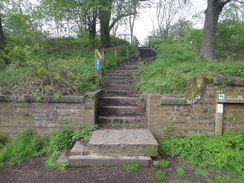
Here the Jurassic Way is left for the day. Turn left down a path, with the old railway in a cutting to the right. A few steps lead down to a path that runs along the old railway trackbed called the Brampton Valley Way. Turn right along this, soon reaching the northern portal of Oxendon Tunnel. Continue along the trail for a couple of miles; it passes an MOD area on the left, and when the path forks, take the left-hand branch that heads through trees and alongside a low brick wall on the right to reach the old site of Kelmarsh station. Pass through the rough car park to reach a road at SP74628047.
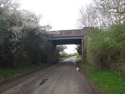
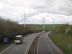
Turn right along the road. It immediately passes under a bridge carrying the old railway line overhead. After two-thirds of a mile this ends at a T-junction with the A508. Carefully cross the road and turn left to follow the verge uphill. As the road enters Kelmarsh, cross the road to join a pavement on the left-hand side. Continue on past a crossroads, and cross the road to join the pavement on the right hand side. The pavement curves right to join Crowthorn Road. Continue along this road for 0.8 miles as it heads southwestwards, crossing the A14 on a bridge before ending at a T-junction with another road at SP72917806.
Turn right along this road and follow it as it heads westwards; after 1.2 miles it reaches a road junction on the left in the hamlet of Haselbech. Ignore the road leading off, and continue straight on for another 1.4 miles until the road ends at a T-junction on the outskirts of Naseby at SP69137812.
Here I turned right to head north along the road for 400 metres to reach an obelisk; if you wish to visit this do so, and then return back to this junction.
Continue straight on along a road called Newlands through Naseby; it passes Naseby church on the left and curves to the left at a triangular junction; turn right along Welford Road. Follow this road as it heads northwestwards out of Naseby; it crosses the A14 on a bridge and heads on. Three miles after Naseby the road joins a stretch of the Jurassic Way walked earlier, and a little further on passes Welford reservoir dam and ends at a T-junction with the A5199. Cross the road to reach the pavement on the other side, and turn left along this road into Welford. Take the first road off to the right, West Street, and follow this as it curves left. Shortly after the bend turn left into Salford Close, where this walk started.
 |
 |
|
Distances
| From | To | Distance (m) | Ascent (ft) | Descent (ft) |
|---|---|---|---|---|
| Welford | Sibbertoft | 4.0 | 240 | 207 |
| Sibbertoft | East Farndon | 3.4 | 214 | 290 |
| East Farndon | Oxendon tunnel | 2.0 | 67 | 146 |
| Oxendon tunnel | Kelmarsh | 3.2 | 151 | 43 |
| Kelmarsh | Naseby | 4.3 | 308 | 164 |
| Naseby | Welford | 3.6 | 131 | 261 |
This makes a total distance of 20.5 miles, with 1111 feet of ascent and 1111 feet of descent.
For more information on profiles, ascents and descents, see this page
 |
 |
|
 |
 |
|
 |
 |
|
 |
 |
|
 |
 |
|
 |
 |
|
 |
 |
|
 |
 |
|
 |
 |
|
 |
 |
|
 |
 |
|
 |
 |
|
 |
 |
|
 |
 |
|
 |
 |
|
 |
Disclaimer
Please note that I take no responsibility for anything that may happen when following these directions. If you intend to follow this route, then please use the relevant maps and check the route out before you go out. As always when walking, use common sense and you should be fine.
If you find any information on any of these routes that is inaccurate, or you wish to add anything, then please email me.
All images on this site are © of the author. Any reproduction, retransmissions, or republication of all or part of any document found on this site is expressly prohibited, unless the author has explicitly granted its prior written consent to so reproduce, retransmit, or republish the material. All other rights reserved.
Although this site includes links providing convenient direct access to other Internet sites, I do not endorse, approve, certify or make warranties or representations as to the accuracy of the information on these sites.
And finally, enjoy your walking!
Nearby walks
| # | Title | Walk length (miles) |
|---|---|---|
| 137 | Market Harborough to Northampton | 18.3 |
| 138 | Market Harborough to Leicester | 17.7 |
| 653 | A circular walk from Welford to Foxton | 20.6 |
|
|

|