Walk #988: Nene Way: Daventry to Northampton
 |
 |
|
General Data
| Date Walked | 24/03/2018 |
| County | Northamptonshire |
| Start Location | Daventry Old Gasworks car park |
| End Location | Northampton Drapery |
| Start time | 06.12 |
| End time | 13.58 |
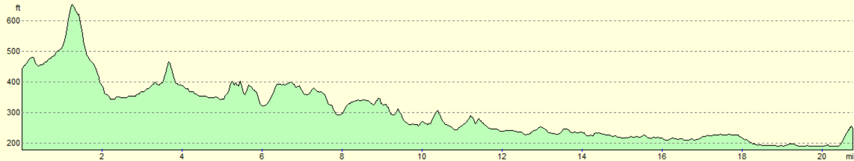
| Distance | 20.8 miles |
| Description | This walk followd the western sixteen miles of the Nene Way. |
| Pack | Today I carried my 30-litre Karrimor rucksack, filled with water, my spare waterproofs, a book and other odds and ends. |
| Condition | I am the worse for wear after this walk. I had some significant problems with my left shoulder, and my feet ended up getting wet and overheated. From a physical point of view, this walk is best fogotten. |
| Weather | The weather forecast ws for early light rain to peter out by eight in the morning. Sadly, drizzle and rain continued or most of the day, aside from about ninety minutes just before midday. It was not a cold day, but it was a cloudy and a fairly miserable one. |
| OS map | Landranger number 152 (Northampton & Milton Keynes) |
 |
 |
|
Map of the walk
Maps courtesy of Google Maps. Route for indicative purposes only, and may have been plotted after the walk. Please let me have comments on what you think of this new format. For a detailed table of timings for this walk, please see the table file.
 |
 |
|
Notes
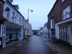
Earlier in the week I did a short stretch of the Nene Way; due to time constraints not the first leg from Badby to Northampton that I had intended to do, but a very pleasant one further downstream. With the weather looking very wet for the week ahead and a walk that required a long day, Sencan allowed me to disappear for the day. I set off just before five, and had a good drive through drizzle to reach Daventry, where I planned to start the walk. I could not find the car park on my map, but I soon found an alternative just to the north of town. No other cars were present as I got my gear together, and I wondered how long it would be before the town woke up. The drizzle had stopped, so I considered just wearing my fleece; however as the rain was not due to stop until eight, I decided to wear my coat.
I do not know Daventry well. I have walked through the town before, but my first memory of the place was going to a party there in the early 1990s. All the furniture in the lounge of a suburban house had been pushed towards the walls to convert it into a small, sweaty dancefloor, and three generations of the family were strutting their moves. I had been there for an hour before I realised that an armchair pushed into the corner, facing away from the room, was actually occupied by a wizened old man who I guessed was the fourth generation!
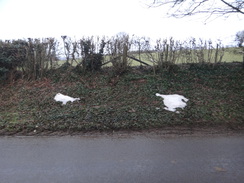
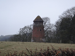
I walked through the town and found my way out along the road, using a similar route to the one I took on a previous walk. The drizzle soon restarted as I climbed up a steep hill out of the town, towards the stump of Newnham windmill at the top. A few patches of dirty snow lay against a bank, so the snow a couple of weeks ago must have lain fairly deep up here. There was not much traffic at the early hour, and I soon found myself in the sleepy village of Newnham.
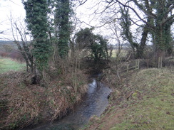
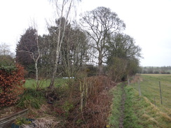
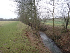
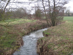
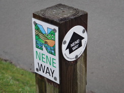
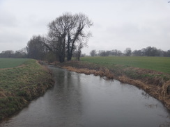
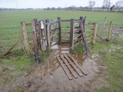
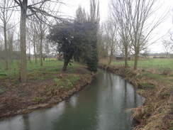
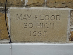
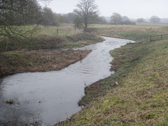
Here I joined the Nene Way, although the first mile and a half would be along it in the 'wrong' direction, i.e. upstream. I could remember nothing of this from my previous walk along here, and I was surprised to see the river was little more than a burbling stream. The ground was not too muddy despite the drizzle, and I reckon it would be a pleasant walk in the sun. Eventually I reached the outskirts of Badby, where a waymarker diverted me off the trail as marked on my map . The path led into the village, but once it ended at the road there were no more markers. I have been careful to update my maps with the route as shown on the latest on-line maps, and such a diversion was not shown. I kept a careful watch for any markers, but found none as I climbed up towards the church.
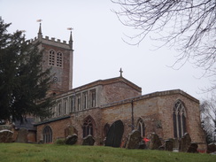
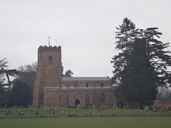
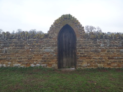
Too many trails have unmarked trailheads in the middle of nowhere, with nothing to say: "this is where you start your journey, enjoy yourself!" or "Well done!" In such cases, I quite like to make my own trailheads at a notable point: in the case of the Ouse Valley Way, I made the endpoint King's Lynn Custom House. A church is always a good, noticeable point, although in this case I wish it hadn't been up such a steep hill!
Barriers and equipment stood outside the church, barring me from entering to have a look around. Instead I started off down the hill, keeping an eye out for any waymarkers. I found the location where the maps show the trail starting, and so I headed down a quiet footpath alongside a stream to a clappergate I had gone through earlier, and where the marker pointed in the 'wrong' direction. This was to become a theme through the day, and the markers, whilst plentiful, do not always match the map. The next mile followed the route I had taken earlier, except in reverse. I discovered a weird wooden sculpture with 'SOV' written on it that I had not noticed on the way to Badby; a search of the Internet has not provided any meaning.
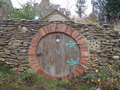
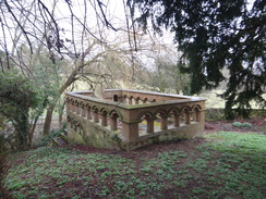
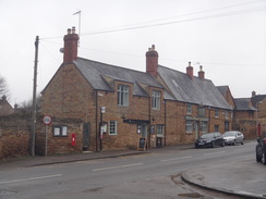
The shop in Newnham was for sale, and the pub would not be open for many hours, so I walked on through the drizzle. Like many Northamptonshire villages, Newnham is pretty with many stone houses, some topped with a dainty thatch hat. One house even had a 'Hobbit House' built into a stone wall outside! The trail took a diversion through the churchyard, where a massive stone mausoleum clung to the steep hillside. A path led past pretty houses out of the village.
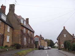
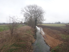
The trail descended to cross the River Nene once more, and it was already wider than it had been a mile further west. It then climbed to the hamlet of Little Everdon, and on across fields to Weedon Bec. The map shows the trail taking a direct route through the village, but a marker on the ground showed a different route. I tried the route from the map and could not find the way, so I turned back to the marker post and followed that route around the road. A series of marker posts took me through the village, granting me a few distant views of the massive brick warehouses on the Ordnance Depot. Despite their size, they had a certain elegance that modern warehouses utterly lack.
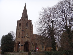
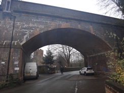
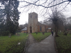
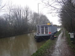
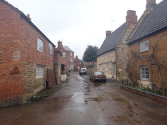
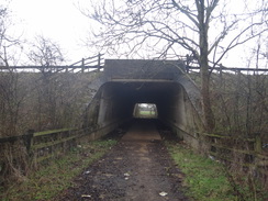
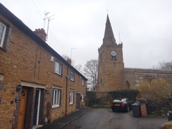
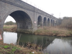
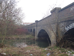
The centre of Weedon Bec was a very pleasant place, with several intriguing buildings. The village seemed to be waking up for the morning as I followed the markers under a railway viaduct towards the church. The map shows the trail following the road past the church, but the markers pointed through the churchyard, my walk accompanied by an over-loud peel of bells. The path approached a massive bank that carries the Grand Union Canal overhead, but it did not climb up the bank, and instead made its way back to the road, to head under the canal by a small arched tunnel. Only then did the trail climb up to join the towpath.
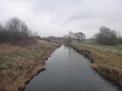
I've walked the Grand Union Canal twice, and parts of it more times, and it always feel good to be back on this old friend. Even the rain could not extinguish that feeling, although the trail soon left the towpath and headed towards the A5. Another crossing of the Nene followed, and again it was wider and faster-flowing; it is a river that grows up fast. The trail climbed slightly to pass Flore church, although it only flirted with the village before heading out across fields. It passed Heyford Mill before crossing the Nene and entering Nether Heyford.
The village was bustling, but I decided not to stop and instead pressed on through the drizzle. I was getting utterly fed up with the rain by this time; although it was never heavy, it was enough to get my coat fairly wet and even seep through the hem of my map case. I discovered there was a bus to Daventry from the village, but it was too early in the day to stop. However I did have a problem: unusually, my left shoulder was aching, and I had to release my pack's strap a little to try to ease the pressure.
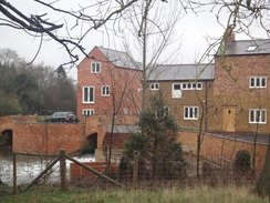
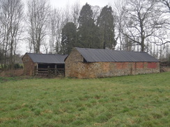
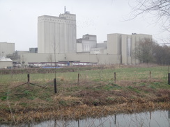
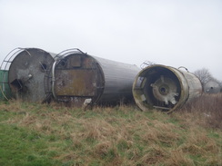
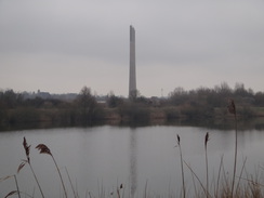
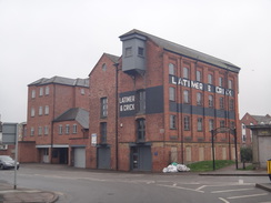
The path headed east out of the village across the floodplain, and soon the noise of the M1 started to intrude. However that noise was soon drowned out by the sounds coming from a massive structure ahead: Bugbrooke Mills, a large flour mill. Whilst the building is intrusive, its sheer bulk made a change from the twee buildings in the surrounding villages. A field just outside the mill contained dozens of old storage cylinders, some looking a little like redundant rocket stages. Few of them looked as though they could ever be used again, but were obviously being stored for a reason.
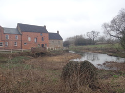
The trail headed under the M1, then across a field that had been thoroughly denuded of vegetation by sheep, to reach Kislingbury. Unusually, a mill by the river appeared to be unrestored, and must be a prime candidate for conversion, given how many others have been altered and 'improved'. It's brick and stonework certainly had more character in its slightly shabby state than any of the shot-blasted and immaculately clean restored buildings.
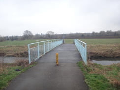
I stopped off at the shop in the village to buy a few shacks and headed on, immediately making a mistake by heading through the churchyard rather than sticking to the road; I headed back once I realised my mistake to take the proper route. By now my left shoulder was actually hurting, and I undid my rucksack's strap as far as it would go. The village supports three pubs and it would have been an ideal time to stop, but I was muddy, wet and the pain from my shoulder had put me in a bad mood. The trail crossed the Nene once more on a footbridge beside the road bridge, before heading across the floodplain. It had stopped raining about an hour before, but just as I considered taking my coat off, the drizzle restarted.
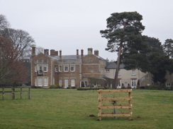
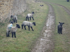
Soon the trail reached a road; this was not marked on my old map, and serves a large distribution centre further south. This area has many such distribution centres, its central location and good road and rail links making it an ideal location, just as it was for the military when the Weedon Bec depot was produced - although I doubt that any of the modern warehouses have a canal link! I crossed the road, and soon afterwards a wall soon started on the left, guarding the grounds of Upton Hall. The field was filled with newborn lambs and their mothers, and several of the lambs were licking the stone wall - I've no idea why, but it was an odd sight.
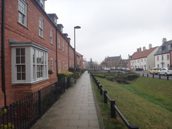
Soon afterwards, the trail entered a new housing development. Some modern housing schemes are rather soulless affairs, but this one felt much better; the houses are all of modern types, but there is a range of styles and everything did not look too new. Fortunately the trail though the development was well waymarked, and soon I was crossing a major road to enter the outskirts of Northampton.
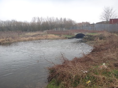
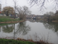
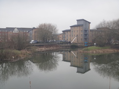
A rather dingy track took me down to the Nene once more, and it looked more like a proper river than an oversized stream: it's remarkable how much it grows in size in just a few miles. I made a mistake here, continuing along a cycle path rather than the river bank. The area had changed since my map was printed, with the lake to the north having been dug and returned to nature. This problem, and the ones on previous walks, has made me realise I probably need to get new maps - I cannot rely on checking routes on the Internet before setting off. I realised my mistake after about a hundred yards, but by this time my shoulder was hurting a lot and I was keen to finish.
I did divert away to visit the Northampton branch of the Grand Union Canal - which I have walked before - and then under a couple of railway bridges. One of these used to carry a line to 'Cotton End' - given my surname, that's a place I'd like to avoid! This line once carried the Northampton to Bedford railway line, and until recently the bridge carried trains over a stub line to serve industry. Not any longer, and I doubt the low bridge will last for long.
This riverside approach to Northampton is not pleasant, with lots of litter and a generally uncared-for feel. This is a shame, as the city could focus towards its waterfront rather than hide it away like an uncared for, geriatric relative. This is not helped by massive buildings belonging to Carlsberg - the brewery is neat and tidy, but the industrial structures rather dominate the surroundings. A footbridge took me over an inlet by the brewery, and soon afterwards I headed away from the river to walk to Drapery Street.
The old Greyfriars bus station was demolished several years ago, and has been replaced with an undersized and poorly-located new bus station and open-air stops in the town centre. I am unsure whether this change was to the city's advantage. Fortunately a bus was due in only fifteen minutes, so I sat down at the stop outside of the McDonalds, realising I had only eaten two bananas and two chocolate bars all day.
It had hardly been a classic walk, and had somewhat been spoilt by the rain. This was a shame as it passed through many pretty villages, and in the sunshine would have much more to recommend it. I hope the next leg to Wellingborough will prove to be a more positive experience.
 |
 |
|
Directions
This walk starts off at the Old Gasworks long-stay caar park in Daventry at SP57016261. Leave the car park and head through the underpass under the B4043 road, signposted for the town centre. The underpass leads to the end of Brook Street. Head up this road, and when it soon ends at a T-junction by the Saracens Head pub, cross the road and head straight on along a pedestrianised road. Continue on until the pedestrianised road ends and becomes Sheaf Street. This in turn ends at a T-junction with Oxford Street. Carefully cross the road, and turn left for a few yards to reach a roundabout. Take the first road off to the right, the B4038. After 0.6 of a mile at SP57766144, shortly after Western Avenue is passed on the right, turn right up another road, following cycle route 50.
This road soon climbs up over the A45 Stefan Way and climbs steeply uphill. It crests the hill and starts descending, passing a cemetery on the left and reaching a crossroads with another road after a mile. Cross this and head straight on down Daventry Road. After a fifth of a mile the road curves to the left; immediately after the bend turn right down Daventry Road, which soon ends at a T-junction with the B4037 Badby Road in Newnham at SP57725954. Here the Nene Way is joined for the next mile into Badby.
Turn right to follow the B4037 road west; it curves to the right as it leaves the village, and after a fifth of a mile, turn left through a clappergate beside a field gate to enter a field, and start following a hedge on the left. After 100 metres the hedge is replaced by a stream (actually the River Nene); continue on as the river gently curves to the right. At the corner of the field go through a clappergate and cross a footbridge over a ditch to enter a second field, still with the river still to the left. In the corner of the second field, cross a footbridge over a stream and go through a clappergate into a third field. Head straight on across the middle of the field; when it ends, go through a clappergate and cross a plank bridge over a stream at SP56225923.
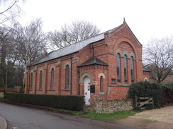
Head on between a fence and hedge to reach another clappergate; go through this and head on for about ten yards until a driveway is reached beside a house on the right in Badby. Continue straight on up the driveway. As the track curves right, turn left to join a surfaced path that follows a low stone wall on the left. The path continues to curve left and ends at Chapel Lane. Turn left along Chapel Lane and follow it past a chapel on the right. Just before the road begins to climb, turn right up Brookside Lane and continue along the lane, with a stream to the right. It becomes Church Hill and climbs uphill to reach Badby Church on the right at SP55955872.
I have called Badby Church the honourary starting point of the Nene Way; the first stretch through Badby is poorly waymarked; the following is the route I chose.
Start at the gate leading from the churchyard onto Church Hill and turn left to follow the road as it curves to the left and descends, becoming Brookside Lane. This meets a stream on the left before ending at a junction with Chapel Lane. Turn left along this lane, and just before a chapel is reached on the left, turn right past a field gate to join a path that squeezes between a stream on the left and a fence on the right.
When a plank footbridge is reached on the left, go through a clappergate on the right to join another path that heads eastwards directly across a field. At the far side of the field, go through a clappergate and cross a footbridge over a stream into a second field, to meet the youthful River Nene on the right. When this field ends, cross a footbridge over a ditch and go through a clappergate into a third field and continue with the river to the right. (Note: the map shows the path leaving the river and cutting across the field; this is a less obvious route than sticking to the edge of the field.). When the river curves away to the right, continue along the edge of the field, following a hedge for about 100 metres until a clappergate beside a field gate is reached. This leads out onto the B4037 road just outside Newnham at SP57445947.
Turn right to follow the B4037 road eastwards; it soon enters the village of Newnham, where a pavement starts on the right. The road starts to climb; after nearly half a mile the road curves to the left past a war memorial to head towards the church. Immediately before the church, turn right through the church gate and join a cobbled path that passes the south side of the church and starts to descend steeply. At the bottom of the hill the path curves to the right and starts climbing; it becomes narrower before emerging out onto Mounts Lane beside a little well.
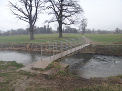
Turn right and follow Mounts Lane downhiill; it becomes barely more than a muddy track before it ends at a junction with another road. Turn left along this road, which immediately curves to the right to end at a stile beside a field gate. Cross this to enter a field. Ignore the track leading straight on and turn half-left to climb eastwards across the field, aiming for a solitary wooden electricity pole. Pass this and at the far side of the field cross a stile over a fence that leads into a second field. Curve half-right to head down towards a clappergate, and go through this to enter a third field. Continue straight on downhill to reach a footbridge over the Nene at SP58725913.
Cross the footbridge to enter another field, and turn half-left to head towards a large tree near the corner of the field. Go through a gate in the hedge, cross a footbridge over a ditch and then through a second gate to enter a field. Angle half-left across this field, aiming for the top corner. Here, go through a clappergate beside a field gate and angle diagonally across a third field. The path descends into a dip, where a clappergate goes through a hedge, and aim for a gap between two hedges ahead. Follow the hedges on both sides for about fifty metres to reach a clapper gate beside a double field gate. On the other side, continue on for about twenty metes to reach another clappergate in a fence. Go through this to enter an area of parkland; angle slightly left to follow a series of white-topped posts. Go through a clappergate across a fence about ten metres to the right of a green barn, and then head across grass towards a surfaced track. Do not join the track, and instead keep it on the left for about fifty metres to reach a clappergate. On the other side descend a few stone steps to reach a road in Little Everdon at SP59415804.
Turn left along the road for a few metres to reach a junction, and then turn right down another road. This starts to climb uphill; shortly after passing a house on the left, turn left through a bridleway gate to enter a field. Follow a hedge on the left; at the far corner of the field go through a pedestrian gate beside a field gate to enter a green track that runs between hedges. This soon curves to the right and sharply left to reach another pedestrian gate beside a field gate. Go through this to enter a field, and continue on with a hedge on the left. The path climbs slightly to a pedestrian gate beside a farm gate. On the other side follow a green lane between hedges. This meets a gravel track coming in from the left at SP59735819.
Continue straight on, following a hedge on the right. The track soon ends and the hedge curves to the right to enter a field. Follow the hedge on the right, and then go through a gap in the hedge ahead to enter a second field. The path descends; at the bottom corner of the field go through a broad gap and continue following the hedge along a third field. At the bottom of this field go through a gateway into a fourth field; head straight across the middle of this field to reach a footbridge over a stream beside a farm bridge at SP60705879.
On the other side, follow an obvious track uphill with a hedge on the right, soon passing a broad gap in a hedge ahead to enter a second field. Pass a ruined building on the right and go through another broad gap in a hedge, and at the end of this third field squeeze through a gap beside a field gate to reach a road at SP61455890. Turn left along the road for a few yards before turning right up Queen Street. Follow the road eastwards into the village of Upper Weedon, and when it curves to the left after half a mile, turn right down Oak Street. This eventually curves to the left to end at a bend in a road at SP62485903.
The route described below follows the route as shown by waymarkers on the ground, which is significantly different to that shown on the map.
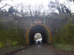
Cross the road ahead to join the pavement on the other side, and start following Croft Way downhill. At the bottom of the hill the road curves to the right, becoming West Street, and then passing Weedon Bec primary school on the right. When the road ends at a crossroads, cross the road ahead to join Church Street. This soon curves to the right and then the left, before passing under a large railway viaduct to reach Weedon church on the left. Turn left through a gateway into the churchyard, and follow a path through the churchyard, passing the church on the left. The path leaves the churchyard through a gap in a wall; ignore the steps leading up a bank ahead, and instead turn right along a path that leads through bike barriers back out onto the road. Turn left along this road to reach a narrow tunnel under the Grand Union Canal. Pass under this, and immediately on the other side, turn right up a stepped path that leads up to the canal towpath. Turn left to follow the towpath southwards until bridge 25 is reached at SP63585894.
Immediately before the bridge, turn left up some steps to reach the top of the bridge, and then turn left to join a track that heads northwards between fields away from the canal. The track soon curves to the right and then left before ending at a road called Church Street. Turn right along Church Street for a few metres until it ends at a T-junction with the A5 road at SP63885919.
Carefully cross the A5, and on the other side pass a garage / car showroom on the right and go through a gateway to enter a field. Keep a stream on the left until a footbridge over it is reached on the left. Cross the bridge and turn right to follow the stream on the right. When the River Nene is soon reached ahead, turn left for about fifty metres to reach a footbridge over the river on the right. Cross this, and on the other side follow an obvious path that cuts north-northeastwards across a field towards Flore church. At the far side of the field, go through a clappergate to enter the churchyard, and follow a path through the churchyard, with the church away to the left. Go through a clappergate at the far side of the churchyard and cross a small gravel parking area to reach a road called the Avenue in Flore at SP64255989.
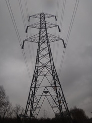
Continue straight on up the road; when it curves to the left in front of a school, turn right along Brickett's Lane. When this immediately curves to the left, head straight on past cycle barriers to join a surfaced path. The path becomes a road for a short distance before ending at a T-junction with another road; turn right along this road for about ten meters to a T-junction, and then turn left along Nether Lane. This swings to the left and right; when it meets a sharp left-hand bend in front of a white house, continue straight on along a path to the right of the house. Go through a clappergate beside a field gate to enter a small field; turn half-right to aim for a clappergate in a fence ahead. Cross this, and then aim half-left across a second field to reach a clappergate through a fence. Head on across a third field to another clappergate. Aim for the far corner of the fourth field; just before the corner, turn right through a clappergate in a hedge and then angle left to a clappergate in a fence. Aim for a power pylon ahead; pass this to reach a footbridge across a stream and then through the hedge at SP65255982.
On the other side of the footbridge, head straight on across a field. After about twenty metres a hedge is joined on the left. At the end of this field squeeze through a gap in the hedge ahead and follow a fence on the right for five metres until a good track is reached. Head straight on along the track between a hedge and a fence. When the track curves to the left beside Heyford Mill, leave the track and cross a footbridge across a stream and head on along a muddy path between fences. After about thirty metres go through a clappergate and follow a fence on the left to a second clappergate beside a field gate. On the other side follow the path as it runs between fences to a third clappergate that leads into a field. Curve left across the field; go through a fourth clappergate and cross a footbridge over the Nene at SP66015899.
Cross the footbridge and continue on along a good broad path between a fence and a hedge. The path emerges out onto a road; turn left along the road and then immediately right up another road. As the road curves to the left, continue straight on along a stub road; when this ends after about ten metres head straight on, initially along a driveway for a few metres and then along a path with a fence on the left and a low stone wall on the right. The path soon emerges out onto a driveway and passes a gate to join the end of a road. Head on down this road; when it soon ends at a T-junction continue straight on down Church Street to reach a triangular junction with Weedon Road in the centre of Nether Heyford at SP65945852.
Turn left along The Green and when this ends at a T-junction, continue straight on along Bugbrooke Road. When this in turn ends at a T-junction, turn left up Watery Lane. After about fifty metres, turn right to join a footpath that runs between fences and then hedges. It crosses a stream on a bridge, and about ten metres after the bridge, turn left though a clappergate beside a field gate to enter a field. Follow a fence on the right, and at the end of this field, go through a clappergate and aim slightly to the left across another field, aiming for the far corner. At the corner, go through a clappergate and follow a hedge on the left. At the end of the next field, go through another clappergate and continue following a hedge on the left. At the end of this field go through another clappergate and continue on, still with a hedge on the left. At the end of this field, go through a clappergate to enter an area of woodland; follow the obvious path through the trees. Ignore a bridge over the river to the left at SP67715862.
Pass the bridge and continue along a track with the river to the left. The track emerges through a gap in a hedge ahead to merge with another track; turn left along this track as it immediately curves to the right with the massive buildings of Bugbrooke Mill across the river to the left. The track curves to the left through field gates; here turn left through a clappergate beside the gates and continue along the track. The track ends at a T-junction; with Mill Lane at SP68075868, with the mill complex to the left.
Turn left along the road for a few yards, and then right through a clappergate in a hedge to enter a field. Follow a hedge on the left; halfway across the field turn left through a pedestrian gate in a gap in the hedge, and then turn half-right to head diagonally across a grassy storage area. Go through a gate, cross a footbridge over a ditch and then go through another gate to enter a field. Head across this field for a short distance to reach another hedge and clappergate. The path heads across a second field, passing a tree on the right to reach a track. Cross the track, and go through a gate to reach a footbridge over a ditch. Go through a second gate on the other side of the bridge to enter another field. Head straight on across this field to reach a gap in a fence, and then turn half left to reach an underpass under the M1 motorway at SP68675911.
Pass under the motorway, and on the other side go through a clappergate to enter a field. Turn slightly to the right across the field, angling away from the motorway on the right. At the end of the field, cross a small ditch and go through a clappergate to join a path that runs between fences guarding paddocks. At the end of the path, go through a clappergate and pass the end of a track on the left for about ten metres to reach a second clappergate beside a field gate. Go through this, and on the other side continue along this track, passing some houses on the right, before it soon ends at Willow View in Kislingbury. Turn left to head straight on along Willow View; when this ends at a T-junction turn left along another road. When this curves to the right, turn left to head straight on along Mill Road until this ends at a T-junction with Church Lane at SP69695943.
Turn left up Church Lane, and follow it as it curves to the right to become Starmers Lane, which soon ends at a T-junction with the High Street. Carefully cross High Street, and then turn left along it for about ten metres before turning right up Hodges Lane. When this road soon ends, turn left along a surfaced path that passes behind the Cromwell Cottage pub before it ends back at the High Street. Turn right along the High Street, keeping the road on the left. The road soon curves to the left; cross the end of Beech Lane and head on along a winding ramp that leads to a footbridge over the river at SP69965981 with the road bridge to the left.
On the other side, continue along the road as it curves to the right, and on the next left-hand bend, turn right through a wooden gate near double field gates. Do not join the track on the right, and head on through a scrubby area into a field. Continue on, aiming for about halfway down the hedge ahead in the distance, with the river away to the right. Cross a plank footbridge over a stream and then curve right to follow a fence on the right with a field on the left. At the end of this field, go through a broad gap in the hedge ahead and continue on, following the edge of a field on the left. At the corner of this field, go through a pedestrian gate and follow a path that heads up to the right to meet the imaginatively-named Upton Valley Way North road at SP70945975.
Cross the road using the traffic lights, and on the other side descend a ramp to a gate that leads into a field. Head diagonally across the field east-northeastwards, aiming to skirt the left-hand end of a band of trees. At the trees, cross a plank footbridge beside a field gate and then go through a pedestrian gate into a second field. Follow a wall on the left towards another band of trees on the right. Pass the trees, and at the end of the field go through a pedestrian gate beside a field gate to enter a third field. Continue following the wall on the left as the path becomes a rough track; go through a pedestrian gate beside a field gate, and then turn half-right to follow a fence on the right. Continue along the path as it curves slightly to the left, going through any gates you come across (they were all down in 2018). The path reaches a stone step-stile through a wall beside a farm gate to reach Upton Lane at SP72035976.
Cross the road, and on the other side go through a gap (do not go through the field gate alongside) and walk along grass with a hedge on the right and a road on the left. Follow the grass alongside the road; the road is currently blocked off to traffic (2018) and head through a new housing development. Go past double field gates and cut across the end of Moorcut Drive, and head along a paved path that runs immediately in front of houses. Cross the High Street and head on until Scribers Drive is reached. Cross this, and then a footbridge over a dry ditch, to reach a pavement in front of some houses. Turn right to follow the pavement; the path curves to the left, still running in front of houses, with Clickers Drive across a grassy dry ditch on the right. Continue on until the path meets Clickers Drive; turn left along the end of the road, which soon becomes a path that ends at the A5076 road at SP72715996.
Cross the dual carriageway using the pedestrian crossing, and on the other side turn left for a few yards to reach a large roundabout. Turn right and take the first road off to the right, Duston Mill Lane. This passes wasteland protected by palisade fencing on the right and becomes unsurfaced. After a fifth of a mile it reaches a vehicle barrier; squeeze past this to reach a bridge over a river stream. Cross the bridge and follow the track as it curves to the right and then left to reach a bridge over another stream. Continue along this track for a hundred metres until it reaches another vehicle barrier; squeeze past this to join a surfaced path at SP73015960.
Here I went wrong; the Nene Way heads to the left from the gate, passing a car park and heading around a lake. The route described below is a more direct route.
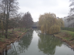
Immediately after the gate, the path crosses a long bridge over a depression and reaches a junction. Turn left along another surfaced path (do not cross a bridge over the river to the right). Continue along this path as it runs between a lake on the left and an artificial cut of the River Nene on the right. After half a mile the surfaced path curves slightly left and then sharply right to cross a blue bridge over the river cut. On the other side head straight on along a surfaced path signposted Briar Hill. The path curves to the left to meet Bridge 14 over the Grand Union Canal (Northampton Branch). Do not cross the bridge, and instead turn left along another surfaced path that cuts across the floodplain towards another blue bridge over the river cut at SP74335964. Here the Nene Way is rejoined.
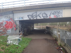
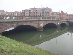
Cross the bridge, and on the northern side turn right to head under a large railway bridge, and continues on to reach another, lower, railway bridge. Head under this and head on. The path rises up towards a footbridge over the river; do not cross the bridge and instead skirt the road on the left; after a few metres turn right to rejoin the riverside path. The path soon passes under a road carrying Towcester Road overhead. The path and river jink past a B&Q store, and then the path turns left to head alongside an inlet on the right. A footbridge over the inlet is soon reached on the right; cross this and on the other side turn right down the inlet. The path soon curves left to continue along the river's northern bank, with the massive buildings of the Carlsberg brewery to the left. Head on until the A508 bridge over the river is reached at SP75465977. Here the Nene Way is left behind.
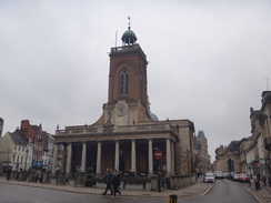
The bus stops for Daventry are currently (2018) in the Drapery in the centre of town. To reach them, turn left up the A508. When a crossroads is reached, use a pedestrian crossing to cross the road and head straight on uphill into the centre of the town. The road passes the ornate All Saints' church on the right, and the road becomes the Drapery. The bus stop for services back to Daventry is currently (2018) beside the McDonald's on the left at SP75396049.
Distances
| From | To | Distance (m) | Ascent (ft) | Descent (ft) |
|---|---|---|---|---|
| Daventry | Badby church | 3.7 | 361 | 348 |
| Badby church | Weedon Bec church | 6.4 | 253 | 430 |
| Weedon Bec church | Kislingbury church | 5.6 | 118 | 177 |
| Kislingbury church | Northampton Draprey | 5.1 | 115 | 75 |
This makes a total distance of 20.8 miles, with 847 feet of ascent and 1030 feet of descent.
For more information on profiles, ascents and descents, see this page
Transport
Stagecoach D1, D2 and D3 bus services run regularly between Northampton Drapery and Daventry bus stations.
Badby is served by regular bus services on the Stagecoach 200 route between Daventry and Banbury.
 |
 |
|
 |
 |
|
 |
 |
|
 |
 |
|
 |
 |
|
 |
 |
|
 |
 |
|
 |
 |
|
 |
 |
|
 |
 |
|
 |
 |
|
 |
 |
|
 |
 |
|
 |
 |
|
 |
 |
|
 |
 |
|
 |
 |
|
 |
 |
|
 |
 |
|
 |
 |
|
 |
 |
|
 |
 |
|
 |
 |
|
 |
 |
|
 |
Disclaimer
Please note that I take no responsibility for anything that may happen when following these directions. If you intend to follow this route, then please use the relevant maps and check the route out before you go out. As always when walking, use common sense and you should be fine.
If you find any information on any of these routes that is inaccurate, or you wish to add anything, then please email me.
All images on this site are © of the author. Any reproduction, retransmissions, or republication of all or part of any document found on this site is expressly prohibited, unless the author has explicitly granted its prior written consent to so reproduce, retransmit, or republish the material. All other rights reserved.
Although this site includes links providing convenient direct access to other Internet sites, I do not endorse, approve, certify or make warranties or representations as to the accuracy of the information on these sites.
And finally, enjoy your walking!
Nearby walks
| # | Title | Walk length (miles) |
|---|---|---|
| 137 | Market Harborough to Northampton | 18.3 |
| 157 | Wolverton to Bugbrooke | 16.6 |
| 158 | Bugbrooke to Braunston | 15.1 |
|
|

|