Walk #1012: Edinburgh to Linlithgow along the Union canal
 |
 |
|
General Data
| Date Walked | 10/08/2018 |
| County | Lothian |
| Start Location | Edinburgh Waverley station |
| End Location | Linlithgow station |
| Start time | 08.30 |
| End time | 16.43 |
| Distance | 23.1 miles |
| Description | This was a pleasant stroll from the centre of Edinburgh to, and then along, the Union Canal. |
| Pack | Today I carried my 30-litre Karrimor rucksack, filled with water, my spare waterproofs, a book and other odds and ends. |
| Condition | I have a couple of hot-spots on my feet, and some chaffing between my thighs; otherwise I feel fine. |
| Weather | Today was a day of sunshine and showers, some of which were heavy. A light drizzle became a heavy shower by the time I started the walk, after which it remained dry for the next few hours. A couple more heavy showers followed, but fortunately these were followed by sunny periods that dried me off. A final heavy shower meant the day was bookended by rain. |
| OS map | Landranger number 66 (Edinburgh, Penicuik & North Berwick) and Landranger number 65 (Falkirk & Linlithgow, Dunfermline) |
 |
 |
|
Map of the walk
Maps courtesy of Google Maps. Route for indicative purposes only, and may have been plotted after the walk. Please let me have comments on what you think of this new format. For a detailed table of timings for this walk, please see the table file.
 |
 |
|
Notes
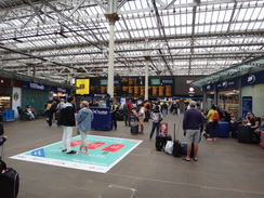
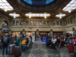
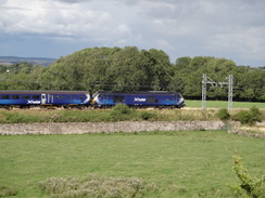
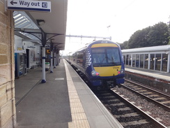
I had a brilliant night's sleep last night, which was followed by an early breakfast, allowing me to arrive at Larbert Station just after seven. A train was due in about twenty minutes, so I paced around as I waited in a light drizzle. It took longer than expected to reach Edinburgh Waverley, but I spared a few minutes to look around: parts of it have changed, such as the new platforms and escalators up onto the footbridge, but much remains the same, including the magnificent overall roof.
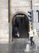
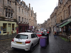
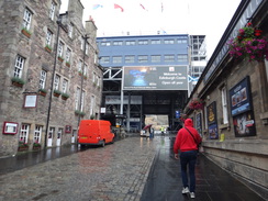
Eventually I tore myself away from the station and climbed up Fleshmarket Close, a narrow, stepped lane that rises towards the Old Town. I climbed past the halfway pub, and then into Cockburn street, which I have very fond memories of. I passed the Edinburgh Backpackers' hostel, where I met the ex-girlfriend who accompanied me on my coastal walk, the adjacent Scotsman's Lounge, and a Pizza Hut where I met another girlfriend. As I said, fond memories.
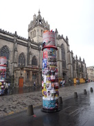
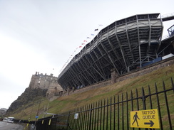
The Royal Mile was bustling with both people and signs for the Fringe. Columns had been erected every few metres, and each one was bedecked with flyers for events. I'd never been to the city during the fringe before, and it was far livelier and messier than I expected. It started to rain heavily as I headed towards the castle, which was dominated by the enormous stands for the military Tattoo. I had hoped to reproduce the start of my coastal walk sixteen years ago, but a security guard told me the esplanade did not open for another hour.
In some ways I haven't changed much in the sixteen years since I started the coastal walk; I am wearing the same red coat that I had worn on that day (although now much faded), and the same rucksack sat on my shoulders. As then, I am wearing Craghopper trousers and thousand mile socks, whilst a Tilley Hat sits on my head - sadly not the same one I wrote on the coastal walk, which eventually split from overuse and sweat. Not many changes in clothing, but my life has moved on: I am married, we own a house, and I am a father. All changes for the better, I believe.
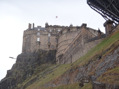
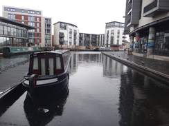
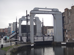
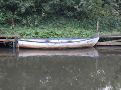
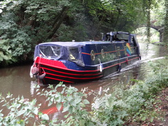
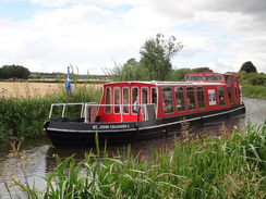
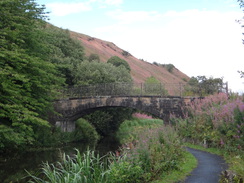
My route took me below the castle and the massive overhanging Tattoo stands, and on through a part of Edinburgh I did not know well to reach the start of the Union Canal at Lochrin Basin. The basin has obviously been recently regenerated, with lots of smart buildings standing around the towpath's cobbles. This modernity conflicted somewhat with the historic canal, and it was hard to imagine what it must have been like when it was filled with working ships. The first bridge over the canal was a vertical lift bridge os unusual size and scale for a canal bridge.
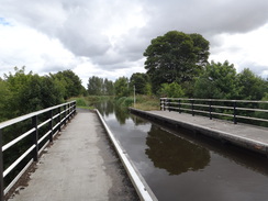
The Union Canal opened in 1822, but only had a couple of decades of prosperity before the opening of the first railway line between the cities started to take its traffic. It closed for commercial traffic in 1933, and fully in 1965. Parts of it were filled in, but a campaign saw it reopen fully in 2002. It is a contour canal, meaning it follows the contours of the land rather than use flights of locks, and indeed I saw no locks on today's long stretch.
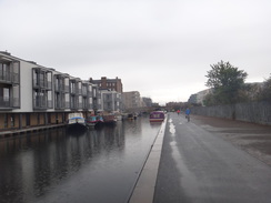
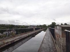
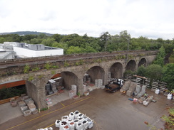
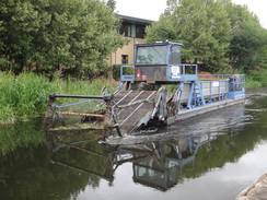
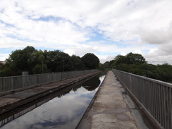
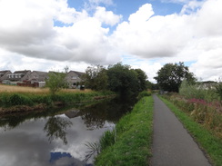
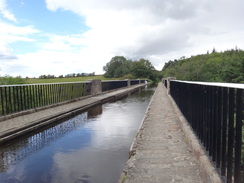
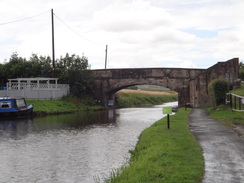
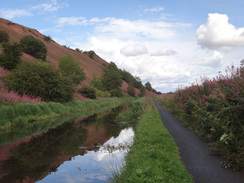
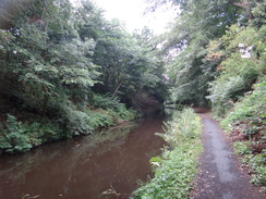
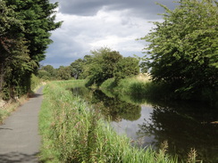
The towpath out of Edinburgh was manically busy, with walkers, runners and many cyclists, most but not all of the latter ringing their bells before swinging around the narrowed towpaths under the bridges. It got rather annoying, especially when one or two cyclists seemed to decide they had right-of-way over other walkers and cyclists. There was not much to be seen; there were occasional grand views over the Forth towards Fife, but most of the time the views were obscured by terrain, buildings or vegetation. A highlight was the 500-foot long Slateford Aqueduct, which carries the canal over the Water of Leith and a road; the adjacent railway viaduct being at a slightly lower level.
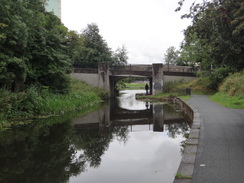
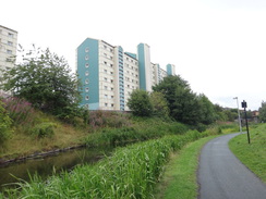
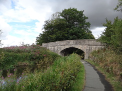
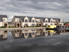
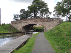
The towpath was still busy as the canal headed towards Wester Hailes. The canal here had been filled in during the 1960s when the surrounding housing was developed, and it had to be rebuilt before the canal could be reopened. I think the canal now takes a slightly different route, and most of the overbridges are to a standardised design - and not a bad-looking design at that.
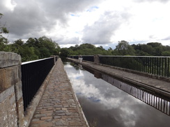
After this, another aqueduct carried the canal over the A720 - a massive road of twelve or more lanes. The aqueduct was named after Scott Russell, who discovered solitary waves on this canal. He noticed that when a barge stopped suddenly, a solitary wave moved forwards for a mile at faster than walking pace. His name sounded familiar, and it is indeed the same Scott Russell who built Brunel's Great Eastern steamship. Whilst Brunel is famed and has many things named after him (including a university), Scott Russell just has this long but rather plain modern aqueduct. Perhaps this is unfair to him, as his discovery of the waves has led to a fruitful area of science that made things like fibre optics possible. He also made one of the first experimental observations of the Doppler Effect, and HMS Warrior, the ship Sencan and I got married on, is known as a 'Russell Ship'.
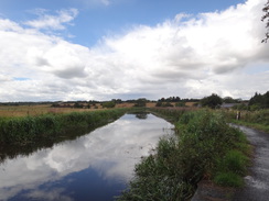
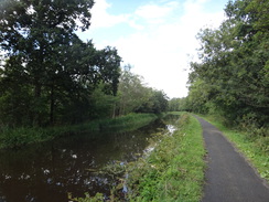
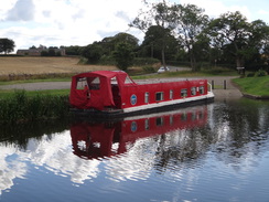
After this the canal's character became more rural, although this effect was somewhat spoilt by the M8, which lies about half a mile to the north. The motorway's noise was very intrusive at times, and I strode on with my head down towards the village of Ratho. A canal-side pub in the village was the only one I passed today; usually canals have many pubs, some so old they must have served Victorian bargemen. Ratho is obviously fond of its canal, and there were plenty of canalside information boards and sculptures to look at.
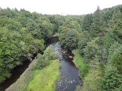
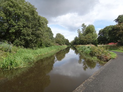
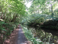
The canal left the village and passed close to the junction of the M8 and the M9, and then reached the Almond Aqueduct over the River Almond. At 420 feet long, this is the shortest of the three aqueducts on the canal, but is apparently very scenic; there were certainly some grand views down the river from the towpath. The canal passed under a railway bridge as the clouds started to gather, and the heavens opened as I neared a bridge under the motorway. A cyclist was sheltering under the bridge but I pressed on; fortunately the rain soon ended, and the sun came out as the canal turned north through Broxburn. Again the village mostly hid out of view, and I started to dislike this stretch of canal as it diverted from its proper westwards course.
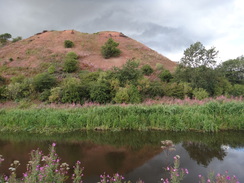
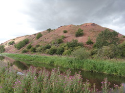
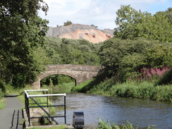
Large red mounds had been visible to the north for the last few miles, with one looking a little like a miniature Ayer's Rock. These are tips called 'bings', the remains of large-scale industrial concerns that obtained oil from the shale rock in the area after the first commercial oil refinery in the world opened nearby in 1851. The tips are breathtaking in scale, and what looked like motorcycle tracks up the side of one must have provided a scary ride, especially as a fall would have seen the rider end up in the canal! The heaps shone orange in the infrequent sunny periods, and the lack of vegetation suggests that chemicals remain within the rocks.
I had just about dried out when it started to rain once more, and I pulled up my hood as the canal entered a long cutting. The canal remained in the cutting through the village of Winchburgh, which I did not see any of. It passed a massive tip on the right, this time of blue-grey shale, which stretched up at a steep angle, and a similar one on the other side of the canal. It is amazing how, aside from the tips, there is no sign of the massive industry that once dominated this area. Signs by an old wharf in Philipstoun stated that it was once the centre of a network of narrow-gauge railways and other transport links - it is hard to imagine such a tranquil spot was once a hive of industry!
My clothes dried out as the canal headed due west, climbing above the surrounding land and offering me views for the first time in the last couple of miles. It soon entered Linlithgow, where the ruins of the palace hung over the surrounding rooftops. I passed the station which sits below the canal, but there was no obvious way down as the rain restarted. The shower got heavier as I found a road that led down to the station. I got inside the waiting room just as the heavens opened, and I was thankful to be inside, even if there were no available seats.
I am absolutely shattered after this walk, which was sadly not a classic. The centre of Edinburgh had brought back memories and was as fantastic as ever, but walking over twenty miles without a break will always be a long day, and outside Edinburgh there was not much to entertain me. The highlights were the centre of Edinburgh and the bings that towered over the canal.
 |
 |
|
Directions
This walk starts off on the concourse of at Edinburgh Waverley station at NT25797385. From the concourse, use stairs or escalator to ascend onto the green footbridge, and then turn right to head south along the footbridge, climbing some steps to reach the Market Street exit. Turn right along Market Street for a few metres to a pedestrian crossing, and use this to cross the road before going through an archway into 'Fleshmarket Close'. Climb the many steps until they end at Cockburn Street at NT25877369.
Turn left and follow Cockburn Street uphill as it curves gently to the right, soon ending at a junction with the Royal Mile. Turn right to head up the High Street (part of the Royal Mile); continue straight on as the road becomes Lawnmarket and passes a mini-roundabout and narrows to become Castle Hill; this ends at Edinburgh Castle's esplanade. Walk on to reach the entrance to the castle at NT25267348.
Do not enter the castle, and instead turn around to head back down Castle Hill. When a mini-roundabout is reached beside an old church, turn right down Johnston Terrace. This heads downhill, almost doubling back on itself, with the castle towering above to the right. The road curves to the left and continues on to a mini-roundabout; head straight on for a short distance until the road forks. Take the left-hand branch that soon ends at a junction with Bread Street at NT24947318.
Turn left to head east along this road, and when it soon also forks, take the right-hand branch that curves right to nearly double back on itself and becomes East Fountainbridge. Follow this southwestwards; at a junction with the A700 Lothian Road, cross the road ahead using the pedestrian crossing and continue along Fountainbridge road. Follow the road on for about 350 metres from the A700 junction; when Gardner's Crescent comes in from the right, turn left along a cobbled path that heads between buildings, soon reaching the end of Lochrin Basin at NT24637283.
Keep the canal basin on the left and join its towpath. From here, follow the towpath for 34.3km in a general westwards direction until it enters Lithlingow; pass some moorings on the left and a couple of beach-hut style buildings on the right, and just before a road overbridge is reached at NT00427695, turn right past a squeeze-gap in a fence to join a road. Turn right to follow this road downhill; there is a pavement on the left beside a stone wall. After 150 metres a gap in the wall on the left leads into Lithlingow station car park; the station lies immediately beyond the car park at NT00527706.
 |
 |
|
Distances
| From | To | Distance (m) | Ascent (ft) | Descent (ft) |
|---|---|---|---|---|
| Edinburgh Waverley station | Lochrin Basin | 1.5 | 132 | 91 |
| Lochrin Basin | Ratho | 8.1 | 0 | 0 |
| Ratho | Broxburn | 4.7 | 0 | 0 |
| Broxburn | Winchburgh | 2.7 | 0 | 0 |
| Winchburgh | Linlithgow station | 6.1 | 0 | 30 |
This makes a total distance of 23.1 miles, with 132 feet of ascent and 121 feet of descent.
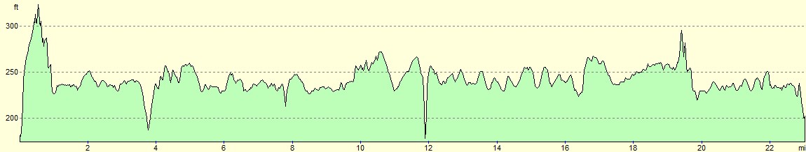
For more information on profiles, ascents and descents, see this page
Accommodation
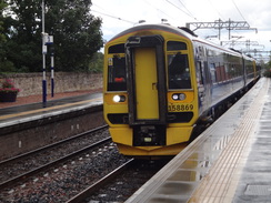
I spent the night at the Premier Inn hotel in Larbert, near Falkirk. This was about half a mile from Larbert railway station, which has regular services to and from Edinburgh and Glasgow without changes, allowing you to access large areas of the central belt.
Unfortunately it was rather expensive when I visited, as the Edinburgh Fringe was on in Edinburgh, and the European Championships in Glasgow, pushing up prices.
Transport
Regular train services run between Linlithgow and Edinburgh Waverley railway stations. See the National Rail Enquiries website for more details.
 |
 |
|
 |
 |
|
 |
 |
|
 |
 |
|
 |
 |
|
 |
 |
|
 |
 |
|
 |
 |
|
 |
 |
|
 |
 |
|
 |
 |
|
 |
 |
|
 |
 |
|
 |
 |
|
 |
 |
|
 |
 |
|
 |
 |
|
 |
Disclaimer
Please note that I take no responsibility for anything that may happen when following these directions. If you intend to follow this route, then please use the relevant maps and check the route out before you go out. As always when walking, use common sense and you should be fine.
If you find any information on any of these routes that is inaccurate, or you wish to add anything, then please email me.
All images on this site are © of the author. Any reproduction, retransmissions, or republication of all or part of any document found on this site is expressly prohibited, unless the author has explicitly granted its prior written consent to so reproduce, retransmit, or republish the material. All other rights reserved.
Although this site includes links providing convenient direct access to other Internet sites, I do not endorse, approve, certify or make warranties or representations as to the accuracy of the information on these sites.
And finally, enjoy your walking!
Nearby walks
| # | Title | Walk length (miles) |
|---|---|---|
| 114 | Tranent to Edinburgh | 10.6 |
| 115 | Edinburgh to Dunfermline | 17.4 |
| 222 | Edinburgh Castle to Seton Sands | 14.0 |
|
|

|