Walk #931: Hadrian's Wall Path: Chollerford to Newcastle
 |
 |
|
General Data
| Date Walked | 26/09/2011 |
| County | Northumberland, Tyne and Wear |
| Start Location | Chollerford |
| End Location | Newcastle Central station |
| Start time | 08.02 |
| End time | 17.42 |
| Distance | 26.9 miles |
| Description | This walk follows the Hadrian's Wall Path eastwards off the high ground towards the Tyne Valley. It is a slight let-down after yesterday's superb walk, but nonetheless is well worth doing. |
| Pack | Today I carried my 30-litre Karrimor rucksack, filled with water, my waterproofs, a book and other odds and ends. |
| Condition | This was a fairly long walk, but I have few problems to report aside from some chaffing and soreness to the underside of my feet. |
| Weather | Today was a lovely day for walking; it was mostly sunny with only occasional cloud, and it felt quite warm for the time of year. |
| OS map | Landranger number 87 (Hexham & Haltwhistle) and Landranger number 88 (Newcastle Upon Tyne, Durham & Sunderland) |
 |
 |
|
Map of the walk
Maps courtesy of Google Maps. Route for indicative purposes only, and may have been plotted after the walk. Please let me have comments on what you think of this new format. For a detailed table of timings for this walk, please see the table file.
 |
 |
|
Notes
I had my room in Greenhead Hostel to myself for the night, and this meant that I woke up rather later than I had wanted. It did not take me long to get my belongings together and I was soon driving eastwards down the A69 towards Chollerford, where I had ended yesterday's walk. Unfortunately getting the right road out of Hexham proved more difficult than it should, but eventually I parked the car in a lay-by just up the road from the George Hotel in the village. It was not the safest or best place to leave my car, but a quick drive around the village showed that there was little alternative.
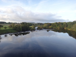
The views of the North Tyne from the bridge were superb in the low sunshine, and I carefully dodged the traffic in order to get photos in both directions. Sadly the first couple of miles were all road walking; initially uphill along the Military Road and then the A6079 towards the little hamlet of Wall (which makes me think of the film 'Stardust'). Since there was still a long way to walk I did not bother going to see the remains of a turret in a field, which were the only signs of Hadrian's Wall obviously visible.
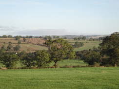
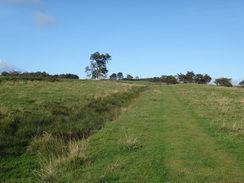
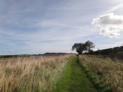
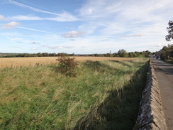
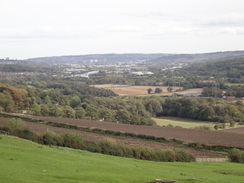
The trail diverted along a minor road before Wall was reached, still climbing. It eventually rejoined the Military Road, meaning that the diversion along the A6079 was really unnecessary unless you wanted to visit the turret. It then started to follow the Military Road eastwards, which it would roughly follow for the next fifteen miles to Heddon-on-the-Wall. I had not really been expecting another climb and therefore the ascent was unwelcome, especially on what I was hoping would be a long day, but it did allow some grand vistas to the north. Whereas yesterday the views had been across moorland and forests, now it was distinctly arable with a patchwork of fields stretching off into the distance.
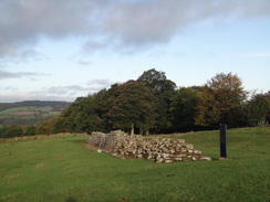
A solitary remnant of wall protruded from the ground at Planetrees, and this was to be the last that I was to see directly on the trail. It was nowhere near as impressive as the earlier sections had been, but I can imagine that it would be exciting to people walking in the other direction, for whom it may well be the first bit of wall seen.
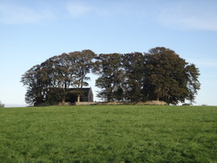
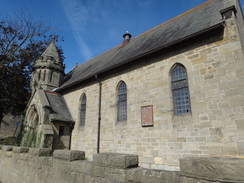
The trail continued eastwards, mostly running alongside the road. At one point there was a large wooden cross standing in a lay-by beside the road, which I soon realised was a war memorial. Its presence was explained by the church standing in the field nearby, surrounded by a low stone wall and trees. It was a remarkable place for a church, and I can only wonder if its presence is connected with the battle site marked nearby on the OS map.
The gradient slackened and the walk turned into a fairly uninteresting slog beside the road. I met my first trail walkers of the day near the roundabout with the A68; they did not seem to be happy and I could understand why, as this was by far the most underwhelming stretch of the trail so far. Fences constrained the trail for a long way with frequent stiles that proved annoying on tired legs, and I can only assume that the landowners were not keen to have the trail running through their land.
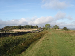
Things improved after passing the lumps and bumps of Downhill Quarries. The trail climbed up towards Halton Shields, and it was a relief to be able to walk without having to stop every twenty yards to negotiate a stile. Soon a steady stream of walkers started to pass me in the opposite direction, all seemingly hurrying to get to the fantastic scenery ahead. And who could blame them, for this stretch was distinctly uninteresting with few, if any traces of the wall visible. The Wall had been demolished for the construction of the military road that I was walking alongside, an act of vandalism that was criticised even as it was being done. The Wall's ditch was visible in places, and indeed the path walked along the bottom of it for a period.
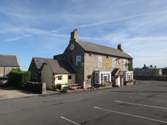
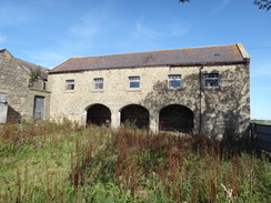
The pub at East Wallhouses was not yet open so I walked on, meeting yet more trailwalkers. After passing the glittering waters of some reservoirs the trail rose steadily to Harlow Hill where there a scattering of houses surround an old chapel. This seemed fairly ornate from the outside, until a quick glance around the back showed that it had been converted into a barn! The secular had made way for the agrarian.
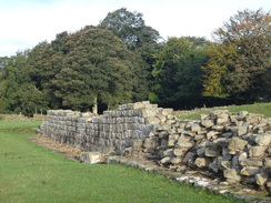
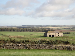
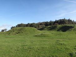
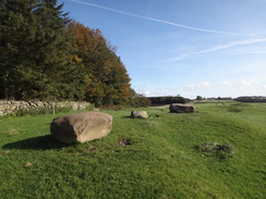
Not much can be said about the walk eastwards. The trail made two diversions away from the road, one around Iron Sign (where I would be staying for the night) and another to visit the Vindobala fort, which is little more than bumps in a grassy field. Some photos showed the stonework and objects uncovered by excavations, but it was a little underwhelming when compared with the wall remnants seen earlier in the trip. I soon came across a man who was raking out molehills. He was a Hadrian's Wall Path volunteer and we chatted for a while before he kindly gave me a free postcard. So many trails depend on these volunteers to keep them clear and maintained, and yet they are seen so infrequently.
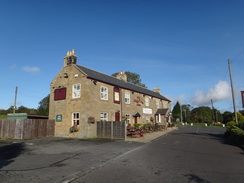
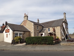
The B6318 jinked away to cross over the A69 before continuing on into the village of Heddon-on-the-Wall, and I decided to stop at the first pub I came across. There was still some distance for me to walk today, but as I had not had any breakfast I decided to have a meal. Sausages and Yorkshire pudding seemed to suit the day, and I washed this down with a couple of pints of shandy. An Australian couple were in the pub and it turned out that they were walking the trail; my leaving was delayed by a long and welcome chat.
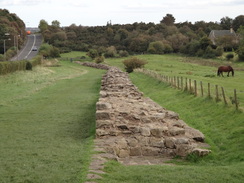
A short diversion off the trail was rewarded by the last stretch of the Wall I would see today. A few courses of stone stretched off eastwards, remnants that had somehow survived the construction of the road. The trail itself left the course of the Wall, descending steeply southwestwards through the village. A continuous stream of walkers came past me including a large bunch of Canadians (whilst the West Highland Way is popular with Germans, this trail seemed to be filled with people from North America).
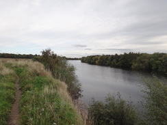
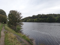
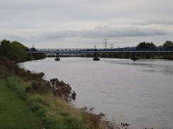
Cars were parked on the narrow road by Close House, but the trail continued on past a golf course and playing fields towards the Tyne. Before this it reached the site of the Wylam Colliery Wagonway, one of the earliest railways and an inspiration for George Stephenson, whose lived just half a mile away from the line. I seemed to go wrong a little here and started following the path around the northern bank of the river as marked on the OS map, whilst the trail actually seemed to follow the old railway trackbed. This was no bad thing, however, as the views over the river were good and in many ways better than those I had obtained from the Speyside Way.
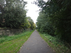
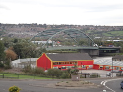
I soon rejoined the trail proper as I passed the last couple of stragglers, walkers who were making their way towards Heddon-on-the-Wall for the night. The trail rejoined an old railway trackbed, leaving the river behind as it headed towards the centre of Newcastle. A short but annoying climb took me over the A1 before dropping back down to the old railway line. Massive buildings sat below me, presumably factories, whilst to the left a hillside was being landscaped by a fleet of yellow machines. Occasional glimpses of the path's railway heritage could be seen, with bridge abutments and signal bases having somehow survived the scrapman's torch.
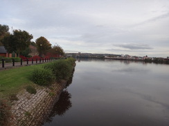
It was a relief when the path dropped away to reach the riverside once more. The views across the river were invariably interesting, if always urban. A series of boards contained information about the area, with many focussing on the Armstrong engineering empire that built so much of Newcastle. I really wanted to catch the 17.54 train back to Hexham, but unfortunately I was running late.
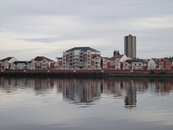
I ended up jogging along the riverside terrain, and must have looked a strange sight with my walking poles held in my hands. There were lots of things to see alongside the path, and despite my hurry I managed to take a few photos as I went along. The Newcastle waterfront is undeniably impressive, although I must admit the sight of the Dunston Coal Staithes on the other bank impressed me the most - a symbol of the industrial heritage that built the city. It was a shame that it was in such a semi-derelict state, with a large section missing due to a fire.
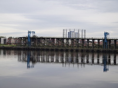
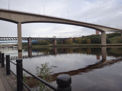
The bridges that span the river in the city centre soon loomed large in front of me, and soon I was faced with deciding how to get to the station, which was situated on the high ground above the river. Annoyingly the main entrance turned out to be at the far side of the station and I hurried around and found a ticket machine to buy a ticket to Hexham. In the end I had ten minutes to spare and so I used a vending machine to get a bottle of water - unfortunately it refused to dispense it, leaving it poised on the edge of the drop. A friendly, tiny and undeniably cute member of platform staff kindly tilted the machine for me (as I did not want to get into trouble for doing so), getting me my much-needed drink.
After reaching Hexham, I had to get a taxi north from Hexham back to my car at Chollerford. It cost a tenner, but I could not really begrudge that cash after what had been a long and enjoyable stroll. The B&B that Sencan booked for me proved easy to find as I had walked past it during the day. Tomorrow's walk is only about five miles to Wallsend from the centre of Newcastle, but I will extend this by walking to the sea at Tynemouth (thereby making the trail a truly coast-to-coast walk) and then possibly up towards St Mary's Lighthouse.
This walk starts off at the roundabout of the B6318 and B6320 in Chollerford at NY918705. Head south along the B6318, passing the George Hotel on the left to carefully cross the North Tyne at Chollerford Bridge, using the pavement on the left-hand side. It crosses a bridge over an old railway line and continues uphill along the road for nearly half a mile before a crossroads is reached with the A6079; turn right and follow the A6079 as it continues climbing uphill. Off to the right is a waterwheel on the side of a house, strangely situated on a hill with seemingly with no stream feeding it. It soon crosses the line of Hadrian's Wall, and although it remains fairly invisible on the ground the remains of Turret 26B lies a short way off to the left, and can be visited.
Half a mile after the roundabout, a lay-by is reached on the right. Here turn left up a narrow, tree-lined lane for another half-mile; this slowly climbs before it ends at a T-junction back with the B6318. Do not join the main road, but instead turn right along a path that leads into the trees, paralleling the road. Follow the obvious path through the trees; it emerges out over a ladder-stile over a stone wall into a field. Continue uphill for a short distance with a fence on the left to another ladder-stile over a stone wall; cross this to enter another field and head towards a short stretch of Hadrian's Wall at Planetrees. This is the last stretch of the wall visible on the trail until the reconstructed stretch at Wallsend, although there is a some visible remains a short distance off the trail in Heddon-on-the-Wall.
Walk past the wall, and then angle slightly to the left to head back towards the field wall. Cross a ladder over a wall to climb up onto the B6318; carefully cross the road and then turn left for a couple of yards and then right up a track. Immediately turn right over a stile over a fence to enter a field to the north of the road; continue on with the road on the right. At the end of the short field cross a ladder-stile over a field wall; at the top of the next field cross a stile over a fence and continue on uphill. Pass a ramshackle barn on the right and head on to another ladder-stile over a stone wall.
In the next field the gradient flattens out; continue on with a stone wall on the left. As the stone wall turns to the left, the path curves to the right to head back towards the road; aim for a large wooden cross that sits in a lay-by. Off to the left is St Oswald's church, which sits within a stone enclosure. Do not go through the gate onto the lay-by, and instead turn left to head eastwards with the field wall and road on the right. At the end of the field the path goes through a wooden clapper gate and squeeze between farm buildings on the left and the road on the right; do not join the road but instead continue on along stone slabs that lead in front of some cottages.
At the end of the cottages, the path heads down some stone steps and continues on with a fence on the right to a clapper gate. Follow a ditch on the right (actually the wall's north ditch) and go through a gate. It crosses a series of ladder-stiles as it heads across fields with the ditch on the right. At NY952694, a mile after the lay-by, it crosses a ladder-stile to reach a track. On the other side of the track the path continues on, still with the ditch on the right.
After another half-mile it goes up a flight of stone steps, then crosses a stone-stile to reach the surfaced access track to Errington Hill Head Farm. Turn right along the track for a few yards to reach the B6318 and carefully cross the road; Climb a stone-stile in an alcove to enter a field on the south side of the road. Parallel the road to reach a ladder-stile over a field wall that leads into some sparse woodland; continue on parallel to the road until it crosses a ladder-stile over a wall to reach a road at NY964691.
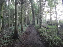
Cross the road and then another ladder-stile to run between a wall on the left and a fence and some woodland on the right. Continue on to a pedestrian gate; go through this onto a track. Turn right up the track for a few yards and then turn left through another gate to enter the woodland. The path continues to parallel the road until the end of the trees are reached; it then turns to the right to head south for a short distance until a wooden clappergate leads through the wall on the left.
Go through the gate and head east across a field, with a ditch (part of the Wall complex) on the right. Cross a ladder-stile over a fence and continue on with grand views to the left; at the end of this field it crosses a ladder-stile over a field wall to reach a surfaced lane; turn right up this lane for a few yards before turning left over another ladder-stile to enter another field. Continue downhill with a fence on the left and a ditch on the right; at the bottom of this field cross a ladder-stile over a fence. Near the bottom of the next field the path curves slightly to the left to reach a ladder-stile over a field wall to emerge out onto the A68 road at NY987686, right beside the Errington Arms.
Go through the pub car park to reach the A68; carefully cross the road and turn left along the verge to head towards a large roundabout, keeping a hedge on the right. Just before the roundabout follow the hedge as it turns sharply to the right. This joins a surfaced road for a short distance; as this curves to the left the path continues straight on along a grassy path as the B6318 approaches on the left. After a short distance turn right over a plank bridge that leads to a stone wall before descending down a ladder into a field.
Turn left to start following the path downhill, with the road close by on the left. At the bottom of the field it crosses a stile over a fence and continues downhill across another field, curving slightly to the right near the bottom to cross a flagstone bridge over a stream. On the other side cross a ladder-stile and continue on with a triangular patch of trees to the left. The path heads uphill; when the trees end continue on with a wall on the left guarding the path from the B6318. Cross a ladder-stile over a field-wall and head on with a wall on the left, passing an ornate gateway on the left. This whole section is dominated by numerous stiles and a fence that separates the path from the fields to the right.
Simply walk between the fence on the right and the field wall on the left, crossing any stiles that you come across. It passes Halton Red House on the other side of the road and then crosses a stonestile over a field wall at NZ003685 to reach the lumps and bumps of Downhill Quarries. The path curves slightly to the right, aiming between two parts of the quarry. Once it crosses a track turn slightly to the left to head uphill across the earthworks towards a band of trees that are guarded by a field wall. Off to the right is a particularly well-preserved stretch of the Vallum. Join the field wall and keep it on the left; it crosses another stile as it approaches the B6318 once more.
The path continues to parallel the B6318 for a quarter of a mile, crossing more stiles on the way. Go through a stone-stile in a field wall, cross a short track and then go through another stone-stile. After a short distance cross a stone-stile to emerge out onto the roadside at NZ009686; continue on with a field wall on the right and the road on the left for about fifty yards and then carefully cross the road; continue on with the road on the right. The verge is wide and safe to follow, but a pavement starts after a layby. Pass the farms at Carr Hill and then Halton Shields; when the pavement on the left side of the road ends at NZ020686, cross over to the southern side of the road and continue along the pavement on that side.
A sixth of a mile after crossing the road, the pavement ends when a road comes in from the right. Cross this road and on the other side turn right to climb some steps that lead through a wall into a field; turn left and follow the path as it parallels the road on the left; a fence is on the right for much of the way. After 0.8 miles, shortly after passing the farm at Matfen Piers on the other side of the road, turn left through a pedestrian gate to join the road once more. Carefully cross it and turn right to walk along the verge for a few yards towards a road junction at NZ033685.
Cross the road junction, and on the other side cross a stone-stile to enter a field. From here the path runs alongside the north ditch, with the road off to the right and a field wall to the left. When the wall jinks to the right, turn left over a stone stile over the wall and head diagonally across the field. This then heads through a clapper-gate and turns half-right to continue with a hedge on the right and a fence on the left; several stiles need to be negotiated. When the hedge ends, pass through a clappergate and turn sharply to the right to continue south with a hedge on the right, soon passing the farm at Wallhouses on the right. Unfortunately this stretch involves crossing a series of annoying gates. As the ditch is approached, go through a clapper gate and turn half-left for a few yards to another gate. Go through this and turn left to continue between a fence on the left and the ditch on the right, crossing a stile on the way. Cross a stone-stile to reach the road to West Moorhouses at NZ043684.
Cross the minor road, and then a stone-stile on the other side to enter a field. Continue on with the ditch on the right and a fence on the left; after a couple of hundred yards turn right to cross a footbridge over the ditch. On the other side of the bridge, go through a gap in a low stone wall to reach the B6318. Turn left to start following the road eastwards for a third of a mile. Immediately after it passes a house on the left, turn left up a track and then immediately right down some steps to join a path that follows the bottom of the ditch.
The path passes through a couple of clapper gates and then a pedestrian gate; go through this and immediately turn right to reach the B6318 once more. Turn left and follow the road as it immediately passes in front of the Robin Hood Inn. Pass the pub and a couple of houses on the left, and just before the verge ends turn left down a track and then immediately right through a pedestrian gate. This leads down a few steps back into another field.
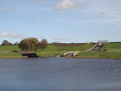
Keep a hedge on the right as the path heads gently downhill, crossing any stiles and gates that you come across. Eventually it goes through a clapper-gate to reach the B6309 road at NZ064682. Cross the road and go through another gate on the other side to continue with a crash barrier to the right and a fence to the left; beyond the fence is a small reservoir. After crossing a small bridge, a gate leads off to the left, taking the path off the road. On the other side of the gate turn right to follow a good path uphill, with a reservoir bank to the left; this soon reaches a picnic area at NZ068682 that is a good place to stop for a rest.
Leave the picnic area through a gate and continue uphill, with a hedge and road on the right and a fence on the left. The ascent is gentle and not in the least bothersome. Half a mile after the picnic site the path approaches some woodland; go through a gap in a stone wall and follow the path as it winds to the left and then right through the trees; it eventually reaches a stone-stile that leads back out onto the B6318. Turn left to walk along the verge past the settlement of Harlow Hill; a narrow pavement soon begins.
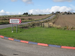
Shortly after the last building on the left (currently a garage), turn left through a gap in the wall and then immediately right, to head downhill with a fence on the left. After a quarter of a mile it goes through a pedestrian gate to reach the access road to Albemarle Barracks at NZ084681; the kerbs at the road junction are gaily painted. Cross the access road and go through a pedestrian gate on the other side to continue with a field on the left and the road on the right.
A short distance later the path goes through a gap in a fence to reach a minor road. Turn left along the road for a few yards and then right through another gap in a fence. Descend a few steps into the bottom of the ditch and then continue downhill along the ditch, initially along some stone flags. It reaches the bottom of the slope at the end of the first field and goes through a pedestrian gate before climbing uphill once more.
Halfway up the next field at NZ097678 climb some wooden steps and then turn right across a footbridge that leads onto the B6318. Carefully cross the road and on the other side descend some wooden steps into a field, and then turn left to start following the path uphill with a hedge to the left. At the end of the field follow a slope that leads up to the left onto the roadside. Continue on along a pavement with the road on the left until a crossroads is reached at NZ103676, opposite the farm and B&B at Iron Sign.
Turn right to head south along the road for a sixth of a mile and then turn left to join a path with a hedge on the right and a fence on the left. At the end of this first field the path curves to the left left to head north with a fence on the left uphill back towards the main road. It does not join the road, and instead turns to the right to parallel the road, with a field on the right. At the bottom of the field cross a footbridge over a stream, and then continue on uphill through a field, still roughly paralleling the road.
At the end of the next field go through a wooden clapper gate and then turn right to follow a fence on the right around the edge of the Vindobala Roman Fort. The path soon curves to the left to head eastwards to a pedestrian gate. Go through this onto a minor road. Turn right along the road for a couple of yards and then left through another pedestrian gate into another field. The path soon curves to the left and then the right to approach the road on the left once more. Continue along the path as it parallels the road for another half a mile downhill, going through a gate on the way. The A69 trunk road becomes visible ahead.
At the bottom of the field the path curves to the left to reach some steps. Climb up these to reach a clapper gate that leads out onto the B6318. Turn right and follow the B6318 on the left until it ends at a T-junction. Here turn right to continue along the B6318 as it crosses the A69 on a bridge. Continue along the road as it curves sharply to the left to head eastwards; there is a good pavement on the left-hand side of the road that makes the walk safe. Eventually the road reaches a T-junction at NZ133670 opposite the Three Tuns pub in the village of Heddon-on-the-Wall.
Carefully cross the road ahead and turn right and then immediately left down Towne Gate. After a few yards turn left past a metal vehicle barrier along a rough track that leads between low stone walls; this climbs up a slight hill and then passes a large house on the left. Immediately past the house the track curves to the left; here continue straight on along another track that soon ends at a T-junction back at Towne Gate. If you wish to see the last stretch of wall on the trail, then a short and worthwhile diversion off to the left will take you there; this is the first stretch of wall to be seen if you are walking east to west. Sadly it does not lie directly on the trail.
Turn right down Towne Gate and follow it as it curves gently to the right. Take the second road to the left, Heddon Banks, and follow this as it curves to the left to head downhill to the south, with the first views of the Tyne becoming visible below. The road slowly curves to the right to take a more westerly course as the gradient slackens; it passes under some high-tension power lines before curving sharply to the left to continue falling, passing under a second set of power lines. The track curves slightly to the right before ending at a T-junction with a surfaced track at NZ126659, immediately to the north of the Close House Hotel.
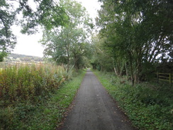
Turn left to follow the track eastwards; it soon passes a vehicle barrier and curves to the right, becoming a path that heads gently downhill through some trees. The path joins a track on the left; turn left down the track for about five yards to reach a surfaced road. Turn right down this road; When it curves to the right towards a small car park (belonging to the adjoining golf course, and not open to the public) turn left along a short gravel track that crosses a bridge and soon curves to the right to enter some playing fields. On entering the fields turn right, keeping a band of rough ground on the right. Halfway down the field turn left to angle towards a corner of a hedge ahead and keeping the playing fields to the left. Join the hedge and turn right, keeping the hedge on the right to reach a clapper gate that leads onto a cycle path that runs along the course of the old Wylam Tramway.
Here the official path runs eastwards along the tree-lined cycle path; however a much preferable route crosses the cycle path and turns right to follow the northern bank of the River Tees, with grand views over the river. The official route follows the cycle path for a mile, passing through a few gates on the way and Haddon Haughs farm on the left. When the end of a road is reached at NZ150654 turn right down a surfaced path that heads south, passing a row of houses on the left. At the end of the houses the path curves to the left and joins the riverbank.
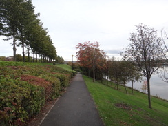
Follow the good path eastwards with the river on the right. After half a mile the path curves to the left beside a concrete slipway sloping into the river, with the Tyne Riverside Country Park Visitor Centre ahead. Turn right to cross the top of the apron, and on the other side turn right to continue along a surfaced path with a small car park on the left. As the road into the car park sweeps to the left, continue straight on along the path as it crosses a footbridge over a stream. On the other side of the bridge turn right to follow the path as it continues along the northern bank of the river.
Continue on for a little over a third of a mile; the path passes the Boathouse pub on the left and becomes a surfaced road that soon ends at a traffic-light controlled junction with the road that leads towards Newburn Bridge on the right. Carefully cross the road and after a few yards turn half-left to join a cycle path that follows the course of an old railway line.
The cycle path heads in a rough easterly direction for a little over a mile and a half until it approaches Neptune Road; it parallels the road on the left for a short distance before ending at the road at NZ191644. Carefully cross the road and head uphill along a surfaced track, keeping some trees to the right. As the gradient slackens it reaches a footbridge over the A1; turn right across this and on the other side turn sharply to the right along another surfaced path. Follow this as it heads downhill; it curves to the left and then the right to pass some playing fields on the right; it passes a building on the left before curving sharply to the left to reach the A191 road at NZ197642.
Turn right to follow the A191 downhill; when a traffic-light controlled crossing is reached cross the road and continue downhill for a short distance until Fowberry Road leads off to the left. Follow this eastwards for about a hundred yards; as it reaches some gates ahead turn right down a path that leads back onto the old railway line. Follow this eastwards for a mile until it emerges out onto the northern side of a dual carriageway. Continue on along a cycle path beside the dual carriageway until some traffic lights are reached at NZ215634.
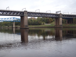
Use the lights to cross onto the southern side of the dual carriageway, and then turn left to head eastwards with the road on the left. After a little under a third of a mile turn right down William Armstrong Drive; this soon curves to the left to run parallel to the northern bank of the Tyne. After a while take a path leads down a ramp to the right; this slopes down to reach a little car park. From here follow the path beside the river for a mile and a half; it passes under the King Edward road bridge and then a railway bridge at NZ246633.
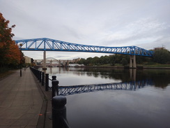
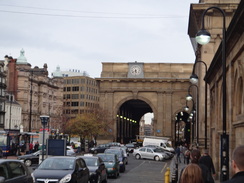
Just before a blue railway bridge is reached, turn left to leave Hadrian's Wall Path and join Skinnerburn Road. Turn right along this for a few yards until it ends at a T-junction with the B1600. Turn left along this road as it climbs uphill and curves to the left to pass under a large railway bridge. On the other side of the bridge turn right along a road, keeping the railway line to the right and the Life Centre on the right. This road ends at a T-junction with the A186 in the centre of Newcastle; turn right to reach the entrance to Newcastle Central railway station at NZ245638.
This makes a total distance of 26.9 miles, with 1938 feet of ascent and 2031 feet of descent.
Frequent trains run from Newcastle Central station to Hexham; after this you will need either to catch the Hadrian's Wall bus to Chollerford (only runs in summer), or get a taxi or a local bus service.
I spent the night at the Ironsign Farm B&B, a pleasant B&B situated right on Hadrian's Wall Path about two miles west of Heddon-on-the-Wall.
Please note that I take no responsibility for anything that may happen when following these directions. If you intend to follow this route, then please use the relevant maps and check the route out before you go out. As always when walking, use common sense and you should be fine.
If you find any information on any of these routes that is inaccurate, or you wish to add anything, then please email me.
All images on this site are © of the author. Any reproduction, retransmissions, or republication of all or part of any document found on this site is expressly prohibited, unless the author has explicitly granted its prior written consent to so reproduce, retransmit, or republish the material. All other rights reserved.
Although this site includes links providing convenient direct access to other Internet sites, I do not endorse, approve, certify or make warranties or representations as to the accuracy of the information on these sites.
And finally, enjoy your walking!
Directions
Distances
From To Distance (m) Ascent (ft) Descent (ft) Chollerford A68 at Port Gate 5.8 810 318 A68 at Port Gate B6309 5.2 141 453 B6309 Heddon-on-the-Wall 5.3 390 348 Heddon-on-the-Wall A1(T) 6.2 305 607 A1(T) Newcastle Central station 4.4 292 305 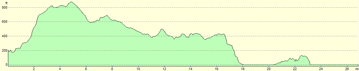
For more information on profiles, ascents and descents, see this page
Transport
Accommodation
Disclaimer
Nearby walks
| # | Title | Walk length (miles) |
|---|---|---|
| 231 | East Sleekburn to Howdon | 18.0 |
| 232 | Howdon Station to Sunderland Station | 15.3 |
| 930 | Hadrian's Wall Path: Greenhead to Chollerford | 20.2 |
|
|

|