Walk #913: Hereward Way: Peterborough to March
 |
 |
|
General Data
| Date Walked | 01/08/2011 |
| County | Cambridgeshire |
| Start Location | Peterborough station |
| End Location | March station |
| Start time | 08.30 |
| End time | 15.51 |
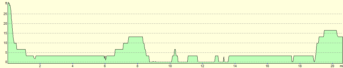
| Distance | 20.6 miles |
| Description | This was a long walk of two halves; the first half follows the River Nene eastwards out of Peterborough before diverting south to Whittlesey. After this the trail heads eastwards across classic Fenland territory, following drainage channels and crossing remote farmland to reach the town of March. |
| Pack | Today I carried my 30-litre Karrimor rucksack, filled with water, my waterproofs, a couple of books and other odds and ends. |
| Condition | My feet overheated slightly on this walk, which was unavoidable on such a warm day. Aside from this I feel fine after this walk. |
| Weather | Today was mainly cloudy with only occasional glimpses of the sun. It was, however, a very hot day despite the cloud. Fortunately there was a litle breeze blowing over the Fens that helped me to cool down. |
| OS map | Landranger number 142 (Peterborough, Market Deeping & Chatteris) |
 |
 |
|
Map of the walk
Maps courtesy of Google Maps. Route for indicative purposes only, and may have been plotted after the walk. Please let me have comments on what you think of this new format. For a detailed table of timings for this walk, please see the table file.
 |
 |
|
Notes
This walk was one of two legs of the Hereward Way that I was both looking forward to, yet was also slightly apprehensive about. The trail east from Peterborough follows the River Nene to Whittlesey before continuing across the perfectly flat Fens to the town of March. It promised to be an enjoyable stroll but I did not have particularly fond memories from when I had walked it ten years ago.
Since the car parking at Peterborough railway station is so expensive I decided to drive to March and get an early train to the city. Unfortunately the drive was excruciatingly slow because of tractors and lorries; I was trapped for twenty minutes behind a lorry that scarcely managed to scrape above thirty miles an hour. It is a common problem at this time of the year in the Fens, when farmers spend every daylight hour harvesting their fields. To make matters worse I had misprogrammed the SatNav to take me to Manea station rather than to March.
I arrived at March station and parked up, buying a ticket for the day for just �2.80. My delays in getting to the station meant that I had missed my train and I was resigned to wait for an hour to catch the eight-thirty train. However the matrix display showed a Peterborough train was due in at just after eight so I nipped on this, happy that my earlier problems had not delayed me too much. On the train I chatted to a pleasant lady who had just been to the Cambridge Folk Festival with her son; she had seemingly had a very enjoyable time.
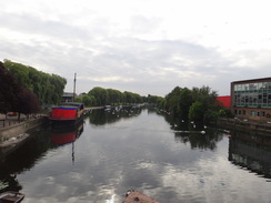
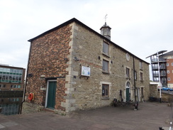
I decided to take a different route from Peterborough station back to the River Nene where I had left it the previous week. Instead of going through the centre of the city I headed along a main road past a large Asda store. Due to a closed stretch of path I followed the road to the main bridge over the river where I joined the Hereward Way beside a superb stone building.
The concrete steps that lead down to the river were dominated by ducks, geese and swans and their droppings. Indeed the entire area stank of ammonia and it was pointless trying to avoid stepping in the mess. Birds may be beautiful to look at, but I doubt about the cleanliness or hygiene of having such a high density of them in a city centre. Indeed, the mess made what should have been a good walk out of the city notable for all the wrong reasons.
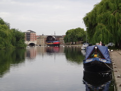
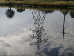
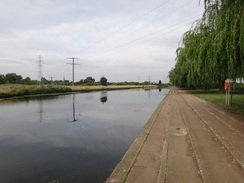
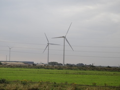
Things improved as the path and river headed under a large bridge that carries the A1139 high overhead. It was turning into a warm day despite the cloud cover and I was concerned that I would not have enough water to complete the walk, despite the extra litre that was in my backpack. The walk eastwards was interesting, not the least because of the wind turbines that stood on the other side of the river, joining the smoke-belching chimneys of the brickworks near Whittlesey.
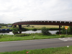
This stretch of path was along a cycle path that was fairly quiet; only two cyclists came past along with a jogger whose over-excited dog was running twice the distance to and fro. After a couple of miles the Shanks Millennium Bridge came into view. This gracefully-arching cycle bridge was not marked on the map and can only be seen as a positive thing; in particular it grants access to the Flag Fen area from the south of the river.
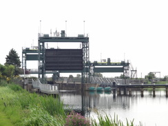
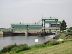
Unfortunately after this the going became worse as the cycle path ended and the trail followed the flood banking with a road alongside. Initially it proved easy for me to walk along the top of the bank but after a while the vegetation was so overgrown that I was forced to walk along the road. The roadside verge was wide and the views over the river were pleasant but the road was annoyingly busy, meaning that I had to step onto the verge to avoid the worst of the traffic. Soon the massive guillotine gates of the Dog-in-a-Doublet lock became visible ahead.
I love the name 'Dog-in-a-Doublet', and can only wonder if it has anything to do with the famous Rubens paintings. The lock is also home to a sluice that marks the upstream limit of the tidal Nene, despite being many miles from the sea. The nearby eponymous pub was boarded up; it must be hard to run a pub in such a remote location.
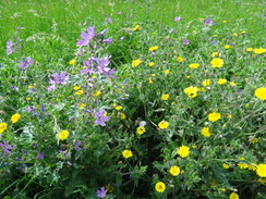
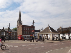
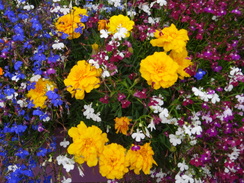
Here the trail left the Nene, heading south along tracks and roads into the town of Whittlesey, the last settlement of any size that I would be passing before the end of the walk. It was a relief to be off the road and the tracks were surrounded by the riotous colours of wildflowers. I headed to the town square where I found the George Hotel, now a Wetherspoon pub, was open despite the early hour. Knowing that I was unlikely to get anywhere else to stop today I nipped in for a quick drink and a rest. It was a classic Wetherspoons pub; neat and tidy with some reasonable beer on tap and lots of local information on the walls, and I read some of this as I supped.
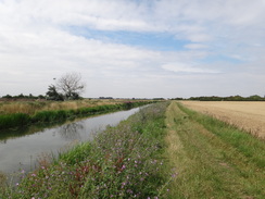
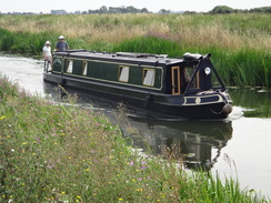
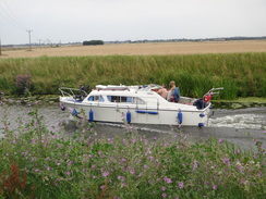
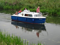
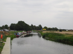
The rest of the day was rather hard on feet that soon started to overheat in the overly warm weather. A road took me southeastwards out of the town towards the wonderfully-named Turningtree Bridge, after which the trail headed along the northern bank of the Briggate River. A cruiser passed me as I walked, surprising me as I had not realised that the river was navigable.
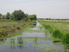
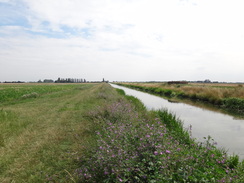
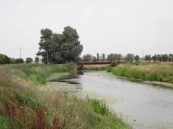
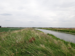
It was a pleasant stroll and for the first time in the day I was starting to get the best of the 360-degree views that the Fens grant over the surrounding flatlands. The trail joined a road for a short distance at Angle Corner Bridge before diverting off to follow the Twenty Foot Drain northeastwards. Many fishermen were sitting on the other side of the river, their cars lined up at the top of the bank. Several bridges broke the monotony of the stroll, especially a massive metal one that carried the March to Peterborough railway line over the drain.
Soon the trail joined a road that headed arrow-straight through Turves; I was glad that I had stopped for a rest in Whittlesey as the pub in Turves does not open on weekday afternoons. And no wonder; it is hard to think of a more remote spot and scattered settlement - it is a pleasant surprise that it had not long since closed. The village comprises a few houses strewn along a couple of roads that intersect at a railway level crossing, with the pub by the crossing.
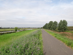
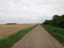
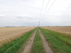
The trail continued south along the road before turning left to head east along the surfaced Quaker's Drove. This soon became unsurfaced as it continued on with fields of crops on either side. I could see three separate windfarms to my right, new additions from when I first walked this way ten years before.
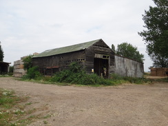
Eventually the track passed a barn at Top Hake's Farm, where it met a winding river that is the old course of the River Nene. This is just one example of how the local waterways changed during the many phases of the draining of the Fens - the current River Nene heads arrow-straight many miles to the north as it makes its way towards Wisbech.
My OS maps showed the trail following the western bank of the river northeastwards, so I ignored the obvious track that ran alongside and climbed up onto the bank. Progress was hard with many thistles overgrowing the bank; it was a good thing that I had not worn my shorts as my legs would have been ripped to shreds. Eventually it became so overgrown that I had to walk through a field for a short distance until the bank reached an old and ramshackled pipe bridge over the river.
Here the path diverted around a little inlet before joining a bank that had been renovated and reshaped; the lack of vegetation showing that the work had only recently been completed. The area had been left clean and tidy and I could make good progress to reach the gardens belonging to some houses. A waymarker pointed over a gate that would not open, so I clambered over and headed through three very neat gardens. The path continued along the bank on the other side towards some large buildings ahead. It had to divert around these, heading towards a road before making its way back to the river. The last stretch of path ran through a narrow gap between fences, and a large telegraph pole sitting in the middle of the gap nearly blocked the route.
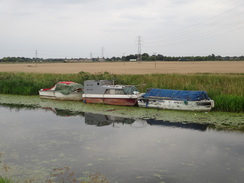
The trail did not stay on the riverbank for long and soon diverted off around a marina. This diversion was well waymarked and easy to follow and I was soon back at the river at the point where it immediately headed under the bridge that carries the A141 over the river. I stopped to talk into my Dictaphones and some children on the other side were convinced that I was a policeman; they were not convinced and soon scarpered. As far as I could see they were doing nothing wrong, and I should think that there would be fewer people looking like a policeman than me, with my pack, Tilley hat and muddy clothes.
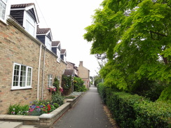
Usually the approach into towns are not very pleasant, often passing through industrial or post-industrial areas and masses of undistinguished housing. The walk into March, however, was very different with interesting houses and well-kept gardens stretching down to the river. It was a very good way to reach the centre of the town, which proved to be bustling. I stopped off at a shop to buy an ice lolly to help me cool down before walking back to my car at the railway station. It had been a good day's walk, and although the Fens is hardly classic walking terrain, there had been much to of interest to see on the stroll.
 |
 |
|
Directions
This walk starts off from Peterborough railway station. Leave the main station entrance and turn right; after about five yards it curves to the left at a mini-roundabout to head towards a multi-story car park. Just before this is reached turn right through a black metal archway (signposted for the city centre and the cathedral) down a cycle path, keeping the car park on the left. At the end of the car park turn left and then immediately right to join another cycle path that heads through an underpass into an area under a roundabout.
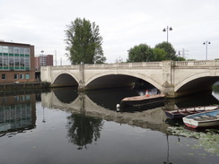
Head straight on, but instead of exiting through another underpass ahead, turn right through a third underpass that heads under the A15 road (signposted for the Nene Valley Railway). On the other side follow it as it turns sharply to the left to run between the road on the left and the station car park on the right. The road slowly curves to the left to take an easterly course, passing the car park for an Asda store on the right. When you reach a pedestrianised road on the right, turn right down it, passing a Magistrates Court on the left and the Rivergate shopping centre on the right. Head south along the road until it ends at the A15. Continue to the bridge over the River Nene, then carefully cross the road to reach the downstream side of the river. Do not cross the bridge and instead keep a lovely stone building on the right to reach a path that runs along the northern bank of the river.
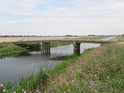
The next few miles follow the Hereward Way and Nene Way, which are coincident as far as the Shanks Millennium Bridge. After passing the stone building, turn right to join the riverside path which soon curves to take a more southeasterly course. After a third of a mile it passes under a bridge that carries the A1139 over the river, and then heads on for another half mile until the concrete riverbank ends at a stream inlet, with Fitzwilliam Bridge over the Nene on the right. Turn left and join a cycle path that crosses the inlet on a bridge. On the other side of the bridge continue along a good surfaced cycle path that heads eastwards along the top of the flood bank, with the river about ten yards away to the right. After 1.75 miles a road is reached at TL234984, with the Shanks Millennium Bridge over the river on the right.
Note: (2018): the route of the Hereward Way has changed between the footbridge and Whittlesey; it now crosses the footbridge and follows a cyclepath inland, avoiding the busy road. I have kept the directions on this page as they were when I walked the route (they are correct for the Nene Way).
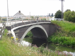
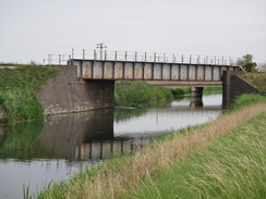
Here the trail follows the floodbank, with the road and river on the right. In summer months it may be possible that the bank is too overgrown to follow, in which case you will have to follow the road; the verge is wide. The road and bank curve slightly twice before settling onto an east-northeasterly course. After 2.5 miles it reaches the Dog-in-a-Doublet lock and sluice; the road diverts to the left around the lock and then right, heading past a now-closed pub before ending at a junction with the B1040 next to the Dog-in-a-Doublet bridge over the river.
Carefully cross the B1040 and then turn right to cross the bridge. Immediately on the other side turn left along a green track that runs along the southern bank of the river. After a couple of hundred yards the track curves to the right to head south-southwestwards towards some power lines. It becomes a gravel track; after nearly half a mile the track curves to the right to reach the B1040 once more at TL273985.
Turn left and start following the B1040 road southwards. It immediately crosses Little Bridge over Moreton's Leam; there is no pavement but the verges are wide. After nearly two-thirds of a mile the road enters Whittlesea; cross over a crossroads with Bassenhally Road at some traffic lights, pass the Ram Inn on the left and when take the road forks, take the left-hand fork that becomes Delph Street. After a couple of hundred yards the road curves to the right to head south for another couple of hundred yards. When it curves to the left once more, head straight on for a few yards to reach the A605 road in the centre of Whittlesea at TL270972.
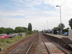
Cross over the A605 using the pedestrian crossing and continue south along the pedestrianised High Causeway. When this ends at a T-junction with Eastgate with the market cross on the right, cross the road using another pedestrian crossing and continue south along Station Road. Follow this as it heads south; after a fifth of a mile it curves to the left to take a more southeasterly course. It crosses the railway line via a level crossing immediately to the west of Whittlesea Station.
Follow the main road southeastwards; there is a pavement on the left. As it curves to the left after another 0.4 miles turn right to continue straight on along Turningtee Road (signposted for Ramsey). After a short distance this reaches Turningtree Bridge over the Briggate River; do not cross this and instead turn left through a metal gate to join a footpath that runs eastwards along the northern bank of the river. The path goes through a series of paddocks separated by two clappergates and a metal pedestrian gate before opening out into fields; it becomes a rough track as it passes Whype Farm on the left and after 1.5 miles it rejoins the B1093 road at TL306955.
Continue straight on along the B1093 as it crosses the Twenty Foot Drain at Angle Corner Bridge. A fifth of a mile after the bridge the road curves to the right to cross Angle Bridge; as it does so turn left to continue straight on along a gravel track before immediately turning to the left along a path that runs northwards between fields. After a sixth of a mile it reaches the southern bank of the Twenty Foot Drain and curves to the right to head northeastwards.
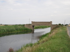
After a quarter of a mile the bank reaches a road called Wype Drove with Poplartree Bridge on the left; cross this and continue northeastwards along the bank for another half mile; the path passes Bate's Farm on the right before dropping down to join a track. Follow this northeastwards until it ends at a road at TL322966. Join the road and continue straight on as it passes under a railway bridge and immediately ends at a T-junction with another road, with Beggar's Bridge to the left.
From here you can either continue northeastwards along the road or follow the flood bank to the left. After 0.8 miles follow the road as it leaves the river by curving to the right to head south, with a bridge over the drain to the left. The road enters the hamlet of Turves, passing The Three Horseshoes pub on the right. Here the road curves to the left; continue straight on along another road that soon reaches a level crossing over a railway line. Follow this road for another half-mile until a road junction with Quaker's Drove is reached at TL334960.
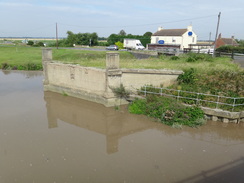
Turn left to start following Quaker's Drive eastwards for half a mile. After half a mile the surfacing ends at Bottom Hake's Farm and a rough track continue arrow-straight between fields. After 1.8 miles it reaches the western bank of the River Nene (Old Course) beside Top Hake's Farm at TL372954. Leave the track and head straight on to climb up onto the western floodbank of the river and turn left to start following it northeastwards with the river on the right. It passes a house on the left; after half a mile an inlet is reached next to a ramshackle bridge over the river.
Here turn left along the edge of a field for a short distance; just before the track is reached turn right through a gap in the hedge and then turn right once more to head back to the floodbank beside the river. Follow the flood bank eastwards as it heads across a couple of gardens. After a little under a mile it reaches a drain in front of some industrial units at TL391965; here turn left to leave the river bank and join a track that heads north with the drain on the right.
After a couple of hundred yards the path crosses a stile beside a vehicle barrier to ends at Whittlesey road; at the road turn right and follow it northeastwards for about a third of a mile with the buildings on the right. Just after a road comes in from the left, turn right down a narrow path that squeezes between tall hedges. This path heads southeastwards for another two hundred yards to rejoin the northern bank of the River Nene.
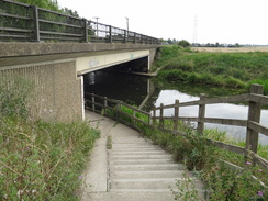
Turn left and follow the river eastwards; after a third of a mile it reaches a barbed wire fence that guards a marina. Turn left up a track that skirts the northern side of the marina, keeping a fence on the right. Cross the main access road to the marina and carry straight on still with a fence on the right. At the eastern end of the marina turn right down a path that parallels the A141 to reach the northern bank of the river once more. Follow the path as it curves to the left, descending down steps to immediately pass under the A141. On the other side it climbs up more steps to meet a surfaced track. Here turn right to follow West End Road through the western outskirts of March.
Follow West End as it winds in a rough easterly direction for a little under a mile, with the river mostly out of view behind houses and gardens to the right. When the road ends go past some bollards and continue straight on along another road for a short distance until it ends at a T-junction with the B1101 Broad Street in March at TL416967.
To get to March railway station, carefully cross Broad Street and turn left to follow it northwards through the centre of the town. When it ends at a T-junction turn right and use a pedestrian crossing to cross the road. On the other side turn right to continue along the road as it curves to the left to head north-northeastwards; the station is a little over half a mile away on the left at TL418978.
 |
 |
|
Distances
| From | To | Distance (m) | Ascent (ft) | Descent (ft) |
|---|---|---|---|---|
| Peterborough station | Whittlesey | 7.6 | 16 | 36 |
| Whittlesey | Turves | 5.6 | 13 | 26 |
| Turves | March station | 7.4 | 23 | 10 |
This makes a total distance of 20.6 miles, with 52 feet of ascent and 72 feet of descent.
For more information on profiles, ascents and descents, see this page
Transport
Regular railway services run between March and Peterborough, calling at Whittlesey on the way. All three railway stations are an easy walking distance away from the Hereward Way. See the National Rail Enquiries website for more details.
 |
 |
|
 |
 |
|
 |
 |
|
 |
 |
|
 |
 |
|
 |
 |
|
 |
 |
|
 |
 |
|
 |
 |
|
 |
 |
|
 |
 |
|
 |
 |
|
 |
 |
|
 |
 |
|
 |
 |
|
 |
 |
|
Disclaimer
Please note that I take no responsibility for anything that may happen when following these directions. If you intend to follow this route, then please use the relevant maps and check the route out before you go out. As always when walking, use common sense and you should be fine.
If you find any information on any of these routes that is inaccurate, or you wish to add anything, then please email me.
All images on this site are © of the author. Any reproduction, retransmissions, or republication of all or part of any document found on this site is expressly prohibited, unless the author has explicitly granted its prior written consent to so reproduce, retransmit, or republish the material. All other rights reserved.
Although this site includes links providing convenient direct access to other Internet sites, I do not endorse, approve, certify or make warranties or representations as to the accuracy of the information on these sites.
And finally, enjoy your walking!
Nearby walks
| # | Title | Walk length (miles) |
|---|---|---|
| 54 | Ely to March | 22.9 |
| 55 | Peterborough to Whittlesey | 8.6 |
| 56 | Peterborough to Stamford | 16.5 |
|
|

|