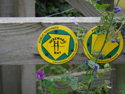
Walk #912: Hereward Way: Stamford to Peterborough
 |
 |
|
General Data
| Date Walked | 26/07/2011 |
| County | Cambridgeshire, Rutland |
| Start Location | Stamford |
| End Location | Peterborough station |
| Start time | 07.28 |
| End time | 14.14 |
| Distance | 18.4 miles |
| Description | This was a pleasant stroll following the Hereward Way eastwards towards Peterborough. It spends many miles following the course of the Roman road, Ermine Street, before joining the banks of the River Nene to head into the city. |
| Pack | Today I carried my 30-litre Karrimor rucksack, filled with water, my waterproofs, a couple of books and other odds and ends. |
| Condition | I feel absolutely fine after this walk. |
| Weather | Heavy cloud dominated today. There was no sight of the sun, and a few spits of drizzle. Despite this it was a good day for a walk. |
| OS map | Landranger number 141 (Kettering, Corby & surrounding area) and Landranger number 142 (Peterborough, Market Deeping & Chatteris) |
 |
 |
|
Map of the walk
Maps courtesy of Google Maps. Route for indicative purposes only, and may have been plotted after the walk. Please let me have comments on what you think of this new format. For a detailed table of timings for this walk, please see the table file.
 |
 |
|
Notes
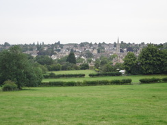
After yesterdays rather splendid stroll through Rutland, I felt like continuing the Hereward Way eastwards. The forecast was for cloud with no rain and so I set off for the drive up to Stamford. After parking I got my kit together and set off. Initially the trail climbs up out of the town, giving some good views over the beautiful stone houses and churches, before following the main road. A high stone wall to the left of the road gives a clue as to what lies beyond - the magnificent Burleigh House.
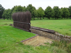
The house dates back To Elizabethan times, when William Cecil started construction. It is a massive pile with a roof that covers three-quarters of an acre. Sadly the house could not be seen from the trail as it passed a well-kept golf course; a ha-ha lay in the bottom of a ditch, so the hillside to my left could obviously be seen from the house. After leaving the golf course behind signs of the major claim to fame of the house came into view - horse jumps. The world-renowned Burghley Horse Trials have been held every September since 1961, and several of the jumps appeared to have been freshly spruced up in preparation.
Aside from a slight diversion, the Hereward Way follows the course of Ermine Street for over three and a half miles. This Roman Road originally ran from London to York via Lincoln, and strangely has a little dogleg in it near Barnack. As usual when walking Roman Roads I let me mind wander and I imagined myself as being a Centurion, my rucksack converted to a leather bag and my walking poles to a sword and shield. This little bit of silliness help me get a few miles under my belt. After leaving the grounds of Burghley House the trail crossed a series of fields in a characteristically arrow-straight course before meeting a road.
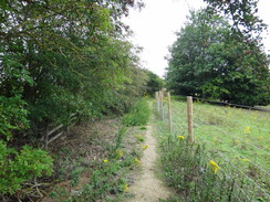
This was where Ermine Street and the trail curves slightly to take a more southwesterly course. After leaving the road it followed a wall on the left; a widely-spaced set of grand gateposts granted me a distant view of Walcot Hall in the distance. I was feeling as though I was in my element; it would have been nice if it was sunnier, but at least the cloud was helping to keep the temperature down. The ground underfoot was firm despite the overnight rain but my trouser legs were getting soaked from the wet undergrowth. Moisture was slowly seeping into the top of the boots and I could feel my ankles starting to get damp.
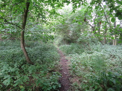
I had a decision to make when the path met another road in Southorpe. The original route of the Hereward Way headed south for a couple of miles along the road, still roughly following the course of Ermine Street. However a sign by Grange Farm showed that a new diversion of the trail had been created, looping to the west away from the road. This was not marked on my map but after a little prevarication I sketched the line and headed off. Some rough lumps and bumps to my left must have been the old fish ponds marked on the map, but these were soon left behind as the path entered some woodland at Southope Bottom.
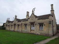
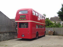
The new path proved to be well waymarked and easy to follow, with a series of posts with yellow blazes marking the way. It crossed a series of fields before joining tracks; the first headed past Sacrewell Lodge Farm, which had a couple of double-decker busses in a barn, and then onto Sacrewell Farm where there is a campsite. Eventually another track dumped me out onto the A47(T) immediately to the east of Wansford. This diversion of the trail was longer than the old one and although it was not classic, it was far preferable to the old route along the road.
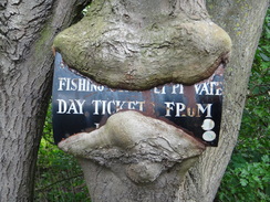
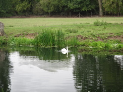
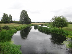
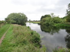
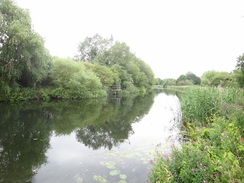
After crossing the A47(T) at a spot that was strewn with litter, the path headed down to join the Nene Way which it would be following for the rest of the day. Initially the walk was spoilt by the noise from the main road, but soon it grew softer as the path angled away. There were occasional pleasant views across the river and a couple were sitting around a campfire, a tent and fishing rods making it look as if they were planning to be there for some time. Indeed it seemed as though such activities were very popular as there were the ashy remains of several other campfires and lots of unsightly litter strewn about.
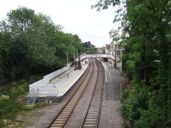
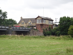
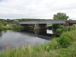
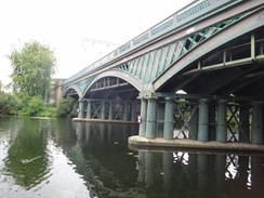
The path skirted the course of the Wansford to Stamford railway line which lay in a shallow cutting before heading away to reach the small village of Sutton and then across the floodplains to reach the River Nene once more. A boardwalk took me under the railway viaduct that carries the Nene Valley Railway preserved line over the river, and then the trail climbed up onto the railway embankment.
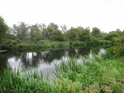
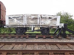
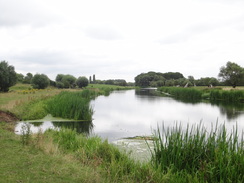
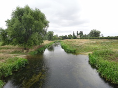
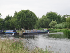
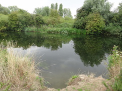
A steam train had just left down the line and I was left looking at a series of old wagons and coaches that were stored on a siding. One wooden wagon had obviously been rough shunted and its underframe was bent like a banana - I doubt it will ever see much use again! Eventually the trail left the railway line and started to make its way back towards the river. At this point the river flows through two tributaries, with the furthest one seemingly doing a good business in narrow boats. The spire of Water Newton church was visible across the river; it is a village that I seem to often pass without ever visiting, and that would not change today.
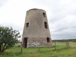
The rest of the day was spent in close company with the river. It passed underneath the brick stump of the old Castor windmill before skirting the Back Dike, which looked remarkably as though it had been used to provide water for a watermill near to the windmill. This marked the southernmost point of a large loop in the river, after which it started heading north, passing under the Nene Valley Railway once more. Some old pits on the other side of the river - flooded clay or gravel pits, perhaps - were home to a number of moving sails, and many people were out and about despite the lack of sunshine.
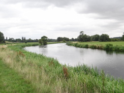
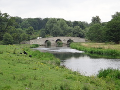
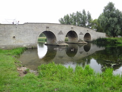
Soon I reached a beautiful stone bridge over the river - a seventeenth century toll bridge. Its reflections in the swirling water below were superb and again it seemed to be a popular spot, including for some rather rowdy children. The character of the walk changed for the next mile or so as a good cycle path headed up and down through some woodland replete with carved tree stumps; unfortunately the traffic noise from the A47(T) was overly intrusive.
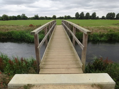
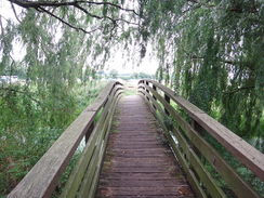
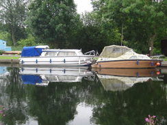
I stopped to read a sign by the next bridge over the river, the pedestrian Bluebell Bridge. It warned that the footpath ahead was closed due to an unsafe footbridge; however the diversion on the map did not look too tempting and so I decided to press on anyway. The path followed a larger expanse of green grass with good views to the boats moored on the other bank of the river and lots of people were walking around the golf course to the left. Soon the footbridge came into sight; it crossed a small water-filled ditch that separated the path from the golf course. Weeds made it look too deep to wade across but it would easily have been possible to walk around the stream. However that would have taken me along the edge of the golf course.
Instead I took a better look at the bridge. Two planks had been placed across its end as a barrier and the rest of the structure had a definite twist. I stepped on a couple of the planks and found that they were relatively firm. I crossed carefully, keeping my feet near the handrail where it would be over the metal girder underneath; in the end there was no problem and I was soon clambering over the planks at the other end.
A couple of the golfers cast looks in my direction as I continued on along the path; the footbridge had been closed for over a year and it seems strange that they had not got round to repairing it yet, especially as it must be a popular path being so near the city.
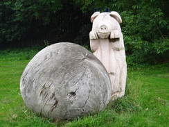
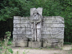
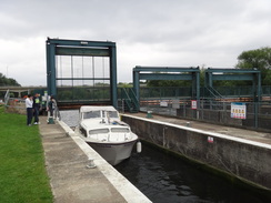
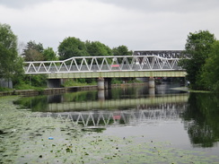
A boat was in Orton Lock and I stopped for a couple of minutes to watch it as it slowly ascended. Nearby some workmen and machines were repairing the river bank and a concrete pump stretched overhead from the track to the bank. After passing under a large bridge the path became relatively rural once more with little sign of the surrounding city. The end of a rowing lake could be seen to the left, and after passing an odd ship-shaped concrete sculpture I passed under a series of railway bridges (including a cast-iron one) to reach the centre of the city.
A flurrying mass of feathers on the path showed where pigeons were fighting over bread thrown to them by some children. Unfortunately the path was closed off a little further on and so I headed past an Asda store towards the centre of the town. I had to buy a birthday card for Sencan, so I pottered around for a while before heading to the station. It had been a good days walk on a stretch of trail that I knew well, but as not quite as good as yesterdays stroll.
 |
 |
|
Directions
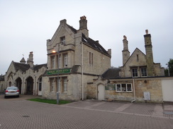
This leg starts off at Stamford railway station. Leave the station and immediately turn right, following the railway line eastwards. It soon passes the station footbridge on the right before heading up some steps that lead onto a road bridge that carries Wothorpe Road over the railway. Turn right and follow Wothorpe Road uphill until it ends at the A16 Kettering Road.
Cross the A16 and go through a gap in metal railings ahead; keep a hedge on the left and after five yards turn left through a wooden clappergate into a field. Cross this field, aiming for another clappergate in the far right-hand corner of the field. Go through this second clappegate and turn left to go through a very rough, overgrown area. It reaches a plank footbridge and another wooden clappergate; go through this and continue on uphill along a footpath with a hedge and fence on the left. Pass a little wooden hut on the right to reach a stile in the upper left-and corner of the field that leads onto a road called First Drift.
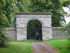
Turn left and walk for a few yards to the B1081 road. Carefully cross the main road to reach the pavement on the other side. Turn right to continue uphill along this road for a third of a mile with a large stone wall on the left. When a gateway leading into a golf course is reached turn left to follow the Way as it follows a surfaced track through Burghley Park across a golf course; the route is easy to follow and well waymarked.
After half a mile it reaches a large stone gateway on the left. Ignore the tracks going off on either side and continue along the track as it curves to the left. Just before a cattle grid turn right over a stile and head on, keeping a hedge and some scrub woodland to the right. The path across the Burghley estate is marked by a series of wooden posts with yellow blazes at the top. Cross a stile over an electric fence and turn half-left, still following the posts.
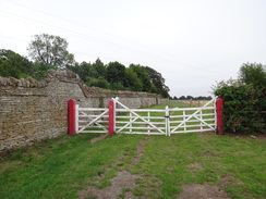
Carefully cross this road and head along the left-hand side of a triangular junction to head straight on along another road for a third of a mile. When it curves to the right continue straight on through two sets of white gates to join a track. This heads southeastwards with a wall on the left. Go through a gate just before the wall ends and continue straight on along the broad track across a field. It skirts a little wall on the right guarding some woodland to reach another gate. It continues on with a wall on the left.
The wall on the left ends and the path continues on for about fifty yards across the field to reach another gate. Continue on with a fence on the left. At the end of this field go through another pedestrian gate and head on across the middle of the field, aiming to meet a wall on the right. Follow this wall down to a gate that leads onto the road in the little hamlet of Southorpe at TF080026.
Turn right to continue along the road; almost immediately it curves to the left at Grange Farm. Here the Hereward way splits. The old route follows the road south-southeastwards, soon crossing an old railway bridge. When a road junction comes in from the left the road curves to the right and then the left. After a couple of miles it ends at a junction with the busy A47(T) road. Turn right and careful follow the A47(T) as it heads westwards, immediately passing over a bridge over an old railway line before heading slightly downhill. Enter a lay-by on the left after a sixth of a mile, and turn left across a stile to join a footpath that heads southeastwards to join the northern bank of the River Nene.
The new route turns right through a clappergate beside a cattle grid to join a track that heads towards Grange Farm on the right. When the track ends at Keepers Cottage continue on across a field that curves slightly to the right to head between two trees to reach another clappergate. Continue on with a hedge on the right and a fence on the left. When the hedge on the right ends go through a gap in another hedge; the path curves slightly to the left to angle towards some woodland on the right. Again the new route is marked with posts topped with yellow blazes.
The path enters some woodland and heads downhill to reach a footbridge over a stream. On the other side go through a gate and head straight on, aiming for another gate. Continue on diagonally across this field aiming for a gap in the hedge ahead. Go through this and turn right up a rough track, keeping the hedge to the left. After about thirty yards turn left down a concrete track that leads towards Sacrewell Lodge Farm. The track forks just before the farm; take the right-hand fork to remain on the concrete track. This immediately joins another track that passes a barn on the left.
The concrete track curves to the left to reach a surfaced road. Turn left down this road and then immediately follow it as it swings to the right, becoming a concrete track once more. It passes the main farm house on the left and continues on with a hedge on the left. It heads south for a sixth of a mile before curving to the left to head southeastwards towards Sacrewell Farm. It crosses a cattle grid to approach a complex junction, where you take the left-hand fork along a surfaced track. This heads around the edge of the farm complex, crossing a bridge over a stream and curving to the right and exiting past the campsites vehicle barrier. It swings to the right and then the left to head south before reaching the A47(T) at TF080996.
Carefully cross the A47(T) and head down a track for a few yards before turning left down a footpath that follows the Nene Way. This skirts a big Telecoms mast on the right. It turns to the right to reach a stile; cross this and descend a slope off a small shelf onto the floodplain. The path heads eastwards across scrubland with the River Nene away to the right and the main road to the left. The path crosses a number of stiles and footbridges as it rejoins the original route of the Hereward Way.
After a third of a mile the path curves to the left away from the river, and then right to skirt a cutting that carries an old railway line on the left. When a metal gate is reached take a wooden clappergate immediately to the right of the gate and walk on through a field, paralleling the track on the left. At the end of this field the path curves to the left slightly to reach another wooden gate. Go through this and continue along the path with a hedge on the right and fence on the left. The path ends at a road opposite a church in Sutton.
Turn left to head northeastwards for about twenty yards towards the church, and then turn right down a green lane called Lovers Lane, passing a little cemetery on the left. As the lane curves to the left turn right across a stile to join a footpath that heads across a field with a hedge to the right. When the hedge on the right end, turn half-left to head southwards, aiming for a stile in a fence.
Cross this stile and head straight on, aiming for a railway bridge in the distance. Halfway down this field the path crosses a footbridge over drainage ditch on the right before turning left to continue towards the railway bridge. As it reaches the bridge the path climbs up onto a boardwalk that leads under the railway line at TL093979. Pass under the bridge and follow the boardwalk as it curves to the left. When the boardwalk ends cross a stile and continue along a path that climbs up steps onto the railway embankment. At the top turn right to follow a narrow path that runs alongside the railway line on the left.
After a few hundred yards at TL102979 the path turns to the right and drops down off the embankment. Immediately after is passes under some power lines it crosses a stile and turns right to head south towards the river; it then curves to the left to follow a good path eastwards with the river on the right. Cross another stile and continue on along a good path, still with the river on the right. The path crosses a series of stiles and passes a bridge over the river on the right.
At TL122974 the path turns to the left, heading towards a clump of trees that guards an ox-bow lake. Skirt the edge of the lake on the right; the path soon curves to the left away from the lake following a ditch on the right to a stile that guards a footbridge over a stream. Cross a stile on the other side of the footbridge and climb up a bank. At the top follow a fence on the left to a stile beside a metal gate. Keep the fence on the left as the path sinuously winds around before reaching another stile beside a gate. Cross this and continue on with a fence on the right to reach the end of Mill Road at TL128969.
Turn right down this road; it soon curves to the left and becomes an unsurfaced track once more. Cross a wooden pedestrian gate and continue on along the rough track with a hedge on the left. The path passes the stump of an old windmill on the left as it parallels the northern bank of a stream called Back Dike; it soon curves to the right to reach a footbridge across the stream. Cross this and turn left to roughly follow the southern bank of the stream southeastwards for another third of a mile to reach another footbridge at TL134963. Cross this and turn right to join the western bank of the River Nene.
It is then simply a case of following the good path as it parallels the riverbank as it winds towards Peterborough. After three-quarters of a mile it reaches a railway bridge over the river; follow the path as it climbs up onto the embankment and carefully cross the track. Descend the path on the other side and rejoin the path as it heads northwards with the river on the right, going through a couple of gates on the way.
The river slowly starts to curves to the right; as it does so the path climbs up to the right slightly to reach a stile beside a metal gate. Go through this and continue on with a hedge on the left; shortly after this the path descends a slope to head towards the Milton Ferry Bridge at TL143984. As it reaches the bridge go through two gates to reach the track that leads to the bridge. Cross this and join a good track that heads through the Ferryhill Plantation.
When the track forks take the left-hand fork that heads uphill; when the track reaches a T-junction turn right down a surfaced track with a golf course on the left; the track soon reaches the Bluebell footbridge at TL154977. Do not cross the footbridge and instead continue straight on along a footpath with the river on the right. The path soon opens out into a grassy area and crosses a plank footbridge over a stream and heads on to reach a more substantial bridge over a reedy stream.
Cross this and continue on with a golf course on the left. After another fifth of a mile the path reaches Orton Lock on the right; continue on along a surfaced path that heads under a large concrete bridge that carries the A1260 overhead. As the main path curves to the left after passing under the bridge, continue straight on along the riverside path. Over the next mile and a half it crosses two substantial footbridges over inlets as it heads eastwards towards the centre of Peterborough.
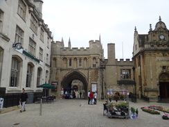
The path passes under a footbridge and two large railway bridges; shortly after the second railway bridge head under another footbridge and turn left up some concrete steps that leads towards an Asda store. Keep the store on the left; when it ends turn right to enter the Rivergate shopping centre. Head through this and exit out onto a pedestrianised road. Cross the A15 and continue on northwards along another pedestrianised road through the centre of Peterborough.
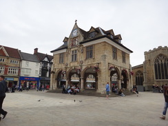
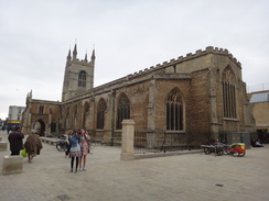
When the road reaches a junction, turn left to pass an ornate building and then a church on the right. This road soon ends at a roundabout; go down some steps to reach an underpass and then turn right to head under the roundabout. On the other side continue straight on to reach Peterborough railway station on the left, where this walk ends.
This makes a total distance of 18.4 miles, with 554 feet of ascent and 621 feet of descent.
Trains run regularly between Peterborough and Stamford, on the line between Stansted and Birmingham. See the National Rail Enquiries website for more information.
Please note that I take no responsibility for anything that may happen when following these directions. If you intend to follow this route, then please use the relevant maps and check the route out before you go out. As always when walking, use common sense and you should be fine.
If you find any information on any of these routes that is inaccurate, or you wish to add anything, then please email me.
All images on this site are © of the author. Any reproduction, retransmissions, or republication of all or part of any document found on this site is expressly prohibited, unless the author has explicitly granted its prior written consent to so reproduce, retransmit, or republish the material. All other rights reserved.
Although this site includes links providing convenient direct access to other Internet sites, I do not endorse, approve, certify or make warranties or representations as to the accuracy of the information on these sites.
And finally, enjoy your walking!
Distances
From To Distance (m) Ascent (ft) Descent (ft) Stamford station Wansford 7.2 308 335 Wansford Castor mill 4.4 85 125 Castor mill Peterborough station 6.8 161 161 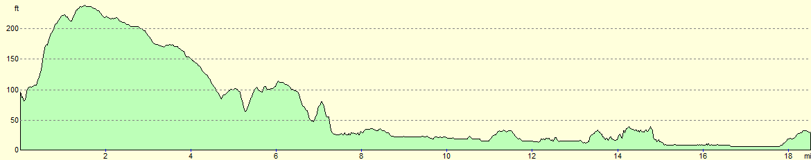
For more information on profiles, ascents and descents, see this page
Transport
Disclaimer
Nearby walks
# Title Walk length (miles) 55 Peterborough to Whittlesey 8.6 56 Peterborough to Stamford 16.5 58 Stamford to Oakham 16.8
![]() Previous walk
Previous walk
![]() Next walk
Next walk
