Walk #898: Limehouse to Hayes
 |
 |
|
General Data
| Date Walked | 02/05/2011 |
| County | London |
| Start Location | Limehouse station |
| End Location | Hayes and Harlington station |
| Start time | 07.38 |
| End time | 15.36 |
| Distance | 23.9 miles |
| Description | This was a pleasant and easy stroll following two canals through the centre of London. |
| Pack | Today I carried my 30-litre Karrimor rucksack, filled with water, my waterproofs, a couple of books and other odds and ends. |
| Condition | I am slightly footsore after this walk, but otherwise feel fine. |
| Weather | Today was sunny, with few clouds in the sky at any time. There was a brisk breeze that prevented me from getting overly warm. |
| OS map | Landranger number 177 (East London, Billericay & Gravesend) and Landranger number 176 (West London, Rickmansworth & Staines) |
 |
 |
|
Map of the walk
Maps courtesy of Google Maps. Route for indicative purposes only, and may have been plotted after the walk. Please let me have comments on what you think of this new format. For a detailed table of timings for this walk, please see the table file.
 |
 |
|
Notes
For some time I have wanted to return to London to re-walk the Regent's Canal. It is a walk that I have many fond memories of from when I attended Queen Mary College, which is right on the canal bank. I walked the canal to Paddington on many occasions, despite being in a great deal of pain from an ankle injury. A bank holiday seemed like a good day to do the walk as it meant that parking would be no real problem.
The drive down to London went easily at the early hour; I parked at South Woodford, near to where my old halls of residences used to be (the grey and dreary tower blocks having been replaced by smart executive housing) and bought a ticket. It was easy to get down to Limehouse, and the changes soon started appearing through the carriage window: the Olympic Stadium looking strangely small, along with all of its surrounding buildings.
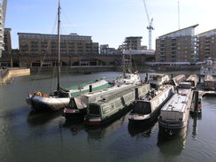
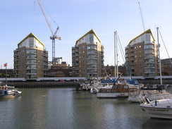
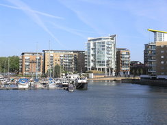
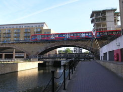
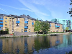
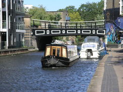
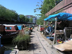
After getting off at Limehouse DLR I decided to take the long route to the start of the Regent's Canal by walking around the Limehouse Basin. This basin was built to allow transhipment of goods between seagoing ships and canal boats; now it is filled with pleasure boats and is surrounded by ultra-modern buildings. A couple of decades before I had been lucky enough to go down into the cut-and-cover Limehouse Link tunnel whilst it was under construction. The road tunnel cost about £100,000 for every metre, and from the surface it is impossible to see that it arcs underneath the water.
A squirrel ran across the lock gates as I passed the entrance lock that connects the Thames to the basin; it seemed perfectly nonplussed by my presence and ran past my legs and then up a nearby tree. It was a perfect indication of the greening of London; I doubt any squirrels would have lived here when the docks were in use.
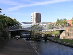
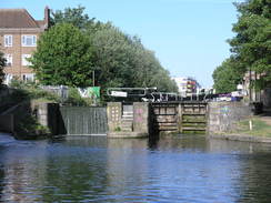
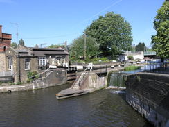
After walking around the basin I reached Commercial Road lock, the first of the many locks that I would pass on my way to Paddington. What used to be a rather run-down stroll had been massively improved; Mile End Park to the right had been tidied, whilst new buildings jutted imperiously towards the sky on the other side of the canal. Twenty years before I would have been along on this walk; today there were many joggers, cyclists and dog walkers joining me on the narrow strand of path. This, more than the new buildings, showed how the area had changed.
I passed under the Mile End bridge to reach the New Globe, memories assaulting me the entire time. Off to the left were the Halls of Residence where a dear friend of mine lived for a year, and to the right were the benches where I had comforted a friend whose dad had died. Benches, it should be said, that had not changed: a homeless man was sitting on the grass beside them, drinking out of a plastic bag-wrapped bottle. For a moment I wondered if it was the same homeless man that used to sit there nineteen years earlier...
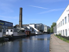
Three tall cranes sat further north, hovering over the site of an old wharfside building called Suttons Wharf. The magnificent green overhead roof had gone, and the buildings were obviously soon to be replaced with yet more plush canalside apartments. It was sad to see that it had gone, and with a jolt I realised that almost all the old canalside buildings had now disappeared.
The going underfoot was easy; many years before the towpath had been converted to carry high-voltage cables, the canal water being used to cool the cables that lay underneath slabs. The lovely Victoria Park was undergoing restoration ready for the 2012 Olympics, and many signs of work were visible from the towpath. There was another change: many cyclists, where cycling on the towpath had been banned years before. A sign showed me the reason; cycling had been allowed after the terrorist bombings in 2005.
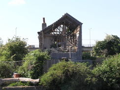
Eventually I got to see an unrestored derelict buildings on the other side of the river, with plants growing out of its dishevelled brickwork and almost all of its windows smashed. I revelled in its glory, and wondered how long it would be before this too was demolished in the name of progress. One good thing as the lack of graffiti; a couple of decades before many walls and signboards along the canal had been cursed with multicoloured scrawls; there was little present to be seen on this walk. Perhaps the graffiti artists have moved away now that the path is more popular for walkers and cyclists.
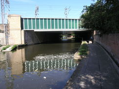
A new railway bridge in Haggerston marked the East London line extension that opened recently, despite a slight collapse during construction. This also had none of the character of the older bridge that it had replaced. I was feeling slightly low as I walked along, and I wished that I had taken more photos of the canal all those years ago, before the gentrification had begun.
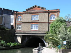
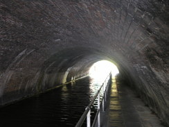
Eventually I reached the eastern portal of Islington tunnel. The towpath does not go through the tunnel, and instead the path follows roads westwards through Angel and Pentonville. Little markers on the pavement show the route along the streets; these can be hard to locate, and I chose a slightly different route that allowed me to nip into Superdrug to get a few little odds and ends.
The path passed through a little housing estate before descending down to the western portal of the tunnel, which is in surprisingly leafy surroundings. A ramp allows cyclists to descend down to the towpath, but some steps to the left led down to a little viewpoint.
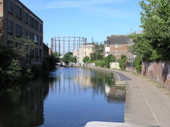
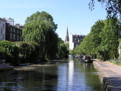
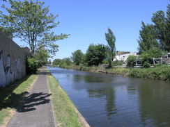
One of things that I used to love about the Regents Canal is that it gives the walker a green route through the centre of the metropolis, a means of crossing the city that is relatively traffic-free. The next stretch was a classic example, with skeletal gas-holders and the magnificent arched overall roof of St Pancras station visible behind the ultra-modern Eurostar extension.
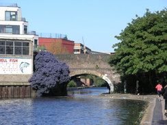
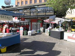
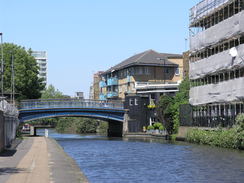
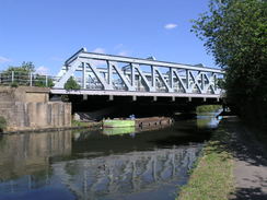
A new bridge carried the Eurostar lines over the canal, replacing earlier bridges. They left a green-painted steel girder of the old bridge to disguise the rather uglier concrete new bridge - a good thing. Soon more locks were passed and I reached Camden, an area that I used to know well and work in. Refreshment booths were just opening in the market, and weird, exotic smells were wafting around me as I passed.
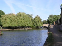
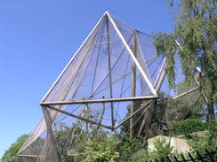
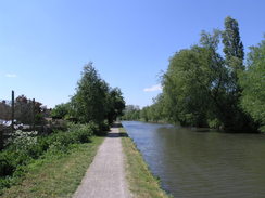
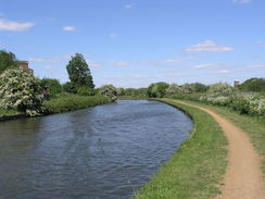
Soon the character of the canal changed as it skirted the northern side of Regent's Park. I was overjoyed to see a red pagoda boat near a turning hole, which I remembered fondly and marked the approach to a much more rural-seeming walk. Some netting of London zoo's aviary spanned over the towpath, allowing tantalising glances of the striking birds inside. The buildings on either bank of the canal changed, from dilapidated industrial buildings or ultramodern apartment blocks to large Georgian buildings with expansive gardens; obviously a multi-millionaires row.
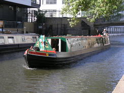
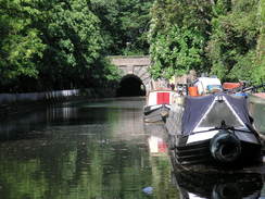
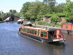
I had been slowly overhauling a boat as I walked; this was another change from my previous walks, as the canal was far busier than I remembered. Twenty years before I would scarcely see a single boat moving on the canal, but today there were many, with some locks being doubled-up with boats. I was about twenty yards ahead of it as I approached the Maida Hill Tunnel. Once again the towpath left the canal, but the route over the top was much easier, with a street leading directly to the western portal. I arrived just as the boat emerged from the tunnel, my lead still intact.
The next stretch of towpath was closed off to walkers as it had been totally taken over by the adjacent moored houseboats, and the road had to do. Fortunately this stretch soon ended and the towpath was rejoined just before Paddington Basin was reached.
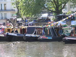
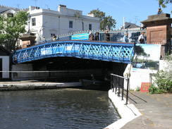
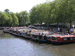
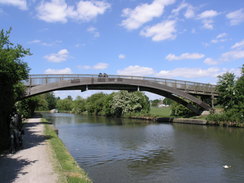
One glance at the basin showed why the canal was so busy - the large basin was filled with narrow boats and a PA system was blaring a distorted voice over the water. Almost every boat was festooned with bunting and flags, and a large sign declared that it was an Inland Waterways Association rally. I was very tempted to take a long look around, but my legs were nicely warmed up and I wanted to get on. A bridge took me over another canal, and I joined the Paddington Branch of the Grand Union Canal.
I had spent the entire day so far walking with the canal on the left; the bridge had taken me to the other side of the canal and almost all the rest of the day would be spent with the canal on the right. More flag-clad boats were moored along the canal making a wonderful sight.
I have not walked the Paddington Branch of the canal as much, but I must still have walked it a dozen times. It was a wonderful day to be doing the walk, and again it was a green corridor through the suburbs. The A40 Westway looped overhead on a concrete viaduct before Kensal Green cemetery was approached on the far side of the canal, and then the vast area of Old Oak Common railway depot on the left.
My GPS showed that I had managed to average well over 3.5 MPH on the walk so far, a little more than usual but not too surprising as I had been pushing myself hard, especially in the earlier part of the walk. The canal became slightly more rural as it curves westwards from Alperton, and many people were sunning themselves beside the golf course on the opposite bank.
It became more urban as it approached Greenford, and it seemed like a good time to stop for a break. There was a convenient canal-side pub, so I went in and ordered myself a pint of bitter shandy before going to sit on the benches outside. People were enjoying the sunshine in the pub's garden and I joined them, smiling as I watched people continue along the towpath. Unfortunately the only negative thing of the day happened at the pub: a barmaid refused to fill up my water bottle for me, despite the fact that I had just spent over tenner in the pub on food and drink. This is the first time someone in a pub has ever refused to fill up my water bottle, and it left a literal and metaphorical bad taste in my mouth.
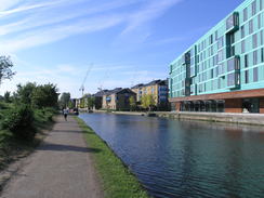
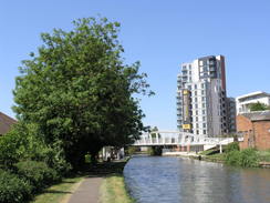
Instead of pushing the matter I decided to just ration the little water I had left. The pub marked the point where the canal changed from heading in a rough westerly to a more southwesterly direction, and I enjoyed the next few miles as it headed towards Southall. Occasional smart new buildings and apartments towered overhead, and in one place a new marina had been dug out and surrounded with similar smart buildings.
The canal wounds its way through Southall before approaching the point where the Paddington Arm meets the Grand Union Canal proper at Bull's Bridge. My GPS showed that I had done nearly 26 miles by this point, and as there was still plenty of time left I was tempted to walk further to try and make it a thirty-plus mile walk. However I still had to travel back across London and then drive for an hour home, so with some regret I left the canal to walk the short distance to Hayes and Harlington railway station.
It had been a superb day's stroll, and one that was well worth doing. The journey back to my car was easy enough, and so was the drive home. Unfortunately when I got home I received a shock - the GPS log showed that I had only done about 24 miles, much shorter than I expected. The was no obvious reason for this as the tracklog seemed fine with no spurious points, and so I can only assume that my GPS unit had a fit somewhere around Victoria Park.
 |
 |
|
Directions
This walk starts off from Limehouse Docklands Light Railway station. Leave the station and turn left to head south for a short distance away from the railway line. After a few yards turn left to head eastwards across Ratcliffe Lane, paralleling the station platform, before it ends at a T-junction with the A101 road. Carefully cross the road and then turn right to head south along Branch Road; do not take the A101 that curves to the right to enter the Rotherhithe Tunnel.
Just before Branch Road ends at a T-junction with Horseferry Road, turn left along a path that meets the western edge of the Limehouse Basin. Keep the basin on the left as you walk around the southern side of the basin to reach the sea lock that leads to the Thames. Cross the lock and then turn left to head up the eastern side of the basin, shortly reaching a bridge over the Limehouse Cut. Cross the bridge and turn left to head north; after a short distance turn left to follow the northern side of the basin westwards, immediately below four large buildings. Soon the entrance to the Regent's Canal is reached.
Turn right to start following the Regent's Canal, keeping the canal on the left. Follow the canal as it initially heads northwards, before curving to take a more westerly course. After 4.5 miles the eastern port of the Islington Tunnel is reached at TQ316832. Here the towpath leaves the canal and slopes up to reach Colebrooke Row. Cross this using the pedestrian crossing and then continue straight on up Duncan Street.
When Duncan Street ends at a T-junction with the A1. Turn left to head south along the A1; when some traffic lights are reached just before Angel tube station carefully cross the road and start heading northwestwards up the B515 Liverpool Road. Take the second road off to the left, Tolpuddle Street, and follow thbis westwards for a sixth of a mile until it too ends at a T-junction with Barnsbury Road. Cross the new road using the pedestrian crossing and then turn right to follow Barnsbury Road northwards for about 100 yards. Take the first road to the left, Maygood Street, and when this ends turn right along a path and then left to head down a path. This reaches Muriel Street above the tunnel's western portal; cross Muriel Street and then turn right and immediately left to join the sloping path that leads down to the canal towpath.
Continue along the canal for another 3.5 miles, passing Regent's Park and through Lisson Grove tunnel before reaching the eastern portal of the Maida Hill tunnel at TQ267823. Take the path that leads up from the towpath that soon ends at Aberdeen Place. Head straight on down Aberdeen Place; when this ends at a T-junction with the A5, carefully cross the main road and turn right and then immediately left along Blomfield Road.
Follow Blomfield Road as it parallels a section of towpath that is closed off to the public; when you can rejoin the towpath and head on along the canal for another quarter of a mile to reach Paddington Basin. Keep the basin on the left to reach a blue bridge beside a road bridge; cross the bridge and on the other side turn left to descend to the towpath. At the towpath turn sharply left to head under the bridge and join the Paddington Arm of the Grand Union Canal.
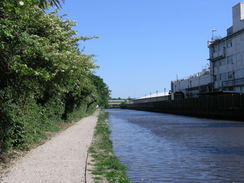
Follow the towpath and keep the canal on the right for another thirteen miles; it heads in a rough westerly direction for about eight miles before curving to the left to take a more southerly course for the last five miles until Bull's Bridge is reached at TQ107790. When the Paddington Arms ends at a junction with the main canal at Bull's Bridge, cross the bridge to join the northern bank of the Grand Union. Follow this northwestwards with the canal on the left for two-thirds of a mile, passing under a railway bridge before reaching a road overbridge at TQ097795. Join this bridge and cross it to head down Station Road. Cross straight over another roundabout and climb slightly for a short distance before Hayes and Harlington railway station is reached on the left, where this walk ends.
 |
 |
|
Distances
| From | To | Distance (m) | Ascent (ft) | Descent (ft) |
|---|---|---|---|---|
| Limehouse | Angel | 5.4 | 131 | 49 |
| Angel | Paddington Basin | 4.6 | 115 | 131 |
| Paddington Basin | Alperton | 5.9 | 125 | 121 |
| Alperton | Harlington and Hayes station | 8.0 | 157 | 154 |
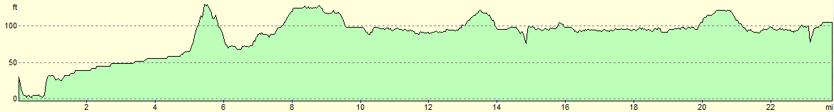
This makes a total distance of 23.9 miles, with 528 feet of ascent and 455 feet of descent.
For more information on profiles, ascents and descents, see this page
Transport
Regular trains run from Hayes and Harlington railway station towards Paddington; from there, the tube system will take you back to Limehouse, although several changes would be needed.
 |
 |
|
 |
 |
|
 |
 |
|
 |
 |
|
 |
 |
|
 |
 |
|
 |
 |
|
 |
 |
|
 |
 |
|
 |
 |
|
 |
 |
|
 |
 |
|
 |
 |
|
 |
 |
|
 |
 |
|
 |
 |
|
 |
Disclaimer
Please note that I take no responsibility for anything that may happen when following these directions. If you intend to follow this route, then please use the relevant maps and check the route out before you go out. As always when walking, use common sense and you should be fine.
If you find any information on any of these routes that is inaccurate, or you wish to add anything, then please email me.
All images on this site are © of the author. Any reproduction, retransmissions, or republication of all or part of any document found on this site is expressly prohibited, unless the author has explicitly granted its prior written consent to so reproduce, retransmit, or republish the material. All other rights reserved.
Although this site includes links providing convenient direct access to other Internet sites, I do not endorse, approve, certify or make warranties or representations as to the accuracy of the information on these sites.
And finally, enjoy your walking!
Nearby walks
| # | Title | Walk length (miles) |
|---|---|---|
| 50 | Paddington to Mile End | 8.3 |
| 51 | Mile End to Enfield Lock | 12.7 |
| 60 | Slough to Alperton | 16.7 |
|
|

|