Walk #891: A circular walk from Aldeburgh to Tunstall via Snape
 |
 |
|
General Data
| Date Walked | 06/04/2011 |
| County | Suffolk |
| Start Location | Aldeburgh beach car park |
| End Location | Aldeburgh beach car park |
| Start time | 08.21 |
| End time | 16.30 |
| Distance | 21.7 miles |
| Description | This twisting walk took me over Tunstall forest and out towards the coast at Thorpeness. The scenery is varied and the going underfoot invariably good. |
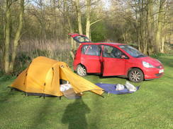
| Pack | Today I carried my 30-litre Karrimor rucksack, filled with water, my waterproofs, a couple of books and other odds and ends. |
| Condition | I had some significant problems with hot-spots forming on the heels of mty feet today, which appears to be due to my having worn the wrong socks. As often happens in such cases, the blister-induced gait caused other muscles to get tired. |
| Weather | Today was bright, warm and sunny, with a slight breeze to help me keep cool. It was nearly ideal walking weather. |
| OS map | Landranger number 156 (Saxmundham, Aldeburgh & Southwold) |
 |
 |
|
Map of the walk
Maps courtesy of Google Maps. Route for indicative purposes only, and may have been plotted after the walk. Please let me have comments on what you think of this new format. For a detailed table of timings for this walk, please see the table file.
 |
 |
|
Notes
I decided to finish off the Sandlings Walk in a three-day session, taking advantage of what promised to be some glorious weather. Althought he walk could easily be completed in two days, transport difficulties meant this was going to be a series of three circular strolls. The journey to Suffolk went well, but at the last minute I decided to alter the start point - instead of parking at a remote car park in the middle of Tunstall Forest, it seemed more sensible to park in the middle of the planned walk, to the north of Aldeburgh.
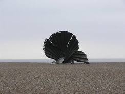
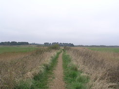
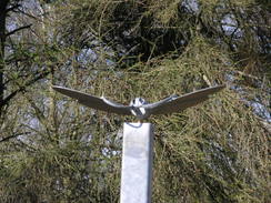
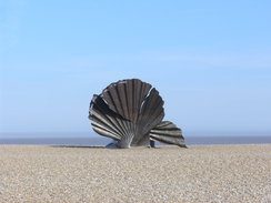
The car park was dominated by the Scallop' - a tribute to Benjamin Britten, who for much of his life lived in the area. It is a fascinating metal structure, and unlike many such large sculptures it seems to fit gracefully in amongst the shingle beach. A short walk along a tarmac path took me up to join the Suffolk Coast and Heaths Path, which I would be following for a few miles in order to reach the Sandlings Walk in Tunstall Forest. Initially the path took me along a bank through an area of marshland, a route that is obviously well-used by birdwatchers. I was feeling fine and very fit.
The path crosses the route of the old Saxmundham to Aldeburgh railway line, most of which closed in 1966 (the line as far as Leiston remained open to serve the Sizewell power stations. The line ran in a low cutting, which had to be low as it is so near to sea level, and a permissive footpath ran along it to the north and south. It then joined a track that took me to a B road, and then across a golf course. A few lone golfers were about, but none in the immediate vicinity. Another track took me past expensive-looking houses to reach the A 1094.
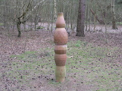
Here I joined the route that I walked on the coastwalk, and which I remembered with fondness. This was not the case for the first half mile, which followed the pavementless main road, but the 2.5 miles that followed. This was a path called the Sailor's Walk, which was a wonderfully varied stroll. It started off as heathland that descended to a couple of bridges and a boardwalk over a low, boggy area. After this it entered Black Heath Wood, an area of attractive, relatively sparse woodland that included some weird pottery sculptures by Jonathon Keep. These fitted in well with the woodland light, and seemed to be rapidly becoming part of nature. This page explains a little more about the sculptures.
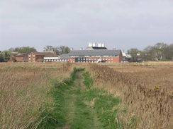
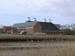
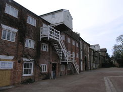
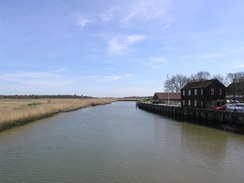
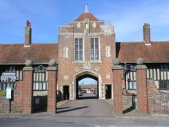
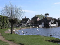
I was really enjoying this walk; there is something about this part of Suffolk that is almost magical. Eventually the Sailor's Path left the wood and passed some cottages to reach a minor road. Before it met this, however, it diverted off to plunge south along the edge of Snape Warren. There were only glimpses of the heathland, but these were tantalising in the sunshine. The path took me down to the bank of the River Alde, and then followed a grassy floodbank between reed banks. Ahead lay the massive buildings of Snape Maltings, fitting well into even this countryside scene. Plaintive tones from a trumpet drifted down the river, an indication of the concert hall that is the centre of Aldeburgh Music Festival, which Britten founded in 1948. Although some of the buildings are still dilapidated, some have been converted into shops and housing. There was a pub, the Plough and Sail, although this was not yet open.
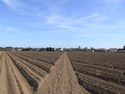
I was faced with a choice after this; I could either continue along the heaths and coast path southeastwards, before cutting through the forest towards the Sandlings Walk. In the end, however, I chose to use the less scenic but more direct road route. The road was not too busy, and passed through the scenic Blaxhall Heath. Before long another track took me due south towards the village of Tunstall across yet more sandy ground. A bulldozer was working in a field off to the left, levelling a load of earth that had just been dropped off by a lorry.
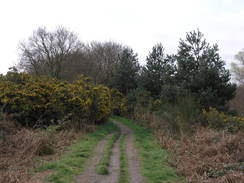
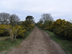
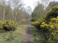
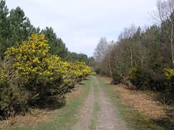
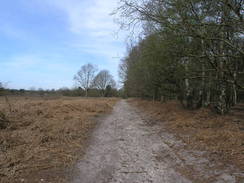
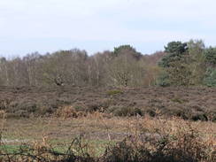
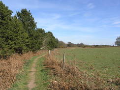
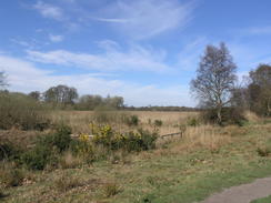
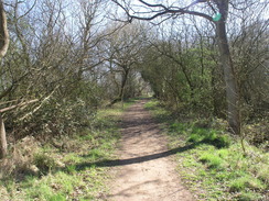
I rejoined the Sandlings Walk immediately to the east of Tunstall, where I had left it on the previous walk. The first part of this walk across Tunstall Common was wonderful, a classic heathland walk enhanced by the butter-coconut smell of the gorse in flower. Sadly this ended when the path plunged into the depths of Tunstall Forest. The previous day of the Sandlings Walk had been slightly spoilt by miles through forestry land, but fortunately this stretch did not last long and the path emerged to cross Blaxhall Heath. Sadly north of the main road the path chose to skirt through the woodland rather than continue along the common, seemingly a strange choice as there is a perfectly good track across the heath.
A rather ordinary road walk took me back to Snape Maltings, where I was pleased to find that the pub was open. I decided to nip in and take advantage of the fact that they were serving food. I ordered a burger, and sat outside in the sunshine. A very large meal arrived, and I scoffed it down, all too aware that I was rather scruffy compared to the other visitors to the maltings. No-one made any comment, however, and the staff were all polite and friendly.
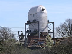
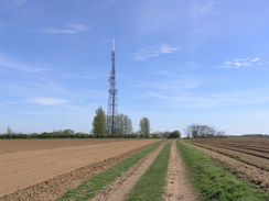
I set off again along the road that led up into the village of Snape, where there were two other pubs settled almost opposite of each other; people were sitting outside of each, enjoying the sunshine. Another road took me to reach the very end of the Sailor's Path, before turning to head northwards. It was a relief when the road finally ended and another path took me on northwards, before passing close to Friston Hall and reaching the village of Friston itself. In the village I was surprised to see the body of a windmill - seemingly in good condition - that was surrounded by a metal dramework. More paths took me east to Goldfair Green after which the path then continued southeastwards, heading under a massive transmitter mast. It was all good walking along tracks and fairly scenic, but I found my heart yearning for more of the heathland. Glimpses of the glistening white dome of the Sizewell B power station were visible above the trees in the distance.
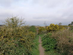
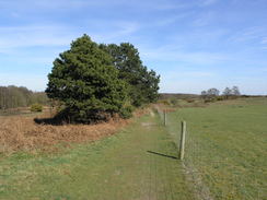
Fortunately my desires were fully met as the path headed across the wonderful North Warren, again alive with flowering gorse. Unfortunately my feet were now aching for some reason, and I could feel a deep blister forming on my right heel, somewhere I do not normally get blisters. Something was obviously wrong, but I powered on as there was only a few miles still to go. Besides, the walking was wonderful. The course of the old railway line was reached once again, and followed northwards towards the B1353, skirting a golf course on the way.
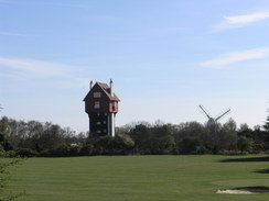
I was tempted to extend the walk by a mile or so, reducing tomorrow's walk and also removing the need to walk down the main road. My complaining feet persuaded me otherwise, however, and I chose to stroll down the road. Fortunately it was not too busy, and soon I was rewarded with the extraordinary House in the Clouds, a house built below a water tank. Due to the unique design, the house looks like a column, and the tank looks like a house! It would not seem out of place in Portmeirion, and was a fitting introduction to the wonders of Thorpeness.
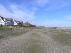
Thorpeness was first developed in the 1920s as a holiday resort, and like Portmeirion was the idea of one man, Glencairn Stuart Ogilvie, who developed it as a private holiday village. Many of the houses are suitably grand, and despite being less than a century old appear to be from many different periods, including some ancient-looking Almshouses. The area around the boating lake was bustling, and I resisted the temptation to have an ice cream, plodding on through the car park to reach the beach.
The rest of the walk took me south along the coast towards the car park. My feet were really aching by now, far more than they should have been at this stage of the day. It meant that I could not face the last mile or so along the shingle, and instead I took a grassy path that ran behind the beach. It was with relief that I met the path that I had followed earlier. I reached the car very footsore, but happy after a good walk.
I had booked myself in for the night at Run Cottage in Hollesley, which I had stayed at the previous week. It was a bit of a drive south, but soon my tent was packed up and my socks were off so that I could inspect my feet. The problem was obvious - last year I bought some thousand mile socks that were a size too small, and I had worn them today rather than the larger pairs I normally use. The constriction caused by the socks, added to the heat of the day, caused the problems. Happy that I had found the problem, I cooked myself a meal and went for a wash. If today's walk had been god, then tomorrow's promised to be even better.
 |
 |
|
Directions
This walk starts off at the Thorpe Road car park, about half a mile north of the town of Aldeburgh, at TM466574. Leave the car park to walk north; there is a surfaced path that runs between the road on the left and the shingle beach on the right. After half a mile a ruined house is reached on the other side of the road at TM467583. Turn left to cross the road and take a footpath that heads westwards, with the house on the right.
Continue westwards along a good path on a flood bank with a stream on the left. It curves to the right and then the left to take a southwesterly course, before descending down to cross an old railway cutting. Climb up the other side to join a track that heads southwestwards past some large houses on the left, becoming firmer and better-quality as it goes. This eventually reaches the B1122 road at TM456580.
Carefully cross the main road and go through a gate to join a footpath that continues southwestwards on the other side, squeezing through a narrow band of scrubland before reaching a golf course. The route across the golf course is well marked; just head straight across. At the other side of the golf course, go through a gate to join a track; join this and turn right to follow it southwestwards for a third of a mile until it reaches the A1094.
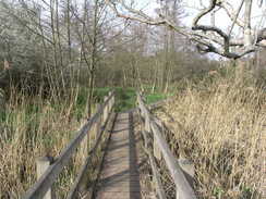
Turn right and follow the main road northwestwards for a little over half a mile; there is no pavement, but the verges are generally wide enough to allow you to safely walk. Near the South Warren car park, turn left at TM442581 to join a sandy track. Follow this track as it passes some cottages on the left. When the track turns left into the last cottage continue straight on for a short distance along a path that meets another track. Turn left down this track and follow it as it heads through the Cliff Plantation. Once it leaves the woodland an area of marshy land is crossed, with boardwalks and bridges carrying the path over the worst bits, before the path enters Black Heath Wood.
Follow the obvious path through the woods and then continue on westwards for 2.6 miles from the A1094, until the track approaches a surfaced road at TM401583. Just before the road is reached turn left down a footpath that heads southwards down a narrow path, initially with a fence guarding a house on the right. When this path approaches the northern bank of the River Alde after half a mile, turn right and follow the bank of the river as it winds westwards for two-thirds of a mile until it meets the B1069 road to the south of Snape.
At the road turn left and cross the river Alde on the road bridge. On the southern side of the river pass the Snape Maltings and continue along the road as it heads southwestwards for 1.5 miles. Immediately after a road comes in from the left at TM375561 turn left down a sandy track. This heads south for two-thirds of a mile; as the track continues straight on the footpath turns to the right, heading southwestwards across heathland to reach the B1078 road in Tunstall. Turn left to follow this road southeastwards for a couple of hundred yards until a path leads off to the left at TM375548, heading northwards across heathland.
After a few yards, take a path that curves away to the left to take a northerly course. This soon reaches an unsurfaced track called Forest Enterprise Road. Cross this and continue northwards; after a few yards turn right to join another footpath that heads east-northeastwards across rough scrubland and past gorse bushes. It slowly curves to the left to take a more northeasterly course, running with a field a short distance away to the left. At TM378551 turn left along a narrow path, and then right to join another track. Half a mile after crossing the track, it reaches anther track at TM380554.
Turn right and follow this new track eastwards; after a while the surface becomes firmer. After 0.4 miles at TM387553 turn left to join another footpath that heads in a rough northerly direction through the forest for a little over a third of a mile until it reaches a road. Cross this and continue on northwards along a footpath on the other side. Just before this curves to the left after a couple of hundred yards, turn left to join a footpath that angles away from the track on the right. The footpath heads northwesterly across Blaxhall Heath for a quarter of a mile until it reaches the B1069 road at TM382565.
Turn right along this road for a few yards, and as the track comes in from the right turn left and go past a metal barrier to join another track. This heads northwestwards before reaching a road after half a mile at TM378571. Ignore the road going straight on, and turn right to follow another road in a rough easterly direction. After two-thirds of a mile it joins the B1069 road opposite Dunningworth Hall; turn left to continue on along the main road as it passes Snape Maltings and crosses the River Alde at Snape Bridge. A third of a mile after the bridge it reaches the hamlet of Snape at TM393580; there is a pavement on the left between the bridge and the village.
After passing the Crown Inn on the right, turn right along Priory Road to pass the Golden Key pub on the left. Follow the road east-northeastwards; after half a mile it curves sharply to the left to head northwards for 0.6 miles, passing Rookery Farm before ending at the A1094 road at TM403593. Carefully cross the main road, and continue straight on along a track on the other side. This immediately passes some buildings on the left before curving slightly to the left.
A junction with a track called Sloe Lane is reached after half a mile, with electricity pylons striding across the landscape ahead; turn right to follow this track in a rough easterly direction. The track forks as it approaches Friston Hall. Take the middle of the three forks and follow a good-quality concrete track as it head to the south of the hall. Pass some woodland on the right, and then turn right along a footpath that heads eastwards across a field. Go through two hedges; at the second then turn half-right to head southeastwards across another field before it ends at Mill Road in Friston (TM411601).
Turn left and follow Mill Road northeastwards for a couple of hundred yards until it reaches the B1121 beside the Old Chequers PH. Cross this road and continue on up Grove Road for a fifth of a mile until it curves sharply to the left. At the bend continue straight on to cross a stile to join a track; turn right down the track for a short distance with a hedge on the right. When the gardens on the right end, turn left across a stile to head east-northeastwards across a field for a fifth of a mile, aiming for a stile in the left-hand hedge. Cross this and turn right down the track.
Continue on this track for 0.8 miles; initially it heads east-northeastwards before curving to take an east-southeasterly and then easterly course to end at the B1069 road at TM431605. Turn left to head northeast along this road for a short distance, and then turn right to continue south along Sloe Lane for half a mile, passing Billeaford Hall on the left. When some woodland is reached on the right, turn left to head eastwards along another track. Initially this heads to the north of some more woodland, before heading to the south of another copse. After this it curves to take a more southeasterly course. When the track approaches a tall transmitter mast, take the left-most track that heads through a gate. This passes the transmitter and some industrial buildings on the left. This track eventually ends at the B1122 at TM451592.
Carefully cross the road, and continue eastwards along a path that crosses North Warren. A hedge on the left eventually peters out, leaving the path to cross some heathland; after two-thirds of a mile a junction with a track that runs along an old railway trackbed at TM462594. Turn left to start following this track northwards. When a track is reached turn right for a few yards, then left by a house down another track. Finally turn right to rejoin another track. When a large shed is reached on the right with a golf course ahead, turn left down another track. 0.6 miles after joining the old railway trackbed this meets the B1353 road at TM462604.
Turn right to follow the B1353 road southeastwards for two-thirds of a mile as it heads into Thorpeness; although there is no pavement, the road is relatively quiet. As the road enters Thorpeness it curves sharply to the right, and then more gently to the left with a boating lake called The Meare on the right. Immediately after The Meare, turn right down a road that leads for a few yards to a car park. Turn left to go through this car park to reach the beach, and then turn right to start heading southwards for 1.3 miles until the Thorpe Road car park is reached, where this walk started. The shingle beach can be hard going, and the walking is easier along the partially grassy areas shoreward of the beach.
 |
 |
|
Distances
| From | To | Distance (m) | Ascent (ft) | Descent (ft) |
|---|---|---|---|---|
| Thorpe Road car park, Aldeburgh | Snape Maltings | 6.5 | 159 | 164 |
| Snape Maltings | Tunstall Common | 2.3 | 82 | 26 |
| Tunstall Common | Snape | 3.6 | 52 | 85 |
| Snape | Knodishall Common | 3.8 | 108 | 98 |
| Knodishall Common | Thorpe Road car park, Aldeburgh | 5.5 | 126 | 154 |
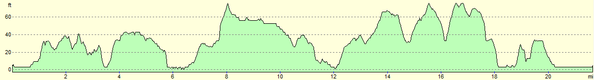
This makes a total distance of 21.7 miles, with 527 feet of ascent and 527 feet of descent.
For more information on profiles, ascents and descents, see this page
Accommodation
I spent the night at Run Cottage, which is situated just outside the village of Hollesley. It cost me just £10 for a ptich for the night, and the facilities were all clean and tidy.
 |
 |
|
 |
 |
|
 |
 |
|
 |
 |
|
 |
 |
|
 |
 |
|
 |
 |
|
 |
 |
|
 |
 |
|
 |
 |
|
 |
 |
|
Disclaimer
Please note that I take no responsibility for anything that may happen when following these directions. If you intend to follow this route, then please use the relevant maps and check the route out before you go out. As always when walking, use common sense and you should be fine.
If you find any information on any of these routes that is inaccurate, or you wish to add anything, then please email me.
All images on this site are © of the author. Any reproduction, retransmissions, or republication of all or part of any document found on this site is expressly prohibited, unless the author has explicitly granted its prior written consent to so reproduce, retransmit, or republish the material. All other rights reserved.
Although this site includes links providing convenient direct access to other Internet sites, I do not endorse, approve, certify or make warranties or representations as to the accuracy of the information on these sites.
And finally, enjoy your walking!
Nearby walks
| # | Title | Walk length (miles) |
|---|---|---|
| 131 | Ipswich to Wickham Market Station | 16.7 |
| 132 | Wickham Market Station to Darsham Station | 12.7 |
| 135 | Darsham Station to Brampton Station | 12.3 |
|
|

|