Walk #674: Clova to Brechin
 |
 |
|
General Data
| Date Walked | 16/05/2005 |
| County | Tayside |
| Start Location | Clova |
| End Location | Brechin |
| Start time | 09.02 |
| End time | 17.52 |
| Distance | 24.1 miles |
| Description | This was a fairly long and, if the truth be told, boring, road walk south and eastwards. |
| Pack | Today I carried my 70-litre Craghoppers WildPlaces rucksack, filled with full camping gear. |
| Condition | My feet really ached towards the end of this walk, but aside from this my body felt fine. I have closely inspected my feet after the bath and I appear to have no blisters - my feet were just affected by the constant pounding on tarmac. |
| Weather | After the highs of yesterday today was a great disappointment - there had been rain overnight and it was a far colder morning than yesterday. Before I setoff there was a hailstorm, sand for the first half hour there were a few snow flurries in the air. It was a windy day, with a cold northerly breeze chilling me when I was exposed to it. Aside from the snow flurries it was dry all day, and the sun occasionally made appearances through gaps in the cloud. |
| OS map | Landranger number 44 (Ballater, Glen Clova & surrounding area) and Landranger number 54 (Dundee & Montrose, Forfar & Arbroath) |
 |
 |
|
 |
Map of the walk
Maps courtesy of Google Maps. Route for indicative purposes only, and may have been plotted after the walk. Please let me have comments on what you think of this new format. For a detailed table of timings for this walk, please see the table file.
Notes
Last night I had an unsettled night's sleep last night and I am at a loss to explain why - I had a good day's walk yesterday, and was tired when I went to bed, so I should have slept like a log, as I usually do after a hard day's walk. I went into the common room at the bunkhouse for a while before breakfast and had a chat, and then the three of us who had ordered breakfast went into the hotel for it. This was quite nice, and set me up well for the day's walk ahead. I was slightly envious of the others, who were going over the hills towards Tarfside, whereas my route was going to be a relatively boring, long day along roads. I was in no particular hurry to set off, and so we continued chatting for a while after we had finished eating. I also realised that these could be the last TGO'ers I would meet until the end of the walk, which seemed strange as they have been virtually ever-present over the last ten days.
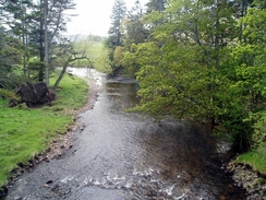
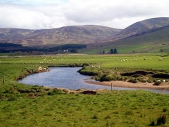
Eventually I was ready to go, and fortunately this was only a couple of minutes past my target start time. I had resolved to set myself a fast pace along the road and to get to the hotel at Dykehead by midday - this was nine miles away when I measured it by the highly accurate measurement system called a length of Paracord, and so I strode off past the little Clova church and down the road. This road is quite unusual as it runs on both sides of the valley; traffic heading towards Clova runs on the western side, and traffic heading away on the eastern side. Because I wanted to walk facing oncoming traffic I took the western side, although I need hardly have bothered as the road was very quiet (apparently Sunday's are the busiest days on the road as people come to walk in Glen Doll and the surrounding hills).
As I walked away I kept on looking over my shoulder towards the surrounding hills, knowing I had picked a boring and pedestrian route to the coast; many people were walking over to Tarfside, and then heading to Edzell and the coast, which reduced the amount of road walking considerably. With my limited holiday time, however, I had little choice, especially as I decided it was too risky time-wise to take my planned route over the hills to Afflochie. I made good time as I strolled along, and I reached the hotel in Dykehead with about a quarter of an hour to spare on my target time. I was relieved when I reached the hotel (which is a fairly unattractive structure), as it meant that I had nearly finished the long stretch of main road walking. As soon as I left the main road for the side road that led through Cortachy I met two gents with large packs, and as suspected these also turned out to be TGO Challengers - they were making their way to Kirriemuir before heading to the coast tomorrow.
Cortachy Castle seemed like an impressive structure when viewed through the trees from the road, but unfortunately I could not get a photograph of it because of the same tree cover. The next couple of miles flew by, and I soon found myself at the small Drovers Arms pub in the village of Memus. I was immediately made to feel very welcome, and after I had ordered a pint I took my rucksack, boots and outer layer of socks off, the latter items to allow my feet to recover from the punishment that they had received from the tarmac. I chatted to a couple of locals as I drunk the pint, and another one soon followed, which I savoured as we chatted and I rubbed the underside of my feet.
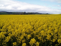
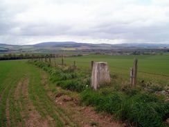
Eventually I could not prevaricate any further and I put my sock and boots back on before hoisting my rucksack onto my back and saying goodbye. The weather in the afternoon seemed slightly better than it had been in he morning with less of a breeze, and I made good time for the first few miles as the road headed past arable fields (the first ones of any size that I had seen on he trip). I soon reached Noranside, and what followed was a long road walk eastwards. I had not booked any accommodation in Brechin, so I made a phone call to the Brechin TI and eventually after a couple of calls I managed to get a bed in one, which relieved me considerably. As I walked along the road the undersides of my feet start to increasingly ache, and as I approached Careston this aching slowly became pain. I nipped away from the road to visit a trig pillar at Craigend of Careston, and then continued on.
A little further on I came across the Killievair Stone, which lies at an almost incumbrent angle in a field immediately to the north of the road. An old local rhyme (from a book dated 1854) says : "Between the Killievair and the Buckler Stanem There lies many a bluidy bane". For more details on this stone see www.themodernantiquarian.com/site/2833. This was the last highlight of the day, and although I could see the A90 from near the stone it seemed to take an age for me to reach it. Once I passed under the road bridge I was in the outskirts of Brechin, and I wearily followed the road as it headed southeastwards towards the centre of the town. Once I reached the centre I was not in a condition to study some of the nice buildings, and I was keen to get to the B&B. Although the lady had given me good directions on the phone I found it difficult to find the place; a quick phone call showed that I had misheard the street name 'Airlie', and that the B&B was on the road I had followed to reach the centre of the town. I staggered back up the light hill (which on weary legs seemed much steeper than it really was).
The landlady made me feel very welcome, and she took me up to my room where I dumped off my rucksack and lay on the bed, absolutely shattered after the long walk. On the bedside table I noticed a book about Hannah Hauxwell, the lady who became famous in the eighties for living in a remote farm with no electricity or running water in Baldersdale, I lay down and read the book, entranced by the lifestyle, before having a long soak in the bath. I was too tired to even consider going out in the evening, and I just lay in bed until my fatigue won, and sleep overcame me.
Directions
This walks starts off at the Clova Hotel in Clova. Leave the hotel and turn right along the road for a few yards until a road junction with the B955 is reached on the left; turn left down this road as it passes to the right of Clova Church and then crosses the River South Esk on a bridge. On the other side of the bridge the road curves to the left, to start following the river southeastwards. Over the next few miles the road slowly curves to head in a more southerly direction. It passes a road junction near a patch of woodland at Craigs of Lethnot and continues on southwards. After about nine and a half miles have been walked from Clova the Dykehead Hotel is reached in Dykehead. Continue on along the B955 as it heads downhill out of Dykehead; it soon curves sharply to the left to head eastwards. A few hundred yards after the bend it curves to the right; here leave the B955 and continue straight on along a local road that soon curves to the left to head northeastwards past Cortachy School and the entrance to Cortachy Castle before crossing the South Esk on a bridge. Continue along the road as it curves around, heading in a rough easterly course. Ignore a couple of roads that lead off to the left and head on past the farm at Newton of Inshewan. In Memus the road curves sharply to the right; follow it as it does so until the church is reached on the left; a few yards further on is the Drover's Inn, which is highly recommended as a place to stop for a quick drink.
At the church in Memus turn left and start following a road that heads northeastwards, passing farmland until a crossroads is reached after a couple of miles. Here continue straight on along a road that curves to the left and then the right, soon crossing Noran Water and curving to the right. When the road curves to the left once more continue straight on along a road that heads southeastwards through Noranside; this road in turn soon curves to the left to head in a more easterly direction. Stay on this road as it heads eastwards, passing to the north of Vayne and Hilton of Fern before reaching Careston. At a crossroads continue straight on as the road climbs uphill past Craigend of Careston; it then slowly descends, passing the Killievair Stone and Barrelwell as it heads eastwards towards the A90 road. At the A90 it curves sharply to the left to parallel the main road for a couple of hundred yards until a T-junction with another road is reached. Here turn right, and follow the new road as it immediately passes under the A90 and enters the western outskirts of Brechin, The road heads southeastwards before curving to the left. A couple of hundred yards after the bend turn right down Airlie Road towards the centre of the town; the B&B that I spent the night at is a short distance down the road on the left.
Distances
| From | To | Distance (m) | Ascent (ft) | Descent (ft) |
|---|---|---|---|---|
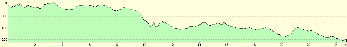
| Clova | Dykehead | 9.5 | 709 | 863 |
| Dykehead | Noranside | 6.4 | 459 | 646 |
| Noranside | Brechin | 8.2 | 322 | 561 |
This makes a total distance of 24.1 miles, with 1490 feet of ascent and 2070 feet of descent.
For more information on profiles, ascents and descents, see this page
Accommodation
I spent the night with the B&B run by Ann Stewart at 26 Airlie Street, Brechin, DD9 6JX, telephone (01356) 622361. This was a lovely B&B that cost me Ł22.00 for the night, and I was made to feel extremely welcome.
Disclaimer
Please note that I take no responsibility for anything that may happen when following these directions. If you intend to follow this route, then please use the relevant maps and check the route out before you go out. As always when walking, use common sense and you should be fine.
If you find any information on any of these routes that is inaccurate, or you wish to add anything, then please email me.
All images on this site are © of the author. Any reproduction, retransmissions, or republication of all or part of any document found on this site is expressly prohibited, unless the author has explicitly granted its prior written consent to so reproduce, retransmit, or republish the material. All other rights reserved.
Although this site includes links providing convenient direct access to other Internet sites, I do not endorse, approve, certify or make warranties or representations as to the accuracy of the information on these sites.
And finally, enjoy your walking!
This walk was mentioned in the following routes:
| The Great Outdoors Challenge 2005 |
Nearby walks
| # | Title | Walk length (miles) |
|---|---|---|
| 673 | Braemar to Clova | 18.2 |
|
|

|