Walk #660: Sedbergh to Staveley
 |
 |
|
General Data
| Date Walked | 28/03/2005 |
| County | Cumbria |
| Start Location | Sedbergh |
| End Location | Staveley |
| Start time | 08.08 |
| End time | 17.41 |
| Distance | 21.1 miles |
| Description | This was a nice, varied walk, taking in valleys and rolling dales on the way towards the end of the Dales Way. |
| Pack | Today I carried my 70-litre Craghoppers WildPlaces 70-litre rucksack, filled with full camping gear and food. |
| Condition | I am fairly fatigued after this walk, which is to be expected after this strenuous walk. My shoulders are fine, and I still have not got any blisters. |
| Weather | The forecast for today was for rain, and so I set off with my fleece and coat on. The fleece soon disappeared as I warmed up, and as the day went on the sun started to make increasing appearances, until at the end of the walk there was scarcely a cloud in the sky. As has been the case on every day of this walk, the forecast has been very wrong. |
| OS map | Landranger number 98 (Wensleydale & Upper Wharfedale) and Landranger number 97 (Kendal & Morecambe, Windermere & Lancaster) |
 |
 |
|
 |
 |
|
Map of the walk
Maps courtesy of Google Maps. Route for indicative purposes only, and may have been plotted after the walk. Please let me have comments on what you think of this new format. For a detailed table of timings for this walk, please see the table file.
 |
 |
|
 |
Notes
It was another wet night, although it was not as cold and breezy (perhaps due to being lower down?) and I did not feel nearly as chilly. I woke up with my bladder complaining, and I went through the usual ritual of trying to get dressed within the tiny confines of the tent. This proved to be impossible, and I ended up cricking my neck in the attempt, which was understandably annoying. Eventually I gave in and unzipped my tent to allow me to stick my head out and got dressed. I went without any breakfast and instead packed up my tent and started off down the road, passing the Pinfold outside the site on the way.
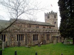
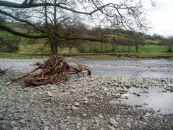
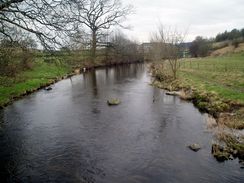
As I had not seen Sedbergh yesterday I decided that instead of walking back along the river to the Dales Way I would go for a walk through the town. This proved to be a god idea as it is an amiable place, and I nipped into a shop to buy some chocolate for the day as I looked around. The streets were quiet at this time in the morning, and this increased the ambience of the place. I soon found myself back at the bridge, where I rejoined the Dales Way at the point where I had finished yesterday. The initial going was quite pleasant along the northern bank of the River Rawthey, and soon the River Dee joined it and I headed towards a high embankment. This proved to be the embankment of the old railway line that went to Ingleton, and right beside it was a graceful iron-arch bridge over the river. The path climbed up to the top of the embankment and I went to look at the bridge through the railings; the iron girders are clearly visible except for one small section, where a British Gas walkway goes across.
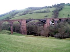
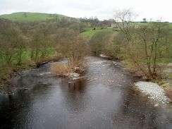
A short stretch of road was followed by a nice path that led to the farm at The Oaks. I nearly went wrong here, but after ten yards I realised that I was walking in the wrong direction and found the path that went behind the houses before heading north towards Lincoln Inn Bridge. Fairly soon afterwards the next target became visible; a magnificent viaduct soaring high above the river. A stream immediately before the viaduct was reached proved easy to ford, and soon I was looking up at the six arches, three on either side of the central iron arch. It really was an impressive structure, and I could not help but look up at it for a few minutes. This proved to be a useful rest, because as soon as it had passed under the viaduct the path climbed up to the same height as it moved slightly away from the river, passing a couple of pretty farms and with some good views over the nearby fells.
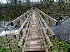
The path eventually met the river once again at Hole House, and I made a major navigational mistake; instead of following the Dales Way across a stream using a footbridge, I followed an obvious path alongside the stream to a bridge over the River Lune. Once on the other side I climbed high up a steep footpath until I reached the course of the old railway line. This made me realise my mistake, and discontendly I headed back down the path to the footbridge and rejoined the path alongside the river. Upset as I was by the stupid mistake, the wonderful riverside walk soon had me smiling, and too soon I reached the Crook of Lune Bridge. This is a narrow two-arch bridge over the River Lune, and as it was a beautiful spot I sat down on a stone beside the river bank, took my rucksack off and relaxed, watching the water flow by. As I had mobile reception I used the opportunity to arrange accommodation for the night so that I would not have the same problems as last night, and after a couple of phone calls I had booked myself into a B&B in�Staveley.
It was truly a lovely spot, but I knew that I till had a long distance to walk and so I shrugged on my rucksack and headed up the road towards the Lowgill Viaduct. This was an interesting spot, as directly under the viaduct is a road bridge, and next to this is a tiny packhorse bridge; the comparisons in scale were outstanding. A path led me on towards a bridge over the M6, which was an audible intrusion for a considerable time before and after crossing it. some undistinguished paths took me on westwards, skirting the railway line for a period before winding around past the farm at Greenheead and crossing the A685 road.
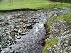
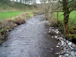
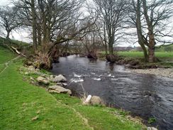
Just before the next farm, Thursgill, came a pleasant surprise. Beside the track there was a cool box and a seat, inviting passers-by to buy a drink for fifty pence. This seemed like a superb idea, and so I purchased a bottle of Dandelion and Burdock. It was tempting to sit down for the drink, but I decided to move on and drink it as I walked. This trustful refreshment booth was much appreciated, as I daresay it has been for many others. The next few miles were fairly pedestrian, following paths and tracks all the way down to the A6. This road proved to be surprisingly quiet, and was easy to cross before following footpaths westwards towards Burneside. I went slightly off course here and took a footpath that headed south, but I soon regained the proper path as it skirted a road, before diverting off to meet a stream at Sprint Mill, before heading to meet the road at Sprint Bridge.
By this time I was feeling very fatigued, and I started to wish that I had got accommodation in Burneside instead of Staveley. I plodded on, however, and soon rejoined the river near a mill and following it on to the little village of Bowston. There followed a wonderful riverside walk along the River Kent, soon reaching a mill that had been tastefully converted into a housing estate Due to fatigue I really could not take in the beautiful scenery, and I started counting the steps until I reached the end of the day. Already it had been by far the longest walk of the trip (and year so far), and I as relieved when the road that led into Staveley became visible.
The B&B�is at the other side of the village, and I staggered slowly up the road towards it. The proprietors made me incredibly welcome, and I had a wonderful evening chatting with them - this is the best B&B that I have stayed in for some time.
Directions
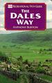
The majority of this walk follows the Dales Way; as this is a named trail I will not give directions. Instead I will refer you to the Ordnance Survey Recreational Path Guide for the path, which I used throughout my walk. This proved to be invaluable, and is bound to be kept more up to date than any directions I put on this site. The book also includes details of the Leeds extension to Ilkley, which adds twenty miles onto the Dales Way. Please click on the image below to go to the Amazon page for this book.
There are two exceptions to this; firstly, I started the walk at the Pinfold caravan site in Sedbergh, and made a diversion off into Sedbergh before descending down to the bridge over the River Rawthey in Millthrop. The second extension happened in the village of Staveley; when I reached Stockbridge Farm on the outskirts of the village, instead of following the Dales Way as it headed away from the road and under the railway line, I continued along the road north into the village, before turning left along Danes Road to reach the B&B in which I was staying.
Distances
| From | To | Distance (m) | Ascent (ft) | Descent (ft) |
|---|---|---|---|---|
| Sedbergh | Crook of Lune | 8.3 | 991 | 932 |
| Crook of Lune | Patton Bridge | 5.1 | 764 | 728 |
| Patton Bridge | Burneside | 3.7 | 308 | 564 |
| Burneside | Staveley B&B | 4.0 | 381 | 207 |
This makes a total distance of 21.1 miles, with 2444 feet of ascent and 2431 feet of descent.
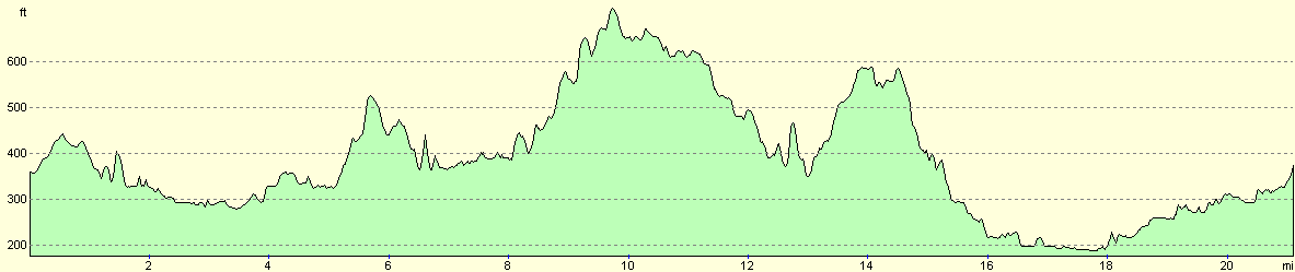
For more information on profiles, ascents and descents, see this page
Accommodation
I spent the night at Tarn House, 18 Danes Road, Staveley, near Kendal, Cumbria, LA8 9PW, telephone (01539) 821656. This was an absolutely superb B&B, indeed one of the most welcoming that I have stayed in for some time. The place was spick and span, and the first thing they asked me was if I wanted a cup of tea. The twin room cost me twenty-five pounds for the night, although a single room costs only twenty pounds. This B&B is highly recommended.
Disclaimer
Please note that I take no responsibility for anything that may happen when following these directions. If you intend to follow this route, then please use the relevant maps and check the route out before you go out. As always when walking, use common sense and you should be fine.
If you find any information on any of these routes that is inaccurate, or you wish to add anything, then please email me.
All images on this site are © of the author. Any reproduction, retransmissions, or republication of all or part of any document found on this site is expressly prohibited, unless the author has explicitly granted its prior written consent to so reproduce, retransmit, or republish the material. All other rights reserved.
Although this site includes links providing convenient direct access to other Internet sites, I do not endorse, approve, certify or make warranties or representations as to the accuracy of the information on these sites.
And finally, enjoy your walking!
This walk was mentioned in the following routes:
| The Dales Way |
Nearby walks
| # | Title | Walk length (miles) |
|---|---|---|
| 659 | Swarthgill to Sedbergh | 20.0 |
|
|

|