Walk #661: Staveley to Windermere
 |
 |
|
General Data
| Date Walked | 29/03/2005 |
| County | Cumbria |
| Start Location | Staveley |
| End Location | Windermere |
| Start time | 09.23 |
| End time | 13.34 |
| Distance | 10.0 miles |
| Description | This was a short walk, ending the Dales Way into Bowness and continuing on for the shot distance into Windermere. |
| Pack | Today I carried my 70-litre Craghoppers WildPlaces 70-litre rucksack, filled with full camping gear and food. |
| Condition | I feel better after this walk than I have after any long multi-day backpack - my body has no significant aches or pains and I feel as though I could easily have done double the distance. |
| Weather | Today was a nice, warm day, with thin, high cloud and large periods of sunshine. The wind, when I was exposed to it, was very chilly, but it was by far the warmest day of the walk so far. |
| OS map | Landranger number 97 (Kendal & Morecambe, Windermere & Lancaster) |
 |
 |
|
 |
 |
|
Map of the walk
Maps courtesy of Google Maps. Route for indicative purposes only, and may have been plotted after the walk. Please let me have comments on what you think of this new format. For a detailed table of timings for this walk, please see the table file.
 |
Notes
I awoke this morning after a wonderful nights sleep in a soft bed. It felt very strange to be able to stretch my body out in the bed rather than being constrained to the small area of my sleeping bag and tent. I woke up with me legs and arms outstretched, as if my body was savouring the space that surrounded it as I slept. As usual when sleeping in a bed during a long-distance walk the first thing I did when getting up was gingerly put the weight on my legs, to see if any problems had shown up over the night. Fortunately my legs did not protest, and I started to get ready for breakfast. It had been the latest night of the walk so far - I had not gone to bed until ten the previous evening due to chatting to the landlady. Breakfast was quickly dispatched, but as I had a short days walking ahead of me I was in hurry to leave, and so I chatted to the proprietors and the other guests. As a result by the time I had finished chatting and got all my kit together it was well after nine, and I headed off down through the village to regain the Dales Way where I had left it last night.
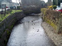
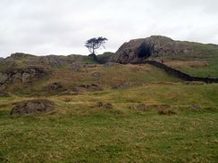
Despite the strenuous and long walk of the previous day my legs felt fine as I started heading across fields away from Staveley. The A591 road was soon crossed, and after a short footpath the way joined a quite lane. To say that this lane was quiet is an understatement; no vehicles passed me as I walked along it, and I let my eyes wander over the stunning vista of the Lakeland Fells to my right. The road rose and fell and was not surprisingly strenuous, but the views more than made up for the tiring walking. The road was eventually left behind, and I started following the way as it crossed rocky grazing meadows, with the rocks sticking out of the ground complementing well the views of the fells in the distance. As I headed down towards the farm at Outrun Nook I came across a Yew that had just given birth - the lamb was standing, being licked by its mother, and the afterbirth was sill attached. I stood transfixed as I watched, and departed silently in order not to disturb them.
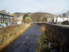
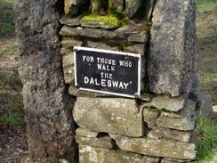
From Hag End the path started to descend, and although it was muddy underfoot I managed to make good time as I�headed downhill, eventually joining an unsurfaced track with craggy hillside to both sides. This track soon doubled back on itself, heading south and becoming surfaced as it approached the B5284 road. For some strange reason I found it difficult to find the path that led northwestwards from the main road, and after heading down towards Low Cleabarrow I turned back and headed back towards the main road, before realising that I had been on the correct route after all and headed back towards the cottage. Quite what the two men behind me though of my actions I do not know! The last kilometre of the way was easy to follow - although muddy in places - as it headed westwards, and I soon came across the slate bench that marks the end of the Dales Way. I sat down on it, feeling justified in doing so at having completed the walk, and contemplated the last five days.
I did not want to sit for too long, however, and after a couple of minutes I got up and started heading down the road into the village. At the first pub that I passed there was a sign stating that it was the first pub at the end of the Dale Way, so I nipped in and had a quick pint, a deserved celebration after the long walk. Whilst in there I chatted to some of the locals, and the main topic of conversation was the speed limit of 10 MPH placed on Windermere the previous night. This move by the National Park is highly controversial as it has put many speedboat companies out of business, but apparently the main aim of the law is to ban jet skis, who have been causing annoyance on the lake. Despite five year's notice the ban was still unpopular, and apparently just before midnight last night several speedboats had made one last journey up the lake.
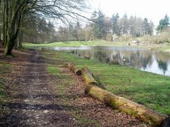
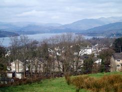
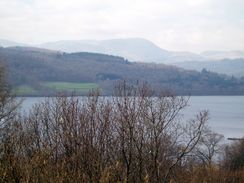
I did not want to spend too long chatting, particularly as it would mean having another pint, and so I picked up my rucksack ready to put it on. As I did so one of the locals asked me if he could feel the weight, and I felt strangely happy when he proclaimed that I must be insane for carrying that much weight on my back for 100miles! I left the pub and started on an indirect route towards the railway station; I planned to follow the road that skirts the eastern side of the lake before diverting inland to the centre of Windermere, as I was hoping to get some good views of the lake. Unfortunately this did not really turn out to be the case due to housing and the slightly inland route that the road took, and so I consoled myself with an ice cream from a roadside stall at one of the few viewpoints and merrily munched on this was I walked.
I powered my way up the last hill and soon found myself at the railway station; I found myself to be slightly annoyed at having by-passed the centre of Windermere for the hope of getting good views of the lake. Just as I arrived at the station a train was arriving, and when I enquired at the ticket office the man behind the screen advised me to hop on that train. Thus I found myself in a little bit of a whirlwind - no sooner had I finished the walk than I was on a train. wheedling its way through the hills and onto the West Coast Main Line. As I had a return ticket for Leeds it was cheaper to go via Leeds, which meant quite a roundabout and long return journey. In the hurry I had no chance to buy a newspaper or magazine, and so I was forced to spend the journey looking out of the window - hardly a hardship, and I was surprised to get a glimpse of the sea to the south of Carnforth.
So what are my immediate thoughts about the Dales Way? Well, it is a relatively easy walk when compared to (say) the Pennine Way - it is mainly a low-level walk, with the highest point being the climb over the watershed. Despite this, however, it was a superb walk, and I have many happy memories that photos will barely do justice of. It was one of the muddiest long-distance walks that I have ever done, but that was a result of the wet spring rather than any intrinsic feature of the walk. I also did rather long and strenuous days - it could be more enjoyable to spend and extra day or two and spend the nights in B&B's rather than carrying camping gear. It would be a very good warm-up walk for someone considering doing the Pennine Way or Coast to Coast walks.
Directions
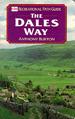
The majority of this walk follows the Dales Way; as this is a named trail I will not give directions. Instead I will refer you to the Ordnance Survey Recreational Path Guide for the path, which I used throughout my walk. This proved to be invaluable, and is bound to be kept more up to date than any directions I put on this site. The book also includes details of the Leeds extension to Ilkley, which adds twenty miles onto the Dales Way. Please click on the image below to go to the Amazon page for this book.
The diversions from the Dales Way were at the start and the end of the day. Initially, I had to walk back from my B&B in the village towards the point where I had left the Dales Way the previous night at Stockbridge Farm. This was easy road walking, and was not complex. Then, when I had reached the end of the Dales Way in Bowness on Windermere, I continued walking downhill, past the Royal Oak pub until the main A592 road is reached. Turn right, to head north along the A592 as it parallels the eastern shore of Windermere northwards for a couple of kilometres until a roundabout with the A591 is reached. At the roundabout, turn hard-right and follow the A591 as it heads uphill southeastwards for about a kilometre to Windermere railway station, where this walk ends. this is a long route, and if you want to get to the railway station from the end of the Dales Way in Bowness-on-Windermere, then a more direct main road heads up to the railway station through the centre of the town.
Distances
| From | To | Distance (m) | Ascent (ft) | Descent (ft) |
|---|---|---|---|---|
| Staveley B&B | Bowness on Solway | 7.3 | 1017 | 1204 |
| Bowness on Solway | Windermere station | 2.7 | 417 | 164 |
This makes a total distance of 10.0 miles, with 1434 feet of ascent and 1368 feet of descent.
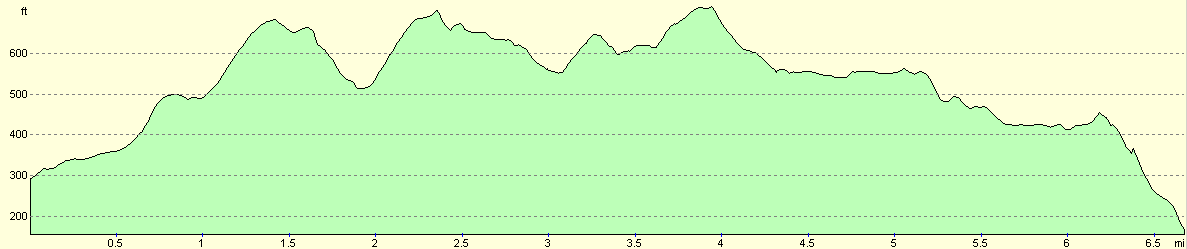
For more information on profiles, ascents and descents, see this page
Transport
There are regular train services running from Windermere station to Manchester; there are also many bus services running from the railway station to many places in the Lake District.
Disclaimer
Please note that I take no responsibility for anything that may happen when following these directions. If you intend to follow this route, then please use the relevant maps and check the route out before you go out. As always when walking, use common sense and you should be fine.
If you find any information on any of these routes that is inaccurate, or you wish to add anything, then please email me.
All images on this site are © of the author. Any reproduction, retransmissions, or republication of all or part of any document found on this site is expressly prohibited, unless the author has explicitly granted its prior written consent to so reproduce, retransmit, or republish the material. All other rights reserved.
Although this site includes links providing convenient direct access to other Internet sites, I do not endorse, approve, certify or make warranties or representations as to the accuracy of the information on these sites.
And finally, enjoy your walking!
This walk was mentioned in the following routes:
| The Dales Way |
Nearby walks
| # | Title | Walk length (miles) |
|---|---|---|
| 660 | Sedbergh to Staveley | 21.1 |
|
|

|