Walk #433: Haverigg to Ravenglass
 |
 |
|
General Data
| Date Walked | 04/05/2003 |
| County | Cumbria |
| Start Location | Haverigg |
| End Location | Ravenglass |
| Start time | 10.00 |
| End time | 17.17 |
| Distance | 19.8 miles |
| Description | This was a surprisingly strenuous walk over sand, shingle and boggy ground. Some of this walk is very dependant on the state of the tides. |
| Pack | Today I carried my 30-litre Karrimor HotRock rucksack, which was filled with my packed lunch, waterproof leggings, water bottle and a couple of spare shirts, together with the usual assortment of odds and ends. |
| Condition | I had a certain amount of aching in my left knee and ankle towards the end of this walk, and this was extremely annoying. Aside from this I did not have any problems, and this can only be a good sign. |
| Weather | The weather today was very varied; at times there were significant periods of sunshine, and at others thick cloud and light rain. Last night had been extremely wet, but this ended a couple of hours before I set off. The wind also varied in strength, from non-existent to quite strong gusts. All in all it could have been much worse. |
| OS map | Landranger number 96 (Barrow-in-Furness & South Lakeland) |
 |
 |
|
 |
 |
|
Map of the walk
Maps courtesy of Google Maps. Route for indicative purposes only, and may have been plotted after the walk. Please let me have comments on what you think of this new format. For a detailed table of timings for this walk, please see the table file.
 |
 |
|
Notes
It felt very strange this morning to wake up in a proper bed, and to be able to sit up without banging my head on the ceiling. I woke up quite late for once after a good nights sleep and our long chat last night, and after doing our ablutions we went down to breakfast with June. She is a lovely lady, and it was kind of her to put us up for the night (and to put up with out verbal diarrhoea all evening).
The rain that started after I finished yesterday's walk continued all night, leaving roads that were waterlogged with large puddles across them. We filler Mervan up with water before leaving June's house, although I feel that we could just have drilled a hole in the top of it last night and collected a tank full!
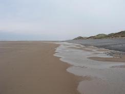
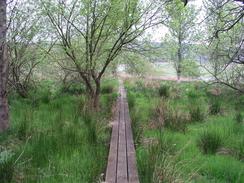
Walking on the shingle was extremely tiring, and a couple of times I went slightly over on my left ankle, causing it to ache for the rest of the day. I think that I also must have stressed my left knee, as this also ached for much of the time. I really do hate walking on shingle - it is by far my least favourite terrain.
The path eventually and thankfully climbed up onto the top of the cliffs near Gutterby Spa, and this allowed me to give my ankle a stretch. The path follows the edge of the cliff for the initial section, but I made a slight diversion inland over a fence to avoid a section that had half-slipped down the cliffs. The situation got better when the path joined a good track that headed northwestwards along the cliffs, passing a trig point that looked as though it was soon going to plunge to the beach below - normally I go up to trig points, but it was so close to the edge I decided to stay on the landward side of the fence.
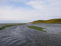
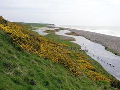
The track ends at Annaside, and I rejoined the beach and walked along that. I was also aware that the tide was getting high, and that I would have to cross the River Annaside, which had flooded fields to my right. I had two options; I could try and cross the mouth of the beach on the shingle, or cross the river on a bridge. I decided that as the river was in flood crossing the mouth would be too dangerous, so I had to cross the bridge. Most of the land on either side of the elegant wooden structure was flooded, but I managed to get across using a narrow strip of land that allowed me to cross - if there had been another couple of inches of water I would have had to do some wading. The fields looked nice in flood, with a background of the shingle beach and a foreground of green grass and yellow gorse.
The red flags were not flying at the Eskmeals army range, but I could not see the point of walking along the beach through the range, and chose to walk the inland route following the Cumbria Coast Way. I had been intending to continue along the road for as long as possible, a sign warned of tidal flooding, and as it was near high tide and the previous river had been in flood I decided to follow the official path, which heads slightly inland. The path between Hall Waberthwaite and Rougholme passes Broadoak Beck, and there was a sign stating that this was only passable two hour either side of a certain high tide. There was a tide table beside the sign, and this showed me that I had an hour to go before it would be passable, but I decided to progress on anyway. I managed to pass this section carefully without getting my feet wet, but it took some nifty footwork over the boggy ground.
This evening we went into the pub beside the car park, the Ratty Arms, so that we could have a drink. The manager was kind enough to allow us to do a collection, so we did this and got a nice sum of money. I got slightly fed up with explaining that tomorrow I will be ending the walk at the base of Scafell Pike - I would then invariably be told that it is not on the coast!
Directions
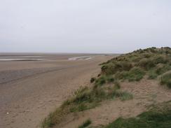
This walk starts off at the car park near the lifeboat station in the village of Haverigg. Leave the car park and head through the dunes to he beach, and then turn right to walk westwards along the beach, with the sand dunes to the right. The beach approaches Haverigg Point, where it turns from heading westwards to a more northwesterly course, and follows it past a wind farm and a golf course until it reaches Gutterby Spa.
At Gutterby Spa the path turns to the right and heads along a path up the cliffs to a gate. At the gate it turns to the left; this section of path had been eroded away, so I climbed over a fence and walked through a field keeping the cliffs to my left. Eventually a track is reached that follows the top of the cliffs past a trig point until it turns to the right to head inland towards Annaside. At the bend continue straight on along a footpath that meets another track before dropping back down onto the beach.
Follow the beach northwestward until a footbridge is reached on the right. Use this footbridge to cross the river Annas, and once on the other side turn left and walk along the side of a hill past Hyton Marsh before reaching the farm at Selker. From here follow the edge of the cliffs around until the path reaches a car park beside a road at Stubb Place. Join this road and follow it as it heads northwards, with the Eskmels military range on the left. After a couple of miles the Cumbrian Coast Way lead off down a track to the right; if the tide is high then you can follow this route under the railway line to reach Newbiggin, or otherwise you could continue along the road to reach the same place.
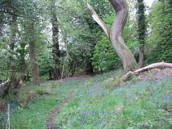
From Newbiggin a path heads northeastwards across Waberthwaite Marsh to reach the hamlet of Hall Waberthwaite; this section of path could be impassable for two hours either side of high tide. From Hall Waberthwaite the path follows a track along the southern bank of Broadoak Beck before reaching the farm at Rougholme, where it continues on through some woodland and down onto the floodplain of the River Esk to reach Muncaster Bridge.
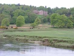
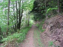
At Muncaster Bridge turn left and walk up the A595(T) until a lodge is reached on the left. Turn left and follow the Cumbrian Cast Way all the way through the grounds of Muncaster Castle until Ravenglass is reached; again the route from Beacon Plantation is flooded by the tide, so is impassable for two hours either side of high tides, but this time an alternative inland route is provided. The path passes through some woodland before descending down to meet the northern bank of the River Esk, which it follows to Beacon Plantation. If the tide is low turn left to descend down onto the marshland, and from here a clear path heads westwards to a bridge under the railway line. Immediately after the bridge turn right and follow the path northwards along the floodplain for a little over a mile until a road is reached at the southern end of the village of Ravenglass. Follow this road through the village and follow it as it curves to the right to reach a car park beside the station, where this walk ends.
For more details of the Cumbria Coastal Way, see the excellent little book, The Cumbria Coastal Way: A Walker's Guide", by Ian and Krysia Brodie, ISBN 187355110X. This book is a lovely and detailed description of the walk, and unfortunately I did not manage to get a copy until after I finished the walk, for it would have been quite handy.
Distances
| From | To | Distance (m) | Ascent (ft) | Descent (ft) |
|---|---|---|---|---|
| Haverigg | Stubb Place | 11.0 | 804 | 804 |
| Stubb Place | Ravenglass | 8.8 | 502 | 469 |
This makes a total distance of 19.8 miles, with 1306 feet of ascent and 1273 feet of descent.
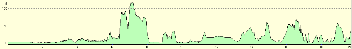
For more information on profiles, ascents and descents, see this page
Accommodation
We spent the night in the car park beside the Ratty Arms in Ravenglass, which was very handy for the pub. There were also some public toilets in the car park that were open for use.
Disclaimer
Please note that I take no responsibility for anything that may happen when following these directions. If you intend to follow this route, then please use the relevant maps and check the route out before you go out. As always when walking, use common sense and you should be fine.
If you find any information on any of these routes that is inaccurate, or you wish to add anything, then please email me.
All images on this site are © of the author. Any reproduction, retransmissions, or republication of all or part of any document found on this site is expressly prohibited, unless the author has explicitly granted its prior written consent to so reproduce, retransmit, or republish the material. All other rights reserved.
Although this site includes links providing convenient direct access to other Internet sites, I do not endorse, approve, certify or make warranties or representations as to the accuracy of the information on these sites.
And finally, enjoy your walking!
This walk was mentioned in the following routes:
| My walk around the coastline of Britain |
Nearby walks
| # | Title | Walk length (miles) |
|---|---|---|
| 431 | Robin Whins Point to Askam in Furness | 17.9 |
| 432 | Askam in Furness to Haverigg | 19.6 |
| 434 | Ravenglass to Wasdale Head, via Seascale | 17.7 |
|
|

|