Walk #430: Ulverston Sands to Robin Whins Point
 |
 |
|
General Data
| Date Walked | 01/05/2003 |
| County | Cumbria |
| Start Location | Ulverston Sands |
| End Location | Robin Whins Point |
| Start time | 09.33 |
| End time | 16.50 |
| Distance | 18.0 miles |
| Description | This was quite a nice walk to Barrow-in-Furness, and out onto Walney Island, visiting Roa Island on the way. |
| Pack | Today I carried my 30-litre Karrimor HotRock rucksack, which was filled with my packed lunch, waterproof leggings, water bottle and a couple of spare shirts, together with the usual assortment of odds and ends. |
| Condition | I never really felt one hundred percent during this walk, and I found each mile quite hard to complete. By the end of the walk I was quite tired and I was glad for the walk to end. |
| Weather | Yet again I had been expecting it to rain, and yet again it did not. There was a very heavy shower this morning before I set off, but after this there was none, and the afternoon wsa quite sunny and warm. |
| OS map | Landranger number 96 (Barrow-in-Furness & South Lakeland) |
 |
 |
|
 |
 |
|
Map of the walk
Maps courtesy of Google Maps. Route for indicative purposes only, and may have been plotted after the walk. Please let me have comments on what you think of this new format. For a detailed table of timings for this walk, please see the table file.
 |
 |
|
Notes
I found it quite hard to get going this morning, and I was feeling quite out of sorts when Sam dropped me off at the car park at Ulverston Sands. It had been another late start, as I used the opportunity of having mains power to Mervan to do some work on my website, and the eyestrain this caused could not have helped matters. My right thigh was aching and was slightly sore to the touch, and the first mile was a real swine; I found it quite hard.
Before the end of the first mile I got a phone call from a photographer from the local newspaper, the Evening Post, and we arranged to meet outside the Fishermans Arms Hotel in Baycliff. This meant that I had to make a little diversion inland to reach the hotel, and I waited a couple of minutes for the photographer to arrive. He then drove me back down to the beach so that he could take some photographs. He was a nice bloke, and we chatted away whilst he took the photos, and then he dropped me back off at the hotel. There should be an article in tomorrow's paper, and it should be interesting to see how well the photos turn out.
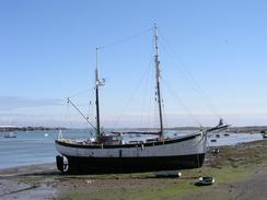
I walked over the causeway onto Roa Island so that I could have a quick look around. There is not much on the island, although I enjoyed looking at the RNLI lifeboat station, from where a ferry makes regular trips in summer over to Piel Island. I had been intending to drop in at the pub on Roa Island that is marked on the map, but it has been shut for two years so I walked back over the causeway to the Concle Inn, which I nipped into for a drink. Sam joined me in the pub whilst I had my drink, and we chatted to the owner and her Labrador dog. I was curious about what a Concle was (the name of the pub), and apparently it means a hole that gets filled at high tide, which locals could use once the tide had gone out. It is the first time that I have heard that word, and so it could very well be a local term.
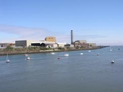
During this trip I have passed many shipyards, both closed and open, and unfortunately most of them have been in varying states of decay (the most notable exception being Appledore shipyard in North Devon, which is Britain's biggest independent shipyard, and was in good condition). I knew that Barrow-in-Furness was responsible for building submarines, and so I was expecting to see a run-down shipyard. Fortunately this was not the case, and the buildings in the shipyard looked spick and span, with BAE logos everywhere. I can only assume that their order books are quite full, or have been recently. The buildings are absolutely massive, and dwarf the houses in the town beneath them like some giant monoliths. This sort of massive engineering fascinates me, and I wish that I could see what happens inside the buildings. The construction of the submarines would be fascinating enough, as they are such massive yet highly technical constructions, designed and built to work in a totally alien environment, to glide silently where no-one can see.
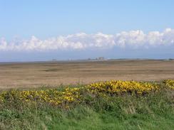
From Barrow-in-Furness I walked over the bridge and onto Walney Island. I met Sam on the island, and we had a chat about where we were going to meet up. By going onto the island I had broken my rule about not going onto islands or onto places with only one route on and off, but the island looks an interesting place and so I decided to explore it. The views in the afternoon sunshine were nice, and I could see the castle on Piel Island clearly.
I ended the walk at a little car park (at least that is how it is marked on the map; it looks more like an entry to a landfill site), and it was obvious that we could not send the night there. We therefore drove back to Biggar, and parked in the car park of the Queens Arms and went in for a drink. The landlord aid that we could park there after nine, but he was expecting the car park to be full before this, and in the meantime we could park on a triangle of grass outside the pub. Whilst we were in the pub Sam noticed that there was a half-price night on the food, and as I had been intending to treat Sam for some time, we decided to eat a meal at the pub, and it was a great ides - the food was superb and come in large quantities. The whole thing cost us under twelve pounds for the two of us, including starters and main course. This was tremendous value, and I left the pub totally stuffed.
Directions
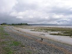
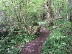
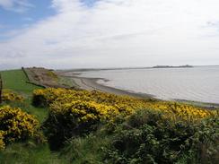
This walk starts off at the car park at Ulverston Sands. Leave the car park and take a footpath that leads uphill from the road, before dropping down to meet a track that runs southwestwards beside the coast. The track passes a little car park where the A5087 road approaches it. The track ends, and I dropped down onto the beach for a short distance before climbing up and walking through Sea Wood, at the southern edge of which I dropped back down onto the beach. Continue southwards along the beach past Baycliff and Maskel Point until you reach the church at Aldringham. Here I joined the little road through the village, and followed this southwestwards along the coast until it ended at the A5087 road. Turn left and follow the A5087 until it reaches Moat Farm; at the end of a right-hand bend past the farm a footpath leads off to the left and heads towards the sea, before following the cliffs along towards a little caravan park. Here a track is joined, which ends at the A5087 road, which can be followed southwestwards past Point of Comfort Scar until a roundabout is reached in Rempside.
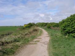
At the roundabout turn left and follow a minor road southwestwards for about a mile until the Concle Inn is reached, where the road turns to the left to head southwards over a causeway onto Roa Island. Walk to the lifeboat station at the southern end of Roa Island, before turning around and heading back northwards across the causeway towards the Concle Inn. Just before the road curves to the right a track continues straight on (the course of an old railway), and this can be followed for about half a mile, The path then dives off to the left to meets the cliffs, which it follows around past Westfield Point and back towards the gas terminals. Shortly beyond this the path rejoins the course of the railway track, which it followed northwestwards past a power station until it reaches a railway line.
The path heads under the railway line on a low bridge and reach a road junction on the other side. Turn left and follow a road westwards until it reaches the A5087 road, which can be followed westwards through Barrow-in-Furness. Near a church and a new Morrisons superstore the road curves to the right to head northwestwards; at a bend in this road take a minor road straight on that climb uphill for a hundred metres and ends at the northern end of a high-level bridge. Turn left to cross this bridge over the docks onto Barrow Island.
Continue on down the road through the dockyards until a roundabout is reached; turn right at this roundabout and follow the road around to another roundabout. Turn left at this roundabout and follow the road across the Jubilee Bridge to Walney Island, and on the other side of the bridge turn left and follow the A590 road southwards; after a few hundred metres it turns to the right to head southwestwards. The road passes an area of marshland on the left, and when Carr Lane is reached turn left and follow it southeastwards towards Biggar Village. Continue on along the road through the village and then on for a mile and a half until a landfill site is reached on the right, where this walk ends.
For more details of the Cumbria Coastal Way, see the excellent little book, The Cumbria Coastal Way: A Walker's Guide", by Ian and Krysia Brodie, ISBN 187355110X. This book is a lovely and detailed description of the walk, and unfortunately I did not manage to get a copy until after I fnished the walk, for it would have been quite handy.
Distances
| From | To | Distance (m) | Ascent (ft) | Descent (ft) |
|---|---|---|---|---|
| Ulverstone Sands | Roa Island | 8.8 | 518 | 518 |
| Roa Island | Barrow-in-Furness | 5.2 | 190 | 151 |
| Barrow-in-Furness | Robin Whins Point | 4.0 | 164 | 197 |
This makes a total distance of 18.0 miles, with 872 feet of ascent and 866 feet of descent.
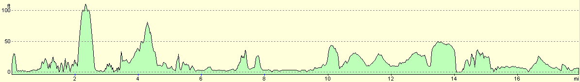
For more information on profiles, ascents and descents, see this page
Accommodation
We parked Mervan on the grass outside the Queens Arms in Biggar. This was veryconvenient for the pub, which served some absolutely superb food.
Disclaimer
Please note that I take no responsibility for anything that may happen when following these directions. If you intend to follow this route, then please use the relevant maps and check the route out before you go out. As always when walking, use common sense and you should be fine.
If you find any information on any of these routes that is inaccurate, or you wish to add anything, then please email me.
All images on this site are © of the author. Any reproduction, retransmissions, or republication of all or part of any document found on this site is expressly prohibited, unless the author has explicitly granted its prior written consent to so reproduce, retransmit, or republish the material. All other rights reserved.
Although this site includes links providing convenient direct access to other Internet sites, I do not endorse, approve, certify or make warranties or representations as to the accuracy of the information on these sites.
And finally, enjoy your walking!
This walk was mentioned in the following routes:
| My walk around the coastline of Britain |
Nearby walks
| # | Title | Walk length (miles) |
|---|---|---|
| 428 | Silverdale to Grange-over-Sands | 22.2 |
| 429 | Grange-over-Sands to Ulverston Sands | 22.8 |
| 431 | Robin Whins Point to Askam in Furness | 17.9 |
|
|

|