Walk #344: Mawgan to Coverack
 |
 |
|
General Data
| Date Walked | 02/02/2003 |
| County | Cornwall |
| Start Location | Mawgan |
| End Location | Coverack |
| Start time | 08.30 |
| End time | 15.33 |
| Distance | 16.5 miles |
| Description | This was a lovely walk following the southern bank of the Hleford River and then the South West Coast Path southwards as far as Coveack. |
| Pack | Today I carried my 30-litre Karrimor HotRock rucksack, which was filled with my packed lunch, waterproof leggings, water bottle and a couple of spare shirts, together with the usual assortment of odds and ends. |
| Condition | The biggest problem that I had today was with my right eye, which was aching all day and which got worse as the day went on. I got a small piece of grit in it yesterday in St Ives as we walked back to the van, and although Sam cannot see it in my eye it is hurting very much, especially when the wind blows in my eye. Aside from this I had a couple of little tweaks from my ankle during the day, but nothing that I was too concerned about. |
| Weather | The weather today was a mixture of sunshine and showers, and fortunately there was more of the former than the latter. AT times the wind gusts were quite strong, but this was fairly rare and did not spoil the walk. The showers were generally quite short and never really got me wet, and it was not a cold day, so all in all I cannot really complain. |
| OS map | Landranger number 203 (Land's End & Isles of Scilly, St Ives & Lizard Point) and Landranger number 204 (Truro & Falmouth, Roseland Peninsula) |
 |
 |
|
 |
 |
|
Map of the walk
Maps courtesy of Google Maps. Route for indicative purposes only, and may have been plotted after the walk. Please let me have comments on what you think of this new format. For a detailed table of timings for this walk, please see the table file.
 |
Notes
After a day off, it was really nice to be back on the trail once more. What was even nicer was the fact that I have now finished the last of the many estuaries on the south coasts of Devon and Cornwall, and from now on the walk becomes simpler for a long time, with only one major estuary to be walked around on the north coasts of the two counties.
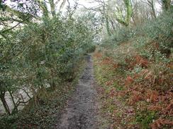
The section of walk from Mawgan to Helford took me much longer than I was expecting, and in particular the section along the permissive path around Frenchmen's Creek seemed to take me an inordinately long time. I am unsure why this was, as the path was not particularly bad and was fairly distinct on the ground, so I must just have walked slowly over this section.
By the time that I got to Gillan Creek the tide was quite far out, and so I was hopeful of being able to ford the creek and save myself a walk of a little over a mile around the estuary. However when I got to the fording point some of the stepping-stones were still submerged b the water flowing out to sea, and the others were slippy. I therefore decided to just plough through the water downstream of the stones. My feet did not really get wet in doing this, but immediately after this I had another stretch to cross that was slightly deeper, and whilst doing this both my feet got slightly damp despite my gaiters, which was a shame but hardly catastrophic.
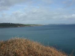
The path from Lowland Point to Coverack was exceedingly muddy and boggy in places, and this made progress difficult at times. Some parts of the path were totally flooded, and I had little option but to squelch through the thick mud and just hope that my feet did not get wet. The whole area is a raised cliff system, so the area I was walking on was once the foreshore at a time when sea levels were higher, so I guess that the ground can get saturated very easily as it is so level.
Yesterday I chose to take the day off, which was not a decision that came easily. We had to get up to St Ives to meet Tom Isaacs and various other people at two in the afternoon, and I could not see the point of doing a very short walk as far as Helford in the morning before the drive up to the north coast. Instead I did some more work on the computer and got some more walks up to date and completed. We then drove into Helston to pick up a load of post that Dad had sent to us by poste restante before driving up to St Ives.
Sam and I had a quick drink in the Tate Gallery in St Ives (unfortunately the gallery was shut for rehanging) to while away the hour before everyone was due to come. We then went outside to see para surfers do their stuff on the beach outside before the first people turned up. Eventually there was quite a huddle of people outside the Tate, and then when Tom and the local M.P., Andrew George, turned up the work could begin. Also there were some people from a couple of the local RDA groups, and we should be going along to see one of them near St Ives on Wednesday if I can fit it in with the walk.
It was really nice meeting Tom, who has now completed just over 3,500 miles of his walk and has a little under 1.000 to go. It is amazing to think that I still have to do the total distance that he has done so far - I feel it slightly overwhelming, if the truth be known! He seems a really nice chap, and we should be meeting up in the next few days so that we can have a longer chat. I am particularly interested in the route that he took in various places, as he could be able to give me some useful tips on routes and other things. As much as anything else it is lovely to talk to someone else who knows what it is like to be out each day on a trip like this, who knows the strange feelings you get when walking in all weathers.
After an hour everything had been done, and Sam and I went to a local pub for a quick drink before driving back to Helston for the night. Whilst we were in the pub someone came in and said that the space shuttle Columbia had exploded on re-entry. I did not place too much credence on this, as ugly rumours often start in pubs, but when we got back to the van and I could put the radio on the awful truth emerged. This put me in a very depressed mood all evening, as the awful truth and pictures started coming in from Texas and the pictures of the break-up of the shuttle was shown. It was a terrible, terrible event, and one that is not just a tragedy for the families and friends of seven people, but for several nations and an entire industry.
On a lighter note, tomorrow I will finally reach the Lizard, which will be my second cardinal point. I reached the easternmost point of the mainland, The Ness in Lowestoft, in November, and I am now going to be reaching the southern point. I have a long way to go until I reach the next cardinal point at Ardamurchan in western Scotland, which is probably four or five months away.
Directions
| During this walk I followed the South West Coast Path, the route of which is detailed in the Ordnance Survey National Trail Guide 9, Padstow to Falmouth (ISBN 1-854108-50-6). Unfortunately the route description is written in reverse to the direction that I am walking, but the 1:25,000 maps in the book are clear and the signs on the ground are very good. Also to be recommended is the South West Coast Path Association guidebook (ISBN 0-907055-04-4), which has less concise directions and no maps, but includes accommodation details and grades each section of the walk according to difficulty. They also publish reverse directions, which are suitable for walking in the direction that I walked the route. They have a website at www.swcp.org.uk, which is well worth a visit. | 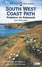
|
| 
| |
| |
| |
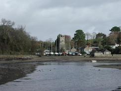
The directions for the first part of this walk along the southern bank of the Helford River from Mawgan to Helford are detailed in the South West Coast Path Association guidebook, so I will not replicate the directions here.
Distances
| From | To | Distance (m) | Ascent (ft) | Descent (ft) |
|---|---|---|---|---|
| Mawgan | Helford | 4.2 | 689 | 820 |
| Helford | Gillan | 5.3 | 1158 | 1175 |
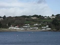
| Gillan | Coverack | 7.0 | 1627 | 1555 |
This makes a total distance of 16.5 miles, with 3474 feet of ascent and 3550 feet of descent.
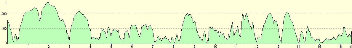
For more information on profiles, ascents and descents, see this page
Accommodation
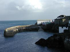
Sam had parked the van in the car park beside the pub and harbour in Coverack, which is right beside the South West Coast Path (indeed there is a way marker right outside one of the windows). This means that I will be able to set off in the morning without Sam having to drive the van anywhere, which is always a bonus. However I hope that it is not too windy during the night, as the van is in quite an exposed location.
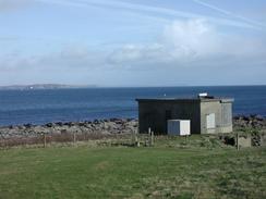
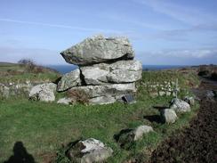
A few photographs from yesterday...
Disclaimer
Please note that I take no responsibility for anything that may happen when following these directions. If you intend to follow this route, then please use the relevant maps and check the route out before you go out. As always when walking, use common sense and you should be fine.
If you find any information on any of these routes that is inaccurate, or you wish to add anything, then please email me.
All images on this site are © of the author. Any reproduction, retransmissions, or republication of all or part of any document found on this site is expressly prohibited, unless the author has explicitly granted its prior written consent to so reproduce, retransmit, or republish the material. All other rights reserved.
Although this site includes links providing convenient direct access to other Internet sites, I do not endorse, approve, certify or make warranties or representations as to the accuracy of the information on these sites.
And finally, enjoy your walking!
This walk was mentioned in the following routes:
| My walk around the coastline of Britain |
| South West Coast Path |
Nearby walks
| # | Title | Walk length (miles) |
|---|---|---|
| 340 | Portscatho to Ruan Lanihorne | 17.9 |
| 342 | Feock to Falmouth | 15.4 |
| 343 | Falmouth to Mawgan | 17.0 |
|
|

|