Walk #302: West Itchenor to Chidham
 |
 |
|
General Data
| Date Walked | 20/12/2002 |
| County | West Sussex |
| Start Location | West Itchenor |
| End Location | Chidham |
| Start time | 08.38 |
| End time | 15.17 |
| Distance | 14.9 miles |
| Description | This was a nice walk around part of Chichester Harbour, taking in the historic and lovely village of Bosham on the way. |
| Pack | Today I carried my 30-litre Karrimor HotRock rucksack, which was filled with my packed lunch, waterproof leggings, water bottle and a couple of spare shirts, together with the usual assortment of odds and ends. |
| Condition | I feel absolutely fine after this walk, and have no problems to report. My ankle gave me no trouble at all today, and my shoulders were also fine. |
| Weather | The wind that was very noticeable yesterday had died down by this morning, but the blue sky had been replaced with a blanket of cloud. It was dry all morning, but it started to rain a few minutes before I got to the pub in Bosham, and by the time I got out it was still raining. It continued raining whilst I was walking, but fortunately it did not get too wet, although a mist came down that annoyed me because I could not get many photographs. |
| OS map | Landranger number 197 (Chichester & The South Downs, Bognor Regis & Arundel) |
 |
 |
|
 |
 |
|
Map of the walk
Maps courtesy of Google Maps. Route for indicative purposes only, and may have been plotted after the walk. Please let me have comments on what you think of this new format. For a detailed table of timings for this walk, please see the table file.
 |
 |
|
Notes
Dell Quay was a tiny little village in the parish of Apuldram, whose village no longer exists. I find it quite strange to learn that at one time Dell Quay was England's ninth largest port. It is now a tiny place, mainly with a pub and a small boat yard, and it is hard to believe that at one stage it was so large.
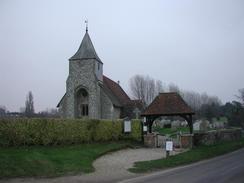
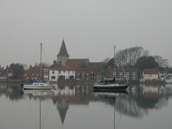
In a similar manner Bosham was once much larger than it is nowadays. Bosham has many claims to fame; one is that it is one of the places where it is reputed that King Canute attempted to hold back the tide (the other being Creeksea in Essex). Bosham is probably the more likely place however, as it is firmly believed that King Canute lived here after he succeeded to the throne in 1017. It is known (or at least as known as any historical fact can be) that Canute's eight-year-old daughter is buried in the church after she died falling into the millstream behind the church. This was believed to be apocryphal until her tomb was opened in 1865 and a coffin containing a young girl of 3 foot 9 inched in height was discovered.
The church is built at the place where it is believed that the Roman's first landed in Britain. Indeed, some of the columns in the church are built from the remains of columns from a basilica and Roman pottery has been found under the nave of the church. Venerable Bede mentions the village, and the doorway has crosses carved into it by returning Crusaders. The entire plan of the church is quite strange as there is not any right angle at the junction of an of the walls.
As I was reaching Bosham it started to rain, so I decided to take shelter in a local pub, The Anchor Bleu, for a while to see if it would ease off I spent fifty minutes in the pub chatting to the bar staff and some of the locals, and everyone was very friendly. I was given some money for the charity and a couple of free drinks, which meant that the next stretch of the walk was undertaken in a much more merry mood. The landlady of the pub even offered me a free meal as I was doing a long charity event, but I had to reject her kind offer as I knew Sam was going to cook for me in the late afternoon.
When I was walking into Bosham there was a man standing by a bike who was feeding the swans. They were pecking food from his hands, and when I commented to him how tame they were he replied that they were only tame to him - mainly as he had been feeding that family for 37 years! The road that he was standing on is flooded by the high tide, and as I had walked along it the water was lapping at its edge at times. Some of the houses alongside it were quite strange as they had brick or stone walls up to above the high water mark before the windows and doors begin. Indeed, a couple of driveways had high-tide marks on them. The entire village is lovely and beautiful, and was a real gem that I shall have to come back and visit sometime.
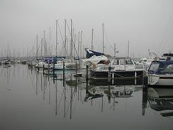
I managed to get myself lost whilst I was making my way around to Chichester Yacht Harbour. I mistook an area of water around Birdham Pool to be the harbour and spent some time attempting to find the lock gates. This was an annoying mistake to make, but it did not really affect me aside from delaying me slightly.
My schedule for the next five days is now more or less fixed, as I want to be able to reach Southampton by around midday on Christmas day so that we can drive up to Salisbury to meet friends for lunch. I am also going to be doing a radio interview on at ten to eight in the morning on Christmas Eve, which should be about the time that I am setting off on the walk. I find having to walk to a schedule to be extremely annoying - I very much enjoy the freedom that being able to walk as far as I want each day.
As I was approaching Hook to the southeast of Bosham I received a phone call on my mobile and I had to look something up in my notebook. I was going through a very muddy section of path at the time, and by the time the call had finished I realised that my pen had dropped out of my book. I opened my rucksack but soon discovered that I did not have a spare one. I was therefore forced to use my mobile to text message my location and the time to myself so that I could write them down later one - an expensive replacement for a pen!
Directions
This walk starts off at the public car park next to the boatyard in West Itchenor. Leave the car park and turn right to walk for a hundred yards down an access road to a junction with a public road. At the road turn right and walk southwards through the village until the church is reached.
Walk along the road past the church and cross over a little stream. Take the first road to the left, which is a private road that lead to a row of smart houses. At the end of the road continue on along a footpath that heads through an area of woodland as it heads southeastwards before it meets a track at Westlands Farm. Join the track and follow it as it heads eastwards, entering a little area of housing. Take the first road to the left along which runs a footpath that skirts the southern bank of the Chichester Channel before heading inland and joining a surfaced track. This track then ends at a public road at a bend.
Turn left down this road and follow it as it curves to the right past a boatyard and crosses over Birdham Pool. Past the pool the road turns to the right; at the bend a footpath leads straight on between some houses and reaches a lock on the Chichester Canal. Cross the lock gates and then turn right on the other side towards Chichester Yacht Harbour. After about a hundred yards turn to the left through a boatyard along a track that leads to the lock gates into the harbour.
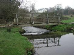
Cross the lock gates an take a footpath that continues northeastwards on the other side. The footpath enters a patch of woodland before emerging and crossing a field and reaching a surfaced track by New Barn. Turn left up this track and follow it for a kilometre until it ends at a public road. Turn left down this road and follow it until it reaches Dell Quay. Walk past the pub to the river bank and then turn to the right along a footpath that runs right beside the channel. The footpath crosses a field before joining the flood bank and heads north for a little over a mile until it crosses a stream by a bridge on the southern edge of Fishbourne.
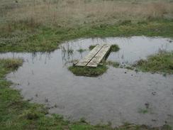
When the footpath crosses another stream by another bridge turn left along another footpath that heads westwards beside a stream for a short distance until it emerges at a road beside a lovely pond. The path continues on the other side and runs through an area of low-lying and boggy land with reeds everywhere. The path leaves this area and climbs up onto the flood bank and heads south for a little over a kilometre. When the footpath approaches a little creek it turns to the right and heads inland to the west for a few hundred yards until it meets another footpath. Turn left along this footpath as it heads southwards until it meets a bend in a surfaced track near Hook Farm.
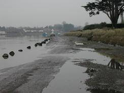
Turn right to head westwards along the track for a little under a kilometre until it meets a road by Church Farm. Turn left along this road and follow it westwards until it ends at a T-junction with another road by Hart's Farm. Turn left down this road and follow it southwards past Hoe Farm towards Bosham Hoe. Follow the road as it curves around to the right and heads westwards for a little over a kilometre. When the road turns sharply to the right to head northwards take a track that leads off to the left to head southward for a short distance to the river, at an old ferry landing place. At the river turn right along a footpath that follows the edge of the river along Bosham Channel over ground that is sometimes boggy as it is below the high tide line.
Eventually the path meets the road once more. This road also floods at high tide, although in places there is a footpath at a higher level that will allow progress when the road is flooded. The road curves past Southwood Farm along the southern edge of a channel before curving around the end of the creek and entering Bosham. Follow the road around until it ends and make your way the short distance through the village towards the church. Before the church is reached turn right along a road that heads northwards past a chapel. When the road curves to the right continue straight on along a road and then after a few yards turn left down a footpath that leads westwards to the riverbank. The footpath then turns to the right to head northwards alongside the river until it meets the A259 road.
Turn left and walk westwards along the A259 road for a little under a kilometre. Immediately past a house on the left turn left down a footpath that skirts the eastern edge of a creek for a kilometre until it curves to the right and ends at a road. Turn left and follow the road southwards into Chidham to the phone box in the village, where this walk ends.
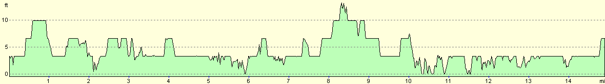
Distances
| From | To | Distance (m) | Ascent (ft) | Descent (ft) |
|---|---|---|---|---|
| West Itchenor | Fishbourne | 6.4 | 56 | 52 |
| Fishbourne | Chidham | 8.5 | 62 | 62 |
This makes a total distance of 14.9 miles, with 118 feet of ascent and 118 feet of descent.
For more information on profiles, ascents and descents, see this page
Accommodation
We parked in the road outside the 'Old House at Home' pub in Chidham, which was a lovely pub and some of the locals gave us some money for the charity, which was gratefully received.
Disclaimer
Please note that I take no responsibility for anything that may happen when following these directions. If you intend to follow this route, then please use the relevant maps and check the route out before you go out. As always when walking, use common sense and you should be fine.
If you find any information on any of these routes that is inaccurate, or you wish to add anything, then please email me.
All images on this site are © of the author. Any reproduction, retransmissions, or republication of all or part of any document found on this site is expressly prohibited, unless the author has explicitly granted its prior written consent to so reproduce, retransmit, or republish the material. All other rights reserved.
Although this site includes links providing convenient direct access to other Internet sites, I do not endorse, approve, certify or make warranties or representations as to the accuracy of the information on these sites.
And finally, enjoy your walking!
This walk was mentioned in the following routes:
| My walk around the coastline of Britain |
Nearby walks
| # | Title | Walk length (miles) |
|---|---|---|
| 300 | Worthing to Pagham | 18.7 |
| 301 | Pagham to West Itchenor | 19.4 |
| 303 | Chidham to Langstone | 16.0 |
|
|

|