Walk #300: Worthing to Pagham
 |
 |
|
General Data
| Date Walked | 18/12/2002 |
| County | West Sussex |
| Start Location | Worthing |
| End Location | Pagham |
| Start time | 08.20 |
| End time | 15.37 |
| Distance | 18.7 miles |
| Description | This was a nice walk westwards along the south coast, taking in Littlehampton an Bognor Regis on the way. |
| Pack | Today I carried my 30-litre Karrimor HotRock rucksack, which was filled with my packed lunch, waterproof leggings, water bottle and a couple of spare shirts, together with the usual assortment of odds and ends. |
| Condition | I feel absolutely fine after this walk, and have no real problems to report. The walking along shingle was hard on my ankle, but not enough to concern me. Aside from this I am fairly tired, which seems to be a norm at the moment. |
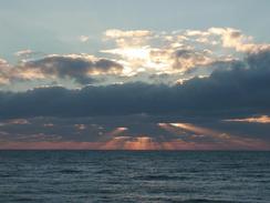
| Weather | For the fourth day in a row the weather has improved with today being mostly sunny and a really lovely day. There was an easterly wind that at times was brisk, but this was okay because I was heading westwards so it was a tail wind. It was quite a cold day, but as soon as I started walking I warmed up, and could remove my hat. |
| OS map | Landranger number 198 (Brighton & Lewes, Haywards Heath) and Landranger number 197 (Chichester & The South Downs, Bognor Regis & Arundel) |
 |
 |
|
 |
 |
|
Map of the walk
Maps courtesy of Google Maps. Route for indicative purposes only, and may have been plotted after the walk. Please let me have comments on what you think of this new format. For a detailed table of timings for this walk, please see the table file.
 |
 |
|
 |
Notes
This was another day with another good distance done. The last couple of days have about made up for the ten mile walk that I did on Sunday, so I am now more or less back on my schedule to reach Southampton on Christmas Day. I had a phone call from BBC Radio Solent, who cover the Isle of Wight, Dorset and Sussex, and they want to interview me on the morning show on either Christmas Eve or Christmas Day. This would be very nice, although it will feel very weird doing a radio interview on Christmas morning!
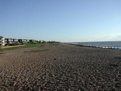
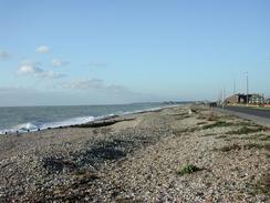
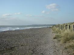
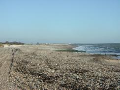
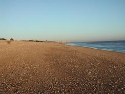
I am getting fed up with shingle beaches. It has to be the worst surface that I have had to walk along on this walk so far - worse than soft sand, or worse than rocky shores. Most beaches that I have come across since before Dungeness have been shingle, and I am missing nice wide sandy beaches. I just do not trust my ankle on shingle - I find that walking on it places more stress on my ankle and this worries me. It also means that after spending a couple of hours walking on it the underside of my feet ache, which is not pleasant.
The grassy section of paths around Ferring and East Preston was like some form of canine motorway, with seemingly four dogs for every owner in sight. It must have been the time in the morning for people to walk their dogs, as it seemed like the whole area was out. It was a good job that Sam was not with me, as she has a tendency to say hello to every dog that we pass, or we would still be out there tonight!
On the seashore in Rustington there is a stone commemorating the place where twice after the war (on the seventh of September 1946 and 1953) the world air speed record was broken just offshore. I am intrigued by this, and would like to know more details but have no way of finding out more at the moment. It is also quite sad that only a small stone marks such a massive feat, although I must admit I do not know what would help - an information board, perhaps.
By the late morning I was really desperate to go to the toilet, so when I reached Littlehampton I went into the Cob and Pen pub and had a pint of Arundle Gauntlet so that I could use their facilities. The twenty-minute rest that this gave me also allowed me to relax and de-stress slightly, although I am unsure about why I was feeling stressed as the day's walk was going well. The pint was very nice, and I could easily have had another one but I really could not afford the time off the walk at this time of the year.
On the sea front in Bognor Regis I saw a cast-iron finger signpost with a finger pointing out to sea. I automatically assumed that someone had turned the finger around, but as I got closer I saw that it read 'France', which amused me intensely.
Another day, another milestone. Today was my three hundredth walk since I started logging them at the beginning of 1999, which I feel is more than a little achievement. If all goes well in the next year I shall have over three hundred more walks added on to that total. The long straight walk along the south coast now gets more complex, with long diversions having to be made on the way to Southampton. This is a shame as I have made noticeable progress on the map over the last few days, but nonetheless it will still be progress.
Directions
This walk starts a little way to the west of Worthing Pier, on the promenade. Walk westwards along the promenade or the beach out of Worthing and into Ferring and Kingston Gorse. In Ferring the seawall ends but there are footpaths inland of the beach that skirt the beach westwards if you want to avoid walking on the shingle.
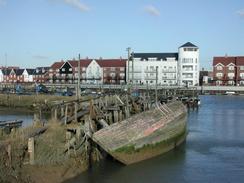
Continue on into Rustington, where a promenade restarts when the B2140 road joins the sea front. Walk westwards as far as the lighthouse at the mouth of the River Arun, and then turn right and head inland along the eastern bank of the river. A road is soon joined, which can be followed into the centre of Littlehampton. Follow the road as it swings around to the left and pass the railway station. A little distance further on there is a footbridge on the left that leads over the river.
On the western side of the bridge turn left to walk down a road past some buildings. At the end of the road turn half-left down a footpath that runs between a hedge and a fence for under a kilometre until it reaches the mouth of the River Arun. Here turn right and walk along the shingle beach; there is no official footpath but there is a firm band of shingle at the top of the beach that is easy to walk along.
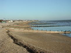
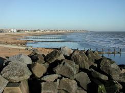
Continue along the beach through Atherington to Middleton-on-Sea, and then continue on along the beach until a seawall begins to the east of the large tent-like buildings of Southcoast World. Join the seawall and walk westwards towards the pier in Bognor Regis. Continue on past the pier until the seawall ends and then drop down onto the beach as it heads past Aldwick towards Pagham and slowly curves to heads southwestwards. This walk ends by the buildings of the Pagham Yacht Club, which is near to the centre of the village.
Distances
| From | To | Distance (m) | Ascent (ft) | Descent (ft) |
|---|---|---|---|---|
| Worthing | Littlehampton | 8.4 | 39 | 39 |
| Littlehampton | Pagham | 10.3 | 92 | 89 |
This makes a total distance of 18.7 miles, with 131 feet of ascent and 128 feet of descent.
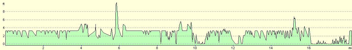
For more information on profiles, ascents and descents, see this page
Accommodation
We parked on the roadside in Pagham near the yacht club, outside a chip shop that had shut for the winter. Tomorrow we shall be staying in a campsite near the place where I finish the walk so that I can update the website on the computer and check my itinerary.
Disclaimer
Please note that I take no responsibility for anything that may happen when following these directions. If you intend to follow this route, then please use the relevant maps and check the route out before you go out. As always when walking, use common sense and you should be fine.
If you find any information on any of these routes that is inaccurate, or you wish to add anything, then please email me.
All images on this site are © of the author. Any reproduction, retransmissions, or republication of all or part of any document found on this site is expressly prohibited, unless the author has explicitly granted its prior written consent to so reproduce, retransmit, or republish the material. All other rights reserved.
Although this site includes links providing convenient direct access to other Internet sites, I do not endorse, approve, certify or make warranties or representations as to the accuracy of the information on these sites.
And finally, enjoy your walking!
This walk was mentioned in the following routes:
| My walk around the coastline of Britain |
Nearby walks
| # | Title | Walk length (miles) |
|---|---|---|
| 299 | Peacehaven to Worthing via Brighton | 20.5 |
| 301 | Pagham to West Itchenor | 19.4 |
| 302 | West Itchenor to Chidham | 14.9 |
|
|

|