Walk #276: Althorne to Battlesbridge
 |
 |
|
General Data
| Date Walked | 24/11/2002 |
| County | Essex |
| Start Location | Althorne Station |
| End Location | Battlesbridge |
| Start time | 09.06 |
| End time | 15.08 |
| Distance | 17.7 miles |
| Description | This was a long and winding walk to the first point at which I could cross the River Crouch at Battlesbridge. This proved to be a longer diversion than I expected as the path was hardly direct in most places and tributaries of the river had to be crossed. |
| Pack | Today I carried my 30-litre Karrimor HotRock rucksack, which was filled with my packed lunch, waterproof leggings, water bottle and a couple of spare shirts, together with the usual assortment of odds and ends. |
| Condition | I am relatively okay after this walk. I was quite fatigued when I finished until I had my shower after which I woke up considerably. My ankle ached a few time during the day, but these always eased off and I did not have the prolonged aching of yesterday. I still have no blisters, and the under side of my feet are now very rough and hard from all the walking. |
| Weather | The weather today was not at all bad. There was lots of sunshine and some long cloudy periods, but fortunately there was not much rain, with only a couple of drizzle showers to be contended with. It was also quite mild so at times I got rather hot which meant that I should really have taken my fleece off, but I did not want to stop. |
| OS map | Landranger number 168 (Colchester, Halstead & Maldon) and Landranger number 167 (Chelmsford, Harlow & Bishop's Stortford) |
 |
 |
|
 |
 |
|
Map of the walk
Maps courtesy of Google Maps. Route for indicative purposes only, and may have been plotted after the walk. Please let me have comments on what you think of this new format. For a detailed table of timings for this walk, please see the table file.
 |
 |
|
Notes
Last night Terry and I discovered a problem with the toilet in Mervan. Mike had emptied it before he left, but since then it had totally filled up. We decided to do nothing about it last night, but this morning it had to be tackled. I had rather stunningly avoided anything to do with emptying the toilet so far on the trip, but I felt very bad about letting Terry try and sort out this literal mess on his own. After reading and rereading the manual several times we worked out what to do, and we managed to get the job done with very little mess being made. As we were doing this it was sporadically raining, and there was a lovely double rainbow in the distance as we worked. In a weird sort of way it was quite an enjoyable task, probably because neither of us could take it too seriously. As a consequence of all this I started the walk much later than I wanted, and I was playing catch-up all day.
I did not get as far as I expected. When I planned this section of the walk I did not have the OS map for the section of the walk around the top of the River Crouch. Instead of buying the map I measured this section on a road map, and did not realise that a large diversion had to be made northwards to avoid Fenn Creek. This was annoying, but at least the walk was more interesting than the yesterday was along bland sea banks.
The going today was very hard at times with some very muddy sections making the walk less than enjoyable in those sections. Once or twice both my feet slid in different directions, which must have made me look something like a drunken rollerskater who had been shut in a dark ice rink. This was all good and well, but as I was walking along the top of the riverbank if I lost my balance I would get a mouthful of either sea water or marsh depending on which way I bounced. I took great joy in striding past couples who were walking slowly, walking halfway down the bank to avoid the muddy areas whilst I strode along the top of the bank, joyously going through the mud. My boots and legs were already covered in mud, so there was little point in avoiding it.
When I finished the walk I met Terry by a pub in Battlesbridge. The pub was advertising food all day, and so I suggested that we go in for a meal to save us having to cook. Unfortunately Terry said that the campsite was closing it's gates at dusk, so we could not really afford the time to go in for a meal. This was annoying, but at least we have all the facilities in the van that we need.
Today is Terry's last day driving Mervan, and tomorrow he is going back to Cambridge to drop the van off with Sam. Sam phoned me up today on a friend's mobile from Al Sham in Egypt, and it sounds like she had had a great time, and did thirteen dives in the week. Although I have really enjoyed having Mike and Terry around I have missed Sam and cannot wait for her to be back. Tomorrow I may well have an early start and do a short walk as far as South Fambridge, and then go back with Terry to surprise Sam. Part of the reason for this is that if I were to do a full day I would end up in a place which Sam would find very hard to find as it is in the middle of nowhere. At least that is my excuse, and I will stick to it (unless I change my mind, that is).
Directions
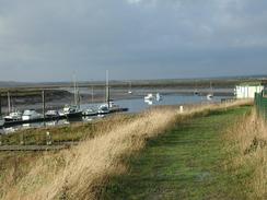
This walk starts off at Althone Station car park. Turn right out of the car park and cross over the level crossing over the railway line before heading southwards to the river. When the track ends at a boatyard turn right and climb up onto the top of a riverbank. Follow this riverbank as it goes around a small creek before following the northern bank of the Bridgemarsh Creek with Bridgemarsh Island on the other side of the creek before the River Crouch is reached.
Continue on along the northern bank of the River Crouch until the boatyard at North Fambridge. Here the path along the riverbank ends so turn right and go through a car park before joining a tarmac road which head northwards through North Fambridge. When the road ends at a T-junction turn left along a road that swings to the right towards a yacht club. When the road curves to the left after a short distance continue straight on along a footpath that heads northwards across fields towards a railway line.
Cross the railway line on a crossing and continue on for about fifty yards across a field. Here a junction with another footpath is met. Turn left down this footpath and follow it westwards until it meets the end of a road. Walk along this road and then turn right to head northwards past Rookery Farm and under some power lines before it ends at the B1012 road. Turn left down the B1012 road which was very busy, so care is needed on this road. The road bends around before getting to a sharp left-hand turn to pass the farm at Great Hayes.
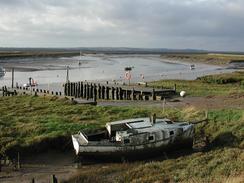
Immediately past the farm the road curves sharply to the right. A footpath leads off to the left here, but the route looked overgrown and uncertain so I decided to walk along the road which was only slightly longer. Walk around the bend and then take a road that heads off to the left. This road leads southwards under some power lines to Little Hayes Farm, where it ends. Continue on through the farm and go through two gates and cross the railway on a level crossing. A track continues on the southern side of the railway line towards two ramshackle buildings, where the track meets the riverbank.
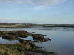
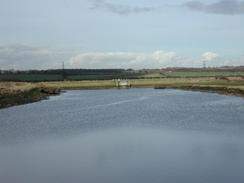
Climb up onto the top of the riverbank and join a footpath that runs along the top of it. This path follows the western end of Stow Creek before turning to the right to head westwards along the southern edge of the River Crouch. The path leaves the river behind and enters Clementsgreen Creek, which it follows around as it turns to the north for a short distance. The path then follows the end of the creek before entering a country park immediately to the east of South Woodham Ferrers. The path then heads south along the southern bank of Clementsgreen Creek before meeting the river once more.
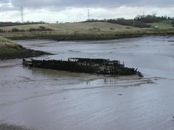
Follow the path westwards along the river once more. After two miles you pass a slipway into the river, which is at the end of a road leading southwards from South Woodham Ferrers. The path continues past here for a short distance before turning to the right to head northwards along the eastern bank of Fenn Creek. The path continues along the bank of the creek past the western edge of South Woodham Ferrers. Near the end of the creek a bridge leads off to the left. Cross this bridge and follow a path across a field towards a crossing over a railway line. On the other side of the line continue straight on for about fifty yards before turning to the left along a path. This path passes over a nice bridge with some wooden boards missing before continuing alongside the railway line south-westwards. Eventually the path meets the A132 road when it gets squeezed between the railway line and the road.
Cross the A132 road and head up a surfaced track on the other side of the road. This track passes some greenhouses as it heads south-westwards before ending at a road near Rottendon Grange Farm. Turn left to head south-westwards along this road past several garden nurseries before it ends at a roundabout with the A132 road. Take the second road to the left, which leads a short distance to another roundabout. Take the second road to the left which heads south-eastwards, passing under a railway line on its way towards Battlesbridge. The walk ends just after the railway bridge in the car park next to a pub.
Distances
| From | To | Distance (m) | Ascent (ft) | Descent (ft) |
|---|---|---|---|---|
| Althone Station | South Woodham Ferrers | 10.0 | 167 | 190 |
| South Woodham Ferrers | Battlesbridge | 7.7 | 223 | 217 |
This makes a total distance of 17.7 miles, with 390 feet of ascent and 407 feet of descent.
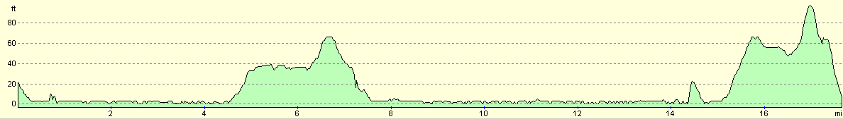
For more information on profiles, ascents and descents, see this page
Accommodation
We stayed at Barleylands Farm, Barleylands, Billericay, Essex CM11 2UD, telephone 01268 532253. This site cost us six pounds and fifty pence for the night including electricity hook-up, with a five pounds deposit for the toilet key. The showers were hot and powerful, but were situated a long way away from where we parked. The toilets nearest the van were portaloos, but when we went to them we could not find any light switches. This meant that to go to the toilet we had to walk a long distance to the shower block, where there was a disabled toilet.
Disclaimer
Please note that I take no responsibility for anything that may happen when following these directions. If you intend to follow this route, then please use the relevant maps and check the route out before you go out. As always when walking, use common sense and you should be fine.
If you find any information on any of these routes that is inaccurate, or you wish to add anything, then please email me.
All images on this site are © of the author. Any reproduction, retransmissions, or republication of all or part of any document found on this site is expressly prohibited, unless the author has explicitly granted its prior written consent to so reproduce, retransmit, or republish the material. All other rights reserved.
Although this site includes links providing convenient direct access to other Internet sites, I do not endorse, approve, certify or make warranties or representations as to the accuracy of the information on these sites.
And finally, enjoy your walking!
This walk was mentioned in the following routes:
| My walk around the coastline of Britain |
Nearby walks
| # | Title | Walk length (miles) |
|---|---|---|
| 272 | Tollesbury to Maldon | 17.2 |
| 273 | Maldon to St Lawrence | 16.0 |
| 275 | Tillingham Marshes to Althorne Station | 16.0 |
|
|

|