Walk #1027: Wellingborough to Corby via Kettering
 |
 |
|
General Data
| Date Walked | 16/12/2018 |
| County | Northamptonshire |
| Start Location | Wellingborough Station |
| End Location | Corby railway station |
| Start time | 08.16 |
| End time | 15.38 |
| Distance | 22.1 miles |
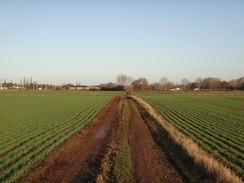
| Description | This was an intensely forgettable walk heading north across a part of Northamptonshire that I have not walked before. |
| Pack | Today I carried my 30-litre Karrimor rucksack, filled with water, my spare waterproofs, a book and other odds and ends. |
| Condition | Aside from a hotspot on the little toe of mt right foot, I feel absolutely fine after this walk. |
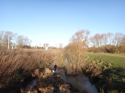
| Weather | The day started cloudless, and there was a little frost on the ground as the sun rose. It got warmer through the morning, although it as never warm, and the temperature fell as the clouds gathered during the afternoon. |
| OS map | Landranger number 152 (Northampton & Milton Keynes) and Landranger number 141 (Kettering, Corby & surrounding area) |
 |
 |
|
Map of the walk
Maps courtesy of Google Maps. Route for indicative purposes only, and may have been plotted after the walk. Please let me have comments on what you think of this new format. For a detailed table of timings for this walk, please see the table file.
 |
 |
|
Notes
I had first planned this walk earlier in the year, after my walk along the Nene Way to Market Harborough. There are not many footpaths, yet alone trails, in this area, but I quite fancied walking from Market Harborough to Corby (which I had also walked to as part of my Jurassic Way campaign), going through the town of Kettering on the way.
I had not done a walk for a month for various reasons, and was keen to get another three done to reach 1,000 miles walked before the end of the year. Sencan therefore allowed me out of the house, but I did not fancy a long drive in the short daylight hours. Instead of heading up to Yorkshire or across to Gloucestershire, I settled for this walk in Northamptonshire.
The day got off to a bad start. I parked in the station car park outside Market Harborough station, not wanting the long walk to the station from the free car park in the town centre. It would cost £5.50 for the day, but I preferred that to the walk. The car park was quiet, and I bent over to change my boots when I realised I couldn’t find the car park ticket. I spent the next fifteen minutes feverishly looking around my car for it, before eventually I drove out through the open barrier, turned around, re-entered and got another ticket – as I was paying for the day, I hoped it would not matter.
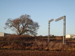
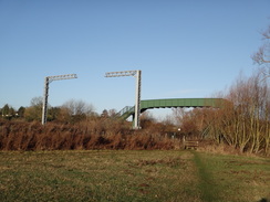
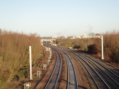
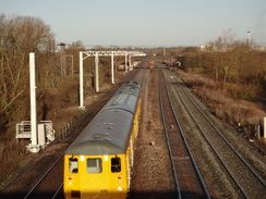
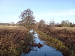
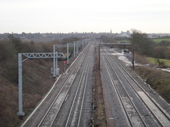
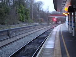
I was in a terrible mood when I finally set off, having wasted about twenty minutes of precious daylight. I walked to the station to start the walk, and then headed back past an area that is being altered to provide an access road to a new housing development that stretched up the hillside on the other side of the railway. The next couple of miles took me north out of the town, through residential streets and then a dreary industrial estate to reach a muddy area of churned-up ground that led back to the railway line. A brand-new bridge stretched over the railway tracks, and the ground showed that the contractors had only recently left. The reason for the new bridge could be seen along the tracks: metal masts for an electrification scheme.
A little diversion, if I may. For years Corby had no rail station; one was reopened in 1987, but shut three years later. A new station opened at a different location in 2009, and this has apparently thrived. The plan had been for the entire Midland Main Line from London to Sheffield to be electrified, but technical and financial problems with the Great Western electrification scheme led to the Midland scheme being cut back to Kettering and Corby. Hence a town that has had a rail service on a branch line for barely ten years will get electrified, whilst those on the busier main line further north won’t.
I considered this madness as a track took me north, with the railway line off to my left. It was a pleasant enough stroll, albeit muddy in places, and the half-completed masts for the electrification towered over the tracks to my right. Some seemed nearly complete, with the cantilever arms in place, whilst other masts were bare, and there were long gaps with no masts in place. It seems a rather piecemeal and inefficient way to be going about things.
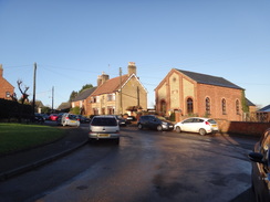
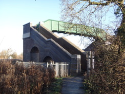
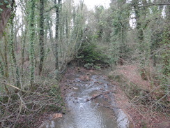
A couple of short stretches of road took me past a compound for the works that contained gleaming steelwork, and on to a footbridge over the tracks. This appeared quite old, and I guess this is going to have to be raised or renewed as part of the works. On the other side, a path took me into the little village of Isham, which I did not see much of before another path led to a footbridge over the railway. This had massive brick steps that surely must need to be rebuilt before electrification – a shame, as it is quite an impressive structure in scale. The footbridge took me to a bridge over the River Ise, before the path headed up, past a new housing estate into Burton Latimer.
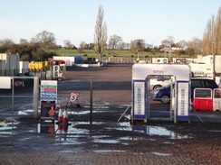
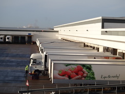
My route allowed me only to see glimpses of the outskirts of this village, and I was soon into an industrial area – aside from a football ground, that is. A few joggers were running along the road, and I took a wrong route – a new road has been built to support a distribution centre, including a massive Morrisons that seemed to have a hundred lorries outside it. I soon realised my mistake but decided to press on, passing the buildings and heading up to cross the A14 at a busy roundabout.
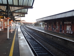
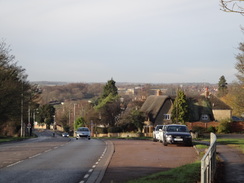
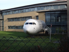
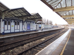
The next few miles saw me walk through the outskirts of Kettering, passing Wicksteed Park, an amusement park that first opened in 1921. Many of the attractions were visible from the road and appeared closed, but I can see myself taking Robert there soon. Another thing of note was the fuselage of a passenger plane in the grounds of a college – it is apparently used for training plane crew, although it seemed more than a little out of place. Eventually I reached Kettering station, after which I headed through the centre of town, nipping into a Greggs to get some food. Kettering did not seem too busy given it was little more than a week before Christmas, and frankly there was little of interest as busy roads took me out of town.
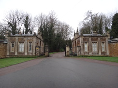
The area north of the A43(T) was radically different from that shown on my dated map, with new buildings having sprung up around an altered road layout. Fortunately I found the old road with ease and followed it past an old farm that seemed of place amongst the modern industry, an oasis of agrarian calm. The road became quieter as it headed on a bridge over Glendon South Junction, where the line to Corby splits from the main line; rows of masts stood along the branch, with the main line’s tracks mastless. The road took me to Glendon Hall, which sadly remained mostly out of view, and then another headed north to Rushton and its eponymous hall – which was also hidden from sight, mostly behind a big wall.
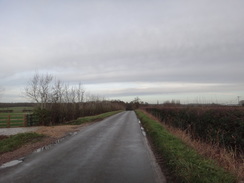
Since I was feeling fit, I decided to take a different route from my planned one, and instead of heading directly to Corby from Rushton, I headed north along roads to Pipewell, and then east towards Great Oakley. A massive roundabout brought the rural area to an end, and I then had to follow the A6014 northeastwards towards the town centre. Since this is a fairly suburban area I had expected this to have a pavement, but I was forced to follow the verge as a steady stream of cars roared past. It was far from pleasant, and it was a relief when a pavement started just before a roundabout.
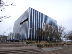
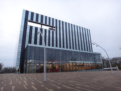
The rest of the walk into Corby was unnoteworthy – I passed the Corby Cube, a dramatically ugly structure whose fiscal mismanagement has featured many times over the years in Private Eye. Outside of this was a much more pleasant memorial to the men who made PLUTO – the PipeLine Under The Ocean, which proved so useful on D-Day. I am unsure of the connection with Corby, but given the town’s history with steel, I would guess at least part of the pipeline was made in the town.
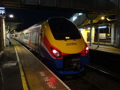
I nipped into a bookshop, and nearly bought a large book before realising that I would have to lug it to the station. Instead I plodded on along streets that were much busier than Kettering’s had been, and looped around to reach the station. The booking office was closed, and so I sat and waited for my train on the cold platform. It had been one of the worst walks I have done for some time, with little to recommend it aside from having another line drawn on my walks map.
 |
 |
|
Directions
This walk starts off at Wellingborough railway station at SP90346811. Leave the station and follow the station approach southwards away from the station; it soon curves right to become Midland Road. Pass Senwick Road on the left, and then turn right to head north along the B573 Elsden road. After 900 metres this ends at a roundabout with the A5128 Finedon Road; turn left to follow the A5128 towards town. After 250 metres turn right up Cross Road, passing a recreation area on the left. As this road curves left, turn right up Nest Lane. Follow this road north-northeastwards for 800 metres until it reaches a roundabout at SP89796957.
Head straight on across the roundabout, along Sanders Road. As this soon curves left, turn right down Paterson Road to enter an industrial area. The road curves gently left to take a more northerly course, and after 540 metres ends. At the end, turn right past a gap in a fence to join a path that heads across an area of wasteland. Walk downhill with a hedge on the left to reach a bridge over a railway line at SP90007029.
Cross the bridge, and on the other side follow the path as it turns left to start paralleling the railway line on the left. It soon starts angling away from the railway, with a field between the path and railway. 700 metres after the railway bridge, the path meets double field gates that guard a bend in a road. Head straight on northwards along this road; as it soon curves left, head straight on past another double field gate to rejoin the path, which continues north, still with the railway line across a field on the left. This crosses a farm bridge over a ditch and meets a hedge on the right, and 1km after the road it squeezes past an old gate to meet Furnace Lane at SP89577215.
Head straight on north along this road, initially past some industrial buildings on the left. After 830 metres the road ends at a T-junction. Cross the road ahead, and then cross a stile to enter a field. Follow a hedge on the right northwards; halfway across the field, go through a gap on the right into the field on the right, and then turn left to start following the same hedge on the left. At the end of the field, cross a farm bridge over a stream to enter a second field. Continue following the hedge on the left, and at the corner of the field go through a stile into a third field. Angle slightly left across this field, aiming for a green footbridge over the railway ahead. In the far left-hand corner of the field, cross a stile and then immediately turn left to a second stile. Cross this, and then turn right for five metres to reach a footbridge at SP89127374.
Cross the bridge and descend the steps on the western side. At the bottom, cross a stile into a field and angle right across the field’s corner. Go through a clappergate that leads into a second field. Angle across this field, passing a little tree-covered mound on the right to reach a clapperplate beside a field gate that leads into a third field. Angle left across this field, aiming for the far top left-hand corner, in front of houses. At the corner go through another clappergate and walk between a fence on the left and a hedge on the right; the path soon emerges out onto South Street in Isham. Head straight on along this road for 140 metres until a triangular road junction is reached at SP88747402.
At the triangular junction, turn right to head down Mill Lane. This descends past houses on the left, and when it ends it becomes a surfaced path that leads to a footbridge over the railway line. Cross the bridge, and immediately on the other side cross a footbridge over the River Ise. Head straight on up a field away from the railway. Go through a gap in a hedge, and continue on to a gap in a second hedge. After the second gap, angle slightly to the right up the hill, to join a bank at the top. Turn right to follow the base of the bank, and follow it as it curves left. The field narrows and goes through a clappergate beside a field gate to become a track. Follow the track until it ends at a T-junction with Mutlow Drive in Burton Latimer. Turn right along the road for a few metres until it ends at a T-junction with Bridle Road at SP89337465.
Turn left to follow Bridle Road northwards; after 300 metres it ends at a T-junction. Cross the road ahead, and continue straight on along Polwell Lane. This passes the entrance to Kettering Town Football Club on the right, and then curves right to pass a massive Morrisons distribution centre on the right. The road continues to curve around to the right, and 1.3km after the road junction, it reaches a roundabout. Take the second road off to the left, Altendiez Way, and follow it to another roundabout. Leave the road, and follow the cyclepath that heads off left away from the roundabout, heading northwards and passing a stub road on the left. This ends at a large roundabout between the A6 and A14 at SP89717596.
Carefully cross the sliproad leading down to the A14 on the left, and then cross the bridge over the A14 and then the sliproad heading up from the dual carriageway. On the far side, head straight on up the A6003 Barton Road. This heads northwards before curving to the left to head westwards past Barton Seagrave and Wicksteed Park; after 3.2km it reaches a roundabout with the A509. Turn right to follow London Road northwestwards; it descends a little hill to a roundabout before ascending. 750 metres after the A6003/A509 roundabout, turn left along Broadway. After 350 metres this ends at a T-junction; head straight on down Queensberry Road, which soon curves to the right and descends to a T-junction with Station road. Turn left down Station road to reach Kettering railway station at SP86387802.
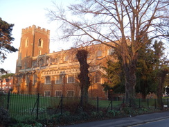
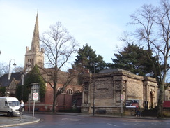
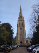
Turn around to head back up Station Road; when it ends at a T-junction, turn right along the pavement for a few metres to reach a bend in the road. Cross the road on the bend using a pedestrian crossing, and then turn left up Sheep Street. This passes the Alfred East Gallery and then St Peter and St Paul church on the right. As the road curves right, head straight on along the pedestrianised High Street. Follow this northwards through the centre of the town; when it forks, take the right-hand branch that becomes Gold Street. This climbs slightly before ending at a T-junction; turn left along another road, and as this immediately curves right, turn left to head straight on along Newland Street. This in turn ends at a crossroads with the A4300 at SP86757901.
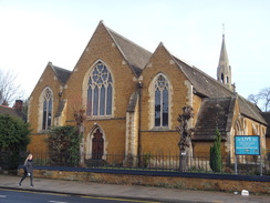
Carefully cross the road using the pedestrian crossing, and head straight on up Rockingham road, immediately passing St Andrew’s church on the right and a Sainsbury’s on the left. After 1km a roundabout is reached with the junction with Northfield Avenue on the left; head straight on to head north for another 600 metres to another roundabout. Change over onto the left-hand side of the road, and after another 500 metres the road reaches a very large roundabout with the A43(T) at SP86648105.
Cross the A43 using the pedestrian crossing, and then head north along the A43. After about 100 metres and just before a Holiday Inn Express is reached on the other side of the road, turn left past bollards in a gap in the hedge to reach an old road. Follow this road as it heads northwestwards, passing Glendon Lodge and after 350 metres ending at another large roundabout. Cross the road coming in from the left to head straight on along a road westwards. This crosses a bridge over a railway line near Glendon South Junction, and curves sharply right and then left. 1.8km after the roundabout, a road junction is reached on the right near Glendon Hall at SP84438142.
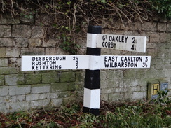
Turn right to follow the new road as it heads northwards; after 1.5km it crosses a bridge over a stream and climbs to reach a road junction with Station Road opposite Rushton Hall. Continue straight on north along the road out of Rushton; it curves to the left, and 620 metres after Rushton Hall, turn right along another road. This heads northwards before curving to take a more northeasterly course. After 2.3km it ends at a T-junction at SP83708530 in the little hamlet of Pipewell.
Turn right along the road and follow it as it heads in a rough easterly direction through, and out, of the hamlet. After 2.1km the road ends at a T-junction; turn left along the new road for a few metres to reach a very large roundabout with the A6003 and A6014 roads. Head anticlockwise around the roundabout; carefully cross the A6003 that comes in from the south, and pass a filling station on the right. Cross a minor road coming off the roundabout, and then turn right down the A6014 Oakley Road. Follow this road as it heads northeastwards; there is no pavement and it is busy, so you may want to find an alternative route through the neighbouring estates. The road passes the Spread Eagle pub on the left, and after nearly 1.5km the road reaches a roundabout at SP86808657.
Carefully cross the road coming in from the right to continue straight on along the road. It reaches a second roundabout, and then leads on to a third. Pass this and then immediately turn left to cross the road using a pedestrian crossing, and then head northwards up Sower Leys Road for 600 metres to a roundabout. Cross Gainsborough Road that comes in from the right, and continue straight on along Jubilee Avenue, which soon starts curving to the right. After another 900 metres this ends at a roundabout with the A427 in the centre of Corby at SP88008838.
Use the pedestrian crossing to cross the A427 ahead, and then angle right to head down George Street, passing The Cube on the left. After a short distance, cross George Street at a pedestrian crossing and head straight on eastwards down a pedrestrianised street. When this forks in near a Lloyds Bank, turn left along another pedestrianised road, which soon turns right and ends at Elizabeth Street. Turn left to follow Elizabeth Street north; when it reaches a roundabout, head straight on, still following Elizabeth Street. When this ends at another roundabout, turn right to head east along Cottingham Road. After 600 metres this crosses a railway line on a bridge, and on the other side curves right. Follow this road south; after about 150 metres turn right down Station Road. Corby railway station is ahead at SP89168865.
 |
 |
|
Distances
| From | To | Distance (m) | Ascent (ft) | Descent (ft) |
|---|---|---|---|---|
| Wellingborough station | Burton Latimer | 5.5 | 318 | 262 |
| Burton Latimer | Kettering station | 4.4 | 236 | 240 |
| Kettering station | Pipewell | 6.7 | 397 | 249 |
| Pipewell | Corby station | 5.5 | 207 | 240 |
This makes a total distance of 22.1 miles, with 1158 feet of ascent and 991 feet of descent.
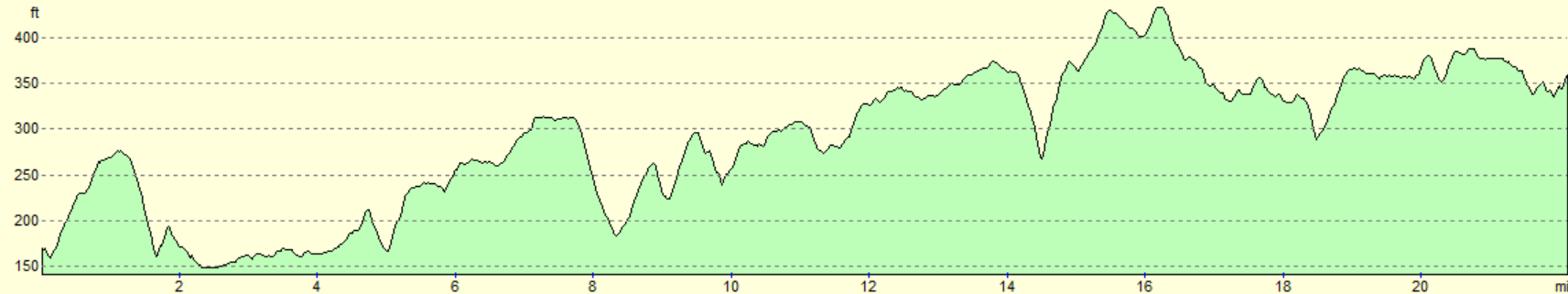
For more information on profiles, ascents and descents, see this page
Transport
Regular train services run between Corby and Market Harborough; some are direct, whilst on others you may have to change at Kettering. See the National Rail Enquiries website for more details.
 |
 |
|
 |
 |
|
 |
 |
|
 |
 |
|
 |
 |
|
 |
 |
|
 |
 |
|
 |
 |
|
 |
 |
|
 |
 |
|
 |
 |
|
Disclaimer
Please note that I take no responsibility for anything that may happen when following these directions. If you intend to follow this route, then please use the relevant maps and check the route out before you go out. As always when walking, use common sense and you should be fine.
If you find any information on any of these routes that is inaccurate, or you wish to add anything, then please email me.
All images on this site are © of the author. Any reproduction, retransmissions, or republication of all or part of any document found on this site is expressly prohibited, unless the author has explicitly granted its prior written consent to so reproduce, retransmit, or republish the material. All other rights reserved.
Although this site includes links providing convenient direct access to other Internet sites, I do not endorse, approve, certify or make warranties or representations as to the accuracy of the information on these sites.
And finally, enjoy your walking!
Nearby walks
| # | Title | Walk length (miles) |
|---|---|---|
| 137 | Market Harborough to Northampton | 18.3 |
| 184 | A circular walk between Hargrave, Raunds and Rushden | 18.4 |
| 213 | Rushden to Northampton | 16.4 |
|
|

|