Walk #1028: Gipping Valley River Path: Stowmarket to Ipswich
 |
 |
|
General Data
| Date Walked | 22/12/2018 |
| County | Suffolk |
| Start Location | Stowmarket station |
| End Location | Ipswich railway station |
| Start time | 08.01 |
| End time | 15.28 |
| Distance | 20.9 miles |
| Description | This was a very pleasant walk, following the Gipping Valley River Path downstream to Ipswich, and then looping for a short distance around Ipswich. |
| Pack | Today I carried my 30-litre Karrimor rucksack, filled with water, my spare waterproofs, a book and other odds and ends. |
| Condition | I feel a little tired after this walk, but am otherwise fine. |
| Weather | The day started off sunny, but as the day wore on the clouds gathered slightly. It was surprisingly warm for the time of day. |
| OS map | Landranger number 155 (Bury St Edmunds, Sudbury & Stowmarket) and Landranger number 169 (Ipswich & The Naze, Clacton-on-sea) |
 |
 |
|
Map of the walk
Maps courtesy of Google Maps. Route for indicative purposes only, and may have been plotted after the walk. Please let me have comments on what you think of this new format. For a detailed table of timings for this walk, please see the table file.
 |
 |
|
Notes
I have only about 26 miles to walk to reach 1,000 miles walked this year, and only a couple of weeks left in which to do them. This is a little too much to do in a single day's walk at this time of year, and Sencan has allowed me today off to knock off most of those miles. Unfortunately a minor computer-related catastrophe meant I lost almost all the maps for future walks I have planned, and I did not have the time or inclination to fix the problem and design a new walk.
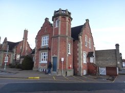
Instead, I decided to do a walk that I had done previously. I remember enjoying my previous walk along the Gipping Valley River Path, and had been considering doing it again sometime. Since its trailhead in Stowmarket is only an hour's drive away, I decided it would make a good pre-Christmas jaunt. I headed off quite late this morning – there being little point in arriving whilst it was still dark – and arrived just as dawn was breaking. I purchased a ticket for the car park, shouldered my rucksack, and headed off.
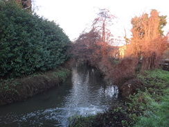
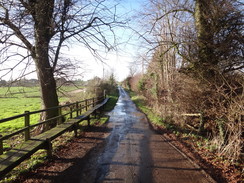
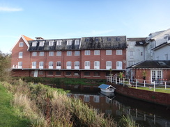
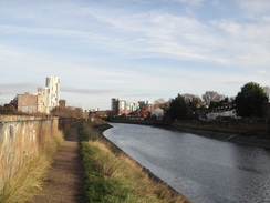
The trail starts a convenient few metres away from the station, and I was soon following the trail beside the river. The recent rain meant the path was very muddy, and fallen leaves formed a brown mulch underfoot. It was a grey walk past grey industrial buildings, with the surrounding leafless trees blocking views of the blue skies. The path passed industrial buildings – once ICI, now PPG paints (apparently the makers of Dulux). I have a certain fondness for bleak industrial landscapes, and this one was particularly pleasant – and would have been more so on a summer's day. One brick industrial building had its ground-floor windows covered with metal sheeting – a security measure that had, in this case, been improved by the sheets having been painted over in pleasant colours, as if advertising the company's wares.
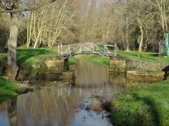
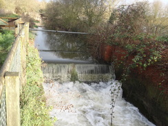
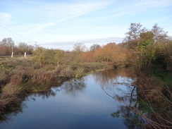
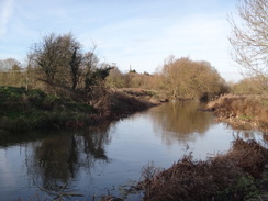
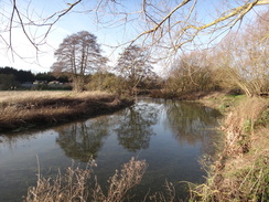
A maltings replaced the factory appeared on the left, and then the river passed under a rail bridge to enter countryside. I soon passed a gateless lock chamber, a first indication that the River Gipping was once a canal (actually technically a navigation, or a canalised river). The canal closed in 1922, and many of the locks are now gateless sluices. There are plans to restore the navigation, although that seems like a massive task.
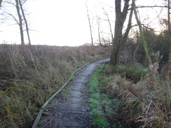
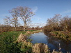
The path was rather muddy, and in a few places it had eroded into a slope that merged with the water. I wanted to make quick progress, but the conditions underfoot made it a bit of a slog, albeit an enjoyable one. The trail eventually approached Needham Market, where I met a man walking along the path. He turned out to be an ex-BT engineer, and we ended up chatting for ten minutes about computers and rockets. Eventually I had to continue on, and I said goodbye and continued along the riverside path past the village.
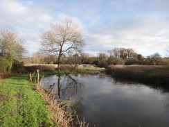
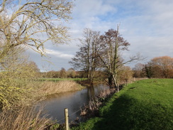
As is often the case with canal with canal or railway walks, most of the village remained out of view, and the walk appeared rather rural rather than suburban as it passed some lakes to reach a road. I made a slight mistake here, crossing a bridge over the river and walking through a car park to reach the road, rather than continuing over the river. It was easy to fix, and I was soon heading along the riverside path, this time with the water on the left.
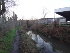
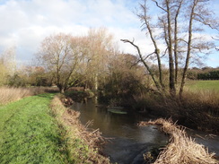
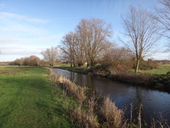
More rural riverside walking followed, before the path left the river to follow the base of a railway embankment for a short distance. Initially this was rather difficult, with barbed-wire fences close by on both sides, and the path underfoot a deep, muddy V. I could only put one foot in front of the other, although thankfully things improved when the path climbed up to the same level as the railway.
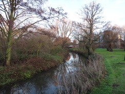
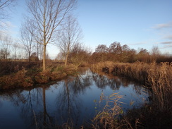
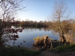
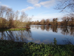
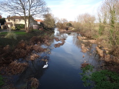
The path soon returned to the river, passing a crowd of people going to a rare breeds farm. It swapped from one bank to the other as the river meandered south; an enjoyable but unremarkable stroll. Houses eventually started on the other side of the canal, and when I reached a road bridge I diverted off into Bramford to find a shop where I could purchase some water, having set off without any. It's common for me to walk twenty miles on a winter's day without needing any water, but today was turning out to be unseasonably warm and it seemed unwise to continue without any.
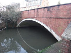
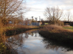
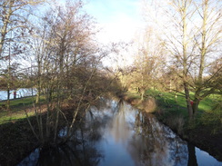
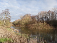
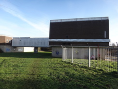
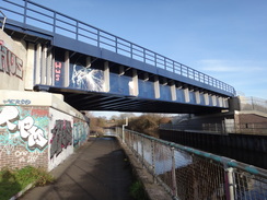
Suitably refreshed, I rejoined the river and continued along the path. Initially this was rural, but after heading under the A14 it passed a large ex-industrial site on my left, guarded by big fences. It appears that this area is being redeveloped, and a short section of path was diverted away from the river between temporary fences, before returning to the water. After this the path passed under a railway bridge, and immediately afterwards, a second. This latter bridge was not on my map, as it only opened a few years ago, as part of a chord line called the 'Bacon Factory Curve' that allows freight trains from Felixstowe to go to the Midlands without having to reverse at Ipswich.
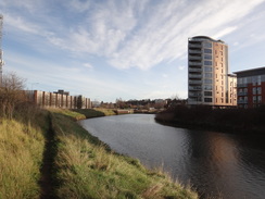
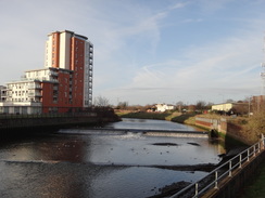
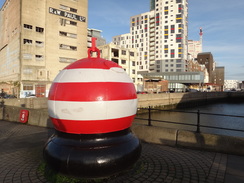
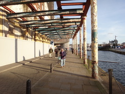
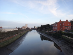
The river passed under a third rail bridge, after which the going became more urban. As the path neared Ipswich, it left the riverside and instead followed a cut, before joining the River Orwell. Ipswich station soon appeared across the river, but it had been a short day's walk and there was still enough daylight to walk further. I continued along the trail to its southern trailhead by a road bridge, and then entered a large redeveloped quayside. Or at least part-redeveloped: brand new buildings stood beside the renovated industrial structures, and these were interspersed with decrepit buildings that had still to be demolished or converted. One line of metal columns had the most fantastic peeling paint, the multicoloured layers appearing like a history book.
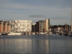
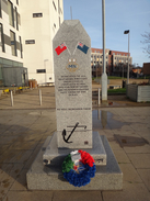
Where the water would once have been filled with grimy ships unloading goods, it was now filled with boats, some large and luxurious. A steady stream of people headed towards and past me, many heading to a football match. The southern end of the dock was more industrial in nature. To be honest, I preferred this somewhat ramshackle end to the somewhat sterile luxury yachts I'd passed earlier, as if it was more honest.
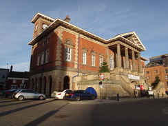
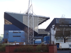
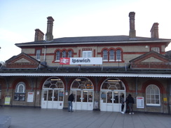
Further progress was blocked at the harbour's southern gates, and roads took me away from the water and towards the centre of Ipswich. The town was bustling on this last weekend before Christmas, and I enjoyed my stroll as the skies started to darken. Eventually my route took me past the football stadium, where chants and roars seemed to fill the streets, and on to the station. A delay to a train meant I could clamber straight on it a couple of minutes before it left.
It had been a good day's walk, and one I could easily be persuaded to do for a third time.
 |
 |
|
Directions
This walk starts off at Stowmarket railway station at TM05165884. Leave the station and head down the short station approach road, passing the Kings Arms on the left. When the road soon ends, turn left down Station Road East for about twenty metres, until some steps lead down immediately before a bridge over the River Gipping to reach the riverside path at TM05085880.
Descend the steps and follow the riverside path as it heads southwards through Stowmarket, passing the various buildings and structures of chemical plants on the left. Simply follow the river, crossing any roads that cross the river and continuing with the water on the right. It passes under the A1120 and then a maltings on the left, and then under a railway bridge. 6.5km after joining the riverside path in Stowmarket, Hawks Mill Street is reached on the northern side of Needham Market at TM08945540.
Cross the road, and continue on for another 1.3km until the B1078 road is reached at TM09655469; ignore any bridges leading over the river towards Needham Lake. The path emerges out onto the B1078; carefully turn right to cross the bridge, and on the other side turn left through a clappergate beside a field gate to join a track, with the River Gipping now on the left and a fishing lake on the right. At the end of the track, go through a pedestrian gate and continue following the river on the left. 2.5km after the B1078, the path curves right for a short distance away from the river, and then left to run between fences along the base of a railway embankment on the right. The path is initially narrow, but it climbs up to the level of the railway and widens slightly. After 650 metres of following the railway, it meets a road at TM11055256, with a level crossing immediately to the right.
Turn left to follow the road away from the level crossing; it crosses a bridge over a stream, and then after 220 metres meets the River Gipping once more beside an old white mill building. Do not cross the bridge over the river, and instead turn right through over a stile to join a path that heads south alongside the river on the left. Do not take any paths that head away from the river. The path passes under a low bridge that carries the railway line overhead, and reaches great Blakenham. 2.5km after the mill; the path curves right away from the river, squeezing between two buildings to join a track. Turn left down the track, and after a short distance, turn left down another track that crosses the river beside Great Blakenham Lock sluice at TM11935088.
On the other side of the river, turn right to start following the river on the right. It soon passes under another railway bridge, and after 1.4km reaches Gipping Road at TM12755010. Go through a pedestrian gate onto the road, carefully cross the road, and then turn right to cross the bridge. On the other side, turn left down a slight bank, and follow the path as it curves back towards the river. It then turns right to start following the river on the left. 2.1km after Gipping Road, the path passes an old-style mill building on the other side of the river, and then curves left to meet a road called Paper Mill Lane at TM12664813.
Turn right to follow the road south for about thirty metres, and then turn right down a path, initially with a wall on the left. The wall soon ends, and the path continues on with the river on the right. It passes under another rail bridge. 2.0km after the road, the B1067 road is reached in Bramford at TM12754644.
Here I left the riverside path to go into the village to find a shop; there is a shop and pub 500 metres down the road to the right. The directions below continue along the riverside path.
Cross the road, turn right for a few metres, and then left to descend some steps to reach the riverbank. Turn left to follow the river on the right. After 2.4km Spoughton Bridge is approached at TM12554507; the path climbs up a slope to reach the road.
Carefully cross the road, and on the other side go through a pedestrian gate and descend some steps to rejoin the riverbank. Continue southeastwards with the river on the right. The path diverts to pass under an elevated enclosed walkway linking two buildings (part of a water treatment complex), and then heads under the A14. 2.0 km after Spoughton Bridge, a railway bridge is reached at TM14084493.
Pass under the rail bridge, and immediately afterwards climb up some narrow concrete steps and then pass under a second, newer, rail bridge. Continue along the surfaced path with the river away to the right for another 430 metres to reach a third rail bridge at TM14374524.
Pass under the rail bridge, and then continue along the surfaced riverside path. The path passes under a low bridge carrying the A1214 Yarmouth Road overhead, and continues following a river cut on the right until the path ends at a bridge carrying the A1071 Handford Road. Carefully cross the busy road, and on the other side turn right across the bridge, and then turn left to follow a path, now with the river on the left. After another 380 metres the path ends at the A137 road bridge at TM15254426.
Carefully cross the road, and then turn left to cross the river on its bridge. On the other side, turn right to join a path that squeezes between the river on the right and the road on the left. As the road curves away to the left, head straight on along the riverside path as it heads under the Sir Bobby Robson cycle bridge. It then passes under an old rail bridge and curves left, still following the river downstream. 450 metres after the Bobby Robson bridge, the Princes Street road bridge is reached at TM15744390 There is no direct way up onto the bridge from the path; if you want to shorten this walk by going directly to Ipswich station, then take a path that heads off to the left shortly after the rail bridge.
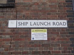
Otherwise, continue east along the riverside path for another 560 metres from the Princes Street bridge until it passes a skate park on the left and ends at the B1075 Bridge Street. Carefully cross the busy road, and on the other side turn left and then right to head down St Peter's Dock, with the River Orwell to the right. As the road soon curves right, angle left to head under some buildings, with a dock away to the right. Continue east along the dockside, initially along Albion Wharf, then Common Quay, then Wherry Quay and Neptune Quay, with yacht moorings in the dock to the right. The dock curves right and becomes more industrial; after 1.2km the dockside path ends near dock gates at Ship Launch Lane at TM17024338.
Turn left along Ship Launch Lane, and when it soon ends, turn left up the B1458 Cliff Road. When a roundabout is reached, take the road straight ahead that heads north off of it, Duke Street. This ends at a T-junction with the A1156 Fore Hamlet; turn left to head west, and then turn right up Grimwade Street. Follow this road as it heads north through Ipswich, and then turn left along St Helen's Street. As the road curves right, turn left along the pedestrianised Carr Street through the town centre. It becomes Tavern Street and then Westgate Street as it passes the town hall on the left, before the pedestrianised road finally ends at a T-junction with the A1156 at TM16004476.
Turn left along this road for a short distance to reach a roundabout, and then turn left to follow Civic Drive downhill to another roundabout. Head straight on at this roundabout, still along Civic Drive. Shortly after the road starts to curve to the left, carefully cross to the road's right-hand side and turn right down Princes Street. This road slowly curves left and reaches the A137; cross this road, and then a second road, and continue on to reach a bridge over the river. Finally cross the B1075 road to reach the forecourt of Ipswich station at TM15714381, where this walk ends.
 |
 |
|
Distances
| From | To | Distance (m) | Ascent (ft) | Descent (ft) |
|---|---|---|---|---|
| Stowmarket station | Needham Market | 4.9 | 16 | 69 |
| Needham Market | Bramford co-op | 7.8 | 52 | 66 |
| Bramford co-op | Ipswich station | 8.2 | 102 | 131 |
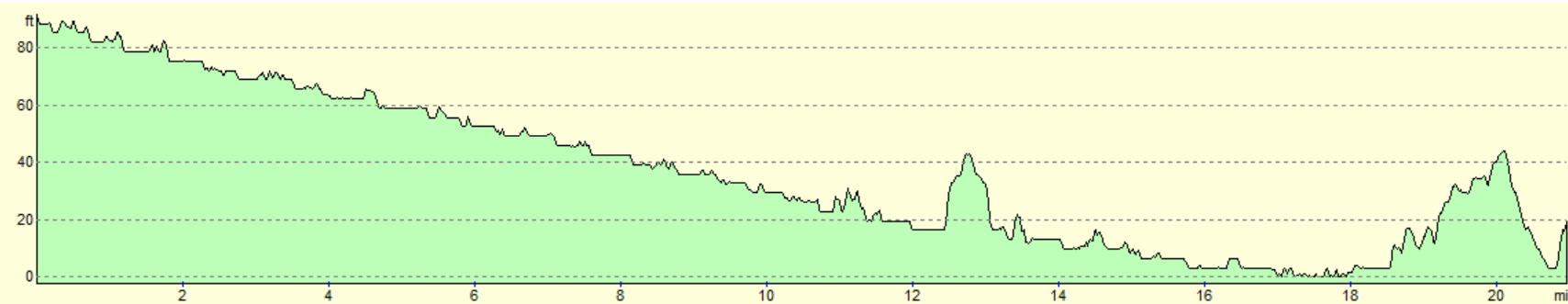
This makes a total distance of 20.9 miles, with 170 feet of ascent and 266 feet of descent.
For more information on profiles, ascents and descents, see this page
Transport
regular train services run between Ipswich and Stowmarket. See the National Rail Enquiries website for more details.
 |
 |
|
| |
 |
|
 |
 |
|
 |
 |
|
 |
 |
|
 |
 |
|
 |
 |
|
 |
 |
|
 |
 |
|
 |
 |
|
 |
 |
|
 |
 |
|
 |
 |
|
 |
 |
|
 |
 |
|
 |
 |
|
 |
 |
|
 |
 |
|
Disclaimer
Please note that I take no responsibility for anything that may happen when following these directions. If you intend to follow this route, then please use the relevant maps and check the route out before you go out. As always when walking, use common sense and you should be fine.
If you find any information on any of these routes that is inaccurate, or you wish to add anything, then please email me.
All images on this site are © of the author. Any reproduction, retransmissions, or republication of all or part of any document found on this site is expressly prohibited, unless the author has explicitly granted its prior written consent to so reproduce, retransmit, or republish the material. All other rights reserved.
Although this site includes links providing convenient direct access to other Internet sites, I do not endorse, approve, certify or make warranties or representations as to the accuracy of the information on these sites.
And finally, enjoy your walking!
Nearby walks
| # | Title | Walk length (miles) |
|---|---|---|
| 106 | Bury St Edmunds to Stowmarket | 15.6 |
| 107 | Stowmarket to Ipswich | 16.1 |
| 131 | Ipswich to Wickham Market Station | 16.7 |
|
|

|