Walk #1026: A circular walk from Aylesbury, taking in the Grand Union Canal's Aylesbury and Wendover branches
 |
 |
|
General Data
| Date Walked | 18/11/2018 |
| County | Buckinghamshire, Hertfordshire |
| Start Location | Aylesbury railway station |
| End Location | Aylesbury railway station |
| Start time | 07.49 |
| End time | 14.53 |
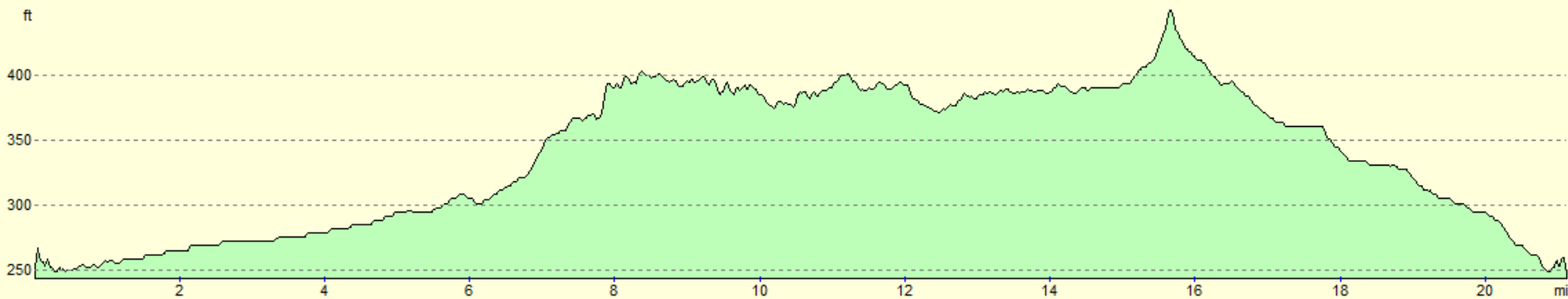
| Distance | 21.1 miles |
| Description | This was a pleasant stroll along the Aylesbury and Wendover arms of the Grand Union Canal, which was followed by a somewhat less pleasant road walk back to Aylesbury. |
| Pack | Today I carried my 30-litre Karrimor rucksack, filled with water, my spare waterproofs, a book and other odds and ends. |
| Condition | I feel absolutely fine after this walk. |
| Weather | The day started off very foggy, but the fog burnt off as the morning progressed, leaving a pleasant and warm sunny autumn day. |
| OS map | Landranger number 165 (Aylesbury & Leighton Buzzard, Thame & Berkhamstead) |
 |
 |
|
Map of the walk
Maps courtesy of Google Maps. Route for indicative purposes only, and may have been plotted after the walk. Please let me have comments on what you think of this new format. For a detailed table of timings for this walk, please see the table file.
 |
 |
|
Notes
I have wanted to walk the Aylesbury and Wendover arms of the Grand Union Canal since I first walked the main canal, around two decades ago. I had never quite got around to doing them, with other walks always calling for my attention. It was not my first choice for today either, and a problem with the trains on my preferred route forced me to pick this one instead. Ordinarily I might have cancelled the trip, but I am at 930 miles walked so far this year, and am keen to reach 1,000 before the year is out. A thick fog greeted me outside my home, and it was nearly thick enough to force me to turn back, but eventually cleared up.
There are a couple of multi-storey car parks near Aylesbury railway station, and I parked in the first I came to. This was nearly empty, surprisingly so even for a Sunday morning, and was also quite cheap to park for the entire day. I pulled my kit together and left the car park, only to briefly return to ensure I had turned my lights off – paranoia strikes!
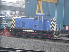
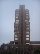
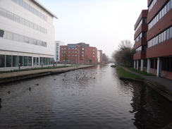
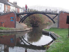
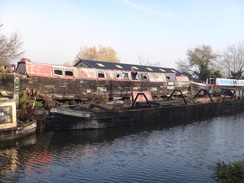
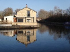
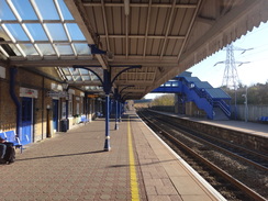
Aylesbury station was only a short walk away, and on the way I passed Aylesbury train depot, along with a small blue shunter named ‘Lesley’. This is the first time I have ever been the town, and I was unsure what to expect: it has hardly impinged on my consciousness before. I found a tidy but modern city centre, depressingly quiet on a cold Sunday morning. A large tower block stood by a shopping centre, and it was only a short walk to the basin marking the end of the Aylesbury arm. Like many such basins, this has been redeveloped, with part of a university and a hotel overlooking the water.
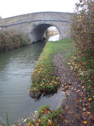
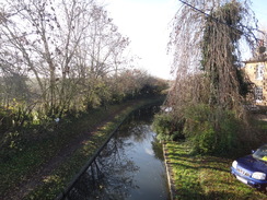
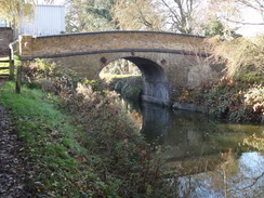
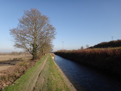
The canal took me dead east, past new housing developments on the other side of the canal. It was a cold walk, with the sun struggling to break through the fog. Two men were huddled under a bridge, peering intently after a line they were throwing into the depths – the first magnet fishermen I’ve seen. Aylesbury is not a small place, but as is often the case with canals, the suburban sprawl mainly remains out of view from the towpath, and the locale soon felt fairly rural. In one place the towpath had eroded nearly fully away, meaning I had to make a little jump to get to the other side.
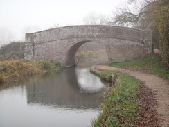
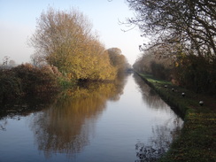
The canal is fairly straight; it opened in 1814 as part of a planned route to Abingdon on the Thames, the rest of which was never opened. Commercial traffic continued to use it until the 1950s – just long enough for it to be saved for the leisure market. I strode along the towpath past a series of locks as the sun started to burn though the lingering fog. It was a very enjoyable morning’s stroll, and there was soon an unusual sight: a female angler, one of the few I have ever encountered.
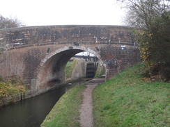
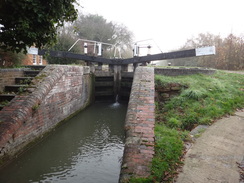
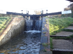
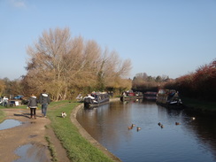
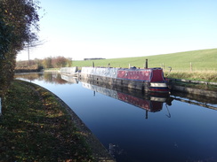
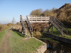
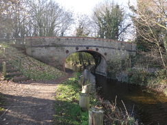
I had left my water bottle at home, so I diverted off the canal to head into the village of Wilstone, where a canalside sign had said there was a shop. It turned out to be some way from the canal, and was filled with friendly locals and the enticing smell of frying bacon. Having bought some provisions, I headed back to the canal. A peel of bells rang out as I approached Marsworth, and the scene of canal, blue sky and green fields, complete with the sound of the bells, made me feel as though I was intruding on a quintessentially English scene that could have been from any time in the last fifty years. I passed the last few locks that lifted it up to the main Grand Union Canal at Marsworth Junction – the last two locks being a rare staircase lock – its presence and the narrow beam of the locks showing the problems this summit level had with water supply.
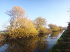
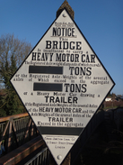
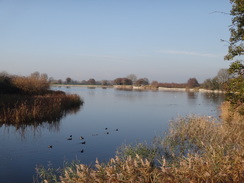
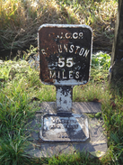
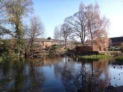
Another, and more obvious, sign came into view as the canal’s main line took me south: a couple of massive reservoirs that had been built to supply the canal with water. This pair – Startop’s End and Marsworth – were half of the four reservoirs built in the early 1800s as the canal desperately tried to keep the summit level in water. They looked beautiful in the morning sunshine, and the area was certainly popular with walkers and runners. I have walked this stretch of canal several times before, but could not remember much about it - even an unusual old diamond-shaped sign on a road bridge escaped my memory.
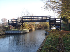
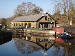
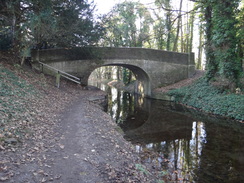
I soon reached Bulbourne Junction, where the Wendover branch of the canal leaves the main line. This opened in 1799, and its main purpose was not to carry commerce, but to instead carry water from springs near Wendover to the canal’s main line. They decided to make the channel navigable, and hence the route does not have any locks on it. Sadly the branch always suffered from leaks and it closed in 1904, with only the first mile or so remaining navigable from the junction to carry water from the reservoirs.
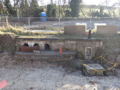
Fortunately a group are working to reopen the canal in its entirety, and the first short section from Little Tring has already reopened. This includes a newly-opened winding basin, but it turned out that the route from the end of the navigable stretch was blocked off, and so I had to return to the bridge and take a road to rejoin the towpath.
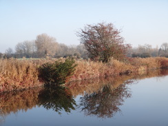
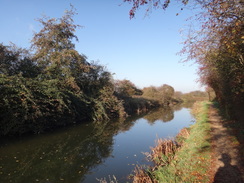
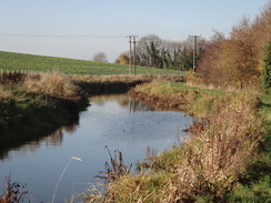
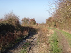
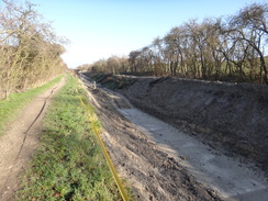
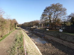
The canal on this stretch was dry, although tracks in the mud bottom showed that it was being used by vehicles. The reason soon became clear: this stretch of canal is under active restoration, and there was a long section where a new clay bottom was being added, with blocks placed on the canal’s sloping sides. It was fascinating to see how the work is being done, the bottom of canals usually remaining out of sight. I soon came to a freshly rewatered stretch of canal, although the water level seemed low – apparently on purpose, until the works are completed on the entire canal.
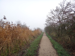
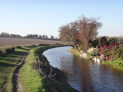
The towpath became busier as it wound its way west – whilst the Aylesbury arm had been very straight, the Wendover arm wound its way around, as might be expected by a water-supply channel. A plaque on a new bridge near Drayton Beauchamp stated that the burial side of a Saxon princess had been found nearby, though a quick trawl of the Internet later provided no further information.
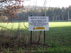
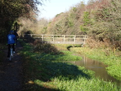
It was an enjoyable stroll, aside from the many bikes that were using the towpath, many without bells to warn me of their approach. The canal passed Halton Camp, an RAF base (despite apparently only having grass runways), where signs warned the public to keep off their playing fields. A wooded hillside behind the camp marked Wendover Woods, which carries the Ridgeway and Icknield Way past two county tops. It has been many years since I was last up there, and I felet a strong desire to visit the woods again soon. A footbridge marked the old site of a rail bridge that had carried a line into the camp, and soon afterwards Wendover canal basin was reached.
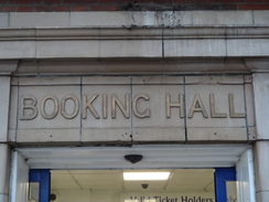
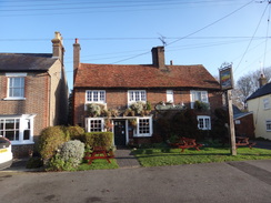
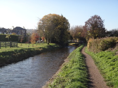
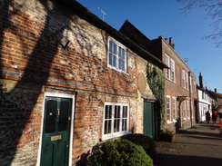
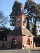
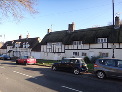
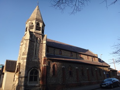
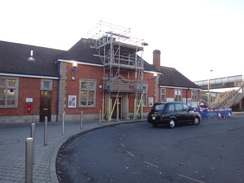
Wendover is a beautiful little town, chock-full of attractive buildings, and it was fairly busy on this Sunday lunchtime. I decided to eschew the pubs, and instead strolled from the basin to the town centre, where a clock tower stands beside a road junction. I made my way to the railway station – a rather nondescript building with lots of peeling paint - and then followed footpaths and roads around to a main road.
All that remained was to get back to Aylesbury. There were some footpaths that could take me there, but a cyclepath runs alongside the main road between the two towns, and this seemed the most sensible route. It passed a large garden centre with other shops, and I nipped into a butchers to buy a delicious sausage roll, which I munched as I headed north into Aylesbury. I arrived at the station, switched off my GPS, and headed back to my car.
It had been an enjoyable stroll along two canal branches, although it had hardly been a spectacular or strenuous one. Sadly the journey home took over half an hour longer than it should have done due to two road closures, meaning that it was a much longer day than it should have been.
 |
 |
|
Directions
This walk starts off at Aylesbury railway station at SP81781347. Leave the station’s main exit and turn right, passing a little turning circle and joining Station Way, which leads up towards the A41. This immediately crosses a stream; a couple of metres after the bridge, turn right along a ramp that descends, ending at the Friars’ Square multi-storey car park’s access road. Head straight on, between the car park on the left and the stream on the right. This road ends at a roundabout; cross the road coming in from the right, and turn left along the pavement, which angles to the right away from a road on the left. This pavement soon joins the A41. Continue along this for a short distance to a large roundabout at SP82091349. At the large roundabout, turn right down Walton Street. When a traffic-light controlled pedestrian crossing is reached after 100 metres, use it to cross over to the other (northern) side of the road, and turn left to double back towards the roundabout. After about twenty metres, turn right into a car park, and head between a red brick building (‘Kingfisher House’) on the right and Aylesbury Vale University Campus on the left. This immediately leads to the Aylesbury canal basin at SP82191345.
At the end of the basin, turn right and then left to start following the canal on the left. Simply follow the Aylesbury Arm of the canal eastwards for 10 km until Marsworth Junction with the Grand Union Canal Main Line is reached at SP91781436. The towpath always remains on the right-hand (southern) side of the canal. I made a diversion off to visit a shop in the village in Wilstone; when a footbridge over the canal is reached at SP90311436, turn right to walk past a recreation ground to reach a road, and then turn right along the road, which immediately curves left. The shop is opposite the village church.
From Marsworth Junction, turn right to follow the Grand Union Canal south, keeping the canal to the left. The towpath rises to cross the B489 at bridge 132, and then winds around past Starttop’s End Reservoir and then Marsworth Reservoir on the right, passing several locks on the way. 1.5km after joining the canal, the towpath crosses a bridge over the entrance to the Grand Union Canal’s Wendover Arm at SP92891385.
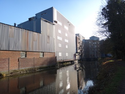
Cross the bridge, and then turn sharply left, and then left again, to join the Wendover Arm’s towpath. Continue along the canal as it winds around southwestwards, with the water to the right. After 1.1km bridge 2 is reached at Tring Wharf at SP92401312; the towpath rises up to a stile beside a field gate to reach the road. Turn right to cross the bridge over the canal, and then turn left to rejoin the towpath, which now runs along the northern side of the canal, with the water to the left. Continue along the canal as it immediately passes a mill on the other side of the canal, and winds around in a generally westerly direction. After 1km Little Tring bridge (number 3) is reached at SP91661283.
Whilst the canal continues in water for a short distance, the towpath leaves the canal before the bridge and climbs up steps onto the top of the bridge. At the top, turn right along the road and follow it north. After 250 metres, turn left up a track. Go past a gate, and curve slightly right to go through a clapper gate beside two field gates to rejoin the canal towpath, this time alongside a (in 2018) dry section of canal. After 2.9 km the towpath reaches Bridge 6, which carries London Road over the canal in Bucklandwharf at SP89551151.
The towpath rises up to end at the road; carefully cross the road, and then turn left for about five metres, and right to rejoin the towpath, which now follows the canal’s southern bank, with the canal on the right. After another 2.8km Bridge 9 is reached in Halton at SP87361014.
The towpath climbs up to the top of the bridge. Carefully cross the road, and then turn right and then left to rejoin the towpath, which is once again on the canal’s northern bank. Continue along the towpath as it heads past Halton, curving left to head in a more southerly direction. After 2.7km the towpath passes Wendover Basin and becomes a short path that ends at Wharf Road in Wendover at SP86960819.
Turn right to follow Wharf Road westwards; when it ends at a mini-roundabout, turn left down Aylesbury Road towards the centre of Wendover. After 250 metres this ends at a roundabout in front of the Wendover Clock Tower; turn right to follow the High Street as it curves right and climbs slightly. After 380 metres, and just before a bridge over a railway line, turn right down Station Approach and follow it until Wendover railway station is reached on the left at SP86550774.
The road forks immediately past the station, with the right-hand branch entering a car park. Take the right-hand branch and follow it through the car park. At the far end of the car park, go through a gap in a fence to rejoin Station Approach. Turn right along this, and follow it as it passes a series of industrial buildings on the left before it ends at large security gates. Go past the gates, and after a few metres turn right along a footpath that gently curves right to end at a T-junction with another path. Turn right down this path, away from a rail overbridge, until it ends at a bend in a road. Turn right down the road for a few metres as it curves right, and then turn sharply left down a nearly-hidden cycle path that ends after a few metres at the end of Lionel Avenue. Head straight on up Lionel Avenue; after 580 metres it ends at a T-junction with the B4009 Aylesbury Road at SP86510873.
Turn left along this road and follow it as it heads northwestwards; there is a cyclepath the entire way, although it swaps sides of the road more than once. The B4009 becomes the A413 at a roundabout; after 6.7km on the road it descends into the centre of Aylesbury, to rejoin the route taken at the start of the day. When a pedestrian crossing is reached at SP82191341, turn left to access the southern side of the road (if not already on it), and turn right to continue on towards a large roundabout. Follow the pavement as it curves left from the roundabout alongside the first exit, and then curves left away from the road to miss another roundabout at SP81971347.
The path soon rejoins the road before another roundabout. Turn right down Station Way, which passes between the Friars’ Square multi-storey car park on the right and a stream on the left. When the road ends, head straight up a pedestrian ramp that ends at Station Way. Aylesbury railway station is a few metres to the left at SP81781347.
 |
 |
|
Distances
| From | To | Distance (m) | Ascent (ft) | Descent (ft) |
|---|---|---|---|---|
| Aylesbury station | Marsworth junction | 7.1 | 173 | 0 |
| Marsworth junction | Bulbourne junction | 1.0 | 56 | 5 |
| Bulbourne junction | Wendover station | 7.6 | 68 | 95 |
| Wendover station | Aylesbury station | 5.4 | 20 | 217 |
This makes a total distance of 21.1 miles, with 317 feet of ascent and 317 feet of descent.
For more information on profiles, ascents and descents, see this page
 |
 |
|
 |
 |
|
 |
 |
|
 |
 |
|
 |
 |
|
 |
 |
|
 |
 |
|
 |
 |
|
 |
 |
|
 |
 |
|
 |
 |
|
 |
 |
|
 |
 |
|
 |
 |
|
 |
 |
|
 |
 |
|
 |
|
|
 |
 |
|
 |
 |
|
 |
 |
|
 |
Disclaimer
Please note that I take no responsibility for anything that may happen when following these directions. If you intend to follow this route, then please use the relevant maps and check the route out before you go out. As always when walking, use common sense and you should be fine.
If you find any information on any of these routes that is inaccurate, or you wish to add anything, then please email me.
All images on this site are © of the author. Any reproduction, retransmissions, or republication of all or part of any document found on this site is expressly prohibited, unless the author has explicitly granted its prior written consent to so reproduce, retransmit, or republish the material. All other rights reserved.
Although this site includes links providing convenient direct access to other Internet sites, I do not endorse, approve, certify or make warranties or representations as to the accuracy of the information on these sites.
And finally, enjoy your walking!
Nearby walks
| # | Title | Walk length (miles) |
|---|---|---|
| 129 | Dunstable to Tring | 14.1 |
| 130 | Tring Station to Hemel Hempstead Station | 8.0 |
| 141 | Tring Station to Cheddington Station | 6.1 |
|
|

|