Walk #1021: Moreton-in-Marsh to Evesham via Chipping Campden
 |
 |
|
General Data
| Date Walked | 07/10/2018 |
| County | Gloucestershire, Worcestershire |
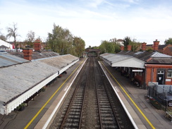
| Start Location | Moreton-in-Marsh station |
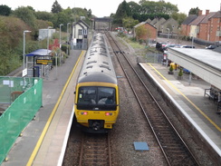
| End Location | Evesham station |
| Start time | 07.13 |
| End time | 15.30 |
| Distance | 22.6 miles |
| Description | This was a very pleasant walk, following the Heart of England Way to Chipping Campden, the Cotswold Way to Broadway, and then roads and footpath to Evesham. |
| Pack | Today I carried my 30-litre Karrimor rucksack, filled with water, my spare waterproofs, a book and other odds and ends. |
| Condition | I feel rather tired after this walk, but otherwise feel fine. |
| Weather | The day started off cold and frosty, although it soon warmed up as the morning got older. Cloudy periods interrupted sunshine, and the breeze was chilly enough to allow me to keep my fleece on all day. |
| OS map | Landranger number 151 (Stratford-upon-Avon, Warwick & Banbury) and Landranger number 150 (Worcester & The Malverns, Evesham & Tewkesbury) |
 |
 |
|
Map of the walk
Maps courtesy of Google Maps. Route for indicative purposes only, and may have been plotted after the walk. Please let me have comments on what you think of this new format. For a detailed table of timings for this walk, please see the table file.
 |
 |
|
Notes
Last week's walk had left me itching to do another stroll in the Cotswolds, and there was an obvious gap to be filled between Moreton-in-Marsh and the trip I'd done years ago along the Cotswold Way. Fortunately the Heart of England Way neatly filled that gap, but would have led to a very short day with difficult transport back. It made sense to extend the walk, following the Cotswold Way to Broadway, before following roads to Evesham, which is on the same railway line as Moreton-in-Marsh.
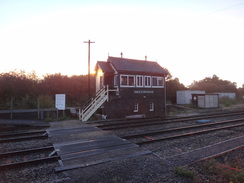
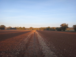
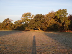
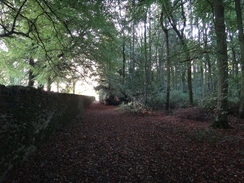
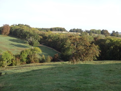
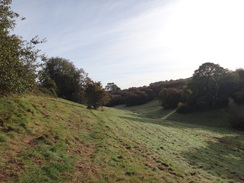
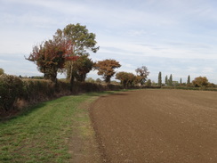
I set off early; it was a cold morning, and frost sat on the few cars in the station car park at Moreton-in-Marsh as I arrived. Men clad in orange jackets were scurrying around, clearing up after their night spent extending the station platforms. The town seemed barely awake at seven on a Sunday morning (perhaps understandably so), and I was soon following the route I'd taken into town the previous week in reverse. A well-walked path led across a series of fields towards Batsford Arboretum, when the Heart of England Way was joined and I started across fresh territory. The sun was low in the sky behind me, and the combination of blue sky, green grass, white frost and orange sun gave the scenery a magical hue.
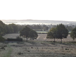
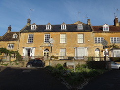
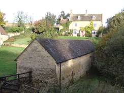
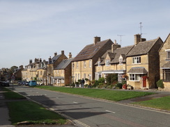
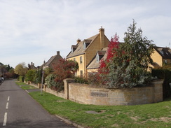
A stiff climb up through trees to a road was followed by a slow descent down into Blockley, which is a typical Cotswold village of attractive stone houses. The trail took a slightly roundabout way through the village, before leaving northwards, descending into a valley and climbing up the other side. Superb views occasionally opened up of distant valleys filled with mist, and I paused to take it all in. The trail passes a farm before following the top of a little valley; this stretch was over rather uneven ground and progress was slow, before eventually leading out into Broad Campden.
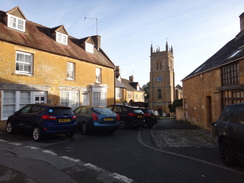
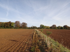
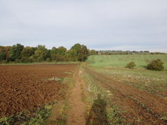
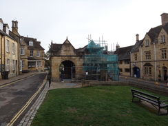
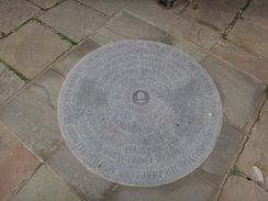
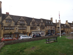
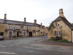
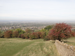
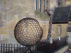
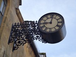
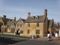
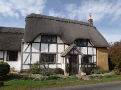
This village also had some very attractive buildings, including a row of almost perfect stone cottages and a Quaker meeting house. I'd been unsure which route to take from here, with two possible alternatives on the map; fortunately waymarkers pointed me to the correct route, past a field being ploughed and on into Chipping Campden. The trail joined the route I'd taken on another walk a few weeks earlier, and I soon found myself in the center of the village. I walked up to the magnificent columned Market Hall, which was partly clad in scaffolding and inaccessible, and found the circular slab on the ground that marks the northern trailhead of the Cotswold Way.
For the next few miles I would be following this National Trail, which I walked in the opposite direction many years ago. Chipping Campden seemed fairly busy, including a group of bikers. The buildings seemed to glow in the sun, and all too soon the trail left the town and started to climb up towards Dover's Hill. I had not seen a single walker before Chipping Campden, but now there were plenty of people making their way uphill. A jogger came running down past me, and we exchanged pleasantries as she sped past.
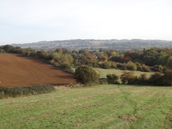
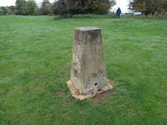
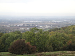
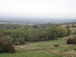
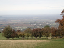
The views from Dover's Hill are superb, with occasional hills puncturing the Severn Valley plains below. On a perfectly clear day the views musty be spectacular. I wandered past the trig pillar and took in the views along the edge of the escarpment. Many people were milling around, including families who evidently had not walked much further than the adjacent car park. I do lots of lowland walking, and views like this make me regret not getting into the hills more frequently.
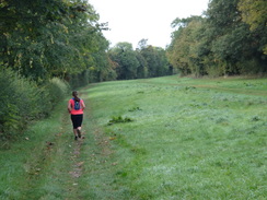
I encountered more walkers as the trail headed southwestwards along easy, flattish terrain, alongside something called 'The Mile Drive'. The jogger who had passed me on the ascent came past in the other direction, having made good time down and back up – she was much fitter than me! The trail led to the A44 at Fish Hill, where there was another well-used car park. The track on the other side of the road was filled with cars and motorbikes, and the reason soon became clear: the woodland was being used for a trailbike competiton. The air was filled with the air of exhaust fumes and two-stroke oil, which made me fairly nostalgic.
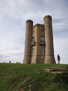
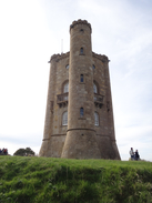
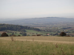
The trial emerged from the trees and skirted the side of Broadway Hill, as more great views down to the west unveiled themselves. A truly beautiful Japanese lady was being photographed by a man with some very expensive-looking camera kit, and passing walkers tried to divert around or behind them rather than appear in the pictures. The triple turrets of Capability-Brown's Broadway Tower started to peep above the horizon, the tower revealing itself from top to bottom as I approached. Lots of people were milling around the tower, and I decided not to go in to visit, and instead continued down along the trail.
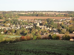
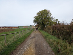
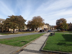
A long descent followed across a series of fields. A steady stream of people puffed their way up, often couples and families. One man asked me if he was near the top, and he was glad when I replied that he was. The views ahead were superb, although trees obscured the tower behind me. It seemed to take an eternity to reach the bottom, after which the path dumped me off in the middle of Broadway. This should be a beautiful Cotswold village, but the good Sunday weather made it seem more like it's American namesake – a bustling, busy place filled with people. I walked on through the village, feeling a little underdressed for any of the pubs.
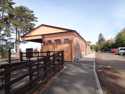
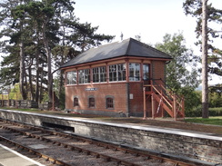
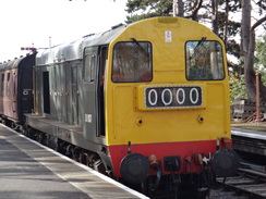
I left the Cotswold Way in the village, and started off on my next stretch towards Evesham. This took me to Broadway station on the preserved Gloucestershire Warwickshire Railway, which only reopened in March. I nipped up to have a look, and discovered that the guys and gals have done a superb job of rebuilding the station, with a large signal box and traditional-looking GWR station building. I was lucky that a train came in during the couple of minutes I was there, pulled by a Class 20 diesel. I listened to the familiar thump of its engine, and then headed back to my walk.
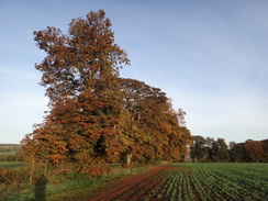
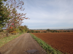
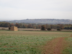
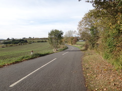
Roads took me past Childswickham, where again I decided not to visit a pub, and on to Murcot, after which a path took me north to the A44 and Wickhamford. At first this village seemed unspectacular, but more and more timber-framed houses came into view. This style of housing was a dramatic change from the Cotswold stone villages I'd seen earlier in the day, as if totally different styles of architecture lay on either side of the escarpment.
I had planned to follow Wickhamford Lane toward Evesham, but before I had travelled more than a few metres a couple stopped me and told me it was not a public right-of-way; I checked on my map and found they were right. After apologising I headed back, where a footpath headed north towards Badsey, and then a road took me west into Evesham.
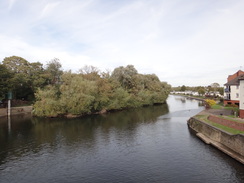
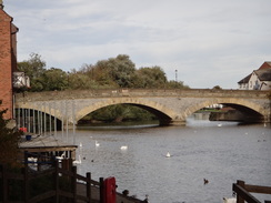
On the way into the town, I realised that I was short of time to catch the next train – and if I made it, it would only be by a couple of minutes. Instead of rushing after a long walk, and because I was feeling fit, I decided to extend the walk and catch the next train an hour later. After crossing Workman bridge over the Avon (named not after any egalitarian unnamed employee, but after the town's Mayor), I headed down to the riverside path and started following it around.
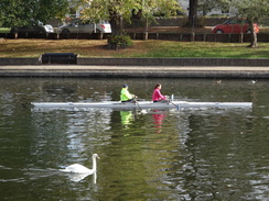
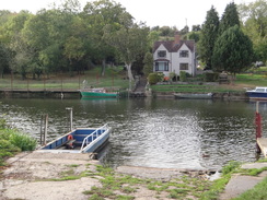
The riverside path was fairly busy with people out and about enjoying the Sunday afternoon sun. The water was also busy with rowers from a rowing club and swans. It was all very pleasant – and then I came across a hot air balloon being laid out, with what looked like an unfeasibly large basket attached to it. I've never seen a hot-air balloon take off before, but that treat shall have to wait as I plodded on past a ferry landing.
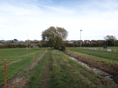
When I had joined the river I had been travelling south, and now I was heading north, the river having performed a big U-shape around the town. I was running short of time to catch the next train, so I hurried past a rugby club before heading into the town to the railway station, where a blue plaque celebrated the town's connection with Sir Henry Fowler, the old Midland Railway and LMS locomotive designer.
I had a few minutes to wait for my train, so I sat down and relaxed as I considered my next walks: I have done several walks from Worcester in the past, so one between there and Evesham might be in order. However I have developed a fondness for the Cotswolds over the last couple of walks, and perhaps another stroll in that beautiful area might be in order. Whichever it is, it may have to wait a few weeks as family obligations and half term intrude.
 |
 |
|
Directions
This walk starts off at Moreton-in-Marsh railway station at SP20673267. Leave the station and walk down the station approach; when it ends at a T-junction, turn right down New Road, immediately passing the end of a car park on the left. This road soon ends at a T-junction with the High Street. Cross the High Street, pass the war memorial, and then turn left to head south along the road. Continue on for a short distance until Corder's Lane leads off to the right, opposite the Black Bear Inn. This road ends at a T-junction with Hospital Road at SP2035432467.
Cross the road and join a path that runs between walls. The wall on the right is replaced with a fence, with allotments beyond. The path soon ends at a clapper gate that leads into a field. Follow a fence on the right for about five metres, and when it ends turn slightly to the left across the field toward a hedge. It joins the hedge on the left, and then curves left to reach a clappergate through the hedge to enter a narrow field. On the other side, turn right to follow a fence on the left to reach a plank bridge over a ditch and then a clappergate that leads into a third field. Head straight across this field, paralleling a hedge away to the right. At the far end of this field, go through a gap in a hedge beside a pedestrian gate and continue across a fourth field. When this field ends, go through another clappergate at SP19663260 into a fifth field.
Head across this larger field, again paralleling the hedge to the right. At the end, go through a clappergate and head on across a sixth field; when the field ends go through a gap in a hedge to enter a seventh field, and angle slightly right to head towards the far right-hand corner. In the corner, go through a clappergate and cross a plank bridge over a ditch into an eighth field. Angle right across the corner of this field for about twenty metres to reach a stone-slab bridge over a stream. Cross this into a ninth field and then follow a hedge on the right past the field. At the far side, go through a clappergate into a tenth field and follow the hedge on the right. At the end of this field, go through another clappergate and cross a plank bridge over a ditch to enter an eleventh field at SP18593299.
Here the Heart of England Way is joined, which will be followed as far as Chipping Campden. Continue across this field, paralleling some woodland away to the right, aiming just to the left of a small stone cottage ahead. Pass the cottage's fence on the right to reach a bridleway gate that leads onto the access road leading to Batsford Arboretum. Turn right down the track for a few metres, and then left to a pedestrian gate beside a field gate. Go through this to enter a rough field. Head straight on up the slope, angling slightly away from a wall on the right. At the top of the slope, cross a stile at SP18153323 to enter some woodland.
Follow an obvious path uphill through the trees; after five metres it joins a broader track that continues uphill beside a tall stone wall on the right. As the track curves left, turn right up a path to continue straight on uphill, still alongside the wall. The gradient slackens and the track levels out; 1.1km after the Arboretum road, it crosses a stile beside a field gate to reach a road at SP17373365.
Turn right down the road for a couple of metres, and then left down another track, with a low stone wall on the right. The track soon forks; take the right-hand branch through a field gate that leads into a field. Head on alongside a wall on the left; it starts to gently fall. At the bottom corner of the field go through an open gateway and continue downhill along a second field, still with a wall on the left. At the bottom corner, go through a gap in a low stone wall ahead to join a track. Turn left to head west down the track, and immediately go through a field gate. Follow the track downhill for 100 metres until a stile beside a field gate is reached on the right at SP16963408.
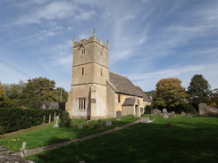
Cross the stile into a field and head downhill, slowly angling away from the hedge on the right. At the bottom left-hand corner of the field, with a farm away to the right, go through a stile beside a field gate into a second field. Head on, aiming for a church ahead; cross a track and at the field's bottom corner, cross a stile beside a field gate into a third field. Continue on, following a hedge on the right; the hedge curves slightly right to reach a stile beside a field gate. Cross this and turn right to join a track that heads downhill, soon meeting the B4479 road in Blockley at SP16523474.
Just before the road is reached, turn left along a path that parallels the road on the right. When the path ends beside the road after 100 metres, turn right to carefully cross the road and head on down School Lane. This curves left; as it curves left for a second time, turn right to head steeply uphill, still following School Lane. This road soon forks; take the right-hand branch to join High Street in Blockley. Turn right along this road, and after it curves left with the village church to the right, turn left up a steep road called Bell Bank. After nearly 150 metres this road ends at a T-junction with another road. Turn right to head north along this road until it too ends at a T-junction with Greenway Road at SP16223507.
Cross Greenway Road and join a surfaced path that heads straight on northwards. The path soon reaches a stile that leads into a field. Head straight on along an obvious unfenced path across the field; after 330 metres go through a gap in a hedge ahead and walk on for ten metres to a stile that leads into a second field. Angle slightly right across this field to continue northwards, angling away from the fence on the left. Head through a line of trees, and then continue down the field, aiming for the bottom right-hand corner. At the bottom, join a track that crosses a farm bridge over a stream to reach a stile beside a field gate in the field corner at SP16213581.
Cross the stile to enter a field and head uphill, paralleling a fence on the right – there is a road behind the hedge. At the top corner of the field go through a field gate into a second field. After about five metres turn right through a gap in the hedge to join a path, and immediately turn left along the path, with the hedge on the left. This soon enters a third field; continue uphill, following a hedge on the left. The path joins a track that goes through a gap in a hedge ahead, and continues climbing alongside the hedge. 650 metres after joining the track, the corner of the field is reached at SP15183636.
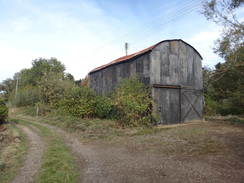
Continue straight on along the track as it passes through a band of tress, after which it curves slightly to the right, crosses another track and emerges out into a field. Head straight on down a slope, still following the track, past another field. After 280 metres the bottom corner of the field is reached; the track curves left and becomes rougher as it continues to fall towards Campden Hill Farm. Just before it reaches the farm, turn right down some steps and go through a pedestrian gate. Pass the side of a barn on the left; just before the end of the barn, the path curves right and climbs to reach a pedestrian gate at SP14953669.
Do not go through the gate, and instead turn right to contour the side of a small dry valley to the right. Do not descend down into the valley, and instead keep as high as you can, near a stone wall at the top. Continue on to a clappergate, and continue following the wall on the left. After 650 metres the path meets a metal fence on the right; squeeze between this and the field boundary, until the fence soon ends at SP15353725.
Angle slightly to the right to head towards another corner of the field. At the corner, go through a gap in the hedge to enter another field. Head across this, angling slightly away from the hedge on the left to reach a stile that leads into a small band of trees. Continue through the trees for ten metres to a second stile, which leads into another field. Angle slightly right across this field, aiming to meet the corner of a fence on the right. Follow the fence on the right; the fence becomes the side-wall of a barn. The wall then curves right to reach a field gate. Go through the gate and continue following the wall for five metres to meet a road in Broad Campden at SP15753783.
Turn right down the road, heading away from the Bakers Arms pub. The road soon curves left, and when it curves right, turn left up a road, and then immediately left up Angel Lane, passing a dramatic stone building on the right. When this road forks after a few metres, take the left-hand branch, which soon passes a row of beautiful stone cottages on the left. When this road ends with a Quaker Meeting House on the right, turn left along a narrow path that runs between walls. The path leads to a clapper gate; go through this and walk on between trees to join a driveway. Pass a house on the right, and when the driveway ends, veer left across grass with a hedge on the right to reach a clappergate at SP15813805.
The clappergate leads into a field. Head on along the middle of the field, towards a church in the distance. After 170 metres the path curves left and starts to descend across the field. At the bottom, meet a hedge on the left and follow the hedge along, with a road on the other side of the hedge. After 300 metres the hedge and path meet a surfaced track; turn left down the track for two metres towards a bend in the road at SP15373856.
At the bend in the road, turn right along a narrow road called George Lane. The lane passes a car park for a tennis club on the left and becomes a narrow surfaced path. The path emerges out onto a road; head straight on down this road. When it soon curves to the right, turn left along an access road that leads into the car park of the Noel Arms. Aim for the car park's far right-hand corner, where a path leads under a building to meet the High Street in Chipping Campden opposite the Town Hall. Cross the road and climb up steps beside the town hall, and then turn right for a few metres to reach Chipping Campden Market Hall, in front of which a stone circle on the ground at SP15123917 marks the northern trailhead of the Cotswold Way.
Here the Heart of England Way is left; the Cotswold Way will be followed for the next few miles. Turn around to head southwestwards down the road, passing the Town Hall on the left. After 300 metres, opposite the Volunteer Inn, turn right up Hoo Lane; as the road soon curves right, turn left to head straight on, continuing up Hoo Lane. The road becomes an unsurfaced track; it passes a farm on the left, and as it curves to the right immediately afterwards, continue straight on along a footpath. This path emerges out through a gateway onto Kingcomb Lane at SP14293969.
Turn left down to head westwards down the road for nearly 100 metres, and then turn right up a path that heads north between hedges. After 300 metres it goes through a clappergate to enter a field on Dover's Hill. Turn left, following the edge of the field to the left, passing a trig pillar on the right – although a diversion to walk along the edge of the escarpment a little to the right can be very rewarding. Continue along to a viewpoint at SP13653965.
From the viewpoint, turn left to head towards a car park, aiming for the left-most of two pedestrian gates. Go through this into the car park, and walk along the access road. Just before a road is reached, turn left down a path that runs between a wall and a fence. Go through a bridleway gate and walk onto a second gate; cross a track to a third, and then continue along the path with a hedge on the right and a field to the left. At the bottom corner of the field, go through a fourth bridleway gate and down some steps to reach a road. Turn left down this road for a few metres to reach a road junction at SP13743927.
Carefully cross the road ahead, Ignore a road heading off downhill ahead, and instead angle right along a path that enters a field. The path then turns right, paralleling the road on the right southwestwards; after 500 metres cross a stone stile ahead through a stone wall, and follow the path as it curves left through trees away from the road. The path soon curves right and emerges into a long, narrow field. Follow a hedge on the left southwestwards, with a vague track off to the right. After 1.6km the track curves left; cross this and continue on for a few metres to a gap in a wall that leads into a field. Angle slightly away from the hedge on the left, aiming for another gap in a wall at the far side of the field. Go through this into a second field, and angle slightly right to head diagonally across the large field. At the far side, go through a gap in another stone wall to join Buckle Street at SP12083720.
Turn left along the road for a few metres, and then right over a stone stile into another field. Angle slightly left across this field, and at the far side go through a clappergate and turn left along a grassy path. The path swings right as it descends a slope, passing picnic benches to reach Fish Hill car park (there are public toilets in the car park). Follow the right-hand edge of the car park, and curve right through a small band of trees and across a plank bridge over a ditch to reach the A44 at Fish Hill at SP11983684.
Carefully cross the main road, and on the other side turn right along the road. After a few metres turn left down a slip road; after 200 metres this road passes houses on the right and left. After the house on the left the track becomes a path, with the main road through trees on the right. The path descends into some woodland and curves left; follow the obvious path along south-southwestwards through the trees. It reaches a clappergate beside a field gate that leads into some open ground. Continue straight on, keeping the boundary away to the left. It enters a little dry valley that leads to a clappergate beside a field gate. Go through this and head up a little slope towards Broadway Tower, contouring the hillside with a boundary away to the left. Continue on to another clappergate that leads to a better-quality path in front of Broadway Tower at SP11393622.
Turn right to head downhill along a path between a stone wall and a fence – divert off to visit the tower if you wish. At the bottom, go through a bridlway gate to enter a field. Head down this field, with the boundary on the right. At the bottom of this field, go through a gap in a hedge into a second field, still following the field boundary. At the bottom, go through another bridleway gate into a third field and continue downhill beside the boundary. At the next corner, go through another bridleway gate into a fourth field and follow the boundary as it curves slightly to the right. At the next bottom corner go through another bridleway gate and descend some steps and continue following a wall on the right downhill past the fifth field to reach the next field corner at SP10643690.
Here, go through a clappergate beside a field gate and continue on into a sixth field. As a fence on the right curves away to the right, head straight on down the field towards the town ahead. Continue down the middle of this field; at the bottom go through a clappergate beside a field gate and continue on for a short distance to reach a hedge ahead. Go through a gap in the hedge to enter an eighth field. Curve slightly right across this field, aiming for the bottom right-hand corner. Go through a clappergate beside a field gate and then cross the ninth field, heading towards houses ahead. It crosses a farm bridge over a stream, and then enters a tenth field. Head on towards buildings ahead. Go through a clappergate beside a field gate, and head on for twenty metres to another gate. Follow the path as it runs between walls for a few metres until it ends at the High Street in Broadway at SP10173759.
Turn left down the High Street; when a mini-roundabout is reached after 200 metres, continue straight on down High Street. Follow the road all the way through Broadway; it curves to the right by the Swan pub, and continues northwestwards out of the village. 1.5km after the roundabout, a bridge under a railway line is reached with Broadway station (on the preserved Gloucestershire Warwickshire Railway) to the right. Head under the bridge and continue along the road for another 650 metres as it climbs uphill until Pennylands Bank leads off to the left at SP08483880.
Turn left down Pennylands Bank, and follow it as it falls West-southwestwards; after 580 metres it ends at a T-junction with another road to the east of Childswickham. Turn right to head straight on along the road; it curves right and then left as it passes the village. When the Childswickham Inn is reached on the left after nearly 1km, turn right up Murcot Road. After 1.5km this ends at a T-junction with another road at SP06614020, just to the east of Murcot.
Turn right along the road, and after about 80 metres turn left down a bridleway into a large field. Follow a hedge on the left; when the corner of the field is reached after 500 metres, go through a gap in the hedge ahead and turn right to walk along a narrow field between hedges. When the hedge on the left turns left, follow it on the left, heading northwards. This soon leads to a bridleway gate beside a field gate that leads into another field. Turn right, to follow a fence and then hedge on the right. These curve left past the field; at the corner of this field, go through a bridleway gate and head straight on across another field, aiming for a gap in a hedge ahead. Go through a bridleway gate in the hedge gap to reach the A44 road in Wickhamford at SP06644129.
Carefully cross the A44 to reach the pavement on the other side, turn right for a few metres, and then left up a road. This soon curves to the left; at the end of the bend, turn right up Manor Road. Follow this road as it heads north past Wickhamford; when the road curves right after 750 metres, turn left down another road. This soon curves right to pass a house on the right; as the road soon curves left towards a bridge over a stream, veer right to continue straight on along a path for a few metres to reach Wickhamford church at SP06784225.
Pass the church's parking area to reach a footbridge over a stream. On the other side, go through a pedestrian gate and down some step into a field. Follow a fence north across this field; when it ends, cross a stile and continue on between a hedge and a fence past a second field to reach a track. Turn right down this track towards a barn ahead; pass the barn on the right, and go past a farm gate. Continue along the track until it ends at Badsey Lane on the western outskirts of Badsey at SP06774301.
Turn left to follow Badsey Lane westwards; after 1.5km it ends at a T-junction with the A46. Carefully cross the main road, and on the other side head up a sloping path that leads out onto the continuation of Badsey Lane in the east of Evesham. Follow Badsey Lane as it heads west for 700 metres until it ends at a T-junction with Elm Road. Carefully cross Elm Road, and then turn left to follow it west-southwestwards towards a roundabout. At the roundabout take the first exit on the right, the B4035 Port Street. Follow the B4035 westwards for 500 metres until Workman Bridge over the River Avon is reached at SP04014367.
Cross the bridge, and on the other side take the first road to the left, Monk's Walk. As this road soon veers right, turn left through a gateway to enter Abbey Park, and follow a surfaced path down to the western bank of the Avon. Turn right to start following the river downstream; the path sticks to the riverside, and after 680 metres a viaduct carrying the A4184 road overhead. Head under the viaduct and continue following the river as it slowly swings around and becomes unsurfaced; after another 900 metres it reaches a ferry landing at SP02974364.
Continue following the riverside path northwards; after another 500 metres the path meets a surfaced access road. Follow this north towards Evesham Rugby Club. Pass the club's building on the right and then head through the club's car park, and continue along a track beside the river. After passing the first set of pitches, cross a farm bridge over a ditch at SP03184441.
Do not continue along the river, and instead turn right to follow a path that heads east away from the river, with the ditch on the right and a fence on the left. At the end of the pitches, go past a field gate and continue up a path that climbs past buildings above to the left, before emerging out onto a road. Turn right down this road for a few metres until it ends at a T-junction, and then right down Briar Close. After about fifty metres, turn left along Queen's Road. When this ends at a T-junction with the A4184, turn left to follow the main road northwards, and then turn left down the station approach that leads to Evesham railway station at SP03684445, where this walk ends.
 |
 |
|
Distances
| From | To | Distance (m) | Ascent (ft) | Descent (ft) |
|---|---|---|---|---|
| Moreton-in-Marsh station | Blockley | 3.5 | 515 | 699 |
| Blockley | Chipping Campden | 3.8 | 505 | 538 |
| Chipping Campden | Broadway | 6.1 | 692 | 876 |
| Broadway | Badsey | 5.1 | 75 | 246 |
| Badsey | Evesham station | 4.1 | 197 | 197 |
This makes a total distance of 22.6 miles, with 1984 feet of ascent and 2556 feet of descent.
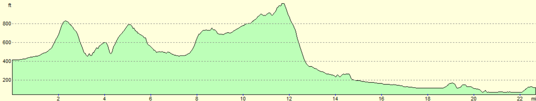
For more information on profiles, ascents and descents, see this page
Transport
There are regular train services between Evesham and Moreton-in-Marsh, on the Worcester to London line. See the National Rail Enquiries website for more details.
 |
 |
|
 |
 |
|
 |
 |
|
 |
 |
|
 |
 |
|
 |
 |
|
 |
 |
|
 |
 |
|
 |
 |
|
 |
 |
|
 |
 |
|
 |
 |
|
 |
 |
|
 |
 |
|
 |
 |
|
 |
 |
|
 |
 |
|
 |
 |
|
 |
 |
|
 |
 |
|
 |
 |
|
 |
 |
|
 |
 |
|
 |
 |
|
 |
 |
|
 |
 |
|
 |
 |
|
 |
 |
|
 |
Disclaimer
Please note that I take no responsibility for anything that may happen when following these directions. If you intend to follow this route, then please use the relevant maps and check the route out before you go out. As always when walking, use common sense and you should be fine.
If you find any information on any of these routes that is inaccurate, or you wish to add anything, then please email me.
All images on this site are © of the author. Any reproduction, retransmissions, or republication of all or part of any document found on this site is expressly prohibited, unless the author has explicitly granted its prior written consent to so reproduce, retransmit, or republish the material. All other rights reserved.
Although this site includes links providing convenient direct access to other Internet sites, I do not endorse, approve, certify or make warranties or representations as to the accuracy of the information on these sites.
And finally, enjoy your walking!
Nearby walks
| # | Title | Walk length (miles) |
|---|---|---|
| 620 | Cotswold Way: Dowdeswell Reservoir to Stanton | 19.8 |
| 621 | Cotswold Way: Stanton to Lower Quinton | 17.0 |
| 622 | Lower Quinton to Buckley Green | 22.2 |
|
|

|