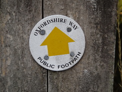
Walk #1019: Oxfordshire Way: Tackley to Kingham
 |
 |
|
General Data
| Date Walked | 09/09/2018 |
| County | Oxfordshire, Gloucestershire |
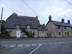
| Start Location | Tackley village hall |
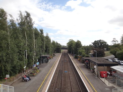
| End Location | Kingham station |
| Start time | 06.25 |
| End time | 14.10 |
| Distance | 22.5 miles |
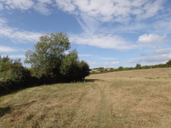
| Description | This was a pleasant walk following the Oxfordshire Way west to the border with Gloucestershire. |
| Pack | Today I carried my 30-litre Karrimor rucksack, filled with water, my spare waterproofs, a book and other odds and ends. |
| Condition | I feel absolutely fine after this walk. |
| Weather | The day started off cloudy and slightly chilly; however the morning soon warmed up despite a breeze that was at times fierce. There was a little drizzle, and then one short bu sharp rainstorm, after which the sun mae more of an appearance. |
| OS map | Landranger number 164 (Oxford, Chipping Norton & Bicester) and Landranger number 163 (Cheltenham & Cirencester, Stow-on-the-Wold) |
 |
 |
|
Map of the walk
Maps courtesy of Google Maps. Route for indicative purposes only, and may have been plotted after the walk. Please let me have comments on what you think of this new format. For a detailed table of timings for this walk, please see the table file.
 |
 |
|
Notes
It had been a couple of weeks since my last walk; Sencan has started a new job that requires a longer drive, and Robert no longer attends nursery that ended at 18.00, which used to allow me a long day on which I could go for walks. This means my opportunities for walks are fewer, and this is why I'm walking on a Sunday. I had never really considered walking the Oxfordshire Way before, but I have enjoyed my last couple of walks into the Cotswolds and wanted to do another west across Oxfordshire, and it fitted the bill well.
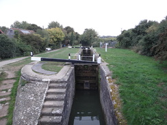
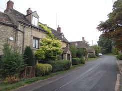
The drive to Tackley was straightforward, and I pulled up into the village hall car park just as it was getting light. The village was quiet as I walked to the station, and here I decided to change my route; instead of heading straight down to join the Oxfordshire Way, I walked along another path that led down to the Oxford Canal, which I had walked many years ago. It was an easy walk along a good track, and after crossing the Cherwell the canal was reached at Pigeons Lock. I then walked back over the Cherwell, following the Oxfordshire Way under a railway line and on past Tackley. I had started with my fleece on, concerned about getting chilled; however it was already warm and I stopped for a minute to take it off - only to be immediately assaulted by the stiff breeze!
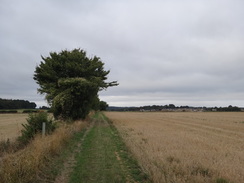
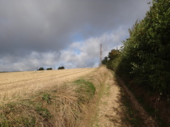
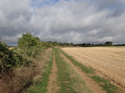
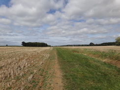
The first few miles followed Akeman Street, the old Roman road that once linked the Foss Way at Cirencester with Watling Street near St Albans. Because of this, the trail ran arrow-straight across the countryside, climbing and falling with the terrain. Cows in one field blocked the path, and I had that familiar uneasy feeling as they ambled towards me, as if I was bringing them food. It's not exactly a scary situation, but neither do I find it fully comfortable. The path than crossed a main road near Sturdy's Castle (where there was a pub, but no sign of any castle), and continued on to join a road to the north of Woodstock. It was still early but I was very hungry, so I scoffed my sandwiches as I walked along the road. As ever when walking Roman roads, I tried to imagine how centurions must have felt as they made similar journeys nearly two thousand years ago.
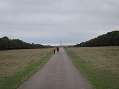
The road ended at a T-junction with another main road, and the trail continued on through a gate in a tall wall to enter the grounds of Blenheim Palace, called the 'Great Park'. The palace itself remained resolutely out of sight, and the only trace of it was a tall column with a figure atop it: probably the Column of Victory. The palace was built in the English Baroque style and is home to the Dukes of Marlborough; the most famous resident was probably Winston Churchill, who was born in the house in 1874.
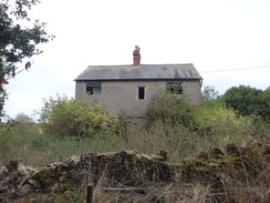
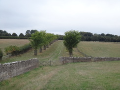
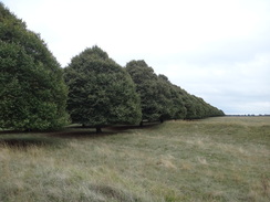
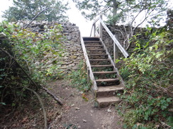
The grounds themselves were well-kept, aside from a farm that had sadly been allowed to go to ruin; surely there must be a way to earn money from a farmhouse in such luxurious grounds? The dilapidation contrasted with two rows of perfectly topiaried trees that guarded an avenue that stretched away towards the column. Another two rows of trees stood on the other side of the avenue, and the path continued arrow-straight across the grounds, eventually leaving via some steps that climbed over the boundary wall.
The trail continued straight on across the countryside, and a short distance further on the map was marked with 'beech' and 'elms', as though individual trees in the hedge were being marked. After crossing a couple of roads, the trail followed a deepening valley on the left, called Begg's Bottom. The map showed the path aiming for the centre of a field, but on the ground it seemed to stick to the field's edge. This seemed to be right, as it descended through gates to approach a footbridge over a stream, before climbing up along a narrow track with exposed rock edges. A board at the top gave details of the fossils found in the area, and apparently the first scientific research on fossils were performed on samples found nearby.
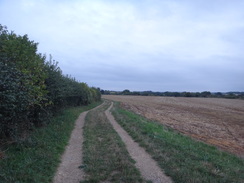
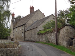
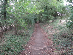
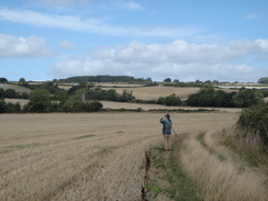
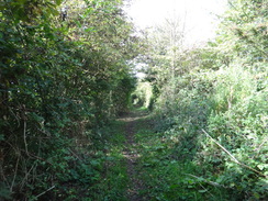
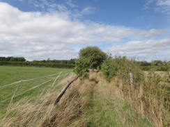
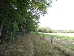
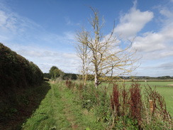
The trail headed through the little village of Stonesfield before climbing up onto hills on the other side. No rain was forecast, but there had been a couple of minutes of light drizzle earlier - barely more than a few drops in the air. However streaks of grey showed rain was falling in the distance, and it was soon upon me. Within a few minutes I was soaked. I didn't bother putting my coat on as the rain soon ended, and was replaced with warm, sunny periods. By the time I had walked another half-mile I was dry, and this was just in time for a very enjoyable stretch of path. Hedges enclosed both sides, sometimes so closely that I wondered how the horses whose hooves marked the ground managed to get past. Occasional gaps gave glimpses of good views, and I wished it would never end - for some reason this stretch of bridleway was just what I needed at that moment.
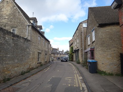
This bridleway ended on the outskirts of Charlbury, and roads took me on through the village. People were heading to church, and although shops lined one of the streets there was no sign of anywhere I might buy snacks. I didn't want to divert off the trail to try to find one, so I plodded out of the town where my map showed the trail splitting. One branch headed down towards a railway station and then along the southern side of the River Evenlode's valley, whilst the other stuck to slightly lower ground to the north.
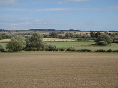
I picked the former, and headed past the station before a bridleway headed west, passing a farm and with occasional grand views north. A lack of waymarkers indicated I might not be on the trail, and this became clear as a road took me off the hillside, across the railway and river, to meet up with the other branch, where a waymarker pointed in the opposite direction. I had made an incorrect choice, and a check when I got back home showed that more recent maps show only the northern branch. This should have annoyed me, but it's given me a reason to come back here and do another walk.
A bridleway took me across fields to the north of the Evenlode, where a woman was picking some blackberries. I picked a few as a walked, and they were perfectly sweet, almost bursting with flavour on my tongue. After crossing a road the bridleway became a path, and at one point it curved around the edge of a field. I took the 'proper' route and watched as people took a direct and well-walked route across its top edge. A little further on a family were collecting blackberries, understandably too busy in their tasty task to even say hello.
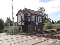
The trail headed into the little village of Ascott-under-Wytchwood, whose station has a pretty little signalbox of the kind that is rapidly disappearing from our railways. The trail soon left the village, crossing the railway line and heading on a short distance to meet a main road that headed past Shipton station and down towards Shipton-under-Wytchwood (I have no idea what, or where, 'Wytchwood' is). I bought some snacks at a petrol station, and the trail barely flirted with the village before heading north out of it.
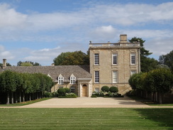
The travel back from this walk looked troublesome. Trains from the next station, Kingham, ran to Oxford, and from there trains ran back to Tackley - though mine would take me up to Banbury before returning south to Tackley. However there were only a few trains running between Oxford and Tackley, and these were every two hours, with the journey including connections taking two hours. I realised I could make a train that was due to leave Kingham a little after two, so I sped up along the path. It was easy but unspectacular going, the highlight being the grand house at Bruern Abbey, which was made all the more English by the people playing cricket nearby.
The path from the road beside the houses was not obvious, and I made a slight mistake before heading back to the road and finding the right route. Again it was a fairly unspectacular stretch of path, and it soon dropped me off at the road outside Bledington, crossing over the border from Oxfordshire into Gloucestershire for a few metres. The road led down to Kingham station, and I arrived ten minutes before the train was due. The station's car park was surprisingly large, and I was hardly the only person waiting for the train - the reason for the station's size being the close proximity of Stow-on-the-Wold and Chipping Norton, both of which lack a station.
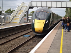
A sign on the platform said you had to buy a ticket before you got on the train, and the sign was a little more strident than usual. The ticket office did not open on Sundays, so I tried buying one on-line on the GWR website, but hadn't even managed too create an account before the train arrived. I was surprised to see it was one of the new Azuma trains, which only went into service earlier in the year. It all looked very smart, and the guard said he could sell me a ticket on board, so I clambered on.
The guard chatted to another employee for most of the journey to Oxford, and I tried to get comfortable on the hard, thin-backed seats. He came past me just as we were approaching Oxford and said he'd get his ticket machine, but hadn't returned by the time the train stopped. To make matters worse, the train was late, meaning I'd missed the next train to Banbury. I purchased a ticket at the ticket barrier and waited for the next Banbury train, which was due to arrive in Banbury six minutes before the train back down to Tackley was due to depart. Five policemen and women were waiting on the platform, waiting for a train that would be carrying football fans.
The fans were on the service I needed to catch, a Virgin Cross-Country train that was packed to the gunwales with passengers. I stood in a vestibule, and the train was a couple of minutes late setting off, eating into the six minutes I had to change trains at Banbury. It eventually arrived with three minutes to spare, and the moment the doors opened I jumped out and ran across the footbridge, reaching the Tackley train a minute before it departed. I thanked my lucky stars for having made it, although it had been a close-run thing and much more stressful than it should have been.
It had been an enjoyable day's walk despite the travel travails, and I hope I will soon be walking another walk in this area soon.
 |
 |
|
Directions
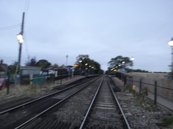
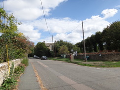
This walk starts off in the car park of Tackley village hall at SP47982071. Leave the car park via its access drive, and then turn right up Medcroft Road. When a road junction is met on the right after 200 metres, turn right down Nethercote Road and follow it southeastwards through the village. After nearly 500 metres the road ends by Tackley station at SP48432049.
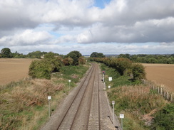
At the end of the road, go through a pedestrian gate and carefully cross the railway line, going through another gate on the other side to join a track. Follow the track; it soon curves to the right to take a southerly course, slowly descending for 900 metres before ending at a T-junction with another track that carries the Oxfordshire Way at SP48721965.
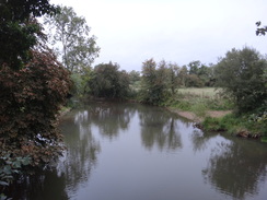
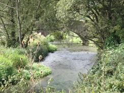
Turn left along this track and follow it eastwards with a hedge on the right; it soon curves to the right through a band of trees and crosses a couple of farm bridges over streams. The path continues between fences, curving left near the River Cherwell to reach a bridge over the river by a sluice. It then curves to the right, crossing a footbridge over a millstream and then left to squeeze past a farm gate to join a track beside a bridge 213 on the Oxford Canal, by Pigeons Lock at SP48691940.
The next part of this walk reverses the instructions above, following the Oxfordshire Way. Leave Pigeons Lock by going through a gap beside a farm gate to join a footpath that passes a millstream on the right, and then curves right to reach a footbridge over the stream. It continues on between fences and crosses a bridge over the River Cherwell by a sluice. It then curves right to continue between fences away from the river. The path becomes a track; it crosses a couple of farm bridges over streams, and then curves left to follow a hedge on the left. Soon the place the trail was joined is reached at SP48721965.
Continue straight on westwards along the track; the hedge on the left soon becomes intermittent. It slowly descends to pass a sewage farm on the left, and then heads under a railway bridge. 100 metres after the bridge, and just before the track becomes a surfaced road, turn right through a pedestrian gate beside a field gate to enter a field. Head straight on northwards across the field with some woodland away to the left; just before the far left-hand corner is reached after 250 metres, turn left along a footpath that goes through a gap into the woodland. The path descends to cross a footbridge over a stream, and then continues straight on until it reaches a clappergate at SP48171985 that leads out into a large field. Follow a hedge on the right, with the field away to the left; after about 750 metres the path emerges out through a clappergate in a hedge to reach a road at SP47481968.
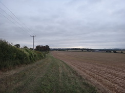
Cross the road, and on the other side go through a gap in a hedge to enter a field. Follow a hedge on the right, with power lines slightly to the left. When this field ends, go through a broad gap in a hedge ahead and continue following the hedge on the right across a second field. About 100 metres, before the corner of the field is reached, turn right through a small gap beside a double field gate to join a road. Turn left along this road for a short distance to reach a junction with the A4260 at Sturdy's Castle at SP46301936.
Carefully cross the road, and on the other side, with a lay-by to the right, go through a gap in a hedge and start following a path enclosed by trees. After 250 metres the trees end at a junction with another bridleway; cross this and go through a pedestrian gate to join a path that heads on between fields. After another 250 metres a gap in a hedge is reached at the end of the field; go through this and continue on between fences. At the bottom of this field, go through a pedestrian gate, cross a track, and then go through a gap in a hedge to continue along the path as it heads between fields. As the edge of the field curves gently right, head straight on along the path to meet a gravel area. Cross this, passing a house on the left to reach the B4027 road at SP45081900.
Carefully cross the road and continue on along Stratford Lane. This descends to cross the River Glyme at Stratford Bridge, and then climbs. After 1.5km the road ends at a T-junction; turn left along this road for about 60 metres until it ends at a T-junction with the A44 at SP43551856.
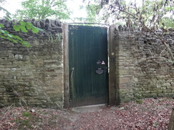
Carefully cross the main road, turn right for a few metres, and then left through a pedestrian gate beside a field gate to join a path that immediately runs through trees. This leads to a gate through a tall wall that guards Blenheim Great Park. Follow the obvious path as it soon joins a rough track. After a short distance, turn left through a bridleway gate through a fence into a field, and then head diagonally west-southwestwards across this field, aiming slightly to the right of a barn ahead. At the far side of the field, go through a pedestrian gate at SP43191844 to enter a small clump of trees to reach a second pedestrian gate, with an abandoned (in 2018) house at Furze Platt on the left.
The second gate leads into a field; head straight on across this field, initially with a barn on the left. At the bottom of a dip, go through a pedestrian gate through a wall about five metres to the right of a double field gate, and on the other side join a rough track that runs between an avenue of trees. The avenue of trees soon ends; continue straight on along the track that crosses through a double-line of trees to reach a surfaced track at SP42691829.
Cross the track, and on the other side continue straight on, following a fence to the right. Go through another double line of trees, and continue to a bridleway gate. On the other side, follow a fence on the right for 150 metres until it reaches a gravel track. Head straight on along the track; after nearly 600 metres it reaches a bridleway gate beside a field gate across the track, after which the track immediately ends at a T-junction with another track at SP41961794.
Cross the track ahead and go through another bridleway gate beside a field gate to enter a field. Continue straight on along the field, following a fence on the right. At the end of this field, go through a bridleway gate beside a field gate to enter a band of trees. Head straight on through the trees; cross a track to reach some stone steps that lead up over a wall and then down the other side back to ground level at SP41701780. This wall marks the western boundary of Blenheim Great Park.
Continue straight on across the field, following a hedge on the left. After nearly 500 metres go through a gap in a hedge ahead to join a surfaced road. Cross the road and go through another gap in a hedge opposite to enter another field. Head straight on down this field, following an intermittent hedge on the left. When the hedge on the left ends near the end of the field, turn left and then right into another large field, to start following a hedge on the right (this is essentially continuing straight on, just on the other side of the hedge). The path descends; at the bottom corner of the field, continue straight on, passing a stone wall on the left for ten metres to reach a road at SP39891682.
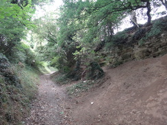
Cross the road and continue straight on to descend down into another field. A hedge is off to the left, beyond which is an overgrown valley called Bagg's Bottom. The path descends beside the hedge; at the bottom corner of the field go past the end of a stone wall on the right to enter a second field. Continue following the hedge on the left. In the next corner, go through a clapper gate into a third field and immediately follow the path as it curves right away from a fence on the left. After a short distance, go through another clappergate and then turn right uphill, away from a bridge over the River Evenlode on the left. The path soon becomes a sunken track as it climbs steeply. At the top pass a couple of bollards and continue along the track into the village of Stonesfield. The track becomes Brook Lane; this ends at a junction at SP39361694.
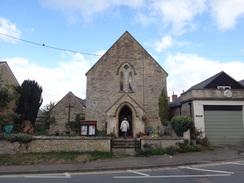
Turn left along to follow Church Fields northwestwards through the village. After 300 metres it curves right and ends a T-junction opposite a Methodist church. Do not join a road at the T-junction, and instead turn left down a surfaced path called Well Lane that follows a stone wall on the left;. The path descends, and after 100 metres ends at a T-junction with Laughton Hill. Turn left along the road for a few metres, and then right to head northwestwards up an unsurfaced track. This passes houses and a farm on the right as it climbs uphill. After 400 metres it ends at a crossroads with other tracks at SP38741755.
Head straight on along a surfaced track, initially with a hedge on the left. The track descends downhill and passes through a small band of woodland. It starts curving to the right; on the bend is a junction with another track on the left, just before some houses. Turn left along this track; it descends and then climbs up in a rough westerly direction, and starts following a fence on the right. The fence on the right ends; continue along he track following a hedge on the left until the field's end is reached at SP37551797.
At the end of this field, follow the track as it enters another field and curves left, still following a hedge on the left. Continue along the track past this short field to reach another track that crosses from the right. Cross than and continue straight on along a path that runs between hedges. After nearly 1.5kmthe hedges end, and the path opens out to meet a track, which immediately curves left to reach Stonesfield Lane on the outskirts of Charlbury at SP36381870.
Follow the lane westwards for a short distance until it ends at a T-junction with the B4437 Woodstock Road, and then turn left to follow this road westwards through the town. It curves right; ignore the first road off to the left, and turn down the second, but after a few metres turn right up Hixet Wood and follow this as it heads north-northwestwards through the village. After 950 metres this reaches a junction with the B4437 Dyers Hill on the left at SP35611960.
Note: the following paragraph is not following the correct Oxfordshire Way route.
Turn left to start following the road downhill. It crosses Dyers Hill Bridge over the River Evenlode to reach a mini-roundabout. Heads straight on across this, and then cross a bridge over a railway line near Charlbury station. 700 metres after the junction in the village, a road leads off to the right. Turn right down it; it passes s short row of houses on the right and then becomes unsurfaced, gently curving to take a more westerly course. Pass a ruined barn on the right, and continue along the track as it passes unfenced between fields. A hedge starts on the right, and swaps sides as it descends down into a little dry valley and up the other side. At the top, go through or past a field gate to reach a road. Turn right to head north down the road; it crosses a bridge over the railway line and then Catsham Bridge over the Evenlode; after 850 metres on the road, turn left through a pedestrian gate beside a field gate at SP33082078 to enter a field.
Note: the Oxfordshire Way is rejoined here.
Follow a hedge on the right westwards; at the far corner of this field cross a farm bridge over a stream into a second field. Turn right to follow a hedge on the right for a short distance to the field corner, and then follow it around to the left. At the corner of this field, go through a bridleway gate and continue on between a hedge and a fence. When the hedge ends, continue on along a track that runs between fields. When this field eventually ends, go through a field gate into another field and continue between a hedge and a fence. The track then emerges through a gap between a wall on the left and a hedge on the right onto a lane at SP31492031.
Cross the lane and go through a field gate. Follow a track southwestwards between a hedge and fence. The track becomes less distinct; at the end of the field go through a field gate into a second field. Follow a hedge on the right. Near the corner of the field the hedge becomes a wall; continue on to a gateway through another wall ahead. In the next field follow the wall on the right for about five meters, and when the wall ends continue straight on across parkland, aiming for a hedge ahead at SP30711986.
At the far side of the field, go through a gateway into another field. Do not follow the hedge on the right, and instead turn left. In the bottom corner of the field, turn right to follow a hedge on the left along the field. In the far corner, go through the left-most of two field gates and cross a farm bridge over a stream to enter another field. Curve left, following a hedge on the left. In the corner of this field turn right for about five metres and then left through a gap in a hedge at SP30311939.
The gap leads into another field. Follow a hedge on the left; when the hedge ends, continue along a vague track that leads towards a footbridge over the river. Do not cross the footbridge, and instead continue westwards along the edge of the field, with the river away to the left. The river twists and turns; when the field curves away to the right 350 metres after the footbridge, continue straight on along a rough path across scrubland for a few metres to reach a bridleway gate that leads onto a road at SP29871906.
Turn left to follow the road southeastwards; it immediately cross the river on a bridge, and after 300 metes crosses a level crossing in front of Ascott railway station. Cross the level crossing, and on the other side turn right along Shipton Road. This soon passes The Swan Inn and continues through the village. After 650 metres the road curves to the left; here turn right along a surfaced lane. The surfacing soon ends and a track continues on, soon crossing another bridge over the River Evenlode. The track then curves left and goes through a field gate; 400 metres after the bridge, turn right through a bridleway gate to reach a level crossing over the railway at SP29141842.
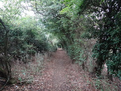
Carefully cross the railway line, and on the other side go through another bridleway gate to enter a field. Keep a hedge on the right; when the field ends go through a gap and continue on between close-set hedges that form a green tunnel. The path winds slightly; then tunnel ends and the path continues on, eventually passing an area of gravel and a garage wall before going through a gate to reach the A361 road at SP28371868.
Turn left to follow the road south; it soon crosses a bridge over a railway line and heads on, eventually curving to the right to cross a bridge over the River Evenlode. After 900 metres, and just before the road enters Shipton Under Wychwood, take the first road off to the right, Meadow Lane. The surfacing ends, and immediately afterwards cross a farm bridge over a stream. Continue north along the track; 500 metres after the road junction, follow the track as it curves left, following a hedge on the left with a field on the right. The hedge ends after 150 metres at SP27601864.
At the end of the hedge, turn right to continue along the track as it heads between fields; it soon angles left to head northwestwards. At the end of the large field, go through a field gate and angle slightly right across a second field. At the far side, go through a gateway into a third field. Head straight across this field to another field gate that leads into a fourth field. Continue straight on, following a fence on the left. The path emerges out onto a road at SP27031932.
Cross the road and go through a bridleway gate and follow a path north-northwestwards between a fence and a hedge. At the end of this field, go through a gap into a second field, and follow a hedge on the left. At the corner of the next field, go through a gap ahead to enter Bruern Wood. A good track heads straight on north-northwestwards through the wood; after 300 metres it emerges from the trees through a bridleway gate into some parkland at SP26671996.
Continue straight on across the parkland, aiming slightly to the left of a grand house ahead. At the end of the parkland, go through a bridleway gate into a field, and follow a fence on the left. When the fence on the left ends, continue on along the grass for a few metres to join a fence and hedge on the right, with the house beyond. This emerges out through a field gate onto a road near Bruern Abbey at SP26402039.
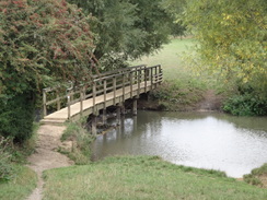
Turn left along the road for 100 metres, and then at the end of a stone wall on the right, turn right along a footpath that follows a fence on the right, with woodland on the left. At the end of the field after 300 metres, the path enters woodland ahead; it passes a pond on the right and continues on. When the path turns left after 800 metres from the road, turn right through a gap in a hedge into a field. Head down a slope towards the river; after twenty metres a farm bridge is reached over a ditch at SP25802105.
Turn left to follow the ditch on the right. At the corner of the field, turn left to head past an area of woodland on the right, and then turn right through a gap in the hedge to join a path with a hedge on the left and woodland on the right. The woodland ends and is replaced with a large field. At the corner of the field, turn left through a pedestrian gate beside a field gate and head on to a bridleway gate in a short section of fence. Go through the gate to join a road at SP25032212.
Turn right down the road for 100 metres until it ends at the B4450 road immediately to the south of Bledington. Here leave the Oxfordshire Way by turning right to head northeastwards along the main road as it heads away from the village. The pavement swaps side several times, and the road crosses the River Evenlode. After 750 metres, and just before the road climbs to a bridge over a railway line, turn left along the access road leading into Kingham Station at SP25652270, where this walk ends.
 |
 |
|
Distances
| From | To | Distance (m) | Ascent (ft) | Descent (ft) |
|---|---|---|---|---|
| Tackley village hall | Pigeons Lock | 1.4 | 36 | 59 |
| Pigeons Lock | Stonesfield | 7.4 | 469 | 328 |
| Stonesfield | Charlbury | 2.8 | 272 | 295 |
| Charlbury | Shipton under Wytchwood | 6.8 | 410 | 443 |
| Shipton under Wytchwood | Kingham station | 4.1 | 144 | 108 |
This makes a total distance of 22.5 miles, with 1331 feet of ascent and 1233 feet of descent.
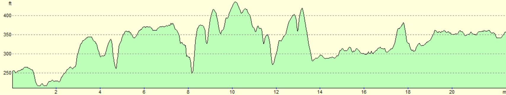
For more information on profiles, ascents and descents, see this page
Transport
Both Kingham and Tackley villages have railway stations. Kingham is served by regular trains on the Worcester to Oxford line, and Tackley with far less frequent trains on the Oxford to Banbury line. Unfortunately the latter only run infrequently, so it can be quickeer to get a train up to Banbury, and then another back down to Tackley. See the National Rail Enquiries website for more details.
 |
 |
|
 |
 |
|
 |
 |
|
 |
 |
|
 |
 |
|
 |
 |
|
 |
 |
|
 |
 |
|
 |
 |
|
 |
 |
|
 |
 |
|
 |
 |
|
 |
 |
|
 |
 |
|
 |
 |
|
 |
 |
|
 |
 |
|
 |
 |
|
 |
 |
|
 |
Disclaimer
Please note that I take no responsibility for anything that may happen when following these directions. If you intend to follow this route, then please use the relevant maps and check the route out before you go out. As always when walking, use common sense and you should be fine.
If you find any information on any of these routes that is inaccurate, or you wish to add anything, then please email me.
All images on this site are © of the author. Any reproduction, retransmissions, or republication of all or part of any document found on this site is expressly prohibited, unless the author has explicitly granted its prior written consent to so reproduce, retransmit, or republish the material. All other rights reserved.
Although this site includes links providing convenient direct access to other Internet sites, I do not endorse, approve, certify or make warranties or representations as to the accuracy of the information on these sites.
And finally, enjoy your walking!
Nearby walks
| # | Title | Walk length (miles) |
|---|---|---|
| 571 | Oxford to Lower Heyford | 16.4 |
| 737 | Thames Path: Rushey Lock to Oxford | 21.4 |
| 996 | Oxford Canal and Jurassic Way: Hayford station to Banbury | 23.5 |
|
|

|