Walk #1015: Croy to Bowling
 |
 |
|
General Data
| Date Walked | 13/08/2018 |
| County | Strathclyde |
| Start Location | Croy station |
| End Location | Bowling station |
| Start time | 07.46 |
| End time | 16.42 |
| Distance | 23.7 miles |
| Description | This walk followed the Forth and Clyde canal west through Glasgow to its terminus with the Clyde at Bowling. |
| Pack | Today I carried my 30-litre Karrimor rucksack, filled with water, my spare waterproofs, a book and other odds and ends. |
| Condition | I felt a few twinges from my back, but otherwise I feel fine. |
| Weather | Today was thankfully a dry day, with only a few minutes of drizzle during the day. It was reasonably warm; perhaps a bit too much as I was wearing a long-sleeved running shirt. |
| OS map | Landranger number 64 (Glasgow, Motherwell & Airdrie) |
 |
 |
|
Map of the walk
Maps courtesy of Google Maps. Route for indicative purposes only, and may have been plotted after the walk. Please let me have comments on what you think of this new format. For a detailed table of timings for this walk, please see the table file.
 |
 |
|
Notes
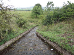
Today's task was to complete my stroll between Glasgow and Edinburgh along the Forth and Clyde Canal. I parked at Larbert and caught a train to Croy, getting off and climbing up to a bridge over the railway. Two old ladies were standing on the bridge with a little stand of religious pamphlets, and they studiously ignored me as I stood near them to turn on my GPS. A bus was due to head down towards the canal, but it seemed a good idea to walk instead, reversing the walk I did last thing on Saturday. It was tempting to go and visit the route of the Antonine Wall, which was well waymarked from the road, but decided the day would be long enough as it was. Instead I continued down the road to Auchinstarry, where I joined the Forth and Clude canal.
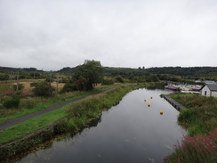
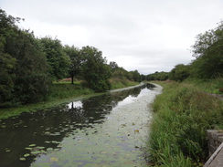
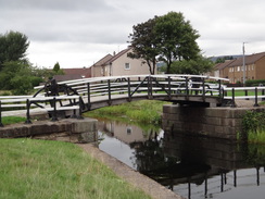
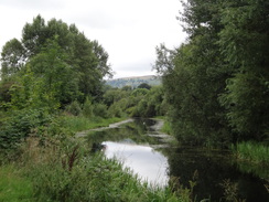
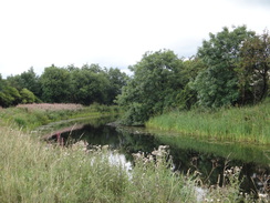
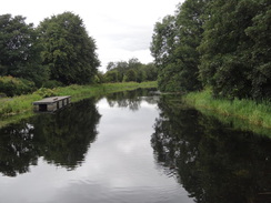
This took me westwards; the towpath was surfaced, as it had been all the way from Edinburgh, and a few cyclists passed me as I strode along. It was a pleasant walk, but nothing spectacular. Off to the right, and mostly out of sight, was the River Kelvin, which I had followed in part yesterday. It was a case of putting my head down and walking, and eventually Kirkintilloch was reached.
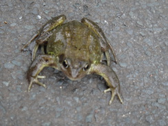
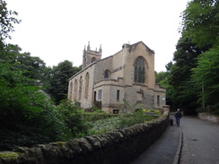
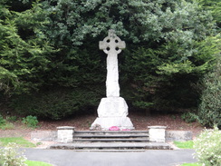
A frog was sitting on the towpath on the way out of town. I protected it from a cyclist who passed, but it refused my efforts to move it off the path. The towpath continued on, and again there was little to note. I caught a glimpse of the little church at Cadder, after which the canal turned southwestwards towards Glasgow. Time and the miles appeared to be flying, and I soon reached Stockingfield Junction, where the Speirs Wharf branch heads south into the centre of Glasgow. I walked this branch yesterday, and was thankful that today's weather was much better.
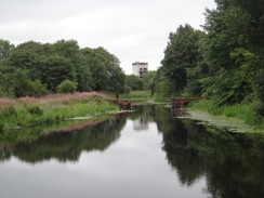
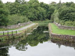
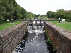
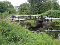
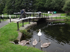
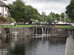
The towpath had been following the right-hand bank of the canal all the way from Edinburgh, but at the junction it dived down to an imposing bridge under the canal, before climbing up to join the other side of the canal. The Maryhill flight of locks was a short distance further on, and I stopped on a bench near the bottom lock to eat my sandwiches and have a break. There was only nine miles to go, and I expected to take another break in four or so miles, splitting the remainder of the day into two. The Kelvin Aqueduct was immediately below the locks, although it did not look as impressive from above as it did from below.
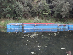
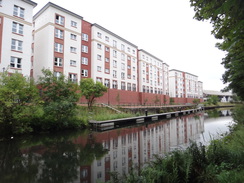
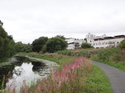
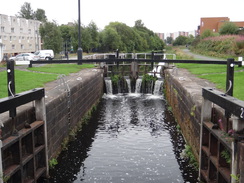
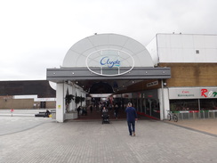
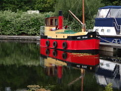
The canal started to turn to head northwestwards, passing a series of locks as it headed through Glasgow. The towpath was quite busy at times, although I rarely felt as though I was in the middle of a big city. Eventually the canal passed a faux-ship and entered the Clydebank shopping centre. This was bustling, and they seem to have made the canal a central location amidst the shops.
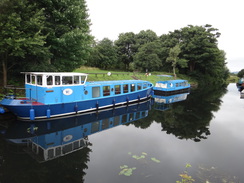
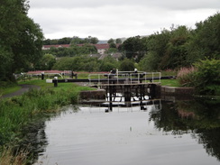
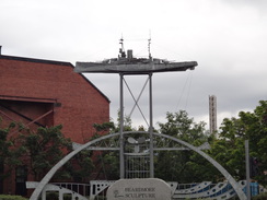
A little further on was Dalmuir drop lock. This is unique in the world, and involves lowering the water level between two gates to allow boats to pass under a busy road that could not realistically be replaced with a lifting bridge. It was a shame that I could not see it in use, and in fact the entire canal today was very quiet, with only a couple of boats moving on the water. A pleasant sculpture of a ship stood next to the drop lock. I had intended to take a rest around here, but I was feeling fine and so I decided to press on.
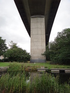
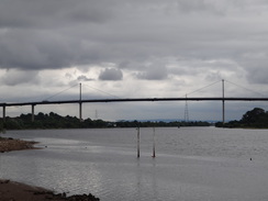
I got my first glance of the Erskine Bridge ahead as I continued along the canal, which slowly approached the River Clyde away to the left. A couple of massively tall electricity pylons carried lines across the river, and soon afterwards I was heading under the bridge itself - sadly there was nowhere to get a good picture from the canal. Passing under the bridge meant that I joined the route of my coastal walk of fifteen years ago, and that this trip had joined the east and west coasts between Edinburgh and Glasgow.
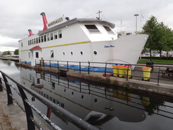
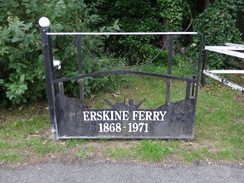
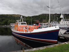
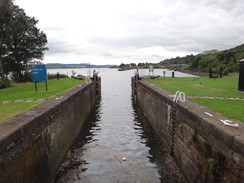
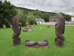
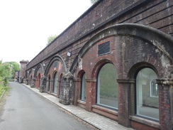
The canal carried on northwestwards for another mile or so, eventually turning to pass under a pleasant-looking railway bridge to reach Bowling Harbour and the River Clyde. Lots of boat were moored around the little harbour, which was an attractive place. A little beach on the banks of the Clyde stretched in front of a distant view of the Erskine Bridge. I could see no way down to the beach, and so instead I crossed the gates of the sea lock and walked past some wooden statues to reach the old railway line once more. The viaduct's arches have been converted into shops, many of which seemed sadly empty, and I headed past these to reach the man road in Bowling.
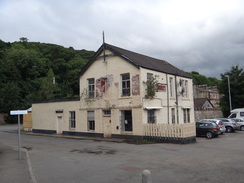
On my coastal walk I followed a cyclepath along the top of the old railway line into Dumbarton. Since I did not know whether it was possible to reach Bowling station from the cyclepath, I followed the road instead. I considered strolling on for another four miles into Dumbarton, but instead I diverted towards the railway station. The pub beside it had obviously been closed for some time, so instead I sat on a bench near a footbridge that was festooned with orange streaks of rust.
As I sat on the train on the way back, I realised I could not recall the first half of this walk; perhaps it was fatigue, but my mind was utterly blank. I have completed the Union and Forth and Clyde canals, but I think I was a little jaded after three days of canal walking and did not get the best out of the day.
The journey back was straightforward, and the moment I got on the first train I started to regret not extending the walk to Dumbarton, especially as the weather forecast for the next few days looks wet enough to make further walks in the area unlikely. It has been a pleasant enough trip, although except for yesterday's walk from Milngavie into Glasgow, it had not been a classic one.
 |
 |
|
Directions
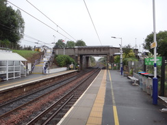
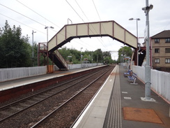
This walk starts off from Croy railway station at NS72977551. Leave the station and climb up steps to reach a bridge over the railway; turn left to follow the road away from the station. The road soon becomes a pavement that runs alongside the B802. Follow this road as it heads northwestwards through the village of Croy; after three-quarters of a mile it ends at a T-junction with Howe Road at NS72177612.
Turn right to follow this road downhill; there is a pavement on the right. After a third of a mile a roundabout is reached; cross the road coming off to the right from a pub and marina, and take the second exit to continue along the road for a short distance as it crosses a bridge over the Forth and Clyde Canal. On the other side turn right past a vehicle barrier to join a track that leads to the canal towpath at NS72067690.
Turn right to join the towpath as it heads under the bridge and heads westwards, with the canal on the left. The canal passes through Kirkintilloch, Bishopriggs and Cadder. After twelve miles Stockingfield Junction is approached, where the Port Dundas branch of the canal leads off to the left; from here on the canal runs on the other side of the water. The branch is at NS57146899.
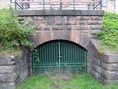
Fifty metres before the branch at NS57216902, go through a vehicle barrier and take a path that leads off to the right, sloping down a bank to reach Lochburn Road. At the road turn left and pass through a long, narrow tunnel under the canal, and immediately on the other side turn left past a vehicle barrier to join a surfaced path that ascends a slope. At the top, go through a vehicle barrier to join the towpath of the Port Dundas branch at NS57126892.
Turn left to follow the towpath north for a few metres back to Stockingfield Junction; for the rest of the day the towpath remains on the southern side of the canal. The towpath passes over the tunnel passed through earlier, and immediately curves left to follow the canal westwards, with the water on the right. Follow the canal for another half-mile until the top Maryhill Lock is reached, and then continue past the five locks and basins of the flight; at the bottom the canal and towpath cross the Kelvin Aqueduct over the River Kelvin at NS56146896.
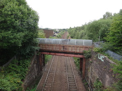
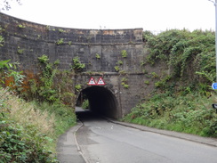
From here, simply continue along the towpath as it heads in a rough westerly direction, heading through Clydebank, where it takes a more northwesterly course as it nears the Clyde. After 7.5 miles it passes under the Erskine Bridge, which carries the A898 over the river. Follow the canal west-northwestwards for another mile, still with the canal to the right; it passes lock 38 and then curves to the left to pass immediately under an arch of an old railway viaduct to reach Bowling Harbour. Follow the surfaced path past the harbour on the right until it ends at the northern bank of the Clyde. Turn right to cross a bridge over what must once have been a lock, and then follow the path as it winds around to reach the sea lock (number 40) at NS44977353.
Carefully cross the lock gates and angle right across grass to reach the northern side of the harbour. After a few metres take a track that leads off to the left. This soon curves right to head under the old viaduct once more. Immediately on the other side, climb some steps that leads up onto a road, and then turn left to follow the road as it crosses a bridge over an extant railway line before it ends at a T-junction with the A814 Dumbarton Road. Turn left to follow the road westwards; after nearly half a mile turn left down a road for about fifty metres to reach Bowling railway station at NS44367369, where this walk ends.
 |
 |
|
Distances
| From | To | Distance (m) | Ascent (ft) | Descent (ft) |
|---|---|---|---|---|
| Croy station | Auchinstarry | 1.3 | 39 | 115 |
| Auchinstarry | Kirkintilloch | 5.0 | 23 | 16 |
| Kirkintilloch | Kelvin Aqueduct | 7.9 | 80 | 100 |
| Kelvin Aqueduct | Clydebank | 5.9 | 10 | 102 |
| Clydebank | Bowling station | 3.6 | 66 | 43 |
This makes a total distance of 23.7 miles, with 218 feet of ascent and 376 feet of descent.
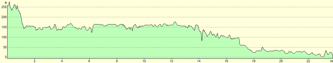
For more information on profiles, ascents and descents, see this page
 |
 |
|
Accommodation
I spent the night at the Premier Inn hotel in Larbert, near Falkirk. This was about half a mile from Larbert railway station, which has regular services to and from Edinburgh and Glasgow without changes, allowing you to access large areas of the central belt.
Unfortunately it was rather expensive when I visited, as the Edinburgh Fringe was on in Edinburgh, and the European Championships in Glasgow, pushing up prices.
Transport
The best public transport for this walk is by train; you need to catch a train from Bowling to Glasgow Queen Street, and then change for a service to Croy. See the National Rail Enquiries website for more details.
 |
 |
|
 |
 |
|
 |
 |
|
 |
 |
|
 |
 |
|
 |
 |
|
 |
 |
|
 |
 |
|
 |
 |
|
 |
 |
|
 |
 |
|
 |
 |
|
 |
 |
|
 |
 |
|
 |
 |
|
Disclaimer
Please note that I take no responsibility for anything that may happen when following these directions. If you intend to follow this route, then please use the relevant maps and check the route out before you go out. As always when walking, use common sense and you should be fine.
If you find any information on any of these routes that is inaccurate, or you wish to add anything, then please email me.
All images on this site are © of the author. Any reproduction, retransmissions, or republication of all or part of any document found on this site is expressly prohibited, unless the author has explicitly granted its prior written consent to so reproduce, retransmit, or republish the material. All other rights reserved.
Although this site includes links providing convenient direct access to other Internet sites, I do not endorse, approve, certify or make warranties or representations as to the accuracy of the information on these sites.
And finally, enjoy your walking!
Nearby walks
| # | Title | Walk length (miles) |
|---|---|---|
| 460 | Fort Matilda to Dalreach | 21.1 |
| 461 | Dalreach to Rosneath | 22.2 |
| 905 | West Highland Way: Milgavie to East Drumquhassle | 11.1 |
|
|

|