Walk #1014: Milngavie to Glasgow Central, including the Glasgow branch of the canal:
 |
 |
|
General Data
| Date Walked | 12/08/2018 |
| County | Strathclyde |
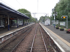
| Start Location | Milngavie station |
| End Location | Glasgow Central station |
| Start time | 08.34 |
| End time | 16.18 |
| Distance | 20.4 miles |
| Description | This was a very enjoyable stroll following the River Kelvin into Glasgow, and taking in the Spiers Wharf branch of the Forth and Clyde canal, and then along the Clyde into the centre of the city. |
| Pack | Today I carried my 30-litre Karrimor rucksack, filled with water, my spare waterproofs, a book and other odds and ends. |
| Condition | I had a few twinges from my back on this walk, and am a little tired, but otherwise I feel fine. |
| Weather | There was a steady drizzle outside my hotel this morning, although it was not raining at the start in Milngavie. There was no sign of the sun, and a light drizzle started after a couple of hours, which was followed by heavy rain. This eventually ended, although there was another brief shower a few minutes before the end. |
| OS map | Landranger number 64 (Glasgow, Motherwell & Airdrie) |
 |
 |
|
Map of the walk
Maps courtesy of Google Maps. Route for indicative purposes only, and may have been plotted after the walk. Please let me have comments on what you think of this new format. For a detailed table of timings for this walk, please see the table file.
 |
 |
|
Notes
My plan had been to walk the next stretch of the Forth and Clyde Canal west through Glasgow today - but I decided against it. Firstly, it will be a 23-mile walk, and after a couple of similarly long days, I fancied an easier one. Secondly, the weather this morning was fairly awful, with drizzle falling outside my hotel, and a forecast that promised little better. Finally, being a Sunday the trains are less frequent, and the trip back would require a change of trains between Queen Street and Central stations - a fifteen minute walk, but the shuttle bus between them would not be running due to the European Championship road races that are going on.
Not wanting to forego a day's walking, I decided to do the walk I had planned for tomorrow, the Kelvin Walkway from the southern end of the West Highland Way at Milngavie into Glasgow. This is shorter (nine miles), but can be extended if required; there are also plenty of stations if I decided to stop early due to the weather, and it doesn't matter much if the rain meant few opportunities for photos.
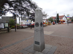
I drove to Milngavie, parked in the station car park, and walked to the monument that marks the start of the West Highland Way. The Gregg's next to the monument was open, and I chatted to a women from New Zealand who was about to start the West Highland Way with her partner. It was nice to talk to another walker, even if my day would take me south instead of north, and into very different terrain. I bought a couple of sausage rolls from the shop – whose assistant seemed well used to having walkers inside the shop - and headed off.
A problem occurred immediately: the trail is marked on my map as the 'Kelvin Walkway', and I had expected it to be a signposted route. Unfortunately there was no sign of this, but there was for the 'Allander Way'. Since this was pointing in the direction I wanted to go, I started following it as it ran alongside Allander Water past a fish ladder and then a supermarket. I was surprised to see the latter was open so early, even though Scotland has different opening hours on Sundays.
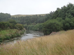
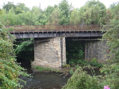
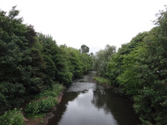
I went a little wrong in a park, taking an incorrect route before retracing my steps to find the path that led out of town. This initially led along a good path beside the railway line, with occasional pleasant views over the river. It felt very different to the canal walking that had dominated the last couple of days, and I really enjoyed it - especially as the promised rain had not materialised. Eventually an old railway bridge was reached, and then a road bridge.
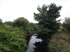
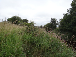
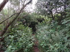
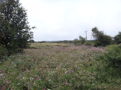
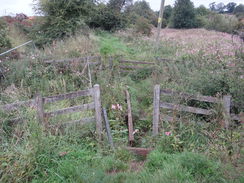
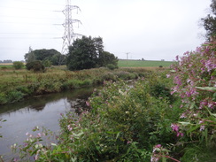
After this the path became very overgrown, and my trousers were soon wet below the knees as I pushed through the vegetation. Things did not improve as the path followed the river across occasionally rough ground. The vegetation was high, but not so high as to block the pleasant views, and the rough terrain - and even mud - was a welcome change after the tarmac towpath of the last few days. At one point a stile was broken, and in others I needed to take care as the path came perilously close to the bank, with vegetation hiding the edge. I was only a few miles away from the centre of Glasgow, but it felt wonderfully rural.
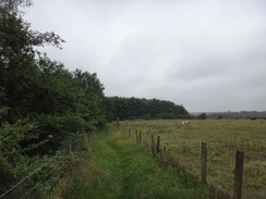
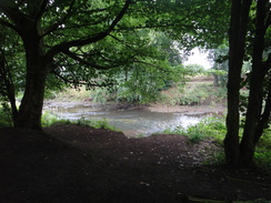
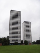
An old railway line was crossed, one of several I'd seen that I'm guessing once served industrial endeavours. The path continued to be overgrown, but eventually I reached what looked like a rail bridge, but which was actually an aqueduct carrying large water pipes. By now the Allendale Way had transformed into the Kelvin Way, although it remained annoyingly unwaymarked. The trail used a road bridge to cross over to the river's eastern bank, after which a good, clear path led through a wooded area high above the water, which was now much wider than it had been in Milngavie. It was an enjoyable stroll, and the path appeared much better used - indeed, a cyclist zoomed past me along the bank. It felt a very rural environment, but some high-rise tower blocks shattered that illusion.
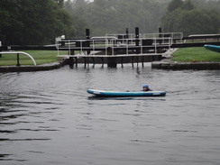
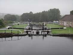
The path became slightly overgrown for a short distance, before it left the river and took me into a built-up area with tarmac underfoot. It led me through a park and down to a road, and then back to the riverbank. A series of bridges stretched overhead, and then I diverted off to climb up to the Forth and Clyde Canal at Maryhill locks. It had been my intention to walk just the Kelvin Way today, but as the weather had been dry I decided to also do the Glasgow arm of the canal. As if tempting fate, it started to drizzle, and then rain, as I passed people playing with canoes in a lock pond and climbed up to the summit level.
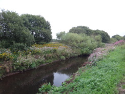
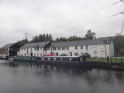
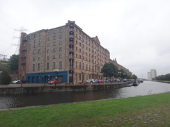
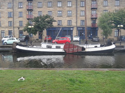
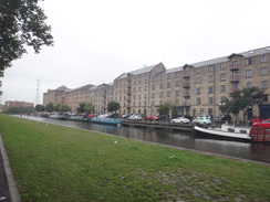
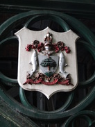
I pulled my coat hood up as I reached the junction with the canal's Glasgow arm, and then started following it south towards the city centre. In dry weather it would have been a pleasant enough stroll, but in wet weather it was a bit of a drag, only slightly lifted by occasional dramatic views over the city's rooftops. There was plenty to see beside the canal, and a fair few information boards, and eventually I reached what I thought was the end of the canal at Speirs Wharf, where the canalside buildings had been very well restored for commercial or residential use. Boats were neatly moored against the wharf, but I was surprised to find a lock leading down - it turns out this extends the canal a short distance to Port Dundas.
I was now only a mile away from the city centre, and I was tempted to walk down to Port Dundas and head on into the city. However I also wanted to 'complete' the Kelvin Walkway, so I turned around and started following the canal branch back the way I had come. The rain slackened and became a drizzle as I returned to the Maryhill locks and then the walkway.
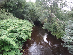
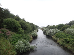
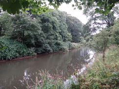
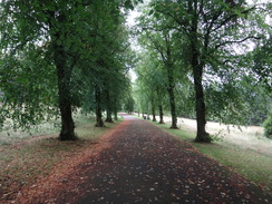
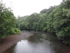
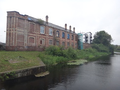
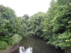
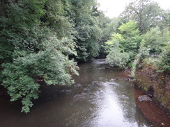
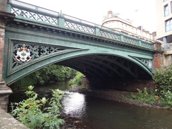
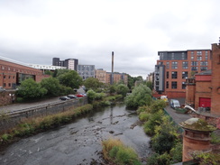
The next few miles following the River Kelvin through Glasgow proved to be very enjoyable. At times the path was on the western bank; at others the eastern; whilst at others it barely seemed to matter, with good paths available on both sides. But it was always enjoyable, with lots to see, from pleasant parkland to dramatic bridges - both extant and the remnants of others. Occasional glimpses of grand buildings broke through the trees, and the river itself was at times dramatic as it flowed towards the sea. Glaswegians are very lucky to have this on their doorstep, and the paths and parks certainly seemed well used. It was one of the most enjoyable 'urban' walks I have done for some time.
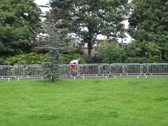
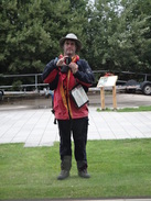
Distorted, loud voices started to intrude, and I slowly realised it was some coming from a distant Tannoy system. This was part of the European Championships, whose men's road race was occurring today (and which was also part of the reason I had changed my planned walk today). More signs of the race soon appeared - spectators lining roads, along with barriers and signs marking crossing points. This disruption soon affected my route, as the path I wanted to follow was blocked. I headed back to the other side of the river and walked through a park, passing another footbridge to discover the way ahead was also blocked. I eventually found a crossing point, where I chatted to a lovely lady who was stewarding the event about what was going on.
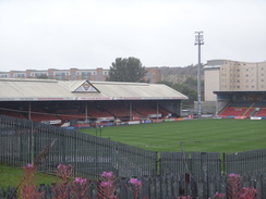
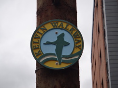
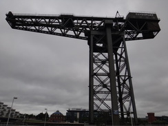
These diversions should have been annoying, but they were actually quite enjoyable as I was not tired and had plenty of time. The disruption ended and I came across a sign for the Kelvin Walkway hanging off a lamppost – one of the few I'd seen. The path then followed roads away from the river, before passing the Riverside Museum (being used as part of the European Championships) to reach the mouth of the Kelvin. I stood at the confluence point and stared at the views eastwards, as the Clyde stretched away past a hammerhead crane and then out of view.
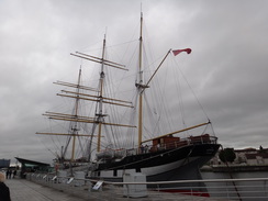
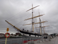
A large tall ship, the Glenlee, was moored beside the museum. She was launched from Glasgow in 1896, and about thirty years later became a Spanish training ship. After nearly being scrapped, the hulk was purchased and returned to Glasgow in the 1990s for restoration. She makes for a magnificent sight, and her sleek masts contrast well with the ultra-modern museum alongside.
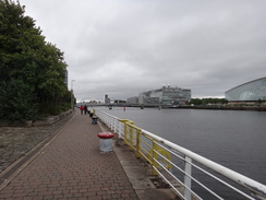
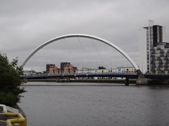
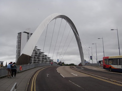
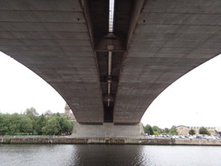
I had assumed that I could follow the riverside into the centre of the city, but some waste ground stood next to the museum. Instead I joined a road on what was quite a spectacular little stroll, with lots to see. There were modern new buildings and bridges across the river, with some large ones such as a BBC office looming across the water. In contrast, there were some structures harking back to the city's history, with a rotunda that once belonged to the first tunnel under the Clyde and (now tastefully converted into a restaurant), and the massive Finnieston hammerhead crane. The massive 1970-built concrete Kingston Bridge carrying the M8 over the river contrasts with the slender 2006-built Clyde Arc>.
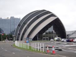
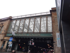
The stroll beside the Clyde was superb, and it ended all too soon as I diverted away from the river for a short distance to reach Glasgow Central station. It was my first visit there, and some of the station's architecture was quite superb, especially from the outside. It took me a few minutes to find a way in, and then I purchased a ticket and headed down to reach the buried lower platforms to catch my train back to Milngavie.
This has been a highly enjoyable walk despite the rain, and gave me a brilliant walking introduction to Glasgow, a city that is not particularly well known for its beauty - wrongly, if this walk is anything to go by.
I saw a crashed car on the drive back to the hotel, and fortunately it looked as though everyone was out and okay. My evening was the same as it had been for the last couple of nights: a shower followed by writing up these notes, followed by a visit to the adjacent pub for a meal.
 |
 |
|
Directions
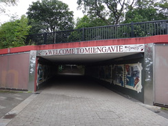
This walk starts at Milngavie railway station at NS55537446. Leave the station by its main entrance and turn left to join a path that heads through an underpass that leads out onto a pedestrianised road in the town. Follow this along past shops; it soon curves left and crosses a bridge over a road to reach a monument marking the start of the West Highland Way at NS55337447.
Pass the monument and then turn left to take a surfaced path called the 'Allander Walkway', which follows its eponymous stream away to the left. The path passes a car park belonging to an M&S store on the right, and then descends down to an underpass under the B8030. On the other side, follow the path along the edge of a car park belonging to a Tesco store, with the river still away to the left. At the far end of the car park cross a bridge over the river on the left and follow a surfaced path as it curves right, with the river on the right. The path heads through trees to reach another footbridge at NS55477409.
Turn right to cross the bridge, and on the other side follow a surfaced path up a slope. It passes a playground on the left and reaches a junction with another path just before a road. Turn left past a skate park along another surfaced path; when the path ends at a T-junction, turn right out of the park onto Keystone Avenue and turn left to follow this road downhill for a short distance until it ends. Continue past the road's dead end to reach the A81. Turn left along the A81 and follow it as it immediately heads under a rail bridge. Cross the road to its eastern side, and fifty metres after the bridge turn right down a path at NS55697399.
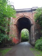
The path heads south with Allander Water to the left and the railway line away to the right; it soon becomes unsurfaced. After a third of a mile it crosses the river on a footbridge and starts to follow the river on the right, which soon curves slightly to take a more southeasterly course. After another third of a mile it turns right to cross a second footbridge over the river, and then continues with the river on the left. Keep the river on the left; it turns slightly to the left and after two-thirds of a mile reaches an old railway bridge over the river. The path climbs up to cross the approach to the bridge, and then descends down steps to a V-stile. Go through this and continue along the riverside path as it heads through a small area of woodland. The path soon reaches a stile that leads to some wooden steps. Climb these to reach a crash barrier that leads onto a road at NS57437284.
Carefully cross the road, and on the other side go through a gap to join a footpath that follows the river away to the left. Turn left along what was evidently an old road; after about 100 metres angle left to an underpass under the A879. On the other side of the underpass, cross a stile and follow a fence on the right, with the river still away to the left. Continue along the path, crossing any stiles you reach. After two-thirds of a mile an old railway line is reached at NS58407285, with the bridge over the river to the left missing.
Cross a stile to reach the embankment, and then turn right to follow it away from the river. After a short distance the vague path turns left away from the railway line and starts following a fence on the right, with the river mostly out of view away to the left. Shortly afterwards, Allander Water meets the River Kelvin. Continue along the riverside path for 0.8 miles, crossing any stiles or gates you reach. The path is rough in places, but eventually curves to the right to head westwards towards an aqueduct. Go through a V-stile and climb some wooden steps to reach the aqueduct; cross this and angle right to reach the A879 once more at NS57947187, beside Balmuidy Bridge.
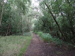
Carefully cross the road to reach a pavement, and then turn left to follow the road south across Balmuidy Bridge over Kelvin Water. On the other side turn right through a gap in a wall to enter Balmuidy Woods. A better-quality path leads westwards through the woods, with the river mostly out of sight on the right. It leaves the river for a short distance to head through the trees before rejoining it. Three-quarters of a mile after the bridge, the path goes through a gap in a fence to leave the woodland at NS57377128.
Continue following the river on the right, initially across grassland; the path is occasionally on top of a low floodbank. Three-quarters of a mile after the woods at NS56447081, the track forks; turn the left-hand branch down a path that heads south away from the river; the path soon becomes a track. After a quarter of a mile a clappergate beside a field gate leads onto the end of Caldercuilt Road, with playing fields away to the left. The road soon ends at a roundabout at NS56427022.
Cross the roundabout and follow a road straight on uphill. At a second mini-roundabout, turn half-right diagonally though a gate to enter a park. Turn right to follow a path through the park; it soon passes a play area, and then curves left to head up a slope. At the top, turn right to follow another path westwards; this soon curves around to the left, cresting the hill and then descending. It goes past a vehicle barrier to reach the A81 Maryhill Road at NS56136975.
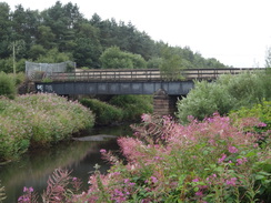
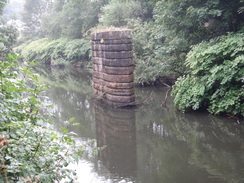
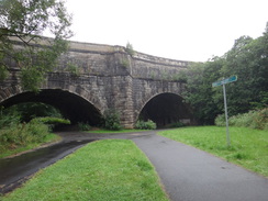
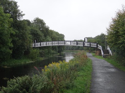
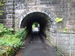
Carefully cross the road (there is a traffic-light controlled crossing a short distance away to the right), and then continue on down the dead-end Dalsholm Road. This immediately curves to the right; as it curves to the left soon afterwards, turn right down the second of two surfaced paths. Pass vehicle barriers and follow a wall on the right, with the river beyond. Ignore a footbridge across the river and head on along the path. This curves left and soon afterwards reaches a railway bridge overhead. Pass under this and continue following the river on the right. It heads under a bridge carrying Cowal Road overhead and joins a wall on the left. It passes a solitary stone bridge pier in the river and then curves left to immediately head under a bridge, and then approaches a massive stone aqueduct ahead at NS56166900.
I diverted off route here to walk the Speirs Wharf branch of the Forth and Clyde canal into the centre of Glasgow; if you want to continue along the trail, miss off the next few paragraphs.
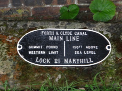
Do not go under the aqueduct, and instead take a surfaced path that turns sharply left, nearly doubling back on itself as it climbs. At the top go past a vehicle barrier and turn right along an old road that climbs, swinging to the right. Go past another vehicle barrier and then turn right along another road for a few metres to reach some small canal gates that lead to Lock 23 on the Forth and Clyde canal. Cross a lock gate to reach the towpath on the other side at NS56376906.
Turn left to follow the towpath as it climbs past two more locks and heads southeastwards; it curves to take a more easterly course, and after about half a mile curves sharply to the right to reach Stockingfield Junction, where the Port Dundas branch leads off to the south. Continue along the towpath as the canal winds in a rough southeasterly direction towards the centre of Glasgow, always keeping the canal to the left; after 2.4 miles the towpath ends by a lock at Speirs Wharf at NS58826651.
There is a small stub of canal to the east that can be visited; if not, head back for the 2.4 miles to Stockingfield junction, and then turn left to join the Forth and Clyde canal as it heads westwards to reach the topmost lock of the Maryhill flight. Pass two locks and two pounds, and at lock 23 cross the lock gates to reach the northern side of the canal. Turn left along a track that soon curves right to reach some small canal gates. Go past these and then immediately turn left past a vehicle barrier to head down an old road. The old road soon curves to the left; and when it forks turn left down a tarmac path. This descends to meet the Kelvin Walkway immediately in front of the Kelvin Acqueduct at NS56166900.
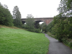
Turn left and follow a surfaced path as it heads under the aqueduct. Stay on the main track as it slopes up and then follow it as it curves to the right through trees. When the path reaches Kelvindale Road after a third of a mile, go past a vehicle barrier, carefully cross the road, pass another vehicle barrier and continue along a surfaced path on the other side that climbs into a park. Continue along the path as it roughly parallels the river to the right; after another third of a mile two old railway viaducts are reached. When the path curves left just before the viaducts, head straight on down another path that leads to an arch under one of the bridges and then under the second. The path then descends down a slope to reach a footbridge over the river on the right at NS56866805.
Cross the footbridge over the river, and on the other side turn left to start following a path that follows the river on the left. This soon curves to the right and heads under a large arch of a bridge that carries Kirklee Road overhead. Go through a gateway and then skirt a road on the right, with the abutments of an old railway bridge to the right, and then take a path off to the left that leads to the Ha'penny footbridge over the river at NS56726775.
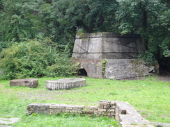
Cross the bridge to enter the Botanic Gardens. When the path immediately forks, continue straight on along the right-hand branch, passing a small cafe building on the left, and at the next junction turn right to follow a path with the river away to the right. The path passes a beautiful humpback bridge and then passes through an archway through the abutment of a massive road bridge that carries the B808 overhead. Continue along the path for a fifth of a mile from the B808 bridge to reach the ruins of a flint mill; immediately past the ruins cross a footbridge over the river at NS57376731.
On the other, southern, side of the river, turn left to follow a surfaced path, with the river on the left. This passes under another large bridge that carries Belmont Street overhead and curves around to pass under a large metal arch of the bridge that carries the A82 overhead. Walk on for a short distance to reach a metal bridge across the river beside the Inn Deep pub. Turn left to cross this, and on the other side angle right to follow a surfaced path south, with the river away to the right. Head through an underpass through a bridge that carries Eldon Street overhead, and then angle right along the riverside path through Kelvingrove Park. Pass one bridge over the river on the right beside a war memorial, and then head on to a second, smaller, footbridge at NS57076629.
Turn right to cross the footbridge, and on the other side turn left along a riverside path that soon reaches a road called Kelvin Way. Cross this road (do not cross the road bridge) and continue along the riverside path, with the river away to the left. After a third of a mile it ends at a T-junction with a broad path; turn left along this, and soon afterwards ignore another path leading off to the left to a bridge. Instead, continue on for a short distance until the path ends at a bridge carrying Argyle Street over the river at NS56516645.
Turn left to cross the river using the road bridge, and on the other side carefully cross the road using a pedestrians crossing and head on down Bunhouse Road, passing between the Kelvin Hall on the left and the river on the right. The road ends at a T-junction with Old Dumbarton Road; turn right to head westwards down this road. When it ends at a T-junction after 250 metres, turn left along Ferry Road. This passes under a railway viaduct and immediately afterwards ends in front of a second viaduct that carries the A814 Pointhouse Road overhead. At the end of Ferry Road, turn right along to follow a path that heads towards the river, and then left to head under an underpass under the road. Continue along the path as it curves around with the river away to the right; it soon ends at a road in front of the Riverside Museum of Transport at NS55846609.
Just before a pedestrian crossing into the museum is reached, turn right along another path that curves left to squeeze between the museum and the river. Continue along the path for a short distance until it reaches a quayside beside a tall ship. Turn left to walk past the ship, and then left to pass the other side of the museum on the left to reach a road. Cross the road and go through a car park to reach an areas of grass and then Stobcross Road. Turn right to follow the road southeastwards. Follow the path south-eastwards for a third of a mile until it ends at a road in front of a mini-roundabout and beside a distillery at NS56376562.
Cross the roundabout and continue on for a few metres to reach a T-junction with Stobcross Road. Turn right along this road and follow it as it curves left, with a car park on the left. At the top of the bend, turn right along a path for a few metres to reach a riverside promenade. Turn left to start following the promenade east-southeastwards alongside the river towards the centre of the city. Continue along the promenade as it passes a couple of bridge and the Armadillo building; as it approaches the Finnieston Hammerhead crane it angles left to join a road. Turn right along this road, passing the crane on the right, and follow it as it curves right to pass 'The Rotunda' on the left at NS57186515.
Continue eastwards along the road, passing a new hotel on the right, and then cross the approach road to the Clyde Arc bridge on the right using a pedestrian crossing, Continue along the road for a short distance, and then turn right through a gap in a wall to rejoin the riverside promenade. Turn left to follow the walkway eastwards. It passes under the M8 viaduct, and after three-quarters of a mile the King George V bridge is reached in front of a rail bridge. Just before the road bridge, turn left up some steps that lead onto Broomielaw road. Cross this using the pedestrian crossing, and head on up Oswald Street. This curves right to reach a crossroads; carefully cross the road and turn right to reach Glasgow Central station at NS58706516, where this walk ends.
 |
 |
|
Distances
| From | To | Distance (m) | Ascent (ft) | Descent (ft) |
|---|---|---|---|---|
| Milgavie station | Maryhill Locks | 7.6 | 233 | 262 |
| Maryhill Locks | Maryhill Locks (via Spiers Wharf) | 6.0 | 0 | 0 |
| Maryhill Locks | Glasgow Riverside Museum | 4.3 | 95 | 236 |
| Glasgow Riverside Museum | Glasgow Central station | 2.5 | 43 | 0 |
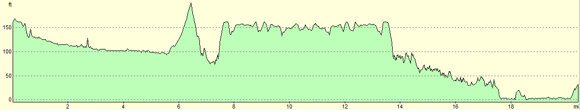
This makes a total distance of 20.4 miles, with 371 feet of ascent and 498 feet of descent.
For more information on profiles, ascents and descents, see this page
Accommodation
I spent the night at the Premier Inn hotel in Larbert, near Falkirk. This was about half a mile from Larbert railway station, which has regular services to and from Edinburgh and Glasgow without changes, allowing you to access large areas of the central belt.
Unfortunately it was rather expensive when I visited, as the Edinburgh Fringe was on in Edinburgh, and the European Championships in Glasgow, pushing up prices.
Transport
Regular train services run between Glasgow Central and Milngavie stations. See the National Rail Enquiries website for more details.
 |
 |
|
 |
 |
|
 |
 |
|
 |
 |
|
 |
 |
|
 |
 |
|
 |
 |
|
 |
 |
|
 |
 |
|
 |
 |
|
 |
 |
|
 |
 |
|
 |
 |
|
 |
 |
|
 |
 |
|
 |
 |
|
 |
 |
|
 |
 |
|
 |
 |
|
 |
 |
|
 |
 |
|
 |
 |
|
 |
 |
|
 |
 |
|
 |
 |
|
 |
 |
|
Disclaimer
Please note that I take no responsibility for anything that may happen when following these directions. If you intend to follow this route, then please use the relevant maps and check the route out before you go out. As always when walking, use common sense and you should be fine.
If you find any information on any of these routes that is inaccurate, or you wish to add anything, then please email me.
All images on this site are © of the author. Any reproduction, retransmissions, or republication of all or part of any document found on this site is expressly prohibited, unless the author has explicitly granted its prior written consent to so reproduce, retransmit, or republish the material. All other rights reserved.
Although this site includes links providing convenient direct access to other Internet sites, I do not endorse, approve, certify or make warranties or representations as to the accuracy of the information on these sites.
And finally, enjoy your walking!
Nearby walks
| # | Title | Walk length (miles) |
|---|---|---|
| 460 | Fort Matilda to Dalreach | 21.1 |
| 905 | West Highland Way: Milgavie to East Drumquhassle | 11.1 |
|
|

|