Walk #1009: Jurassic Way: West Haddon to Watford and back, and then West Haddon to Welford and back
 |
 |
|
General Data
| Date Walked | 22/07/2018 |
| County | Northamptonshire |
| Start Location | West Haddon |
| End Location | West Haddon |
| Start time | 06.49 |
| End time | 14.47 |
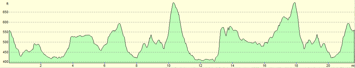
| Distance | 21.6 miles |
| Description | This should have been an interesting and pleasant walk, but it was rather let down by mistakes I made and changes to footpaths in the local area. It was a dumbbell-sheaped walk, with a common there-and-back middle section seaparating two smaller loops. |
| Pack | Today I carried my 30-litre Karrimor rucksack, filled with water, my spare waterproofs, a book and other odds and ends. |
| Condition | I feel absolutely fine after this walk. |
| Weather | Today was quite warm, with some frequent cloud to preent the sun's worst excesses. There were two short periods of drizzle near the top of Honey Hill. |
| OS map | Landranger number 140 (Leicester, Coventry & Rugby) and Landranger number 152 (Northampton & Milton Keynes) |
 |
 |
|
Map of the walk
Maps courtesy of Google Maps. Route for indicative purposes only, and may have been plotted after the walk. Please let me have comments on what you think of this new format. For a detailed table of timings for this walk, please see the table file.
 |
 |
|
Notes
Today's mission was to complete the Jurassic Way, and I set off fairly early this morning for the drive to West Haddon. I had only twelve miles of the trail left to do before it is completed; too much for a there-and-back walk, and too little for a full day (and besides, public transport between the end-points was difficult). Instead I planned a figure-of-eight walk, and as much of it would be along roads, I chose to do it on a Sunday when the roads would hopefully be quieter.
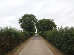
It proved difficult to find somewhere to park, and in the end I stopped in a space on a road leading out of the village. I got my kit together and headed down the road towards a pub, which seemed like as good a place as any to be the 'start' point. The first three miles were following a road south to the village of Watford, which I had reached on the previous walk on this trail. The traffic was light, and it was already starting to feel rather warm despite the early hour.
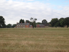
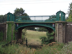
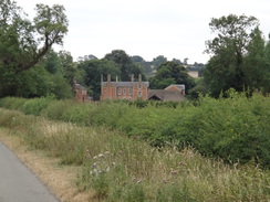
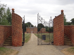
Watford is a tiny place; more famous for the nearby Watford Gap services than anything else. A house near the church had three ambulances outside it, and I continued on to reach a path that headed across what was evidently parkland, following an avenue of trees down to an ornate railway bridge – the Pulpit Bridge, so-called because some of its features look like a pulpit. It is an unusual and quite enchanting bridge, and a welcome surprise. Fortunately it seems to have been restored since the photos in the link above were taken, and it is now much more colourful. The stately home the bridge and the surrounding parkland belonged to Watford Court, which was sadly demolished in 1975, but the gardens area is protected. What a shame the building did not last for another decade or two, when it might have found a new purpose.
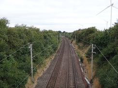
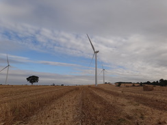
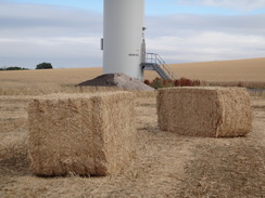
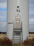
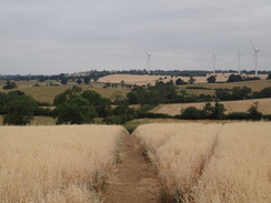
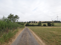
A path led on towards a wind farm. It had been built a couple of years ago, and I followed a track that led past a couple of the turbines. You only get a sense of the scale of the turbines when you stand at their base and look up, the blades seeming like an infinity away. Unfortunately the trail took the other side of the hedge to the track, but a handy gap allowed me to access the path, which continued across a field.
The map showed the next stretch of path passing Silsworth Lodge, but instead a waymarker pointed down a track away from it. I followed the track, and after a while started to worry that I'd made a mistake. Fortunately another waymarker pointed off through a new-looking gate into a field. On the other side there was little indication of which way to go, but the edges of a couple of fields took me to another gate that led back onto the trail, alongside a notice about the recent official footpath diversion. The gates were helpful, but a couple more waymarkers on the diversion might have been helpful.
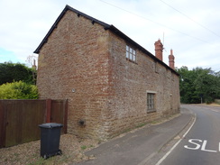
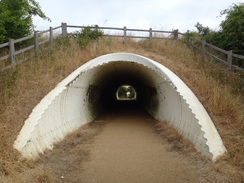
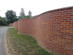
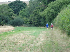
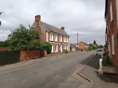
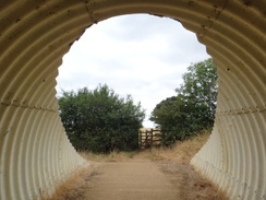
I felt slightly frustrated as paths took me back towards West Haddon. They took me past the village primary school and on towards the church, where I took a little diversion to see if my car was okay. After this a path left the village and passed through a corrugated tunnel beneath a new bypass and started to fall. A track, and then a road, took me into the pretty little village of Winwick. A large house just outside the village had an attractive wiggly brick wall surrounding it. Nearby two men were preparing for a walk; they said they had done the Jurassic Way before, and were going for a short walk to Honey Hill. I left them behind and strode on.
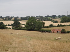
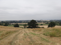
A surfaced track became unsurfaced, rising and falling; I exchanged a few words with a jogger by a gate and continue on as the track climbed towards a windfarm. The views back were superb, and five or six groups of wind turbines could be seen in the distance. It was an easy track to follow, and the views kept me busy, but I soon started to feel a sense on unease; I checked my GPS and my map, and realised that I should have turned off the track half a mile earlier. Cursing, I headed back, only two encounter the two walkers. They checked their map as well, and we chatted as we walked back along the track. They took a short-cut, whilst I continued down to the junction, where waymarkers pointed in the correct direction. They were not obvious, but I should have seen them.
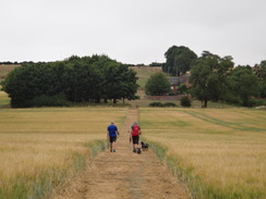
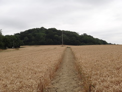
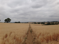
Fortunately the next stretch of trail was pleasant enough, following the edges of fields with reasonable views. Unfortunately the clouds were starting to gather a little, obscuring those views. I caught up with the two men shortly after crossing a golf course, after which the trail climbed up onto Honey Hill. Near a farm we passed the jogger who I had talked to earlier, except this time he was walking his dog. We exchanged a few words again, and he asked us to read some plaques beside trees as we ascended. We did so, and they were all remarking on the number of wind turbines in the area. I have some sympathy with this, as the surroundings did seem somewhat overloaded with them!
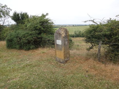
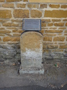
It started to drizzle as we ascended, the first rain I had felt for a couple of months. We soon reached the top of the hill, where the trail strikes southwestwards down the hill's flank towards Elkington. I strode ahead of the two gentlemen, and soon passed a stone commemorating the trail's opening in 1994. Shortly after this I passed a little area of woodland, and a vague track took me downhill towards a stream. I felt a little confused on the other side of this, and could not work out how the terrain matched what I saw on the map. The two gentlemen passed by, and we walked together to the road in Elkington. We saw no waymarkers, and I realised I had somehow – again – taken the wrong route.
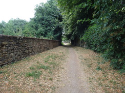
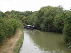
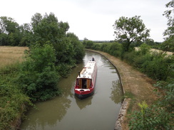
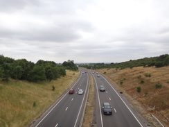
It is unusual for me to go wrong on a walk, yet alone twice, and rarely in such a big way. I said goodbye to the two men as they continued their circular walk back to Elkington, whilst I continued along the trail towards the canal, soon coming across a trailmarker that showed where we should have entered the village. Very annoyed with myself, I continued to the canal, whose towpath was uneven and not particularly pleasant to walk along. It passed under the A14 road, and continued on to a bridge where the trail left the canal and started a steep climb up to Hemplow Hills.
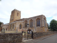
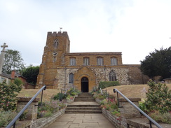
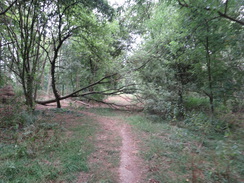
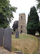
This was not a bad stretch, and again there were some good views to be had behind me before the trail entered some woodland. I soon came across another footpath diversion; this was much easier to follow than the earlier one, and I was soon striding along an access track that led directly to Welford. The track became a road that took me through the village to the church, which meant that I had just completed the entirety of the Jurassic Way.
I had intended to follow the trail back for half a mile, before taking footpaths, bridleways and roads back to West Haddon. However as it was a Sunday and traffic was light, I walked south along the main road; there was a pavement almost all of the way. This led to a lay-by and then onto an old bypassed stretch of road, from where a footpath and then bridleway led off to the A14. The old road was quite overgrown but passable, whilst the footpath was heavily overgrown and nearly impassable, especially as I was in shorts. This was followed by a footbridge covered in nettles, before I eventually reached the bridleway, which was thankfully clearer.
There was only one problem, however: my now-dated maps showed the bridleway heading southeastwards towards the A14, whilst on the ground it headed south and then west to a road bridge. I followed this rather than try to make my own way to the A14, and it was a good decision, as modern maps at home showed that I had followed an official diversion – presumably because the A14 crossing was unsafe.
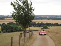
I was feeling rather annoyed as I crossed the bridge over the A14; I was in the wrong position to take my planned route back to my car, and the diversion back to that route would add half a mile onto an already-long day. Instead I decided to follow the trail; the road took me to to the top of Honey Hill. As I descended a classic MG car approached from behind, and inside was the man I had met twice already today! We exchanged a few words and I continued on along the trail.
Following the trail back to West Haddon proved simple and unremarkable; I had not had a stop all day and was feeling tired, but otherwise I was fine. I've recently tried moving over to old pairs of my Thousand Mile socks rather than the new ones I had been using, and it seems to have helped my feet a lot.
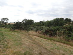
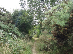
Once at my car, rather than immediately go home, I decided to drive to Elkington to see if I could do the stretch of path where I had gone wrong earlier on. I parked my car near a barn and returned to the place that the trail left the village. It passed paddocks before descending to cross a stream, and then climbed through a wonderful area of gorse to reach the covert I had passed earlier. Once there, I could see where I had gone wrong; I had continued along an indistinct track rather than veer off into the gorse. This was annoying, but it was perhaps an understandable mistake given the lack of signage.
It had been a slightly annoying day's walk, on what should have been a glorious day for walking a pleasant stretch of trail. Still, I have now completed the Jurassic Way, which I think in the whole I have enjoyed. It is not a classic trail, but it is a pleasant one – and one which I will doubtless do parts of again in the future.
 |
 |
|
Directions
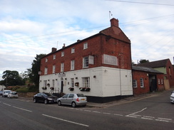
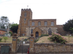
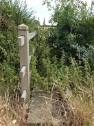
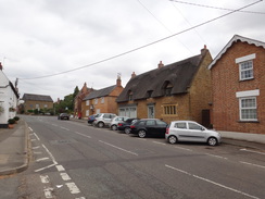
This walk starts off outside the Pytchley Arms in West Haddon at SP63197184. Leave the pub and turn right to follow the High Street westwards; pass the Crown Inn and then the church on the right to reach a mini-roundabout. Take the first road off to the left, Station Road, and follow it as it leaves the village and becomes Watford Road. There is no pavement for most of the way, but the verges tend to be wide; however care should be taken. The road crosses a railway line, and after 2.5 miles swings to the right at a road junction to enter the village of Watford. Continue west along the road for about 250 metres until a junction with Church Street is met on the right at SP60326885.
Here the Jurassic Way is joined. Turn right to head north up Church Street, passing the church on the left; after 250 metres this ends at a T-junction with another road. Turn left along this road, and when a barn ends on the right after a short distance, turn right across a stile beside a field gate to enter a field. Angle left for a short distance across some parkland to encounter an avenue of trees, and then angle right to walk northwards between the trees. The path passes the right-hand end of a copse, after which it continues on. Nearly half a mile after the road, the path heads through the ornate Pulpit Bridge under a railway line at SP60376988.
Go through an ornate field gate under the bridge, and on the other side head straight on across a field border into a field. The path heads straight across the field northwards, aiming for two wind turbines ahead. The field ends at a boundary-less track with a turbine on the left; do not head straight on uphill along the track, and instead angle right into a field, and head uphill with a hedge to the left, with the track on the other side of the hedge. Just before the top corner of the field is reached, angle half-right across the field, aiming for the far right-hand corner at SP60507071.
In the corner, turn slightly left to head north between a hedge on the right and a small patch of woodland on the left. This soon leads out into a field. Head straight on northwards across this field; at the far side, go through a field gate to enter a second field, and angle half-right to head diagonally towards the far right-hand corner of this field. In the corner, go through a broad gap into a third field, and follow a hedge on the right. When a corner is soon reached, turn left to follow the edge of the field northwards. Just before the far corner of the field, turn right through a clappergate and walk across a narrow field with a hedge to the left. In the corner, turn left to go past a field gate to join a track that follows a vague field boundary on the right. After 170 metres it curves right for a few metres to a track junction at SP60857150.
Here the course of the Jurassic Way has recently changed (2018). Instead of heading down towards Silsworth Lodge, turn left to head northwards along the track as it heads between hedges. After 300 metres, and just before the track curves left, go through a gate across the track and then immediately turn right through a clappergate beside a field gate to enter a field. Follow a hedge on the left; the hedge jinks left, and at the far corner turn right, still following a hedge on the left past the same field. At the bottom of the field, go through a gap in a hedge ahead and continue following a hedge on the left down a second field. At the bottom of this field, go through a bridleway gate through a broad hedge at SP61367165 into a field, rejoining the trail's old route.
Angle left across the field, heading slightly away from the hedge on the left and towards power lines ahead. At the far end of this field, cross a footbridge through a hedge and cross a stile to enter a second field. Head straight on across the field, paralleling the hedge away to the left at the top of the field. At the end of this field, go through a pedestrian gate and cross a footbridge to enter a third field. Follow a hedge on the left; the path soon passes under power lines. At the corner of the field, go through a gap in a hedge ahead and cross a farm bridge over a stream at SP62087185.
In the next field, angle right to head diagonally up the field; it climbs a slight slope and then falls to reach two stiles in quick succession in the far corner to enter a second field. Follow a hedge on the left; at the next field corner beside a barn, cross a stile and then angle right up the slope; ignore a gate ahead on the left. As it climbs the path joins a very indistinct track that leads to a stile to enter the outskirts of West Haddon. Continue along a path, following a fence on the right that guards a school's grounds. The path then curves right, still following the fence, and emerges out in front of the school. Turn left down a short road passing the West Haddon village hall on the left, to reach West End Road. Turn right down this for a short distance until a mini-roundabout that was encountered at the beginning of this walk is reached at SP62977179.
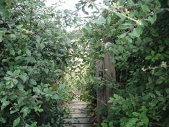
Turn left along the road, passing the church and then the Crown Inn on the left. Immediately after the Crown Inn, turn left up Crown Lane. When this soon turns right, turn left for a few metres, and then right to follow a path that follows the churchyard wall on the left. When the path turns sharply right, head straight on through a clappergate to enter a field. Turn half-left across the field to meet the hedge on the left. Follow this hedge north-northeastwards; at the corner of this field, go through a clappergate and head straight on across the middle of a second field towards a road. At the end of this field, go through another clappergate and go through a tunnel under the bypass at SP63127246.
On the other (northern) side of this tunnel, go through another clappergate to enter a field. Head straight on northwards across this field as it falls, aiming slightly to the left of some distant wind turbines. At the far end of this field, go through a gap in a hedge and descend a couple of steps to a clappergate that leads into a second field. Head down this field, angling slightly towards the hedge on the left. After 100 metres turn left through a gap into a third field, and angle diagonally across this field, aiming to join a track in the far corner at SP63127306.
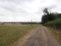
Continue along the track as it heads through a gap in a hedge into a field. When the track starts to curves left after a few metres, angle right across grass, aiming for a field gate in the far corner. Join a surfaced road, go through the gate, and continue along the road. At the end of this field, go through a second field gate. Continue along this road as it heads into Winwick; after 400 metres a road junction is reached beside a bus stop at SP62637372.
At the junction, and just before a bridge over a stream on the left, turn right up Elkington Lane and follow the road as it swings to the right at the top of the hill, past a wiggly wall on the right. A short distance after the bend, follow the road as it becomes a track and swings left across a cattle grid with an adjacent gate. A good track heads on north-northeastwards; it climbs up to pass the entrance to a farm on the left, and then descends, becoming rougher in nature. It goes through a field gate and heads on. 700 metres after the cattle grid, it curves left at SP63077451.
At the bend, turn right to head straight on along a track to reach a bridleway gate beside a field gate. Continue on to, and through, another field gate, and when a hedge on the left turns left 250 metres after the bend, turn left into a field. Do not continue uphill northeastwards along the track.. Head north across the field, angling away from the hedge on the left and climbing slightly and then falling to reach a field gate in the corner at SP63287498.
Go through this, and turn right along a vague track following a hedge on the right. At the corner of this field, go through a field gate and aim slightly to the left across a short field. At the far side, go through another field gate and then a bridleway gate in the hedge to enter a larger field. Turn right to follow a hedge a short distance to a field corner, and then left to follow a hedge on the right in a rough north-northeastwards direction for about 700 metres. At the northern corner of this field, turn left for a few metres and then right through a gap in a hedge and descend down a slope through trees at SP63577603.
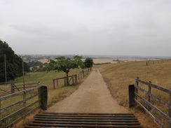
It emerges from the trees; turn right for a few metres and then left to cross part of a golf course. Go through a pedestrian gate and head straight on across a field, aiming just to the left of a farm halfway up the hill. Go through a bridleway gate and continue between fences to another gate; soon after the path ends at a concrete track. Heads straight on up this, soon passing Honey Hill Farm on the right. At the top of the field cross a cattle grid or go through the adjacent gate, and continue along the track past a house on the right to reach a road on the top of Honey Hill at SP63937696.
Turn left along the road; when it soon curves right, continue straight on along a path that runs between hedges. Go through a field gate into a field and follow a hedge on the right down past a memorial stone to the opening of the Jurassic Way on the right. After this the path curves slightly to the left away from the hedge, and then descends to reach a field gate in a hedge. On the other side, continue on southwestwards, following a hedge on the left past a field. At the corner of this field, go through a field gate and continue on, passing Elkington Covert on the left until the trees soon end at SP62937660.
At the end of the trees, angle right to join a half-hidden path that descends through an area of gorse and scrub. Do not continue on along the vague track curving to the left downhill from the covert. The path descends downhill, curving right to reach an area of grass at the bottom. Curve left alongside a hedge on the left as the field narrows. Go through a field gate and head on along a path that climbs slightly through a scrubby area to reach a pedestrian gate. Go through this and head on west-southwestwards between electric fences past paddocks. The fences are replaced by hedges; the path emerges out onto a road in Elkington at SP62577651.
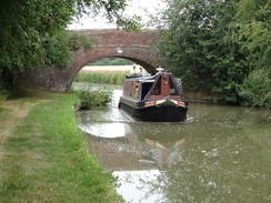
Head straight on along the road; when it soon ends at a triangular junction, turn left to head west along a road. After 250 metres this reaches bridge 28 over the Grand Union Canal. Cross the bridge, and on the other side turn right down some steps to reach the canal towpath. Follow the canal north, with the water away to the right. It passes under several bridges – including a large one carrying the A14 overhead – and after 1.2 miles bridge 31 is reached. Climb up some steps to reach the road over the bridge at SP61347833.
Turn right to cross the bridge, and immediately on the other side turn left through a gap in a hedge into a field. Angle across the field, aiming for a telegraph post in the middle of the field and trees ahead. Pass the post, cross a concrete track, and head straight on, climbing towards the trees across a field. At the top of the field, cross a broad, grassy area and enter the woodland through a gap. Head straight on steeply uphill through the trees, and exit them through a gate to enter a field. Head eastwards across the field, angling away from the fence on the left. Pass a small pond on the right, and at the bottom of the field go through a gate in a fence into a second field. Head straight on across this, crossing a gravel track to reach a pedestrian gate to join another track at SP62447862.
Turn left to follow the track northwards; after 250 metres it curves to the right to head northeastwards for another 0.75 miles along the good track until it ends at a road at SP63467955. Carefully cross the road, and continue on along a road called West End; after a little over half a mile a road junction is reached opposite the church in Welford at SP64078030.
Turn right down Church Lane, passing the church on the left, and follow it down to the A5199 in Welford. Here the Jurassic Way is left for the day. Turn right down the main road to head south out of the village; there is a pavement on the right-hand side of the road. The pavement ends at a lay-by after 600 metres; continue along the main road for another 300 metres until a road leads in from the right. Turn right down this road for 100 metres turn left until it meets another road junction on the left at SP64277934.
At the junction, turn hard left to find a barely-visible path that follows an old road eastwards back towards the main road. After 150 metres turn right to cross a plank bridge over a ditch to enter a field. Angle half-left diagonally across this field. At the far side go through a gap in a hedge and head straight on across a second field. At the far side of this field, turn left to cross a footbridge across a ditch, and then angle right alongside a hedge on the left. In the corner of the field turn left across a footbridge through a hedge, and then turn right to follow the hedge on the right. In the corner of the field cross a footbridge over a ditch, and then continue on along a bridleway, with a ditch to the right. In the next corner, angle slightly right through a gap in the hedge along a track. Follow this track as it soon curves right to head westwards up a slight slope. Go through double field gate to reach a road at SP64187822.
Turn left to follow the road south; it soon passes over the A14(T) on a bridge, and after half a mile ends at a triangular junction with another road. Turn left to head south down this road, and after another third of a mile it curves to the left to rejoin the course of the Jurassic Way walked earlier on Honey Hill. Continue along the road for a short distance until a track leads off to the right at SP63937696, following a hedge on the left.
After 200 metres the track curves slightly to the right, passing a house on the left to reach a cattle grid with a gate nearby. Go through this and continue on down the track. When the track curves left into Honey Hill Farm, head straight on between fences for a short distance to reach a bridleway gate. Go through this, and on the other side continue on downhill to a second bridleway gate that leads into a field. Head straight on down the field, paralleling a hedge away to the left, and at the bottom go through a pedestrian gate and head on between trees across part of a golf course. Pass Hole 8, and head on down a slope. The path enters some woodland and meets a rough track. Turn right along the track for a few metres and then left to join a path that leads steeply up a slope through trees; this emerges out into a field at SP63577602.
Turn left to follow the edge of the field; when the corner is soon reached, turn right, following a hedge on the left for about 700 metres. At the far corner of the field, turn right to follow a hedge on the left for a few metres, and then turn left through the hedge, going through a pedestrian gate and field gate to enter another field. Angle slightly to the left across this field, and at the far side go through a field gate and follow a hedge on the left. At the corner of this field, cross a vague track and turn left to reach a field gate. Go through this into a field and angle slightly right to head diagonally across this field, climbing and then falling to meet a hedge on the right, which soon ends at a grassy track in the far corner of the field at SP63287471.
Turn right to head southwestwards along the track; it soon meets a field gate. Go through this and continue on down the track to reach a bridleway gate beside a field gate; on the other side the track meets another coming in from the right. Continue straight on down this to reach a field gate; go through this and continue on along the track. It climbs uphill, passes a farm away to the right, and then descends. 700 metres after the track junction, cross a cattle grid or go through the nearby gate, and follow the track as it curves right, with a wiggly brick wall on the left. The track becomes a road, and soon curves left to head downhill into Winwick, ending at a T-junction beside a bus shelter at SP62637373.
Turn left along to head southeastwards along West Haddon Gated Road. After 400 metres go through a field gate and continue along the road (now little more than a track) to reach another field gate in the corner of the field. Go through this into a field, and turn half-left across the grass, aiming for another track ahead. Join the track and then immediately go through a gap in a hedge ahead. Go through the gap and turn half-right off the track, heading diagonally across the field. In the far corner go through a gap at SP63197292.
Turn right to go up the field, angling slightly away from the hedge on the right. At the top of the field, go through a clappergate in a hedge and ascend a couple of steps into another field. Head straight on uphill across the field; at the end of the field go through a clappergate and head under a tunnel under the A428 bypass. On the other side of the bridge, go through another clappergate and angle slightly right across a field. At the far side of the field, go through a clappergate and follow a hedge on the right. After 200 metres the hedge curves left, and when it curves right soon afterwards, continue straight on across grass towards the field's far corner to reach a clappergate to join a path at SP63067197.
Head straight on down this path, which soon joins the churchyard wall of West Haddon church on the right, and then curves left to reach Crown Lane. Turn right down the lane to reach the High Street in West Haddon beside the Crown Inn. Turn left up the road for a short distance to reach the Pytchley Arms at SP63197184, where this walk ends.
 |
 |
|
Distances
| From | To | Distance (m) | Ascent (ft) | Descent (ft) |
|---|---|---|---|---|
| West Haddon | Watford | 2.8 | 86 | 223 |
| Watford | West Haddon | 3.7 | 243 | 118 |
| West Haddon | Honey Hill | 3.9 | 363 | 243 |
| Honey Hill | Welford | 4.8 | 228 | 403 |
| Welford | Honey Hill | 2.6 | 212 | 32 |
| Honey Hill | West Haddon | 3.8 | 262 | 375 |
This makes a total distance of 21.6 miles, with 1394 feet of ascent and 1394 feet of descent.
For more information on profiles, ascents and descents, see this page
 |
 |
|
 |
 |
|
 |
 |
|
 |
 |
|
 |
 |
|
 |
 |
|
 |
 |
|
 |
 |
|
 |
 |
|
 |
 |
|
 |
 |
|
 |
 |
|
 |
 |
|
 |
 |
|
 |
 |
|
 |
 |
|
 |
 |
|
 |
 |
|
 |
 |
|
 |
 |
|
 |
 |
|
 |
 |
|
Disclaimer
Please note that I take no responsibility for anything that may happen when following these directions. If you intend to follow this route, then please use the relevant maps and check the route out before you go out. As always when walking, use common sense and you should be fine.
If you find any information on any of these routes that is inaccurate, or you wish to add anything, then please email me.
All images on this site are © of the author. Any reproduction, retransmissions, or republication of all or part of any document found on this site is expressly prohibited, unless the author has explicitly granted its prior written consent to so reproduce, retransmit, or republish the material. All other rights reserved.
Although this site includes links providing convenient direct access to other Internet sites, I do not endorse, approve, certify or make warranties or representations as to the accuracy of the information on these sites.
And finally, enjoy your walking!
Nearby walks
| # | Title | Walk length (miles) |
|---|---|---|
| 137 | Market Harborough to Northampton | 18.3 |
| 158 | Bugbrooke to Braunston | 15.1 |
| 162 | Braunston to Leamington Spa | 16.6 |
|
|

|