Walk #1008: A circular walk between Northampton, Harlestone and Nether Heyford
 |
 |
|
General Data
| Date Walked | 19/07/2018 |
| County | Northamptonshire |
| Start Location | Upton Country Park |
| End Location | Upton Country Park |
| Start time | 05.46 |
| End time | 13.03 |
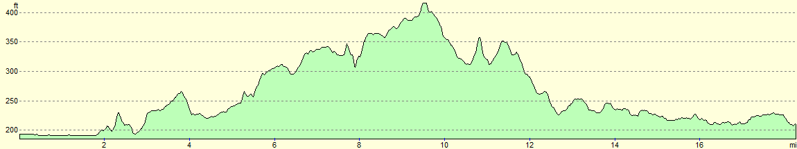
| Distance | 19.1 miles |
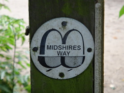
| Description | This walk followed parts of the Midshire Way and Nene Way trails, in a circular walk that also took in the centre of Northampton. |
| Pack | Today I carried my 30-litre Karrimor rucksack, filled with water, my spare waterproofs, a book and other odds and ends. |
| Condition | I feel absolutely fine after this walk. |
| Weather | Today started overcast, with little sign of the sun that had seemingly been ever present for the last month. Despite this it was quite warm, and there was little breeze to cool me down. There were some sunny periods during which I got too warm, but it was mostly a good day for a stroll. |
| OS map | Landranger number 152 (Northampton & Milton Keynes) |
 |
 |
|
Map of the walk
Maps courtesy of Google Maps. Route for indicative purposes only, and may have been plotted after the walk. Please let me have comments on what you think of this new format. For a detailed table of timings for this walk, please see the table file.
 |
 |
|
Notes
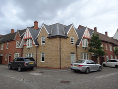
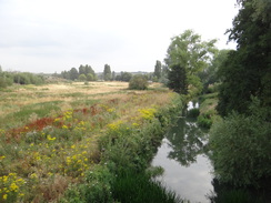
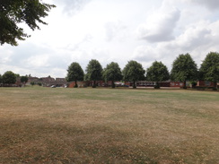
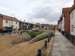
During my walk along the westernmost stretch of the Nene Way a few months back, I took what I thought was an incorrect route along the southern side of a lake near Northampton, whilst my map showed the trail following the northern bank. I could have just walked this short stretch again, but I decided on a longer route that would take in not just that stretch, but part of the Midshires Way as well. I therefore drove to the village of Upton – a newly built complex of houses – and parked in a car park adjacent to Upton Country Park.
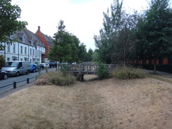
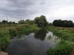
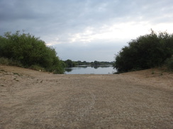
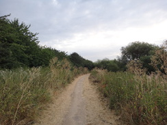
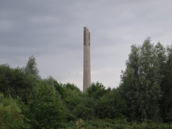
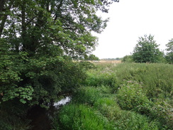
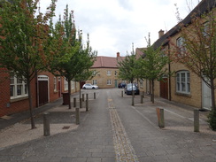
Upton may be a new village, but it appears to be quite a well-designed settlement. There are some wide streets, greenery, and an eclectic range of style of houses. I quite liked it, although I have no idea what it is like to live there. I headed a short distance through the village to join the Nene Way and followed a rather dismal track down to the Nene and the stretch of the trail that I thought I had made a mistake on. It took me a few minutes to find the way to the northern side of the lake, and this involved crossing a grassy low area that looked like a flood relief channel. The path around the northern side of the lake was gravel, and gave occasional glimpses towards the massive lift tower that dominates Northampton's skyline, but there were no signs of any Nene Way markers.
The path curved around the lake, and the smell of burnt ground heralded the skelatal frame of a motorbike abandoned between the path and the water. A narrow overgrown path led out to the surfaced path I had walked along on the previous trip, but fingerposts showed the trail following the route I had taken previously. There had been previous places where the waymarked route of the Nene Way on the ground had varied from the one shown on the map, and I can only assume this was another. It also made today's walk rather pointless, as there was no need to rewalk this stretch. I was not too bothered though, and I was looking forward to the rest of the walk.
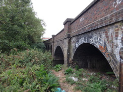
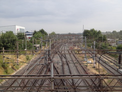
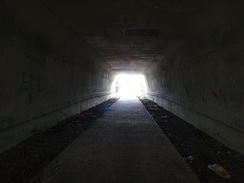
I rejoined the trail as it headed under a railway line bridge spanning the river, and then a lower one that used to carry a line south of the river. A couple of disheveled shopping trolleys sat under this bridge, and in one was an empty drinks can and two plastic containers for used needles. Welcome to Northampton!
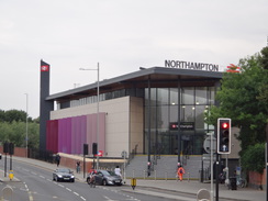
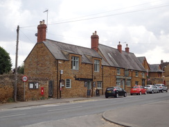
Fortunately things got a little better as the path headed past the massive Carlsberg Brewery, where I left the trail to follow roads towards the station. This was much neater than I remembered – it turns out that a new station building opened only three years ago, and that the old one has been demolished. It seems a change for the better, as the new building seemed a very usable and attractive space. I bought some sandwiches at a shop and headed back to continue my walk north through Northampton.
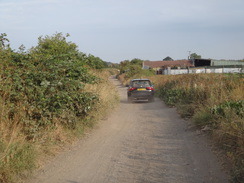
This was a fairly nondescript stroll. As I crossed a bridge over the railway, a large circular disc of cardboard flew off the back of a flatbed lorry and rolled down the pavement past me – a rather unusual and alarming experience. Needless to say, the lorry did not stop. More roads led to a dusty track that headed north past signs warning against fly-tipping – signs that were being ignored, as the roadside was littered with small drums filled with engine oil, some of which had leaked.
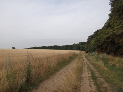
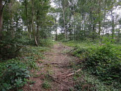
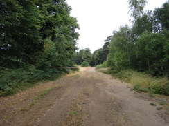
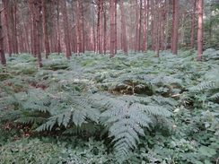
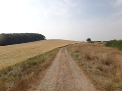
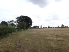
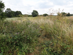
This stretch was also rather nondescript, and I put my mind in neutral as I plodded along. I had been walking for two hours and was nearly a third of the way through the day, and yet it was not even eight in the morning. I passed a farm, before paralleling the Midshires Way and entering an area of woodland on Dallington Heath. The map showed the trail heading off through the woodland away from the main track; I found the right footpath, but it was covered in branches that had been deliberately laid across it, and I soon came to a wire fence guarding a cleared area. Instead of trying to plough on, I headed back and took a track that passed an area being felled, beyond a wood mill nestled right in the heart of the woods. When I got home my map showed that I had been on the Midshires Way when forced to turn back. The trail's proper route was blocked, and this is rather annoying.
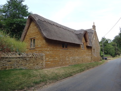
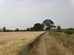
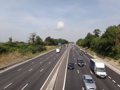
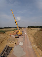
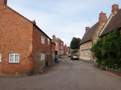
Eventually I rejoined the trail, which soon afterwards emerged from the woods into a field before reaching a road in the little village of Harlestone. Much of this area borders the Althorp estate, and blue signs warned of private land. Harlestone itself was pretty, but a rather unpleasantly overgrown stretch of path took me across fields to a main road in Nobottle. After this it was a simple a case of following a long track southwards; I resisted the temptation to divert off to visit a trig pillar on top of a hill, and instead walked down to a bridge over the M1, which was soon followed by a new bridge over the under-construction A45 bypass.
I made a little diversion in Nether Heyford to follow a Nene Way marker (it turns out there might be two routes through the village), and then nipped into the village shop to buy an ice cream. By this time my feet were a little warm, and I stopped on a bench on the village green, took off my boots and spent ten minutes getting loose pieces of straw and grass off my socks! I could have spent longer there, but I wanted to get home as early as possible, so I pulled my boots back on and headed down the road.
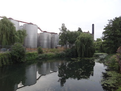
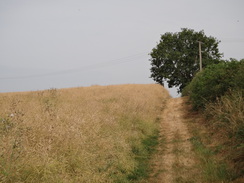
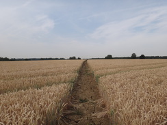
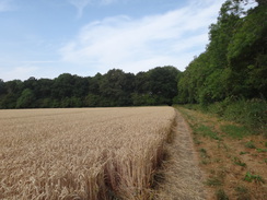
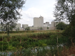
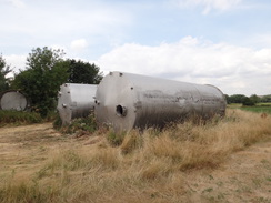
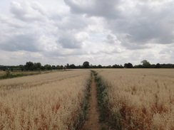
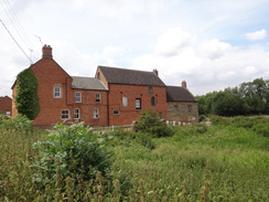
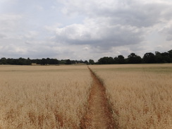
I was now back on the Nene Way, walking a part of the trail I first did back in March. Navigation was easy, although fields that had been bare were now clothed in crops. The weather was also different; then it had been grey and the ground sodden from the recent snows; now it was hot and the ground was baked dry. The massive mill at Bugbrooke was livelier on a weekday than it had been on a Saturday, and a nearby area of ground filled with old silos still looked like it was a dumping ground for old rocket stages.
After passing under the M1, a cleared path took me indirectly to Kiskingbury – although the indirect route was still much preferable to wading through the crops. A few people were walking from the church towards a pub; the women were somberly dressed, and many of the men were wearing black ties, and I wondered whose funeral they had just attended. I was tempted to nip into the pub for a drink, but with only a few miles to go it seemed better to press on.
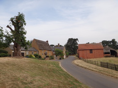
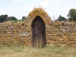
The rest of the walk flew by, as I had walked it just a few months ago. The only thing of particular note was that the attractive stone wall around Upton Park was being rebuilt; I waved at men lifting stones and headed on back into Upton and my car. It had been a slightly pointless day's walk, as my main reason for walking it had turned out to be invalid. However I had still enjoyed it, and with two trails nearly completed, I am starting to covetously eye the Midshires Way.
Now that would be an adventure …
 |
 |
|
Directions
This walk starts off at the car park for Upton Country Park at SP72515963. Leave the car park by its main entrance, turn right along High Street for a few metres, and then left up Black Cat Street. This crosses another road and then forks; take the left-hand branch that ends at Clickers Drive. Cross the road, and then a footbridge over a drainage ditch, to reach a pavement in front of some houses. Turn right to follow the pavement; the path curves to the left, still running in front of houses, with Clickers Drive across a grassy dry ditch on the right. Continue on until the path meets Clickers Drive; turn left along the end of the road, which soon becomes a path that ends at the A5076 dual carriageway at SP72715996.
Cross the dual carriageway using the pedestrian crossing, and on the other side turn left for a few metres to reach a large roundabout. Take the first road off to the right off the roundabout, Duston Mill Lane. This passes wasteland protected by palisade fencing on the right and becomes unsurfaced. After a fifth of a mile it reaches a vehicle barrier; squeeze past this to reach a bridge over a river stream. Cross the bridge and follow the track as it curves to the right and then left to reach a bridge over a second stream. Cross the bridge and continue along this track for a hundred metres until it reaches another vehicle barrier; squeeze past this to join a surfaced path at SP73015960, with a car park away to the left.
Immediately after the gate, the path crosses a long bridge over a depression and reaches a junction. Turn left along another surfaced path (do not continue straight on to cross a bridge over the river to the right). The path curves to the right; after a few metres turn left across an area of grass that dips down, crossing a small grassy flood-relief channel with a lake to the right, and up the other side to reach the car park at SP73035970.
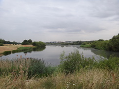
Turn right through the car park, and then join a firm path that runs between Sixfields Lake on the right and the River Nene on the left (although the latter mostly remains out of sight). After three-quarters of a mile the path curves right to head past the eastern end of the lake; on another right-hand bend to join the southern side, turn left along a vague path that leads for a short distance through a scrubby area and past trees to reach a footbridge over a river stream at SP74195970.
Cross the bridge, and on the other side turn left to follow a path eastwards to reach a blue bridge over the river cut at SP74335964. Turn left to cross the bridge, and on the northern side turn right to head towards and under a large railway bridge, and on to a second, lower, railway bridge. Head under this; on the other side, the path rises up towards a footbridge over the river at SP74845969.
Do not cross the footbridge, and instead skirt a road on the left; after a few metres turn right to rejoin the riverside path. The path soon passes under a bridge carrying Towcester Road overhead. The path and river jink past a B&Q store, and then the path turns left to head alongside an inlet on the right. Ignore a footbridge over the inlet on the right, and continue north along the path – here the Nene way is left. When the inlet ends, continue straight on along a path that soon meets a road on the right that leads into the Carlsberg plant. Keep this road on the right for a short distance to reach the A5123 dual carriageway at SP75176013.
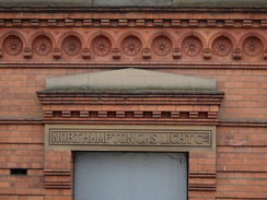
Turn left along the road for a short distance to reach a large roundabout beside an attractive but currently (2018) disused brick building. Pass the roundabout, and at its exit, turn right to cross the A5123 Towcester Road by a pedestrian crossing, and then turn right back towards the roundabout. Take the next exit, the A4500 St Peter's Way, and follow it as it curves to the right. Immediately after the bend the road forks; turn left along the new road for a few metres, and then right to cross the new road at the junction. On the other (northern) side, turn left to reach Northampton Railway Station at SP74756041.
Leave the station, and head east along the road away from the railway bridge. When the road immediately splits, take the left-hand branch that soon ends at a crossroads. Turn left to follow the A5095 northwards, with the railway station car park off to the left. After a third of a mile a crossroads is reached with the A428. Carefully cross the A428 to reach its northern side, and then turn left to follow it across a bridge over a river and then a second bridge over the railway to reach a road junction with Gladstone Road on the right at SP74556104.
Turn right to follow Gladstone Road northwards; it passes two roundabouts, and after 0.9 miles reaches a third at SP74056235. Follow the exit to Mill Lane on the right, and then immediately use a pedestrian crossing to cross to the northern side of the road. Turn left along the pavement back past the roundabout, and after a few metres turn right along another path that soon meets the end of Windrush Way. Follow this road along as it parallels Mill Lane on the right; when Windrush Way ends after 250 metres, cross a road called Nene Way ahead and continue on along a dirt track, still with Mill Lane to the right. This track passes sports fields on the left, and soon curves left at SP74326263.
Continue along this broad and easy to follow track as it heads northwards, slowly curving to the left to a more northwesterly course. After 1.2 miles it approaches Grange Farm; follow the track as it curves left to pass between the farm and some barns to reach a gateway. Go through this and continue along the track as it curves right past a field. The track becomes less distinct as it curves left to follow a band of trees on the right, still with a field on the left; at the corner of this field it angles right; squeeze past a barrier to enter the woodland at SP72606396.
A good track angles slightly left immediately on entering the woodland; follow this for a little over 100 metres, and then take a less distinct track that angles off to the right through the trees. This heads west-northwestwards, and after a third of a mile reaches a surfaced access road that leads to a wood mill on the right. Cross this road, and them continue along a track on the other side. It crosses another track, and then heads straight on as a path through the trees. It meets another broad track; cross this and had straight on along the path that heads downhill to a bridleway gate at SP71306419 that leads out of the woodland and into a field.
The path angles across the field away from the hedge on the right; however I followed the hedge on the right because of crops. At the corner of the field, I turned left to follow another hedge, which jinked right to lead to a bridleway gate beside a field gate in the field's corner, rejoining the official route. Head straight on along a track that runs between a fence and a hedge to emerge out onto the A428 road at SP70836424.
Turn tight along the road for a few metres, and then carefully cross the road to reach a road that leads off on the other side. This initially heads westwards with a wall on the right, before taking a more southwesterly course; after three-quarters of a mile it curves left in Upper Harlestone as a road comes in from the right. Continue along the road as it curves right in a large arc and descends slightly to enter Harlestone. A triangular junction is reaches on the left at SP69386395, after 1.2 miles on the road.
Angle left at the junction, with a barn wall on the left and a small green in the middle of the triangle on the right. When Cross Hill Farm is passed on the left after a short distance, turn right through a pedestrian gate to enter a paddock. Angle for the far left-hand corner of the paddock, through electric fences might make this slightly difficult. At the corner go through a field gate into a field, and turn left. When a field corner is soon reached, go through a gap in the hedge ahead and immediately turn right to start following a hedge on the right westwards. The hedge curves slightly to the left and starts to fall downhill towards the right-hand end of a band of trees ahead at SP68776375.
Pass the end of the trees on the left, and then cross a little track and head through a gap ahead to enter another field. Head straight on diagonally southwestwards across this field. At the far corner, skirt a barn on the left and go through a gap to enter another field. Angle slightly right to head westwards across the field, aiming for a small patch of woodland ahead. The path meets the woodland on the right; walk past it to reach a gap between a hedge and the trees into another field. Turn half-left across this field, aiming for the far corner beside Nobottle Wood at SP68026317.
In the corner, go ahead through a broad gap and turn right, to follow the woodland on the right westwards. At the corner of this field, head straight on along a path through the woodland. When the end of the trees is reached, go through a field gate into a field and then continue following the edge of the woodland on the right. At the corner of this field, go through another field gate and angle half-left across a field to reach a bridleway gate in a fence. On the other side, continue on to another bridleway gate beside a field gate that leads out onto a road in Nobottle at SP67426302.
Turn right and carefully follow the road west-northwestwards; after 300 metres carefully cross the road to join a track that immediately passes Townsend Farm on the left. After 250 metres a field gate is reached; go through this into a field, following a fence on the right. In the corner of this field, go through a field gate into another field and follow a fence and hedge on the right for a short distance to a third field gate. Turn right to follow a hedge on the right. At the corner of this field, go through two field gates close to each other, cross a vague track and continue on, following a fence on the right. In the corner of this field, go through a gate into another field, and continue following the fence on the right. At the far end of this field, go through another field gate and angle slightly left to head diagonally across a field to reach a field gate to reach a farm bridge over a stream at SP66466204.
Join a track and start following it southwards, going through several field gates on the way. After 0.9 miles a field gate is reached at SP66496059. Go through this and follow the track as it immediately curves right and then left to resume its southerly course. At the end of this long field go through a pedestrian gate beside another field gate, after which the track becomes a public road. Follow this south as it soon crosses the M1 on a bridge, and shortly afterwards a second bridge over a new (in 2018) bypass. Continue along the road until it ends at a junction with the A45 in Upper Heyford at SP66335967.
Carefully cross the main road, and on the other side head straight on south along a road that soon ends at a T-junction. Head straight on down the new road; there are no pavements, so care needs taking. After a third of a mile the road curves left and then right to cross the Nene on a bridge. A fifth of a mile after the bridge, and shortly after a left-hand bend in Heyford, turn right along a narrow path that squeezes between a wall on the right and a hedge on the left. This path emerges out onto a minor road, with a gateway to the right. Turn left to follow the minor road south; when it soon ends at a T-junction continue straight on down Church Street to reach a triangular junction with Weedon Road in the centre of Nether Heyford at SP65945852, near the Foresters Arms pub.
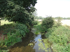
Turn left to head east along The Green and when this ends at a T-junction, continue straight on along Bugbrooke Road. When this in turn ends at a T-junction, turn left up Watery Lane. After about fifty metres, turn right to join a footpath that runs between fences and then hedges. It crosses a stream on a bridge, and about ten metres after the bridge, turn left though a clappergate beside a field gate to enter a field. Follow a fence on the right, and at the end of this field, go through a clappergate and aim slightly to the left across a second field, aiming for the far left-hand corner (or if there are crops, turn left to the corner of the field, and then right along the northern edge of the field) at SP67095856.
At the corner, go through a clappergate and follow a hedge on the left. At the end of the this field, go through a second clappergate and continue past a second field, following a hedge on the left. At the end of this field go through a third clappergate and continue on, still with a hedge on the left. At the end of this field, go through a fourth clappergate to enter a small area of woodland; follow the obvious path through the trees. When it emerges from the trees, ignore a bridge over the river to the left at SP67715862.
Pass the bridge and continue along a track with the river to the left. The track emerges through a gap in a hedge ahead to merge with a better-quality track; turn left along this track as it immediately curves to the right with the massive buildings of Bugbrooke Mill across the river on the left. The track curves to the left through field gates; here turn left through a clappergate beside the gates and continue along the track which soon ends at a T-junction with Mill Lane at SP68075868, with the mill complex to the left.
Turn left along the road for a few metres, and then right through a clappergate in a hedge to enter a field. Follow a hedge on the left; halfway across the field turn left through a pedestrian gate in a gap in the hedge, and then turn half-right to head diagonally across a grassy storage area. Go through a gate at the far side, cross a footbridge over a ditch and then go through another pedestrian gate to enter a field. Head across this field for a short distance to reach another clappergate through a hedge. The path heads across a second field, passing a solitary tree on the right to reach a track. Cross the track, and go through a gate to reach a footbridge over a ditch. Go through a second gate on the other side of the bridge to enter a third field. Head straight on across this field to reach a gap in a fence beside the M1 motorway embankment. Go through the gap and turn half-left to reach an underpass under the M1 at SP68675911.
Pass under the motorway, and on the other side go through a clappergate to enter a field. Turn slightly to the right across the field, angling away from the motorway on the right and aiming to eventually parallel the Nene away to the left. At the end of the field, go through a clappergate to join a path that runs between fences guarding paddocks. At the end of the path, go through a clappergate and pass the end of a track on the left for about ten metres to reach another gate beside a field gate. Go through this, and on the other side continue along this track, passing some houses on the right, before it soon ends at Willow View in Kislingbury. Turn left to head straight on along Willow View; when this ends at a T-junction turn left along another road. When this curves to the right, turn left to head straight on along Mill Road until this ends at a T-junction with Church Lane near the Sun Inn at SP69695943.
Turn left up Church Lane, and follow it as it curves to the right to become Starmers Lane, which soon ends at a T-junction with the High Street. Carefully cross High Street, and then turn left along it for about ten metres before turning right up Hodges Lane. When this road soon ends, turn left along a surfaced path that passes behind the Cromwell Cottage pub before it rejoins the High Street. Turn right along the High Street, keeping the road on the left. The road soon curves to the left; cross the end of Beech Lane and go through a gap in a wall to join a winding ramp that leads to a footbridge over the River Nene at SP69965981 with the road bridge to the left.
On the other side, continue along the road as it curves to the right, and on the next left-hand bend, turn right through a wooden gate near double field gates. Do not join the track on the right, and head on through a scrubby area into a field. Continue on, aiming for about halfway down the hedge ahead in the distance, with the river away to the right. Cross a plank footbridge over a stream and then curve right to follow a fence on the right with a second field away to the left. At the end of this field, go through a broad gap in the hedge ahead and continue on, following the edge of a third field. At the corner of this third field, go through a pedestrian gate and follow a path that heads up to the right to meet the imaginatively-named Upton Valley Way North road at SP70945975.
Cross the road using the traffic lights, and on the other side descend a ramp to a gate that leads into a field. Head diagonally across the field east-northeastwards, aiming to skirt the left-hand end of a band of trees ahead. At the trees, cross a plank footbridge beside a field gate and then go through a pedestrian gate into a second field. Follow a wall on the left towards another band of trees on the right. Pass the trees, and at the end of the field go through a pedestrian gate beside a field gate to enter a third field. Continue following the wall on the left as the path becomes a rough track; go through a pedestrian gate beside a field gate to enter the grounds of Upton Hall Farm, and then turn half-right away from the track to follow a fence on the right. Continue along the path as it curves slightly to the left, going through any gates you come across (they were all down in 2018). The path reaches a stone step-stile through a wall beside a farm gate to reach Upton Lane at SP72035976.
Cross the road, and on the other side go through a gap in a hedge (do not go through the field gate alongside) and walk across a grassy gap between a hedge on the right and a road on the left. Follow the grass alongside the road; the road is currently blocked off to traffic (2018) and head through the new housing development of Upton. Go past double field gates and cut across the end of Moorcut Drive, and head along a paved path that runs immediately in front of houses. Cross the High Street and head on past the houses until Scribers Drive is reached at SP72405984.
Cross this, and then a footbridge over a dry ditch, to reach a pavement in front of some houses. Turn right to follow the pavement; the path curves to the left, still running in front of houses, with a road across a grassy dry ditch on the right. Continue on past two wooden bridges over the dry ditch; at the third, cross it and Clickers Drive, and head on down Clickers Mews. When this forks take the right-hand branch, and cross Black Cat Drive and head on down Black Cat Street. This ends at the High Street; turn right along it for a few metres, and then left to enter the car park for Upton Country Park at SP72515963, where this walk ends.
 |
 |
|
Distances
| From | To | Distance (m) | Ascent (ft) | Descent (ft) |
|---|---|---|---|---|
| Upton Country Park | Northampton railway station | 3.0 | 50 | 54 |
| Northampton railway station | Grange Farm | 3.2 | 127 | 65 |
| Grange Farm | Nobottle | 4.3 | 303 | 177 |
| Nobottle | Nether Heyford | 3.4 | 97 | 242 |
| Nether Heyford | Kislingbury | 2.9 | 20 | 56 |
| Kislingbury | Upton Country Park | 2.3 | 20 | 23 |
This makes a total distance of miles, with 617 feet of ascent and 617 feet of descent.
For more information on profiles, ascents and descents, see this page
 |
 |
|
 |
 |
|
 |
 |
|
 |
 |
|
 |
 |
|
 |
 |
|
 |
 |
|
 |
 |
|
 |
 |
|
 |
 |
|
 |
 |
|
 |
 |
|
 |
 |
|
 |
 |
|
 |
 |
|
 |
 |
|
 |
 |
|
 |
 |
|
 |
 |
|
 |
 |
|
 |
 |
|
 |
Disclaimer
Please note that I take no responsibility for anything that may happen when following these directions. If you intend to follow this route, then please use the relevant maps and check the route out before you go out. As always when walking, use common sense and you should be fine.
If you find any information on any of these routes that is inaccurate, or you wish to add anything, then please email me.
All images on this site are © of the author. Any reproduction, retransmissions, or republication of all or part of any document found on this site is expressly prohibited, unless the author has explicitly granted its prior written consent to so reproduce, retransmit, or republish the material. All other rights reserved.
Although this site includes links providing convenient direct access to other Internet sites, I do not endorse, approve, certify or make warranties or representations as to the accuracy of the information on these sites.
And finally, enjoy your walking!
Nearby walks
| # | Title | Walk length (miles) |
|---|---|---|
| 137 | Market Harborough to Northampton | 18.3 |
| 157 | Wolverton to Bugbrooke | 16.6 |
| 158 | Bugbrooke to Braunston | 15.1 |
|
|

|