Walk #1010: Nene Way and Peter Scott Walk: Wisbech to Sutton Bridge, and then around the coast to King's Lynn
 |
 |
|
General Data
| Date Walked | 03/08/2018 |
| County | Cambridgeshire, Lincolnshire, Norfolk |
| Start Location | Wisbech bus station |
| End Location | Kings Lynn Station |
| Start time | 06.05 |
| End time | 15.10 |
| Distance | 25.1 miles |
| Description | This was a pleasant waterside walk of two parts: the first following the River Nene to its outfall at the Wash, and the second following the edge of the Wash around to King's Lynn. It is a generally flat and easy stroll. |
| Pack | Today I carried my 30-litre Karrimor rucksack, filled with water, my spare waterproofs, a book and other odds and ends. |
| Condition | I am very tired after this walk; I had a few twinges from my right Achilles, and my feet ached a little at times. However given the hot weather, I am not in too bad a state. |
| Weather | Today started off hot and sunny, with no sign of any clouds. The temperature started to climb as the day progressed, reaching over thirty degrees without much breeze to help keep me cool. Fortunately clouds started to gather after about midday, giving me occasional respite from the sun. |
| OS map | Landranger number 143 (Ely & Wisbech, Downham Market), Landranger number 131 (Boston & Spalding) and Landranger number 132 (North West Norfolk, King's Lynn & Fakenham) |
 |
 |
|
Map of the walk
Maps courtesy of Google Maps. Route for indicative purposes only, and may have been plotted after the walk. Please let me have comments on what you think of this new format. For a detailed table of timings for this walk, please see the table file.
 |
 |
|
Notes
I only had about eleven miles of the Nene Way left to complete, from the Cambridgeshire town of Wisbech north past Sutton Bridge in Lincolnshire to the river's outfall in the Wash. The forecast was for very hot and sunny weather, and therefore I set off early, arriving at the Horsefair car park in the centre of the town before six in the morning. It took me a few minutes to put my boots on and get my kit together, after which I headed out to the adjacent bus station – barely fifty metres from my car, and set off. I made a diversion to a petrol station to buy a few snacks, and as I left I realised I had forgotten my hat. Due to the forecast temperature, I decided it would be really foolish to walk without it, and headed back to my car and restarted the walk.
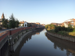
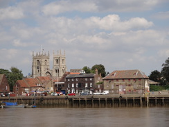
I decided against taking the trail's route through the town, and instead headed to the place I had left the trail on the last walk a little to the north. I needed the toilet, and the ones at the bus station were not to open for some time, and a supermarket I passed would also not open for a while – the lack of toilets is becoming an increasing problem as I get older, although only early in the morning. Instead I walked to to join the trail and followed it past what has to be one of the meanest childrens' play area I've seen: a single set of swings on a patch of grass beside some pallisade fencing. Soon afterwards the trail met the western bank of the river Nene, and I started following it northwards.
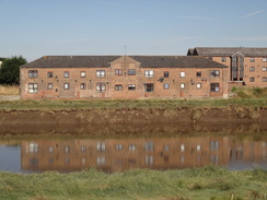
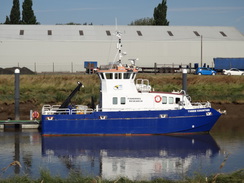
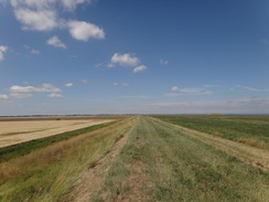
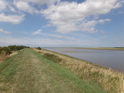
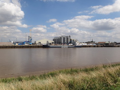
Wharfs and industrial areas of the town could be seen across the river, showing that it was still – just – a working port. The buildings and stores seen ended, and I started along a floodbank that I would follow for many miles. As usual for the Fens, there were wide vistas, if slightly spoiled by haze, and the low-cut grass on the banks was easy to walk along. I saw one other person; a woman walking in the opposite direction, and she soon disappeared behind me. My back was already wet with sweat before seven, and I started to worry that I might not have enough water with me.
A narrow band of grass sat at the base of the bank, and only the words 'disused railway' showed that this once carried the Wisbech to Sutton Bridge railway, which opened in 1866 and was an early closure in 1959 – like many of the lines in the area, before Beeching and his axe. I could see no obvious signs that it was once a railway, the six decades since closure having thoroughly cleansed it of railway remains.
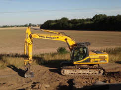
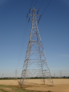
A digger became visible further on, sitting on the old railway line. Rolls of flexible metal netting had been rolled over the embankment for a hundred metres; it was obviously meant to strengthen the bank, but I have no idea what for – perhaps to protect the bank from machinery movements? Shortly afterwards there were three sets of power lines over the river, the pylons on either side very tall to provide enough clearance. After this came the oddly-named village of Foul Anchor, which had a series of information boards that were sadly hard to read. Apparently the odd name of the village came from the fact that swift currents in the area would frequently dislodge, or foul, anchors. It is a slightly unfortunate name, as whilst it is not a beautiful place, it is certainly not foul.
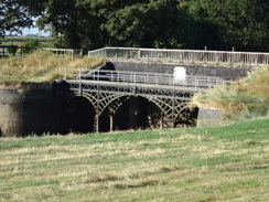
Here the trail joined a road, which led to a bridge over the Telford-designed drainage river called the North Level Main Drain. On the map this was marked as a 'footbridge', although it showed a road. The reason became clear as I approached: an exquisite triple-arched footbridge sits beside and below the road bridge, in front of some lock gates that look as if they have not opened for some time. The cast-iron bridge certainly looks like something Telford would have designed, although it's not a place I'd have expected to find some of his work.
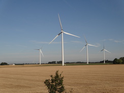
The trail then joined a road that ran along the top of a floodbank. Two things were of note: a large windfarm, and a sign saying: “Please dip headlights when ship approaching". This seemed an odd sign, and a reminder that Wisbech is still a working port. It's hard to believe nowadays, with flat, productive fields surrounding the river but, according to legend, there might be treasure in this area. King John travelled from Bishop's Lynn (now King's Lynn) to Spalding in 1216 across the marshes, and famously lost his crown jewels to the water. Land reclamation has diminished the Wash, and whilst it is tempting to think of buried treasure, what they thought of as treasure back there – e.g. dyed fabrics – might not be seen as such nowadays, even if they survived.
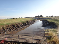
The road walk was long and fairly uninteresting, and sadly at a busy time of day as people headed to work, meaning I frequently had to step onto the verge. It crossed the South Holland Bridge over the South Holland Main Drain, where an empty hearse was parked up and soon afterwards led me to Sutton Bridge.
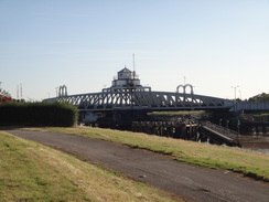
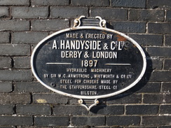
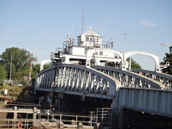
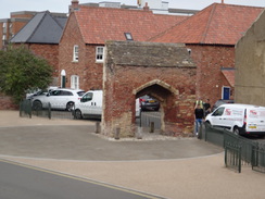
This took me past Sutton Bridge's eponymous bridge, a marvelous structure called 'Crosskeys Bridge' that can swivel to allow river traffic upstream towards Wisbech – something it only does a handful of times a week nowadays, and which I have never seen. The current bridge is the third on the site, and was built in 1897 to carry both road and rail traffic across the river. It was built by the Handyside Company of my native Derby with machinery from Armstrong-Whitworth – the latter man is a hero of mine, so it is an 'interesting' bridge for me. Since the railway's closure in 1965 both sides of the bridge have been used by road traffic, but it has left behind it an interesting and still-useful structure.
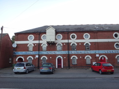
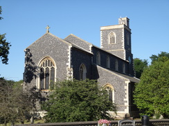
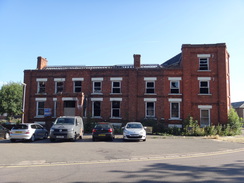
The same cannot be said for the adjacent Bridge Hotel. I remember this from my coastal walk as a slightly run-down establishment, but it was now little more than an empty shell. It had burnt down almost exactly two years ago, and its somewhat sad appearance added nothing to the village. It was very hot, and so I decided to nip into the village to see if I could buy more water, just in case. Fortunately there turned out to be a shop beside the church, and I bought another litre of water and a bottle of orange juice, of which the latter disappeared immediately. According to one website, Geoff Capes, twice the World's Strongest Man, was from Sutton Bridge, and in the heat I felt like I needed his strength to finish the walk.
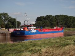
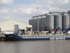
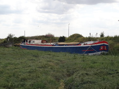
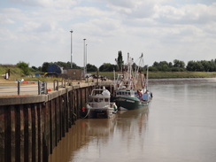
I had now completed the Nene Way, as I had walked the stretch north of here a couple of times before, including on my coastal walk. Ships were moored on the other side of the river at Port Sutton Bridge; a relatively new establishment opened in 1987 that has taken much of the traffic from Wisbech. A few years back I had come here on a Sunday afternoon to find the road lined with parked cars as people – including us – came to see the Sutton Bridge Dock; this opened in 1881 but was highly unsuccessful as the dock sides almost immediately collapsed. The dock soon became disused and is now a golf course. This did not mean the end of shipping in the village however, and two ships were moored at a riverside wharf, with coils of steel were being offloaded from one.
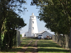
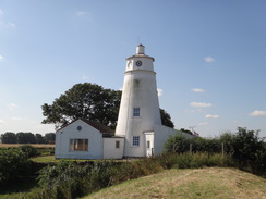
The road was quiet as I followed the river northwards; soon white pepperpot lighthouses became visible, one on ether side of the river ahead. These were built in 1830 and although called 'light' houses, they never housed lights and were really daymarks. They were mainly used as customs houses; in 1933 Peter Scott, son of the famous Captain Scott of the Antarctic, moved in and started his career as naturalist. The houses once stood at the mouth of the man-made river; with the eastern one on the end of a long bank separating the river from the sands to the east. Over time the sands had been reclaimed and the river pushed further out into the Wash, leaving the houses some distance away from the sea. Scott's work was so important that some claim the lighthouse is the most important building in the history of global conservation.
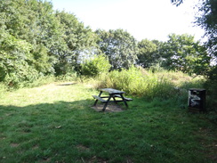
The lighthouse also marks the end of the Nene Way. There is a car park and picnic area in the lighthouse's shadow, and I descended to a picnic bench to eat some sandwiches. The area was gloriously shaded by trees, and I picked little bits of straw off my socks as I cooled down. Eventually I could delay no longer, and I headed off back to the road, which soon ended at the lighthouse. The path descended past the light, and then climbed back up onto the foodbank. The map showed a series of sea banks to my right: one of 1910, one of 1917, 1925, and an undated one, as the country's voracious need for food caused the marshland to be reclaimed from the sea.
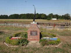
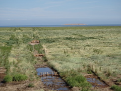
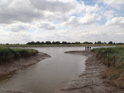
Soon the true mouth of the Nene was a reached, and the bank turned to take a more easterly course. Out to sea to my left was the Outer Trial Bank, a circular island made in 1975 as part of a feasibility study into turning the Wash into a freshwater storage reservoir. A bird of prey hovered over the marshes, gazing downwards for prey. It was a magnificent sight, and not for the first time I was annoyed I can not tell my Buzzard from my Budgerigar.
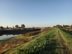
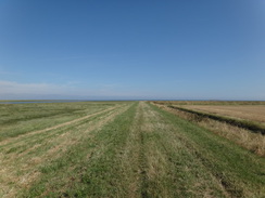
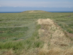
The sun bore mercilessly down on me as I followed the floodbank eastwards. The going was easy and the walk should have been pleasant, but the heat sucked every ounce of enjoyment out of it. A distant stick-figure of a man was half a mile or so ahead of me, and I gave up hope of catching him as we approached the second of the 1970s trial banks; this one is reachable via a causeway, as I did on a previous walk along here. By this time the man had stopped in a nearby field and was staring inland through some binoculars. I passed him and approached the causey that leads to the island. However since it was already going to be a long day, and the tide was high, I decided against going out to it, and instead plodded on along the bank. Behind me, I could see the man start trudging across the marshes towards the island.
A vehicle stood on the floodbank in front of double gates with Environment Agency branding, and a man was repairing the adjacent fence and stile. I crossed this, but the floodbank on the other side had not been mown and I had to wade through deep grass and weeds. It was exceptionally unpleasant in the heat, and my lower legs were soon black from dirt and grass debris. My water was also running low, as he heat was forcing me to drink much more than usual. Eventually I reached another pair of double gates, after which the grass had thankfully been cut. I stopped beside the gate; there was no shade, but thankfully the clouds had started to gather, granting me momentary respite from the sun. I stopped, sat down on the short grass and took off my boots. My socks were covered in straw and debris, and after scoffing the remainder of my sandwiches I spent a few idle minutes trying to clear them.
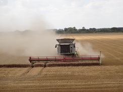
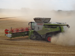
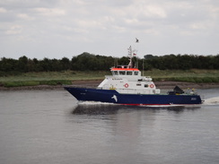
It was boiling hot as I restarted, and the air was almost too warm to breathe. A cloud of dust ahead showed where a large combine harvester was clearing a large field. It was heading up the field towards me as I passed, and I paused to take some photographs and suck up the last of my water. The floodbank approached the outfall of the Great Ouse, and I watched a couple of boats come past as I strode south beside the river. The path passed under another massive electricity pylon, and continued past a couple of wind turbines on the far bank. I was not too interested in any of this as I was only interested in getting more water, and I knew there was a shop in the next village, West Lynn.
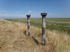
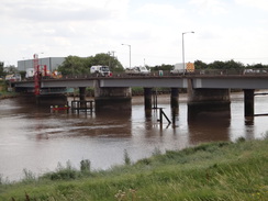
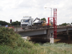
A ferry runs from West Lynn across the river to King's Lynn, but I decided to do the short walk downstream to the bridge instead. The shop was open, and a kind lady chatted to me as I bought several bottles of liquid and an ice lolly. I tried to drink these slowly as I headed through the village and rejoined the floodbank to walk south to the Free Bridge, the first bridge over the river. This was under repair, and an inspection platform stretched from a vehicle underneath it. Metal pillars on the other side of the bridge were from an old railway bridge, on the same route as the Cross Keys Bridge I had crossed earlier.
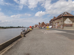
It was then simply a case of following the river north, using the same route I had taken on completing the Ouse Valley Way a few months earlier. If anything it was now hotter, and I could only concentrate on completing the walk. I normally love King's Lynn's waterfront, but I put my head down and walked past the Customs House and on to the bus station. Annoyingly a bus back to Wisbech had departed a few seconds earlier, and so I walked on to the railway station before heading back to the bus station. I went into the toilets to splash water on my face, and then tried to find a shaded area to rest whilst I waited for the bus. As I did so a young man, obviously high on some substance, tried to get in through the doorway and repeatedly missed, hitting first one side and then the other. It was a tragic but comedic sight.
This should have been a lovely walk, but the oppressive heat somewhat spoilt it. However I can see myself walking the sea banks between Sutton Bridge and King's Lynn again in the future – it is a lovely, if flat, stroll.
 |
 |
|
Directions
This walk starts off at the Horseferry bus station in Wisbech at TF46260981. Leave the bus station and walk past the car park on the right; when the car park ends after a few metres, cross a pedestrian crossing ahead and then turn right, to follow Horse Fair on the right until it ends at a roundabout. Turn left, cross the B198 Nene Quay road leading off the roundabout, and thead on to reach the Freedom Bridge over the River Nene. Use a pedestrian crossing to cross to the northern side of the road, and then turn left to cross the bridge. On the other side, follow the road as it swings to the right, becoming the A1101 Leverington Road that initially follows the river on the right. The road soon swings left and then right away from the river, and passes an Asda store on the other side of the road, after which the road curves to the left. 600 metres after the bridge, the Nene Way comes in past cycle barriers on the other side of the road at TF45731037.
Continue along the road for another 100 metres until just past the West End restaurant, and then turn right into the restaurant's car park. Head straight on across the car park and then an area of gravel, and squeeze past a fence to enter a narrow area of grass, with a palisade fence to the left. Cross the grass lengthways, and at the far end go through a gap between fence and a hedge to emerge out onto West Parade beside the Nene. Turn left along the road (there is a pavement on the left), and as it curves to the left after 350 metres, turn right to go past a squeeze-style to join a path that runs along the top of a flood bank. Continue along the top of the flood bank, going through any gates you reach. The path passes under some power lines, and after 4.3 miles joins with Front Road in Foul Anchor at TF46591773.
Continue on north along the road, still with the river on the right. After nearly a third of a mile the road curves to the left to reach a bridge and sluice over a channel, with a cast-iron footbridge immediately in front of it. Cross either the road bridge or the footbridge, to reach a triangular road junction. Take the right-hand branch that meets another road; turn right along this; it soon curves to the left to run alongside the river on the right. After 1.3 miles South Holland Bridge over a drainage channel is reached; cross this, and on the other side climb up onto the top of the floodbank on the left and follow a path that runs along the top (alternatively, the road can be followed with care). After another half-mile the road approaches a roundabout with the A17(T) immediately to the south of Sutton Bridge at TF47982073.
Just before the roundabout is reached, the road climbs up to meet the top of the floodbank. Turn right to carefully cross the road, and continue straight on along a ribbon of tarmac (part of an old road) alongside the river. This soon curves left and ends at the A17(T); turn right along it for a few metres to a roundabout. Carefully cross the road ahead, with a bridge away to the right, to reach its northern side in Sutton Bridge.
Here, I left the Nene Way for a short distance to visit the nearest shop in the village; I turned left and then right to join a path that heads past trees for a few metres before ending at Bridge Road, with (in 2018) the remains of the Bridge Hotel on the right. Turn left along Bridge Road and follow it west-northwestwards through Sutton Bridge until a Co-Op store is reached on the left immediately before the church. Then return to the roundabout in front of the bridge.
Once there, cross the bridge using the pavement on the northern, downstream, side. Immediately on the eastern side of the bridge, turn left along a surfaced path that crosses a short area of grass, ending after a few metres at a road called East Bank. Continue along the road, with the river immediately to the left, for 2.8 miles until the East Bank car park and picnic area is reached on the right at TF49282553, where the Nene Way ends.
Continue along the road for a short distance from the car park's entrance to reach a lighthouse. At this point turn left through a bridleway gate and descend some steps to enter a field. Turn right to skirt a hedge guarding the lighthouse grounds. Once the hedge on the right ends, turn right to climb back up onto the top of the sea bank and follow it as it heads northwards, going through any gates you come across. 0.6 miles after the lighthouse the bank turns sharply to the right to head in an easterly direction. Continue along it as it skirts the edge of some marshland.
The bank twists and turns whilst maintaining a rough easterly direction, passing a little parking area, which is unmarked on the map, on the fens to the right. This car park is connected by a track to the smaller of the two islands on the Breast Sands – the Inner Trial Bank, but I have no idea if the car park is usable by the general public.
Pass the parking area and continue on. After a while the sea bank starts to curve to a more south easterly direction, passing a farm shed on the right and 6.3 miles after the lighthouse, it reaches Admiralty Point at TF57962555. where it starts to meet the mouth of the River Great Ouse. Presumably Admiralty Point was once at the edge of the sea, but another sea bank has landlocked it.
Continue on southeastwards for 1.5 miles until the bank meets another bank at a T-junction at TF59582385. At this junction turn left and follow the bank as it heads in a more southerly direction along a footpath. The path crosses a stile beside a field gate and soon afterwards it curves right to run alongside the western bank of the Great Ouse. Go through a clappergate and walk alongside a hedge on the left that prevents views of the river to the left. At the end of this field, go through a broad gap in a hedgerow ahead into a long field.
Pass by a large electricity pylon and continue on; at the end of the field (0.8 miles after the pylon) go through another broad gap ahead and head on to a clapper gate. Go through this and continue on until the path ends at a fence across the top of the bank in West Lynn. At this point drop down to the right onto an unsurfaced road and follow this around as it curves to the right. After a short distance it meets a road called Ferry Square; turn right up this until it ends at a T-junction with St Peter's Road.
Turn left along this road and follow it as it heads southwards through West Lynn. After nearly half a mile the church is passed on the right, head on along a lay-by on the left, and climb up a small bank on the left. This drops down; squeeze between a children's play area and a brick building to enter a playing field. Head diagonally across this, aiming for the flood bank ahead at TF61471954. Climb the bank turn right and follow a footpath along the top of it southwards to Free Bridge over the river Great Ouse. Just before the bridge after half a mile, take a right-hand fork off the floodbank along a track to a gate that leads onto the road at TF61131864.
Turn left to cross the bridge. On the other side, turn left past a cycle barrier and continue on northeastwards along the cycle path for 0.6 miles until the bank and path curve sharply to the right to reach a road bridge over the mouth of the River Nar at TF61801932.
Turn left to join the cyclepath across the bridge, and on the other side turn left to join a footpath that runs along the top of a bank, with a reed-strewn old channel to the left. The bank ends, and is replaced with a low concrete flood barrier on the right that soon curves to the left, passing an old vehicle barrier. When the wall curves sharply to the right, continue straight on for about twenty metres, crossing a track to reach Boal's Quay at TF61691956.
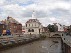
Turn right along the quay for a few metres, and just before it ends, cross a small strip of grass to reach a road bridge over an inlet. Cross the bridge and join the quayside; head north for a third of a mile until a little footbridge over an inlet on the right is reached at TF61562001, with the Custom House off to the right.
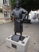
Cross the footbridge and turn right towards the Custom House, passing the statue of George Vancouver and the Custom House itself to reach King Street. Cross this and head on up Purfleet Street. When this curves to the left, continue straight on along a pedestrianised street. This crosses another pedestrianised street and curves to the right. Take the first path off to the left after the bend, which curves to the right to reach King's Lynn bus station.
Turn right to pass the station on the left and King's Lynn museum on the right to reach Old Market Street. Turn left along Old Market Street; when it soon ends at a T-junction, cross the road and head straight on up Waterloo Street. This ends at a T-junction with Backfriars Road; cross the road ahead using the pedestrian crossing to reach King's Lynn railway station at TF62342009.
 |
 |
|
Distances
| From | To | Distance (m) | Ascent (ft) | Descent (ft) |
|---|---|---|---|---|
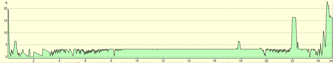
| Wisbech | Sutton Bridge | 8.0 | 12 | 10 |
| Sutton Bridge | Lighthouse car park | 3.4 | 10 | 18 |
| Lighthouse car park | West Lynn | 10.7 | 20 | 24 |
| West Lynn | King's Lynn | 3.0 | 20 | 23 |
This makes a total distance of 25.1 miles, with 62 feet of ascent and 75 feet of descent.
For more information on profiles, ascents and descents, see this page
Transport
Two bus services run regularly between King's Lynn and Wisbech:
- The First Group Norwich to Peterborough service runs half-hourly busses between King's lynn and Wisbech; hourly services run on a Sunday.
- The Lynx #46 service runs hourly through the day during the week, and every two hours on Saturdays. There are no Sunday services.
In addition, for those wanting a shorter walk, the Interconnect 505 service runs between King's Lynn and Sutton Bridge.
 |
 |
|
 |
 |
|
 |
 |
|
 |
 |
|
 |
 |
|
 |
 |
|
 |
 |
|
 |
 |
|
 |
 |
|
 |
 |
|
 |
 |
|
 |
 |
|
 |
 |
|
 |
 |
|
 |
 |
|
 |
 |
|
 |
 |
|
 |
Disclaimer
Please note that I take no responsibility for anything that may happen when following these directions. If you intend to follow this route, then please use the relevant maps and check the route out before you go out. As always when walking, use common sense and you should be fine.
If you find any information on any of these routes that is inaccurate, or you wish to add anything, then please email me.
All images on this site are © of the author. Any reproduction, retransmissions, or republication of all or part of any document found on this site is expressly prohibited, unless the author has explicitly granted its prior written consent to so reproduce, retransmit, or republish the material. All other rights reserved.
Although this site includes links providing convenient direct access to other Internet sites, I do not endorse, approve, certify or make warranties or representations as to the accuracy of the information on these sites.
And finally, enjoy your walking!
Nearby walks
| # | Title | Walk length (miles) |
|---|---|---|
| 4 | Downham Market to Watlington | 6.2 |
| 28 | Kings Lynn to Watlington | 7.4 |
| 156 | Kings Lynn to Snettisham | 14.6 |
|
|

|