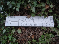
Walk #1031: London Loop: Loughton to Rainham
 |
 |
|
General Data
| Date Walked | 05/01/2019 |
| County | London, Essex |
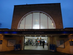
| Start Location | Loughton station |
| End Location | Rainham station |
| Start time | 07.55 |
| End time | 16.17 |
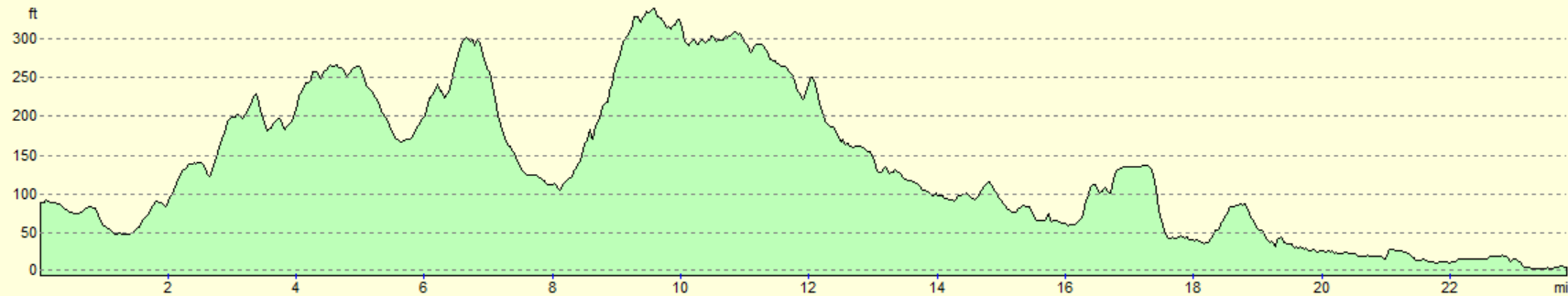
| Distance | 23.7 miles |
| Description | This was a pleasant stroll following the London Loop around the northeastern London, with a surprising amount of wildlife to be seen in the countryside. |
| Pack | Today I carried my 30-litre Karrimor rucksack, filled with water, my spare waterproofs, a book and other odds and ends. |
| Condition | I feel absolutely fine after this walk. |
| Weather | Today was a cold and grey day, and the sun never decided to make an appearance. There was also a quite chilly breeze when fully exposed to it. |
| OS map | Landranger number 177 (East London, Billericay & Gravesend) |
 |
 |
|
Map of the walk
Maps courtesy of Google Maps. Route for indicative purposes only, and may have been plotted after the walk. Please let me have comments on what you think of this new format. For a detailed table of timings for this walk, please see the table file.
 |
 |
|
Notes
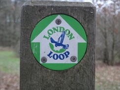
Today I decided to do another stroll along the London Loop; I had really enjoyed the stretch I did earlier in the week, and was keen to get on with another. I drove down to Loughton station, pulled on my gear, and set off just as dawn was breaking, knowing there would not be much to photograph before I reached the point I'd left the trail on the previous walk.
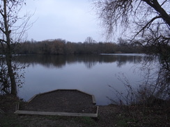
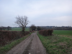
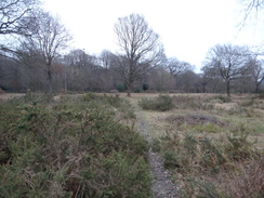
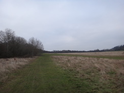
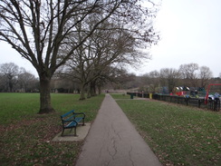
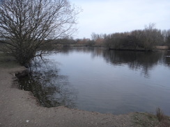
A path led across a recreation ground towards a lake – which was apparently dug to provide gravel for construction of the M11. The path followed two sides of the lake, before heading uphill to join an access road and then a road that crossed the motorway. This road led into Chigwell; the guidebook stated that there were some good views over the Roding Valley, but all I got to see was haze.
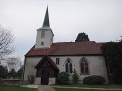
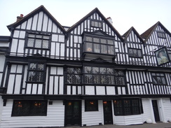
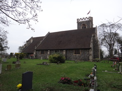
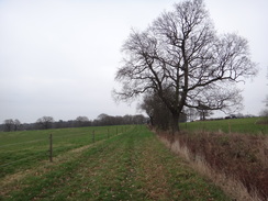
Another road headed through Chigwell towards a rather pleasant church and a pub whose core appeared ancient, and whose modern additions appeared in character. Paths and tracks then headed east across farmland, and only the M25's low rumble told me we were within London. A house near Chigwell Row had a large, well-kept garden, with a hedge made from gigantic conifers. A fox – seeming as large as a dog – ran out from the hedge and trotted past me, seemingly uncaring of my presence.
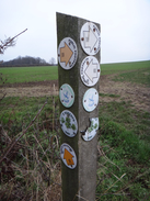
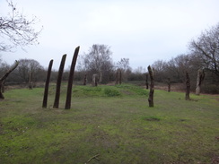
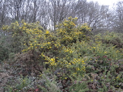
The path flirted with Chigwell Road, before crossing a recreation ground to reach a main road. I crossed this to reach Hainault Forest Country Park, where the London Loop joins the Three Forests Way for a period, the two splitting and joining regularly as they take different routes through the park. The London Loop descended past a curious glade that was filled with a circle of wooden poles, each one carved with a different animal. It felt a slightly eerie place, and I sought reality at a lake at the bottom of the hill.
After this the trail burst into an open area of the park. Lots of people were walking around as the trail stuck to the edge of the treeline, before climbing steeply uphill through the trees. Sadly the trees blocked any views, and just before the top a stile led off into a golf course. I checked that no-one was teeing off and stepped onto the grass.
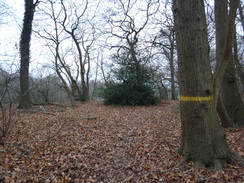
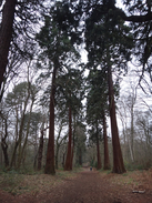
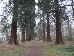
The path then entered a band of woodland that headed downhill between two parts of the golf course, yellow blazes on the trees guiding me down. It then left the trees to cross another section of the course, and then crossed fields past a very horsey and rather down-at-heel farm. A path had been badly churned up by horses, but this soon improved as I entered Havering Country Park. Unfortunately I entered it at the wrong place, and instead of following the avenue I went for a winding yet interesting stroll through the trees. Eventually I got back on the correct route and started passing through an avenue of 100 massive giant redwoods. All were magnificent, but none had trunks large enough to drive a car through – at least, unless it is a Little Tykes!
It was another location that, although pleasant in winter, must be fairly spectacular at another time of the year – perhaps with a carpet of wildflowers in spring, or with yellowing leaves in early autumn. I was still glad of the walk, and the avenue of massive trees led out past a horse riding centre. It was a welcome surprise to find a burger van outside the centre, and I waited for a few minutes for a bacon and egg baguette.
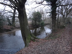
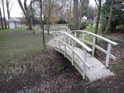
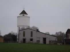
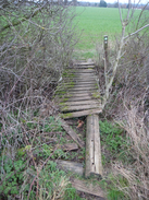
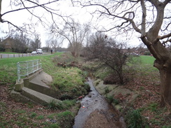
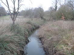
I munched this as I passed the church to enter the oddly-named village of Havering-atte-Bower. This seemed pleasant enough, but the trail soon left the village to head east across fields, initially passing near a water tower with a conical roof before entering a more remote area. One footbridge over a ditch was decidedly rotten, and I guess will not see many more winters before collapsing. The trail eventually reached a road on the northern outskirts of Harold Hill, and I said goodbye to countryside for the day. But not greenery, as the trail soon joined a stream that it would follow for the rest of the day along a green corridor through suburban East London.
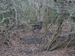
But not before I made a glorious mistake. The mistake was to follow a fingerpost over to the eastern side of the stream; it was glorious because this allowed me to come across a herd of wild deer. One deer had large antlers, and its smaller companions stared at me before darting off into the trees that surrounded the stream. The large male waited until the last minute before entering the trees. It then stood staring out at me, as if daring me to follow. It was a magnificent encounter, and all the more so for having occurred within sight of suburban houses.
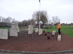
I crossed the stream and continued following it south past Central Park – not the one in New York, but a rather pleasant recreation park in Harold Hill. This even had a parkour area, and two men were practising jumping from concrete walls and metal bars. A good path continued on alongside the stream, eventually reaching the A12, which proved easier to cross than I feared due to a wide central reservation. Roads led on towards Harold Hill station, where flowers and tributes had been left outside a pub in memory of a young boy who died last year.
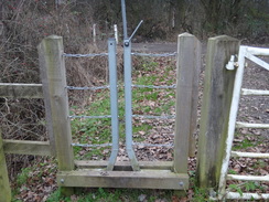
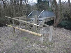
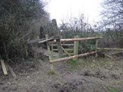
Roads led a short distance out of the town into yet another country park, still following the stream. This park was relatively new and still seemed a little sterile, and there was not much of interest. I soon found myself at a car park and road, which led down to a bridge over the A127 Southend Road. The road continued south into the outskirts of Cranham, before taking a road and then path that descended back down to a footbridge over the stream. A gate on the other side of the footbridge had been blocked by two horizontal planks that I had to clamber over to reach the path. The gate leading out of the field on the other side had suffered a similar treatment, except with the added indignity of a fingerpost that had been taken down and placed across it!
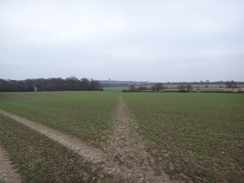
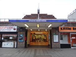
Fortunately this was the only problem as the path passed more fields, before climbing up and skirting housing in Hornchurch. Local roads then led onto Upminster Bridge tube station. I had intended to leave the trail here and walk along to Upminster station. However there was still ninety minutes of daylight left, and I had only done 19 miles, so I decided to press on.
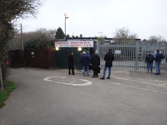
The trail passed a football ground, with the turnstiles manned and busy with people queing for a match. After this a surfaced path led on beside the stream, and a couple were running after their young son who was evidently learning to ride a bike – and given the speed they were running, he was evidently learning fast. The next couple of miles were straightforward but also fairly boring.
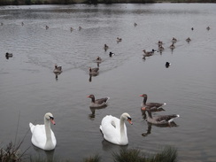
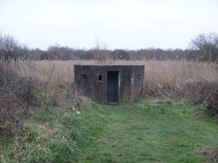
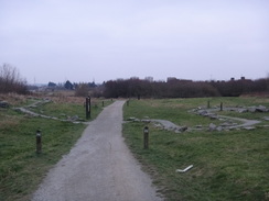
Things improved when the path entered Hornchurch Country Park, passing a memorial to RAF Hornchurch – much of which is now a series of lakes after gravel extraction. A large visitors' centre was busy still selling coffee and cakes, and the paths were bustling with people despite the approaching dusk. Three old pillboxes – one partially buried – were the only signs of the old RAF base, and they now guarded nothing but paths and lakes. The skies were getting gloomier as the trail passed a smaller ornamental lake to join a track that led towards a farm.
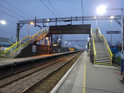
Here the trail is shown in the guidebook as continuing towards South Hornchurch, but waymarkers pointed down a new path that climbed over reclaimed land before joining a road in Rainham. I realised I had about half an hour before the next train, and so I pressed on, crossing a busy road at a roundabout and passing a supermarket before reaching Rainham station.
I had to change trains twice to get back to Loughton; firstly, a C2C train took me to West Ham, where I changed to the Jubilee Line for one stop to Stratford. I then had a couple of minutes' wait for the next Central Line train to Loughton. I arrived at my car feeling very happy and not in the least tired after what had been an interesting and enjoyable stroll – not something you necessarily expect to say about a walk in London.
 |
 |
|
Directions
This walk starts off at the main entrance to Loughton station at TQ42309564. At the entrance, turn right across the forecourt, aiming for a little square-topped entrance way through a brick wall. Pass under this, and follow a surfaced path as it turns right and then left, before ending at Roding Road. Turn right along the road, immediately passing under a railway bridge, and after 450 metres a crossroads is reached. Turn right to follow Valley Hill southwestwards; after 450 metres at TQ42249473 a short stub road comes in from the right, immediately before some shops on the right.
Here the London Loop is joined. Just before the shops, turn left along a surfaced path that heads southeastwards across a narrow grassy strip. It crosses Greensted Road and emerges out onto a recreation ground; follow a hedge on the right until a lake is reached ahead. Turn right to follow a path beside the lake on the left; continue along the path as it turns left to pass the end of the lake. When the lake curves away left, follow the path as it curves right and then left to reach a footbridge over the River Roding at TQ42689421.
Immediately on the other side of the bridge, turn left to start following the river on the left past trees. When the path emerges from the trees after 250 metres, go through a clappergate and turn right uphill, with a grassy area to the left and the trees on the right. When a gravel path is reached, turn right to follow it past the trees; it emerges out through a vehicle barrier into a car park. Head through the car park to its exit, and then turn left to join its access road. The road soon curves right to head southwestwards, with the M11 out of sight (not bot out of earshot) in a cutting to the left. This access road then ends at a T-junction with the B170 Roding Road at TQ42979394.
Turn left along the B170, immediately crossing the M11 on a bridge. The road heads southeastwards before curving to take a more easterly course as it enters Chigwell. After 1km it ends at a roundabout with the A113 High Road. Turn left up to head northeastwards up the A113; after about 500 metres it passes a church on the left and the Ye Olde Kings Head on the right. Continue a short distance beyond the pub until a traffic-light controlled pedestrian crossing is reached at TQ44159381.
If not already on the right-hand side of the road, cross over to it, and take a path ahead that follows a fence on the right to a clappergate that leads into a field. Continue straight on eastwards across the field towards trees ahead. The path emerges out through a second clappergate beside a field gate onto Vicarage Lane at TQ44359383.
Turn right down the lane for a few metres, and then turn left to enter an area of scrubland. Turn right along an obvious path that crosses the scrubland. This emerges out into a field; turn left along the edge of the field, and then follow the scrubland as it curves right to reach a gap in a hedge ahead. This emerges out into a field; turn left along the field boundary, keeping the field to the right and a school in the distance to the left. The path becomes a grassy track as it approaches a farm to reach a track in front of Old Farm at TQ44679395.
Turn right past a vehicle barrier to follow the track downhill southeastwards. After 250 metres turn left up another track that runs between hedges. As this track veers left after another 250 metres, turn right through a gap in the hedge on the right to enter a field. Follow a hedge on the left southeastwards; at the bottom corner go through a gap in the hedge ahead to enter a second field. Continue following the hedge on the left up a slope; when the hedge ends, continue along the track for another ten metres until it too ends. Angle half-left diagonally across a third field, aiming for a hedge and palisade fencing ahead at TQ45569357.
When the hedge is reached, go through a gap and turn right to follow the palisade fencing. The fencing ends by a gate leading into a water works; continue straight on along the access driveway. After about ten metres, turn left off the concrete path that parallels more fencing off to the left. After another 130 metres turn right over a stile into a little field. Follow a hedge on the left southwards; at the end of the field, go through a field gate into a garden. Follow the edge of the garden on the left to a stile. Cross this and follow the path as it curves right and then left beside metal fencing. Continue along the path after the fencing ends; it emerges out onto a gravel lane that leads out onto the B173 in Chigwell Row at TQ46009310.
Turn left along the road for about 70 metres, and then carefully cross the road and turn right through a clappergate into a recreation ground. Follow a broad concrete path, passing a basketball court and tennis courts on the left. At a path junction, take the right-hand branch to head towards the treeline ahead. It passes a children's play area on the left, and once the trees are reached swings left to run alongside the trees on the right towards a church in the distance. When the path ends, continue alongside the trees on the right as they curve right. The recreation ground narrows; as it ends, continue alongside a hedge on the left, with the A1112 on the other side of the hedge. Parallel the main road; just before buildings are reached ahead, turn left through a clappergate to join the A1112 at TQ46629304.
Carefully cross the main road, and on the other side go through a gap into Hainault Forest. Take the middle of three paths that leads to a clappergate through a fence. Go through this and follow the path as it curves right beside the fence for a metres before angling left. It soon enters some woodland and continues on to a clappergate beside a field gate. Go through this and continue down the path for a short distance to reach a rough track. Turn left along the track, and then after a couple of metres turn right along another path that passes a field gate and heads on along a track between trees. When it forks, take the left-hand branch that leads down to a lake at TQ47299274.
Turn left along the path beside the lake, with the water on the right. After 150 metres the path curves left away from the lake; shortly afterwards turn right along a broad track into open grassland, and them immediately turn left to follow the edge of some woodland on the left, with the grassland sweeping away to the right. The woodland's edge heads in a rough northerly direction, before curving right and starting to descend slightly. After about 850 metres turn left to enter the woodland at TQ47979330.
Follow a path along through the trees; after about thirty metres the path enters a little clearing. When the main path turns left, turn right to head straight on along a minor path for about twenty metres to a gap in a hedge that leads out onto a good path. Turn left to follow the path northwards uphill between hedges, with a golf course on the right. After 370 metres, and near the top of the hill, turn right past a broken stile at TQ48039371 to enter the golf course.
Head directly east across the golf course, taking care of any players. Aim for a band of trees about fifty metres ahead; skirt a bunch of trees on the right, and when the band of trees is reached, cross a gravel path in front of these to enter the trees. After a few metres, turn right to follow a path downhill through the trees – yellow blazes on the trees show the correct route. The band of trees is narrow, and bisects the golf course. After about 350 metres it meets a larger track; cross this track and continue on along a rough path through the trees that emerges out onto another part of the golf course. Keep a bunker to the right, and pass some trees on the left to reach the far hedge. Turn left along the hedge on the right for about twenty metres, before angling right to a stile that leads into a field at TQ48599333.
Angle left diagonally across this field, heading towards a tower block on a hillside in the distance. When the hedge at the bottom is reached, turn right through a gap in the hedge and cross a farm bridge over a ditch into a second field. Immediately turn left to follow the overgrown ditch on the left in a rough southerly direction. When the corner of this field is reached after 350 metres, go through a gap in the hedge ahead into a third field, and then immediately turn left to follow a ditch on the left eastwards. After 450 metres go through a stile beside a field gate to join a track at TQ49399287.
Turn right to follow the track south; it passes a farm on the right and then a small patch of woodland on the left. After 200 metres a track leads away to the left; turn left and follow this eastwards. When it curves right, continue straight on along a narrow bridleway that runs between a hedge on the left and a fence on the right, with paddocks beyond the fence. After 400 metres this path ends at a junction with a track at TQ49999270.
Turn left to follow this track uphill northwards; after 200 metres turn right along a good track that heads eastwards into Havering Country Park. Follow this track as it heads directly eastwards, eventually running between an avenue of Giant Redwoods. After about 600 metres this leads to a field gate; go past this and head on along the track. Go past another field gate to join the end of a road, Wellington Avenue. Continue along this past a riding school on the left and a church on the right until it ends at the B175 road at TQ51239314 in Havering-atte-Bower.
Turn left to follow the road northwards, passing the Royal Oak pub on the left; after about 150 metres, turn right down a surfaced driveway. Just before a vehicle barrier is reached after a few metres, angle left to cross grass, joining a path that initially squeezes past a garage wall on the right. The path reaches a pedestrian gate beside a field gate; go through this into a field. Follow a ditch on the right; at the bottom of the slope, ignore a bridge leading off to the right across the ditch, and instead follow a ditch on the right up a slope straight ahead. Near the top the ditch and path curve right and then left to reach the corner of the field at TQ51699333.
Turn left to follow a rough track north downhill. 200 metres after the field comer, turn right to cross a rickety bridge over a ditch guarded by clappergates into a second field. Head directly across this field, aiming for the left-hand edge of some trees ahead. The path skirts the trees and enters a third field. It immediately curves left, passing a solitary tree on the left as it aims towards some woodland ahead. At the far side of the field, turn right to follow the edge of the woodland on the left. After about 150 metres turn left, still following the woodland off to the left and the field to the right. The path descends into a little dip before climbing up slightly. As you do so, veer right away from the trees to join a fence on the right. Shortly afterwards the fence curves right at TQ52389369.
Turn right to follow the fence on the right as it heads in a rough easterly direction; when the fence curves right after 250 metres, leave it and angle slightly right for a few metres to meet a green track. Turn right down the track, and follow it as it soon curves left to head unfenced between fields to meet the northern edge of the Tench Pond Plantation. Ignore a track leading off to the right, and instead follow the edge of the woodland on the right. At the corner of the field, turn left to follow a hedge on the right northwards. After 300 metres, and just before the hedge curves slightly left, a ramshackle footbridge over a ditch is reached at TQ53049404.
Turn right to cross the footbridge into another field, and then turn left to follow a hedge on the left. This slowly curves right, and when the corner of the field is reached after nearly 400 metres, head straight on to a stile that leads onto a road called Paternoster Row. Turn right to follow this road south; when some gates are approached ahead after about 300 metres, turn left over a stile and then angle right along a green lane that continues roughly southwards. The track climbs uphill, passing a fence on the right protecting a static caravan park. The track ends at a stile that leads onto Cummings Hall Lane. Turn left along this road; after 300 metres it ends at a T-junction with Noak Hill Road at TQ53719321.
Turn left to follow Noak Hill Road northeastwards, immediately passing The Bear pub on the left. When a roundabout is reached after 100 metres, turn right down Tees Drive, entering Harold Hill. Please note that the following directions are uncertain; the proper route is not clear on the ground. Alternatively just continue on down Tees Drive to Whitchurch Road. Turn left up Priory Road, immediately crossing Carter's Brook, and a few metres after the bridge turn right across a field, following the edge of some woodland on the right, with the brook down within the trees. At the southern end of the field, go through the trees, ford a tributary of the brook, and then ascend to meet Whitchurch Road. Turn right down the road for a short distance until a bridge over the brook is reached at TQ54069278
Just before the bridge, turn left along a surfaced path that heads south. It slowly curves left to meet Paine's Brook on the right; continue along the path to reach Dagnam Park Drive. Cross the road and turn left along it for a few metres to reach a gate on the right that leads into Central Park. Continue along the path on the other side, initially with a fence guarding a skatepark on the right. The path then curves right and then left to rejoin the brook on the right. Cross a circular path and continue on southwards, with the brook to the right. Go through a gateway into a car park, and go through its exit to reach Petersfield Avenue at TQ54539193.
Carefully cross the road, and on the other side continue along a surfaced path, with the brook on the right. After 570 metres it reaches St Neot's Road; cross this and continue along the path until it ends at the A12 Colchester Road. Very carefully cross the dual carriageway; there is fortunately a large central reservation. On the other side, rejoin the surfaced path, with the brook some distance away to the right. This eventually passes a children's play park on the right, and 300 metres after the A12, it goes past a vehicle barrier to reach Church Road at TQ55289116.
Turn right down Church Road; after 250 metres turn left down Queens Park Road. when some gates are reached ahead, turn right past bollards to continue along Queens Park Road. When this road ends at Station Road, turn left to follow the road along, with the railway line off to the left. It passes Harold Wood station, and ends at a T-junction with Gubbins Lane at TQ54759060.
Turn left to cross the railway line on a bridge, and on the other side take the first road off to the left, Oak Road, which parallels the railway line behind houses to the left. This becomes Fitzilian Avenue; after 280 metres turn right down the unsurfaced Archibald Road. Pass a vehicle barrier and continue along the road until it ends at Squirrels Heath Road at TQ55129032.
Turn right along this road, and then take the first road off to the left, Brinsmead Road. At its end, go through a gap in a fence into Harold Wood Park. Immediately on the other side, turn right along a path; after ten metres and before a car park is reached, turn left down a surfaced path that passes tennis courts on the right. When the path meets a T-junction with another path, turn left down this path and follow it as it curves right to a footbridge over the Ingrebourne River at TQ55249007.
Cross the bridge, and when the path soon ends at a T-junction with an unsurfaced path, turn right to follow the track in a rough southerly direction, with the river off to the right. When a junction is reached with another path as it nears a power pylon after about 2km, turn left along this new track for a few metres, and then after twenty metres turn right along another path that heads under the power lines. Cross a bridge over a stream and head on along the path as it parallels the overhead power lines. The path starts to climb, with the power lines to the right. It then curves left; to join some woodland on the right. When the path forks, take the right-hand fork that heads to, and past, a car park on the left. Go through a wooden gate to reach Hall Lane at TQ56208932.
Carefully cross the road to reach the pavement on the other side, and turn right to follow the road south. Just before a junction with the A127 is reached ahead, follow the pavement as it curves left to join another road that sweeps right to cross the A127 on a bridge. Continue south along the road on the other side; shortly after a vets on the left, turn left down an access road that curves right to parallel the main road to the right. Continue on down this access road until it ends at a junction with Avon Road in Cranham. Turn right along Avon Road for a few metres to reach a roundabout at TQ56508813.
Carefully cross the roundabout ahead, and turn left for a few metres before turning right to head west down River Drive. This passes houses on both sides, and when it ends, go through a gap in a fence ahead to enter some woodland. The path continues west downhill, eventually reaching a footbridge over the Ingrebourne River. Cross the bridge and then a stile to enter a field; turn left across this field, initially passing some trees on the left before cutting across the field for a short distance to reach a gate and a footbridge over a ditch at TQ55878799.
Go through these, and follow the path between a hedge on the left and a fence on the right, with school playing fields beyond the fence. At the corner of this second field, head straight on into a third field, and then turn left for a few metres to reach the field's corner, where it swings right. Continue alongside a hedge on the left, with a golf course beyond. At the end of this field go through a gap in a hedge ahead into a fourth field. At the far end of this field, turn right to follow a hedge on the left uphill away from the golf course. At the top, cross a footbridge across a ditch in a hedge into a fifth field, and then turn left to follow a hedge on the left. When the field's corner is soon reached, turn right to continue uphill, with houses away to the left. Just before the top corner of this field is reached, turn left along a path that runs between fences and emerges out onto a bend in a road at TQ55058738.
Turn right to head straight on along this road; it soon ends at a T-junction with Wingletye Lane. Turn left down the road; it crosses a railway line on a bridge, and then take the first road off to the left, Minster Way. This passes houses before curving right to end at Upminster Road opposite Upminster Road tube station at TQ55068682.
Cross Upminster Road, and turn left to pass in front of the tube station. Follow the road as it heads east under a railway bridge, and then take the third road off to the right, Bridge Avenue. Follow this south. Just before a slight left-hand bend after nearly 300 metres, turn right down the access road to Hornchurch Stadium. When the access road soon curves right to a car park, veer left past a vehicle barrier to join a surfaced path through trees that enters parkland in Caynes Parkway. Follow the surfaced path south, with the Ingrebourne River away to the right. After nearly 500 metres a bridge over the river is reached at TQ55068600.
Turn right across the bridge, and on the other side immediately turn left to follow the river on the left. The path then curves right to reach Hacton Lane. Cross the road using a pedestrian crossing, and on the other side rejoin the surfaced path. This curves left to pass between a play park on the right and a car park on the left, before turning right to rejoin the river on the left. Continue along the path, roughly paralleling the river; after 1.5km it curves right across a footbridge over a ditch to enter Hornchurch Country Park. Soon afterwards, turn left along a minor path, passing a children's play area on the right. This minor path soon joins a larger one, and a short distance further on is the Ingrebourne Valley Visitor Centre at TQ53688479.
Continue on along the track, which curves to the left past a lake. Ignore a path leading off to the left, and instead follow the path as it curves right, signposted for Albyns Farm. Pass a pillbox away to the left; 1.1km after the visitors centre the path curves right and then left to pass the southern end of a little lake on the right. The path then curves right to join a track that runs northwestwards between hedges. Go past a field gate, with Albyns Farm on the right; just before the track curves right at TQ52888390, turn left past a field gate to join another surfaced path.
When the path ends after about 100 metres, turn right through a gap beside a field gate, and then immediately left along another gravel path, initially following a hedge on the left. The path ascends a small hill and descends the other side. When the path forks, take the left-hand branch and continue on along the gravel path. Just before a car park is reached, turn right along a path that gently curves left to end at the A125 Rainham Road. Turn left to follow this road south for 400 metres until a large roundabout with the A1306 is reached at TQ52078262.
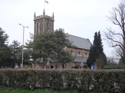
Follow the pavement as it curves left alongside the roundabout, to reach a crossing over the A1306. On the other side, turn right to pass the roundabout once more, and turn left down Bridge Road. This soon reaches a roundabout leading to a Tesco store on the left; cross this road and continue straight on down Bridge Road into the centre of Rainham. It passes Rainham Church on the left, and then turn right down Old Station Lane. After a few metres, turn left down Celtic Farm Road, passing Rainham Library on the left to reach Rainham station at TQ52098203.
 |
 |
|
Distances
| From | To | Distance (m) | Ascent (ft) | Descent (ft) |
|---|---|---|---|---|
| Loughton station | Chigwell Row | 4.6 | 322 | 138 |
| Chigwell Row | Havering-atte-Bower | 4.9 | 433 | 351 |
| Havering-atte-Bower | Harold Wood station | 5.1 | 194 | 433 |
| Harold Wood station | Upminster Bridge station | 4.4 | 190 | 266 |
| Upminster Bridge station | Rainham station | 4.7 | 102 | 112 |
This makes a total distance of miles, with 1241 feet of ascent and 1300 feet of descent.
For more information on profiles, ascents and descents, see this page
Transport
You can choose to either catch a train from Rainham into the centre of London and change onto the tube there, or do as I did: catch the train to West Ham, and then change onto the Jubilee Line for one stop north to Stratford. See the National Rail Enquiries website for more details of the railway section.
 |
 |
|
 |
 |
|
 |
 |
|
 |
 |
|
 |
 |
|
 |
 |
|
 |
 |
|
 |
 |
|
 |
 |
|
 |
 |
|
 |
 |
|
 |
 |
|
 |
 |
|
 |
 |
|
 |
 |
|
 |
 |
|
 |
 |
|
 |
Disclaimer
Please note that I take no responsibility for anything that may happen when following these directions. If you intend to follow this route, then please use the relevant maps and check the route out before you go out. As always when walking, use common sense and you should be fine.
If you find any information on any of these routes that is inaccurate, or you wish to add anything, then please email me.
All images on this site are © of the author. Any reproduction, retransmissions, or republication of all or part of any document found on this site is expressly prohibited, unless the author has explicitly granted its prior written consent to so reproduce, retransmit, or republish the material. All other rights reserved.
Although this site includes links providing convenient direct access to other Internet sites, I do not endorse, approve, certify or make warranties or representations as to the accuracy of the information on these sites.
And finally, enjoy your walking!
Nearby walks
| # | Title | Walk length (miles) |
|---|---|---|
| 51 | Mile End to Enfield Lock | 12.7 |
| 52 | Enfield Lock to Harlow Town | 12.6 |
| 123 | Mile End to Dartford | 15.0 |
|
|

|