Walk #924: Great Glen Way: Drumnadrochit to Inverness
 |
 |
|
General Data
| Date Walked | 17/09/2011 |
| County | Highlands |
| Start Location | Drumnadrochit |
| End Location | Inverness bus station |
| Start time | 07.14 |
| End time | 15.36 |
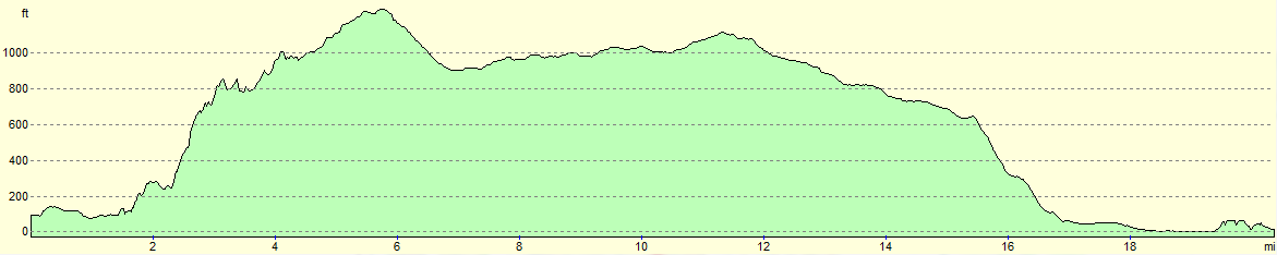
| Distance | 20.4 miles |
| Description | This very enjoyable walk follows the Great Gloen Way as it heads over the hills at the northern end of Loch Ness. It crosses a variety of ground, from moorland to forest before eventually rejoining the Caledonian Canal and the River Ness into Inverness. |
| Pack | Today I carried my 30-litre Karrimor rucksack, filled with water, my waterproofs, a book and other odds and ends. |
| Condition | The problem I had with my left foot did not recur today, meaning that the only problem I had was a little footsoreness from the walk. |
| Weather | This was a real mixed bag of a day; light drizzle at times and blazing sunshine at others. There was not much wind but there were a couple of rainbows; the very heavy rain started as soon as I had finished the walk - perfect timing. |
| OS map | Landranger number 26 (Inverness & Loch Ness) |
 |
 |
|
Map of the walk
Maps courtesy of Google Maps. Route for indicative purposes only, and may have been plotted after the walk. Please let me have comments on what you think of this new format. For a detailed table of timings for this walk, please see the table file.
 |
 |
|
Notes
I had a great nights sleep in the hostel despite partaking of one too many pints of Fraoch last night whilst chatting to someone about walking - he wanted me to have a whisky chaser and in the morning my head was glad I had abstained. As it was I felt a little sluggish as I drove to the car park in Drumnadrochit so that I could start the walk. To be honest I was not looking forward to it - it seemed far from a classic days walk on the map, and I am keen to finish this trail and to start the next one. Despite this I had little choice but to do it, so after nipping into the little post office to buy some snacks I headed off.
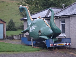
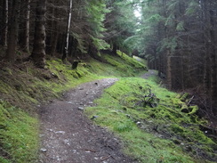
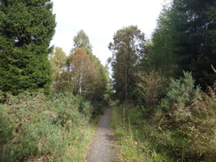
Initially the trail followed the main road as it skirted the northern side of the glen, passing a couple of Loch Ness visitor centres on the way - a nearby house had a green Nessie on a trailer, presumably some form of float. Sencan rang and we chatted as I walked. Soon the trail diverted off, climbing to pass a house at Temple Pier before entering an area of woodland. It was a path of many gates; indeed, it felt like there were more gates than I had seen on the rest of the trail so far. Gate followed gate followed gate as the path continued to climb.
John Cobb died on Loch Ness in 1952 whilst trying to set the water speed record in his 'Crusader craft. Although eclipsed by the far more famous father-and-son Campbells, Cobb deserves more fame - he twice broke the Land Speed. The crash can be seen in, of all places, the Human Leagues video for their song 'Mirror Man.
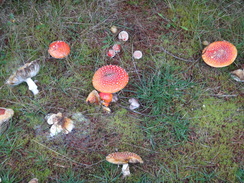
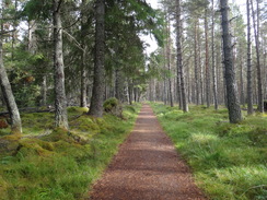
I was minding my own business when a red squirrel ran onto the path about five yards in front of me. It stopped, stared at me for a moment, than leapt for the nearest tree (I seem to have that effect on people as well as wild animals). This was the first time I have ever managed to see a red squirrel in the wild, and this few seconds meant that whatever else happened today, I would be happy. Ecstatic, I walked on. The path made a big zigzag up the hill, the steep gradient causing me to puff and sweat despite my lack of fleece. Mushrooms and toadstools abounded in the woods alongside the path, making the floor a carpet of browns, reds and whites.
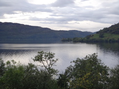
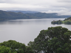
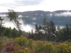
It was a relief when the path joined a track and the gradient slackened. I had not expected to get any views over Loch Ness today due to the forestry, but there were a few places where the tree cover was such that magnificent views presented themselves, with mist rising up off the water far below. Again this made me feel exceptionally happy as I continued on up the slope.
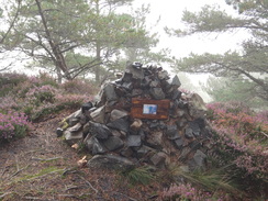
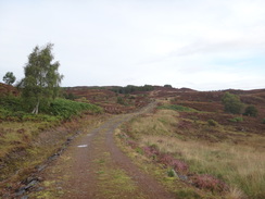
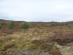
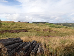
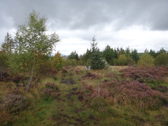
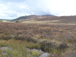
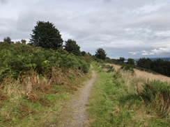
At one point a small path led off the trail and I followed this to investigate. It led to a viewpoint where there was a little memorial to someone called Stuart. There was no way to know who he was or who had made the memorial, but the setting in a little wooded glade was utterly delightful. I returned to the trail; a little further on it left the woodland and headed across some exquisite moorland, with a little croft at Corrryfoyness a short distance away to the right. I love moorland walking and I had not expected to find any on this trip so it was a welcome bonus. What I had expected to be the least interesting day of the Great Glen way was turning out to be the best.
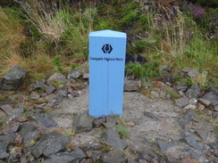
All too soon the trail passed a large fence with a sign on it stating that the next few miles were a water catchment area, with harsh warnings about polluting the supplies. After this a winding path led through the woodland, approaching a sign that proclaimed the highest point on the entire trail - a pleasing touch, although the views were non-existent due to the surrounding trees. The track then became straighter and firmer underfoot as it passed a car park hidden in the trees to reach a road.
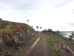
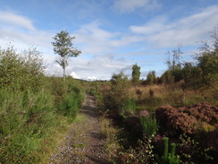
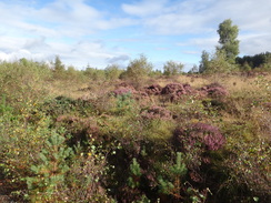
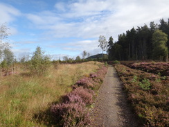
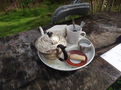
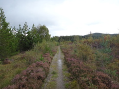
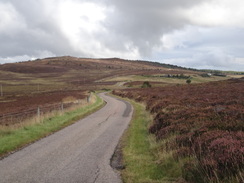
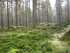
The next stretch of path was absolutely marvellous. It passed through an area of low, shrubby bushes and empurpled heather; the colours were mesmirising and my sprits soared, especially when I started passing signs stating 'campsite ahead', 'tea' and 'toasties'. I was intrigued as a cafe was not marked on the map - indeed there were no buildings in the immediate area. Eventually I reached a little junction with welcoming signs and I followed these up a muddy path.
This led to a booth where a man with a long grey beard welcomed me. He somewhat gruffly told me that there was no food on, and took me to a damp table set in the middle of a glade. The tea cost two pounds fifty, which was rather a lot, but I felt like a rest so I sat down on a chair as he went away. A few chickens came along to say hello as I sat admiring the views. The man returned ten minutes later with the strangest tea apparatus I have seen in years - a large florid teapot that seemed to be made of pewter, a tea strainer, a pot of milk covered by a doily weighted by coloured stones, and a plate containing a solitary shortbread biscuit.
I had become rather reticent about this 'cafe during the wait, and this unusual arrangement did not put my mind at ease -for one thing it was the first time in years that I have been served proper tea (i.e. loose leaf and not teabags) in a cafe. Yet as I drunk I started to feel better; everything fitted in with the extremely rustic setting, and I felt as though I had somehow been transported back a hundred years to some remote crofters cottage, and that I was being offered tea from their best service.
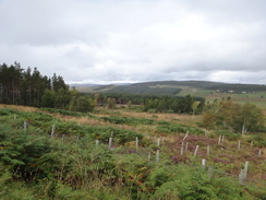
After a few minutes the man came back and sit opposite me. His name was Rory, and he runs the cafe and the adjoining campsite whilst looking after the acres of surrounding land. He has planted thousands of trees in the area, and although many are still young it looks superb. We chatted about the wildlife in the area, the harsh winters he gets up here and even the RAF planes that frequently fly over. It was a surprisingly fulfilling chat, and I left feeling deliriously happy at having met a man who was truly of his place - this place.
Soon afterwards the trail joined a road and slowly started to climb once more. Good views unfolded on either side of the road and I was tempted to cross the moorland to the nearby summit of An Leacainn; in the end I decided against as there was still quite a way to go. The trail left the road and started following an old drovers track which had been well surfaced with grit. A jogger ran past me, her black Labrador joyously bounding by her feet, and I took her to be a sign that I was approaching civilisation once more.
It looked like the rain had disappeared for the day, but I decided not to stop to take my coat off. I was wearing my old faithful Lowe Alpine coat; after ten years and many thousands of miles this is still more or less waterproof, although it has a couple of minor rips and the sun-bleached fabric is more pink than red in places. I love the coat, and although I have better coats for use on backpacking trips, it is still fine for this sort of day walking. It has been to so many places with me, and I have worn it on so many memorable occasions: it is more like an old friend than a worn and tattered piece of clothing.
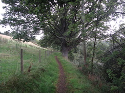
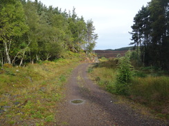
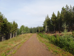
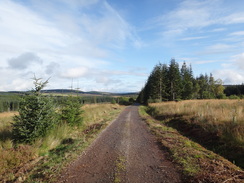
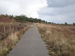
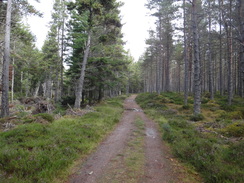
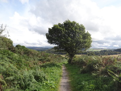
The trail entered woodland once again, but this was nothing like the dark lines of trees that had straddled the trail earlier. Instead they were widely spaced, with grass and heather between them; it seemed an altogether more natural type of coniferous woodland, and I think it is a remnant of the old Scots Pine forests that once covered this area. It was pleasant to walk through, and I munched on a couple of apples as I strode along.
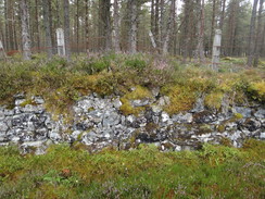
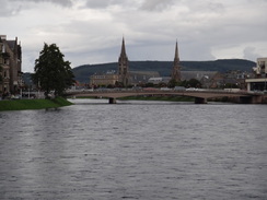
Soon it became obvious that I was following an old track, with a moss-covered stone wall on my right and a ditch and bank on the left, the area between narrowed by scrub. This skirted the edge of Dunain Hill before dropping me unceremoniously out beside a small reservoir. Several couples were walking around, again making me feel like I was nearing civilisation. This was proved true around the next corner when Inverness became visible far below.
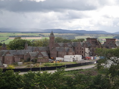
A good stretch of path took me steeply downhill towards an old hospital complex, the main buildings bearing magnificent turrets. These were disused, but activity made it seem as though they are being converted to some other purpose. Less appealing was a modern building, only a few years old - a sign stated that it was the most energy efficient building in Britain, but from a distance it looked hideous, with the specially-treated windows looking like the metal sheeting that gets put over pub windows when they are closed. From a distance it looked like an architectural monstrosity.
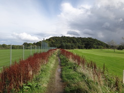
The trail tried its best to find a grassy route through a small housing estate before passing through an underpass under a road. It passed a golf course on the right and some playing fields on the left, both of which were busy with people trying out various sports, then climbed up some steps to reach the banks of the Caledonian Canal.
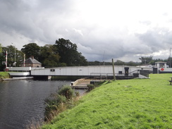
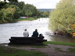
It felt strange to be walking along the canal in the wrong direction, i.e. back towards Loch Ness. Nearby was a swing bridge, which I reached just as it was starting to open. I took some photographs as it swung open with remarkable speed, then hurried across the road before the traffic resumed. An athletics competition was going on at a sports complex with lots of parents watching children running about, for too energetically for me. I nipped into a cafe for an ice cream, praying that I would not upset the rain gods by doing so.
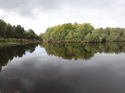
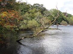
What followed was a pleasant walk across footbridges and along Ness Island, which is strung out in the middle of the river. I had walked this route before as part of my coastwalk, and it was as pleasant as I remembered. Soon after passing a long suspension bridge over the river, the trail headed off to the right and climbed up towards Inverness Castle.
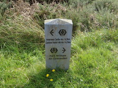
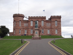
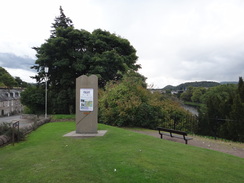
At first I could not find the finishing point and walked around the outside of the castle. Like Nottingham Castle it is far too modern and brash to really be called a castle, but the magnificent red stone means that it is a stunning building. Eventually I found the monument marking the trailhead at the entrance, leaving me wondering how I had managed to miss it.
A bus was due to leave for Drumnadrochit soon so I hurried towards the bus station, stopping only to buy a guide to the Speyside Way in the tourist information office. I reached the bus stop just five minutes before the bus was due to leave and so there was just time to buy a packet of crisps before boarding, a shame as I was hungry and the food in the cafe looked appetising.
The Great Glen Way had been a varied walk; I had walked the centre section before, and feel no real desire to do it a third time. This last days walk, however, had been an unexpected gem of a stroll and one that I would feel very happy to repeat in the future.
I stayed in the Loch Ness Backpackers for a third night tonight and there are a fairly eclectic mix of people staying - one man walked all the way from Laggan to Drumnadrochit today, a stupendous 32 miles with full backpacking kit. He has walked the West Highland Way before the Great Glen way, and he is trying to get as many trails done as possible whilst he can. 32 miles with full kit is an amazing achievement.
 |
 |
|
Directions
This walk starts off at the car park and visitor centre in Drumnadrochit at NH508298. Leave the car park and turn left to follow the A82(T) northwards for a sixth of a mile; it crosses a bridge high above the River Enrick and curves to the right, passing a junction with the A831 on the left. Turn right to follow the A82(T) eastwards for 1.2 miles; there is a good pavement on the left-hand side of the road as it passes the Loch Ness Visitors Centre and a hotel.
Just before Temple Pier is reached on the right, a path leads off to the left at NH527300. It climbs uphill along a surfaced track; after about twenty yards it turns left up a path through a wooden gate. Head on up the path; it follows a fence on the right, with a house on the other side of the path. Once past the house the path turns to the right to head downhill back towards the road. It does not join the road and instead turns to the left to parallel the road.
It goes through another gate and curves to the left to start heading uphill, going through a third gate to enter some woodland. Follow the path as it heads through the woodland, going through a gate and curving downhill to cross a rough track. It continues on, keeping the track above and to the left. When the path reaches a field gate ahead, turn left through a gate. The path immediately crosses a rough track and continues uphill. It goes through a second gate and continues on, with the main track still above and to the left.
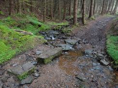
The path crests a little hill as the track ziagzags up the hillside to the left; the path leaves the woodland and descends to go through two clapper gates in quick succession. The path passes a field on either side before reaching a deer gate that leads into a forested area and then descends to reach a footbridge over a stream. The path starts to climb, and after a fifth of a mile curves sharply to the left to head uphill. Shortly after this it curves to the right to continue climbing steeply northeastwards.
The path meets a narrow track; turn right along the track, passing a viewpoint before starting to descend slightly to cross a stream on some stepping stones. On the other side of the stream the track starts to climb once more before joining a better-quality track at NH541310. Turn right to start following this track northeastwards through the woodland.
2.3 miles after entering the forest, the track leaves the trees through a deer gate at NH551327 and follows the track northwards across moorland. It passes the house at Corryfoyness to the right; ignore the track that leads off towards the house and instead continue northwards. The track crosses the Allt Coire Shalachaidh and goes through a field gate to enter some more forest.
A good track leads through the forest, soon turning to the left to head westwards before curving to the right to take a more northwesterly course. At NH541340 it passes the highest point on the entire trail and then starts to descend. It goes through a clapper gate and continues to the right of a barn. At a junction with another track at NH536344 beside the barn, turn right down a better-quality track. Follow this track northwards for 0.8 miles, passing a car park hidden in the trees on the right before the track ends at a T-junction with a road at NH541356.
Cross the road and go through a clapper gate to continue northwards along a path, following signs for a campsite and a cafe. It passes through a pretty scrubland area; the path is obvious and easy to follow. After three-quarters of a mile it curves to the right and goes through a clapper gate to reach a road at NH548368.
Turn left to follow this road north-northeastwards; it slowly curves to take a more northeasterly course. After a mile it emerges from the forest near a house called Ladycairn; continue along the road for another 1.3 miles as it crosses moorland. It curves sharply to the left to cross a stream, and then to the right. Shortly afterwards a good path leads off to the left at NH569399, following an old drove yard across moorland. The path diverges slowly away from the road for 0.9 miles before reaching some woodland at NH581406.
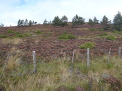
Some sparse old coniferous woodland starts on the left, and soon afterwards on the right. This is a much more pleasant and lighter area than the tightly-packed coniferous woodland that was passed through earlier in the day. Go through a clapper gate to enter the woodland. At NH596410 the path curves to the left; do not continue straight on along a minor path. Go through another clapper gate to continue on along the track, following a moss-laden stone wall on the right.
The path follows what was obviously once quite a wide track beside the wall, now narrowed by shrubbery. It passes under two sets of high-tension power lines and then skirts immediately to the west of Dunain Hill, its summit out of sight to the right. Go through a clapper gate to join a track; head straight on downhill along this track.
As it approaches another set of power lines at NH626437 the track forks; take the right-hand branch, immediately passing a pylon. As it emerges from the trees turn left through a gate to pass a lake on the left, and the first views over Inverness unfold ahead. The path winds downhill, curving to the right to reach a clapper gate. Go through this and follow the path as it curves sharply to the left downhill to the east; at the bottom go through a clapper gate to reach the end of a road at NH635440. Turn left, immediately passing the gable ends of two whitewashed buildings on the left. (It should be noted that this area is going to be redeveloped, and so the precise directions may be changed).
Turn left, keeping the buildings on the left and then turn right down a track that soon leads out onto a road. Turn left to head northeastwards up this road for a short distance, then take the first road to the right. Follow this as it heads in a rough easterly direction, heading downhill as it passes a private car park on the left and the imposing Scottish National Heritage building on the right. When this road ends at a T-junction, cross the road ahead and continue on downhill along a path. After a third of a mile it passes near to some power lines and then curves to the left, passing houses on the right.
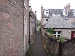
After a short distance at NH644440 the path turns to the right, heading across a grassy area between houses. At the end of the grass cross a road and continue along a gravel path, initially between more houses. It passes a playground on the left and continues across grass. After 100 yards on the grass turn half-left, skirting the last house of a terrace on the left to reach another road. Cross the end of this road and join a paved path that leads down to an underpass under a road. On the other side of the road continue along the paved path, initially with a golf course to the right. After a short distance turn right off the paved path onto a gravel path that heads on, initially with a fence on the right.
The path curves away from the fence on the rightand parallels one on the left, which separates the path from playing fields. It aims straight for a wooded hillside ahead; it goes through a little band of trees and climbs up steps to reach a surfaced track that parallels the Caledonian Canal at NH652442.
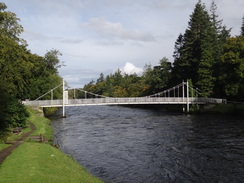
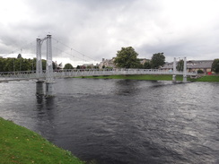
Turn right and follow the canal south-southeastwards for a third of a mile until the A82(T) is reached at NH654438. Turn left to cross a swing bridge over the canal, and on the other side turn right down Bught Road. After a quarter of a mile the road curves to the left; as it does so continue on towards Whin Island.
Do not cross a footbridge onto the island, and instead turn left to follow a path that parallels Bught Road on the left, with a small tributary stream of the river on the right. Soon a suspension footbridge is reached on the right at NH660436; cross this and on the other side turn left to walk northeastwards along a surfaced path that heads across an island in the middle of the river. At the end of the island it turns right to cross another footbridge that curves between trees onto a second island.
At the end of the second island turn right to cross another suspension footbridge. On the other side turn left to head north along a surfaced path that runs with the B862 on the right and the river on the left. After a while it crosses a short footbridge with ornate handrails to reach the main road, then turns right to continue north along the main road. It passes a long suspension bridge over the river, with the cathedral on the other side. At NH665448 turn right along an alleyway called Ness Place; go up a few steps and then turn left up View Bank road.
After a few yards the road forks; take the right-hand branch and follow it as it continues north. It swings slightly to the left and then right; at the right-hand bend turn left up the access road that leads to Inverness Castle. The stone marking the end of the Great Glen Way stands immediately to the left of this junction at NH666449, with fine view of the castle ahead.
To get to the bus and railway stations, head back to the public road and follow it for a few yards until it ends at a T-junction with the B861. Turn left to follow this road northwards; it slowly curves to the left before reaching at a T-junction with the High Street, with the tourist information office in a building to the left. Turn right along this pedestrianised road for a hundred yards and then turn left up Inglis Street. This soon ends at a junction with the B865; turn right along this road to pass the entrance to the railway station on the right before turning right up Strothers Lane. Follow this as it heads between shops, then turn left to reach Inverness bus station, where this walk ends.
 |
 |
|
Distances
| From | To | Distance (m) | Ascent (ft) | Descent (ft) |
|---|---|---|---|---|
| Drumnadrochit | Moorland near Corryfoyness | 4.7 | 1496 | 581 |
| >Moorland near Corryfoyness | Ladycairn | 4.7 | 466 | 472 |
| Ladycairn | Leachkin | 6.7 | 230 | 922 |
| Leachkin | Inverness bus station | 4.3 | 210 | 502 |
This makes a total distance of 20.4 miles, with 2402 feet of ascent and 2477 feet of descent.
For more information on profiles, ascents and descents, see this page
Accommodation
I spent the night at Loch Ness Backpackers, a rather good hostel at Drumnadrochit beside Loch Ness. This hostel is rather well equipped, and serves meals in the evening in the on-campus bar. The staff are also very friendly. Its cost of �16 per night is more than reasonable, and it is situated just a couple of hundred yards off the Great Glen Way.
Transport
I used the Scottish CityLink service 919 that runs between Inverness and Fort William to get between Inverness and Drumandrochit. This service runs every couple of hours during the day, although less frequently during the winter timetable. Sadly the path diverges rapidly from the bus route, meaning that there are no convenient bus stops between the start and end points.
 |
 |
|
 |
 |
|
 |
 |
|
 |
 |
|
 |
 |
|
 |
 |
|
 |
 |
|
 |
 |
|
 |
 |
|
 |
 |
|
 |
 |
|
 |
 |
|
 |
 |
|
 |
 |
|
 |
 |
|
 |
 |
|
 |
 |
|
 |
 |
|
 |
 |
|
 |
 |
|
 |
Disclaimer
Please note that I take no responsibility for anything that may happen when following these directions. If you intend to follow this route, then please use the relevant maps and check the route out before you go out. As always when walking, use common sense and you should be fine.
If you find any information on any of these routes that is inaccurate, or you wish to add anything, then please email me.
All images on this site are © of the author. Any reproduction, retransmissions, or republication of all or part of any document found on this site is expressly prohibited, unless the author has explicitly granted its prior written consent to so reproduce, retransmit, or republish the material. All other rights reserved.
Although this site includes links providing convenient direct access to other Internet sites, I do not endorse, approve, certify or make warranties or representations as to the accuracy of the information on these sites.
And finally, enjoy your walking!
Nearby walks
| # | Title | Walk length (miles) |
|---|---|---|
| 191 | Alltsigh to Lewiston | 9.5 |
| 192 | Lewiston to Beauly | 14.7 |
| 193 | Beauly to Garve | 16.4 |
|
|

|